
×

Réunion🇷🇪 | hikesPiton de la FournaiseVolcanic crater, lava fields, barren plateau, active eruption zone | things to do and best time to go

Explore Grand BassinExplore Sentier Scout

Backpacking in Piton de la Fournaise
🏆 Top pickhike ranked #1
By Johan Kruseman 🇳🇱 | Updated September 4, 2026

Every traveler who lands on Réunion faces a fork-in-the-road question: do you wake up before dawn, lace up your boots, and tackle the raw, lunar slopes of Piton de la Fournaise, or do you settle for a distant viewpoint and keep your shoes clean? That choice matters—because this isn’t just a volcano, it’s the living, breathing heart of the island, pulsing on the southeastern flank like a drumbeat you feel in your chest. The hike itself is a test of willpower and curiosity. You crunch over black lava fields, wind biting your cheeks, sulfur in the air, the landscape so stark it feels like you’ve left Earth behind. It’s not a casual stroll: the main route clocks in at around 5 hours round-trip, exposed, with little shade and a relentless, ankle-twisting surface. Public buses get you close, but the last stretch to Pas de Bellecombe—the trailhead—demands a taxi or a hitched ride. Compared to the lush, shaded trails of Cirque de Mafate, Fournaise is pure elemental drama. The payoff? Standing on the rim, breathless, watching steam curl from the caldera as the Indian Ocean glimmers far below—suddenly, every step makes sense.

Discover everything you want to know in the 📖 Réunion Travel Guide.
Best time to go: May - November
Duration: 6 to 8 hours
Distance: 10 to 16 kilometers
Total ascent: 800 meters


Get your Réunion guide
65 ranked highlights, routes & tips, works offline (236 pages)
Loading the map 🌍
CLICK TO FILTER
cities
towns
villages
landmarks
national parks
hikes
beaches
attractions
festivals
SHOW COUNTRY’S BESTSHOW ALL

✨ Why go?
Ranked #1 hike in Réunion
What sets this place apart

The hike to Piton de la Fournaise is a magnet for backpackers, and for good reason. This active volcano offers a scenery-to-effort ratio that’s hard to beat. You’ll start at the Pas de Bellecombe trailhead, easily accessible via public transport from Saint-Pierre. The bus ride is cheap, and the anticipation builds as you approach the trail.

Once you hit the ground, the terrain shifts from lush greenery to stark volcanic rock. Each step feels like a mini-adventure, with the landscape morphing around you. The flexible distances mean you can tailor your trek—whether you want a quick jaunt to the crater or a full day exploring the surrounding caldera.

And let’s talk about the payoff: standing at the rim, you’re greeted by a surreal view of the crater, a vast expanse of blackened earth and the … read more 👉
The hike to Piton de la Fournaise is a magnet for backpackers, and for good reason. This active volcano offers a scenery-to-effort ratio that’s hard to beat. You’ll start at the Pas de Bellecombe trailhead, easily accessible via public transport from Saint-Pierre. The bus ride is cheap, and the anticipation builds as you approach the trail.

Once you hit the ground, the terrain shifts from lush greenery to stark volcanic rock. Each step feels like a mini-adventure, with the landscape morphing around you. The flexible distances mean you can tailor your trek—whether you want a quick jaunt to the crater or a full day exploring the surrounding caldera.

And let’s talk about the payoff: standing at the rim, you’re greeted by a surreal view of the crater, a vast expanse of blackened earth and the occasional plume of steam. It’s a moment that makes the burn in your legs worthwhile. Afterward, you can cool off with a cold beer in a nearby village, savoring the satisfaction of a day well spent. This hike isn’t just a trek; it’s a highlight that fits seamlessly into any backpacking route on the island.
Want to include Piton de la Fournaise in your Réunion route?
Create a personalized Réunion itinerary that includes Piton de la Fournaise and the places that fit your trip — based on your travel style, budget, and available time. Get your route in seconds.

Generate my trip

💡 HighlightsWhat this place is best known for

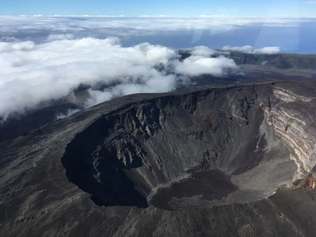
  1. Pas de Bellecombe viewpoint — The classic launch point for the hike and the best “first look” into the caldera (Enclos Fouqué). You get an immediate sense of scale: a massive hollow rim with the Dolomieu crater sitting like a bowl in the middle. It’s also where you’ll see the whole landscape change with clouds and light, sometimes even steam from recent activity — dramatic and quick to set the tone for the trail.
  2. Formica Leo (the little cone) — A perfectly formed miniature volcanic cone near the rim that you can walk around or hop up for a close-up. It’s tiny compared to the main crater but huge on character: the scale, the black sand at its base, and the way wind has swept it make it feel like a moonscape — great for photos and to appreciate how recent volcanic processes shape everything.
read more 👉
  1. Pas de Bellecombe viewpoint — The classic launch point for the hike and the best “first look” into the caldera (Enclos Fouqué). You get an immediate sense of scale: a massive hollow rim with the Dolomieu crater sitting like a bowl in the middle. It’s also where you’ll see the whole landscape change with clouds and light, sometimes even steam from recent activity — dramatic and quick to set the tone for the trail.
  2. Formica Leo (the little cone) — A perfectly formed miniature volcanic cone near the rim that you can walk around or hop up for a close-up. It’s tiny compared to the main crater but huge on character: the scale, the black sand at its base, and the way wind has swept it make it feel like a moonscape — great for photos and to appreciate how recent volcanic processes shape everything.
  3. Cratère Dolomieu — The massive central crater and one of the volcano’s active vents. The raw geology here is the star: layered rock, fresh-looking scarred walls, and, depending on activity, fumaroles or recent lava scars. No other day-hike gives you that immediate, up-close reminder you’re walking on an active planet.
  4. Plaine des Sables — A wide, red-brown desert of volcanic sand and broken lava that feels utterly unlike the island’s usual lushness. Walking across it is surreal — flat, open, wind-swept — and it’s a great contrast to tropical Réunion, which is why this stretch sticks in your memory more than another forested path.
  5. Lava textures and recent flows on the Enclos floor — The variety of hardened lava is a hike highlight in itself: smooth ropy pahoehoe, jagged aa, glassy crusts and bulbous flow edges. Inspecting those textures up close (and the occasional steam fissure if activity is recent) is a geology lesson you can feel underfoot — tactile, loud with crunching rock, and very different from any regular mountain trail.
Spotted a mistake or missing something? Contact us.
🌤️ When to go?Best time to hike the Piton de la Fournaise


  • Weather: The dry season from May to November is your best bet—clear skies and less mud make the volcanic trails manageable. The wet season (December to April) turns paths slick and visibility poor, with frequent showers that can kill momentum.

  • Temperature: Expect daytime highs around 20-25°C (68-77°F) at the summit, dropping sharply after sunset to 10°C (50°F) or lower. Dress in layers; the volcanic wind bites hard once the sun dips.

  • Daylight Hours: Roughly 11 to 12 hours of daylight year-round, but the dry season offers more consistent, predictable light—crucial for timing your ascent and descent safely.

  • Crowds: Peak hiking season aligns with European summer holidays (July-August), swelling the trail with tourists. For a quieter trek, aim for shoulder months like May, June, or September.
read more 👉

  • Weather: The dry season from May to November is your best bet—clear skies and less mud make the volcanic trails manageable. The wet season (December to April) turns paths slick and visibility poor, with frequent showers that can kill momentum.

  • Temperature: Expect daytime highs around 20-25°C (68-77°F) at the summit, dropping sharply after sunset to 10°C (50°F) or lower. Dress in layers; the volcanic wind bites hard once the sun dips.

  • Daylight Hours: Roughly 11 to 12 hours of daylight year-round, but the dry season offers more consistent, predictable light—crucial for timing your ascent and descent safely.

  • Crowds: Peak hiking season aligns with European summer holidays (July-August), swelling the trail with tourists. For a quieter trek, aim for shoulder months like May, June, or September.

  • Seasonal Activities: The dry season also hosts local festivals and lava viewing opportunities, adding cultural and visual punch to your hike. Wet season often means restricted access due to safety concerns.

  • Price Fluctuations: Accommodation and flights spike during the dry season and European holidays. Booking early or traveling in shoulder months can save you cash without sacrificing trail conditions.


Pro-tip: Start your hike early in the dry season’s shoulder months to dodge crowds, catch crisp morning light, and savor the volcanic landscape before the midday heat and wind kick in.


source: climatestotravel.comJANJanuary: fair for travelingFEBFebruary: fair for travelingMARMarch: fair for travelingAPRApril: fair for travelingMAYMay: highly recommended for travelingJUNJune: highly recommended for travelingJULJuly: good for travelingAUGAugust: good for travelingSEPSeptember: highly recommended for travelingOCTOctober: excellent for travelingNOVNovember: excellent for travelingDECDecember: fair for traveling
reunion-hike-piton-de-la-fournaise v1
© Google |

✈️ The backpacker research shortcutRéunion Travel Guide

An offline-friendly backpacking guide with optimized travel routes, ranked highlights, transport advice, and the best areas to stay.
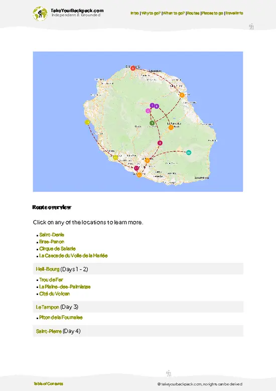
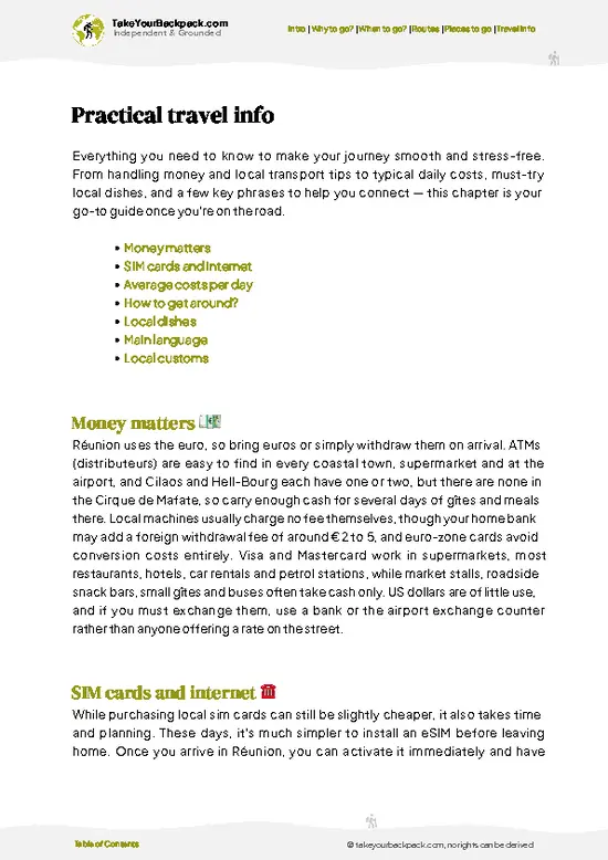
example page 0 from our offline Travel Guide for Réunion
example page 1 from our offline Travel Guide for Réunion
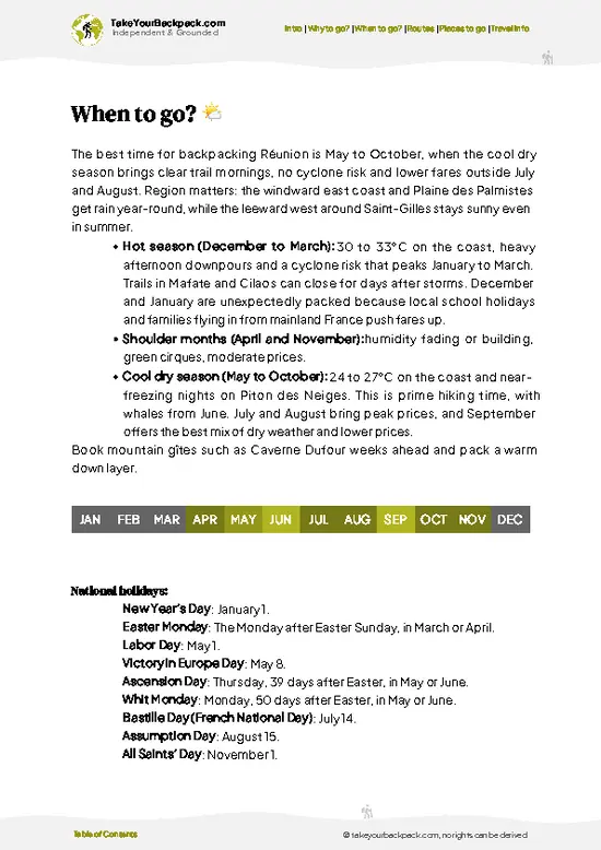
example page 2 from our offline Travel Guide for Réunion
example page 3 from our offline Travel Guide for Réunion
example page 4 from our offline Travel Guide for Réunion
example page 5 from our offline Travel Guide for Réunion
example page 6 from our offline Travel Guide for Réunion
example page 7 from our offline Travel Guide for Réunion
The digital guide (236 pages) contains:
65 highlights, ranked by travel appeal
Optimized 2, 3 & 5-day travel routes
Cities, national parks, landmarks, beaches
How to get around
Offline-friendly for travel without Wi-Fi
👉 Click to see all 30+ guide features

📅 Plan smarter in minutes, not weeks
Month by month travel advice
Festivals & national holidays
Budget expectations

🗺️ Go to the right places, skip the overrated ones
Honest pros & cons of destinations
Top hikes, parks & viewpoints
Lesser-known places most travelers miss
Clear “worth it vs skip it” guidance

🛏️ Travel smoothly without rookie mistakes
Best areas to stay
Transport systems explained simply
Common scams & safety advice
SIM cards, money & practical tips

🌍 Understand the country, not just visit it
Culture & traditions
52 Essential phrases & customs
Festivals worth planning around
Traveler-friendly historical context
Insights that make places more meaningful

📱 Built for real travel conditions
Fully downloadable PDF
Works completely offline
Optimized for phone use
Useful in remote areas & buses
Everything in one place
Save weeks of stressful planning
Get instant access to your full guide. 30‑day money-back guarantee.
+ Add another guide for just US$7.80

By proceeding you agree to our terms.
Sent to your inbox immediately after payment • 100% Secure Checkout
Best Backpacking Travel Advisor 2025 tourism awardBest Backpacking
Travel Advisor
2025
What others say about Take Your Backpack Guides:
⭐⭐⭐⭐⭐
Fantastic, amazing amount of information!
⭐⭐⭐⭐⭐
My goodness this is amazing, it's what I've been looking for hats off too you!
⭐⭐⭐⭐⭐
I think this is absolutely BRILLIANT
⭐⭐⭐⭐
Very complete and informative. It's still missing places, but I gotta to commend you
⭐⭐⭐⭐⭐
This is truly amazing, thank you, can't wait to explore it with my kids!
⭐⭐⭐⭐⭐
Awesome resource, thank you!
⭐⭐⭐⭐⭐
This is amazing! Can't wait to explore the ones I haven't seen
⭐⭐⭐⭐
I love this! Well done, great idea.
⭐⭐⭐⭐⭐
Thanks for taking the time to make this gem!
⭐⭐⭐⭐⭐
This might be the best website I've ever seen.
⭐⭐⭐⭐⭐
Congratulations, and thank you so much for your work; it's incredibly valuable.
⭐⭐⭐⭐
In all seriousness I think you did a great job pointing out the important spots
⭐⭐⭐⭐⭐
10/10 very good
⭐⭐⭐⭐⭐
As someone who's only just starting to visit regularly this is awesome, thank you.
⭐⭐⭐⭐
Thank you very much! I'm going to visit my dad, it's going to be very useful!
⭐⭐⭐⭐⭐
This is really cool! We'll be travelling for the first time and this definitely come in handy.
⭐⭐⭐⭐⭐
You are now our minister of culture, congratulations 👨‍💼
⭐⭐⭐⭐⭐
Just wanted to tell you that this is a pearl! Going to follow your recommendations.
⭐⭐⭐⭐⭐
This is so cool. I'll definitely be using the resource for my travels soon.
⭐⭐⭐⭐⭐
This is very impressive! Good work.
⭐⭐⭐⭐⭐
This is an amazing and informative site. Very well done!

🛏️ Where to stay?Best areas and accommodation options

If you enjoy meeting fellow travelers, consider choosing hostels with high ratings for atmosphere. On the other hand, if you prefer having your own space, a hotel might be a better option.

🥾 Hike detailsHike details: route, duration, and difficulty of Piton de la Fournaise

Total Distance: The trail covers about 10 kilometers (6.2 miles) round trip, depending on how far you venture into the crater.

Estimated Duration: Expect to spend around 4 to 6 hours on the hike. This includes time for breaks and taking in the views, which you definitely won’t want to rush.

Difficulty Level: This hike is generally rated as moderate. While it’s not technically challenging, the altitude and volcanic terrain can be a bit taxing, especially if you’re not acclimatized.

Starting Point: The trailhead is at the Pas de Bellecombe viewpoint. You can get there by taking a bus from Saint-Denis … read more 👉
Total Distance: The trail covers about 10 kilometers (6.2 miles) round trip, depending on how far you venture into the crater.

Estimated Duration: Expect to spend around 4 to 6 hours on the hike. This includes time for breaks and taking in the views, which you definitely won’t want to rush.

Difficulty Level: This hike is generally rated as moderate. While it’s not technically challenging, the altitude and volcanic terrain can be a bit taxing, especially if you’re not acclimatized.

Starting Point: The trailhead is at the Pas de Bellecombe viewpoint. You can get there by taking a bus from Saint-Denis to Saint-Pierre, then transfer to a local bus that heads towards the volcano. It’s a bit of a journey, so plan accordingly.

Major Landmarks Along the Route:
  • Pas de Bellecombe: This is where you start and offers stunning views of the volcano and surrounding landscape.
  • Enclos Fouqué: As you descend, you’ll enter this massive caldera, which is a highlight of the hike.
  • Crater of Piton de la Fournaise: The main attraction, where you can see the lava flows and volcanic features up close.

Type of Terrain and Scenery: The trail features a mix of rocky paths, volcanic soil, and some loose gravel. The scenery is out of this world—think stark black lava fields contrasted with vibrant green vegetation in some areas. You’ll also get panoramic views of the surrounding mountains and the ocean on clear days.

Typical Vegetation and Wildlife:
  • Vegetation: You’ll find hardy plants that thrive in volcanic soil, like tamarind trees and various ferns. Some areas are more barren due to past eruptions.
  • Wildlife: Keep your eyes peeled for endemic birds like the Reunion Ibis. You might also spot some lizards and insects, but not much else in terms of larger wildlife.

Pack plenty of water and snacks, as facilities are limited. And don’t forget your camera—this hike is a visual feast!
⚠️ Hiking info can sometimes be outdated or inaccurate. Before you hit the trail, check the latest conditions with locals. If you do spot anything that's off, I'd love to hear from you, so I can update it for fellow travelers.

🛡️ SafetySafety Tips and Common Scams in Piton de la Fournaise

The hike up Piton de la Fournaise is a thrilling blend of challenge and reward. Expect weather shifts; the mountain can go from sunny to stormy in a heartbeat. Dress in layers and keep an eye on the clouds. The terrain is mostly straightforward, but rocky sections demand attention. Footing can be tricky, especially after rain, so sturdy boots are a must.

Altitude isn’t a major issue here, but if you’re not acclimated, take it slow. The trail is well-marked, but a map or GPS can be your best friend when navigating the craggy landscape.

Wildlife encounters are rare, but you might spot a few endemic birds. Respect their space; they’re part of the island’s unique charm.

Timing is key. Start early to avoid the heat and crowds. The view from the summit, with the caldera stretching below, is … read more 👉
The hike up Piton de la Fournaise is a thrilling blend of challenge and reward. Expect weather shifts; the mountain can go from sunny to stormy in a heartbeat. Dress in layers and keep an eye on the clouds. The terrain is mostly straightforward, but rocky sections demand attention. Footing can be tricky, especially after rain, so sturdy boots are a must.

Altitude isn’t a major issue here, but if you’re not acclimated, take it slow. The trail is well-marked, but a map or GPS can be your best friend when navigating the craggy landscape.

Wildlife encounters are rare, but you might spot a few endemic birds. Respect their space; they’re part of the island’s unique charm.

Timing is key. Start early to avoid the heat and crowds. The view from the summit, with the caldera stretching below, is worth every step. Afterward, reward yourself with a cold drink at a nearby café. You’ve earned it!

FAQCommon questions from travelers

The Piton de la Fournaise hike typically takes 6 to 8 hours round trip, depending on your pace and starting point. The most common route is about 10 kilometers from the Pas de Bellecombe trailhead to the summit and back. Plan for a full day to complete the hike safely.
The hike is moderately difficult due to the steep ascent and volcanic terrain. It involves about 500 meters of elevation gain and some loose volcanic rock underfoot, requiring good physical fitness and sturdy hiking boots. Weather can change rapidly, adding to the challenge.
No guide or permit is required to hike Piton de la Fournaise, but it is strongly recommended to check volcanic activity updates before going. The volcano is active, and access can be restricted during eruptions or hazardous conditions. Local authorities provide information on safe hiking periods.
⚠️ Things can change over time, so always validate details locally before you go.

Other Réunionnais hikes near Piton de la Fournaise

Explore more nearby:

  • Grand Bassin—Steep descent, remote hamlet, waterfalls, terraced gardens| 19 km away
  • Sentier Scout—Mafate rim, airy ledges, endemic forest, panoramic lookouts| 35 km away

💡 Not sure where to go next?
Create a personalized itinerary for Réunion including Piton de la Fournaise and the places that fit your trip.

Generate my itinerary

👉 Discover all hikes

Or checkout all Réunion has to offer (think cities, towns, villages, national parks, hikes, beaches, festivals)
Country photo of Réunion

We 💚 feedbackParting advice and final tips

The vibe at Piton de la Fournaise is electric. You’re not just hiking; you’re feeling the earth pulse beneath your feet. The best surprise? The stark contrast of the black lava fields against the vibrant greens. It’s like stepping onto another planet. But be warned: the winds can whip up unexpectedly, so pack layers. When you finally reach the summit, the view is a hard-earned reward. Take a moment to breathe it all in—then treat yourself to a cold local beer. You’ve earned it.

✍️ Help improve this page!
The information on this page is based on in-depth research, insights shared by experienced travelers, and feedback from the local travel community in Réunion. While every effort is made to keep the information accurate and current, conditions can change — so if you spot anything incorrect or outdated, please get in touch.


🙋‍♂️ Give feedback

👋 Meet the founderWho’s Behind Take Your Backpack?

Johan, backpacker and founder of TakeYourBackpackHi, I’m Johan (Netherlands 🇳🇱), the creator of TakeYourBackpack. Over the past decade, I’ve backpacked through 80+ countries across six continents, gaining extensive experience with independent travel, long-term trips, and overland routes.

This site is built on a combination of firsthand travel experience and carefully curated insights from other backpackers. Many guides are based on places I’ve personally visited, while others bring together tips, observations, and practical advice shared by trusted travelers I’ve met along the way.

The goal is to provide realistic, experience-driven guidance — not generic itineraries — so you can explore destinations with better context, clearer expectations, and more confidence.

Get full Réunion guide •
Instant download • 65 highlights • Full Offline guide