×

Rwanda🇷🇼 | hikesCongo Nile TrailLake Kivu ridges, multi-day by bike or foot, coffee stations, Kibuye | things to do and best time to go

Explore Bisoke VolcanoExplore Mount Karisimbi

Backpacking in Congo Nile Trail
🌟 Highlighthike ranked #3
By Johan Kruseman 🇳🇱 | Updated October 22, 2026

The Congo Nile Trail is a route along Lake Kivu’s shore, and it is not a single marked footpath that you walk start to finish with a backpack; most people cover it by mountain bike or in stages on foot. It runs through the west of Rwanda, from Rubavu (Gisenyi) south toward Rusizi (Cyangugu), about 227 kilometers by the full route, following the ridge above the water. On the ground it is red dirt, cattle tracks and village lanes, with long climbs followed by drops to small beaches, and the lake appears below at nearly every bend. Hills are steep, shade is thin, and there are tea fields and banana groves between the stretches. Reaching Rubavu by bus from Kigali is easy, while the later stages need local minibuses or motorbike taxis. It suits fit walkers who like slow days and simple guesthouses. It frustrates anyone who wants a continuous wilderness trek or fast mileage.

Discover everything you want to know in the 📖 Rwanda Travel Guide.
Best time to go: June - February
Duration: 10 days
Distance: 227 kilometers
Total ascent: 5000 meters


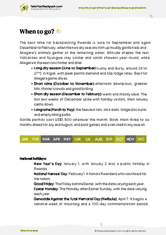
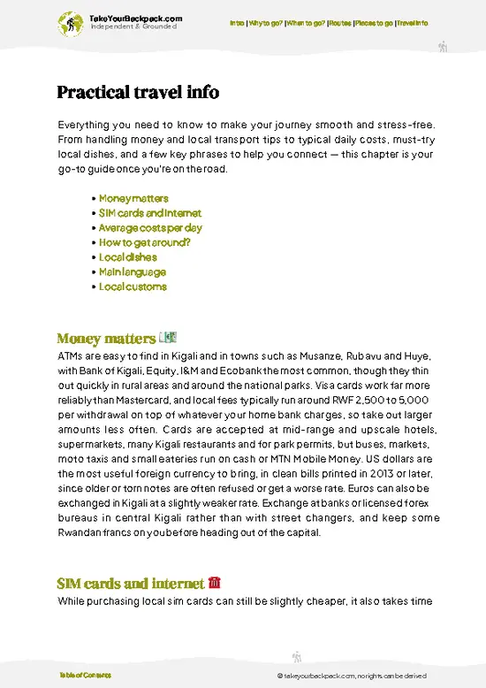
example page 0 from our offline Travel Guide for Rwanda
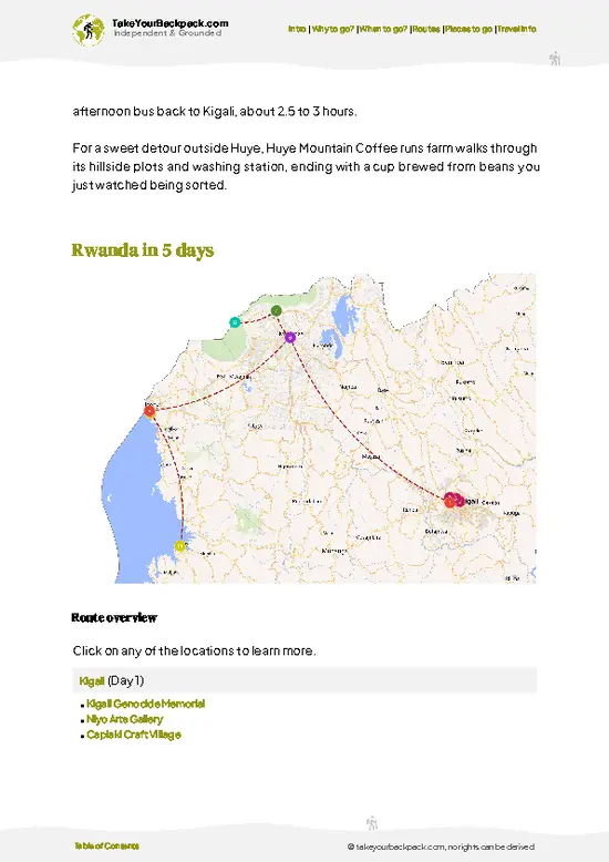
example page 1 from our offline Travel Guide for Rwanda
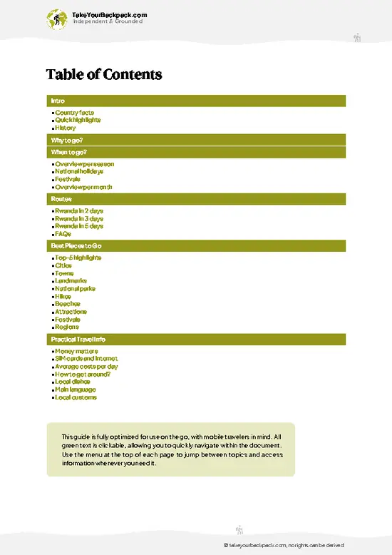
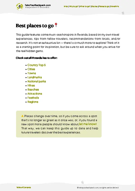
example page 2 from our offline Travel Guide for Rwanda
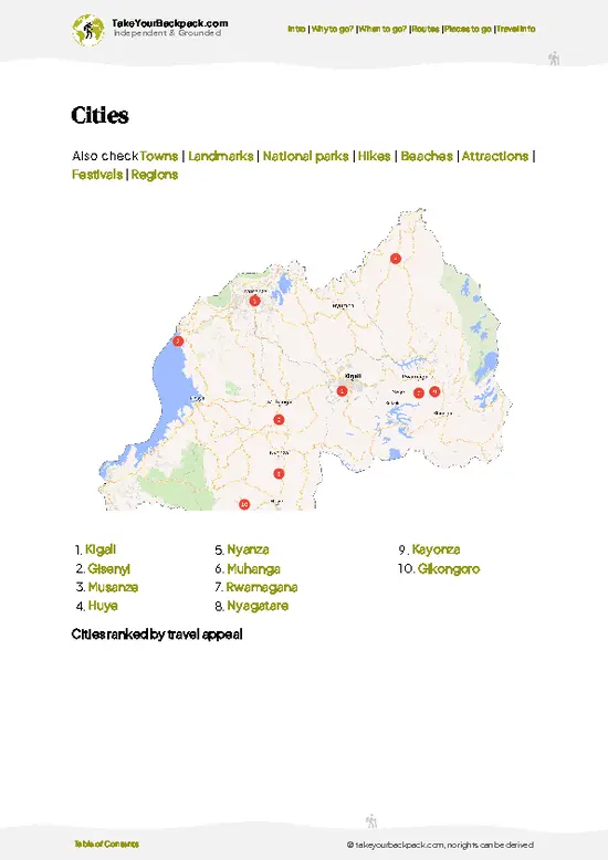
example page 3 from our offline Travel Guide for Rwanda
example page 4 from our offline Travel Guide for Rwanda
example page 5 from our offline Travel Guide for Rwanda
example page 6 from our offline Travel Guide for Rwanda
example page 7 from our offline Travel Guide for Rwanda
Loading the map 🌍
CLICK TO FILTER
cities
towns
landmarks
national parks
hikes
beaches
attractions
festivals
regions
SHOW COUNTRY’S BESTSHOW ALL

✨ Why go?
Ranked #3 hike in Rwanda
What makes it a must-see hike

Congo Nile Trail gives you a lake-and-ridge landscape that you can sample in small pieces, which is the main reason backpackers seek it out. The route follows the western edge of Lake Kivu, and you can stop at Kibuye (Karongi), Kinunu or Nyamasheke, where there are guesthouses and lakeside camps. You are not committed to the full length. A day of 15 to 25 kilometers on foot can be done between two towns, and local minibuses fill the gaps when legs give out. That flexibility matters on a route with real climbing. It also fits a longer Rwanda loop well: Kigali, Rubavu, the trail, then Nyungwe Forest at the southern end, with Volcanoes National Park on the other side of Rubavu. Along the way you pass coffee washing stations, fishing villages and quiet beaches, and you meet far more farmers and … read more 👉
Congo Nile Trail gives you a lake-and-ridge landscape that you can sample in small pieces, which is the main reason backpackers seek it out. The route follows the western edge of Lake Kivu, and you can stop at Kibuye (Karongi), Kinunu or Nyamasheke, where there are guesthouses and lakeside camps. You are not committed to the full length. A day of 15 to 25 kilometers on foot can be done between two towns, and local minibuses fill the gaps when legs give out. That flexibility matters on a route with real climbing. It also fits a longer Rwanda loop well: Kigali, Rubavu, the trail, then Nyungwe Forest at the southern end, with Volcanoes National Park on the other side of Rubavu. Along the way you pass coffee washing stations, fishing villages and quiet beaches, and you meet far more farmers and schoolchildren than other hikers. That ordinary contact with village life is what people remember afterward.

💡 HighlightsEssential experiences to have while hiking the Congo Nile Trail

  1. Lake Kivu shoreline: The whole trail is built around this deep lake, and the best views come from ridges high above the water, where bays and forested islands spread out below you.
  2. Kibuye (Karongi) waterfront: The main town on the route has a lakeside promenade, small hotels and boat departures. It is the natural place to rest a day and buy supplies.
  3. Napoleon Island (Bat Island): A small forested island near Kibuye where a large fruit bat colony roosts in the trees. You reach it by boat, and the bats are loudest and most active around dusk.
  4. Coffee washing stations: Several co-operative stations along the trail process cherries from the surrounding hillsides. Staff will often show you the sorting tables and drying beds in season, and the coffee tastes better afterward.
  5. Bugarama and Nyamasheke stretch:
… read more 👉
  1. Lake Kivu shoreline: The whole trail is built around this deep lake, and the best views come from ridges high above the water, where bays and forested islands spread out below you.
  2. Kibuye (Karongi) waterfront: The main town on the route has a lakeside promenade, small hotels and boat departures. It is the natural place to rest a day and buy supplies.
  3. Napoleon Island (Bat Island): A small forested island near Kibuye where a large fruit bat colony roosts in the trees. You reach it by boat, and the bats are loudest and most active around dusk.
  4. Coffee washing stations: Several co-operative stations along the trail process cherries from the surrounding hillsides. Staff will often show you the sorting tables and drying beds in season, and the coffee tastes better afterward.
  5. Bugarama and Nyamasheke stretch: The southern sections pass tea plantations and quiet bays, and the hills grow greener and more forested as you approach Nyungwe country. Walking here you see far fewer vehicles than in the north.
Congo Nile Trail itself needs no ticket, but the boat trip to Napoleon Island is best arranged ahead through a guesthouse or boat operator in Kibuye.
Spotted a mistake or missing something? Contact us.

Things to do near Congo Nile Trail

Ratings based on Tripadvisor reviews. When you book through this link, you support our work at no extra cost to you.

🌤️ When to go?Best time to hike the Congo Nile Trail

  • Long dry season (June to September): Mornings on Lake Kivu run 14 to 18°C (57 to 64°F) and afternoons reach 25 to 28°C (77 to 82°F). Tracks are firm, views across the lake stay clear, and this is when most hikers and cyclists come. Guesthouses along the shore fill faster, so book ahead.
  • Short dry spell (December to February): Similar temperatures, with a mix of sun and showers. Rwandan holidays bring a few more local visitors, and prices at lakeside lodges can rise slightly.
  • Long rains (March to May): Daytime highs sit near 24 to 26°C (75 to 79°F). Clay slopes turn slick, rivers rise, and low cloud hides the hills. Rooms are easy to find and often discounted by 10 to 20 percent.
  • Short rains (October to November): Afternoon storms are common, but mornings are often clear enough to walk. Crowds
… read more 👉
  • Long dry season (June to September): Mornings on Lake Kivu run 14 to 18°C (57 to 64°F) and afternoons reach 25 to 28°C (77 to 82°F). Tracks are firm, views across the lake stay clear, and this is when most hikers and cyclists come. Guesthouses along the shore fill faster, so book ahead.
  • Short dry spell (December to February): Similar temperatures, with a mix of sun and showers. Rwandan holidays bring a few more local visitors, and prices at lakeside lodges can rise slightly.
  • Long rains (March to May): Daytime highs sit near 24 to 26°C (75 to 79°F). Clay slopes turn slick, rivers rise, and low cloud hides the hills. Rooms are easy to find and often discounted by 10 to 20 percent.
  • Short rains (October to November): Afternoon storms are common, but mornings are often clear enough to walk. Crowds are thin.
Daylight stays close to 12 hours all year, so start walking by 7 a.m. to finish before the afternoon storms or the dark.


source: climatestotravel.comJANJanuary: highly recommended for travelingFEBFebruary: highly recommended for travelingMARMarch: fair for travelingAPRApril: fair for travelingMAYMay: fair for travelingJUNJune: excellent for travelingJULJuly: excellent for travelingAUGAugust: excellent for travelingSEPSeptember: excellent for travelingOCTOctober: good for travelingNOVNovember: good for travelingDECDecember: excellent for traveling
when-to-go

✈️ The backpacker research shortcutRwanda Travel Guide

An offline-friendly backpacking guide with optimized travel routes, ranked highlights, transport advice, and the best areas to stay.
example page 0 from our offline Travel Guide for Rwanda
example page 1 from our offline Travel Guide for Rwanda
example page 2 from our offline Travel Guide for Rwanda
example page 3 from our offline Travel Guide for Rwanda
example page 4 from our offline Travel Guide for Rwanda
example page 5 from our offline Travel Guide for Rwanda
example page 6 from our offline Travel Guide for Rwanda
example page 7 from our offline Travel Guide for Rwanda
The digital guide (233 pages) contains:
✅ 57 highlights, ranked by travel appeal
✅ Optimized 2, 3 & 5-day travel routes
✅ Cities, national parks, landmarks, beaches
✅ How to get around
✅ Offline-friendly for travel without Wi-Fi
👉 Click to see all 30+ guide features

📅 Plan smarter in minutes, not weeks
✅ Month by month travel advice
✅ Festivals & national holidays
✅ Budget expectations

🗺️ Go to the right places, skip the overrated ones
✅ Honest pros & cons of destinations
✅ Top hikes, parks & viewpoints
✅ Lesser-known places most travelers miss
✅ Clear “worth it vs skip it” guidance

🛏️ Travel smoothly without rookie mistakes
✅ Best areas to stay
✅ Transport systems explained simply
✅ Common scams & safety advice
✅ SIM cards, money & practical tips

🌍 Understand the country, not just visit it
✅ Culture & traditions
✅ 52 Essential phrases & customs
✅ Festivals worth planning around
✅ Traveler-friendly historical context
✅ Insights that make places more meaningful

📱 Built for real travel conditions
✅ Fully downloadable PDF
✅ Works completely offline
✅ Optimized for phone use
✅ Useful in remote areas & buses
✅ Everything in one place
Stop searching, start planning
Get instant access to your full guide. 30‑day money-back guarantee.
+ Add another guide for just

By proceeding you agree to our terms.
Sent to your inbox immediately after payment • 100% Secure Checkout
Best Backpacking Travel Advisor 2025 tourism awardBest Backpacking
Travel Advisor
2025
What others say about Take Your Backpack Guides:
⭐⭐⭐⭐⭐
Fantastic, amazing amount of information!
⭐⭐⭐⭐⭐
My goodness this is amazing, it's what I've been looking for hats off too you!
⭐⭐⭐⭐⭐
I think this is absolutely BRILLIANT
⭐⭐⭐⭐
Very complete and informative. It's still missing places, but I gotta to commend you
⭐⭐⭐⭐⭐
This is truly amazing, thank you, can't wait to explore it with my kids!
⭐⭐⭐⭐⭐
Awesome resource, thank you!
⭐⭐⭐⭐⭐
This is amazing! Can't wait to explore the ones I haven't seen
⭐⭐⭐⭐
I love this! Well done, great idea.
⭐⭐⭐⭐⭐
Thanks for taking the time to make this gem!
⭐⭐⭐⭐⭐
This might be the best website I've ever seen.
⭐⭐⭐⭐⭐
Congratulations, and thank you so much for your work; it's incredibly valuable.
⭐⭐⭐⭐
In all seriousness I think you did a great job pointing out the important spots
⭐⭐⭐⭐⭐
10/10 very good
⭐⭐⭐⭐⭐
As someone who's only just starting to visit regularly this is awesome, thank you.
⭐⭐⭐⭐
Thank you very much! I'm going to visit my dad, it's going to be very useful!
⭐⭐⭐⭐⭐
This is really cool! We'll be travelling for the first time and this definitely come in handy.
⭐⭐⭐⭐⭐
You are now our minister of culture, congratulations 👨‍💼
⭐⭐⭐⭐⭐
Just wanted to tell you that this is a pearl! Going to follow your recommendations.
⭐⭐⭐⭐⭐
This is so cool. I'll definitely be using the resource for my travels soon.
⭐⭐⭐⭐⭐
This is very impressive! Good work.
⭐⭐⭐⭐⭐
This is an amazing and informative site. Very well done!

🛏️ Where to stay?Where staying makes the most sense

If you enjoy meeting fellow travelers, consider choosing hostels with high ratings for atmosphere. On the other hand, if you prefer having your own space, a hotel might be a better option.

🥾 Hike detailsRoute, distance, and difficulty explained

Total Distance: Congo Nile Trail runs roughly 227 kilometers in full, with most walkers choosing sections of 15 to 30 kilometers a day.
Estimated Duration: Around 10 to 12 days on foot for the whole route, or 4 to 5 days by mountain bike.
Difficulty: Moderate to demanding. Climbs are repeated and steep, the sun is strong, and shade is limited on exposed ridges.
Starting Point: Rubavu (Gisenyi) in the north.
  • Public Transport: Buses run from Kigali to Rubavu, and minibuses link lakeside towns for the southern sections.
  • Finish: Rusizi (Cyangugu), with connections toward Nyungwe.
Major Landmarks:
  • Rubavu:
… read more 👉
Total Distance: Congo Nile Trail runs roughly 227 kilometers in full, with most walkers choosing sections of 15 to 30 kilometers a day.
Estimated Duration: Around 10 to 12 days on foot for the whole route, or 4 to 5 days by mountain bike.
Difficulty: Moderate to demanding. Climbs are repeated and steep, the sun is strong, and shade is limited on exposed ridges.
Starting Point: Rubavu (Gisenyi) in the north.
  • Public Transport: Buses run from Kigali to Rubavu, and minibuses link lakeside towns for the southern sections.
  • Finish: Rusizi (Cyangugu), with connections toward Nyungwe.
Major Landmarks:
  • Rubavu: Beach town and the usual launch point.
  • Kibuye (Karongi): Main rest town, with Napoleon Island close by.
  • Kinunu: Coffee-growing area with a washing station.
  • Nyamasheke: Hilltop town with a large church overlooking the lake.
Terrain and Scenery: Red dirt roads and footpaths follow the ridge above the lake, dropping to small beaches and rising again. Views over Lake Kivu are frequent.
Vegetation: Terraced fields of banana, cassava and beans, tea plantations, coffee shrubs and patches of eucalyptus. The forest thickens in the south.
Wildlife: Birdlife is the most common sighting, including kingfishers and sunbirds. Fruit bats roost at Napoleon Island. Large mammals are not a feature of the route.
⚠️ Hiking info can sometimes be outdated or inaccurate. Before you hit the trail, check the latest conditions with locals. If you do spot anything that's off, I'd love to hear from you, so I can update it for fellow travelers.

🛡️ SafetyScams, Hazards, and Annoyances

The Congo Nile Trail is a well-used route through farming villages along Lake Kivu, and the main risks are steep, slippery ground and the afternoon sun rather than crime or wildlife. Climbs of several hundred meters come back to back, and the red clay turns greasy after rain, so wear shoes with real tread and shorten your day in the wet season. Elevation sits around 1,450 to 2,500 meters, which can leave first-timers breathless on the ridges. Set a slow pace and carry at least 2 liters of water, since shops are sparse between villages. The route is signed in places but not everywhere, so download an offline map or hire a local guide for tricky sections. Hikers meet no dangerous animals, though children and farm dogs will often follow you. Greet people, ask before taking photos, and keep cash in Rwandan francs for lodging and snacks.

FAQTraveler FAQ

Most backpackers cover the Congo Nile Trail in 3 to 5 days, walking about 20 to 30 kilometers a day. The full route runs roughly 227 kilometers from Rubavu (Gisenyi) south to Rusizi (Cyangugu), and fit hikers or cyclists can do it faster. Many people walk shorter sections, such as Rubavu to Kibuye, in 2 days and then take a boat or bus onward.
Congo Nile Trail is moderate overall, but the daily ups and downs make it tiring. Expect repeated climbs of 300 to 600 meters, rough dirt tracks, and slippery clay in the rains. No technical skills are needed, and a reasonable fitness level and sturdy shoes are enough. Walking 4 to 5 days in a row is what wears people down.
Congo Nile Trail needs no permit, and there is no entry fee for the trail itself. Many hikers go independently using offline maps and book lakeside guesthouses at roughly US$10 to 40 a night. A local guide costs about US$20 to 40 a day through community groups or lodges in Rubavu, Kibuye or Kamembe, and is helpful where signage is thin.
⚠️ Things can change over time, so always validate details locally before you go.

Other Rwandan hikes near Congo Nile Trail

Explore more nearby:


💡 Not sure where to go next?
Create a personalized itinerary for Rwanda including Congo Nile Trail and the places that fit your trip.

Generate my itinerary

👉 Discover all hikes

Or checkout all Rwanda has to offer (think cities, towns, villages, national parks, hikes, beaches, festivals)
Country photo of Rwanda

We 💚 feedbackFinal thoughts on hiking the Congo Nile Trail

Congo Nile Trail works best as a slow middle chapter between Volcanoes National Park in the north and Nyungwe Forest in the south, with Kibuye as a rest day in between. I would walk two or three stages and ride the rest, carry plenty of water, and keep the afternoons free for the lake.

✍️ Help improve this page!
The information on this page is based on in-depth research, insights shared by experienced travelers, and feedback from the local travel community in Rwanda. While every effort is made to keep the information accurate and current, conditions can change — so if you spot anything incorrect or outdated, please get in touch.


🙋‍♂️ Give feedback

👋 Meet the founderWho’s Behind Take Your Backpack?

Johan, backpacker and founder of TakeYourBackpackHi, I’m Johan (Netherlands 🇳🇱), the creator of TakeYourBackpack. Over the past 3 decades, I’ve backpacked through 90+ countries across six continents, gaining extensive experience with independent travel, long-term trips, and overland routes.

This site is built on a combination of firsthand travel experience and carefully curated insights from other backpackers. Many guides are based on places I’ve personally visited, while others bring together tips, observations, and practical advice shared by trusted travelers I’ve met along the way.

The goal is to provide realistic, experience-driven guidance — not generic itineraries — so you can explore destinations with better context, clearer expectations, and more confidence.