×

Rwanda🇷🇼 | hikesMount Karisimbi4,507 m summit, overnight camp, Afroalpine zones, golden monkeys | things to do and best time to go

Explore Congo Nile TrailExplore Mount Muhabura

Backpacking in Mount Karisimbi
🏆 Top pickhike ranked #2
By Johan Kruseman 🇳🇱 | Updated October 22, 2026

The decision at Mount Karisimbi is whether to do it as a two-day camp trek or push for a single long day, and the two-day version wins for almost everyone because the summit sits at 4,507 meters. The volcano rises in the north of Rwanda, in Volcanoes National Park, the highest of the Virunga peaks. The trail climbs through bamboo and mossy forest, then into giant lobelia and heather, and you get a view across to the other volcanoes and into Congo. It is steep, cold and often wet, and permits are expensive. Reaching the start is easy enough by minibus to Musanze and a short transfer to Kinigi park headquarters, though most people arrive on an arranged park vehicle. Armed rangers walk with you. A first day here usually means an early briefing at Kinigi, a slow climb to the high camp at about 3,700 meters, and a cold evening with soup and a sky full of stars.

Discover everything you want to know in the 📖 Rwanda Travel Guide.
Best time to go: June - September, December - February
Duration: 2 days
Distance: 14 kilometers
Total ascent: 1800 meters


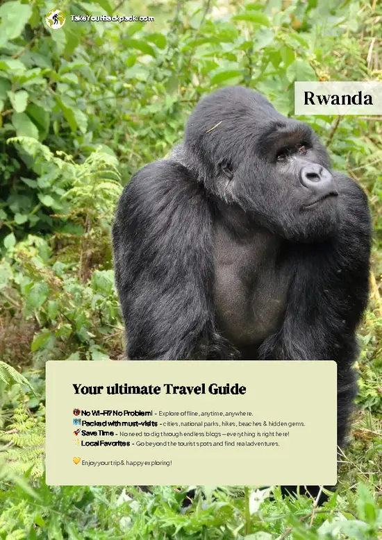
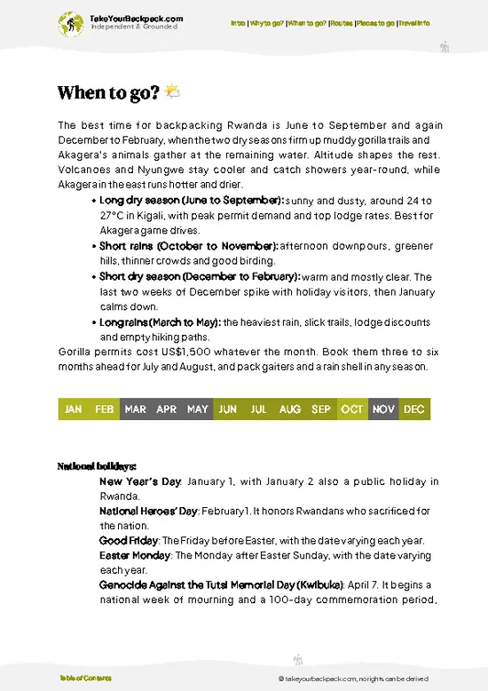
example page 0 from our offline Travel Guide for Rwanda
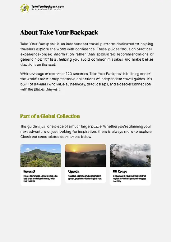
example page 1 from our offline Travel Guide for Rwanda
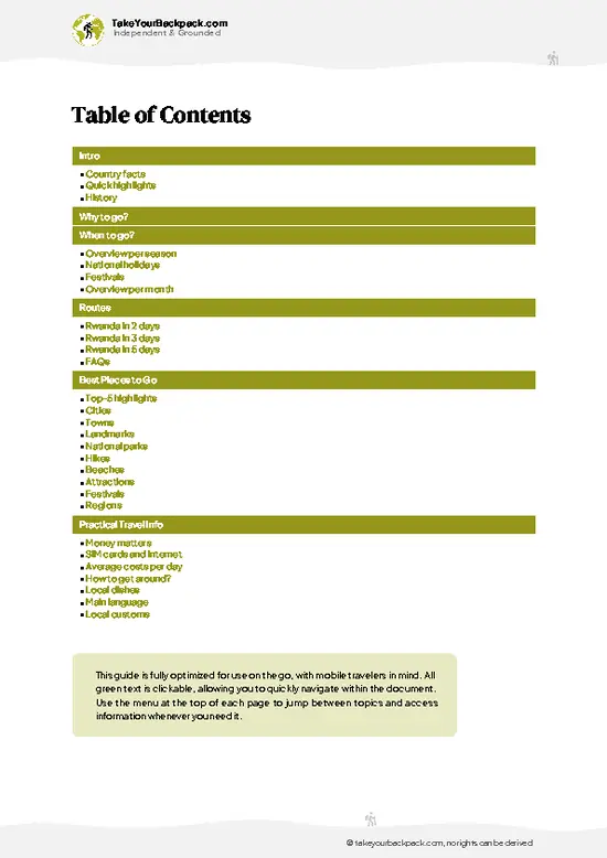
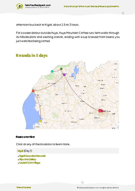
example page 2 from our offline Travel Guide for Rwanda
example page 3 from our offline Travel Guide for Rwanda
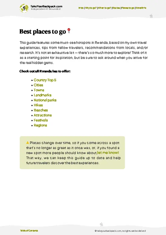
example page 4 from our offline Travel Guide for Rwanda
example page 5 from our offline Travel Guide for Rwanda
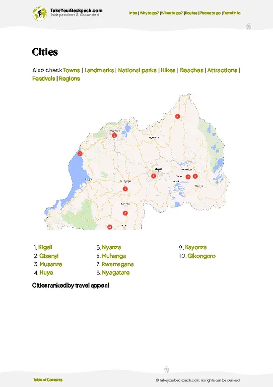
example page 6 from our offline Travel Guide for Rwanda
example page 7 from our offline Travel Guide for Rwanda
Loading the map 🌍
CLICK TO FILTER
cities
towns
landmarks
national parks
hikes
beaches
attractions
festivals
regions
SHOW COUNTRY’S BESTSHOW ALL

✨ Why go?
Ranked #2 hike in Rwanda
Reasons people choose to hike the here

Mount Karisimbi gives you the highest point in Rwanda and one of the few multi-day treks in the country, which is why backpackers who have already done gorillas and Lake Kivu come for it. The route crosses four vegetation zones in two days, from bamboo forest where golden monkeys sometimes appear, to the open giant lobelia slopes near the top, and the altitude gain is serious. On a clear morning the summit looks across the whole Virunga chain. It also fits a loop through the north easily, since Musanze is a hub with guesthouses and onward buses to Kigali and the Congo and Uganda borders. Expect to pay properly for the permit and the basic camping service, but you pay once and the park handles guides, porters and armed escorts. If you want one real mountain on a Rwanda route, this is it, and … read more 👉
Mount Karisimbi gives you the highest point in Rwanda and one of the few multi-day treks in the country, which is why backpackers who have already done gorillas and Lake Kivu come for it. The route crosses four vegetation zones in two days, from bamboo forest where golden monkeys sometimes appear, to the open giant lobelia slopes near the top, and the altitude gain is serious. On a clear morning the summit looks across the whole Virunga chain. It also fits a loop through the north easily, since Musanze is a hub with guesthouses and onward buses to Kigali and the Congo and Uganda borders. Expect to pay properly for the permit and the basic camping service, but you pay once and the park handles guides, porters and armed escorts. If you want one real mountain on a Rwanda route, this is it, and the 4,507 meter summit gives a sense of achievement that short walks cannot match.

💡 HighlightsTop highlights of Mount Karisimbi

  1. Karisimbi Summit: The top of the volcano and the main reason anyone signs up. A small crater is often draped in cloud, and when it clears you see Bisoke, Muhabura, Mikeno and the Congolese peaks. Frost and even a light dusting of hail are possible.
  2. High Camp Plateau: The overnight spot at about 3,700 meters sits on a saddle between Karisimbi and Bisoke. Mornings are bitterly cold, and the view from the tents is of rolling cloud banks and surrounding volcano cones.
  3. Bamboo Forest Zone: The first stretch of trail climbs through dense bamboo that is home to golden monkeys. You hear them rustling before you see them, and the ground here is slick with leaf litter and mud.
  4. Giant Lobelia and Hagenia Zone: Higher up, twisted hagenia trees draped in moss give way to towering lobelia and everlasting flowers.
… read more 👉
  1. Karisimbi Summit: The top of the volcano and the main reason anyone signs up. A small crater is often draped in cloud, and when it clears you see Bisoke, Muhabura, Mikeno and the Congolese peaks. Frost and even a light dusting of hail are possible.
  2. High Camp Plateau: The overnight spot at about 3,700 meters sits on a saddle between Karisimbi and Bisoke. Mornings are bitterly cold, and the view from the tents is of rolling cloud banks and surrounding volcano cones.
  3. Bamboo Forest Zone: The first stretch of trail climbs through dense bamboo that is home to golden monkeys. You hear them rustling before you see them, and the ground here is slick with leaf litter and mud.
  4. Giant Lobelia and Hagenia Zone: Higher up, twisted hagenia trees draped in moss give way to towering lobelia and everlasting flowers. It looks like another planet, and the Afroalpine plants are found only on these high African mountains.
  5. Kinigi Park Headquarters: The starting point, where the briefing and guide assignment happen at the base of the volcanoes. Dancers sometimes perform in the morning, and you can see the green farmland and the volcano cones rising behind.
The cheapest item on the list is the Kinigi Park Headquarters, since you only pay for it as part of your trek permit and the briefing and views cost nothing extra.
Spotted a mistake or missing something? Contact us.

Things to do near Mount Karisimbi

Ratings based on Tripadvisor reviews. When you book through this link, you support our work at no extra cost to you.

🌤️ When to go?When to go for the best experience

  • Long Dry Season (June to September): This is the window for the summit. Trails on the Virunga slopes stay firmest, and mornings at the Bisoke-side trailhead start around 8 to 12°C (46 to 54°F). Camp at about 3,700 m (12,140 ft) drops to 0 to 3°C (32 to 37°F) at night, and the summit near 4,507 m (14,787 ft) can hit freezing with wind. Expect the most hikers and the tightest booking.
  • Short Dry Season (December to February): Also good, with clearer mornings and slightly warmer days of 12 to 16°C (54 to 61°F) at the base. Fewer people than July and August, though festive weeks fill up.
  • Wet Seasons (March to May, October to November): Rain turns the bamboo and heather zones into slick mud, and cloud often blocks the view by midday. Summit nights stay at or below 2°C (36°F). Crowds thin, and trekkers
… read more 👉
  • Long Dry Season (June to September): This is the window for the summit. Trails on the Virunga slopes stay firmest, and mornings at the Bisoke-side trailhead start around 8 to 12°C (46 to 54°F). Camp at about 3,700 m (12,140 ft) drops to 0 to 3°C (32 to 37°F) at night, and the summit near 4,507 m (14,787 ft) can hit freezing with wind. Expect the most hikers and the tightest booking.
  • Short Dry Season (December to February): Also good, with clearer mornings and slightly warmer days of 12 to 16°C (54 to 61°F) at the base. Fewer people than July and August, though festive weeks fill up.
  • Wet Seasons (March to May, October to November): Rain turns the bamboo and heather zones into slick mud, and cloud often blocks the view by midday. Summit nights stay at or below 2°C (36°F). Crowds thin, and trekkers can sometimes find easier availability.
  • Daylight: Days run roughly 12 hours all year, so start the hike early regardless of month.
Book the two-day trek several weeks ahead for June to September, and pick a weekday departure for emptier trails.


source: climatestotravel.comJANJanuary: highly recommended for travelingFEBFebruary: highly recommended for travelingMARMarch: fair for travelingAPRApril: below average for travelingMAYMay: fair for travelingJUNJune: highly recommended for travelingJULJuly: excellent for travelingAUGAugust: excellent for travelingSEPSeptember: highly recommended for travelingOCTOctober: fair for travelingNOVNovember: below average for travelingDECDecember: highly recommended for traveling
when-to-go

✈️ The backpacker research shortcutRwanda Travel Guide

An offline-friendly backpacking guide with optimized travel routes, ranked highlights, transport advice, and the best areas to stay.
example page 0 from our offline Travel Guide for Rwanda
example page 1 from our offline Travel Guide for Rwanda
example page 2 from our offline Travel Guide for Rwanda
example page 3 from our offline Travel Guide for Rwanda
example page 4 from our offline Travel Guide for Rwanda
example page 5 from our offline Travel Guide for Rwanda
example page 6 from our offline Travel Guide for Rwanda
example page 7 from our offline Travel Guide for Rwanda
The digital guide (233 pages) contains:
✅ 57 highlights, ranked by travel appeal
✅ Optimized 2, 3 & 5-day travel routes
✅ Cities, national parks, landmarks, beaches
✅ How to get around
✅ Offline-friendly for travel without Wi-Fi
👉 Click to see all 30+ guide features

📅 Plan smarter in minutes, not weeks
✅ Month by month travel advice
✅ Festivals & national holidays
✅ Budget expectations

🗺️ Go to the right places, skip the overrated ones
✅ Honest pros & cons of destinations
✅ Top hikes, parks & viewpoints
✅ Lesser-known places most travelers miss
✅ Clear “worth it vs skip it” guidance

🛏️ Travel smoothly without rookie mistakes
✅ Best areas to stay
✅ Transport systems explained simply
✅ Common scams & safety advice
✅ SIM cards, money & practical tips

🌍 Understand the country, not just visit it
✅ Culture & traditions
✅ 52 Essential phrases & customs
✅ Festivals worth planning around
✅ Traveler-friendly historical context
✅ Insights that make places more meaningful

📱 Built for real travel conditions
✅ Fully downloadable PDF
✅ Works completely offline
✅ Optimized for phone use
✅ Useful in remote areas & buses
✅ Everything in one place
Stop searching, start planning
Get instant access to your full guide. 30‑day money-back guarantee.
+ Add another guide for just

By proceeding you agree to our terms.
Sent to your inbox immediately after payment • 100% Secure Checkout
Best Backpacking Travel Advisor 2025 tourism awardBest Backpacking
Travel Advisor
2025
What others say about Take Your Backpack Guides:
⭐⭐⭐⭐⭐
Fantastic, amazing amount of information!
⭐⭐⭐⭐⭐
My goodness this is amazing, it's what I've been looking for hats off too you!
⭐⭐⭐⭐⭐
I think this is absolutely BRILLIANT
⭐⭐⭐⭐
Very complete and informative. It's still missing places, but I gotta to commend you
⭐⭐⭐⭐⭐
This is truly amazing, thank you, can't wait to explore it with my kids!
⭐⭐⭐⭐⭐
Awesome resource, thank you!
⭐⭐⭐⭐⭐
This is amazing! Can't wait to explore the ones I haven't seen
⭐⭐⭐⭐
I love this! Well done, great idea.
⭐⭐⭐⭐⭐
Thanks for taking the time to make this gem!
⭐⭐⭐⭐⭐
This might be the best website I've ever seen.
⭐⭐⭐⭐⭐
Congratulations, and thank you so much for your work; it's incredibly valuable.
⭐⭐⭐⭐
In all seriousness I think you did a great job pointing out the important spots
⭐⭐⭐⭐⭐
10/10 very good
⭐⭐⭐⭐⭐
As someone who's only just starting to visit regularly this is awesome, thank you.
⭐⭐⭐⭐
Thank you very much! I'm going to visit my dad, it's going to be very useful!
⭐⭐⭐⭐⭐
This is really cool! We'll be travelling for the first time and this definitely come in handy.
⭐⭐⭐⭐⭐
You are now our minister of culture, congratulations 👨‍💼
⭐⭐⭐⭐⭐
Just wanted to tell you that this is a pearl! Going to follow your recommendations.
⭐⭐⭐⭐⭐
This is so cool. I'll definitely be using the resource for my travels soon.
⭐⭐⭐⭐⭐
This is very impressive! Good work.
⭐⭐⭐⭐⭐
This is an amazing and informative site. Very well done!

🛏️ Where to stay?Best areas and accommodation options

If you enjoy meeting fellow travelers, consider choosing hostels with high ratings for atmosphere. On the other hand, if you prefer having your own space, a hotel might be a better option.

🥾 Hike detailsA practical overview of the hike

Total Distance: Mount Karisimbi is roughly 13 to 15 kilometers return from the trailhead, usually split across two days.
Estimated Duration: Two days with one night at high camp. Day one is about 5 to 6 hours of climbing, and the summit push and descent the next day takes 6 to 8 hours.
Difficulty: Demanding. The climb is steep, the altitude can cause headaches, and the path is muddy and cold.
Starting Point: Kinigi, the Volcanoes National Park headquarters outside Musanze.
  • Public Transport: Minibuses run from Kigali to Musanze, and from there you need a moto or taxi to Kinigi.
  • Briefing: You assemble
… read more 👉
Total Distance: Mount Karisimbi is roughly 13 to 15 kilometers return from the trailhead, usually split across two days.
Estimated Duration: Two days with one night at high camp. Day one is about 5 to 6 hours of climbing, and the summit push and descent the next day takes 6 to 8 hours.
Difficulty: Demanding. The climb is steep, the altitude can cause headaches, and the path is muddy and cold.
Starting Point: Kinigi, the Volcanoes National Park headquarters outside Musanze.
  • Public Transport: Minibuses run from Kigali to Musanze, and from there you need a moto or taxi to Kinigi.
  • Briefing: You assemble early at the headquarters, where guides and armed rangers are assigned.
Major Landmarks:
  • Bamboo Forest: The lower slopes, with golden monkeys.
  • High Camp: The overnight base on the saddle near Bisoke.
  • Summit Crater: The small crater at 4,507 meters.
Terrain and Scenery: Steep, rooty trail, volcanic soil, wet ground and some rocky scrambling near the top. Views open toward the Virunga chain and into Congo when clouds lift.
Vegetation: Bamboo, hagenia and moss forest, then giant lobelia, heather and everlasting flowers on the open upper slopes.
Wildlife: Golden monkeys, forest birds, buffalo and elephant signs lower down, and occasional duiker. Gorillas live on these slopes, but the trek is not a gorilla visit.
⚠️ Hiking info can sometimes be outdated or inaccurate. Before you hit the trail, check the latest conditions with locals. If you do spot anything that's off, I'd love to hear from you, so I can update it for fellow travelers.

🛡️ SafetyStaying Safe: What Travelers Should Know

Mount Karisimbi is a well-managed, guided trek, and the main issues are cold, altitude and wet footing rather than crime or dangerous animals. The summit sits above 4,500 m (14,760 ft), so headaches and nausea are common. Walk slowly, drink steadily, and tell your guide early if symptoms build. Weather swings fast, with rain, hail and sub-freezing wind possible even in the dry season, so carry a waterproof shell, warm hat, gloves and a proper sleeping bag rated for freezing nights. The path climbs steeply through bamboo and giant lobelia zones, and mud and loose volcanic rock make sturdy boots and trekking poles worth having. Armed park rangers walk with groups because buffalo and elephants roam the lower forest, and gorilla groups range on the slopes. Follow ranger instructions, stay quiet, … read more 👉
Mount Karisimbi is a well-managed, guided trek, and the main issues are cold, altitude and wet footing rather than crime or dangerous animals. The summit sits above 4,500 m (14,760 ft), so headaches and nausea are common. Walk slowly, drink steadily, and tell your guide early if symptoms build. Weather swings fast, with rain, hail and sub-freezing wind possible even in the dry season, so carry a waterproof shell, warm hat, gloves and a proper sleeping bag rated for freezing nights. The path climbs steeply through bamboo and giant lobelia zones, and mud and loose volcanic rock make sturdy boots and trekking poles worth having. Armed park rangers walk with groups because buffalo and elephants roam the lower forest, and gorilla groups range on the slopes. Follow ranger instructions, stay quiet, and keep your distance. First-timers often underpack for the camp night, so bring extra layers and enough food for two days.

FAQFrequently asked questions about Mount Karisimbi

Mount Karisimbi takes two days, with about 6 to 7 hours up to the camp at roughly 3,700 m and a further 2 to 3 hours to reach the 4,507 m summit the next morning. The descent back to the trailhead takes about 4 to 5 hours. The total distance is roughly 14 to 15 km (9 miles) round trip, starting near Bisate in Volcanoes National Park.
Mount Karisimbi is a hard trek, mainly because of the altitude gain of about 1,900 m from the trailhead and the cold camp night. The trail is steep and muddy in places, but no technical climbing is needed. Fit hikers with decent boots usually manage, and a slow pace helps with altitude. Rain from March to May and October to November makes the footing tougher.
Yes, you must book a permit through the Rwanda Development Board, and a park guide with armed rangers is required. The Karisimbi permit costs around US$400 per person, which covers the guide and park entry, and porters are available for roughly US$20 to 30. Camping gear and tents can be arranged for an extra fee, so confirm what your booking includes in advance.
⚠️ Things can change over time, so always validate details locally before you go.

Other Rwandan hikes near Mount Karisimbi

Explore more nearby:


💡 Not sure where to go next?
Create a personalized itinerary for Rwanda including Mount Karisimbi and the places that fit your trip.

Generate my itinerary

👉 Discover all hikes

Or checkout all Rwanda has to offer (think cities, towns, villages, national parks, hikes, beaches, festivals)
Country photo of Rwanda

We 💚 feedbackFinal thoughts on hiking the Mount Karisimbi

Many people underestimate Mount Karisimbi and show up in light cotton layers and old sneakers. Pack proper waterproofs, warm gloves, a hat and sturdy boots, since the camp can drop near freezing, and hire a porter to carry your bag. You will climb better and enjoy the summit far more.

✍️ Help improve this page!
The information on this page is based on in-depth research, insights shared by experienced travelers, and feedback from the local travel community in Rwanda. While every effort is made to keep the information accurate and current, conditions can change — so if you spot anything incorrect or outdated, please get in touch.


🙋‍♂️ Give feedback

👋 Meet the founderWho’s Behind Take Your Backpack?

Johan, backpacker and founder of TakeYourBackpackHi, I’m Johan (Netherlands 🇳🇱), the creator of TakeYourBackpack. Over the past 3 decades, I’ve backpacked through 90+ countries across six continents, gaining extensive experience with independent travel, long-term trips, and overland routes.

This site is built on a combination of firsthand travel experience and carefully curated insights from other backpackers. Many guides are based on places I’ve personally visited, while others bring together tips, observations, and practical advice shared by trusted travelers I’ve met along the way.

The goal is to provide realistic, experience-driven guidance — not generic itineraries — so you can explore destinations with better context, clearer expectations, and more confidence.