×

Sint Maarten🇸🇽 | hikesBellevueLagoon ridge, sunrise loop, Saba sightline, goat slopes | things to do and best time to go

Explore Naked Boy HillExplore Cole Bay to Indigo Bay

Backpacking in Bellevue
By Johan Kruseman 🇳🇱 | Updated October 22, 2026

Bellevue is free, needs no gear beyond decent shoes, and works as a sunrise or late-afternoon loop that stays in shade once the sun drops behind the hills. It starts at the roundabout by the Simpson Bay Lagoon causeway and climbs the hills along the Dutch-French border. Expect a short, rolling walk of about 4 kilometers on a mix of paved lane, dirt track and rocky footpath, with sea and lagoon views opening between scrub and goat-grazed slopes. Difficulty is easy to moderate, mostly from heat and loose stones. Local buses run along the main road below, and you walk up from there. Go before 8 a.m. and bring more water than seems sensible. Compared with Pic Paradis, the island’s highest summit, Bellevue is shorter, quieter and has no ticketed entrance.

Discover everything you want to know in the 📖 Sint Maarten Travel Guide.
Best time to go: November - May
Duration: 2 hours
Distance: 4 kilometers
Total ascent: 150 meters


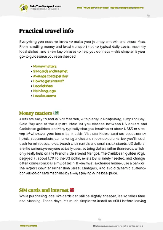
example page 0 from our offline Travel Guide for Sint Maarten
example page 1 from our offline Travel Guide for Sint Maarten
example page 2 from our offline Travel Guide for Sint Maarten
example page 3 from our offline Travel Guide for Sint Maarten
example page 4 from our offline Travel Guide for Sint Maarten
example page 5 from our offline Travel Guide for Sint Maarten
example page 6 from our offline Travel Guide for Sint Maarten
example page 7 from our offline Travel Guide for Sint Maarten
Loading the map 🌍
CLICK TO FILTER
towns
villages
landmarks
national parks
hikes
beaches
attractions
festivals
SHOW COUNTRY’S BESTSHOW ALL

✨ Why go?
Ranked #99 hike in Sint Maarten
Why Bellevue should be on your travel list

Bellevue gives you a proper island overview in about two hours, which is why backpackers slot it into a lazy beach week. The Simpson Bay Lagoon panorama is the draw: you see yachts at anchor, the bridge channel and the French side stretching toward Marigot, all from a ridge you reach without a car. Because the walk is short and there is no entry fee, you can bend it to your mood. Do the full loop, turn back at the first open lookout, or string it together with a swim afterward. It also suits a long layover, since the starting area is a short bus ride from the main road. On clear mornings Saba’s peak rises on the horizon, a reminder of how small and steep these islands are. Pack light, start early, and the day stays open for everything else.

💡 HighlightsEssential experiences to have while hiking the Bellevue

  1. Simpson Bay Lagoon Views: The headline sight. From the ridge you look down on a huge sheltered lagoon dotted with sailboats, with the channel and the low spit of land separating it from the Caribbean Sea.
  2. Cole Bay Hill Lookout: A rocky open stretch where the scrub drops away and you can follow the coastline toward the Dutch-French border. It is the best place for a water break.
  3. Sentry Hill Skyline: One of the island’s higher peaks, visible inland as a green dome. Seeing it from the ridge helps you read how the hills run across Sint Maarten.
  4. Saba on the Horizon: On clear mornings the cone of Saba floats to the south-southwest, with Sint Eustatius sometimes faint beside it. Go early, as haze often hides them by midday.
  5. Great Bay and Philipsburg Glimpse: Looking east you can pick out the long sweep
… read more 👉
  1. Simpson Bay Lagoon Views: The headline sight. From the ridge you look down on a huge sheltered lagoon dotted with sailboats, with the channel and the low spit of land separating it from the Caribbean Sea.
  2. Cole Bay Hill Lookout: A rocky open stretch where the scrub drops away and you can follow the coastline toward the Dutch-French border. It is the best place for a water break.
  3. Sentry Hill Skyline: One of the island’s higher peaks, visible inland as a green dome. Seeing it from the ridge helps you read how the hills run across Sint Maarten.
  4. Saba on the Horizon: On clear mornings the cone of Saba floats to the south-southwest, with Sint Eustatius sometimes faint beside it. Go early, as haze often hides them by midday.
  5. Great Bay and Philipsburg Glimpse: Looking east you can pick out the long sweep of Great Bay and the cruise ships when they are in. It gives you a sense of scale between the quiet hills and the busy waterfront.
Bellevue and all five lookouts fit into roughly two to three hours, including photo stops and a slow walk back down.
Spotted a mistake or missing something? Contact us.

🌤️ When to go?Weather, crowds, and seasonal trade-offs

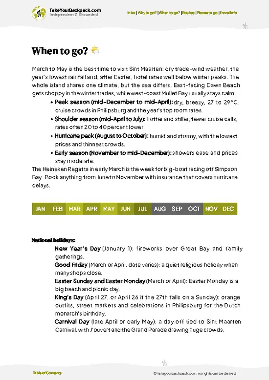
  • Dry Season (December to April): Bellevue sits on the Dutch side near Pelikan and Simpson Bay, and these months give the steadiest trail conditions. Days run 27 to 30°C (81 to 86°F), nights 22 to 24°C (72 to 75°F), with trade winds that take the edge off midday climbs. Daylight lasts roughly 11 to 12 hours. Crowds and lodging prices peak, especially over Christmas and February.
  • Hurricane Season (June to November): Expect 29 to 33°C (84 to 91°F), heavy humidity and afternoon downpours that turn slopes slick. August to October carries the highest storm risk, and trails may be closed after a system passes. Rooms drop by a third or more.
  • Shoulder Months (May and November): Warm, greener hills, thinner crowds and moderate prices, with showers that rarely last long.
Start at first light in any season, since the hill heat builds fast by 10 a.m.

source: climatestotravel.comJANJanuary: excellent for travelingFEBFebruary: excellent for travelingMARMarch: excellent for travelingAPRApril: excellent for travelingMAYMay: highly recommended for travelingJUNJune: fair for travelingJULJuly: fair for travelingAUGAugust: fair for travelingSEPSeptember: fair for travelingOCTOctober: fair for travelingNOVNovember: highly recommended for travelingDECDecember: excellent for traveling
sint-maarten-hike-bellevue
© Google |

✈️ The backpacker research shortcutSint Maarten Travel Guide

An offline-friendly backpacking guide with optimized travel routes, ranked highlights, transport advice, and the best areas to stay.
example page 0 from our offline Travel Guide for Sint Maarten
example page 1 from our offline Travel Guide for Sint Maarten
example page 2 from our offline Travel Guide for Sint Maarten
example page 3 from our offline Travel Guide for Sint Maarten
example page 4 from our offline Travel Guide for Sint Maarten
example page 5 from our offline Travel Guide for Sint Maarten
example page 6 from our offline Travel Guide for Sint Maarten
example page 7 from our offline Travel Guide for Sint Maarten
The digital guide (104 pages) contains:
✅ 20 highlights, ranked by travel appeal
✅ Optimized 2, 3 & 5-day travel routes
✅ Cities, national parks, landmarks, beaches
✅ How to get around
✅ Offline-friendly for travel without Wi-Fi
👉 Click to see all 30+ guide features

📅 Plan smarter in minutes, not weeks
✅ Month by month travel advice
✅ Festivals & national holidays
✅ Budget expectations

🗺️ Go to the right places, skip the overrated ones
✅ Honest pros & cons of destinations
✅ Top hikes, parks & viewpoints
✅ Lesser-known places most travelers miss
✅ Clear “worth it vs skip it” guidance

🛏️ Travel smoothly without rookie mistakes
✅ Best areas to stay
✅ Transport systems explained simply
✅ Common scams & safety advice
✅ SIM cards, money & practical tips

🌍 Understand the country, not just visit it
✅ Culture & traditions
✅ Local customs
✅ Festivals worth planning around
✅ Traveler-friendly historical context
✅ Insights that make places more meaningful

📱 Built for real travel conditions
✅ Fully downloadable PDF
✅ Works completely offline
✅ Optimized for phone use
✅ Useful in remote areas & buses
✅ Everything in one place
Stop searching, start planning
Get instant access to your full guide. 30‑day money-back guarantee.
+ Add another guide for just

By proceeding you agree to our terms.
Sent to your inbox immediately after payment • 100% Secure Checkout
Best Backpacking Travel Advisor 2025 tourism awardBest Backpacking
Travel Advisor
2025
What others say about Take Your Backpack Guides:
⭐⭐⭐⭐⭐
Fantastic, amazing amount of information!
⭐⭐⭐⭐⭐
My goodness this is amazing, it's what I've been looking for hats off too you!
⭐⭐⭐⭐⭐
I think this is absolutely BRILLIANT
⭐⭐⭐⭐
Very complete and informative. It's still missing places, but I gotta to commend you
⭐⭐⭐⭐⭐
This is truly amazing, thank you, can't wait to explore it with my kids!
⭐⭐⭐⭐⭐
Awesome resource, thank you!
⭐⭐⭐⭐⭐
This is amazing! Can't wait to explore the ones I haven't seen
⭐⭐⭐⭐
I love this! Well done, great idea.
⭐⭐⭐⭐⭐
Thanks for taking the time to make this gem!
⭐⭐⭐⭐⭐
This might be the best website I've ever seen.
⭐⭐⭐⭐⭐
Congratulations, and thank you so much for your work; it's incredibly valuable.
⭐⭐⭐⭐
In all seriousness I think you did a great job pointing out the important spots
⭐⭐⭐⭐⭐
10/10 very good
⭐⭐⭐⭐⭐
As someone who's only just starting to visit regularly this is awesome, thank you.
⭐⭐⭐⭐
Thank you very much! I'm going to visit my dad, it's going to be very useful!
⭐⭐⭐⭐⭐
This is really cool! We'll be travelling for the first time and this definitely come in handy.
⭐⭐⭐⭐⭐
You are now our minister of culture, congratulations 👨‍💼
⭐⭐⭐⭐⭐
Just wanted to tell you that this is a pearl! Going to follow your recommendations.
⭐⭐⭐⭐⭐
This is so cool. I'll definitely be using the resource for my travels soon.
⭐⭐⭐⭐⭐
This is very impressive! Good work.
⭐⭐⭐⭐⭐
This is an amazing and informative site. Very well done!

🛏️ Where to stay?Where staying makes the most sense

If you enjoy meeting fellow travelers, consider choosing hostels with high ratings for atmosphere. On the other hand, if you prefer having your own space, a hotel might be a better option.

🥾 Hike detailsRoute, distance, and difficulty explained

Total Distance: Bellevue is a loop or out-and-back walk of about 4 kilometers, depending on how far you push along the ridge.
Estimated Duration: Two hours at a relaxed pace, three if you stop at every lookout.
Difficulty: Easy to moderate. The climb is short, but sun exposure and loose stone make it feel harder than the numbers suggest.
Starting Point: The roundabout by the causeway across Simpson Bay Lagoon, reached by local bus along the main road. Taxis also run from nearby bays.
Major Landmarks:
  • Lagoon Lookout: The first open view over Simpson Bay Lagoon.
  • Ridge Section: A rocky crest with views
… read more 👉
Total Distance: Bellevue is a loop or out-and-back walk of about 4 kilometers, depending on how far you push along the ridge.
Estimated Duration: Two hours at a relaxed pace, three if you stop at every lookout.
Difficulty: Easy to moderate. The climb is short, but sun exposure and loose stone make it feel harder than the numbers suggest.
Starting Point: The roundabout by the causeway across Simpson Bay Lagoon, reached by local bus along the main road. Taxis also run from nearby bays.
Major Landmarks:
  • Lagoon Lookout: The first open view over Simpson Bay Lagoon.
  • Ridge Section: A rocky crest with views both ways, toward the lagoon and toward the open sea.
  • Inland Viewpoint: A gap in the scrub showing Sentry Hill and neighboring peaks.
Terrain and Scenery: Paved lane at first, then packed dirt and rocky footpath. Footing gets slippery on loose gravel after rain, and there is little shade on the crest.
Vegetation: Dry tropical scrub, acacia, cactus and frangipani, with greener patches in the folds of the hills.
Wildlife: Lizards on the rocks, hummingbirds and bananaquits in the flowering shrubs, pelicans over the lagoon below, and the occasional free-roaming goat.
Practical Notes: Bring at least 1.5 liters of water, a hat and sun protection. Wear closed shoes with grip rather than sandals.
⚠️ Hiking info can sometimes be outdated or inaccurate. Before you hit the trail, check the latest conditions with locals. If you do spot anything that's off, I'd love to hear from you, so I can update it for fellow travelers.

🛡️ SafetyStaying Safe: What Travelers Should Know

Bellevue is a low-risk hike where the main hazards are heat, loose footing and sun exposure. The slopes around the hill have little shade, so start early, carry at least 2 liters of water per person and wear a hat. Rocky, dry-packed sections turn slippery after rain, so trail shoes with real tread beat sandals. Paths are not always signed, and side tracks from goat paths and old construction cuts can confuse you, so download an offline map before leaving the road. Stray dogs and free-ranging goats are the animals you will most likely meet, and both ignore you if you stay calm and keep walking. Skip the hike during tropical storms, when runoff and wind make the ridge unpleasant. Tell your host your route, and keep your phone charged for the descent.

FAQTraveler FAQ

Bellevue takes about 1 to 2 hours round trip for most hikers, depending on which route you pick. A steady walker covers the main climb in 30 to 45 minutes, and the descent is quicker. Add another 30 minutes if you stop for photos of Simpson Bay Lagoon and the Caribbean Sea.
Bellevue is an easy to moderate hike. The climb is short, but sections are steep and rocky, with loose stones and almost no shade, so the heat does most of the work. Most reasonably fit first-timers manage it in sneakers, though trail shoes help on slick or dusty ground.
Bellevue does not require a guide or a permit, and there is no entry fee, so you can walk it independently at any time of day. The paths are informal and not always signed, so an offline map is useful. If you want local history and plant knowledge, a guided island walk typically costs around US$40 to 80 per person.
⚠️ Things can change over time, so always validate details locally before you go.

Other St. Maartener hikes near Bellevue

Explore more nearby:

  • Simpson Bay to Beacon Hill—Low jets, beachfront start, lagoon masts, easy headland| 2 km away
  • Sentry Hill—Summit ridge, dry forest, two-bay panorama, steep footing| 2 km away
  • Pelican Key—residential hills, sea-facing slopes, cactus stands| 2 km away

💡 Not sure where to go next?
Create a personalized itinerary for Sint Maarten including Bellevue and the places that fit your trip.

Generate my itinerary

👉 Discover all hikes

Or checkout all Sint Maarten has to offer (think cities, towns, villages, national parks, hikes, beaches, festivals)
Country photo of Sint Maarten

We 💚 feedbackFinal thoughts on hiking the Bellevue

Bellevue looks like a quick sweat for a photo, but the detail to catch is the lagoon itself: stop at the lookout and watch the boats come and go through the channel. I would walk it early, carry a swimsuit, and finish at a bay for a cold drink instead of heading straight back.

✍️ Help improve this page!
The information on this page is based on in-depth research, insights shared by experienced travelers, and feedback from the local travel community in Sint Maarten. While every effort is made to keep the information accurate and current, conditions can change — so if you spot anything incorrect or outdated, please get in touch.


🙋‍♂️ Give feedback

👋 Meet the founderWho’s Behind Take Your Backpack?

Johan, backpacker and founder of TakeYourBackpackHi, I’m Johan (Netherlands 🇳🇱), the creator of TakeYourBackpack. Over the past 3 decades, I’ve backpacked through 90+ countries across six continents, gaining extensive experience with independent travel, long-term trips, and overland routes.

This site is built on a combination of firsthand travel experience and carefully curated insights from other backpackers. Many guides are based on places I’ve personally visited, while others bring together tips, observations, and practical advice shared by trusted travelers I’ve met along the way.

The goal is to provide realistic, experience-driven guidance — not generic itineraries — so you can explore destinations with better context, clearer expectations, and more confidence.