

×

Slovakia🇸🇰 | hikesLow Tatrasbroad ridgelines, grassy summits, karst caves | things to do and best time to go

Explore High TatrasExplore Mala Fatra

Backpacking in Low Tatras
🌟 Highlighthike ranked #3
By Johan Kruseman 🇳🇱 | Updated July 30, 2026

Your boots crunch over a spine of broken frost as the wind shoves hard across the ridge, carrying the smell of wet pine and woodsmoke from some valley you can’t even see. A cable car hum fades behind you; ahead, the trail rolls away in pale grass and rock, clouds dragging shadows over everything. This is the Low Tatras, the long, muscular mountain range running west–east through central Slovakia, opposite the sharper High Tatras to the north. The classic ridge hike is big: long days, steady climbs, exposed sections, and weather that can flip from bluebird to sideways rain in an hour, but the payoff is huge, with wide-open views, bunkhouse-style huts, and a real sense of crossing a whole region on foot. It’s easier to reach by bus and train than many Slovak ranges, less dramatic than the High Tatras but wilder, more continuous, and more about the journey than the summit photo.

Discover everything you want to know in the 📖 Slovakia Travel Guide.
Best time to go: April - October, December - February
Duration: 5 to 7 days
Distance: 300 kilometers
Total ascent: 1,200 to 1,500 meters


Get your Slovakia guide
76 ranked highlights, routes & tips, works offline (295 pages)
Loading the map 🌍
CLICK TO FILTER
cities
towns
villages
landmarks
national parks
hikes
beaches
attractions
festivals
regions
SHOW COUNTRY’S BESTSHOW ALL

✨ Why go?
Ranked #3 hike in Slovakia
What makes it a must-see hike

The Low Tatras in Slovakia draw backpackers for a reason. It’s not just about the scenery-to-effort ratio—though that’s a big part of it. You’ll find staggering views of jagged peaks and lush valleys that reward every uphill step. The trails are well-marked, making navigation a breeze, and they offer flexible distances to suit any level of endurance. Whether you’re in for a quick day hike or a multi-day trek, you can tailor your adventure.

Getting there is a cinch, too. Public transport access is solid, with buses and trains connecting you to trailheads without breaking the bank. Speaking of costs, this region is a low-cost haven. You can grab a hearty meal for a few euros and find budget-friendly accommodations that don’t skimp on character.

As you trek, the burn in your legs transforms … read more 👉
The Low Tatras in Slovakia draw backpackers for a reason. It’s not just about the scenery-to-effort ratio—though that’s a big part of it. You’ll find staggering views of jagged peaks and lush valleys that reward every uphill step. The trails are well-marked, making navigation a breeze, and they offer flexible distances to suit any level of endurance. Whether you’re in for a quick day hike or a multi-day trek, you can tailor your adventure.

Getting there is a cinch, too. Public transport access is solid, with buses and trains connecting you to trailheads without breaking the bank. Speaking of costs, this region is a low-cost haven. You can grab a hearty meal for a few euros and find budget-friendly accommodations that don’t skimp on character.

As you trek, the burn in your legs transforms into a rush of exhilaration when you reach a summit. Picture yourself cracking open that first cold beer, soaking in the panorama. The Low Tatras are not just a hike; they’re a celebration of the journey itself.
Want to include Low Tatras in your Slovakia route?
Create a personalized Slovakia itinerary that includes Low Tatras and the places that fit your trip — based on your travel style, budget, and available time. Get your route in seconds.

Generate my trip

💡 HighlightsMust-see experiences and standout moments

  1. Ďumbier (2,043 m) — The highest point of the Low Tatras, and for good reason: long, raw ridge walks, huge 360° views (Liptov and the High Tatras to the north, rolling lowlands to the south) and alpine meadows that stay snow-dusted late into spring. It feels like you’ve climbed “the roof” of the range without the crowds of the High Tatras, and the ridge between Ďumbier and Chopok is classic day-hike stuff.
  2. Chopok (2,024 m) and the Jasná ridge — Easy to reach by cable car if you want a short, spectacular fix or use it as the start of a proper traverse. The summit terraces give insane panoramas at sunrise/sunset, and the mix of resort infrastructure and wild ridge means you can snack comfortably before heading into real alpine terrain.
  3. Dereše (≈2,004 m) — Sharp, open slopes and dramatic skyline
read more 👉
  1. Ďumbier (2,043 m) — The highest point of the Low Tatras, and for good reason: long, raw ridge walks, huge 360° views (Liptov and the High Tatras to the north, rolling lowlands to the south) and alpine meadows that stay snow-dusted late into spring. It feels like you’ve climbed “the roof” of the range without the crowds of the High Tatras, and the ridge between Ďumbier and Chopok is classic day-hike stuff.
  2. Chopok (2,024 m) and the Jasná ridge — Easy to reach by cable car if you want a short, spectacular fix or use it as the start of a proper traverse. The summit terraces give insane panoramas at sunrise/sunset, and the mix of resort infrastructure and wild ridge means you can snack comfortably before heading into real alpine terrain.
  3. Dereše (≈2,004 m) — Sharp, open slopes and dramatic skyline profiles make this one of the most photogenic peaks on the ridge. The ascent/descents have scree fields, flowers in summer, and frequent marmot sightings — it’s the kind of place where the terrain itself keeps you honest and the views reward the effort.
  4. Demänovská Caves (Cave of Liberty & Ice Cave) — A totally different kind of highlight: subterranean karst wonderlands at the foot of the mountains. After a sweaty climb you can descend into cooled halls full of stalactites, bizarre formations and year-round ice — a great contrast to the sun-baked ridges above and an easy, sheltered half-day detour.
  5. Kráľova hoľa (≈1,946 m) — More than a summit: a place steeped in Slovak folklore and quiet, wind-swept panoramas. The rounded, open top gives long views across central Slovakia and feels wildly peaceful compared with the busier western ridges — a good spot for sunrise, solitude, and to notice bird life or fresh tracks rather than other hikers.
Spotted a mistake or missing something? Contact us.

Things to do near Low Tatras

Ratings based on Tripadvisor reviews. When you book through this link, you support our work at no extra cost to you.

🌤️ When to go?Best time to hike the Low Tatras


  • Weather: Spring and early autumn bring crisp, clear air with less rain, making trails grippy and the views sharp. Summer heats up to 20-25°C (68-77°F), perfect for sweating it out but expect afternoon showers that can turn paths slick fast.

  • Temperature: Winter drops below freezing, often -5 to -15°C (23 to 5°F), turning the Low Tatras into a snow playground but demanding serious gear. Late spring warms from 5°C (41°F) in mornings to 15°C (59°F) midday, ideal for layering.

  • Daylight Hours: Peak summer stretches daylight to 16 hours, giving you long windows to cover ground. In contrast, winter days shrink to 8 hours, squeezing your hiking time and pushing early starts.

  • Crowds: July and August pack the trails with weekend warriors and families, diluting solitude. Shoulder seasons—May-June
read more 👉

  • Weather: Spring and early autumn bring crisp, clear air with less rain, making trails grippy and the views sharp. Summer heats up to 20-25°C (68-77°F), perfect for sweating it out but expect afternoon showers that can turn paths slick fast.

  • Temperature: Winter drops below freezing, often -5 to -15°C (23 to 5°F), turning the Low Tatras into a snow playground but demanding serious gear. Late spring warms from 5°C (41°F) in mornings to 15°C (59°F) midday, ideal for layering.

  • Daylight Hours: Peak summer stretches daylight to 16 hours, giving you long windows to cover ground. In contrast, winter days shrink to 8 hours, squeezing your hiking time and pushing early starts.

  • Crowds: July and August pack the trails with weekend warriors and families, diluting solitude. Shoulder seasons—May-June and September—offer quieter paths and a more intimate connection with the mountains.

  • Seasonal Activities: Summer is all about hiking and wildflowers; autumn paints the forests in fiery hues and opens mushroom foraging. Winter shifts focus to skiing and snowshoeing, transforming the terrain and your pace.

  • Price Fluctuations: Accommodation and transport costs spike in summer and winter ski season. Shoulder seasons bring better deals and more availability, letting you stretch your budget without sacrificing access.


Pro-tip: Aim for late spring or early autumn—when the trails are quiet, the weather is stable, and the mountain’s character shines without the crush of peak-season crowds.


source: climatestotravel.comJANJanuary: highly recommended for travelingFEBFebruary: highly recommended for travelingMARMarch: fair for travelingAPRApril: good for travelingMAYMay: excellent for travelingJUNJune: excellent for travelingJULJuly: good for travelingAUGAugust: good for travelingSEPSeptember: excellent for travelingOCTOctober: highly recommended for travelingNOVNovember: fair for travelingDECDecember: highly recommended for traveling
slovakia-hike-low-tatras
© Google | Lukas Oliva

✈️ The backpacker research shortcutSlovakia Travel Guide

An offline-friendly backpacking guide with optimized travel routes, ranked highlights, transport advice, and the best areas to stay.
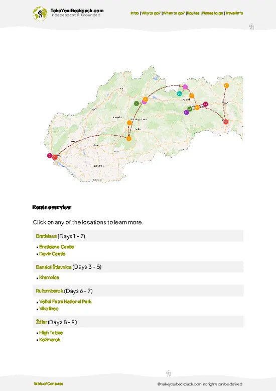
example page 0 from our offline Travel Guide for Slovakia
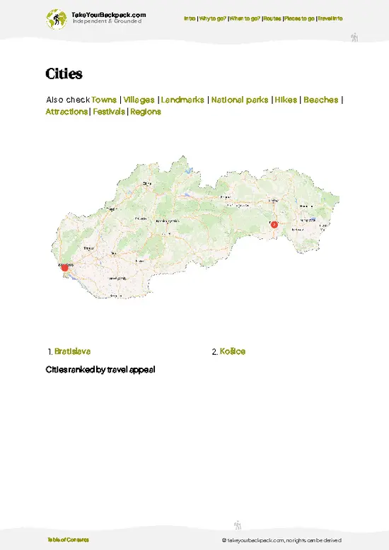
example page 1 from our offline Travel Guide for Slovakia
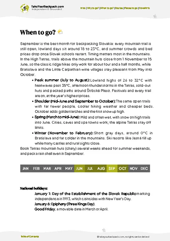
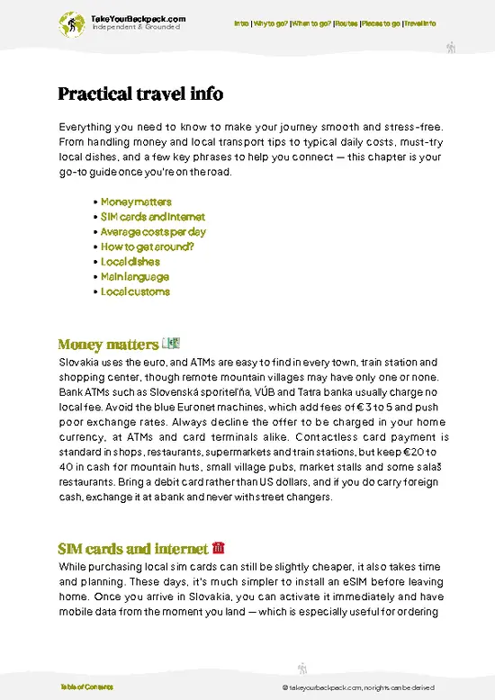
example page 2 from our offline Travel Guide for Slovakia
example page 3 from our offline Travel Guide for Slovakia
example page 4 from our offline Travel Guide for Slovakia
example page 5 from our offline Travel Guide for Slovakia
example page 6 from our offline Travel Guide for Slovakia
example page 7 from our offline Travel Guide for Slovakia
The digital guide (295 pages) contains:
76 highlights, ranked by travel appeal
Optimized 5, 10 & 15-day travel routes
Cities, national parks, landmarks, beaches
How to get around
Offline-friendly for travel without Wi-Fi
👉 Click to see all 30+ guide features

📅 Plan smarter in minutes, not weeks
Month by month travel advice
Festivals & national holidays
Budget expectations

🗺️ Go to the right places, skip the overrated ones
Honest pros & cons of destinations
Top hikes, parks & viewpoints
Lesser-known places most travelers miss
Clear “worth it vs skip it” guidance

🛏️ Travel smoothly without rookie mistakes
Best areas to stay
Transport systems explained simply
Common scams & safety advice
SIM cards, money & practical tips

🌍 Understand the country, not just visit it
Culture & traditions
52 Essential phrases & customs
Festivals worth planning around
Traveler-friendly historical context
Insights that make places more meaningful

📱 Built for real travel conditions
Fully downloadable PDF
Works completely offline
Optimized for phone use
Useful in remote areas & buses
Everything in one place
Save weeks of stressful planning
Get instant access to your full guide. 30‑day money-back guarantee.


By proceeding you agree to our terms.
Sent to your inbox immediately after payment • 100% Secure Checkout
Best Backpacking Travel Advisor 2025 tourism awardBest Backpacking
Travel Advisor
2025
What others say about Take Your Backpack Guides:
⭐⭐⭐⭐⭐
Fantastic, amazing amount of information!
⭐⭐⭐⭐⭐
My goodness this is amazing, it's what I've been looking for hats off too you!
⭐⭐⭐⭐⭐
I think this is absolutely BRILLIANT
⭐⭐⭐⭐
Very complete and informative. It's still missing places, but I gotta to commend you
⭐⭐⭐⭐⭐
This is truly amazing, thank you, can't wait to explore it with my kids!
⭐⭐⭐⭐⭐
Awesome resource, thank you!
⭐⭐⭐⭐⭐
This is amazing! Can't wait to explore the ones I haven't seen
⭐⭐⭐⭐
I love this! Well done, great idea.
⭐⭐⭐⭐⭐
Thanks for taking the time to make this gem!
⭐⭐⭐⭐⭐
This might be the best website I've ever seen.
⭐⭐⭐⭐⭐
Congratulations, and thank you so much for your work; it's incredibly valuable.
⭐⭐⭐⭐
In all seriousness I think you did a great job pointing out the important spots
⭐⭐⭐⭐⭐
10/10 very good
⭐⭐⭐⭐⭐
As someone who's only just starting to visit regularly this is awesome, thank you.
⭐⭐⭐⭐
Thank you very much! I'm going to visit my dad, it's going to be very useful!
⭐⭐⭐⭐⭐
This is really cool! We'll be travelling for the first time and this definitely come in handy.
⭐⭐⭐⭐⭐
You are now our minister of culture, congratulations 👨‍💼
⭐⭐⭐⭐⭐
Just wanted to tell you that this is a pearl! Going to follow your recommendations.
⭐⭐⭐⭐⭐
This is so cool. I'll definitely be using the resource for my travels soon.
⭐⭐⭐⭐⭐
This is very impressive! Good work.
⭐⭐⭐⭐⭐
This is an amazing and informative site. Very well done!

🛏️ Where to stay?Best areas and accommodation options

If you enjoy meeting fellow travelers, consider choosing hostels with high ratings for atmosphere. On the other hand, if you prefer having your own space, a hotel might be a better option.

🥾 Hike detailsHike details: route, duration, and difficulty of Low Tatras

Total Distance: The Low Tatras trail spans roughly 100 kilometers (about 62 miles) if you tackle the whole ridge from east to west.

Estimated Duration: Depending on your pace and how much time you spend soaking in the views, you’re looking at around 5 to 7 days to complete the hike.

Difficulty Level: This trail is generally rated as moderate to challenging. It has some steep sections and rocky paths, so a good level of fitness is recommended.

Starting Point: The most common starting point is the town of Demänovská Dolina.
  • Public Transport: You can catch a bus from Bratislava or Košice to Liptovský
read more 👉
Total Distance: The Low Tatras trail spans roughly 100 kilometers (about 62 miles) if you tackle the whole ridge from east to west.

Estimated Duration: Depending on your pace and how much time you spend soaking in the views, you’re looking at around 5 to 7 days to complete the hike.

Difficulty Level: This trail is generally rated as moderate to challenging. It has some steep sections and rocky paths, so a good level of fitness is recommended.

Starting Point: The most common starting point is the town of Demänovská Dolina.
  • Public Transport: You can catch a bus from Bratislava or Košice to Liptovský Mikuláš, and then take a local bus to Demänovská Dolina. Buses run fairly regularly, but check the schedules in advance, especially on weekends.

Major Landmarks Along the Route:
  • Chopok Peak: At 2,024 meters, it’s one of the highest points and offers stunning panoramic views.
  • Demänovská Cave of Liberty: A fascinating cave system worth a detour.
  • Ďumbier Peak: The highest peak in the Low Tatras, reaching 2,043 meters.

Type of Terrain and Scenery: Expect a mix of rocky paths, grassy meadows, and some forested sections. The scenery varies from lush valleys to rugged mountain ridges, with plenty of breathtaking vistas along the way.

Typical Vegetation and Wildlife:
  • Vegetation: You’ll see a mix of coniferous forests, alpine meadows, and rocky outcrops. Wildflowers bloom in summer, making the meadows vibrant.
  • Wildlife: Keep your eyes peeled for chamois, deer, and various bird species. If you’re lucky, you might spot a golden eagle soaring above.

This trail is a gem for independent hikers. Just remember to pack enough water and snacks, as some stretches can be remote. Happy hiking!
⚠️ Hiking info can sometimes be outdated or inaccurate. Before you hit the trail, check the latest conditions with locals. If you do spot anything that's off, I'd love to hear from you, so I can update it for fellow travelers.

🛡️ SafetyScams, Hazards, and Annoyances

The Low Tatras offer a thrilling mix of challenge and beauty, but staying safe is key. Weather can shift quickly; a sunny morning can morph into a chilly downpour. Dress in layers and pack a reliable rain jacket. The trails are well-marked, but some sections can be steep and rocky. Watch your footing, especially on descents.

Altitude can sneak up on you, so pace yourself and stay hydrated. If you’re crossing streams, look for sturdy rocks or logs; slipping can ruin your day. Wildlife encounters are rare, but if you spot a deer or a chamois, keep your distance and enjoy the moment quietly.

First-timers often underestimate the importance of good footwear. Invest in sturdy, broken-in boots to tackle the terrain confidently. Start early to avoid afternoon storms and give yourself ample time … read more 👉
The Low Tatras offer a thrilling mix of challenge and beauty, but staying safe is key. Weather can shift quickly; a sunny morning can morph into a chilly downpour. Dress in layers and pack a reliable rain jacket. The trails are well-marked, but some sections can be steep and rocky. Watch your footing, especially on descents.

Altitude can sneak up on you, so pace yourself and stay hydrated. If you’re crossing streams, look for sturdy rocks or logs; slipping can ruin your day. Wildlife encounters are rare, but if you spot a deer or a chamois, keep your distance and enjoy the moment quietly.

First-timers often underestimate the importance of good footwear. Invest in sturdy, broken-in boots to tackle the terrain confidently. Start early to avoid afternoon storms and give yourself ample time to soak in those breathtaking views. The reward? A cold beer at a mountain hut, savoring the effort you put in.

Other Slovak hikes near Low Tatras

Explore more nearby:

  • Velka Fatra—meadow plateaus, beech woods, remote shepherd huts| 30 km away
  • Mala Fatra—rocky outcrops, forested slopes, narrow gorges| 47 km away
  • High Tatras—alpine lakes, granite peaks, glacial valleys| 50 km away

💡 Not sure where to go next?
Create a personalized itinerary for Slovakia including Low Tatras and the places that fit your trip.

Generate my itinerary

👉 Discover all hikes

Or checkout all Slovakia has to offer (think cities, towns, villages, national parks, hikes, beaches, festivals)
Country photo of Slovakia

We 💚 feedbackKey takeaways before you go

The Low Tatras are a playground for the adventurous. The trails can be steep and rocky, but that burn in your legs? Totally worth it when you reach the summit and see the valleys stretch out like a patchwork quilt. Don’t miss the local food—try the bryndzové halušky; it’s a game changer. Just a heads up: the weather can flip on you, so pack layers. Embrace the grit, and you’ll find a raw beauty that stays with you long after you leave.

✍️ Help improve this page!
The information on this page is based on in-depth research, insights shared by experienced travelers, and feedback from the local travel community in Slovakia. While every effort is made to keep the information accurate and current, conditions can change — so if you spot anything incorrect or outdated, please get in touch.


🙋‍♂️ Give feedback

👋 Meet the founderWho’s Behind Take Your Backpack?

Johan, backpacker and founder of TakeYourBackpackHi, I’m Johan (Netherlands 🇳🇱), the creator of TakeYourBackpack. Over the past decade, I’ve backpacked through 80+ countries across six continents, gaining extensive experience with independent travel, long-term trips, and overland routes.

This site is built on a combination of firsthand travel experience and carefully curated insights from other backpackers. Many guides are based on places I’ve personally visited, while others bring together tips, observations, and practical advice shared by trusted travelers I’ve met along the way.

The goal is to provide realistic, experience-driven guidance — not generic itineraries — so you can explore destinations with better context, clearer expectations, and more confidence.

Get full Slovakia guide •
Instant download • 76 highlights • Full Offline guide