- Muránsky hrad (Muráň Castle ruins) — Crumbling medieval castle perched on a steep rock above the valley. Great mix of history and raw scenery: scramble up, poke around the ruins, then take in a sweeping panorama of the plateau that few day-trippers see.
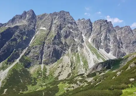
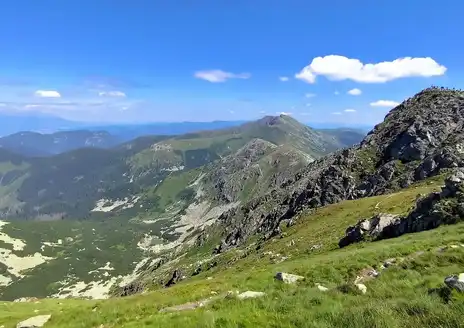
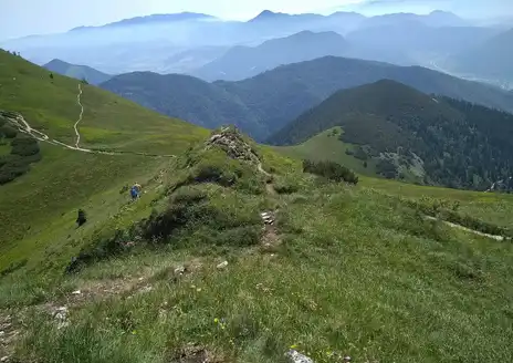
- Open karst plateau and cliff rims — Wide grassy plateaus dropping to sheer limestone escarpments give long, open views you don’t get on most Slovak forest trails. The sensation of walking on a flat “table” above valleys is quiet and unexpectedly dramatic.
- Karst features: sinkholes, rocky towers and small caves — Scattered limestone formations, dolines and cave mouths make the landscape feel sculpted. It’s good geology to poke at and photograph, and fun to explore without the crowds you find at bigger karst sites.
- Wildlife and raptor watching
- Muránsky hrad (Muráň Castle ruins) — Crumbling medieval castle perched on a steep rock above the valley. Great mix of history and raw scenery: scramble up, poke around the ruins, then take in a sweeping panorama of the plateau that few day-trippers see.
- Open karst plateau and cliff rims — Wide grassy plateaus dropping to sheer limestone escarpments give long, open views you don’t get on most Slovak forest trails. The sensation of walking on a flat “table” above valleys is quiet and unexpectedly dramatic.
- Karst features: sinkholes, rocky towers and small caves — Scattered limestone formations, dolines and cave mouths make the landscape feel sculpted. It’s good geology to poke at and photograph, and fun to explore without the crowds you find at bigger karst sites.
- Wildlife and raptor watching — The area is relatively low-traffic, so deer, wild boar and a variety of birds of prey are commonly seen at dawn or dusk. It’s a solid spot for quiet wildlife encounters if you slow down and keep your distance.
- Tradition on the meadows: shepherd huts (salaše) and grazing pastures — Seasonal sheep grazing, small wooden huts and local mountain cheese give the place a real pastoral feel. Adds a cultural layer to the hike — you’ll see landscapes shaped by people and animals, not just untouched wilderness.
Spotted a mistake or missing something? Contact us.

 Best Backpacking
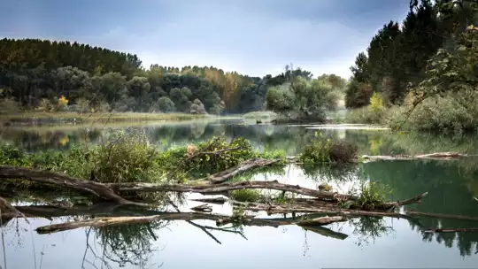


.jpg) Hi, I’m Johan (Netherlands 🇳🇱), the creator of TakeYourBackpack. Over the past decade, I’ve backpacked through 80+ countries across six continents, gaining extensive experience with independent travel, long-term trips, and overland routes.
Hi, I’m Johan (Netherlands 🇳🇱), the creator of TakeYourBackpack. Over the past decade, I’ve backpacked through 80+ countries across six continents, gaining extensive experience with independent travel, long-term trips, and overland routes.