×

Switzerland🇨🇭 | hikesDreibündensteinalpine plateau, panoramic ridges, Roman history | things to do and best time to go

Explore TwannbachschluchtExplore Heidiland

Backpacking in Dreibündenstein
👀 For curious travelershike ranked #16
By Johan Kruseman 🇳🇱 | Updated May 29, 2026

Your boots scrape over frost-hardened grass as the wind snaps at your jacket, and you squint into the sun slicing across the plateau—suddenly, the stone marker of Dreibündenstein stands ahead, battered by centuries, and you realize you’re straddling the old borders of three ancient Swiss leagues. Dreibündenstein sits high above Chur in eastern Switzerland, a place where the Alps flex their muscle without apology. The hike itself is a lung-burner—expect a solid 4-5 hours if you take the classic Brambrüesch route, with enough elevation gain to make your thighs question your life choices. The scenery is the payoff: wide-open ridges, distant peaks, and the kind of silence that makes you grin. Getting to the trailhead is refreshingly easy—tram from Chur, then a cable car, and you’re off. Compared to the more famous Swiss circuits, Dreibündenstein feels raw and less polished, which is exactly its charm. You’ll earn every view, and the first sip of water at the summit tastes like a small victory.

Discover everything you want to know in the 📖 Switzerland Travel Guide.
Best time to go: May - October
Duration: 4 hours
Distance: 12 kilometers
Total ascent: approximately 400 meters
Loading the map 🌍
CLICK TO FILTER
cities
towns
villages
landmarks
national parks
hikes
beaches
attractions
festivals
regions
SHOW COUNTRY’S BESTSHOW ALL

✨ Why go?
Ranked #16 hike in Switzerland
Reasons people choose to hike the here

The hike to Dreibündenstein grabs backpackers because it delivers a punchy payoff without demanding a full day’s grind. You start from a well-connected public transport hub—no car needed—making it a perfect pit stop on a longer Swiss route. The trail’s flexible distances let you tailor the effort: a quick ascent if you’re tight on time or a longer loop if you want to stretch your legs and soak in more alpine air.

The scenery-to-effort ratio here is a rare find. The climb burns your lungs and legs just enough to make the summit view feel earned. From the top, you’re staring down at where three Swiss cantons meet, a sharp-edged panorama of jagged peaks and deep valleys that feels like a secret handshake with the Alps.

Cost? Practically zero beyond your train ticket and a packed lunch. No … read more 👉
The hike to Dreibündenstein grabs backpackers because it delivers a punchy payoff without demanding a full day’s grind. You start from a well-connected public transport hub—no car needed—making it a perfect pit stop on a longer Swiss route. The trail’s flexible distances let you tailor the effort: a quick ascent if you’re tight on time or a longer loop if you want to stretch your legs and soak in more alpine air.

The scenery-to-effort ratio here is a rare find. The climb burns your lungs and legs just enough to make the summit view feel earned. From the top, you’re staring down at where three Swiss cantons meet, a sharp-edged panorama of jagged peaks and deep valleys that feels like a secret handshake with the Alps.

Cost? Practically zero beyond your train ticket and a packed lunch. No pricey lifts or tourist traps. This trail slots neatly into multi-day treks across eastern Switzerland, offering a crisp, physical reminder that the journey itself is the reward. You’ll finish with a grin, knowing you’ve earned every breathtaking step.
Want to include Dreibündenstein in your Switzerland route?
Create a personalized Switzerland itinerary that includes Dreibündenstein and the places that fit your trip — based on your travel style, budget, and available time. Get your route in seconds.

Generate my trip

💡 HighlightsPlaces and moments you shouldn't skip

Dreibündenstein Summit Marker
The trail’s namesake isn’t just a rock—it’s a slab of history hammered into the high plateau. At 2,160 meters, the Dreibündenstein marks the ancient meeting point of the Three Leagues that formed modern Graubünden. You’ll feel the wind whip across the open ridge as you touch the weathered stone, the Alps rolling out in every direction. It’s not just a photo op; it’s a handshake with centuries of Swiss independence. The climb here is a calf-burner, but the payoff is panoramic: Piz Beverin, the distant Bernina range, and the valleys stitched together below. This is the moment you realize why you left the valley floor behind.


360-Degree Alpine Views
This isn’t your average “nice view” trail. The Dreibündenstein ridge throws you into a full-circle amphitheater of … read more 👉
Dreibündenstein Summit Marker
The trail’s namesake isn’t just a rock—it’s a slab of history hammered into the high plateau. At 2,160 meters, the Dreibündenstein marks the ancient meeting point of the Three Leagues that formed modern Graubünden. You’ll feel the wind whip across the open ridge as you touch the weathered stone, the Alps rolling out in every direction. It’s not just a photo op; it’s a handshake with centuries of Swiss independence. The climb here is a calf-burner, but the payoff is panoramic: Piz Beverin, the distant Bernina range, and the valleys stitched together below. This is the moment you realize why you left the valley floor behind.


360-Degree Alpine Views
This isn’t your average “nice view” trail. The Dreibündenstein ridge throws you into a full-circle amphitheater of peaks—no fences, no crowds, just you and the horizon. On a clear day, you can trace the skyline from the jagged Calanda massif to the snow-dusted summits of the Oberhalbstein Alps. The air up here is thin and sharp, and every step along the ridge feels like you’re walking the spine of Switzerland. The light changes by the minute, painting the slopes gold, then blue, then silver. If you want a summit selfie that actually feels earned, this is the spot.


Alpine Flora and Marmot Encounters
Forget manicured gardens—this is wild Switzerland. In late spring and early summer, the meadows explode with gentians, alpine roses, and edelweiss if you’re lucky. The ground crunches underfoot, and the air smells like sun-warmed grass and stone. Marmots whistle warnings from their burrows, popping up like furry sentinels as you pass. I’ve lost count of the times I’ve startled a marmot, only to watch it vanish with a squeak and a flick of its tail. It’s a reminder that you’re a guest here, moving through a landscape that’s alive and alert.


Historic Alp Hut Rest Stops
The trail threads past weathered stone huts—some still used by shepherds, others repurposed as rustic snack stops. These aren’t tourist traps; they’re working pieces of mountain culture. If you time it right, you can snag a slab of local cheese or a cold Rivella, sitting on a rough bench with your boots off and your legs humming from the climb. The huts smell of woodsmoke and old wool. Conversations are a mix of Swiss German, Romansh, and laughter. It’s the kind of break that makes you want to linger, even when the trail calls you onward. This is my personal favorite—nothing beats the first bite of alpine cheese after a hard push uphill.


Descent into Churwalden’s Forests
The final stretch drops you into dense pine and larch, the trail softening underfoot as you leave the exposed ridge behind. Sunlight slants through the trees, dappling the path with gold. The air cools, and the scent shifts from alpine grass to resin and earth. It’s a sensory reset after the high-altitude drama—a quiet, meditative finish where your heart rate slows and your mind catches up to your body. By the time you hit the valley, you’re already plotting your next climb.
Spotted a mistake or missing something? Contact us.

Things to do near Dreibündenstein

Ratings based on Tripadvisor reviews. When you book through this link, you support our work at no extra cost to you.

🌤️ When to go?Weather, crowds, and seasonal trade-offs


  • Weather: The trail to Dreibündenstein is best tackled from late May through September. Snow usually melts by late spring, clearing the path and revealing the rugged alpine terrain. Outside this window, expect icy patches and slippery rocks that demand crampons and serious winter gear.

  • Temperature: Summer days hover between 15°C and 25°C (59°F to 77°F), perfect for sweating up the trail without overheating. Early mornings and evenings can dip to 5°C (41°F), so pack layers. Spring and fall bring chillier temps, often below 10°C (50°F), which can sap your energy fast.

  • Daylight Hours: Peak hiking season benefits from long daylight—up to 15 hours in June—giving you plenty of time to push your pace and savor the views without rushing. By October, daylight shrinks to about 10 hours, forcing earlier
read more 👉

  • Weather: The trail to Dreibündenstein is best tackled from late May through September. Snow usually melts by late spring, clearing the path and revealing the rugged alpine terrain. Outside this window, expect icy patches and slippery rocks that demand crampons and serious winter gear.

  • Temperature: Summer days hover between 15°C and 25°C (59°F to 77°F), perfect for sweating up the trail without overheating. Early mornings and evenings can dip to 5°C (41°F), so pack layers. Spring and fall bring chillier temps, often below 10°C (50°F), which can sap your energy fast.

  • Daylight Hours: Peak hiking season benefits from long daylight—up to 15 hours in June—giving you plenty of time to push your pace and savor the views without rushing. By October, daylight shrinks to about 10 hours, forcing earlier starts and quicker finishes.

  • Crowds: July and August draw the most hikers, especially weekends. The trail can feel busy, which dilutes the wilderness vibe. For a quieter trek, aim for late May, June, or September when the crowds thin but the weather still cooperates.

  • Seasonal Activities: Summer opens up alpine meadows bursting with wildflowers and buzzing with butterflies. September introduces mushroom foraging and early autumn colors, adding a sensory layer to your hike. Winter sports dominate from November onward, shutting down the trail for backpackers.

  • Price Fluctuations: Accommodation and transport costs spike in July and August due to peak tourism. Booking in shoulder months like June or September can save you a chunk of change without sacrificing trail conditions.


Pro-tip: Start your hike early in the shoulder seasons to catch the crisp morning air and avoid the midday sun, turning the climb into a quiet, almost meditative grind before the day heats up.


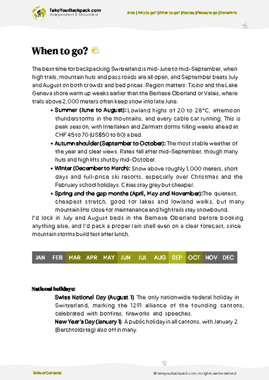
source: climatestotravel.comJANJanuary: below average for travelingFEBFebruary: below average for travelingMARMarch: below average for travelingAPRApril: fair for travelingMAYMay: highly recommended for travelingJUNJune: excellent for travelingJULJuly: highly recommended for travelingAUGAugust: highly recommended for travelingSEPSeptember: highly recommended for travelingOCTOctober: good for travelingNOVNovember: below average for travelingDECDecember: below average for traveling
when-to-go

✈️ The backpacker research shortcutSwitzerland Travel Guide

An offline-friendly backpacking guide with optimized travel routes, ranked highlights, transport advice, and the best areas to stay.
example page 0 from our offline Travel Guide for Switzerland
example page 1 from our offline Travel Guide for Switzerland
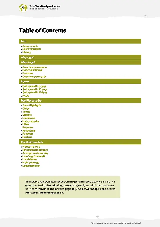
example page 2 from our offline Travel Guide for Switzerland
example page 3 from our offline Travel Guide for Switzerland
example page 4 from our offline Travel Guide for Switzerland
example page 5 from our offline Travel Guide for Switzerland
example page 6 from our offline Travel Guide for Switzerland
example page 7 from our offline Travel Guide for Switzerland
The digital guide (449 pages) contains:
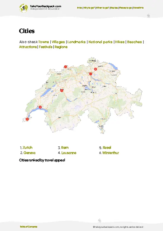
121 highlights, ranked by travel appeal
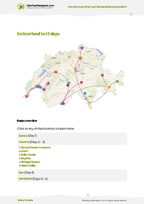
Optimized 5, 10 & 15-day travel routes
Cities, national parks, landmarks, beaches
How to get around
Offline-friendly for travel without Wi-Fi
👉 Click to see all 30+ guide features

📅 Plan smarter in minutes, not weeks
Month by month travel advice
Festivals & national holidays
Budget expectations

🗺️ Go to the right places, skip the overrated ones
Honest pros & cons of destinations
Top hikes, parks & viewpoints
Lesser-known places most travelers miss
Clear “worth it vs skip it” guidance

🛏️ Travel smoothly without rookie mistakes
Best areas to stay
Transport systems explained simply
Common scams & safety advice
SIM cards, money & practical tips

🌍 Understand the country, not just visit it
Culture & traditions
52 Essential phrases & customs
Festivals worth planning around
Traveler-friendly historical context
Insights that make places more meaningful

📱 Built for real travel conditions
Fully downloadable PDF
Works completely offline
Optimized for phone use
Useful in remote areas & buses
Everything in one place
Save weeks of stressful planning
Get instant access to your full guide. 30‑day money-back guarantee.


By proceeding you agree to our terms.
Sent to your inbox immediately after payment • 100% Secure Checkout
Best Backpacking Travel Advisor 2025 tourism awardBest Backpacking
Travel Advisor
2025
What others say about Take Your Backpack Guides:
⭐⭐⭐⭐⭐
Fantastic, amazing amount of information!
⭐⭐⭐⭐⭐
My goodness this is amazing, it's what I've been looking for hats off too you!
⭐⭐⭐⭐⭐
I think this is absolutely BRILLIANT
⭐⭐⭐⭐
Very complete and informative. It's still missing places, but I gotta to commend you
⭐⭐⭐⭐⭐
This is truly amazing, thank you, can't wait to explore it with my kids!
⭐⭐⭐⭐⭐
Awesome resource, thank you!
⭐⭐⭐⭐⭐
This is amazing! Can't wait to explore the ones I haven't seen
⭐⭐⭐⭐
I love this! Well done, great idea.
⭐⭐⭐⭐⭐
Thanks for taking the time to make this gem!
⭐⭐⭐⭐⭐
This might be the best website I've ever seen.
⭐⭐⭐⭐⭐
Congratulations, and thank you so much for your work; it's incredibly valuable.
⭐⭐⭐⭐
In all seriousness I think you did a great job pointing out the important spots
⭐⭐⭐⭐⭐
10/10 very good
⭐⭐⭐⭐⭐
As someone who's only just starting to visit regularly this is awesome, thank you.
⭐⭐⭐⭐
Thank you very much! I'm going to visit my dad, it's going to be very useful!
⭐⭐⭐⭐⭐
This is really cool! We'll be travelling for the first time and this definitely come in handy.
⭐⭐⭐⭐⭐
You are now our minister of culture, congratulations 👨‍💼
⭐⭐⭐⭐⭐
Just wanted to tell you that this is a pearl! Going to follow your recommendations.
⭐⭐⭐⭐⭐
This is so cool. I'll definitely be using the resource for my travels soon.
⭐⭐⭐⭐⭐
This is very impressive! Good work.
⭐⭐⭐⭐⭐
This is an amazing and informative site. Very well done!

🛏️ Where to stay?Where staying makes the most sense

If you enjoy meeting fellow travelers, consider choosing hostels with high ratings for atmosphere. On the other hand, if you prefer having your own space, a hotel might be a better option.

🥾 Hike detailsA practical overview of the hike

Total Distance: The main hiking loop to Dreibündenstein covers roughly 10 kilometers (6.2 miles). It’s a solid half-day trek that demands your attention but rewards with every step.

Estimated Duration: Expect to spend about 3 to 4 hours on the trail, depending on your pace and how often you stop to soak in the views or catch your breath.

Difficulty: Moderate. The trail climbs steadily, with some steep sections that test your legs but nothing technical. It’s a workout, not a scramble. Good boots and a decent level of fitness will get you through comfortably.

Starting Point: Most hikers begin … read more 👉
Total Distance: The main hiking loop to Dreibündenstein covers roughly 10 kilometers (6.2 miles). It’s a solid half-day trek that demands your attention but rewards with every step.

Estimated Duration: Expect to spend about 3 to 4 hours on the trail, depending on your pace and how often you stop to soak in the views or catch your breath.

Difficulty: Moderate. The trail climbs steadily, with some steep sections that test your legs but nothing technical. It’s a workout, not a scramble. Good boots and a decent level of fitness will get you through comfortably.

Starting Point: Most hikers begin in the village of Sils im Domleschg, easily reachable by public transport. The Rhaetian Railway stops here, connecting you from Chur or Thusis. From the village center, follow well-marked signs heading uphill toward the Dreibündenstein.

Major Landmarks:
  • Sils im Domleschg: A quiet village with traditional stone houses and a chance to grab supplies or a coffee before you hit the trail.
  • Ruins of Hochjuvalt Castle: About halfway up, these crumbling walls offer a glimpse into medieval life and a perfect spot to pause.
  • Dreibündenstein Monument: The trail’s highlight—a historic boundary stone marking the meeting point of three Swiss cantons. It’s a rugged slab of granite with plaques and a panoramic view that stretches over the Rhine Valley and the Albula Alps.

Terrain and Scenery: The path snakes through mixed terrain: forested slopes, open meadows, and rocky outcrops. You’ll climb through larch and pine stands, stepping over roots and loose stones. The air sharpens as you gain altitude, and the landscape opens to reveal sweeping valleys and distant peaks.

Vegetation: Expect a mix of alpine flora—wildflowers in summer, dense conifers, and patches of hardy shrubs. The forest floor is often carpeted with moss and small ferns, especially in shaded areas.

Wildlife: Keep your eyes peeled for chamois darting across the cliffs, marmots whistling from their burrows, and a variety of birds like nutcrackers and alpine choughs. Early morning or late afternoon hikes increase your chances of spotting these locals.

This trail isn’t just a walk; it’s a steady climb into the heart of Swiss mountain culture. The burn in your calves matches the thrill of reaching the Dreibündenstein, where history and landscape collide in a moment that makes every step worth it.
⚠️ Hiking info can sometimes be outdated or inaccurate. Before you hit the trail, check the latest conditions with locals. If you do spot anything that's off, I'd love to hear from you, so I can update it for fellow travelers.

🛡️ SafetyScams, Hazards, and Annoyances

The Dreibündenstein hike in Switzerland is a straightforward trek, but don’t let its ease fool you into complacency. The trail is well-marked and maintained, so navigation is rarely an issue. Still, the terrain shifts from gentle forest paths to steeper, rocky stretches that demand steady footing—good hiking boots are a must. Weather can flip quickly in the Alps, especially outside summer months. A sunny morning can turn into a chilly, wind-whipped afternoon, so layering is your best friend. Altitude here isn’t extreme, but the crisp mountain air can sap energy faster than you expect; pace yourself and hydrate often.

Wildlife encounters are low-key—deer and marmots are the usual residents, more curious than threatening. Keep your distance and avoid feeding them; it’s about respect, not fear. … read more 👉
The Dreibündenstein hike in Switzerland is a straightforward trek, but don’t let its ease fool you into complacency. The trail is well-marked and maintained, so navigation is rarely an issue. Still, the terrain shifts from gentle forest paths to steeper, rocky stretches that demand steady footing—good hiking boots are a must. Weather can flip quickly in the Alps, especially outside summer months. A sunny morning can turn into a chilly, wind-whipped afternoon, so layering is your best friend. Altitude here isn’t extreme, but the crisp mountain air can sap energy faster than you expect; pace yourself and hydrate often.

Wildlife encounters are low-key—deer and marmots are the usual residents, more curious than threatening. Keep your distance and avoid feeding them; it’s about respect, not fear. First-timers sometimes underestimate the trail’s subtle ups and downs, so don’t rush. Take breaks, soak in the views, and let the rhythm of the hike carry you. When you reach the Dreibündenstein marker, the payoff hits: a sharp, panoramic snapshot of Swiss mountain life that makes every step worth it.

Other Swiss hikes near Dreibündenstein

Explore more nearby:

  • Viamala Slucht—deep canyon, ancient bridges, turquoise river| 16 km away
  • Heidiland—storybook villages, rolling vineyards, spa towns| 21 km away
  • Rofla Slucht—narrow gorge, waterfalls, granite walls| 25 km away

💡 Not sure where to go next?
Create a personalized itinerary for Switzerland including Dreibündenstein and the places that fit your trip.

Generate my itinerary

👉 Discover all hikes

Or checkout all Switzerland has to offer (think cities, towns, villages, national parks, hikes, beaches, festivals)
Country photo of Switzerland

We 💚 feedbackWhat to keep in mind

The climb to Dreibündenstein punches your legs with steep switchbacks, but that’s part of the deal—this isn’t a stroll in the park. When you finally reach the marker where three Swiss cantons collide, the payoff hits hard: panoramic alpine views that stretch wide enough to swallow your breath. Just know the trail can get crowded on weekends, so if you want that raw, solitary mountain vibe, aim for a weekday trek or early start.

✈️ When did I visit Switzerland?
Being so close to my home country, and me loving mountains, I have visited Switzerland many times in my childhood during summer holidays for hiking in the Alps. One of the most beautiful countries in the world, though expensive.

✍️ Help improve this page!
The information on this page is based on my own backpacking experience in Switzerland, supplemented with up-to-date research and feedback from other travelers. Travel details can change, so if you notice anything outdated or incomplete, feel free to let me know.


🙋‍♂️ Give feedback

👋 Meet the founderWho’s Behind Take Your Backpack?

Johan, backpacker and founder of TakeYourBackpackHi, I’m Johan (Netherlands 🇳🇱), the creator of TakeYourBackpack. Over the past decade, I’ve backpacked through 80+ countries across six continents, gaining extensive experience with independent travel, long-term trips, and overland routes.

This site is built on a combination of firsthand travel experience and carefully curated insights from other backpackers. Many guides are based on places I’ve personally visited, while others bring together tips, observations, and practical advice shared by trusted travelers I’ve met along the way.

The goal is to provide realistic, experience-driven guidance — not generic itineraries — so you can explore destinations with better context, clearer expectations, and more confidence.

Get full country guide •
Instant download • 121 highlights • Full Offline guide