×

Tonga🇹🇴 | landmarksHufangalupe Natural Land BridgeCollapsed sea cave, limestone arch, cliff rim path | things to do and best time to go

Explore Ha’amonga ‘a MauiExplore Mapu ‘a Vaea Blowholes

Backpacking in Hufangalupe Natural Land Bridge
👌 Worth visitingunique site ranked #3
By Johan Kruseman 🇳🇱 | Updated October 15, 2026

Entry costs nothing, and the best light is free too. Hufangalupe Natural Land Bridge sits on the south coast of Tongatapu, in Tonga, a short ride from Nuku’alofa. The wow-factor is real: a limestone arch spans a gap where the roof of a sea cave fell in, and the Pacific heaves through the opening below with a boom you feel in your sternum. The trail from the road is short and flat, running over rough coral rock and through low scrub that rattles in the wind. There are no barriers worth the name, so the cliff edge asks for your full attention, and wet rock turns slick fast. Crowds are thin, usually a few vans and a handful of cameras, though that also means no café and little shade. Photos work best when the sun is lower and the spray glows. Salt hangs in the air, and the arch’s underside is stained dark by centuries of wave-slap.

Discover everything you want to know in the 📖 Tonga Travel Guide.


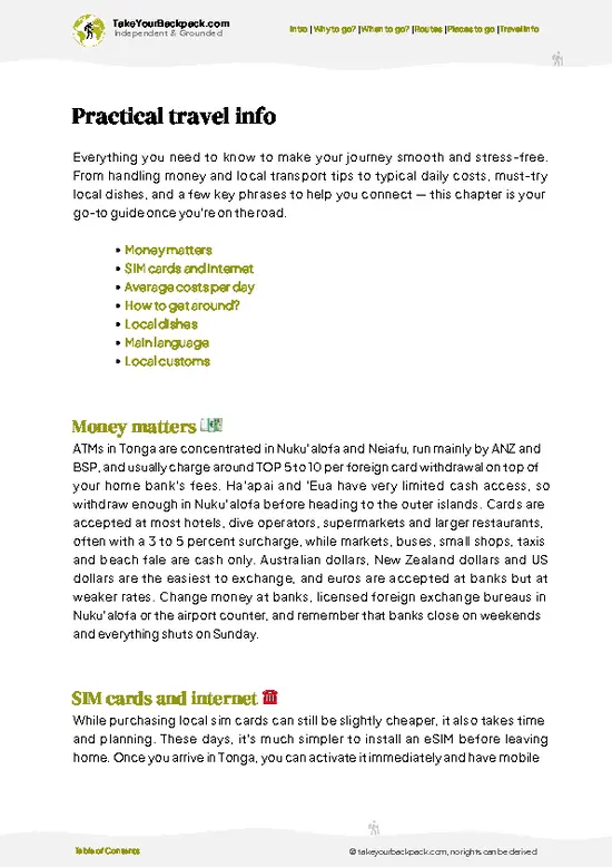
example page 0 from our offline Travel Guide for Tonga
example page 1 from our offline Travel Guide for Tonga
example page 2 from our offline Travel Guide for Tonga
example page 3 from our offline Travel Guide for Tonga
example page 4 from our offline Travel Guide for Tonga
example page 5 from our offline Travel Guide for Tonga
example page 6 from our offline Travel Guide for Tonga
example page 7 from our offline Travel Guide for Tonga
Loading the map 🌍
CLICK TO FILTER
towns
villages
landmarks
national parks
hikes
beaches
attractions
festivals
regions
SHOW COUNTRY’S BESTSHOW ALL

✨ Why go?
Ranked #3 unique site in Tonga
Why visitors keep coming back

Hufangalupe is worth the trip because it gives you a raw stretch of Tongatapu coast without a ticket gate, a guide requirement or a tour-bus schedule. The collapsed sea-cave arch is the kind of thing you normally pay a boat operator to see from the water. Here you stand on top of it and look down into the churn, which is a rare angle and a humbling one.

It also fits a south-coast day neatly. The Mapu’a ‘a Vaea blowholes lie along the same shoreline, where seawater shoots through the limestone in tall white jets, so the two stops pair into a half day by scooter, bicycle or hired car. Add a village lunch and you have covered the island’s wildest edge before the afternoon heat peaks.

Bring sturdy sandals, because the rock is sharp, and water, because the walk offers nothing to buy.

💡 HighlightsWhat this place is best known for

  1. The Land Bridge Arch: The reason you came. A span of limestone stands over the gap left when a sea cave’s roof gave way, with the ocean surging underneath. Look at it from both sides of the opening to see how thin the rock actually is.
  2. The Collapsed Cave Opening: Peer over the edge, carefully, to watch the swell funnel in and slam against the walls. The sound arrives a beat after the water does, and the spray carries a cool, salty mist upward.
  3. Cliff-Top Walk: The rim path crosses sharp, pitted coral rock and low windblown bush. It is short, but the footing is uneven, so closed shoes beat flip-flops. Each bend gives a different view of the arch against the open sea.
  4. The Ocean Horizon: Nothing but water lies south of the cliff, and on clear days the line between sea and sky is razor sharp. It is
… read more 👉
  1. The Land Bridge Arch: The reason you came. A span of limestone stands over the gap left when a sea cave’s roof gave way, with the ocean surging underneath. Look at it from both sides of the opening to see how thin the rock actually is.
  2. The Collapsed Cave Opening: Peer over the edge, carefully, to watch the swell funnel in and slam against the walls. The sound arrives a beat after the water does, and the spray carries a cool, salty mist upward.
  3. Cliff-Top Walk: The rim path crosses sharp, pitted coral rock and low windblown bush. It is short, but the footing is uneven, so closed shoes beat flip-flops. Each bend gives a different view of the arch against the open sea.
  4. The Ocean Horizon: Nothing but water lies south of the cliff, and on clear days the line between sea and sky is razor sharp. It is a good place to sit for ten quiet minutes and watch the waves rebuild.
  5. Erosion Details in the Rock: Crouch near the edge to see the undercut ledges, grooves and honeycombed limestone. They show exactly how the sea carved the cave before the roof failed, and they hint at where the next collapse may come.
  6. The Pigeon Legend: The name means “pigeon’s gate”. Ask a local about the story and you will likely get a different version from each person.
  7. Mapu’a ‘a Vaea Blowholes: Nearby on the same coast, waves are forced through holes in the rock and burst skyward in long plumes. Go when the swell is up for the biggest show.
Allow about an hour at the arch itself, or half a day if you add the blowholes and a slow lunch.
Spotted a mistake or missing something? Contact us.

🌤️ When to go?Weather, crowds, and seasonal trade-offs

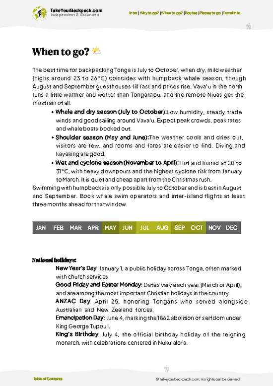
May to October is the window for Hufangalupe, with low humidity, firm tracks and the clearest light over the arch on Tongatapu’s southern coast.
  • Dry Season (May to October): Days run 23 to 27°C (73 to 81°F), nights 18 to 20°C (64 to 68°F). Daylight lasts about 11 hours in June and July. Roads to the coast stay passable, and July to September brings humpback whales offshore, visible from the cliff edge. Visitor numbers are still small, a few vans and cars at a time.
  • Wet Season (November to April): Expect 27 to 31°C (81 to 88°F), heavy humidity and about 13 hours of daylight at the peak. Downpours turn the dirt access track muddy, and the limestone near the edge gets slick. Cyclone risk peaks January to March, and flights or ferries can be disrupted.
  • Shoulder Months (April, November): Fewer people,
… read more 👉
May to October is the window for Hufangalupe, with low humidity, firm tracks and the clearest light over the arch on Tongatapu’s southern coast.
  • Dry Season (May to October): Days run 23 to 27°C (73 to 81°F), nights 18 to 20°C (64 to 68°F). Daylight lasts about 11 hours in June and July. Roads to the coast stay passable, and July to September brings humpback whales offshore, visible from the cliff edge. Visitor numbers are still small, a few vans and cars at a time.
  • Wet Season (November to April): Expect 27 to 31°C (81 to 88°F), heavy humidity and about 13 hours of daylight at the peak. Downpours turn the dirt access track muddy, and the limestone near the edge gets slick. Cyclone risk peaks January to March, and flights or ferries can be disrupted.
  • Shoulder Months (April, November): Fewer people, warm seas and lower prices on guesthouses, though showers can arrive without warning.
  • Time of Day: Go early morning or late afternoon for softer light, cooler air and the best photos of the arch.
Time your visit for low tide on a calm day, when the surf beneath the arch is gentler and easier to watch.


source: climatestotravel.comJANJanuary: fair for travelingFEBFebruary: fair for travelingMARMarch: fair for travelingAPRApril: good for travelingMAYMay: highly recommended for travelingJUNJune: highly recommended for travelingJULJuly: excellent for travelingAUGAugust: excellent for travelingSEPSeptember: excellent for travelingOCTOctober: highly recommended for travelingNOVNovember: fair for travelingDECDecember: fair for traveling
tonga-unique-site-hufangalupe-natural-land-bridge
© Google | 1986evgen

✈️ The backpacker research shortcutTonga Travel Guide

An offline-friendly backpacking guide with optimized travel routes, ranked highlights, transport advice, and the best areas to stay.
example page 0 from our offline Travel Guide for Tonga
example page 1 from our offline Travel Guide for Tonga
example page 2 from our offline Travel Guide for Tonga
example page 3 from our offline Travel Guide for Tonga
example page 4 from our offline Travel Guide for Tonga
example page 5 from our offline Travel Guide for Tonga
example page 6 from our offline Travel Guide for Tonga
example page 7 from our offline Travel Guide for Tonga
The digital guide (128 pages) contains:
✅ 31 highlights, ranked by travel appeal
✅ Optimized 2, 3 & 5-day travel routes
✅ Cities, national parks, landmarks, beaches
✅ How to get around
✅ Offline-friendly for travel without Wi-Fi
👉 Click to see all 30+ guide features

📅 Plan smarter in minutes, not weeks
✅ Month by month travel advice
✅ Festivals & national holidays
✅ Budget expectations

🗺️ Go to the right places, skip the overrated ones
✅ Honest pros & cons of destinations
✅ Top hikes, parks & viewpoints
✅ Lesser-known places most travelers miss
✅ Clear “worth it vs skip it” guidance

🛏️ Travel smoothly without rookie mistakes
✅ Best areas to stay
✅ Transport systems explained simply
✅ Common scams & safety advice
✅ SIM cards, money & practical tips

🌍 Understand the country, not just visit it
✅ Culture & traditions
✅ 52 Essential phrases & customs
✅ Festivals worth planning around
✅ Traveler-friendly historical context
✅ Insights that make places more meaningful

📱 Built for real travel conditions
✅ Fully downloadable PDF
✅ Works completely offline
✅ Optimized for phone use
✅ Useful in remote areas & buses
✅ Everything in one place
Stop searching, start planning
Get instant access to your full guide. 30‑day money-back guarantee.
+ Add another guide for just

By proceeding you agree to our terms.
Sent to your inbox immediately after payment • 100% Secure Checkout
Best Backpacking Travel Advisor 2025 tourism awardBest Backpacking
Travel Advisor
2025
What others say about Take Your Backpack Guides:
⭐⭐⭐⭐⭐
Fantastic, amazing amount of information!
⭐⭐⭐⭐⭐
My goodness this is amazing, it's what I've been looking for hats off too you!
⭐⭐⭐⭐⭐
I think this is absolutely BRILLIANT
⭐⭐⭐⭐
Very complete and informative. It's still missing places, but I gotta to commend you
⭐⭐⭐⭐⭐
This is truly amazing, thank you, can't wait to explore it with my kids!
⭐⭐⭐⭐⭐
Awesome resource, thank you!
⭐⭐⭐⭐⭐
This is amazing! Can't wait to explore the ones I haven't seen
⭐⭐⭐⭐
I love this! Well done, great idea.
⭐⭐⭐⭐⭐
Thanks for taking the time to make this gem!
⭐⭐⭐⭐⭐
This might be the best website I've ever seen.
⭐⭐⭐⭐⭐
Congratulations, and thank you so much for your work; it's incredibly valuable.
⭐⭐⭐⭐
In all seriousness I think you did a great job pointing out the important spots
⭐⭐⭐⭐⭐
10/10 very good
⭐⭐⭐⭐⭐
As someone who's only just starting to visit regularly this is awesome, thank you.
⭐⭐⭐⭐
Thank you very much! I'm going to visit my dad, it's going to be very useful!
⭐⭐⭐⭐⭐
This is really cool! We'll be travelling for the first time and this definitely come in handy.
⭐⭐⭐⭐⭐
You are now our minister of culture, congratulations 👨‍💼
⭐⭐⭐⭐⭐
Just wanted to tell you that this is a pearl! Going to follow your recommendations.
⭐⭐⭐⭐⭐
This is so cool. I'll definitely be using the resource for my travels soon.
⭐⭐⭐⭐⭐
This is very impressive! Good work.
⭐⭐⭐⭐⭐
This is an amazing and informative site. Very well done!

🛏️ Where to stay?Choosing the right base

Nuku’alofa is the best base for Hufangalupe, roughly 30 to 40 minutes by road to the southeast, with the widest choice of budget beds and the easiest transport.
The waterfront and the streets around the central market hold most of the backpacker-friendly guesthouses and hostels. This is where solo travelers meet others, share rental cars or scooter plans, and find cafes, ATMs, supermarkets and tour desks within walking distance. Evenings are quiet by Western standards, and Sunday is a day of rest when almost everything closes, so stock up on Saturday. The area is generally safe, though you should … read more 👉
Nuku’alofa is the best base for Hufangalupe, roughly 30 to 40 minutes by road to the southeast, with the widest choice of budget beds and the easiest transport.
The waterfront and the streets around the central market hold most of the backpacker-friendly guesthouses and hostels. This is where solo travelers meet others, share rental cars or scooter plans, and find cafes, ATMs, supermarkets and tour desks within walking distance. Evenings are quiet by Western standards, and Sunday is a day of rest when almost everything closes, so stock up on Saturday. The area is generally safe, though you should keep valuables out of sight and avoid walking unlit roads late at night.
If you prefer a calmer pace, the villages along Tongatapu’s southwest and west coast, such as Houma and Hihifo, offer a handful of family-run guesthouses and beach fales near the blowholes and reefs. They are close to the blowholes but have few restaurants, little public transport and almost no nightlife, so you will need your own wheels or a pre-arranged driver.
Most travelers choose Nuku’alofa, then rent a car or hire a driver for a half-day loop to the land bridge and the nearby blowholes.

👛 Costs (as of 15 October 2026)Travel costs and budget guide for Hufangalupe Natural Land Bridge

A day at Hufangalupe Natural Land Bridge costs about US$62 for a backpacker in high season, and the arch itself is free to see. Most of that goes on a bed in Nuku’alofa and getting out to the southeast coast. Everyone pays in Tongan currency, and cash is the norm outside the capital.
CategoryBudget RangeLocal Reality
EntryUS$0 to 2The land bridge sits on open coastal land. Some landowners may ask for a small donation or parking contribution.
Accommodation (high season, May to October)US$18 to 30Dorm beds and basic guesthouse rooms in Nuku’alofa. Rates dip a little in the wetter months, and Christmas is the other busy spell.
TransportUS$3 to 20Local buses run toward the southeast and cost a couple of dollars, but services thin out and stop early. A round-trip taxi from Nuku’alofa runs roughly US$15
… read more 👉
A day at Hufangalupe Natural Land Bridge costs about US$62 for a backpacker in high season, and the arch itself is free to see. Most of that goes on a bed in Nuku’alofa and getting out to the southeast coast. Everyone pays in Tongan currency, and cash is the norm outside the capital.
CategoryBudget RangeLocal Reality
EntryUS$0 to 2The land bridge sits on open coastal land. Some landowners may ask for a small donation or parking contribution.
Accommodation (high season, May to October)US$18 to 30Dorm beds and basic guesthouse rooms in Nuku’alofa. Rates dip a little in the wetter months, and Christmas is the other busy spell.
TransportUS$3 to 20Local buses run toward the southeast and cost a couple of dollars, but services thin out and stop early. A round-trip taxi from Nuku’alofa runs roughly US$15 to 25 for the 11 km, and drivers will often wait for you.
FoodUS$10 to 18Market stalls and bakeries in Nuku’alofa keep lunch cheap. A sit-down dinner with fish or roast pork costs more. Pack water and snacks, as nothing is sold at the bridge.
ActivitiesUS$0 to 10Walking the cliff edge and watching the blowholes costs nothing. Add a bike or scooter rental if you want to ride the coast road.
Total Daily BudgetUS$62Based on US$24 for a bed, US$10 for transport, US$14 for food, US$2 for entry and US$12 for extras.
⚠️ Prices can change and everyone travels differently, so take this as a rough guide. Hope it helps you plan your adventure!

FAQFrequently asked questions about Hufangalupe Natural Land Bridge

Hufangalupe is a natural limestone arch on the southeast coast of Tongatapu, formed when the roof of a sea cave collapsed and left a bridge above the Pacific. The name means “pigeon’s gate” in Tongan. Waves boom through the hollow beneath, and there is a sheer drop with no railings, so keep back from the edge.
Plan about 45 minutes to 1 hour at the site for photos and walking along the cliffs. With travel from Nuku’alofa and a stop at nearby blowholes, allow a half day of 3 to 4 hours. It combines easily with other south-coast stops in one day.
From Nuku’alofa, drive about 20 to 30 minutes (roughly 12 to 15 km) south across the island, then follow the unpaved track to the cliff. A rental car, a taxi or a hired driver is the practical way, as local buses do not go to the arch. Expect to pay around TOP 60 to 100 (USD 25 to 42) for a round-trip taxi, and visit in dry weather when the track is firmer.
⚠️ Things can change over time, so always validate details locally before you go.

Other Tongan landmarks near Hufangalupe Natural Land Bridge

Explore more nearby:

  • Mapu ‘a Vaea Blowholes—Coral shelf vents, swell-fed jets, Houma stalls, late-afternoon spray| 14 km away
  • Ha’amonga ‘a Maui—Coral limestone trilithon, notched lintel, solstice sightline, Tu‘itātui legend| 18 km away

💡 Not sure where to go next?
Create a personalized itinerary for Tonga including Hufangalupe Natural Land Bridge and the places that fit your trip.

Generate my itinerary

👉 Discover all landmarks

Or checkout all Tonga has to offer (think cities, towns, villages, national parks, hikes, beaches, festivals)
Country photo of Tonga

We 💚 feedbackIs it worth it?

Hufangalupe suits travelers who like wild coastlines more than finished attractions: photographers, hikers, and anyone who enjoys standing close to something loud and powerful. If you want facilities or a guided tale, skip it. Wear shoes with grip, arrive in the morning or late afternoon, and keep well back from the edge when the swell builds.

✍️ Help improve this page!
The information on this page is based on in-depth research, insights shared by experienced travelers, and feedback from the local travel community in Tonga. While every effort is made to keep the information accurate and current, conditions can change — so if you spot anything incorrect or outdated, please get in touch.


🙋‍♂️ Give feedback

👋 Meet the founderWho’s Behind Take Your Backpack?

Johan, backpacker and founder of TakeYourBackpackHi, I’m Johan (Netherlands 🇳🇱), the creator of TakeYourBackpack. Over the past 3 decades, I’ve backpacked through 90+ countries across six continents, gaining extensive experience with independent travel, long-term trips, and overland routes.

This site is built on a combination of firsthand travel experience and carefully curated insights from other backpackers. Many guides are based on places I’ve personally visited, while others bring together tips, observations, and practical advice shared by trusted travelers I’ve met along the way.

The goal is to provide realistic, experience-driven guidance — not generic itineraries — so you can explore destinations with better context, clearer expectations, and more confidence.