×

United States Virgin Islands🇻🇮 | national parksHurricane HoleMangrove inlet, shore snorkeling, kayak coves, east St. John | things to do and best time to go

Explore Virgin Islands National Park TrailExplore Salt River Bay National Historical Park

Backpacking in Hurricane Hole
👍 Recommendednational park ranked #3
By Johan Kruseman 🇳🇱 | Updated October 22, 2026

The dinghy motor cuts out and the only sound is mangrove roots ticking as the tide shifts, with a sea turtle surfacing a few meters off your bow. Hurricane Hole sits on the northeast coast of St. John, in the United States Virgin Islands, inside Virgin Islands Coral Reef National Monument, in a set of coves (Princess Bay, Otter Creek, Water Creek, Hurricane Hole itself) that boats shelter in during storms. Walking access is limited, so the place works as a paddling and snorkeling destination, not a hiking one. Mangrove-fringed shallows hold living coral right against the roots, which is why you go in with a mask and not much else. A rented kayak from Coral Bay is the smarter way in than a powerboat, because the coves are quiet and the park restricts anchoring to mooring balls. Go early, before the wind builds. Paddlers and snorkelers will love it. Anyone wanting a long trail day or a sandy beach should look elsewhere.

Discover everything you want to know in the 📖 United States Virgin Islands Travel Guide.


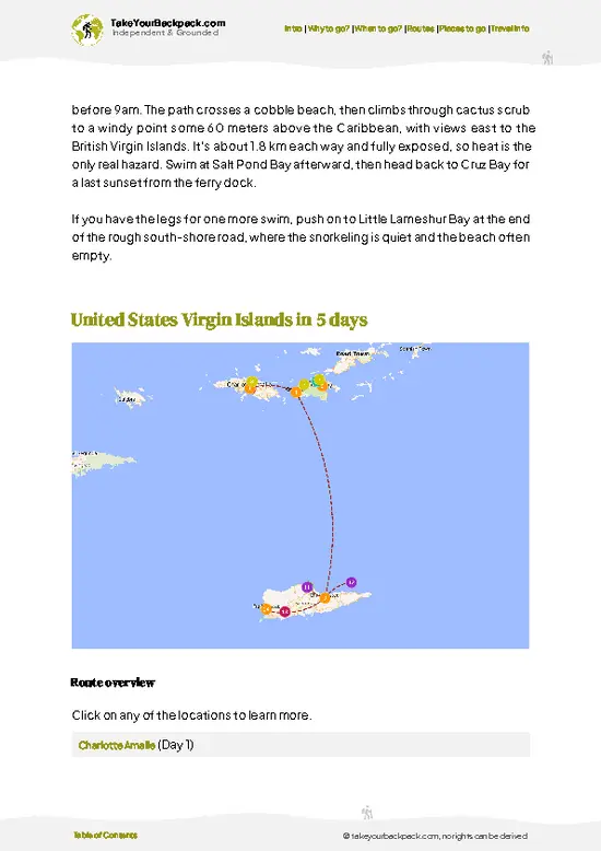
example page 0 from our offline Travel Guide for United States Virgin Islands
example page 1 from our offline Travel Guide for United States Virgin Islands
example page 2 from our offline Travel Guide for United States Virgin Islands
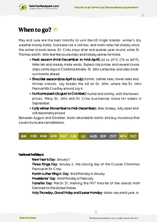
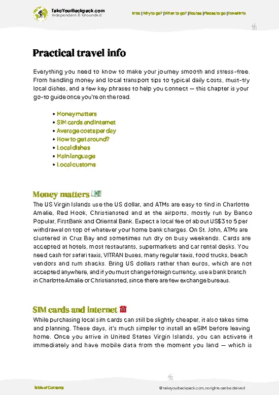
example page 3 from our offline Travel Guide for United States Virgin Islands
example page 4 from our offline Travel Guide for United States Virgin Islands
example page 5 from our offline Travel Guide for United States Virgin Islands
example page 6 from our offline Travel Guide for United States Virgin Islands
example page 7 from our offline Travel Guide for United States Virgin Islands
Loading the map 🌍
CLICK TO FILTER
towns
landmarks
national parks
hikes
beaches
attractions
festivals
regions
SHOW COUNTRY’S BESTSHOW ALL

✨ Why go?
Ranked #3 national park in United States Virgin Islands
What sets this place apart

Hurricane Hole rewards the self-propelled traveler. The coves open off Coral Bay, the quieter and rougher side of St. John, and a kayak lets you reach them without a charter or a boat captain. That independence is the real draw. The mangroves of Hurricane Hole are among the best-studied in the Caribbean, and corals grow directly on the submerged red mangrove prop roots, a setup you will not find at the busy beaches on the north shore. Because the water is shaded and sheltered, visibility holds up even when the open sea is choppy, and you can drift along the roots at your own pace, watching juvenile fish, sponges and tunicates crowd the tangles. The other reason is the crowd, or rather the lack of one. Day-trip boats from the Cruz Bay side seldom linger here, so you can spend an hour snorkeling … read more 👉
Hurricane Hole rewards the self-propelled traveler. The coves open off Coral Bay, the quieter and rougher side of St. John, and a kayak lets you reach them without a charter or a boat captain. That independence is the real draw. The mangroves of Hurricane Hole are among the best-studied in the Caribbean, and corals grow directly on the submerged red mangrove prop roots, a setup you will not find at the busy beaches on the north shore. Because the water is shaded and sheltered, visibility holds up even when the open sea is choppy, and you can drift along the roots at your own pace, watching juvenile fish, sponges and tunicates crowd the tangles. The other reason is the crowd, or rather the lack of one. Day-trip boats from the Cruz Bay side seldom linger here, so you can spend an hour snorkeling a cove with only a few other people. Bring your own gear, pack water and a dry bag, and treat it as a half-day paddle.

💡 HighlightsKey sights and experiences for travelers

  1. Mangrove prop-root snorkeling: Hard and soft corals, sponges and schooling juvenile fish grow on the submerged roots, an unusual reef that sits in only a meter or two of water.
  2. Otter Creek: A narrow, calm cove with tight mangrove edges, good for a slow paddle and easy snorkeling in sheltered, shaded water.
  3. Water Creek: Another protected inlet where the roots form thick curtains, and juvenile fish shelter in the gaps between them.
  4. Princess Bay: The most open of the coves, with a mooring field and clear water along its fringing mangroves.
  5. Sea turtle sightings: Green turtles graze the seagrass beds near the cove mouths and surface to breathe close to kayaks.
  6. Coral Bay approach by kayak: Paddling out past anchored sailboats gives you a view of the rugged eastern shoreline and the hills of the national
… read more 👉
  1. Mangrove prop-root snorkeling: Hard and soft corals, sponges and schooling juvenile fish grow on the submerged roots, an unusual reef that sits in only a meter or two of water.
  2. Otter Creek: A narrow, calm cove with tight mangrove edges, good for a slow paddle and easy snorkeling in sheltered, shaded water.
  3. Water Creek: Another protected inlet where the roots form thick curtains, and juvenile fish shelter in the gaps between them.
  4. Princess Bay: The most open of the coves, with a mooring field and clear water along its fringing mangroves.
  5. Sea turtle sightings: Green turtles graze the seagrass beds near the cove mouths and surface to breathe close to kayaks.
  6. Coral Bay approach by kayak: Paddling out past anchored sailboats gives you a view of the rugged eastern shoreline and the hills of the national park above it.
  7. Upside-down jellyfish and mangrove life: In the shallow muddy edges you may spot small jellyfish resting bell-down, along with tiny snails and crabs on the roots.
Start with the prop-root snorkeling in the first cove you reach, since the water is calmest and clearest in the early morning before boat traffic stirs the surface.
Spotted a mistake or missing something? Contact us.
🌤️ When to go?Choosing the right time of year

  • Dry Season (December to April): Hurricane Hole is best from mid-December through April, with days around 27 to 29°C (81 to 84°F), nights near 23°C (73°F), steady trade winds and about 11 to 12 hours of daylight. Mooring balls and charter boats are scarce around the holidays and rates rise 20 to 40 percent.
  • Shoulder Months (May, June, November): Temperatures climb to 29 to 31°C (84 to 88°F), the wind drops, and the Coral Bay anchorage empties. Kayak and snorkel trips are easy and prices soften.
  • Hurricane Season (July to October): Expect 30 to 32°C (86 to 90°F), high humidity, and afternoon squalls. September is the peak risk month for storms, and some Coral Bay restaurants and charters close. The inlets are used as storm shelter for a reason.
  • Daylight and Water: Sea temperature stays 26 to 29°C
… read more 👉
  • Dry Season (December to April): Hurricane Hole is best from mid-December through April, with days around 27 to 29°C (81 to 84°F), nights near 23°C (73°F), steady trade winds and about 11 to 12 hours of daylight. Mooring balls and charter boats are scarce around the holidays and rates rise 20 to 40 percent.
  • Shoulder Months (May, June, November): Temperatures climb to 29 to 31°C (84 to 88°F), the wind drops, and the Coral Bay anchorage empties. Kayak and snorkel trips are easy and prices soften.
  • Hurricane Season (July to October): Expect 30 to 32°C (86 to 90°F), high humidity, and afternoon squalls. September is the peak risk month for storms, and some Coral Bay restaurants and charters close. The inlets are used as storm shelter for a reason.
  • Daylight and Water: Sea temperature stays 26 to 29°C (79 to 84°F) all year, so snorkeling works in any month, with the clearest water in spring.
Book a late-April or early-May trip for warm calm water, light crowds and lower prices.


source: climatestotravel.comJANJanuary: excellent for travelingFEBFebruary: excellent for travelingMARMarch: excellent for travelingAPRApril: highly recommended for travelingMAYMay: good for travelingJUNJune: good for travelingJULJuly: fair for travelingAUGAugust: fair for travelingSEPSeptember: below average for travelingOCTOctober: below average for travelingNOVNovember: good for travelingDECDecember: highly recommended for traveling
united-states-virgin-islands-national-park-hurricane-hole
© Google | C Rod

✈️ The backpacker research shortcutUnited States Virgin Islands Travel Guide

An offline-friendly backpacking guide with optimized travel routes, ranked highlights, transport advice, and the best areas to stay.
example page 0 from our offline Travel Guide for United States Virgin Islands
example page 1 from our offline Travel Guide for United States Virgin Islands
example page 2 from our offline Travel Guide for United States Virgin Islands
example page 3 from our offline Travel Guide for United States Virgin Islands
example page 4 from our offline Travel Guide for United States Virgin Islands
example page 5 from our offline Travel Guide for United States Virgin Islands
example page 6 from our offline Travel Guide for United States Virgin Islands
example page 7 from our offline Travel Guide for United States Virgin Islands
The digital guide (144 pages) contains:
✅ 35 highlights, ranked by travel appeal
✅ Optimized 2, 3 & 5-day travel routes
✅ Cities, national parks, landmarks, beaches
✅ How to get around
✅ Offline-friendly for travel without Wi-Fi
👉 Click to see all 30+ guide features

📅 Plan smarter in minutes, not weeks
✅ Month by month travel advice
✅ Festivals & national holidays
✅ Budget expectations

🗺️ Go to the right places, skip the overrated ones
✅ Honest pros & cons of destinations
✅ Top hikes, parks & viewpoints
✅ Lesser-known places most travelers miss
✅ Clear “worth it vs skip it” guidance

🛏️ Travel smoothly without rookie mistakes
✅ Best areas to stay
✅ Transport systems explained simply
✅ Common scams & safety advice
✅ SIM cards, money & practical tips

🌍 Understand the country, not just visit it
✅ Culture & traditions
✅ Local customs
✅ Festivals worth planning around
✅ Traveler-friendly historical context
✅ Insights that make places more meaningful

📱 Built for real travel conditions
✅ Fully downloadable PDF
✅ Works completely offline
✅ Optimized for phone use
✅ Useful in remote areas & buses
✅ Everything in one place
Stop searching, start planning
Get instant access to your full guide. 30‑day money-back guarantee.
+ Add another guide for just

By proceeding you agree to our terms.
Sent to your inbox immediately after payment • 100% Secure Checkout
Best Backpacking Travel Advisor 2025 tourism awardBest Backpacking
Travel Advisor
2025
What others say about Take Your Backpack Guides:
⭐⭐⭐⭐⭐
Fantastic, amazing amount of information!
⭐⭐⭐⭐⭐
My goodness this is amazing, it's what I've been looking for hats off too you!
⭐⭐⭐⭐⭐
I think this is absolutely BRILLIANT
⭐⭐⭐⭐
Very complete and informative. It's still missing places, but I gotta to commend you
⭐⭐⭐⭐⭐
This is truly amazing, thank you, can't wait to explore it with my kids!
⭐⭐⭐⭐⭐
Awesome resource, thank you!
⭐⭐⭐⭐⭐
This is amazing! Can't wait to explore the ones I haven't seen
⭐⭐⭐⭐
I love this! Well done, great idea.
⭐⭐⭐⭐⭐
Thanks for taking the time to make this gem!
⭐⭐⭐⭐⭐
This might be the best website I've ever seen.
⭐⭐⭐⭐⭐
Congratulations, and thank you so much for your work; it's incredibly valuable.
⭐⭐⭐⭐
In all seriousness I think you did a great job pointing out the important spots
⭐⭐⭐⭐⭐
10/10 very good
⭐⭐⭐⭐⭐
As someone who's only just starting to visit regularly this is awesome, thank you.
⭐⭐⭐⭐
Thank you very much! I'm going to visit my dad, it's going to be very useful!
⭐⭐⭐⭐⭐
This is really cool! We'll be travelling for the first time and this definitely come in handy.
⭐⭐⭐⭐⭐
You are now our minister of culture, congratulations 👨‍💼
⭐⭐⭐⭐⭐
Just wanted to tell you that this is a pearl! Going to follow your recommendations.
⭐⭐⭐⭐⭐
This is so cool. I'll definitely be using the resource for my travels soon.
⭐⭐⭐⭐⭐
This is very impressive! Good work.
⭐⭐⭐⭐⭐
This is an amazing and informative site. Very well done!

🛏️ Where to stay?Where staying makes the most sense

Coral Bay is the closest place to sleep, about a 10 to 15 minute drive or a short paddle from Hurricane Hole, and nothing inside the monument itself offers beds or campsites.

Coral Bay is a loose scatter of guesthouses, small villas and rooms above bars, mostly US$120 to 220 a night in high season, with cheaper rooms hard to find. The bar and restaurant strip along Route 107 gives you a place to eat and meet boaters, and kayak outfitters operate here.

For true backpacker pricing, go to Cinnamon Bay Campground inside Virgin Islands National Park. Bare sites run roughly US$60 to 100, and tent cottages … read more 👉
Coral Bay is the closest place to sleep, about a 10 to 15 minute drive or a short paddle from Hurricane Hole, and nothing inside the monument itself offers beds or campsites.

Coral Bay is a loose scatter of guesthouses, small villas and rooms above bars, mostly US$120 to 220 a night in high season, with cheaper rooms hard to find. The bar and restaurant strip along Route 107 gives you a place to eat and meet boaters, and kayak outfitters operate here.

For true backpacker pricing, go to Cinnamon Bay Campground inside Virgin Islands National Park. Bare sites run roughly US$60 to 100, and tent cottages cost more. It sits about 40 minutes by road from Coral Bay and is easy to reach by safari taxi from Cruz Bay. Concordia Eco-Tents, on the south side near Salt Pond Bay, are a pricier option with a quiet, ridge-top feel.

Cruz Bay has the ferry dock, the supermarkets and the widest choice of rooms, but the drive over Centerline Road to Coral Bay takes 30 to 40 minutes. Book Cinnamon Bay and any Coral Bay room well ahead for December through April. Rental car owners have the easiest time splitting nights between the two sides.

👛 Costs (as of 22 October 2026)Money, prices, and spending tips

A day around Hurricane Hole costs roughly US$155 to 255 per person, with accommodation making up most of it.
CategoryBudget RangeLocal Reality
Entrance feesUS$0Hurricane Hole lies within Coral Reef National Monument, which charges no entry fee. Nearby Virgin Islands National Park beaches charge US$5 per person at some sites.
Accommodation (high season)US$70 to 100A bare campsite at Cinnamon Bay is the cheapest bed on the island. Guesthouse rooms in Coral Bay start well above this level.
Local transportUS$10 to 20Safari taxis between Cruz Bay and Coral Bay cost a few dollars per ride, and the Red Hook ferry to Cruz Bay is about US$9 to 10 one way. Rental cars are far pricier.
Kayak and snorkel gearUS$40 to 75Coral Bay outfitters rent kayaks for the day, and snorkel sets cost extra. Most visitors
… read more 👉
A day around Hurricane Hole costs roughly US$155 to 255 per person, with accommodation making up most of it.
CategoryBudget RangeLocal Reality
Entrance feesUS$0Hurricane Hole lies within Coral Reef National Monument, which charges no entry fee. Nearby Virgin Islands National Park beaches charge US$5 per person at some sites.
Accommodation (high season)US$70 to 100A bare campsite at Cinnamon Bay is the cheapest bed on the island. Guesthouse rooms in Coral Bay start well above this level.
Local transportUS$10 to 20Safari taxis between Cruz Bay and Coral Bay cost a few dollars per ride, and the Red Hook ferry to Cruz Bay is about US$9 to 10 one way. Rental cars are far pricier.
Kayak and snorkel gearUS$40 to 75Coral Bay outfitters rent kayaks for the day, and snorkel sets cost extra. Most visitors reach the mangrove coves this way.
Food and suppliesUS$35 to 60Groceries on St. John cost noticeably more than on the mainland. A sit-down meal in Coral Bay runs US$18 to 35.
Total Daily BudgetUS$155 to 255Low season trims accommodation by roughly a quarter.


source: nps.gov
⚠️ Prices can change and everyone travels differently, so take this as a rough guide. Hope it helps you plan your adventure!

🥾 TrailsBest hikes in Hurricane Hole national park

Hurricane Hole is a water destination first, so the activity here is paddling and snorkeling more than walking, and there are no named hiking trails inside the coves themselves. The walks people actually do start at Coral Bay and the nearby park roads, where short climbs lead to dry forest and views over the bay. For real hiking, visitors pair a cove paddle with a trail elsewhere on St. John.
  • Terrain: Mangrove shoreline, shallow protected bays and rocky headlands. Water is generally flat inside the coves, with wind picking up in the afternoon.
  • Difficulty: Easy to moderate. Paddling to the coves
… read more 👉
Hurricane Hole is a water destination first, so the activity here is paddling and snorkeling more than walking, and there are no named hiking trails inside the coves themselves. The walks people actually do start at Coral Bay and the nearby park roads, where short climbs lead to dry forest and views over the bay. For real hiking, visitors pair a cove paddle with a trail elsewhere on St. John.
  • Terrain: Mangrove shoreline, shallow protected bays and rocky headlands. Water is generally flat inside the coves, with wind picking up in the afternoon.
  • Difficulty: Easy to moderate. Paddling to the coves takes about 30 to 60 minutes each way from Coral Bay, depending on wind and current.
  • Wildlife: Sea turtles, juvenile reef fish, rays, herons and pelicans along the mangrove edges, plus corals growing directly on the roots.
  • Scenery: Dark green mangrove walls, clear shallows, and the steep hills of the national park rising behind the bay.
  • Snorkeling: Stay at the root line, keep fins off the corals, and avoid standing in the shallows.
Getting here without a car is awkward. Coral Bay is on the far side of the island from the Cruz Bay ferry landing, and the usual route is a taxi or a shared safari bus, with a rental jeep the most flexible option. Boats must use the park mooring balls and cannot anchor in the coves. Crowds are light compared with the north shore beaches, although a few charter boats gather at midday. Hurricane Hole is part of Virgin Islands Coral Reef National Monument, which charges no entrance fee, so check current rules at the visitor center in Cruz Bay before you go.
⚠️ Hiking info can sometimes be outdated or inaccurate. Before you hit the trail, check the latest conditions with locals. If you do spot anything that's off, I'd love to hear from you, so I can update it for fellow travelers.

🛡️ SafetyScams, Hazards, and Annoyances

Hurricane Hole is straightforward and low-risk, since most people reach it by kayak, paddleboard or boat rather than on a trail. The main hazards are sun and heat. Bring reef-safe sunscreen, a long-sleeve shirt and more water than you expect, because shade is limited on the water. Trade winds can build in the afternoon and push a kayak out of the inlets, so paddle out early and return before the breeze strengthens. Stay close to the mangroves where wind is blocked.
Snorkeling is excellent but touching or standing on coral is prohibited, and the rental shops in Coral Bay brief you. Watch for sea urchins and the occasional stinging jellyfish. Barracuda, nurse sharks and rays are common and harmless if left alone. Do not break mangrove roots or feed animals. Land roads are steep, narrow and drive … read more 👉
Hurricane Hole is straightforward and low-risk, since most people reach it by kayak, paddleboard or boat rather than on a trail. The main hazards are sun and heat. Bring reef-safe sunscreen, a long-sleeve shirt and more water than you expect, because shade is limited on the water. Trade winds can build in the afternoon and push a kayak out of the inlets, so paddle out early and return before the breeze strengthens. Stay close to the mangroves where wind is blocked.
Snorkeling is excellent but touching or standing on coral is prohibited, and the rental shops in Coral Bay brief you. Watch for sea urchins and the occasional stinging jellyfish. Barracuda, nurse sharks and rays are common and harmless if left alone. Do not break mangrove roots or feed animals. Land roads are steep, narrow and drive on the left, so take corners slowly. Leave nothing visible in a parked car. Storms in hurricane season can arrive with little warning, so check forecasts daily.

FAQCommon questions from travelers

Half a day is enough for Hurricane Hole itself, since the main activity is a two to four hour paddle and snorkel through the mangrove coves of Water Creek, Otter Creek and Princess Bay. Most backpackers fold it into two or three days on St. John, adding Cinnamon Bay, Salt Pond Bay and the Reef Bay Trail. Go early, when the water is calm and the light is clear.
Yes, though it takes planning. From the Red Hook ferry you reach Cruz Bay in about 15 to 20 minutes, then a safari taxi crosses to Coral Bay for a few dollars, usually taking 30 to 45 minutes. Hurricane Hole is then reached by kayak rental from Coral Bay, which costs roughly US$50 to 80 a day, since there is no shoreline trail to the coves.
Hurricane Hole is part of Coral Reef National Monument, which charges no entrance fee and requires no permit for paddlers or snorkelers. Moorings in the coves are day-use only and anchoring is banned, so private boaters should plan to leave by evening. Surrounding Virgin Islands National Park beaches such as Trunk Bay and Cinnamon Bay charge about US$5 per person.
⚠️ Things can change over time, so always validate details locally before you go.

Other Virgin Islander national parks near Hurricane Hole

Explore more nearby:


💡 Not sure where to go next?
Create a personalized itinerary for United States Virgin Islands including Hurricane Hole and the places that fit your trip.

Generate my itinerary

👉 Discover all national parks

Or checkout all United States Virgin Islands has to offer (think cities, towns, villages, national parks, hikes, beaches, festivals)
Country photo of United States Virgin Islands

We 💚 feedbackWhat to keep in mind

Hurricane Hole works best as a quiet half-day paddle between longer outings. I would pair it with the Reef Bay Trail or a Coral Bay lunch, and keep the north shore beaches for another day. Bring a long-sleeved rash guard, because the mangrove shade hides how much sun you take on the open crossing.

✍️ Help improve this page!
The information on this page is based on in-depth research, insights shared by experienced travelers, and feedback from the local travel community in United States Virgin Islands. While every effort is made to keep the information accurate and current, conditions can change — so if you spot anything incorrect or outdated, please get in touch.


🙋‍♂️ Give feedback

👋 Meet the founderWho’s Behind Take Your Backpack?

Johan, backpacker and founder of TakeYourBackpackHi, I’m Johan (Netherlands 🇳🇱), the creator of TakeYourBackpack. Over the past 3 decades, I’ve backpacked through 90+ countries across six continents, gaining extensive experience with independent travel, long-term trips, and overland routes.

This site is built on a combination of firsthand travel experience and carefully curated insights from other backpackers. Many guides are based on places I’ve personally visited, while others bring together tips, observations, and practical advice shared by trusted travelers I’ve met along the way.

The goal is to provide realistic, experience-driven guidance — not generic itineraries — so you can explore destinations with better context, clearer expectations, and more confidence.