×
Grand Canyon Rim-to-Rim

the USA🇺🇸 | hikesGrand Canyon Rim-to-RimCanyon descent, river crossing, steep switchbacks | things to do and best time to go

Explore Angels LandingExplore Haiku Stairs (Stairway to Heaven)

Backpacking in Grand Canyon Rim-to-Rim
🏆 Top pickhike ranked #2
By Johan Kruseman 🇳🇱 | Updated September 4, 2026

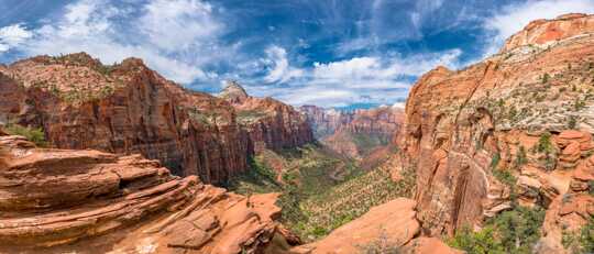
Your quads shake as you step off a sun-baked switchback and the heat hits like you opened an oven door; sweat stings your eyes, your shirt is pasted to your back, and somewhere below, a mule bell clanks once and disappears into the canyon’s echo. This is the Grand Canyon Rim-to-Rim, cutting from the North Rim to the South Rim in northern Arizona, in the USA. It’s a big, serious crossing—around 21–24 miles depending on route—where you trade cool pine forest for red walls, cottonwood shade, and the surreal green ribbon of Bright Angel Creek. The payoff is massive: changing geology under your feet, sunrise on one rim and sunset on the other. The downside: brutal heat, long climbs, and logistics; public transport to the trailheads is limited and clunky compared with other classic USA hikes like Yosemite’s Half Dome. But when you drain that first cold drink at the far rim, every step feels earned.

Discover everything you want to know in the 📖 the USA Travel Guide.
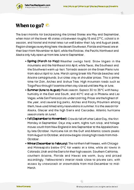
Best time to go: March - June, September - November
Duration: 2 to 3 days
Distance: 34 kilometers
Total ascent: 1,200 meters


Get your USA guide
161 ranked highlights, routes & tips, works offline (586 pages)
Loading the map 🌍
CLICK TO FILTER
cities
towns
villages
landmarks
national parks
hikes
beaches
attractions
festivals
regions
SHOW COUNTRY’S BESTSHOW ALL

✨ Why go?
Ranked #2 hike in the USA
What makes this hike worth hiking

The Grand Canyon Rim-to-Rim hike is a rite of passage for backpackers in the USA. It’s not just about the breathtaking views; it’s the grit of the trail that pulls you in. You start at the North Rim, where the air is crisp and the pine trees whisper secrets. The descent is steep, your legs burn, but every step reveals a new layer of the canyon’s vastness.

The scenery-to-effort ratio is off the charts. You’ll sweat, but the payoff is that moment when you stand at the edge, gazing into the abyss, feeling like you’re on top of the world.

Public transport makes it accessible, so you can hop on a shuttle and dive into this adventure without breaking the bank. Flexible distances allow you to tailor your trek—whether you want a quick jaunt or a multi-day challenge. It fits seamlessly into a longer … read more 👉
The Grand Canyon Rim-to-Rim hike is a rite of passage for backpackers in the USA. It’s not just about the breathtaking views; it’s the grit of the trail that pulls you in. You start at the North Rim, where the air is crisp and the pine trees whisper secrets. The descent is steep, your legs burn, but every step reveals a new layer of the canyon’s vastness.

The scenery-to-effort ratio is off the charts. You’ll sweat, but the payoff is that moment when you stand at the edge, gazing into the abyss, feeling like you’re on top of the world.

Public transport makes it accessible, so you can hop on a shuttle and dive into this adventure without breaking the bank. Flexible distances allow you to tailor your trek—whether you want a quick jaunt or a multi-day challenge. It fits seamlessly into a longer backpacking route, making it a perfect pit stop on your epic journey across the USA. Grab that first cold beer afterward; you’ve earned it!
Want to include Grand Canyon Rim-to-Rim in your the USA route?
Create a personalized the USA itinerary that includes Grand Canyon Rim-to-Rim and the places that fit your trip — based on your travel style, budget, and available time. Get your route in seconds.

Generate my trip

💡 HighlightsMust-see experiences and standout moments

  1. Ooh Aah Point (South Kaibab) — A tiny, exposed promontory that hits you with sweeping, unobstructed canyon vistas almost immediately after you start. It’s the classic “wow” shot: ridgelines falling away, insane color bands, and that dizzying sense of being on the edge — no trees, no distractions, just big space and light.
  2. Skeleton Point — Farther down the South Kaibab, this feels like the canyon’s theater: layered cliffs stack like scenery and you finally get a clear line of sight toward the inner gorge and the river. It’s where the scale of the descent really lands and where geology becomes obvious — every layer tells a story.
  3. Black Bridge & Phantom Ranch — The Colorado River crossing and the oasis at Phantom Ranch are the human-and-water contrast that makes rim-to-rim memorable. Suddenly
read more 👉
  1. Ooh Aah Point (South Kaibab) — A tiny, exposed promontory that hits you with sweeping, unobstructed canyon vistas almost immediately after you start. It’s the classic “wow” shot: ridgelines falling away, insane color bands, and that dizzying sense of being on the edge — no trees, no distractions, just big space and light.
  2. Skeleton Point — Farther down the South Kaibab, this feels like the canyon’s theater: layered cliffs stack like scenery and you finally get a clear line of sight toward the inner gorge and the river. It’s where the scale of the descent really lands and where geology becomes obvious — every layer tells a story.
  3. Black Bridge & Phantom Ranch — The Colorado River crossing and the oasis at Phantom Ranch are the human-and-water contrast that makes rim-to-rim memorable. Suddenly you’re at river level, with cabins, cottonwoods, and hikers swapping stories. Mule trains, rafters, and the smell of wet stone remind you how wild and also how traveled this corridor is. (Personal favorite — it’s the best place to sit, refuel, and soak in the canyon’s bottom.)
  4. Ribbon Falls — A short side-trip off the North Kaibab Trail that rewards you with a cool, mossy waterfall and a tiny fern-draped microclimate. On a hot day it’s a magical, quiet spot — a real contrast to the dry, sun-baked rims and a perfect mid-hike cooldown.
  5. North Rim Forest & Bright Angel Point — Coming up out of the canyon into the North Rim’s spruce-pine high country feels like arriving at a different planet. Cooler air, dense forest, and the rim viewpoints (especially Bright Angel Point) offer solitude and a final panoramic payoff — you see how drastically the ecosystem and mood change from rim to rim.
Spotted a mistake or missing something? Contact us.

Things to do around Grand Canyon Rim-to-Rim

Ratings based on Tripadvisor reviews. When you book through this link, you support our work at no extra cost to you.

🌤️ When to go?Seasonal considerations and timing


  • Weather: Spring (April to early June) and fall (September to mid-October) offer the best weather. Summer broils the canyon with highs often surpassing 38°C (100°F) at the bottom, making dehydration and heat exhaustion real threats. Winter chills the rims below freezing, with snow and ice turning trails into slick hazards.

  • Temperature: Rim-to-Rim means shifting climates. Expect rim temps around 10-20°C (50-68°F) in spring and fall, but the inner canyon can spike to 30°C+ (86°F+). Early morning starts help dodge the heat, especially in warmer months.

  • Daylight Hours: Longer days in spring and fall stretch your hiking window to 12-14 hours, crucial for covering 24 miles without rushing. Winter’s shorter days force tighter schedules and risk hiking in the dark.

  • Crowds: Peak summer draws
read more 👉

  • Weather: Spring (April to early June) and fall (September to mid-October) offer the best weather. Summer broils the canyon with highs often surpassing 38°C (100°F) at the bottom, making dehydration and heat exhaustion real threats. Winter chills the rims below freezing, with snow and ice turning trails into slick hazards.

  • Temperature: Rim-to-Rim means shifting climates. Expect rim temps around 10-20°C (50-68°F) in spring and fall, but the inner canyon can spike to 30°C+ (86°F+). Early morning starts help dodge the heat, especially in warmer months.

  • Daylight Hours: Longer days in spring and fall stretch your hiking window to 12-14 hours, crucial for covering 24 miles without rushing. Winter’s shorter days force tighter schedules and risk hiking in the dark.

  • Crowds: Peak summer draws throngs, turning trails into a slow shuffle. Spring and fall see fewer hikers, letting you own the trail and savor the silence between rim views.

  • Seasonal Activities: Spring and fall bring manageable trail conditions and access to shuttle services, which often pause or reduce in winter. Summer’s heat limits side hikes and camping options.

  • Price Fluctuations: Permits and shuttle services spike in summer due to demand. Booking early in spring or fall can save money and secure spots on limited shuttle runs.


Pro-tip: Aim for late April or early October—cool mornings, warm afternoons, fewer crowds, and a rhythm that lets you chase the canyon’s wild pulse without burning out.


source: climatestotravel.comJANJanuary: below average for travelingFEBFebruary: below average for travelingMARMarch: good for travelingAPRApril: excellent for travelingMAYMay: excellent for travelingJUNJune: good for travelingJULJuly: fair for travelingAUGAugust: fair for travelingSEPSeptember: excellent for travelingOCTOctober: excellent for travelingNOVNovember: good for travelingDECDecember: below average for traveling
United States - Grand Canyon Rim-to-Rim

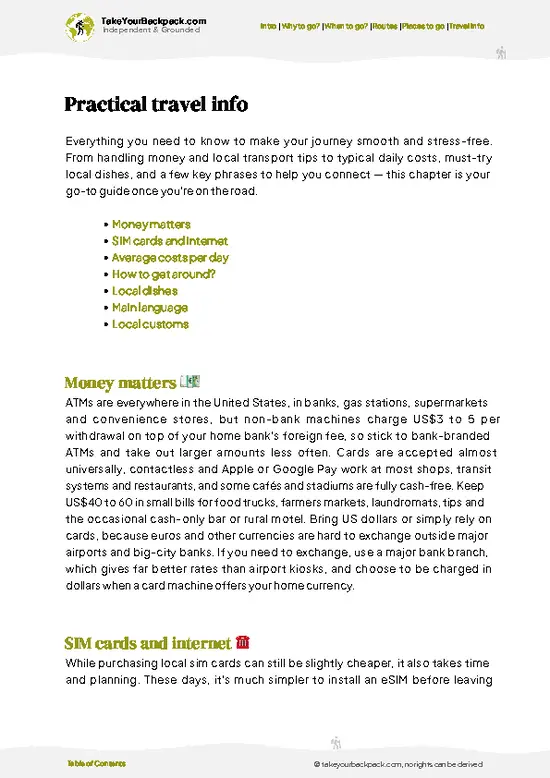
✈️ The backpacker research shortcutthe USA Travel Guide

An offline-friendly backpacking guide with optimized travel routes, ranked highlights, transport advice, and the best areas to stay.
example page 0 from our offline Travel Guide for United States
example page 1 from our offline Travel Guide for United States
example page 2 from our offline Travel Guide for United States
example page 3 from our offline Travel Guide for United States
example page 4 from our offline Travel Guide for United States
example page 5 from our offline Travel Guide for United States
example page 6 from our offline Travel Guide for United States
example page 7 from our offline Travel Guide for United States
The digital guide (586 pages) contains:
161 highlights, ranked by travel appeal
Optimized 14, 21 & 30-day travel routes
Cities, national parks, landmarks, beaches
How to get around
Offline-friendly for travel without Wi-Fi
👉 Click to see all 30+ guide features

📅 Plan smarter in minutes, not weeks
Month by month travel advice
Festivals & national holidays
Budget expectations

🗺️ Go to the right places, skip the overrated ones
Honest pros & cons of destinations
Top hikes, parks & viewpoints
Lesser-known places most travelers miss
Clear “worth it vs skip it” guidance

🛏️ Travel smoothly without rookie mistakes
Best areas to stay
Transport systems explained simply
Common scams & safety advice
SIM cards, money & practical tips

🌍 Understand the country, not just visit it
Culture & traditions
Local customs
Festivals worth planning around
Traveler-friendly historical context
Insights that make places more meaningful

📱 Built for real travel conditions
Fully downloadable PDF
Works completely offline
Optimized for phone use
Useful in remote areas & buses
Everything in one place
Save weeks of stressful planning
Get instant access to your full guide. 30‑day money-back guarantee.
+ Add another guide for just US$7.80

By proceeding you agree to our terms.
Sent to your inbox immediately after payment • 100% Secure Checkout
Best Backpacking Travel Advisor 2025 tourism awardBest Backpacking
Travel Advisor
2025
What others say about Take Your Backpack Guides:
⭐⭐⭐⭐⭐
Fantastic, amazing amount of information!
⭐⭐⭐⭐⭐
My goodness this is amazing, it's what I've been looking for hats off too you!
⭐⭐⭐⭐⭐
I think this is absolutely BRILLIANT
⭐⭐⭐⭐
Very complete and informative. It's still missing places, but I gotta to commend you
⭐⭐⭐⭐⭐
This is truly amazing, thank you, can't wait to explore it with my kids!
⭐⭐⭐⭐⭐
Awesome resource, thank you!
⭐⭐⭐⭐⭐
This is amazing! Can't wait to explore the ones I haven't seen
⭐⭐⭐⭐
I love this! Well done, great idea.
⭐⭐⭐⭐⭐
Thanks for taking the time to make this gem!
⭐⭐⭐⭐⭐
This might be the best website I've ever seen.
⭐⭐⭐⭐⭐
Congratulations, and thank you so much for your work; it's incredibly valuable.
⭐⭐⭐⭐
In all seriousness I think you did a great job pointing out the important spots
⭐⭐⭐⭐⭐
10/10 very good
⭐⭐⭐⭐⭐
As someone who's only just starting to visit regularly this is awesome, thank you.
⭐⭐⭐⭐
Thank you very much! I'm going to visit my dad, it's going to be very useful!
⭐⭐⭐⭐⭐
This is really cool! We'll be travelling for the first time and this definitely come in handy.
⭐⭐⭐⭐⭐
You are now our minister of culture, congratulations 👨‍💼
⭐⭐⭐⭐⭐
Just wanted to tell you that this is a pearl! Going to follow your recommendations.
⭐⭐⭐⭐⭐
This is so cool. I'll definitely be using the resource for my travels soon.
⭐⭐⭐⭐⭐
This is very impressive! Good work.
⭐⭐⭐⭐⭐
This is an amazing and informative site. Very well done!

🛏️ Where to stay?Choosing the right base

If you enjoy meeting fellow travelers, consider choosing hostels with high ratings for atmosphere. On the other hand, if you prefer having your own space, a hotel might be a better option.

🥾 Hike detailsKey facts about the Grand Canyon Rim-to-Rim hike

Total Distance: The Grand Canyon Rim-to-Rim trail stretches about 24 miles (39 kilometers) from the North Rim to the South Rim. If you’re planning to do it in one go, be ready for a long day or an overnight trip.

Estimated Duration: Most hikers take anywhere from 10 to 14 hours to complete the trek in one day. If you’re breaking it up into two days, you’ll want to budget about 6 to 8 hours for each segment, depending on your pace and how much you stop to enjoy the views.

Difficulty Level: This trail is considered strenuous. It’s not just the distance that makes it tough; the elevation changes … read more 👉
Total Distance: The Grand Canyon Rim-to-Rim trail stretches about 24 miles (39 kilometers) from the North Rim to the South Rim. If you’re planning to do it in one go, be ready for a long day or an overnight trip.

Estimated Duration: Most hikers take anywhere from 10 to 14 hours to complete the trek in one day. If you’re breaking it up into two days, you’ll want to budget about 6 to 8 hours for each segment, depending on your pace and how much you stop to enjoy the views.

Difficulty Level: This trail is considered strenuous. It’s not just the distance that makes it tough; the elevation changes are significant. You’ll descend about 5,000 feet from the North Rim to the Colorado River and then climb back up another 4,500 feet to the South Rim.

Starting Point: The North Rim is where the adventure begins. To get there via public transport, you’ll need to take a bus from Las Vegas or Flagstaff to Jacob Lake, and then hop on the North Rim shuttle during the summer months. Keep in mind that the North Rim is only open from mid-May to mid-October, so plan accordingly.

Major Landmarks Along the Route:
  • North Rim Lodge: A great spot to grab a bite before you head out, plus it has stunning views.
  • Roosevelt Point: A fantastic overlook that gives you a taste of the canyon’s grandeur.
  • Bright Angel Campground: A popular resting point if you’re splitting the hike into two days. It’s right by the Colorado River.
  • Phantom Ranch: A historic lodge where you can grab a meal or a drink, but reservations are a must.
  • South Rim: Finally, you’ll reach the South Rim, where the views are just as breathtaking.

Type of Terrain and Scenery: Expect a mix of rocky paths, sandy trails, and some steep switchbacks. The scenery shifts dramatically—from dense pine forests on the North Rim to the arid desert landscapes near the river. You’ll be treated to stunning vistas, towering cliffs, and the iconic Colorado River winding below.

Typical Vegetation and Wildlife:
  • Vegetation: You’ll see a variety of trees like ponderosa pines on the North Rim, transitioning to scrubby desert flora as you descend. Cacti and wildflowers pop up in the lower elevations.
  • Wildlife: Keep your eyes peeled for mule deer, bighorn sheep, and a variety of birds. Just be cautious of rattlesnakes, especially in warmer months.

If you’re planning to tackle this trail, make sure you’re well-prepared with plenty of water, snacks, and a good pair of hiking boots. It’s a breathtaking journey, but it’s no walk in the park!
⚠️ Hiking info can sometimes be outdated or inaccurate. Before you hit the trail, check the latest conditions with locals. If you do spot anything that's off, I'd love to hear from you, so I can update it for fellow travelers.

🛡️ SafetyTraveler Safety Guide

The Grand Canyon Rim-to-Rim hike is a thrilling challenge, but it demands respect for its realities. Weather can shift quickly; summer heat can scorch, while winter brings icy trails. Stay hydrated and check forecasts. The terrain? Expect steep descents and ascents that will test your legs. Footing can be tricky, especially on rocky paths, so watch your step and pace yourself.

Wildlife encounters are part of the experience. You might spot deer or even a curious squirrel. Keep your distance; feeding them is a no-go.

Preparation is key. Many first-timers underestimate the altitude and its effects. Take your time acclimating. Pack layers for temperature swings and sturdy footwear for grip.

Trail etiquette matters. Yield to those climbing up and keep noise to a minimum. Embrace the grit of … read more 👉
The Grand Canyon Rim-to-Rim hike is a thrilling challenge, but it demands respect for its realities. Weather can shift quickly; summer heat can scorch, while winter brings icy trails. Stay hydrated and check forecasts. The terrain? Expect steep descents and ascents that will test your legs. Footing can be tricky, especially on rocky paths, so watch your step and pace yourself.

Wildlife encounters are part of the experience. You might spot deer or even a curious squirrel. Keep your distance; feeding them is a no-go.

Preparation is key. Many first-timers underestimate the altitude and its effects. Take your time acclimating. Pack layers for temperature swings and sturdy footwear for grip.

Trail etiquette matters. Yield to those climbing up and keep noise to a minimum. Embrace the grit of the journey, and the views will reward you tenfold.

FAQTraveler FAQ

The Grand Canyon Rim-to-Rim hike typically takes 2 to 4 days depending on your pace and route. The distance is about 21 to 24 miles one way, depending on whether you start from the North or South Rim. Most hikers plan for 3 days to allow time for rest and acclimatization.
The hike is very strenuous and requires excellent physical fitness due to steep elevation changes and extreme temperatures. Expect elevation gains and losses of over 4,500 feet, with challenging terrain and exposure to heat in summer months. Proper preparation and conditioning are essential.
You do not need a guide for the Rim-to-Rim hike, but many choose to hire one for safety and navigation. A backcountry permit is required if you plan to camp overnight in the canyon, which must be obtained in advance from the National Park Service. Day hikes do not require a permit but require careful planning.
⚠️ Things can change over time, so always validate details locally before you go.

Other American hikes near Grand Canyon Rim-to-Rim

Explore more nearby:

  • Angels Landing—Narrow ridge, steep drop-offs, chain-assisted sections| 153 km away
  • Zion Narrows—Slot canyon, river wading, towering walls| 157 km away
  • John Muir Trail—Sierra passes, granite domes, alpine wilderness| 615 km away

💡 Not sure where to go next?
Create a personalized itinerary for the USA including Grand Canyon Rim-to-Rim and the places that fit your trip.

Generate my itinerary

👉 Discover all hikes

Or checkout all the USA has to offer (think cities, towns, villages, national parks, hikes, beaches, festivals)
Country photo of the USA

We 💚 feedbackKey takeaways before you go

The Grand Canyon Rim-to-Rim is a wild ride—every step is a dance with nature’s raw power. The payoff? Standing at the edge, feeling the vastness swallow you whole. But let’s be real: the elevation changes will test your legs and lungs. It’s not a stroll in the park. Prepare for grit, sweat, and a few moments of doubt. Still, that first cold beer at the finish line? Worth every ounce of effort.

✈️ When did I visit the USA?
In January 2023 I visited New York. Many years before, before digital cameras existed, I discovered most of the national parks in the West.

✍️ Help improve this page!
The information on this page is based on my own backpacking experience in the USA, supplemented with up-to-date research and feedback from other travelers. Travel details can change, so if you notice anything outdated or incomplete, feel free to let me know.


🙋‍♂️ Give feedback

👋 Meet the founderWho’s Behind Take Your Backpack?

Johan, backpacker and founder of TakeYourBackpackHi, I’m Johan (Netherlands 🇳🇱), the creator of TakeYourBackpack. Over the past decade, I’ve backpacked through 80+ countries across six continents, gaining extensive experience with independent travel, long-term trips, and overland routes.

This site is built on a combination of firsthand travel experience and carefully curated insights from other backpackers. Many guides are based on places I’ve personally visited, while others bring together tips, observations, and practical advice shared by trusted travelers I’ve met along the way.

The goal is to provide realistic, experience-driven guidance — not generic itineraries — so you can explore destinations with better context, clearer expectations, and more confidence.

Get full USA guide •
Instant download • 161 highlights • Full Offline guide