
×

the USA🇺🇸 | hikesSuperior Hiking TrailNorth Shore ridges, birch forest, river gorges, shuttle sections | things to do and best time to go

Explore Teton Crest TrailExplore Wonderland Trail

Backpacking in Superior Hiking Trail
👀 For curious travelershike ranked #11
By Johan Kruseman 🇳🇱 | Updated October 22, 2026

Hiking the whole Superior Hiking Trail takes weeks, so most people choose a section, and the shuttle logistics tip that choice either way. The trail runs along the North Shore of Lake Superior in the northeast of Minnesota, United States, about 300 miles from Duluth to the Canadian border. Ridgelines give you lake views, birch and maple forest, and river gorges. The footing is rooty and rocky, with steady climbs. Public transit to trailheads is thin, so expect a shuttle or a ride. I stepped out at my first trailhead, saw a wooden sign, a mud puddle and a mosquito already filing paperwork, and felt wildly overprepared and underprepared at once. Then the first overlook opened onto a gray-blue lake the size of a sea.

Discover everything you want to know in the 📖 the USA Travel Guide.
Best time to go: May - October
Duration: 3 weeks
Distance: 480 kilometers
Total ascent: 12000 meters


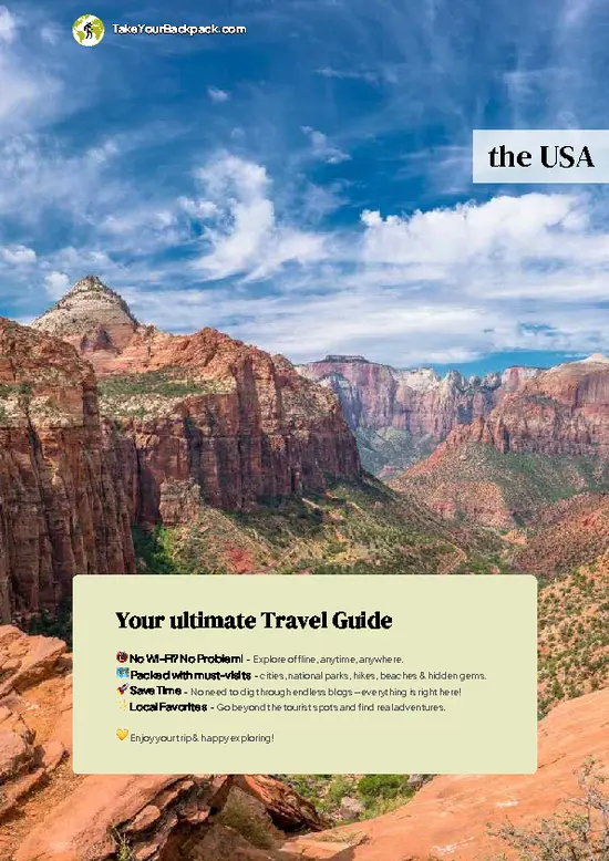
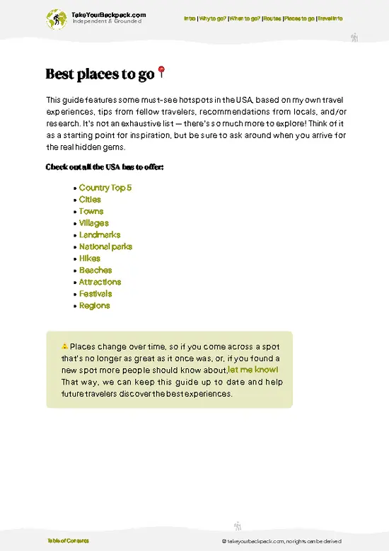
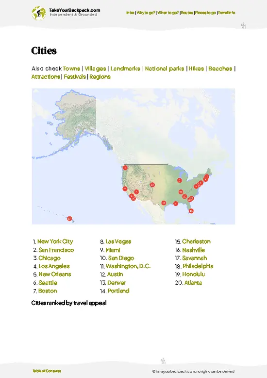
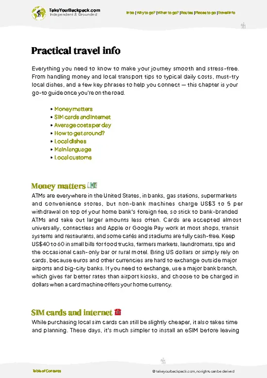
example page 0 from our offline Travel Guide for United States
example page 1 from our offline Travel Guide for United States
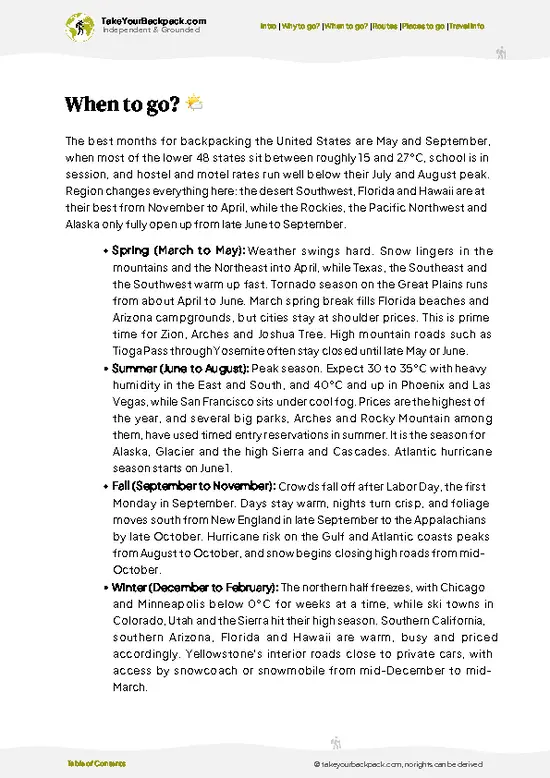
example page 2 from our offline Travel Guide for United States
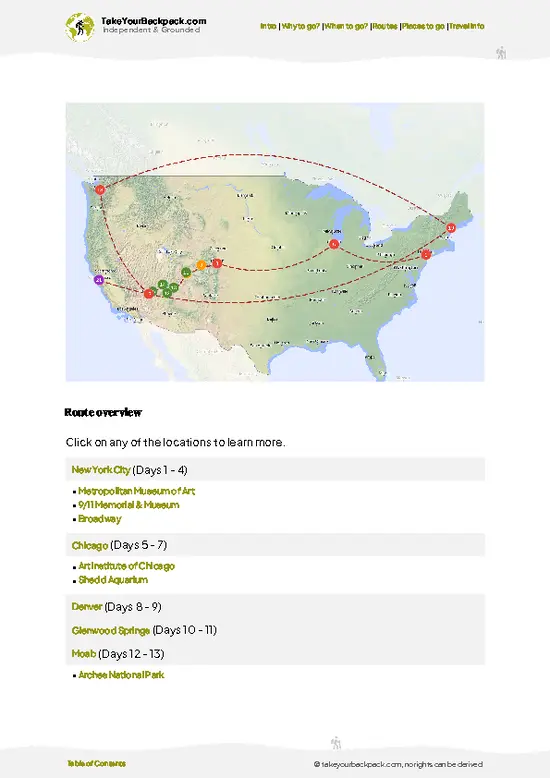
example page 3 from our offline Travel Guide for United States
example page 4 from our offline Travel Guide for United States
example page 5 from our offline Travel Guide for United States
example page 6 from our offline Travel Guide for United States
example page 7 from our offline Travel Guide for United States
Loading the map 🌍
CLICK TO FILTER
cities
towns
villages
landmarks
national parks
hikes
beaches
attractions
festivals
regions
SHOW COUNTRY’S BESTSHOW ALL

✨ Why go?
Ranked #11 hike in the USA
What makes it a must-see hike

Superior Hiking Trail gives backpackers a long-distance path with a rare level of organization. The big draw is the 94 backcountry campsites, free to use, spaced about a day's walk apart and each with a fire ring, tent pads and a latrine. That means you can plan a one-night loop or a week-long push without carrying a stove-burning permit headache. The second reason is the lake itself. Ridges such as Carlton Peak and Oberg Mountain keep Lake Superior in view for hours, and the trail drops to rivers and waterfalls between them. Distances are flexible because road crossings are frequent, so you can bail out or extend a trip. A shuttle network and lodging in towns like Grand Marais make resupply simple.

💡 HighlightsEssential experiences to have while hiking the Superior Hiking Trail

  1. Lake Superior Overlooks: The trail's signature sight is the long view over the lake from open ridgelines, where the water stretches to the horizon like an ocean.
  2. Carlton Peak: A short climb near Tofte reaches bare rock with views over the lake and inland forest, and the boulder-filled top is easy to scramble.
  3. Oberg Mountain Loop: This loop section crosses a flat summit with several lookouts over inland lakes and Lake Superior, especially colorful in autumn.
  4. Cascade River State Park: The trail follows the Cascade River past a chain of waterfalls and pools, with steep stairs and sturdy bridges in the gorge.
  5. Gooseberry Falls Area: Here the trail passes the Gooseberry River, with multi-tiered falls and rocky shoreline that make a rewarding side visit.
Superior Hiking Trail is best sampled first at … read more 👉
  1. Lake Superior Overlooks: The trail's signature sight is the long view over the lake from open ridgelines, where the water stretches to the horizon like an ocean.
  2. Carlton Peak: A short climb near Tofte reaches bare rock with views over the lake and inland forest, and the boulder-filled top is easy to scramble.
  3. Oberg Mountain Loop: This loop section crosses a flat summit with several lookouts over inland lakes and Lake Superior, especially colorful in autumn.
  4. Cascade River State Park: The trail follows the Cascade River past a chain of waterfalls and pools, with steep stairs and sturdy bridges in the gorge.
  5. Gooseberry Falls Area: Here the trail passes the Gooseberry River, with multi-tiered falls and rocky shoreline that make a rewarding side visit.
Superior Hiking Trail is best sampled first at Oberg Mountain, where a short loop gives you wide lake views for little effort.
Spotted a mistake or missing something? Contact us.

🌤️ When to go?Seasonal considerations and timing

  • Late September to early October: Fall color peaks along the Sawtooth ridges, with highs of 10 to 16°C (50 to 61°F), no biting bugs and cool nights near 0 to 4°C (32 to 39°F). Weekends fill up fast, and shuttles and lodging near Lutsen cost more.
  • Summer: Highs of 21 to 27°C (70 to 81°F) bring long daylight, warm lake swims and thunderstorms, but also black flies, mosquitoes and the most campsite competition.
  • Late May to June: Trails run muddy and bugs arrive, though crowds are thin and waterfalls roar at 10 to 20°C (50 to 68°F).
  • Winter: Snow and lows of -20°C (-4°F) suit only experienced snowshoers, and daylight runs short.
Book September campsites and shuttles weeks ahead, and aim for a midweek start.

source: climatestotravel.comJANJanuary: below average for travelingFEBFebruary: below average for travelingMARMarch: fair for travelingAPRApril: fair for travelingMAYMay: good for travelingJUNJune: highly recommended for travelingJULJuly: good for travelingAUGAugust: good for travelingSEPSeptember: highly recommended for travelingOCTOctober: good for travelingNOVNovember: fair for travelingDECDecember: below average for traveling
when-to-go

✈️ The backpacker research shortcutthe USA Travel Guide

An offline-friendly backpacking guide with optimized travel routes, ranked highlights, transport advice, and the best areas to stay.
example page 0 from our offline Travel Guide for United States
example page 1 from our offline Travel Guide for United States
example page 2 from our offline Travel Guide for United States
example page 3 from our offline Travel Guide for United States
example page 4 from our offline Travel Guide for United States
example page 5 from our offline Travel Guide for United States
example page 6 from our offline Travel Guide for United States
example page 7 from our offline Travel Guide for United States
The digital guide (451 pages) contains:
✅ 159 highlights, ranked by travel appeal
✅ Optimized 14, 21 & 30-day travel routes
✅ Cities, national parks, landmarks, beaches
✅ How to get around
✅ Offline-friendly for travel without Wi-Fi
👉 Click to see all 30+ guide features

📅 Plan smarter in minutes, not weeks
✅ Month by month travel advice
✅ Festivals & national holidays
✅ Budget expectations

🗺️ Go to the right places, skip the overrated ones
✅ Honest pros & cons of destinations
✅ Top hikes, parks & viewpoints
✅ Lesser-known places most travelers miss
✅ Clear “worth it vs skip it” guidance

🛏️ Travel smoothly without rookie mistakes
✅ Best areas to stay
✅ Transport systems explained simply
✅ Common scams & safety advice
✅ SIM cards, money & practical tips

🌍 Understand the country, not just visit it
✅ Culture & traditions
✅ Local customs
✅ Festivals worth planning around
✅ Traveler-friendly historical context
✅ Insights that make places more meaningful

📱 Built for real travel conditions
✅ Fully downloadable PDF
✅ Works completely offline
✅ Optimized for phone use
✅ Useful in remote areas & buses
✅ Everything in one place
Stop searching, start planning
Get instant access to your full guide. 30‑day money-back guarantee.
+ Add another guide for just

By proceeding you agree to our terms.
Sent to your inbox immediately after payment • 100% Secure Checkout
Best Backpacking Travel Advisor 2025 tourism awardBest Backpacking
Travel Advisor
2025
What others say about Take Your Backpack Guides:
⭐⭐⭐⭐⭐
Fantastic, amazing amount of information!
⭐⭐⭐⭐⭐
My goodness this is amazing, it's what I've been looking for hats off too you!
⭐⭐⭐⭐⭐
I think this is absolutely BRILLIANT
⭐⭐⭐⭐
Very complete and informative. It's still missing places, but I gotta to commend you
⭐⭐⭐⭐⭐
This is truly amazing, thank you, can't wait to explore it with my kids!
⭐⭐⭐⭐⭐
Awesome resource, thank you!
⭐⭐⭐⭐⭐
This is amazing! Can't wait to explore the ones I haven't seen
⭐⭐⭐⭐
I love this! Well done, great idea.
⭐⭐⭐⭐⭐
Thanks for taking the time to make this gem!
⭐⭐⭐⭐⭐
This might be the best website I've ever seen.
⭐⭐⭐⭐⭐
Congratulations, and thank you so much for your work; it's incredibly valuable.
⭐⭐⭐⭐
In all seriousness I think you did a great job pointing out the important spots
⭐⭐⭐⭐⭐
10/10 very good
⭐⭐⭐⭐⭐
As someone who's only just starting to visit regularly this is awesome, thank you.
⭐⭐⭐⭐
Thank you very much! I'm going to visit my dad, it's going to be very useful!
⭐⭐⭐⭐⭐
This is really cool! We'll be travelling for the first time and this definitely come in handy.
⭐⭐⭐⭐⭐
You are now our minister of culture, congratulations 👨‍💼
⭐⭐⭐⭐⭐
Just wanted to tell you that this is a pearl! Going to follow your recommendations.
⭐⭐⭐⭐⭐
This is so cool. I'll definitely be using the resource for my travels soon.
⭐⭐⭐⭐⭐
This is very impressive! Good work.
⭐⭐⭐⭐⭐
This is an amazing and informative site. Very well done!

🛏️ Where to stay?Best areas to stay in the USA

If you enjoy meeting fellow travelers, consider choosing hostels with high ratings for atmosphere. On the other hand, if you prefer having your own space, a hotel might be a better option.

🥾 Hike detailsKey facts about the Superior Hiking Trail hike

Total Distance: Superior Hiking Trail runs about 300 miles (480 kilometers) from the Minnesota-Wisconsin border near Duluth to the Canadian border near Grand Portage.
Estimated Duration: Thru-hikers take about 3 to 4 weeks. Most people do sections of 1 to 5 days.
Difficulty: Moderate to strenuous. Climbs are short but frequent, and roots and rocks slow progress.
Starting Point: Southern terminus is at Jay Cooke area near Duluth. Duluth has local bus service, and seasonal shuttles reach many northern trailheads.
Major Landmarks:
  • Carlton Peak: A rocky summit with lake views.
  • Oberg Mountain: A loop with
… read more 👉
Total Distance: Superior Hiking Trail runs about 300 miles (480 kilometers) from the Minnesota-Wisconsin border near Duluth to the Canadian border near Grand Portage.
Estimated Duration: Thru-hikers take about 3 to 4 weeks. Most people do sections of 1 to 5 days.
Difficulty: Moderate to strenuous. Climbs are short but frequent, and roots and rocks slow progress.
Starting Point: Southern terminus is at Jay Cooke area near Duluth. Duluth has local bus service, and seasonal shuttles reach many northern trailheads.
Major Landmarks:
  • Carlton Peak: A rocky summit with lake views.
  • Oberg Mountain: A loop with open lookouts.
  • Cascade River: A gorge with waterfalls.
Terrain and Scenery: Ridgelines, river valleys, bogs and boardwalks, with rock outcrops and lake views.
Vegetation: Sugar maple, birch, aspen, spruce, balsam fir and cedar, with ferns and wildflowers.
Wildlife: White-tailed deer, moose, black bears, wolves, ravens, and many songbirds and warblers. Mosquitoes and biting flies are common in early summer.
⚠️ Hiking info can sometimes be outdated or inaccurate. Before you hit the trail, check the latest conditions with locals. If you do spot anything that's off, I'd love to hear from you, so I can update it for fellow travelers.

🛡️ SafetyStaying Safe: What Travelers Should Know

The Superior Hiking Trail is well marked with blue blazes and has few serious hazards, so pace, layers and water matter most. Weather off Lake Superior can swing 10°C (18°F) in an hour, and rocky ridges such as Carlton Peak and the Sawtooths turn slick after rain, so wear shoes with real tread. Black bears live here but rarely cause trouble. Hang or store food in a bear canister and keep it away from your tent. Ticks and mosquitoes are the daily annoyance, so bring repellent and check your skin each evening. Creek water needs filtering. First-timers often underestimate the constant short climbs, so plan 10 to 12 miles (16 to 19 km) a day rather than 15.

FAQCommon questions from travelers

Completing the full Superior Hiking Trail takes most backpackers 3 to 5 weeks, covering about 300 miles (480 km) from the Minnesota-Wisconsin border near Duluth to the Canadian border at Otter Lake Road near Grand Portage. Many people hike sections instead, such as the Lutsen to Caribou Trail stretch in 3 to 4 days. Typical daily mileage runs 8 to 14 miles (13 to 23 km) because of the steady ups and downs.
The Superior Hiking Trail is moderate overall, with no technical climbing but constant elevation change along ridges above Lake Superior. Roots, rocks and wet boulders slow progress, and total gain is large even though the trail tops out at 1,829 feet (557 m). Beginners do well on 2 to 3 day sections with a pack under 25 pounds (11 kg), while thru-hikers need strong knees and good trail fitness.
The Superior Hiking Trail needs no guide, and navigation is easy thanks to blue blazes and the free or low-cost trail guidebook and maps. Its 94 backcountry campsites need no permit, fee or reservation and are shared first come, first served. Overnight parking at trailheads is permitted, and private shuttle services cost roughly US$30 to 100 depending on distance.
⚠️ Things can change over time, so always validate details locally before you go.

Other American hikes near Superior Hiking Trail

Explore more nearby:

  • Teton Crest Trail—Teton views, limestone shelf, alpine tarns, bear spray| 1646 km away
  • Zion Narrows—River wading, Wall Street, sandstone slot, neoprene socks| 2168 km away
  • Angels Landing—Permit lottery, fixed chains, knife-edge ridge, Walter’s Wiggles| 2171 km away

💡 Not sure where to go next?
Create a personalized itinerary for the USA including Superior Hiking Trail and the places that fit your trip.

Generate my itinerary

👉 Discover all hikes

Or checkout all the USA has to offer (think cities, towns, villages, national parks, hikes, beaches, festivals)
Country photo of the USA

We 💚 feedbackSumming up the experience

Superior Hiking Trail is best in late September, when maples turn red and the bugs have gone quiet. I would pack a warm layer, since lake breezes bite after sunset, and book a shuttle ahead for a point-to-point section.

✈️ When did I visit the USA?
In January 2023 I visited New York. Many years before, before digital cameras existed, I discovered most of the national parks in the West.

✍️ Help improve this page!
The information on this page is based on my own backpacking experience in the USA, supplemented with up-to-date research and feedback from other travelers. Travel details can change, so if you notice anything outdated or incomplete, feel free to let me know.


🙋‍♂️ Give feedback

👋 Meet the founderWho’s Behind Take Your Backpack?

Johan, backpacker and founder of TakeYourBackpackHi, I’m Johan (Netherlands 🇳🇱), the creator of TakeYourBackpack. Over the past 3 decades, I’ve backpacked through 90+ countries across six continents, gaining extensive experience with independent travel, long-term trips, and overland routes.

This site is built on a combination of firsthand travel experience and carefully curated insights from other backpackers. Many guides are based on places I’ve personally visited, while others bring together tips, observations, and practical advice shared by trusted travelers I’ve met along the way.

The goal is to provide realistic, experience-driven guidance — not generic itineraries — so you can explore destinations with better context, clearer expectations, and more confidence.