
×

Venezuela🇻🇪 | hikesEl Ávila Trailurban foothills, dense forest, summit cable car | things to do and best time to go

Explore La Culata TrailExplore Cueva del Guácharo Trail

Backpacking in El Ávila Trail
By Johan Kruseman 🇳🇱 | Updated October 15, 2026

Your shirt sticks to your back, knees pumping up stone steps slick with morning humidity, while Caracas growls below like a distant engine and a gust of cold mountain air suddenly cuts through the heat. This is El Ávila Trail, rising straight out of the city in El Ávila National Park, the green wall that frames Venezuela’s capital. The hike is steep, relentless, and crowded on weekends, but the payoff is huge: cloud-draped ridgelines, glimpses of the Caribbean on clear days, and that first icy papelón con limón at a trailside stand. It’s easy to reach by metro and taxi, which makes it more accessible than many Venezuelan treks, but also less wild and more regulated than routes in Mérida or the Gran Sabana. Expect a tough, sweaty climb rather than a quiet wilderness escape—and a view that feels hard-earned.

Discover everything you want to know in the 📖 Venezuela Travel Guide.
Best time to go: December - April
Duration: 2 days
Distance: 20 kilometers
Total ascent: 1,200 meters
Safety warning

The current risk level for Venezuela is high. Check the advice before going.


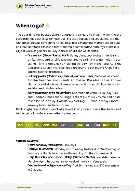
example page 0 from our offline Travel Guide for Venezuela
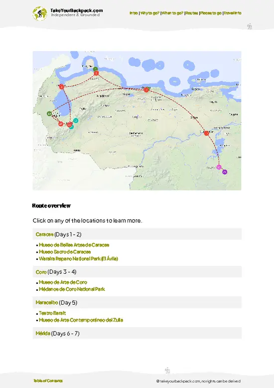
example page 1 from our offline Travel Guide for Venezuela
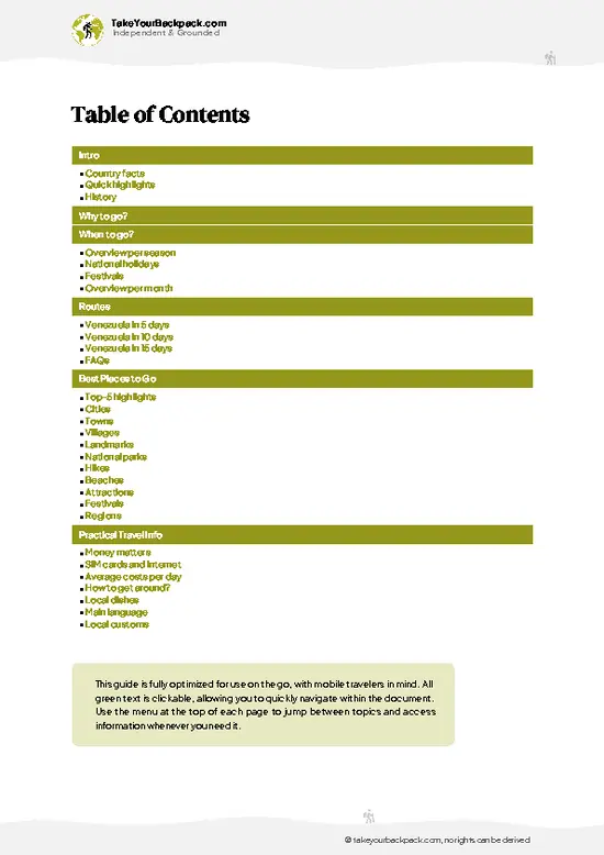
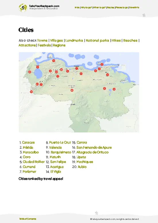
example page 2 from our offline Travel Guide for Venezuela
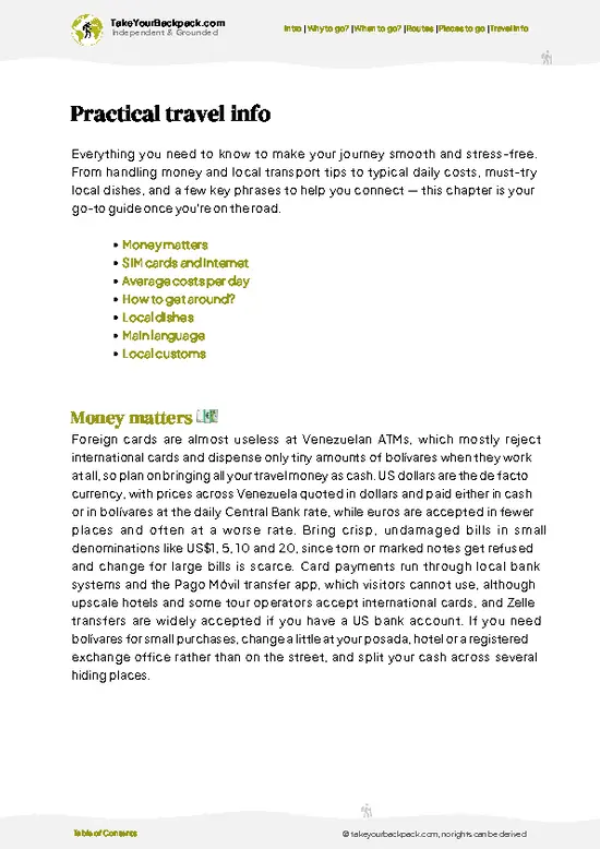
example page 3 from our offline Travel Guide for Venezuela
example page 4 from our offline Travel Guide for Venezuela
example page 5 from our offline Travel Guide for Venezuela
example page 6 from our offline Travel Guide for Venezuela
example page 7 from our offline Travel Guide for Venezuela
Loading the map 🌍
CLICK TO FILTER
cities
towns
villages
landmarks
national parks
hikes
beaches
attractions
festivals
regions
SHOW COUNTRY’S BESTSHOW ALL

✨ Why go?
Ranked #99 hike in Venezuela
What makes it a must-see hike

The El Ávila Trail in Venezuela is a magnet for backpackers, and it’s easy to see why. First off, the scenery-to-effort ratio is off the charts. You’ll sweat it out on the ascent, but the payoff is a panoramic view of Caracas and the Caribbean coast that makes every step worth it.

Getting there is a breeze. Public transport whisks you from the city to the trailhead, making it accessible for anyone eager to lace up their boots. Plus, it’s a low-cost adventure—no pricey permits or guided tours needed. You can choose your distance, whether you want a quick half-day jaunt or a full-day trek that really tests your mettle.

This hike fits seamlessly into a longer backpacking route through Venezuela. You can easily hop from one stunning locale to another, with El Ávila serving as a refreshing … read more 👉
The El Ávila Trail in Venezuela is a magnet for backpackers, and it’s easy to see why. First off, the scenery-to-effort ratio is off the charts. You’ll sweat it out on the ascent, but the payoff is a panoramic view of Caracas and the Caribbean coast that makes every step worth it.

Getting there is a breeze. Public transport whisks you from the city to the trailhead, making it accessible for anyone eager to lace up their boots. Plus, it’s a low-cost adventure—no pricey permits or guided tours needed. You can choose your distance, whether you want a quick half-day jaunt or a full-day trek that really tests your mettle.

This hike fits seamlessly into a longer backpacking route through Venezuela. You can easily hop from one stunning locale to another, with El Ávila serving as a refreshing pit stop. The burn in your legs transforms into a sense of accomplishment, especially when you crack open that first cold beer at the end of the day.

💡 HighlightsPlaces and moments you shouldn't skip

  1. Caracas-to-Caribbean panorama from the ridge: A jaw-dropping contrast — one side is the dense cityscape of Caracas, the other the glittering Caribbean Sea. The way the metropolis tumbles into blue water is unlike most hikes; it’s a photographer’s dream and a constant reminder you’re hiking right above a capital.
  2. The Teleférico (Waraira Repano) viewpoints: Even if you hike, a stop by the cable-car area gives a different angle and quick access to high viewpoints without hours of climbing. The stations and terraces are social hubs where locals picnic, vendors sell snacks, and you get panoramic views with minimal effort.
  3. Cloud-forest and páramo transition: El Ávila shows off a real altitude change in a short distance — dense, mossy cloud forest gives way to wind-swept páramo patches. That
… read more 👉
  1. Caracas-to-Caribbean panorama from the ridge: A jaw-dropping contrast — one side is the dense cityscape of Caracas, the other the glittering Caribbean Sea. The way the metropolis tumbles into blue water is unlike most hikes; it’s a photographer’s dream and a constant reminder you’re hiking right above a capital.
  2. The Teleférico (Waraira Repano) viewpoints: Even if you hike, a stop by the cable-car area gives a different angle and quick access to high viewpoints without hours of climbing. The stations and terraces are social hubs where locals picnic, vendors sell snacks, and you get panoramic views with minimal effort.
  3. Cloud-forest and páramo transition: El Ávila shows off a real altitude change in a short distance — dense, mossy cloud forest gives way to wind-swept páramo patches. That shift in vegetation, temperature and light makes the trail feel like several microclimates stitched into one day’s walk.
  4. Rich birdlife and mountain flora: Hummingbirds dart between bromeliads, tanagers flash color in the canopy, and orchids hide on trunks — good birding and plant spotting without needing to go deep into the jungle. Wildlife encounters are frequent enough to keep every stop interesting, especially early morning.
  5. Sunset and nighttime city-lights show: Hike later in the day and the sunset over sea and city is cinematic; stick around as lights pop on across Caracas for a completely different scene. It’s a cheap, unforgettable skyline experience — bring a light and plan your descent safely if you’re staying for the view.
Spotted a mistake or missing something? Contact us.

🌤️ When to go?Choosing the right time of year

  • Weather: The dry season from December to April is your best bet. Trails stay firm, and the risk of sudden downpours drops sharply. The wet season (May to November) turns paths slick and muddy, making footing tricky and the climb more taxing.
  • Temperature: Daytime highs hover around 24-28°C (75-82°F) during the dry months, perfect for sweating it out without overheating. Nights dip to a cool 15-18°C (59-64°F), so pack a light jacket for summit breaks.
  • Daylight Hours: Expect roughly 11 to 12 hours of daylight year-round, but the dry season offers clearer skies, so you’ll get more reliable light for early starts and late finishes.
  • Crowds: Peak hiking season aligns with the dry months and local holidays, especially around Christmas and Easter. Weekdays are quieter, giving you more breathing
… read more 👉
  • Weather: The dry season from December to April is your best bet. Trails stay firm, and the risk of sudden downpours drops sharply. The wet season (May to November) turns paths slick and muddy, making footing tricky and the climb more taxing.
  • Temperature: Daytime highs hover around 24-28°C (75-82°F) during the dry months, perfect for sweating it out without overheating. Nights dip to a cool 15-18°C (59-64°F), so pack a light jacket for summit breaks.
  • Daylight Hours: Expect roughly 11 to 12 hours of daylight year-round, but the dry season offers clearer skies, so you’ll get more reliable light for early starts and late finishes.
  • Crowds: Peak hiking season aligns with the dry months and local holidays, especially around Christmas and Easter. Weekdays are quieter, giving you more breathing room on narrow trails.
  • Seasonal Activities: Dry season brings outdoor festivals and mountain markets near trailheads, adding local flavor to your trek. Wet season sees fewer events but more lush greenery if you’re chasing that jungle vibe.
  • Price Fluctuations: Accommodation and guided tours spike in the dry season when demand surges. Booking ahead can save you from last-minute price hikes.
Pro-tip: Start your hike early in the dry season to catch sunrise views without the crush—and reward yourself with a cold local beer once you hit the base.


source: climatestotravel.comJANJanuary: excellent for travelingFEBFebruary: excellent for travelingMARMarch: excellent for travelingAPRApril: excellent for travelingMAYMay: fair for travelingJUNJune: fair for travelingJULJuly: fair for travelingAUGAugust: fair for travelingSEPSeptember: fair for travelingOCTOctober: fair for travelingNOVNovember: fair for travelingDECDecember: excellent for traveling
when-to-go

✈️ The backpacker research shortcutVenezuela Travel Guide

An offline-friendly backpacking guide with optimized travel routes, ranked highlights, transport advice, and the best areas to stay.
example page 0 from our offline Travel Guide for Venezuela
example page 1 from our offline Travel Guide for Venezuela
example page 2 from our offline Travel Guide for Venezuela
example page 3 from our offline Travel Guide for Venezuela
example page 4 from our offline Travel Guide for Venezuela
example page 5 from our offline Travel Guide for Venezuela
example page 6 from our offline Travel Guide for Venezuela
example page 7 from our offline Travel Guide for Venezuela
The digital guide (290 pages) contains:
✅ 91 highlights, ranked by travel appeal
✅ Optimized 5, 10 & 15-day travel routes
✅ Cities, national parks, landmarks, beaches
✅ How to get around
✅ Offline-friendly for travel without Wi-Fi
👉 Click to see all 30+ guide features

📅 Plan smarter in minutes, not weeks
✅ Month by month travel advice
✅ Festivals & national holidays
✅ Budget expectations

🗺️ Go to the right places, skip the overrated ones
✅ Honest pros & cons of destinations
✅ Top hikes, parks & viewpoints
✅ Lesser-known places most travelers miss
✅ Clear “worth it vs skip it” guidance

🛏️ Travel smoothly without rookie mistakes
✅ Best areas to stay
✅ Transport systems explained simply
✅ Common scams & safety advice
✅ SIM cards, money & practical tips

🌍 Understand the country, not just visit it
✅ Culture & traditions
✅ 52 Essential phrases & customs
✅ Festivals worth planning around
✅ Traveler-friendly historical context
✅ Insights that make places more meaningful

📱 Built for real travel conditions
✅ Fully downloadable PDF
✅ Works completely offline
✅ Optimized for phone use
✅ Useful in remote areas & buses
✅ Everything in one place
Stop searching, start planning
Get instant access to your full guide. 30‑day money-back guarantee.
+ Add another guide for just

By proceeding you agree to our terms.
Sent to your inbox immediately after payment • 100% Secure Checkout
Best Backpacking Travel Advisor 2025 tourism awardBest Backpacking
Travel Advisor
2025
What others say about Take Your Backpack Guides:
⭐⭐⭐⭐⭐
Fantastic, amazing amount of information!
⭐⭐⭐⭐⭐
My goodness this is amazing, it's what I've been looking for hats off too you!
⭐⭐⭐⭐⭐
I think this is absolutely BRILLIANT
⭐⭐⭐⭐
Very complete and informative. It's still missing places, but I gotta to commend you
⭐⭐⭐⭐⭐
This is truly amazing, thank you, can't wait to explore it with my kids!
⭐⭐⭐⭐⭐
Awesome resource, thank you!
⭐⭐⭐⭐⭐
This is amazing! Can't wait to explore the ones I haven't seen
⭐⭐⭐⭐
I love this! Well done, great idea.
⭐⭐⭐⭐⭐
Thanks for taking the time to make this gem!
⭐⭐⭐⭐⭐
This might be the best website I've ever seen.
⭐⭐⭐⭐⭐
Congratulations, and thank you so much for your work; it's incredibly valuable.
⭐⭐⭐⭐
In all seriousness I think you did a great job pointing out the important spots
⭐⭐⭐⭐⭐
10/10 very good
⭐⭐⭐⭐⭐
As someone who's only just starting to visit regularly this is awesome, thank you.
⭐⭐⭐⭐
Thank you very much! I'm going to visit my dad, it's going to be very useful!
⭐⭐⭐⭐⭐
This is really cool! We'll be travelling for the first time and this definitely come in handy.
⭐⭐⭐⭐⭐
You are now our minister of culture, congratulations 👨‍💼
⭐⭐⭐⭐⭐
Just wanted to tell you that this is a pearl! Going to follow your recommendations.
⭐⭐⭐⭐⭐
This is so cool. I'll definitely be using the resource for my travels soon.
⭐⭐⭐⭐⭐
This is very impressive! Good work.
⭐⭐⭐⭐⭐
This is an amazing and informative site. Very well done!

🛏️ Where to stay?Best areas and accommodation options

If you enjoy meeting fellow travelers, consider choosing hostels with high ratings for atmosphere. On the other hand, if you prefer having your own space, a hotel might be a better option.

🥾 Hike detailsA practical overview of the hike

Total Distance: Approximately 12 kilometers (7.5 miles) round trip, depending on the specific route you take.

Estimated Duration: Expect to spend about 4 to 6 hours on the trail. This can vary based on your pace and how many breaks you take to soak in the views.

Difficulty Level: Moderate. While it’s not a technical climb, the trail has some steep sections that can get your heart pumping. Good fitness is a plus, but it’s manageable for most.

Starting Point: The trailhead is located at the El Ávila National Park entrance near the neighborhood of Sabas Nieves.
  • Public Transport: Take the Metro
… read more 👉
Total Distance: Approximately 12 kilometers (7.5 miles) round trip, depending on the specific route you take.

Estimated Duration: Expect to spend about 4 to 6 hours on the trail. This can vary based on your pace and how many breaks you take to soak in the views.

Difficulty Level: Moderate. While it’s not a technical climb, the trail has some steep sections that can get your heart pumping. Good fitness is a plus, but it’s manageable for most.

Starting Point: The trailhead is located at the El Ávila National Park entrance near the neighborhood of Sabas Nieves.
  • Public Transport: Take the Metro to the Chacaíto Station, then hop on a bus or taxi to the park entrance. Buses are frequent and pretty cheap, making it easy to get there.

Major Landmarks Along the Route:
  • Mirador La Hambrienta: A stunning viewpoint where you can catch your breath and admire the Caracas skyline.
  • La Silla: An iconic rock formation that offers panoramic views of the surrounding area.
  • Los Dos Caminos: A junction where you can choose different paths, adding some variety to your hike.

Type of Terrain and Scenery: The trail features a mix of rocky paths, dirt trails, and some steep inclines. You’ll find yourself surrounded by lush greenery, with occasional open views that reveal the city below and the Caribbean Sea in the distance. The contrast between urban and natural landscapes is pretty striking.

Typical Vegetation and Wildlife: Expect to see a variety of tropical plants, including ferns, orchids, and towering trees.
  • Vegetation: The park is home to cloud forest ecosystems, so you’ll encounter plenty of moisture-loving plants.
  • Wildlife: Keep an eye out for birds like toucans and hummingbirds, as well as small mammals like agoutis. If you’re lucky, you might spot a capybara or a playful squirrel monkey.

This trail is a gem for independent hikers looking for a taste of Venezuela’s natural beauty without straying too far from the city. Just pack plenty of water, wear sturdy shoes, and don’t forget your camera!
⚠️ Hiking info can sometimes be outdated or inaccurate. Before you hit the trail, check the latest conditions with locals. If you do spot anything that's off, I'd love to hear from you, so I can update it for fellow travelers.

🛡️ SafetySafety Tips and Common Scams in El Ávila Trail

El Ávila Trail offers a thrilling blend of challenge and reward. The weather can shift quickly, so pack a light rain jacket and layers. Mornings can be cool, but the sun can blaze by midday.

The trail itself is well-marked but steep in sections, demanding focus on your footing. Watch for loose rocks and roots; a misstep can lead to a tumble. Navigation is straightforward, but keep your phone charged for a backup map.

Wildlife is part of the experience. You might spot a curious squirrel or hear the distant call of a bird. Keep your distance; respect their space.

Start early to avoid the heat and crowds. Hydration is key—bring enough water, as streams can be scarce. With the right prep, you’ll find that the effort pays off in breathtaking views and a well-deserved cold drink at the summit.

FAQCommon questions from travelers

The El Ávila Trail hike typically takes 4 to 6 hours to complete one way, depending on your pace and the chosen route. The main trail from Caracas to the summit is about 8 kilometers long. Plan for a full day if you intend to hike up and back.
The difficulty of the El Ávila Trail is moderate to challenging due to steep sections and variable terrain. Elevation gain is around 1,200 meters, so a reasonable level of fitness is required. Some parts can be slippery or rocky, especially after rain.
No guide or permit is required to hike the El Ávila Trail, but hiring a local guide is recommended for safety and navigation, especially if unfamiliar with the area. The park is open year-round with no entrance fee, but early starts are advised to avoid afternoon heat and crowds.
⚠️ Things can change over time, so always validate details locally before you go.

Other Venezuelan hikes near El Ávila Trail

Explore more nearby:


💡 Not sure where to go next?
Create a personalized itinerary for Venezuela including El Ávila Trail and the places that fit your trip.

Generate my itinerary

👉 Discover all hikes

Or checkout all Venezuela has to offer (think cities, towns, villages, national parks, hikes, beaches, festivals)
Country photo of Venezuela

We 💚 feedbackParting advice and final tips

The El Ávila Trail is a sweat-soaked adventure that rewards you with breathtaking views of Caracas and the Caribbean. Expect a mix of locals and fellow travelers, all fueled by the same thrill. The best surprise? Stumbling upon a tiny roadside stand selling fresh arepas—perfect fuel for the climb. Just a heads-up: the weather can shift in an instant. Pack a light rain jacket. Embrace the grit; the payoff is worth every step.

✍️ Help improve this page!
The information on this page is based on in-depth research, insights shared by experienced travelers, and feedback from the local travel community in Venezuela. While every effort is made to keep the information accurate and current, conditions can change — so if you spot anything incorrect or outdated, please get in touch.


🙋‍♂️ Give feedback

👋 Meet the founderWho’s Behind Take Your Backpack?

Johan, backpacker and founder of TakeYourBackpackHi, I’m Johan (Netherlands 🇳🇱), the creator of TakeYourBackpack. Over the past 3 decades, I’ve backpacked through 90+ countries across six continents, gaining extensive experience with independent travel, long-term trips, and overland routes.

This site is built on a combination of firsthand travel experience and carefully curated insights from other backpackers. Many guides are based on places I’ve personally visited, while others bring together tips, observations, and practical advice shared by trusted travelers I’ve met along the way.

The goal is to provide realistic, experience-driven guidance — not generic itineraries — so you can explore destinations with better context, clearer expectations, and more confidence.