×

Venezuela🇻🇪 | hikesMount RoraimaTepui summit, Pemón-guided trek, quartz pools, Punto Triple | things to do and best time to go

Explore Angel FallsExplore Pico Naiguatá

Backpacking in Mount Roraima
🏆 Top pickhike ranked #1
By Johan Kruseman 🇳🇱 | Updated October 19, 2026

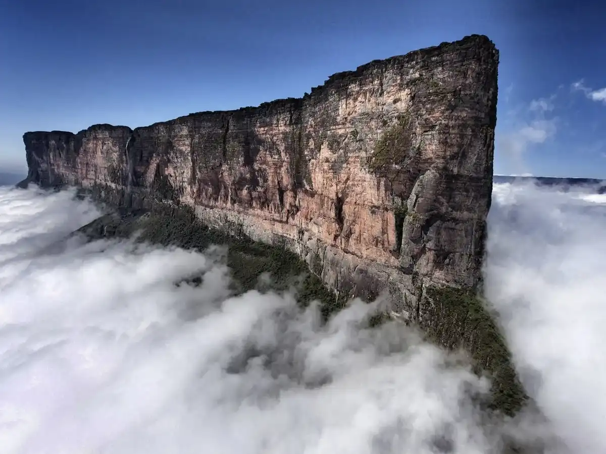
Your boots are soaked to the shins at the Río Kukenán, sandflies are working over your ankles, and a cliff wall rises into the cloud ahead. This is Mount Roraima, a flat-topped tepui in the southeast of Venezuela, in Canaima National Park, where the border meets Brazil and Guyana. The reward is a summit of black rock fins, quartz-lined streams and pitcher plants that exist almost nowhere else. The cost is five to six days of mud, cold nights and rain even in the better months. Skip any attempt to squeeze it into a long weekend. A swollen Kukenán can pin you at camp for a day, so keep a spare day in your schedule. Pack dry socks in a sealed bag and sandfly repellent. The first village is reached by a rough 4x4 track from Santa Elena de Uairén, with no regular bus. Book a licensed Pemón guide and porter there before you go, because trekking alone is not allowed.

Discover everything you want to know in the 📖 Venezuela Travel Guide.
Best time to go: November - April
Duration: 6 days
Distance: 60 kilometers
Total ascent: 1800 meters
Safety warning

The current risk level for Venezuela is high. Check the advice before going.


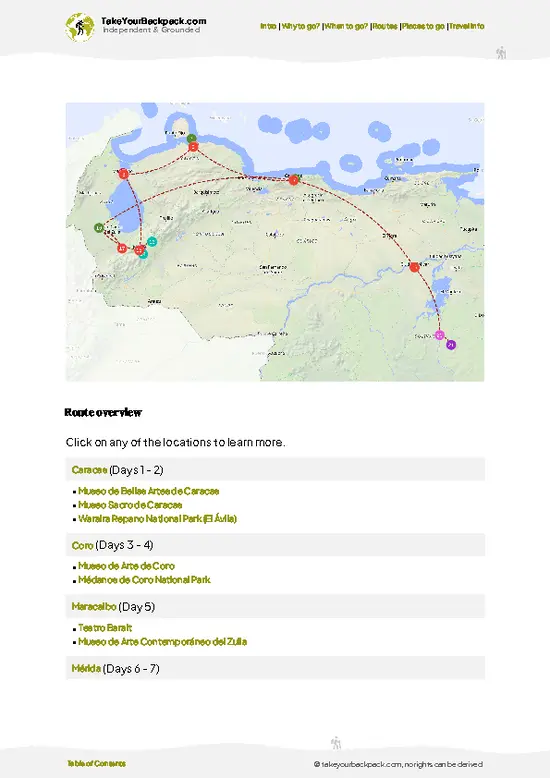
example page 0 from our offline Travel Guide for Venezuela
example page 1 from our offline Travel Guide for Venezuela
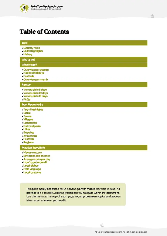
example page 2 from our offline Travel Guide for Venezuela
example page 3 from our offline Travel Guide for Venezuela
example page 4 from our offline Travel Guide for Venezuela
example page 5 from our offline Travel Guide for Venezuela
example page 6 from our offline Travel Guide for Venezuela
example page 7 from our offline Travel Guide for Venezuela
Loading the map 🌍
CLICK TO FILTER
cities
towns
villages
landmarks
national parks
hikes
beaches
attractions
festivals
regions
SHOW COUNTRY’S BESTSHOW ALL

✨ Why go?
Ranked #1 hike in Venezuela
Why Mount Roraima should be on your travel list

Mount Roraima is the tepui that inspired Arthur Conan Doyle’s The Lost World, and standing on it is the point. Backpackers go for the strangeness: a summit at about 2,810 meters where the ground is black sculpted sandstone, carnivorous Heliamphora pitcher plants grow in the bogs and the tiny black Roraima bush toad, Oreophrynella quelchii, lives on the open rock. Nothing in the Andes or the Guiana lowlands looks like it.

The route is also a clean, well-defined trek. The path from the Pemón village of Paraitepui crosses open grassland, then climbs the natural ledge called La Rampa to the top, so you need no technical skills, only fitness and tolerance for wet feet. Camping is simple and the Pemón guides know every shelter.

It fits easily into a longer overland loop. Santa Elena de Uairén … read more 👉
Mount Roraima is the tepui that inspired Arthur Conan Doyle’s The Lost World, and standing on it is the point. Backpackers go for the strangeness: a summit at about 2,810 meters where the ground is black sculpted sandstone, carnivorous Heliamphora pitcher plants grow in the bogs and the tiny black Roraima bush toad, Oreophrynella quelchii, lives on the open rock. Nothing in the Andes or the Guiana lowlands looks like it.

The route is also a clean, well-defined trek. The path from the Pemón village of Paraitepui crosses open grassland, then climbs the natural ledge called La Rampa to the top, so you need no technical skills, only fitness and tolerance for wet feet. Camping is simple and the Pemón guides know every shelter.

It fits easily into a longer overland loop. Santa Elena de Uairén sits near the Brazilian border, so many travelers pair the six-day trek with a crossing toward Boa Vista or a run down the Gran Sabana road past waterfalls such as Quebrada de Jaspe.

💡 HighlightsKey sights and experiences for travelers

  1. Punto Triple: A rock marker on the summit where Venezuela, Brazil and Guyana meet. It is the place most trekkers aim for, and standing with a foot in each country takes a few seconds and a lot of fog-photographing patience. It sits on the far side of the plateau, so it needs a full day trip from camp.
  2. La Rampa: The diagonal ledge that makes the climb possible at all. It cuts across the south-facing cliff through dripping cloudforest, with slick roots and steps, then spits you out onto the summit. In rain it turns into a waterfall staircase, so wear boots with real tread.
  3. Valle de los Cristales: A broad field of quartz crystals, some as large as a fist, scattered over sandstone pavements. Guides lead you here because it is the most open ground on top, and the crystals flash even under gray cloud.
… read more 👉
  1. Punto Triple: A rock marker on the summit where Venezuela, Brazil and Guyana meet. It is the place most trekkers aim for, and standing with a foot in each country takes a few seconds and a lot of fog-photographing patience. It sits on the far side of the plateau, so it needs a full day trip from camp.
  2. La Rampa: The diagonal ledge that makes the climb possible at all. It cuts across the south-facing cliff through dripping cloudforest, with slick roots and steps, then spits you out onto the summit. In rain it turns into a waterfall staircase, so wear boots with real tread.
  3. Valle de los Cristales: A broad field of quartz crystals, some as large as a fist, scattered over sandstone pavements. Guides lead you here because it is the most open ground on top, and the crystals flash even under gray cloud. Look but leave them where they lie, as removal is prohibited.
  4. Los Jacuzzis: Natural quartz-bottomed pools fed by clear rainwater, some deep enough to sit in. The water is cold, around the temperature of the night air, but a dip after a long day on the rock is an old summit tradition. Mist often rolls over the pools around midday.
  5. El Foso: A circular sinkhole with a pond at the bottom, set among rocks and low, stunted shrubs. Climbing to its rim shows how the plateau has been carved by water. Fog can erase it completely, then clear in minutes, which is half the fun.
For a first visit, put Valle de los Cristales first, because it is reachable on a short loop from the camp rock shelters even if the weather limits the rest of your time on top.
Spotted a mistake or missing something? Contact us.
🌤️ When to go?When to go for the best experience

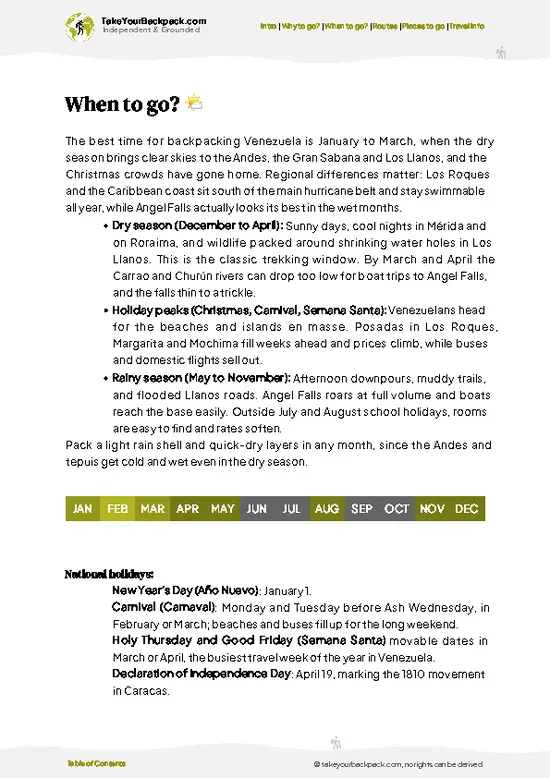
  • Dry Season (December to April): This is the most reliable window for climbing Mount Roraima. Gran Sabana temperatures run 22 to 30°C (72 to 86°F), the rivers stay crossable, and the summit gets the most clear spells. Summit days are 8 to 15°C (46 to 59°F), and nights can fall to 3 to 8°C (37 to 46°F).
  • Holidays (Christmas, New Year, Carnival, Easter): Groups fill the base camps and the summit hotels (rock overhangs), and guides book out. Tour prices stay fairly steady, but spaces are tight.
  • Wet Season (May to November): Afternoon downpours are common, with June to August the wettest. The Tek and Kukenan rivers can rise waist-deep and delay you for a day. Fog often covers the summit, but trails are quiet and guides are easy to book, sometimes at a small discount.
  • Daylight: Days run close to 12
… read more 👉
  • Dry Season (December to April): This is the most reliable window for climbing Mount Roraima. Gran Sabana temperatures run 22 to 30°C (72 to 86°F), the rivers stay crossable, and the summit gets the most clear spells. Summit days are 8 to 15°C (46 to 59°F), and nights can fall to 3 to 8°C (37 to 46°F).
  • Holidays (Christmas, New Year, Carnival, Easter): Groups fill the base camps and the summit hotels (rock overhangs), and guides book out. Tour prices stay fairly steady, but spaces are tight.
  • Wet Season (May to November): Afternoon downpours are common, with June to August the wettest. The Tek and Kukenan rivers can rise waist-deep and delay you for a day. Fog often covers the summit, but trails are quiet and guides are easy to book, sometimes at a small discount.
  • Daylight: Days run close to 12 hours all year, so plan to reach camp by mid-afternoon.
Aim for late January to March, when the rivers are low and the holiday crowds have gone.


source: climatestotravel.comJANJanuary: excellent for travelingFEBFebruary: excellent for travelingMARMarch: excellent for travelingAPRApril: highly recommended for travelingMAYMay: fair for travelingJUNJune: fair for travelingJULJuly: fair for travelingAUGAugust: fair for travelingSEPSeptember: fair for travelingOCTOctober: fair for travelingNOVNovember: good for travelingDECDecember: excellent for traveling
venezuela-hike-mount-roraima
© Google | Sayeh Co

✈️ The backpacker research shortcutVenezuela Travel Guide

An offline-friendly backpacking guide with optimized travel routes, ranked highlights, transport advice, and the best areas to stay.
example page 0 from our offline Travel Guide for Venezuela
example page 1 from our offline Travel Guide for Venezuela
example page 2 from our offline Travel Guide for Venezuela
example page 3 from our offline Travel Guide for Venezuela
example page 4 from our offline Travel Guide for Venezuela
example page 5 from our offline Travel Guide for Venezuela
example page 6 from our offline Travel Guide for Venezuela
example page 7 from our offline Travel Guide for Venezuela
The digital guide (290 pages) contains:
✅ 91 highlights, ranked by travel appeal
✅ Optimized 5, 10 & 15-day travel routes
✅ Cities, national parks, landmarks, beaches
✅ How to get around
✅ Offline-friendly for travel without Wi-Fi
👉 Click to see all 30+ guide features

📅 Plan smarter in minutes, not weeks
✅ Month by month travel advice
✅ Festivals & national holidays
✅ Budget expectations

🗺️ Go to the right places, skip the overrated ones
✅ Honest pros & cons of destinations
✅ Top hikes, parks & viewpoints
✅ Lesser-known places most travelers miss
✅ Clear “worth it vs skip it” guidance

🛏️ Travel smoothly without rookie mistakes
✅ Best areas to stay
✅ Transport systems explained simply
✅ Common scams & safety advice
✅ SIM cards, money & practical tips

🌍 Understand the country, not just visit it
✅ Culture & traditions
✅ 52 Essential phrases & customs
✅ Festivals worth planning around
✅ Traveler-friendly historical context
✅ Insights that make places more meaningful

📱 Built for real travel conditions
✅ Fully downloadable PDF
✅ Works completely offline
✅ Optimized for phone use
✅ Useful in remote areas & buses
✅ Everything in one place
Stop searching, start planning
Get instant access to your full guide. 30‑day money-back guarantee.
+ Add another guide for just

By proceeding you agree to our terms.
Sent to your inbox immediately after payment • 100% Secure Checkout
Best Backpacking Travel Advisor 2025 tourism awardBest Backpacking
Travel Advisor
2025
What others say about Take Your Backpack Guides:
⭐⭐⭐⭐⭐
Fantastic, amazing amount of information!
⭐⭐⭐⭐⭐
My goodness this is amazing, it's what I've been looking for hats off too you!
⭐⭐⭐⭐⭐
I think this is absolutely BRILLIANT
⭐⭐⭐⭐
Very complete and informative. It's still missing places, but I gotta to commend you
⭐⭐⭐⭐⭐
This is truly amazing, thank you, can't wait to explore it with my kids!
⭐⭐⭐⭐⭐
Awesome resource, thank you!
⭐⭐⭐⭐⭐
This is amazing! Can't wait to explore the ones I haven't seen
⭐⭐⭐⭐
I love this! Well done, great idea.
⭐⭐⭐⭐⭐
Thanks for taking the time to make this gem!
⭐⭐⭐⭐⭐
This might be the best website I've ever seen.
⭐⭐⭐⭐⭐
Congratulations, and thank you so much for your work; it's incredibly valuable.
⭐⭐⭐⭐
In all seriousness I think you did a great job pointing out the important spots
⭐⭐⭐⭐⭐
10/10 very good
⭐⭐⭐⭐⭐
As someone who's only just starting to visit regularly this is awesome, thank you.
⭐⭐⭐⭐
Thank you very much! I'm going to visit my dad, it's going to be very useful!
⭐⭐⭐⭐⭐
This is really cool! We'll be travelling for the first time and this definitely come in handy.
⭐⭐⭐⭐⭐
You are now our minister of culture, congratulations 👨‍💼
⭐⭐⭐⭐⭐
Just wanted to tell you that this is a pearl! Going to follow your recommendations.
⭐⭐⭐⭐⭐
This is so cool. I'll definitely be using the resource for my travels soon.
⭐⭐⭐⭐⭐
This is very impressive! Good work.
⭐⭐⭐⭐⭐
This is an amazing and informative site. Very well done!

🛏️ Where to stay?Where staying makes the most sense

If you enjoy meeting fellow travelers, consider choosing hostels with high ratings for atmosphere. On the other hand, if you prefer having your own space, a hotel might be a better option.

🥾 Hike detailsTrail overview: what to expect on the hike

Total Distance: Mount Roraima is trekked as an out-and-back of roughly 55 to 65 kilometers from the Pemón village of Paraitepui, including the walking you do on the summit plateau.
Estimated Duration: Five to six days is standard. Two days climb, one or two days on top and two days back. A seventh day is a sensible reserve for river floods.
Difficulty: Moderate to demanding. There is no technical climbing, but you gain close to 1,800 meters on rough, often wet trails, and rain and cold set the real challenge.
Starting Point: Paraitepui, reached by a rough 4x4 track from the road town of San Francisco
… read more 👉
Total Distance: Mount Roraima is trekked as an out-and-back of roughly 55 to 65 kilometers from the Pemón village of Paraitepui, including the walking you do on the summit plateau.
Estimated Duration: Five to six days is standard. Two days climb, one or two days on top and two days back. A seventh day is a sensible reserve for river floods.
Difficulty: Moderate to demanding. There is no technical climbing, but you gain close to 1,800 meters on rough, often wet trails, and rain and cold set the real challenge.
Starting Point: Paraitepui, reached by a rough 4x4 track from the road town of San Francisco de Yuruaní, which lies on the highway between Santa Elena de Uairén and the rest of the country. Buses and shared taxis serve the highway only, so most trekkers arrange a jeep with their agency.
Major Landmarks:
  • Río Tek: First camp, with swimming and a cold-water river beside the tents.
  • Río Kukenán: The crossing that can flood after rain and cause delays.
  • Base Camp: A forest campsite below the cliff.
  • La Rampa and El Hotel: The ascent ledge and the rock shelters used for summit nights.
  • Summit sights: Valle de los Cristales, Los Jacuzzis, El Foso and Punto Triple.
Terrain and Scenery: Open Gran Sabana grassland first, with Kukenán tepui beside the trail, then forested slope, a steep ledge and a plateau of black eroded sandstone with little soil.
Vegetation: Savanna grass below, cloudforest on the ascent and, on top, endemic bog plants including Heliamphora pitcher plants, orchids, sundews and low shrubs.
Wildlife: The black Roraima bush toad Oreophrynella quelchii on top, plus birds such as swifts and hummingbirds on the slope. Sandflies are the most noticeable animal life at the lower river camps.
⚠️ Hiking info can sometimes be outdated or inaccurate. Before you hit the trail, check the latest conditions with locals. If you do spot anything that's off, I'd love to hear from you, so I can update it for fellow travelers.

🛡️ SafetyScams, Hazards, and Annoyances

Mount Roraima is a demanding but well-trodden trek, and most problems come from weather and river levels. Rain can arrive within an hour, and the Tek and Kukenan rivers swell fast, so cross early and wait if the water is brown and rising. The climb to the plateau is steep and slippery over wet rock, so wear boots with real grip and pack everything in dry bags. On top, fog is thick, temperatures drop sharply at night, and lightning is a risk on the open rock. Stay with your Pemón guide, because the plateau’s maze of rock formations is easy to get lost in. Puri-puris (biting sandflies) swarm the lower savanna, so bring long sleeves and repellent. Take nothing from the summit, including the crystals. Before leaving Santa Elena de Uairén, check the current security situation locally, and stay clear of mining areas along the roads.

FAQTraveler FAQ

Most groups need 5 to 6 days for the round trip on Mount Roraima, starting from the Pemón village of Paraitepui. The route is roughly 50 km, with a day to the Tek river camp, a day to the base camp, and a summit day of about 5 to 6 hours climbing. Plan one or two nights on top, with an extra day if you want to see the Valley of Crystals and the Maverick area.
Mount Roraima is a moderately hard trek, with no technical climbing but long, sustained days. The trail climbs from about 1,000 m at Paraitepui to the plateau at around 2,700 m, with a very steep, slippery rock ramp on the last stretch. Expect 5 to 7 hours walking on most days, plus river crossings that can be waist-deep in the wet months. Reasonable fitness and sturdy boots are enough.
Yes, Mount Roraima requires a licensed Pemón guide, and independent trekking is not allowed. The tour operators in Santa Elena de Uairén typically charge about US$350 to 700 for a 5 to 6 day trip, which includes the guide, porters, food, and park access. Your operator generally arranges the park permit and community fees, so bring your passport and some cash in US dollars for extras.
⚠️ Things can change over time, so always validate details locally before you go.

Other Venezuelan hikes near Mount Roraima

Explore more nearby:

  • Angel Falls—tepui cliffs, misty rainforest, remote river approach| 218 km away
  • Cueva del Guácharo Trail—limestone cave, nocturnal birds, lush foothills| 639 km away
  • Pico Naiguatá—Coastal cordillera, cloud forest, exposed ridge, dawn camp| 896 km away

💡 Not sure where to go next?
Create a personalized itinerary for Venezuela including Mount Roraima and the places that fit your trip.

Generate my itinerary

👉 Discover all hikes

Or checkout all Venezuela has to offer (think cities, towns, villages, national parks, hikes, beaches, festivals)
Country photo of Venezuela

We 💚 feedbackFinal thoughts on hiking the Mount Roraima

Plan six days at the very least, and add a spare one if you can. Two days on the summit is the right amount. Anything shorter wastes the climb on a few foggy hours, and a longer stay lets you wait out the cloud for Punto Triple. I would take warm layers and a waterproof pack liner, because the plateau can hold nights near freezing.

✍️ Help improve this page!
The information on this page is based on in-depth research, insights shared by experienced travelers, and feedback from the local travel community in Venezuela. While every effort is made to keep the information accurate and current, conditions can change — so if you spot anything incorrect or outdated, please get in touch.


🙋‍♂️ Give feedback

👋 Meet the founderWho’s Behind Take Your Backpack?

Johan, backpacker and founder of TakeYourBackpackHi, I’m Johan (Netherlands 🇳🇱), the creator of TakeYourBackpack. Over the past 3 decades, I’ve backpacked through 90+ countries across six continents, gaining extensive experience with independent travel, long-term trips, and overland routes.

This site is built on a combination of firsthand travel experience and carefully curated insights from other backpackers. Many guides are based on places I’ve personally visited, while others bring together tips, observations, and practical advice shared by trusted travelers I’ve met along the way.

The goal is to provide realistic, experience-driven guidance — not generic itineraries — so you can explore destinations with better context, clearer expectations, and more confidence.