×

Venezuela🇻🇪 | national parksWaraira Repano National Park (El Ávila)Caracas ridge, Sabas Nieves, Pico Naiguatá, Camino de los Españoles | things to do and best time to go

Explore Yacambú National ParkExplore Guatopo National Park

Backpacking in Waraira Repano (El Ávila)
🏆 Top picknational park ranked #3
By Johan Kruseman 🇳🇱 | Updated October 19, 2026

Every morning and weekend, Caraqueños climb the lower trails of the mountain wall in sneakers and football shirts, and you can join them at the Sabas Nieves entrance, where arepa and juice stalls sit beside the trailhead. Waraira Repano National Park (El Ávila) is a long green ridge in Venezuela’s capital, rising directly north of Caracas and separating it from the Caribbean coast. The ridge is a true escape: cool cloud forest, orchids, bird calls and views over a city of millions. Skip the paved road stretches and the crowded Sunday lower trails. Choose an early start and the routes toward Pico Naiguatá for solitude. Access from the city is easy, but trails can be steep, muddy and thin on services. Go in the morning, carry all your water, and leave valuables behind.

Discover everything you want to know in the 📖 Venezuela Travel Guide.
Safety warning

The current risk level for Venezuela is high. Check the advice before going.


example page 0 from our offline Travel Guide for Venezuela
example page 1 from our offline Travel Guide for Venezuela
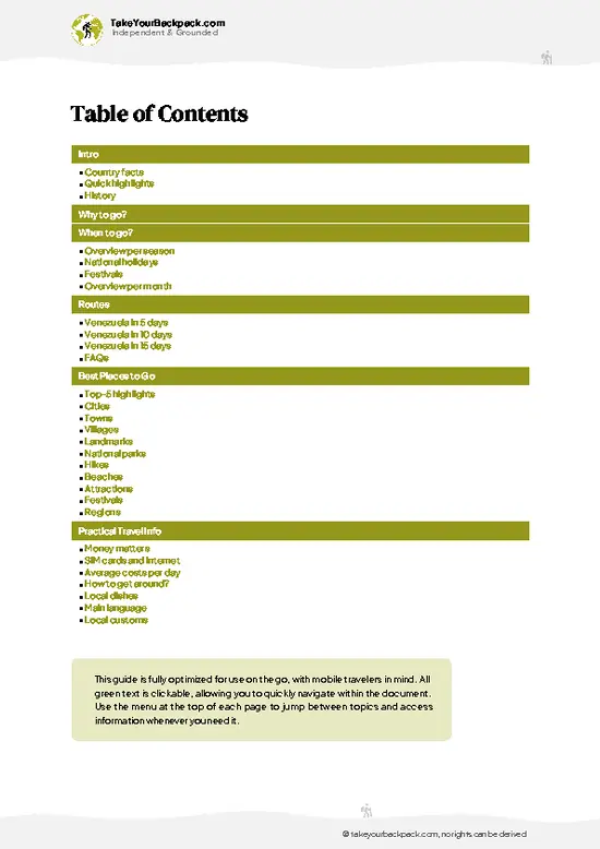
example page 2 from our offline Travel Guide for Venezuela
example page 3 from our offline Travel Guide for Venezuela
example page 4 from our offline Travel Guide for Venezuela
example page 5 from our offline Travel Guide for Venezuela
example page 6 from our offline Travel Guide for Venezuela
example page 7 from our offline Travel Guide for Venezuela
Loading the map 🌍
CLICK TO FILTER
cities
towns
villages
landmarks
national parks
hikes
beaches
attractions
festivals
regions
SHOW COUNTRY’S BESTSHOW ALL

✨ Why go?
Ranked #3 national park in Venezuela
Why Waraira Repano (El Ávila) should be on your travel list

Waraira Repano National Park (El Ávila) gives backpackers a rare thing: a real mountain wilderness that starts at the edge of a capital city. You can walk from a metro-and-taxi ride into cloud forest without booking a tour, and most routes are well marked enough for self-guided hiking. The La Julia to Pico Naiguatá route is the park’s serious backpacking draw, with high ridgelines, shifting weather and campsites for those who plan carefully. Lower paths are also ideal for a short acclimatizing walk. The park also connects to the coast through the old Camino de los Españoles to Galipán and other routes down toward the Caribbean, so you can combine mountain and sea in one trip. Locals hike here constantly, which means you get company, trail advice and an easy way to meet Venezuelans outside … read more 👉
Waraira Repano National Park (El Ávila) gives backpackers a rare thing: a real mountain wilderness that starts at the edge of a capital city. You can walk from a metro-and-taxi ride into cloud forest without booking a tour, and most routes are well marked enough for self-guided hiking. The La Julia to Pico Naiguatá route is the park’s serious backpacking draw, with high ridgelines, shifting weather and campsites for those who plan carefully. Lower paths are also ideal for a short acclimatizing walk. The park also connects to the coast through the old Camino de los Españoles to Galipán and other routes down toward the Caribbean, so you can combine mountain and sea in one trip. Locals hike here constantly, which means you get company, trail advice and an easy way to meet Venezuelans outside tourist settings. Go with a small pack, a map saved offline and a clear plan for coming down before the afternoon cloud settles.

💡 HighlightsDon't-miss highlights and experiences

  1. Pico Naiguatá: The highest point of the park, at about 2,765 meters. The long ridge climb passes cloud forest and open páramo-like slopes with huge views toward the coast.
  2. Silla de Caracas: The twin-peaked saddle above the city, with Pico Oriental and Pico Occidental reached by separate routes from Sabas Nieves. Alexander von Humboldt climbed it on January 2, 1800.
  3. Sabas Nieves: The most popular entrance, a gateway for locals with food stalls and several trails of different lengths. It is busy on weekends and calm on weekday mornings.
  4. Cota Mil: This is the highway that skirts the southern flank of the mountain. It gives access to several trailheads and city viewpoints without the need for a long climb.
  5. Cloud forest: The slopes hold mist-soaked forest thick with ferns, bromeliads and orchids. Birdwatchers
… read more 👉
  1. Pico Naiguatá: The highest point of the park, at about 2,765 meters. The long ridge climb passes cloud forest and open páramo-like slopes with huge views toward the coast.
  2. Silla de Caracas: The twin-peaked saddle above the city, with Pico Oriental and Pico Occidental reached by separate routes from Sabas Nieves. Alexander von Humboldt climbed it on January 2, 1800.
  3. Sabas Nieves: The most popular entrance, a gateway for locals with food stalls and several trails of different lengths. It is busy on weekends and calm on weekday mornings.
  4. Cota Mil: This is the highway that skirts the southern flank of the mountain. It gives access to several trailheads and city viewpoints without the need for a long climb.
  5. Cloud forest: The slopes hold mist-soaked forest thick with ferns, bromeliads and orchids. Birdwatchers can look for toucans and hummingbirds along shady upper paths.
  6. Camino de los Españoles: This old stone route crosses the mountain toward the coast. It carries historical weight and offers a chance to walk where traders and travelers once moved between the valley and the sea.
  7. La Julia: A lower entrance used by hikers and joggers, good for short walks and quiet birdwatching away from the busier gate.
Start with Sabas Nieves on a weekday morning, because it lets you test the terrain, weather and your legs before committing to a long ridge route.
Spotted a mistake or missing something? Contact us.

🌤️ When to go?Best time to explore Waraira Repano (El Ávila)

  • Dry Season (December to April): Clear mornings and the best views from the ridge toward the Caribbean. Caracas valley temperatures run 18 to 28°C (64 to 82°F), while the upper trails near Pico Naiguatá drop to 8 to 14°C (46 to 57°F) at night. Weekends bring the biggest crowds on Sabas Nieves and the Warairarepano trail.
  • Rainy Season (May to November): Afternoon downpours are the norm, trails turn slick, and cloud often swallows the summits by midday. Expect 16 to 26°C (61 to 79°F) in town and cooler, wetter conditions up high. Trails are quieter and the forest is at its greenest.
  • Daylight: Days stay close to 11 to 13 hours all year, so start by 6 or 7 a.m. to finish before clouds and dusk.
  • Prices: Costs barely change by season. Holiday weeks (Christmas, Carnival, Easter) fill beach-bound transport
… read more 👉
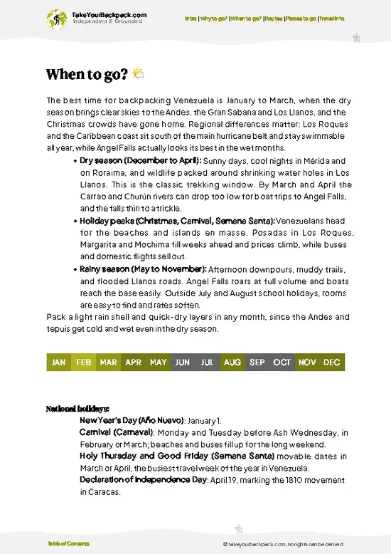
  • Dry Season (December to April): Clear mornings and the best views from the ridge toward the Caribbean. Caracas valley temperatures run 18 to 28°C (64 to 82°F), while the upper trails near Pico Naiguatá drop to 8 to 14°C (46 to 57°F) at night. Weekends bring the biggest crowds on Sabas Nieves and the Warairarepano trail.
  • Rainy Season (May to November): Afternoon downpours are the norm, trails turn slick, and cloud often swallows the summits by midday. Expect 16 to 26°C (61 to 79°F) in town and cooler, wetter conditions up high. Trails are quieter and the forest is at its greenest.
  • Daylight: Days stay close to 11 to 13 hours all year, so start by 6 or 7 a.m. to finish before clouds and dusk.
  • Prices: Costs barely change by season. Holiday weeks (Christmas, Carnival, Easter) fill beach-bound transport and lodging in nearby coastal areas.
Hike on a weekday in January or February for clear views and thin crowds.


source: climatestotravel.comJANJanuary: excellent for travelingFEBFebruary: excellent for travelingMARMarch: excellent for travelingAPRApril: highly recommended for travelingMAYMay: fair for travelingJUNJune: fair for travelingJULJuly: fair for travelingAUGAugust: fair for travelingSEPSeptember: fair for travelingOCTOctober: fair for travelingNOVNovember: fair for travelingDECDecember: highly recommended for traveling
when-to-go

✈️ The backpacker research shortcutVenezuela Travel Guide

An offline-friendly backpacking guide with optimized travel routes, ranked highlights, transport advice, and the best areas to stay.
example page 0 from our offline Travel Guide for Venezuela
example page 1 from our offline Travel Guide for Venezuela
example page 2 from our offline Travel Guide for Venezuela
example page 3 from our offline Travel Guide for Venezuela
example page 4 from our offline Travel Guide for Venezuela
example page 5 from our offline Travel Guide for Venezuela
example page 6 from our offline Travel Guide for Venezuela
example page 7 from our offline Travel Guide for Venezuela
The digital guide (290 pages) contains:
✅ 91 highlights, ranked by travel appeal
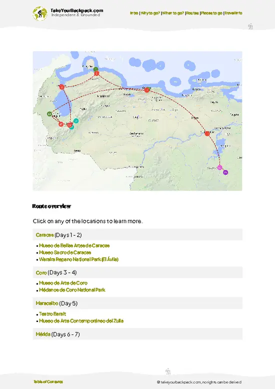
✅ Optimized 5, 10 & 15-day travel routes
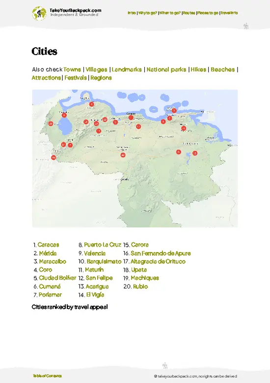
✅ Cities, national parks, landmarks, beaches
✅ How to get around
✅ Offline-friendly for travel without Wi-Fi
👉 Click to see all 30+ guide features

📅 Plan smarter in minutes, not weeks
✅ Month by month travel advice
✅ Festivals & national holidays
✅ Budget expectations

🗺️ Go to the right places, skip the overrated ones
✅ Honest pros & cons of destinations
✅ Top hikes, parks & viewpoints
✅ Lesser-known places most travelers miss
✅ Clear “worth it vs skip it” guidance

🛏️ Travel smoothly without rookie mistakes
✅ Best areas to stay
✅ Transport systems explained simply
✅ Common scams & safety advice
✅ SIM cards, money & practical tips

🌍 Understand the country, not just visit it
✅ Culture & traditions
✅ 52 Essential phrases & customs
✅ Festivals worth planning around
✅ Traveler-friendly historical context
✅ Insights that make places more meaningful

📱 Built for real travel conditions
✅ Fully downloadable PDF
✅ Works completely offline
✅ Optimized for phone use
✅ Useful in remote areas & buses
✅ Everything in one place
Stop searching, start planning
Get instant access to your full guide. 30‑day money-back guarantee.
+ Add another guide for just

By proceeding you agree to our terms.
Sent to your inbox immediately after payment • 100% Secure Checkout
Best Backpacking Travel Advisor 2025 tourism awardBest Backpacking
Travel Advisor
2025
What others say about Take Your Backpack Guides:
⭐⭐⭐⭐⭐
Fantastic, amazing amount of information!
⭐⭐⭐⭐⭐
My goodness this is amazing, it's what I've been looking for hats off too you!
⭐⭐⭐⭐⭐
I think this is absolutely BRILLIANT
⭐⭐⭐⭐
Very complete and informative. It's still missing places, but I gotta to commend you
⭐⭐⭐⭐⭐
This is truly amazing, thank you, can't wait to explore it with my kids!
⭐⭐⭐⭐⭐
Awesome resource, thank you!
⭐⭐⭐⭐⭐
This is amazing! Can't wait to explore the ones I haven't seen
⭐⭐⭐⭐
I love this! Well done, great idea.
⭐⭐⭐⭐⭐
Thanks for taking the time to make this gem!
⭐⭐⭐⭐⭐
This might be the best website I've ever seen.
⭐⭐⭐⭐⭐
Congratulations, and thank you so much for your work; it's incredibly valuable.
⭐⭐⭐⭐
In all seriousness I think you did a great job pointing out the important spots
⭐⭐⭐⭐⭐
10/10 very good
⭐⭐⭐⭐⭐
As someone who's only just starting to visit regularly this is awesome, thank you.
⭐⭐⭐⭐
Thank you very much! I'm going to visit my dad, it's going to be very useful!
⭐⭐⭐⭐⭐
This is really cool! We'll be travelling for the first time and this definitely come in handy.
⭐⭐⭐⭐⭐
You are now our minister of culture, congratulations 👨‍💼
⭐⭐⭐⭐⭐
Just wanted to tell you that this is a pearl! Going to follow your recommendations.
⭐⭐⭐⭐⭐
This is so cool. I'll definitely be using the resource for my travels soon.
⭐⭐⭐⭐⭐
This is very impressive! Good work.
⭐⭐⭐⭐⭐
This is an amazing and informative site. Very well done!

🛏️ Where to stay?Where staying makes the most sense

The easiest base for Waraira Repano National Park (El Ávila) is Caracas itself, because the park forms the northern wall of the city and trailheads sit a short ride from several neighborhoods. Altamira and Los Palos Grandes, on the city’s eastern side, are the best fit for backpackers: they are the most walkable areas, with the Altamira trailhead (Sabas Nieves access) close by. Expect hostels and guesthouses at roughly US$12 to 25 for a dorm or simple room, and decent apartments or mid-range hotels at US$35 to 70. La Castellana and Chacao are also solid, with more restaurants. Inside the park … read more 👉
The easiest base for Waraira Repano National Park (El Ávila) is Caracas itself, because the park forms the northern wall of the city and trailheads sit a short ride from several neighborhoods. Altamira and Los Palos Grandes, on the city’s eastern side, are the best fit for backpackers: they are the most walkable areas, with the Altamira trailhead (Sabas Nieves access) close by. Expect hostels and guesthouses at roughly US$12 to 25 for a dorm or simple room, and decent apartments or mid-range hotels at US$35 to 70. La Castellana and Chacao are also solid, with more restaurants. Inside the park there are no hotels. Camping is possible at Sabas Nieves and along the Naiguatá and Pico Oriental routes, usually by arranging a permit through INPARQUES or going with a local guide company. Mountain refuges and the area near Cota Mil are basic. On the coastal side, Los Caracas and Macuto in La Guaira state offer cheap posadas from US$15 to 35, handy if you plan to cross the range. Book ahead for holidays and confirm cash needs, since card payments are unreliable.

👛 Costs (as of 19 October 2026)Money, prices, and spending tips

Plan on roughly US$39 to 105 per day for hiking Waraira Repano National Park (El Ávila) while staying in Caracas, with the figures below built on high-season rates.
CategoryBudget RangeLocal Reality
Entrance feesUS$1 to 3Small fee at the main Sabas Nieves gate, paid in bolívares or dollars; fees can vary by entry point.
Accommodation (high season)US$15 to 35Hostels or guesthouses in Altamira, Chacao or La Castellana; apartments cost more.
Camping permitUS$0 to 10Arranged through INPARQUES or a guide company; rules vary by route.
Local transportUS$3 to 12Metro, buses and shared rides to trailheads; short taxi rides to Sabas Nieves cost a few dollars more.
Food and suppliesUS$10 to 20Arepas, empanadas and set lunches are cheap; restaurant meals and trail supplies cost more.
Guide (optional)US$10 to
… read more 👉
Plan on roughly US$39 to 105 per day for hiking Waraira Repano National Park (El Ávila) while staying in Caracas, with the figures below built on high-season rates.
CategoryBudget RangeLocal Reality
Entrance feesUS$1 to 3Small fee at the main Sabas Nieves gate, paid in bolívares or dollars; fees can vary by entry point.
Accommodation (high season)US$15 to 35Hostels or guesthouses in Altamira, Chacao or La Castellana; apartments cost more.
Camping permitUS$0 to 10Arranged through INPARQUES or a guide company; rules vary by route.
Local transportUS$3 to 12Metro, buses and shared rides to trailheads; short taxi rides to Sabas Nieves cost a few dollars more.
Food and suppliesUS$10 to 20Arepas, empanadas and set lunches are cheap; restaurant meals and trail supplies cost more.
Guide (optional)US$10 to 25Worth it for Naiguatá or Pico Oriental, with group rates lowering the share per person.
Total Daily BudgetUS$39 to 105Mid-range example: about US$55 to 85 for a typical day.
⚠️ Prices can change and everyone travels differently, so take this as a rough guide. Hope it helps you plan your adventure!

🥾 TrailsScenic routes and wildlife spotting in Waraira Repano (El Ávila)

Waraira Repano National Park (El Ávila) (Parque Nacional Waraira Repano) gives hikers a steep green wall directly above Caracas, with cloud forest, open ridgelines and a sea view on clear mornings. Most routes climb hard from the city side, so expect sustained uphill, loose dirt, and exposed stretches where the sun is strong.
  • Sabas Nieves climb: The classic climb starts at the Sabas Nieves entrance in the Altamira side of the city. The first section follows a wide, well-trodden path to the Papelón area, a favorite for short walks. Beyond it the route steepens through ferns and bromeliads. Allow
… read more 👉
Waraira Repano National Park (El Ávila) (Parque Nacional Waraira Repano) gives hikers a steep green wall directly above Caracas, with cloud forest, open ridgelines and a sea view on clear mornings. Most routes climb hard from the city side, so expect sustained uphill, loose dirt, and exposed stretches where the sun is strong.
  • Sabas Nieves climb: The classic climb starts at the Sabas Nieves entrance in the Altamira side of the city. The first section follows a wide, well-trodden path to the Papelón area, a favorite for short walks. Beyond it the route steepens through ferns and bromeliads. Allow 2 to 3 hours up to the ridge, hard going for beginners but clear to follow.
  • Sabas Nieves to the Silla de Caracas (Pico Oriental and Pico Occidental): Intermediate to hard day hikes that continue along the ridge into cooler, windier ground with dense mist. Plan 5 to 7 hours round trip depending on fitness. Footing is rocky and muddy after rain.
  • Camino de los Españoles: A historic stone-paved path once used by colonial traders between Caracas and the coast. It climbs from the Puerta de Caracas through forest to Galipán and Hoyo de la Cumbre, past colonial-era fortifications. Moderate to hard, around 4 to 6 hours one way, and it is walked mostly by experienced hikers.
  • Sabas Nieves to Los Cocos and Cota Mil loops: Gentler walks below the ridge for those short on time. Roughly 1 to 2 hours, shaded in parts, easy to moderate with some steady climbs.
  • Pico Naiguatá: At 2,765 meters, the highest summit in the park and a serious full-day objective. It is best attempted with a guide or an experienced group, since the upper route is steep, exposed to fog, and easy to lose in poor visibility.
Wildlife is easier to hear than see. Expect birdsong in the forest, including toucans and parrots on lower slopes, and occasional monkeys or foxes on quieter trails. The cloud forest on the upper ridges has orchids and tree ferns, and the temperature drops sharply compared with the city.
Getting there is simple. Reach the main Sabas Nieves entrance by a short taxi ride from central Caracas, or use the nearby Metro and then a taxi or colectivo toward Altamira. Weekends fill with locals, especially on the lower trails, so go early on a weekday for quiet. Entry is typically inexpensive, around US$1 to 3 at official entrances, paid in local currency. Start by early morning, carry plenty of water, and avoid hiking alone on isolated sections, since security can be an issue on remote paths.
⚠️ Hiking info can sometimes be outdated or inaccurate. Before you hit the trail, check the latest conditions with locals. If you do spot anything that's off, I'd love to hear from you, so I can update it for fellow travelers.

🛡️ SafetyScams, Hazards, and Annoyances

The mountain itself is manageable for fit hikers; the bigger concern is personal security around Caracas, so go in a group, travel early, and keep valuables out of sight. Many trailheads are fine on busy weekends, while empty weekday trails call for company or a guide. Leave phones and jewelry at the hotel and carry only what you need. Weather changes fast: mornings can be clear, then cloud and rain arrive by early afternoon, making rock and mud slippery. Wear shoes with grip and bring a rain layer, since summit temperatures can drop sharply. Routes like Naiguatá and Pico Oriental involve steep climbs and unclear paths in fog, so a guide is smart for longer treks. Carry at least 2 to 3 liters of water, as sources are limited. Wildlife is mostly birds, monkeys, and the occasional snake, so … read more 👉
The mountain itself is manageable for fit hikers; the bigger concern is personal security around Caracas, so go in a group, travel early, and keep valuables out of sight. Many trailheads are fine on busy weekends, while empty weekday trails call for company or a guide. Leave phones and jewelry at the hotel and carry only what you need. Weather changes fast: mornings can be clear, then cloud and rain arrive by early afternoon, making rock and mud slippery. Wear shoes with grip and bring a rain layer, since summit temperatures can drop sharply. Routes like Naiguatá and Pico Oriental involve steep climbs and unclear paths in fog, so a guide is smart for longer treks. Carry at least 2 to 3 liters of water, as sources are limited. Wildlife is mostly birds, monkeys, and the occasional snake, so stay on the trail and keep your distance. Tell someone your route and turnaround time.

FAQTraveler FAQ

Two to three days is enough for Waraira Repano National Park (El Ávila) if you are based in Caracas. One day covers the popular Sabas Nieves to Humboldt Hotel route (about 3 to 4 hours one way), while a second day suits the Warairarepano trail toward the coast. Add a third day if you want to climb Pico Naiguatá, which is a long 2-day effort for most hikers.
Yes, you can reach Waraira Repano National Park (El Ávila) without a car because it sits directly above Caracas. Take the metro to Altamira or Chacao, then a short taxi or shared ride (about US$2 to 6) to Sabas Nieves or Cota Mil trailheads. The cable car to the Humboldt Hotel area is another option, though schedules change, so check ahead. Rides back after dark are harder to find, so plan to finish before late afternoon.
Yes, Waraira Repano National Park (El Ávila) charges a small entrance fee at the main gates, typically around US$1 to 3, paid in bolívares or US dollars. Day hikes along popular routes like Sabas Nieves generally need only that fee. Overnight camping or climbing Pico Naiguatá usually requires registration or permission through INPARQUES, so confirm in Caracas before you go. Bring your passport or a copy for checks.
⚠️ Things can change over time, so always validate details locally before you go.

Other Venezuelan national parks near Waraira Repano (El Ávila)

Explore more nearby:


💡 Not sure where to go next?
Create a personalized itinerary for Venezuela including Waraira Repano (El Ávila) and the places that fit your trip.

Generate my itinerary

👉 Discover all national parks

Or checkout all Venezuela has to offer (think cities, towns, villages, national parks, hikes, beaches, festivals)
Country photo of Venezuela

We 💚 feedbackSumming up the experience

Waraira Repano National Park (El Ávila) punishes the traveler who starts a ridge hike at midday in sandals. Go at first light, bring a rain layer even when the city below is sunny, and plan to be heading down by early afternoon, when cloud closes over the high trail. I would also carry more water than seems sensible.

✍️ Help improve this page!
The information on this page is based on in-depth research, insights shared by experienced travelers, and feedback from the local travel community in Venezuela. While every effort is made to keep the information accurate and current, conditions can change — so if you spot anything incorrect or outdated, please get in touch.


🙋‍♂️ Give feedback

👋 Meet the founderWho’s Behind Take Your Backpack?

Johan, backpacker and founder of TakeYourBackpackHi, I’m Johan (Netherlands 🇳🇱), the creator of TakeYourBackpack. Over the past 3 decades, I’ve backpacked through 90+ countries across six continents, gaining extensive experience with independent travel, long-term trips, and overland routes.

This site is built on a combination of firsthand travel experience and carefully curated insights from other backpackers. Many guides are based on places I’ve personally visited, while others bring together tips, observations, and practical advice shared by trusted travelers I’ve met along the way.

The goal is to provide realistic, experience-driven guidance — not generic itineraries — so you can explore destinations with better context, clearer expectations, and more confidence.