


×

Argentina🇦🇷 | hikesLaguna TorreMirador Maestri, Cerro Torre spire, floating icebergs, 18 km round trip | things to do and best time to go

Explore Cerro TronadorExplore Paso de las Nubes

Backpacking in Laguna Torre
🏆 Top pickhike ranked #3
By Johan Kruseman 🇳🇱 | Updated October 19, 2026

People assume Laguna Torre is the flashy glacier hike near El Chaltén; it's actually the quieter sibling to Laguna de los Tres, trading crowds for a raw, wind-punished valley view of Cerro Torre's granite spike. The trailhead sits right in El Chaltén, Santa Cruz province, reachable on foot from any hostel in town, no bus or shuttle needed. It's roughly 18 kilometers round trip, moderate in difficulty, with a mellow climb through lenga forest before the valley opens up. I remember rounding the final bend at Mirador Maestri, wind slamming my jacket flat against my ribs, and catching Cerro Torre's ice-capped tower clear for maybe ninety seconds before cloud swallowed it whole. That's the gamble here: less elevation gain than de los Tres, but Torre hides behind weather far more often, so the payoff feels earned, not guaranteed.

Discover everything you want to know in the 📖 Argentina Travel Guide.
Best time to go: October - March
Duration: 7 hours
Distance: 18 kilometers
Total ascent: 450 meters


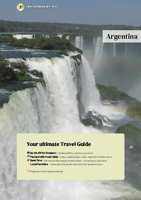
example page 0 from our offline Travel Guide for Argentina
example page 1 from our offline Travel Guide for Argentina
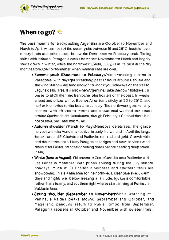
example page 2 from our offline Travel Guide for Argentina
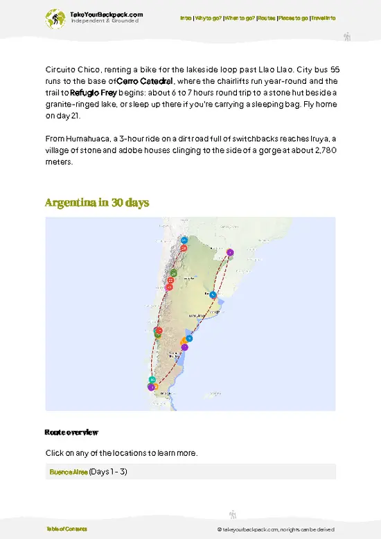
example page 3 from our offline Travel Guide for Argentina
example page 4 from our offline Travel Guide for Argentina
example page 5 from our offline Travel Guide for Argentina
example page 6 from our offline Travel Guide for Argentina
example page 7 from our offline Travel Guide for Argentina
Loading the map 🌍
CLICK TO FILTER
cities
towns
villages
landmarks
national parks
hikes
beaches
attractions
festivals
regions
SHOW COUNTRY’S BESTSHOW ALL

✨ Why go?
Ranked #3 hike in Argentina
What makes this hike worth hiking

Backpackers gravitate here because the scenery-to-effort ratio is almost unfair: minimal elevation gain delivers a full view of Cerro Torre's granite needle and a glacial lake without technical climbing or high-altitude strain. The trailhead starts directly in El Chaltén, so there's zero public transport hassle, no shuttle bookings, no early alarm for a bus. It's also cheap: beyond food and lodging in town, you only need the park pass (about US$33 a day for foreigners). The route's flexible distance makes it easy to shorten (turning back at the campground) or extend into a full day, depending on legs and weather. And because El Chaltén functions as a natural stopover between El Calafate and Patagonia's southern routes, this hike slots cleanly into a longer backpacking itinerary without demanding … read more 👉
Backpackers gravitate here because the scenery-to-effort ratio is almost unfair: minimal elevation gain delivers a full view of Cerro Torre's granite needle and a glacial lake without technical climbing or high-altitude strain. The trailhead starts directly in El Chaltén, so there's zero public transport hassle, no shuttle bookings, no early alarm for a bus. It's also cheap: beyond food and lodging in town, you only need the park pass (about US$33 a day for foreigners). The route's flexible distance makes it easy to shorten (turning back at the campground) or extend into a full day, depending on legs and weather. And because El Chaltén functions as a natural stopover between El Calafate and Patagonia's southern routes, this hike slots cleanly into a longer backpacking itinerary without demanding a detour. For travelers stacking multiple Patagonian trails, it's the low-commitment, high-reward addition that rarely disappoints.

💡 HighlightsKey sights and experiences for travelers

  1. Mirador Maestri: The payoff viewpoint. After hours of forest and moraine, this is where Cerro Torre's granite spire and its ice cap either reveal themselves or vanish into cloud, no in-between. The unpredictability is part of the draw.
  2. Laguna Torre itself: A glacial lake often dotted with small icebergs calved from Glaciar Grande upstream. The color shifts from milky turquoise to slate gray depending on light and sediment, and it's a striking place to sit and eat lunch.
  3. Bosque de Lengas (Lenga Forest): The first stretch of trail winds through dense southern beech forest, offering shelter from wind and a completely different mood than the exposed valley ahead. In autumn the leaves turn a deep orange-red that's genuinely striking against the grey granite backdrop.
  4. Río Fitz Roy Valley Views: As
… read more 👉
  1. Mirador Maestri: The payoff viewpoint. After hours of forest and moraine, this is where Cerro Torre's granite spire and its ice cap either reveal themselves or vanish into cloud, no in-between. The unpredictability is part of the draw.
  2. Laguna Torre itself: A glacial lake often dotted with small icebergs calved from Glaciar Grande upstream. The color shifts from milky turquoise to slate gray depending on light and sediment, and it's a striking place to sit and eat lunch.
  3. Bosque de Lengas (Lenga Forest): The first stretch of trail winds through dense southern beech forest, offering shelter from wind and a completely different mood than the exposed valley ahead. In autumn the leaves turn a deep orange-red that's genuinely striking against the grey granite backdrop.
  4. Río Fitz Roy Valley Views: As the trail opens up past the forest, you get wide views down the glacial valley carved by the Fitz Roy massif's runoff, with braided river channels visible below.
  5. Campamento De Agostini: A backcountry campsite near the lake edge that makes a good option for extending the hike into an overnight trip, letting you catch early morning light on Cerro Torre before day-trippers arrive.
Spotted a mistake or missing something? Contact us.

Things to do around Laguna Torre

Ratings based on Tripadvisor reviews. When you book through this link, you support our work at no extra cost to you.

🌤️ When to go?When to go for the best experience

  • Summer (December to February): Warmest window, daytime temps around 15-20°C (59-68°F), up to 16 hours of daylight, but also the busiest month with trailhead traffic and full hostels.
  • Shoulder Season (March-April, October-November): Fewer crowds, temps drop to 5-12°C (41-54°F), winds calm slightly compared to peak summer, and accommodation prices in El Chaltén ease off.
  • Winter (May-September): Cold, often below freezing, shorter daylight (as little as 9 hours), some services in town close, and snow can make the upper trail slippery without proper gear.
  • Wind Patterns: Patagonian wind peaks in spring and summer afternoons regardless of season, so early starts matter more than the calendar.
Go in late March. The crowds thin, the lenga forest turns rust-orange, and Cerro Torre still has decent visibility odds before winter closes in.

source: climatestotravel.comJANJanuary: excellent for travelingFEBFebruary: excellent for travelingMARMarch: highly recommended for travelingAPRApril: fair for travelingMAYMay: below average for travelingJUNJune: below average for travelingJULJuly: below average for travelingAUGAugust: below average for travelingSEPSeptember: fair for travelingOCTOctober: good for travelingNOVNovember: highly recommended for travelingDECDecember: excellent for traveling
argentina-hike-laguna-torre
© Google |

✈️ The backpacker research shortcutArgentina Travel Guide

An offline-friendly backpacking guide with optimized travel routes, ranked highlights, transport advice, and the best areas to stay.
example page 0 from our offline Travel Guide for Argentina
example page 1 from our offline Travel Guide for Argentina
example page 2 from our offline Travel Guide for Argentina
example page 3 from our offline Travel Guide for Argentina
example page 4 from our offline Travel Guide for Argentina
example page 5 from our offline Travel Guide for Argentina
example page 6 from our offline Travel Guide for Argentina
example page 7 from our offline Travel Guide for Argentina
The digital guide (393 pages) contains:
✅ 131 highlights, ranked by travel appeal
✅ Optimized 14, 21 & 30-day travel routes
✅ Cities, national parks, landmarks, beaches
✅ How to get around
✅ Offline-friendly for travel without Wi-Fi
👉 Click to see all 30+ guide features

📅 Plan smarter in minutes, not weeks
✅ Month by month travel advice
✅ Festivals & national holidays
✅ Budget expectations

🗺️ Go to the right places, skip the overrated ones
✅ Honest pros & cons of destinations
✅ Top hikes, parks & viewpoints
✅ Lesser-known places most travelers miss
✅ Clear “worth it vs skip it” guidance

🛏️ Travel smoothly without rookie mistakes
✅ Best areas to stay
✅ Transport systems explained simply
✅ Common scams & safety advice
✅ SIM cards, money & practical tips

🌍 Understand the country, not just visit it
✅ Culture & traditions
✅ 52 Essential phrases & customs
✅ Festivals worth planning around
✅ Traveler-friendly historical context
✅ Insights that make places more meaningful

📱 Built for real travel conditions
✅ Fully downloadable PDF
✅ Works completely offline
✅ Optimized for phone use
✅ Useful in remote areas & buses
✅ Everything in one place
Stop searching, start planning
Get instant access to your full guide. 30‑day money-back guarantee.
+ Add another guide for just

By proceeding you agree to our terms.
Sent to your inbox immediately after payment • 100% Secure Checkout
Best Backpacking Travel Advisor 2025 tourism awardBest Backpacking
Travel Advisor
2025
What others say about Take Your Backpack Guides:
⭐⭐⭐⭐⭐
Fantastic, amazing amount of information!
⭐⭐⭐⭐⭐
My goodness this is amazing, it's what I've been looking for hats off too you!
⭐⭐⭐⭐⭐
I think this is absolutely BRILLIANT
⭐⭐⭐⭐
Very complete and informative. It's still missing places, but I gotta to commend you
⭐⭐⭐⭐⭐
This is truly amazing, thank you, can't wait to explore it with my kids!
⭐⭐⭐⭐⭐
Awesome resource, thank you!
⭐⭐⭐⭐⭐
This is amazing! Can't wait to explore the ones I haven't seen
⭐⭐⭐⭐
I love this! Well done, great idea.
⭐⭐⭐⭐⭐
Thanks for taking the time to make this gem!
⭐⭐⭐⭐⭐
This might be the best website I've ever seen.
⭐⭐⭐⭐⭐
Congratulations, and thank you so much for your work; it's incredibly valuable.
⭐⭐⭐⭐
In all seriousness I think you did a great job pointing out the important spots
⭐⭐⭐⭐⭐
10/10 very good
⭐⭐⭐⭐⭐
As someone who's only just starting to visit regularly this is awesome, thank you.
⭐⭐⭐⭐
Thank you very much! I'm going to visit my dad, it's going to be very useful!
⭐⭐⭐⭐⭐
This is really cool! We'll be travelling for the first time and this definitely come in handy.
⭐⭐⭐⭐⭐
You are now our minister of culture, congratulations 👨‍💼
⭐⭐⭐⭐⭐
Just wanted to tell you that this is a pearl! Going to follow your recommendations.
⭐⭐⭐⭐⭐
This is so cool. I'll definitely be using the resource for my travels soon.
⭐⭐⭐⭐⭐
This is very impressive! Good work.
⭐⭐⭐⭐⭐
This is an amazing and informative site. Very well done!

🛏️ Where to stay?Choosing the right base

If you enjoy meeting fellow travelers, consider choosing hostels with high ratings for atmosphere. On the other hand, if you prefer having your own space, a hotel might be a better option.

🥾 Hike detailsTrail overview: what to expect on the hike

Total Distance: Approximately 18 kilometers round trip from El Chaltén to Laguna Torre and back.
Estimated Duration: 6 to 8 hours for most hikers, depending on pace and time spent at the lake.
Difficulty: Moderate. The trail is well-marked with a gradual, manageable elevation gain, but strong Patagonian wind on the exposed final stretch adds real difficulty regardless of fitness.
Starting Point: The trailhead begins directly at the edge of El Chaltén, accessible on foot from any hostel or campsite in town. No bus or transfer is required.
Major Landmarks:
  • Bosque de Lengas: Early forested section offering
… read more 👉
Total Distance: Approximately 18 kilometers round trip from El Chaltén to Laguna Torre and back.
Estimated Duration: 6 to 8 hours for most hikers, depending on pace and time spent at the lake.
Difficulty: Moderate. The trail is well-marked with a gradual, manageable elevation gain, but strong Patagonian wind on the exposed final stretch adds real difficulty regardless of fitness.
Starting Point: The trailhead begins directly at the edge of El Chaltén, accessible on foot from any hostel or campsite in town. No bus or transfer is required.
Major Landmarks:
  • Bosque de Lengas: Early forested section offering wind shelter.
  • Río Fitz Roy crossing points: Views of the glacial river along the valley.
  • Mirador Maestri: Final viewpoint overlooking Laguna Torre and Cerro Torre.
  • Campamento De Agostini: Backcountry camping option near the lake.
Terrain and Scenery: A mix of packed dirt forest trail giving way to rockier, more exposed moraine terrain near the lake. The valley widens dramatically in the final third, exposing hikers to full Patagonian wind.
Vegetation: Southern beech (lenga and ñire) forest dominates the lower trail, thinning into low shrubs and grasses as elevation and wind exposure increase.
Wildlife: Andean condors are occasionally visible overhead near the exposed valley sections. Smaller birds like Patagonian sierra finches inhabit the forest, and foxes are sometimes spotted near campsites at dawn or dusk.
⚠️ Hiking info can sometimes be outdated or inaccurate. Before you hit the trail, check the latest conditions with locals. If you do spot anything that's off, I'd love to hear from you, so I can update it for fellow travelers.

🛡️ SafetyTraveler Safety Guide

This trail is well-marked and doesn't demand technical skill, but wind is the real variable. Gusts near Mirador Maestri can knock you off balance, so trekking poles help more than they might seem to warrant. Weather shifts fast here, sun to sleet within an hour, so pack a windproof layer even on a clear morning. Footing turns loose and rocky on the final approach to the lake, slowing pace more than distance alone suggests. First-timers often underestimate how much colder and windier the valley gets compared to town, arriving underdressed. Water sources along the trail are generally safe to drink from moving streams, but carry a filter if you're unsure. Wildlife encounters are minimal and non-threatening; there's no need to alter behavior beyond normal trail courtesy.

FAQTraveler FAQ

Most hikers complete the round trip from El Chaltén to Laguna Torre and back in 6 to 8 hours, covering roughly 18 kilometers total. Pace depends heavily on wind conditions and how long you linger at the viewpoint. Starting early, by 7 or 8 a.m., gives the best shot at clear visibility before afternoon cloud rolls in.
It's rated moderate, with a gradual elevation gain of around 450 meters spread across the full distance, so it's accessible to hikers with average fitness. The real challenge isn't the incline but the wind, which can be strong enough on the exposed final stretch to slow your pace significantly. Sturdy footwear and a windproof jacket matter more here than technical hiking experience.
No guide or permit is required for Laguna Torre. It sits within Los Glaciares National Park, whose El Chaltén portal charges a park pass of about US$33 a day for foreigners, and the trail is straightforward enough for independent hikers to navigate using marked signage from El Chaltén. Registering at the national park office in town before setting out is recommended for safety tracking, but it isn't mandatory.
⚠️ Things can change over time, so always validate details locally before you go.

Other Argentine hikes near Laguna Torre

Explore more nearby:

  • Laguna de los Tres—Steep final kilometer, glacial lake, Poincenot camp, 20 km round trip| 6 km away
  • Fitz Roy Trek—El Chaltén day hikes, no permits, granite spires, wind and cloud| 12 km away
  • Paso de las Nubes—Tronador glaciers, cloud-level pass, two-day traverse, alerce forest| 904 km away

💡 Not sure where to go next?
Create a personalized itinerary for Argentina including Laguna Torre and the places that fit your trip.

Generate my itinerary

👉 Discover all hikes

Or checkout all Argentina has to offer (think cities, towns, villages, national parks, hikes, beaches, festivals)
Country photo of Argentina

We 💚 feedbackIs it worth it?

Worth it for that one unguarded moment when Cerro Torre actually shows itself through the cloud, a payoff that feels rarer and more personal than the more crowded Laguna de los Tres. The drawback: you might hike the whole 18 kilometers and see nothing but grey mist at the top. Bring patience, and maybe a second attempt.

✈️ When did I visit Argentina?
I have visited Argentina, together with Chile, in September 2012.

✍️ Help improve this page!
The information on this page is based on my own backpacking experience in Argentina, supplemented with up-to-date research and feedback from other travelers. Travel details can change, so if you notice anything outdated or incomplete, feel free to let me know.


🙋‍♂️ Give feedback

👋 Meet the founderWho’s Behind Take Your Backpack?

Johan, backpacker and founder of TakeYourBackpackHi, I’m Johan (Netherlands 🇳🇱), the creator of TakeYourBackpack. Over the past 3 decades, I’ve backpacked through 90+ countries across six continents, gaining extensive experience with independent travel, long-term trips, and overland routes.

This site is built on a combination of firsthand travel experience and carefully curated insights from other backpackers. Many guides are based on places I’ve personally visited, while others bring together tips, observations, and practical advice shared by trusted travelers I’ve met along the way.

The goal is to provide realistic, experience-driven guidance — not generic itineraries — so you can explore destinations with better context, clearer expectations, and more confidence.