×

Argentina🇦🇷 | hikesMountains of Los Gigantessandstone labyrinths, grassy summits, hidden caves, climbing routes | things to do and best time to go

Explore Fitz Roy TrekExplore Perito Moreno Glacier

Backpacking in Mountains of Los Gigantes
👌 Worth visitinghike ranked #11
By Johan Kruseman 🇳🇱 | Updated September 4, 2026

Your boots scrape over sun‑baked granite, fingers catching on rough orange lichen as a gust of dry, cold wind slaps sweat off your neck. A condor rides a thermal just above eye level; below, the Sierras de Córdoba roll away in faded blues and browns. This is Los Gigantes, in the Punilla Valley of Córdoba Province, right in central Argentina. The classic routes here are half‑day to full‑day hauls over rocky, ankle‑tricky terrain—shorter and less brutal than big Andean treks like El Chaltén, but steeper and more technical than the mellow hills near Córdoba city. Public transport gets you close via buses toward Tanti, but the last stretch often needs a remis or hitchhike, which adds a bit of logistical faff. The payoff is raw, blocky granite, maze‑like gullies, and huge sky with almost no crowds; the downside is fierce sun, sudden fog, and trails that fade into goat paths if you stop paying attention.

Discover everything you want to know in the 📖 Argentina Travel Guide.
Best time to go: September - May
Duration: 2 to 4 days
Distance: 16 kilometers
Total ascent: 800 to 1,000 meters
Loading the map 🌍
CLICK TO FILTER
cities
towns
villages
landmarks
national parks
hikes
beaches
attractions
festivals
regions
SHOW COUNTRY’S BESTSHOW ALL

✨ Why go?
Ranked #11 hike in Argentina
Why Mountains of Los Gigantes should be on your travel list

The Mountains of Los Gigantes draw backpackers for a reason. The scenery-to-effort ratio is off the charts; you’ll be rewarded with jagged peaks and sweeping valleys without needing to climb Everest. Accessible via public transport, you can hop on a bus from Córdoba, making it a breeze to fit into your travel plans. The low cost of entry means you can splurge on that post-hike meal instead.

You can tailor your trek to your stamina, with flexible distances that cater to both casual walkers and seasoned hikers. Each step brings you closer to breathtaking views that make the sweat worthwhile. When you finally crack open that cold beer at the end, you’ll know every ounce of effort was worth it.
Want to include Mountains of Los Gigantes in your Argentina route?
Create a personalized Argentina itinerary that includes Mountains of Los Gigantes and the places that fit your trip — based on your travel style, budget, and available time. Get your route in seconds.

Generate my trip

💡 HighlightsEssential experiences to have while hiking the Mountains of Los Gigantes

  • La Gran Pared de Los Gigantes — A jaw-dropping granite wall that dominates the skyline; climbers love it, and even if you’re not roped up you get that “tiny human vs giant rock” feeling that photos don’t fully capture. The scale and the clean, sheer faces make this different from the rounded, forested peaks you see elsewhere in Argentina.
  • Mirador del Valle — A wide, exposed vantage point with sweeping views over the valley and the neighbouring sierras. Sunrise or sunset here turns the layers of mountains into bands of color — it’s quiet, easy to reach from the trail, and my personal favorite for coffee and a lazy sit-down to watch the light change.
  • El Cañadón de Agua (seasonal stream and pools) — A narrow ravine that cuts through the rocks where water collects after rains; you’ll find
read more 👉
  • La Gran Pared de Los Gigantes — A jaw-dropping granite wall that dominates the skyline; climbers love it, and even if you’re not roped up you get that “tiny human vs giant rock” feeling that photos don’t fully capture. The scale and the clean, sheer faces make this different from the rounded, forested peaks you see elsewhere in Argentina.
  • Mirador del Valle — A wide, exposed vantage point with sweeping views over the valley and the neighbouring sierras. Sunrise or sunset here turns the layers of mountains into bands of color — it’s quiet, easy to reach from the trail, and my personal favorite for coffee and a lazy sit-down to watch the light change.
  • El Cañadón de Agua (seasonal stream and pools) — A narrow ravine that cuts through the rocks where water collects after rains; you’ll find shaded pools, little cascades, and a noticeably cooler microclimate. It’s a great place to cool off, picnic, and hear the silence of the gorge — just watch the weather and don’t expect full flows year-round.
  • Rock Art & Indigenous Traces — Scattered petroglyphs and painted sites tie the route to the Comechingones and other local peoples. Spotting a panel or a carved shelter gives the hike a human-history layer that makes the landscape feel lived-in rather than just scenic.
  • Raptors, Viscachas and Rocky Wildlife — The cliffs are prime lookout territory for hawks and vultures, and the scree fields host viscachas and other rock specialists. Wildlife encounters here feel intimate because the animals are adapted to those jagged outcrops — early morning and late afternoon are your best bets.
Spotted a mistake or missing something? Contact us.
🌤️ When to go?Weather, crowds, and seasonal trade-offs


  • Weather: Spring (September to November) and fall (March to May) bring stable, dry conditions with less risk of sudden storms that can turn trails into mudslides. Summer heats up to 25-30°C (77-86°F), but also spikes humidity and afternoon thunderstorms.

  • Temperature: Expect crisp mornings around 5°C (41°F) in spring and fall, warming to a comfortable 20°C (68°F) midday. Winter plunges below freezing, making trails icy and risky without gear.

  • Daylight Hours: Longer days in summer offer up to 14 hours of light, perfect for extended treks. Spring and fall provide a balanced 10-12 hours, enough to push hard but still catch sunset views.

  • Crowds: Peak summer draws local hikers and tourists, packing campsites and trails. Shoulder seasons keep the vibe quieter, letting you own the rugged paths.
read more 👉

  • Weather: Spring (September to November) and fall (March to May) bring stable, dry conditions with less risk of sudden storms that can turn trails into mudslides. Summer heats up to 25-30°C (77-86°F), but also spikes humidity and afternoon thunderstorms.

  • Temperature: Expect crisp mornings around 5°C (41°F) in spring and fall, warming to a comfortable 20°C (68°F) midday. Winter plunges below freezing, making trails icy and risky without gear.

  • Daylight Hours: Longer days in summer offer up to 14 hours of light, perfect for extended treks. Spring and fall provide a balanced 10-12 hours, enough to push hard but still catch sunset views.

  • Crowds: Peak summer draws local hikers and tourists, packing campsites and trails. Shoulder seasons keep the vibe quieter, letting you own the rugged paths.

  • Seasonal Activities: Spring bursts with wildflowers and birdlife, while fall paints the landscape in rich golds and reds. Summer’s thunderstorms can disrupt plans but also refresh the air and rivers.

  • Price Fluctuations: Summer sees a spike in accommodation and guide fees. Booking in shoulder seasons often nets better deals and more flexible options.


Pro-tip: Aim for late spring—when the air is fresh, the trails are firm, and the crowds haven’t arrived—to catch the Mountains of Los Gigantes at their raw, untamed best.


source: climatestotravel.comJANJanuary: good for travelingFEBFebruary: good for travelingMARMarch: highly recommended for travelingAPRApril: highly recommended for travelingMAYMay: highly recommended for travelingJUNJune: fair for travelingJULJuly: below average for travelingAUGAugust: fair for travelingSEPSeptember: excellent for travelingOCTOctober: excellent for travelingNOVNovember: excellent for travelingDECDecember: good for traveling
argentina-hike-mountains-of-los-gigantes
© Google | Giuliana Belli

✈️ The backpacker research shortcutArgentina Travel Guide

An offline-friendly backpacking guide with optimized travel routes, ranked highlights, transport advice, and the best areas to stay.
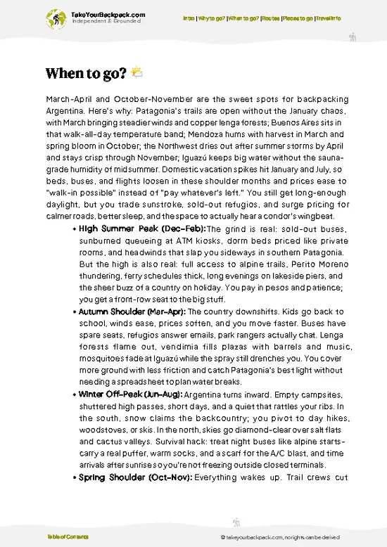
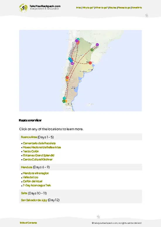
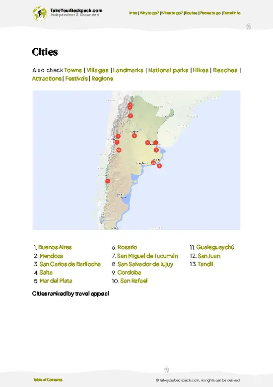
example page 0 from our offline Travel Guide for Argentina
example page 1 from our offline Travel Guide for Argentina
example page 2 from our offline Travel Guide for Argentina
example page 3 from our offline Travel Guide for Argentina
example page 4 from our offline Travel Guide for Argentina
example page 5 from our offline Travel Guide for Argentina
example page 6 from our offline Travel Guide for Argentina
example page 7 from our offline Travel Guide for Argentina
The digital guide (505 pages) contains:
135 highlights, ranked by travel appeal
Optimized 14, 21 & 30-day travel routes
Cities, national parks, landmarks, beaches
How to get around
Offline-friendly for travel without Wi-Fi
👉 Click to see all 30+ guide features

📅 Plan smarter in minutes, not weeks
Month by month travel advice
Festivals & national holidays
Budget expectations

🗺️ Go to the right places, skip the overrated ones
Honest pros & cons of destinations
Top hikes, parks & viewpoints
Lesser-known places most travelers miss
Clear “worth it vs skip it” guidance

🛏️ Travel smoothly without rookie mistakes
Best areas to stay
Transport systems explained simply
Common scams & safety advice
SIM cards, money & practical tips

🌍 Understand the country, not just visit it
Culture & traditions
52 Essential phrases & customs
Festivals worth planning around
Traveler-friendly historical context
Insights that make places more meaningful

📱 Built for real travel conditions
Fully downloadable PDF
Works completely offline
Optimized for phone use
Useful in remote areas & buses
Everything in one place
Save weeks of stressful planning
Get instant access to your full guide. 30‑day money-back guarantee.
+ Add another guide for just US$7.80

By proceeding you agree to our terms.
Sent to your inbox immediately after payment • 100% Secure Checkout
Best Backpacking Travel Advisor 2025 tourism awardBest Backpacking
Travel Advisor
2025
What others say about Take Your Backpack Guides:
⭐⭐⭐⭐⭐
Fantastic, amazing amount of information!
⭐⭐⭐⭐⭐
My goodness this is amazing, it's what I've been looking for hats off too you!
⭐⭐⭐⭐⭐
I think this is absolutely BRILLIANT
⭐⭐⭐⭐
Very complete and informative. It's still missing places, but I gotta to commend you
⭐⭐⭐⭐⭐
This is truly amazing, thank you, can't wait to explore it with my kids!
⭐⭐⭐⭐⭐
Awesome resource, thank you!
⭐⭐⭐⭐⭐
This is amazing! Can't wait to explore the ones I haven't seen
⭐⭐⭐⭐
I love this! Well done, great idea.
⭐⭐⭐⭐⭐
Thanks for taking the time to make this gem!
⭐⭐⭐⭐⭐
This might be the best website I've ever seen.
⭐⭐⭐⭐⭐
Congratulations, and thank you so much for your work; it's incredibly valuable.
⭐⭐⭐⭐
In all seriousness I think you did a great job pointing out the important spots
⭐⭐⭐⭐⭐
10/10 very good
⭐⭐⭐⭐⭐
As someone who's only just starting to visit regularly this is awesome, thank you.
⭐⭐⭐⭐
Thank you very much! I'm going to visit my dad, it's going to be very useful!
⭐⭐⭐⭐⭐
This is really cool! We'll be travelling for the first time and this definitely come in handy.
⭐⭐⭐⭐⭐
You are now our minister of culture, congratulations 👨‍💼
⭐⭐⭐⭐⭐
Just wanted to tell you that this is a pearl! Going to follow your recommendations.
⭐⭐⭐⭐⭐
This is so cool. I'll definitely be using the resource for my travels soon.
⭐⭐⭐⭐⭐
This is very impressive! Good work.
⭐⭐⭐⭐⭐
This is an amazing and informative site. Very well done!

🛏️ Where to stay?Where staying makes the most sense

If you enjoy meeting fellow travelers, consider choosing hostels with high ratings for atmosphere. On the other hand, if you prefer having your own space, a hotel might be a better option.

🥾 Hike detailsHike details: route, duration, and difficulty of Mountains of Los Gigantes

Total Distance: The trail spans approximately 12 kilometers (7.5 miles) round trip, making it a solid day hike without being too overwhelming.

Estimated Duration: Expect to take around 5 to 7 hours to complete the hike, depending on your pace and how often you stop to take in the views or snap some photos.

Difficulty Level: This trail is rated as moderate. While it’s not a technical climb, there are some steep sections that can test your stamina, especially if you’re not used to hiking at altitude.

Starting Point: The hike begins at the village of Los Gigantes. To get there by public transport, … read more 👉
Total Distance: The trail spans approximately 12 kilometers (7.5 miles) round trip, making it a solid day hike without being too overwhelming.

Estimated Duration: Expect to take around 5 to 7 hours to complete the hike, depending on your pace and how often you stop to take in the views or snap some photos.

Difficulty Level: This trail is rated as moderate. While it’s not a technical climb, there are some steep sections that can test your stamina, especially if you’re not used to hiking at altitude.

Starting Point: The hike begins at the village of Los Gigantes. To get there by public transport, you can catch a bus from Córdoba. The ride takes about 2 to 3 hours, and buses run fairly regularly, so check the schedule ahead of time.

Major Landmarks Along the Route:
  • Los Gigantes Cliffs: These impressive, towering rock formations are a highlight and provide stunning views as you ascend.
  • Laguna de los Gigantes: A beautiful alpine lake that’s perfect for a rest stop and a snack.
  • Summit Views: Once you reach the top, you’ll be treated to panoramic views of the surrounding valleys and mountains.

Type of Terrain and Scenery: The trail features a mix of rocky paths, dirt trails, and some gravel sections. You’ll traverse through rugged mountain terrain, with plenty of switchbacks that lead you up to the summit. The scenery is breathtaking, with dramatic cliffs and expansive views of the Sierra de Córdoba.

Typical Vegetation and Wildlife:
  • Vegetation: Expect to see a variety of shrubs, grasses, and some hardy trees. Higher up, the vegetation thins out, revealing more rocky outcrops.
  • Wildlife: Keep an eye out for condors soaring overhead, as well as smaller animals like rabbits and various bird species. If you’re lucky, you might even spot a fox or a deer.

This trail is a fantastic way to experience the natural beauty of Argentina, so pack some snacks, bring plenty of water, and enjoy the adventure!
⚠️ Hiking info can sometimes be outdated or inaccurate. Before you hit the trail, check the latest conditions with locals. If you do spot anything that's off, I'd love to hear from you, so I can update it for fellow travelers.

🛡️ SafetyTraveler Safety Guide

The hike through the Mountains of Los Gigantes is a thrilling blend of challenge and reward. Expect weather shifts; the sun can blaze, then clouds roll in, so pack layers. The trails are steep but well-marked, with rocky sections that demand focus. Watch your footing, especially near river crossings where the rocks can be slippery.

Wildlife is present but generally keeps its distance. If you spot a condor soaring overhead, take a moment to appreciate it—just don’t approach. Timing is key; start early to avoid the heat and enjoy the tranquility. With the right gear and a steady pace, you’ll find the views at the summit are worth every step.

FAQTraveler FAQ

The Mountains of Los Gigantes hike typically takes 2 to 3 days to complete, depending on your pace and route chosen. The main trail covers approximately 30 kilometers with significant elevation changes.
The hike is considered moderate to difficult due to steep ascents and rocky terrain. It requires good physical fitness and some experience with mountain hiking, especially at higher altitudes.
No official permit is required for the Mountains of Los Gigantes hike, but hiring a local guide is recommended for safety and navigation, especially if you are unfamiliar with the area or hiking in the off-season.
⚠️ Things can change over time, so always validate details locally before you go.

Other Argentinian hikes near Mountains of Los Gigantes

Explore more nearby:

  • Fitz Roy Trek—jagged peaks, lenga forests, turquoise lakes, Patagonian wind
  • Laguna de los Tres—alpine lake, glacier backdrop, steep ascent, Fitz Roy panorama
  • Laguna Torre—glacial valley, spire reflections, moraine ridges, iceberg-dotted lake

💡 Not sure where to go next?
Create a personalized itinerary for Argentina including Mountains of Los Gigantes and the places that fit your trip.

Generate my itinerary

👉 Discover all hikes

Or checkout all Argentina has to offer (think cities, towns, villages, national parks, hikes, beaches, festivals)
Country photo of Argentina

We 💚 feedbackSumming up the experience

The Mountains of Los Gigantes are a playground for the adventurous spirit. The sheer cliffs and sweeping vistas make every grueling step worth it. But be ready for the weather; it can turn on a dime, leaving you soaked and shivering. Embrace the challenge, and you’ll find the reward in every breathtaking view and hard-earned summit.

✈️ When did I visit Argentina?
I have visited Argentina, together with Chile, in September 2012.

✍️ Help improve this page!
The information on this page is based on my own backpacking experience in Argentina, supplemented with up-to-date research and feedback from other travelers. Travel details can change, so if you notice anything outdated or incomplete, feel free to let me know.


🙋‍♂️ Give feedback

👋 Meet the founderWho’s Behind Take Your Backpack?

Johan, backpacker and founder of TakeYourBackpackHi, I’m Johan (Netherlands 🇳🇱), the creator of TakeYourBackpack. Over the past decade, I’ve backpacked through 80+ countries across six continents, gaining extensive experience with independent travel, long-term trips, and overland routes.

This site is built on a combination of firsthand travel experience and carefully curated insights from other backpackers. Many guides are based on places I’ve personally visited, while others bring together tips, observations, and practical advice shared by trusted travelers I’ve met along the way.

The goal is to provide realistic, experience-driven guidance — not generic itineraries — so you can explore destinations with better context, clearer expectations, and more confidence.

Get full Argentina guide •
Instant download • 135 highlights • Full Offline guide