
×

Argentina🇦🇷 | national parksParque Nacional los AlercesAncient alerce trees, Futalaufquen lake, temperate rainforest | things to do and best time to go

Explore Baritú National ParkExplore Laguna El Palmar National Park

Backpacking in Parque Nacional los Alerces
By Johan Kruseman 🇳🇱 | Updated October 19, 2026

Do you base yourself in Esquel or push deeper into the park along Route 71, sleeping at one of the lakeside campgrounds? That choice shapes your whole trip. Los Alerces sits in Chubut province, Argentine Patagonia, west of Esquel near the Chilean border. It has turquoise lakes, ancient alerce trees, and quiet trails, with far fewer crowds than Bariloche's parks, though public transport inside is thin and some boat excursions run pricier than expected. I remember eating trout at a rustic parador on Lago Futalaufquen, feet still damp from a river crossing, watching condors ride the thermals above the ridge.

Discover everything you want to know in the 📖 Argentina Travel Guide.


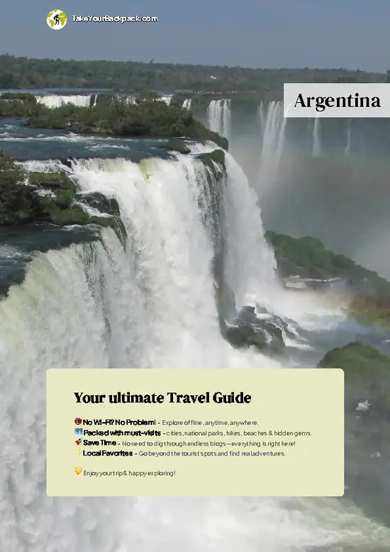
example page 0 from our offline Travel Guide for Argentina
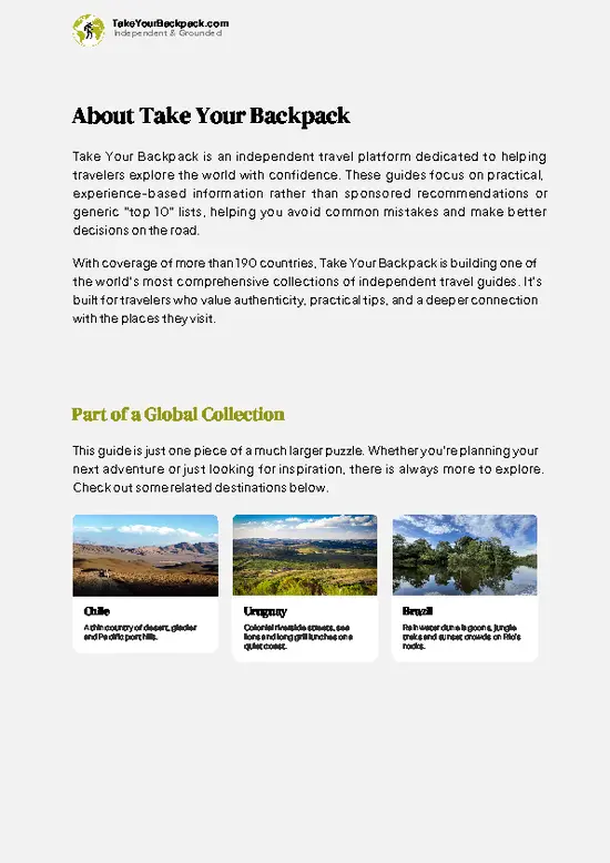
example page 1 from our offline Travel Guide for Argentina
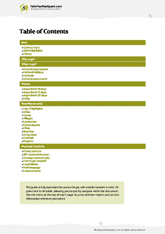
example page 2 from our offline Travel Guide for Argentina
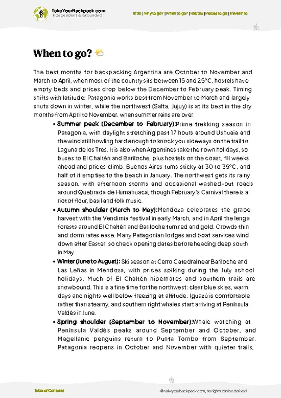
example page 3 from our offline Travel Guide for Argentina
example page 4 from our offline Travel Guide for Argentina
example page 5 from our offline Travel Guide for Argentina
example page 6 from our offline Travel Guide for Argentina
example page 7 from our offline Travel Guide for Argentina
Loading the map 🌍
CLICK TO FILTER
cities
towns
villages
landmarks
national parks
hikes
beaches
attractions
festivals
regions
SHOW COUNTRY’S BESTSHOW ALL

✨ Why go?
Ranked #99 national park in Argentina
Why visitors keep coming back

Backpackers come for the independent access: you can camp, hike, and paddle without joining a single tour. Budget campgrounds line Lago Futalaufquen and Lago Verde, and Esquel offers cheap hostels as a base. Trail variety runs from flat lakeshore walks to the steeper Cerro Alto El Petiso climb. The park rewards self-guided travelers who plan transport carefully, since buses inside are limited and a rental car or hitchhiking often fills the gaps.

💡 HighlightsWhat this place is best known for

  1. Lago Futalaufquen: The park's largest lake, ringed by lenga and coihue forest, with calm water good for kayaking and a visitor center nearby.
  2. Alerzal Milenario Boat Trip: A boat excursion across Lago Menendez to see alerce trees over 1,000 years old, some reaching 60 meters tall. This is my personal favorite, standing under trees that were already ancient before the Roman Empire fell is genuinely humbling.
  3. Cerro Alto El Petiso: A demanding day hike climbing through forest to open ridgeline views over multiple lakes and the Andes.
  4. Lago Verde: Named for its striking green-blue color from glacial sediment, with a short accessible trail and campground.
  5. Río Arrayanes: A clear river connecting Lago Verde and Lago Futalaufquen, popular for fly fishing and short walks along its banks.
  6. Puerto Limonao: A
… read more 👉
  1. Lago Futalaufquen: The park's largest lake, ringed by lenga and coihue forest, with calm water good for kayaking and a visitor center nearby.
  2. Alerzal Milenario Boat Trip: A boat excursion across Lago Menendez to see alerce trees over 1,000 years old, some reaching 60 meters tall. This is my personal favorite, standing under trees that were already ancient before the Roman Empire fell is genuinely humbling.
  3. Cerro Alto El Petiso: A demanding day hike climbing through forest to open ridgeline views over multiple lakes and the Andes.
  4. Lago Verde: Named for its striking green-blue color from glacial sediment, with a short accessible trail and campground.
  5. Río Arrayanes: A clear river connecting Lago Verde and Lago Futalaufquen, popular for fly fishing and short walks along its banks.
  6. Puerto Limonao: A quiet departure point for boat trips, with a small beach good for a break between hikes.
  7. Pampa de Tejas Verdes: An open grassy area where guanacos are regularly spotted grazing near the tree line.
Spotted a mistake or missing something? Contact us.

🌤️ When to go?When to go for the best experience

  • Summer (December to February): Warmest months, 15-25°C (59-77°F), long daylight past 9pm, busiest campgrounds and highest prices.
  • Shoulder season (March, November): Cooler, 8-18°C (46-64°F), thinner crowds, autumn color on the lenga forests in March.
  • Winter (June to August): Cold, often below 5°C (41°F), snow closes some trails, minimal services, some roads restrict access.
  • Spring (September to November): Melting snow swells rivers, wildflowers appear, moderate crowds return by late spring.
Go in late November or March if you want good weather without fighting for a campsite.

source: climatestotravel.comJANJanuary: highly recommended for travelingFEBFebruary: highly recommended for travelingMARMarch: highly recommended for travelingAPRApril: good for travelingMAYMay: fair for travelingJUNJune: below average for travelingJULJuly: below average for travelingAUGAugust: below average for travelingSEPSeptember: fair for travelingOCTOctober: good for travelingNOVNovember: excellent for travelingDECDecember: highly recommended for traveling
when-to-go

✈️ The backpacker research shortcutArgentina Travel Guide

An offline-friendly backpacking guide with optimized travel routes, ranked highlights, transport advice, and the best areas to stay.
example page 0 from our offline Travel Guide for Argentina
example page 1 from our offline Travel Guide for Argentina
example page 2 from our offline Travel Guide for Argentina
example page 3 from our offline Travel Guide for Argentina
example page 4 from our offline Travel Guide for Argentina
example page 5 from our offline Travel Guide for Argentina
example page 6 from our offline Travel Guide for Argentina
example page 7 from our offline Travel Guide for Argentina
The digital guide (393 pages) contains:
✅ 131 highlights, ranked by travel appeal
✅ Optimized 14, 21 & 30-day travel routes
✅ Cities, national parks, landmarks, beaches
✅ How to get around
✅ Offline-friendly for travel without Wi-Fi
👉 Click to see all 30+ guide features

📅 Plan smarter in minutes, not weeks
✅ Month by month travel advice
✅ Festivals & national holidays
✅ Budget expectations

🗺️ Go to the right places, skip the overrated ones
✅ Honest pros & cons of destinations
✅ Top hikes, parks & viewpoints
✅ Lesser-known places most travelers miss
✅ Clear “worth it vs skip it” guidance

🛏️ Travel smoothly without rookie mistakes
✅ Best areas to stay
✅ Transport systems explained simply
✅ Common scams & safety advice
✅ SIM cards, money & practical tips

🌍 Understand the country, not just visit it
✅ Culture & traditions
✅ 52 Essential phrases & customs
✅ Festivals worth planning around
✅ Traveler-friendly historical context
✅ Insights that make places more meaningful

📱 Built for real travel conditions
✅ Fully downloadable PDF
✅ Works completely offline
✅ Optimized for phone use
✅ Useful in remote areas & buses
✅ Everything in one place
Stop searching, start planning
Get instant access to your full guide. 30‑day money-back guarantee.
+ Add another guide for just

By proceeding you agree to our terms.
Sent to your inbox immediately after payment • 100% Secure Checkout
Best Backpacking Travel Advisor 2025 tourism awardBest Backpacking
Travel Advisor
2025
What others say about Take Your Backpack Guides:
⭐⭐⭐⭐⭐
Fantastic, amazing amount of information!
⭐⭐⭐⭐⭐
My goodness this is amazing, it's what I've been looking for hats off too you!
⭐⭐⭐⭐⭐
I think this is absolutely BRILLIANT
⭐⭐⭐⭐
Very complete and informative. It's still missing places, but I gotta to commend you
⭐⭐⭐⭐⭐
This is truly amazing, thank you, can't wait to explore it with my kids!
⭐⭐⭐⭐⭐
Awesome resource, thank you!
⭐⭐⭐⭐⭐
This is amazing! Can't wait to explore the ones I haven't seen
⭐⭐⭐⭐
I love this! Well done, great idea.
⭐⭐⭐⭐⭐
Thanks for taking the time to make this gem!
⭐⭐⭐⭐⭐
This might be the best website I've ever seen.
⭐⭐⭐⭐⭐
Congratulations, and thank you so much for your work; it's incredibly valuable.
⭐⭐⭐⭐
In all seriousness I think you did a great job pointing out the important spots
⭐⭐⭐⭐⭐
10/10 very good
⭐⭐⭐⭐⭐
As someone who's only just starting to visit regularly this is awesome, thank you.
⭐⭐⭐⭐
Thank you very much! I'm going to visit my dad, it's going to be very useful!
⭐⭐⭐⭐⭐
This is really cool! We'll be travelling for the first time and this definitely come in handy.
⭐⭐⭐⭐⭐
You are now our minister of culture, congratulations 👨‍💼
⭐⭐⭐⭐⭐
Just wanted to tell you that this is a pearl! Going to follow your recommendations.
⭐⭐⭐⭐⭐
This is so cool. I'll definitely be using the resource for my travels soon.
⭐⭐⭐⭐⭐
This is very impressive! Good work.
⭐⭐⭐⭐⭐
This is an amazing and informative site. Very well done!

🛏️ Where to stay?Best areas to stay in Argentina

Esquel, about an hour from the park entrance, works well as a budget base with hostels, buses, and grocery stores. Inside the park, camping is the main option: sites like Lago Verde, Lago Futalaufquen, and Bahía Rosales offer basic facilities for a modest nightly fee. A few rustic lodges and cabañas sit near Lago Futalaufquen for travelers wanting a roof without leaving the park. Trevelin, smaller and quieter than Esquel, is another nearby option with cheaper guesthouses and a slower pace.

👛 Costs (as of 19 October 2026)Travel costs and budget guide for Parque Nacional los Alerces

Daily costs in Los Alerces run moderate by Patagonian standards, with camping keeping budgets low and boat excursions pushing costs higher.
CategoryBudget RangeLocal Reality
Entrance feeUSD 10 to 15Paid at the park gate, varies by season and nationality
CampingUSD 8 to 15 per nightBasic sites with cold showers, no electricity at most spots
Cabañas/lodgesUSD 40 to 90 per nightLimited availability near the lakes, book ahead in summer
Boat excursion to alerzalUSD 60 to 90Main splurge item, includes guide and lake crossing
Food/suppliesUSD 10 to 20 per dayCheaper if bought in Esquel before entering the park
⚠️ Prices can change and everyone travels differently, so take this as a rough guide. Hope it helps you plan your adventure!

🥾 TrailsScenic routes and wildlife spotting in Parque Nacional los Alerces

Trails here range from flat forest strolls to steep, rooty climbs, and the terrain often mixes lakeshore gravel with sudden elevation gain through dense lenga and coihue woods. Wildlife sightings include guanacos, foxes, and occasionally the elusive pudú, a small native deer. Condors circle the higher ridges. Most trails see light foot traffic outside January, which makes for quiet walking but also means you should carry your own water and food.
  • Cerro Alto El Petiso: 8km round trip, 5-6 hours, moderate to difficult, steep sections with panoramic lake and mountain views at the summit.
  • Sendero Lago
… read more 👉
Trails here range from flat forest strolls to steep, rooty climbs, and the terrain often mixes lakeshore gravel with sudden elevation gain through dense lenga and coihue woods. Wildlife sightings include guanacos, foxes, and occasionally the elusive pudú, a small native deer. Condors circle the higher ridges. Most trails see light foot traffic outside January, which makes for quiet walking but also means you should carry your own water and food.
  • Cerro Alto El Petiso: 8km round trip, 5-6 hours, moderate to difficult, steep sections with panoramic lake and mountain views at the summit.
  • Sendero Lago Verde: 2km one way, 1 hour, easy, flat path through forest ending at a green-water lake.
  • Sendero Cascada Los Alerces: 1km loop, 30-40 minutes, easy, leads to a small waterfall and old-growth alerce stand.
Public transport inside the park is sparse; a shuttle bus runs from Esquel in summer, but a rental car gives far more flexibility. The entrance fee runs a few thousand Argentine pesos depending on season, and crowds concentrate around the boat dock and main campgrounds in January.
⚠️ Hiking info can sometimes be outdated or inaccurate. Before you hit the trail, check the latest conditions with locals. If you do spot anything that's off, I'd love to hear from you, so I can update it for fellow travelers.

🛡️ SafetyScams, Hazards, and Annoyances

Weather shifts fast here, so pack a rain layer even on clear mornings. Trails are generally well-marked and well-managed, with steep but stable footing on climbs like Cerro Alto El Petiso. River crossings are minor on main routes. Guanacos and foxes are common but keep their distance; store food properly at campsites to avoid attracting them. Start hikes early, since afternoon wind picks up on open ridges.

FAQFrequently asked questions about Parque Nacional los Alerces

Three to four days lets you cover the main trails and take the boat excursion to see the ancient alerce trees without rushing. Two days works if you focus only on Lago Futalaufquen and one hike. Longer stays of five or more days suit those who want to fish or explore quieter corners like Lago Verde at a relaxed pace.
Yes, but it takes planning. A summer shuttle bus connects Esquel to the park entrance and main sites, though schedules are limited outside January and February. Many backpackers combine the bus with hitchhiking or arrange a shared taxi from Esquel for more flexibility.
Yes, there is an entrance fee paid at the park gate, typically a few thousand Argentine pesos depending on the season and whether you're a foreign visitor or Argentine resident. No special permit is needed for day hiking or camping at designated sites, though camping fees are separate from the entrance fee.
⚠️ Things can change over time, so always validate details locally before you go.

Other Argentine national parks near Parque Nacional los Alerces

Explore more nearby:


💡 Not sure where to go next?
Create a personalized itinerary for Argentina including Parque Nacional los Alerces and the places that fit your trip.

Generate my itinerary

👉 Discover all national parks

Or checkout all Argentina has to offer (think cities, towns, villages, national parks, hikes, beaches, festivals)
Country photo of Argentina

We 💚 feedbackParting advice and final tips

Los Alerces is worth it for those ancient alerce trees, some over a thousand years old, seen best by boat. The drawback: thin public transport makes independent movement inside the park slower than you'd expect.

✈️ When did I visit Argentina?
I have visited Argentina, together with Chile, in September 2012.

✍️ Help improve this page!
The information on this page is based on my own backpacking experience in Argentina, supplemented with up-to-date research and feedback from other travelers. Travel details can change, so if you notice anything outdated or incomplete, feel free to let me know.


🙋‍♂️ Give feedback

👋 Meet the founderWho’s Behind Take Your Backpack?

Johan, backpacker and founder of TakeYourBackpackHi, I’m Johan (Netherlands 🇳🇱), the creator of TakeYourBackpack. Over the past 3 decades, I’ve backpacked through 90+ countries across six continents, gaining extensive experience with independent travel, long-term trips, and overland routes.

This site is built on a combination of firsthand travel experience and carefully curated insights from other backpackers. Many guides are based on places I’ve personally visited, while others bring together tips, observations, and practical advice shared by trusted travelers I’ve met along the way.

The goal is to provide realistic, experience-driven guidance — not generic itineraries — so you can explore destinations with better context, clearer expectations, and more confidence.