×

Belize🇧🇿 | landmarksTwin CayesMangrove channels, patch reefs, seagrass flats, seabird roosts | things to do and best time to go

Explore LamanaiExplore Xunantunich

Backpacking in Twin Cayes
👀 For curious travelersunique site ranked #7
By Johan Kruseman 🇳🇱 | Updated October 22, 2026

Red mangrove roots at Twin Cayes arch out of the water like stilts, and the tannin-dark channels between them smell of sulfur and salt mud. Twin Cayes is best known as a pair of mangrove islands in Belize, off the southern coast near Dangriga and Tobacco Caye, inside the barrier reef and part of the Smithsonian’s long-running research at Carrie Bow Cay nearby. There is no beach, no resort and no ticket booth, so the wow-factor is quiet: herons lifting off, upside-down jellyfish pulsing in shallows, mosquitoes at dusk. Crowds are almost nonexistent, but you pay in boat time and fuel rather than entry. Photographers get glassy reflections and tangled roots. Most of the interior is research and protected land, so you stay in the boat or on the water. Book a licensed guide in advance.

Discover everything you want to know in the 📖 Belize Travel Guide.


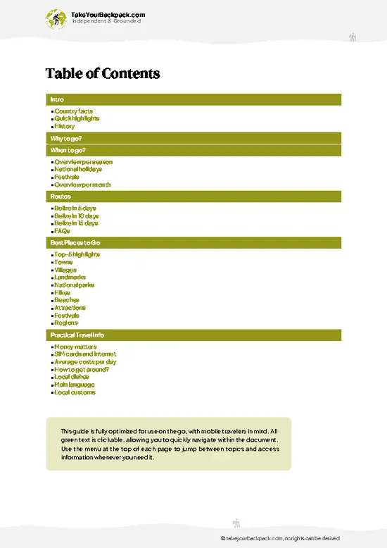
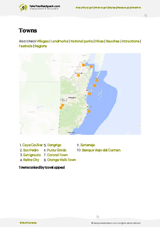
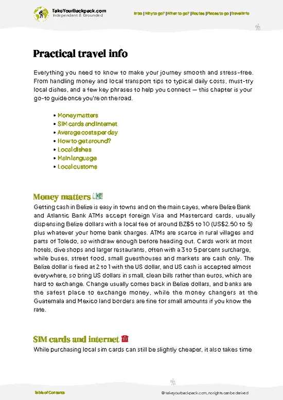
example page 0 from our offline Travel Guide for Belize
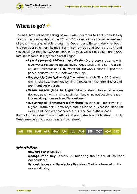
example page 1 from our offline Travel Guide for Belize
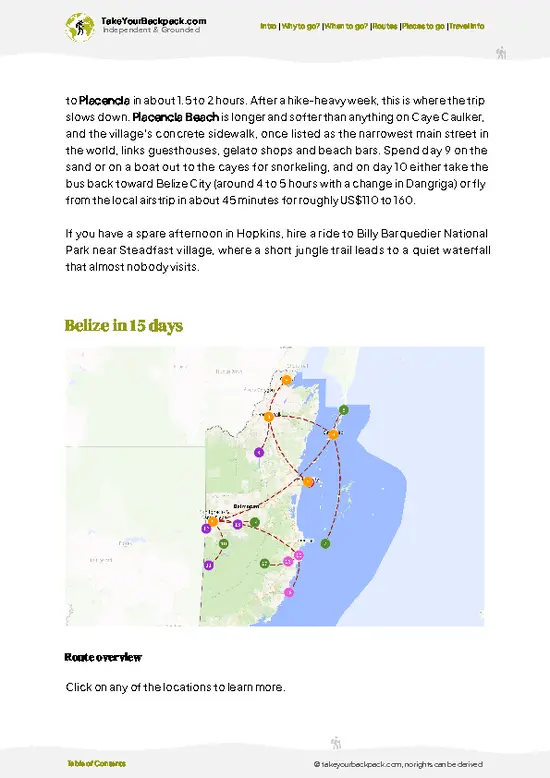
example page 2 from our offline Travel Guide for Belize
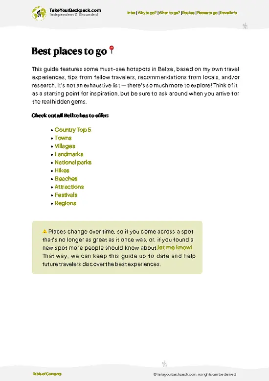
example page 3 from our offline Travel Guide for Belize
example page 4 from our offline Travel Guide for Belize
example page 5 from our offline Travel Guide for Belize
example page 6 from our offline Travel Guide for Belize
example page 7 from our offline Travel Guide for Belize
Loading the map 🌍
CLICK TO FILTER
towns
villages
landmarks
national parks
hikes
beaches
attractions
festivals
regions
SHOW COUNTRY’S BESTSHOW ALL

✨ Why go?
Ranked #7 unique site in Belize
Why Twin Cayes should be on your travel list

Twin Cayes gives you a mangrove ecosystem up close, without the reef crowds of the larger cayes. The reason to make the effort is the water level view: you glide through narrow channels where red mangrove prop roots hold nurseries of snapper, juvenile barracuda and tiny sponges, and where upside-down jellyfish rest on sandy bottoms in the shallows. Birders can add frigatebirds, ospreys and herons without hiking a step. Few places in Belize let you see how the reef is protected by the forests growing behind it.

The islands also fit neatly into a route along the southern cayes. Pair them with a snorkel stop at the reef edge and a night on a small, simple island such as Tobacco Caye, and you get one coherent day of marine life rather than a single photo stop. It suits travelers who like quiet, … read more 👉
Twin Cayes gives you a mangrove ecosystem up close, without the reef crowds of the larger cayes. The reason to make the effort is the water level view: you glide through narrow channels where red mangrove prop roots hold nurseries of snapper, juvenile barracuda and tiny sponges, and where upside-down jellyfish rest on sandy bottoms in the shallows. Birders can add frigatebirds, ospreys and herons without hiking a step. Few places in Belize let you see how the reef is protected by the forests growing behind it.

The islands also fit neatly into a route along the southern cayes. Pair them with a snorkel stop at the reef edge and a night on a small, simple island such as Tobacco Caye, and you get one coherent day of marine life rather than a single photo stop. It suits travelers who like quiet, slow boat days over checklists. Paddlers love it, and the sea stays calm inside the reef.

💡 HighlightsPlaces and moments you shouldn't skip

  1. Mangrove channels by kayak or small boat: the main experience. Narrow tunnels of red mangrove roots open into lagoons, and the water is tea colored from tannins.
  2. Upside-down jellyfish shallows: Cassiopea jellyfish lie bell-down on the mud, pulsing in a few feet of water. Look but don’t touch.
  3. Prop root nurseries: peer over the side and spot young snapper, gobies and sponges clinging to the root curtain that shelters reef fish.
  4. Birdlife: frigatebirds, brown pelicans, ospreys and herons nest or hunt around the islands, best in the cool early hours.
  5. Carrie Bow Cay views: the Smithsonian’s small marine research station sits just off the cayes on the reef crest, a reminder of decades of scientific work here.
  6. Reef edge snorkel stop: boats usually combine the mangroves with clear water and coral heads
… read more 👉
  1. Mangrove channels by kayak or small boat: the main experience. Narrow tunnels of red mangrove roots open into lagoons, and the water is tea colored from tannins.
  2. Upside-down jellyfish shallows: Cassiopea jellyfish lie bell-down on the mud, pulsing in a few feet of water. Look but don’t touch.
  3. Prop root nurseries: peer over the side and spot young snapper, gobies and sponges clinging to the root curtain that shelters reef fish.
  4. Birdlife: frigatebirds, brown pelicans, ospreys and herons nest or hunt around the islands, best in the cool early hours.
  5. Carrie Bow Cay views: the Smithsonian’s small marine research station sits just off the cayes on the reef crest, a reminder of decades of scientific work here.
  6. Reef edge snorkel stop: boats usually combine the mangroves with clear water and coral heads just outside the lagoon.
  7. Mangrove light at dusk: roots silhouette against the sky and the sounds of insects and frogs rise as the day cools.
Twin Cayes is best met first on the water, so start with the mangrove channels by kayak or small boat.
Spotted a mistake or missing something? Contact us.

Things to do near Twin Cayes

Ratings based on Tripadvisor reviews. When you book through this link, you support our work at no extra cost to you.

🌤️ When to go?When to go for the best experience

  • Dry Season (February to May): Twin Cayes is easiest to reach and most comfortable now, with highs of 28 to 32°C (82 to 90°F), steady sea breezes and little rain. Daylight runs about 11.5 to 13 hours. Boat tours from Dangriga and Hopkins fill up, so book a few days ahead.
  • Wet Season (June to November): Expect 25 to 31°C (77 to 88°F), afternoon downpours and heavier mangrove mosquitoes. Visibility for snorkeling drops after storms, but crowds thin and boat operators discount. Hurricane risk peaks from August to October.
  • Holiday Peak (mid-December to early January): Cooler nights near 21°C (70°F) and clear days, but beds and boat charters cost the most and sell out early.
  • Cooler Months (December to February): Northers bring choppy water some mornings, so paddling the mangrove channels is better
… read more 👉
  • Dry Season (February to May): Twin Cayes is easiest to reach and most comfortable now, with highs of 28 to 32°C (82 to 90°F), steady sea breezes and little rain. Daylight runs about 11.5 to 13 hours. Boat tours from Dangriga and Hopkins fill up, so book a few days ahead.
  • Wet Season (June to November): Expect 25 to 31°C (77 to 88°F), afternoon downpours and heavier mangrove mosquitoes. Visibility for snorkeling drops after storms, but crowds thin and boat operators discount. Hurricane risk peaks from August to October.
  • Holiday Peak (mid-December to early January): Cooler nights near 21°C (70°F) and clear days, but beds and boat charters cost the most and sell out early.
  • Cooler Months (December to February): Northers bring choppy water some mornings, so paddling the mangrove channels is better after the wind drops.
Book the mangrove paddle for early morning, when the water is calmest and the heat has not yet built.


source: climatestotravel.comJANJanuary: excellent for travelingFEBFebruary: excellent for travelingMARMarch: excellent for travelingAPRApril: highly recommended for travelingMAYMay: fair for travelingJUNJune: fair for travelingJULJuly: fair for travelingAUGAugust: fair for travelingSEPSeptember: below average for travelingOCTOctober: fair for travelingNOVNovember: highly recommended for travelingDECDecember: excellent for traveling
when-to-go

✈️ The backpacker research shortcutBelize Travel Guide

An offline-friendly backpacking guide with optimized travel routes, ranked highlights, transport advice, and the best areas to stay.
example page 0 from our offline Travel Guide for Belize
example page 1 from our offline Travel Guide for Belize
example page 2 from our offline Travel Guide for Belize
example page 3 from our offline Travel Guide for Belize
example page 4 from our offline Travel Guide for Belize
example page 5 from our offline Travel Guide for Belize
example page 6 from our offline Travel Guide for Belize
example page 7 from our offline Travel Guide for Belize
The digital guide (168 pages) contains:
✅ 45 highlights, ranked by travel appeal
✅ Optimized 5, 10 & 15-day travel routes
✅ Cities, national parks, landmarks, beaches
✅ How to get around
✅ Offline-friendly for travel without Wi-Fi
👉 Click to see all 30+ guide features

📅 Plan smarter in minutes, not weeks
✅ Month by month travel advice
✅ Festivals & national holidays
✅ Budget expectations

🗺️ Go to the right places, skip the overrated ones
✅ Honest pros & cons of destinations
✅ Top hikes, parks & viewpoints
✅ Lesser-known places most travelers miss
✅ Clear “worth it vs skip it” guidance

🛏️ Travel smoothly without rookie mistakes
✅ Best areas to stay
✅ Transport systems explained simply
✅ Common scams & safety advice
✅ SIM cards, money & practical tips

🌍 Understand the country, not just visit it
✅ Culture & traditions
✅ 52 Essential phrases & customs
✅ Festivals worth planning around
✅ Traveler-friendly historical context
✅ Insights that make places more meaningful

📱 Built for real travel conditions
✅ Fully downloadable PDF
✅ Works completely offline
✅ Optimized for phone use
✅ Useful in remote areas & buses
✅ Everything in one place
Stop searching, start planning
Get instant access to your full guide. 30‑day money-back guarantee.
+ Add another guide for just

By proceeding you agree to our terms.
Sent to your inbox immediately after payment • 100% Secure Checkout
Best Backpacking Travel Advisor 2025 tourism awardBest Backpacking
Travel Advisor
2025
What others say about Take Your Backpack Guides:
⭐⭐⭐⭐⭐
Fantastic, amazing amount of information!
⭐⭐⭐⭐⭐
My goodness this is amazing, it's what I've been looking for hats off too you!
⭐⭐⭐⭐⭐
I think this is absolutely BRILLIANT
⭐⭐⭐⭐
Very complete and informative. It's still missing places, but I gotta to commend you
⭐⭐⭐⭐⭐
This is truly amazing, thank you, can't wait to explore it with my kids!
⭐⭐⭐⭐⭐
Awesome resource, thank you!
⭐⭐⭐⭐⭐
This is amazing! Can't wait to explore the ones I haven't seen
⭐⭐⭐⭐
I love this! Well done, great idea.
⭐⭐⭐⭐⭐
Thanks for taking the time to make this gem!
⭐⭐⭐⭐⭐
This might be the best website I've ever seen.
⭐⭐⭐⭐⭐
Congratulations, and thank you so much for your work; it's incredibly valuable.
⭐⭐⭐⭐
In all seriousness I think you did a great job pointing out the important spots
⭐⭐⭐⭐⭐
10/10 very good
⭐⭐⭐⭐⭐
As someone who's only just starting to visit regularly this is awesome, thank you.
⭐⭐⭐⭐
Thank you very much! I'm going to visit my dad, it's going to be very useful!
⭐⭐⭐⭐⭐
This is really cool! We'll be travelling for the first time and this definitely come in handy.
⭐⭐⭐⭐⭐
You are now our minister of culture, congratulations 👨‍💼
⭐⭐⭐⭐⭐
Just wanted to tell you that this is a pearl! Going to follow your recommendations.
⭐⭐⭐⭐⭐
This is so cool. I'll definitely be using the resource for my travels soon.
⭐⭐⭐⭐⭐
This is very impressive! Good work.
⭐⭐⭐⭐⭐
This is an amazing and informative site. Very well done!

🛏️ Where to stay?How to pick the right area

Placencia and Hopkins are the two best bases for reaching Twin Cayes, with Dangriga as a practical third option. Hopkins is the pick for solo travelers: a single sandy road with hostels, guesthouses and beach bars, plenty of backpackers trading boat shares, and Garifuna drumming and cooking classes in the evenings. Dangriga, about 20 minutes away by road, is the real transport hub, with buses, the market and boat operators, but it is rougher at night and fewer travelers linger, so stay if you have an early departure. Placencia, at the tip of its peninsula, has more hostels and dorm beds, easy … read more 👉
Placencia and Hopkins are the two best bases for reaching Twin Cayes, with Dangriga as a practical third option. Hopkins is the pick for solo travelers: a single sandy road with hostels, guesthouses and beach bars, plenty of backpackers trading boat shares, and Garifuna drumming and cooking classes in the evenings. Dangriga, about 20 minutes away by road, is the real transport hub, with buses, the market and boat operators, but it is rougher at night and fewer travelers linger, so stay if you have an early departure. Placencia, at the tip of its peninsula, has more hostels and dorm beds, easy snorkeling and diving trips, and a walkable village where people meet over meals. It suits groups and first-timers who want everything on foot. Whichever you choose, stay in a place with a shared kitchen or common area, because that is where boat splits and tour deals get arranged. Use licensed operators booked through your lodging, and avoid walking the quiet back streets late at night.

👛 Costs (as of 22 October 2026)What things cost and how to budget

Twin Cayes costs a backpacker about US$95 a day in high season, mostly because reaching the cayes requires a boat. The table covers a typical day based from Hopkins or Placencia.
CategoryBudget RangeLocal Reality
Accommodation (high season)US$20 to 35Dorm beds sit at the low end; low season drops about 20 to 30 percent.
Boat or Kayak TourUS$40 to 80Shared boats and guided paddles are priced per person, with fuel driving the cost.
Park or Reserve FeesUS$5 to 10Some fees are charged at landing and may be bundled into the tour.
FoodUS$12 to 22Rice and beans with stew chicken runs about US$5 to 8; seafood costs more.
Local TransportUS$3 to 10Buses between Dangriga, Hopkins and Placencia are cheap; taxis cost more.
Snorkel Gear and ExtrasUS$5 to 10Rentals are a few dollars; bring your own mask to save.
… read more 👉
Twin Cayes costs a backpacker about US$95 a day in high season, mostly because reaching the cayes requires a boat. The table covers a typical day based from Hopkins or Placencia.
CategoryBudget RangeLocal Reality
Accommodation (high season)US$20 to 35Dorm beds sit at the low end; low season drops about 20 to 30 percent.
Boat or Kayak TourUS$40 to 80Shared boats and guided paddles are priced per person, with fuel driving the cost.
Park or Reserve FeesUS$5 to 10Some fees are charged at landing and may be bundled into the tour.
FoodUS$12 to 22Rice and beans with stew chicken runs about US$5 to 8; seafood costs more.
Local TransportUS$3 to 10Buses between Dangriga, Hopkins and Placencia are cheap; taxis cost more.
Snorkel Gear and ExtrasUS$5 to 10Rentals are a few dollars; bring your own mask to save.
Total Daily BudgetUS$95Uses the high-season bed and midpoint tour estimates; prices are payable in Belize dollars or US dollars.


source: travelbelize.org
⚠️ Prices can change and everyone travels differently, so take this as a rough guide. Hope it helps you plan your adventure!

FAQCommon questions from travelers

Twin Cayes is a pair of mangrove islands in the Belize Barrier Reef, inside the South Water Caye Marine Reserve near Dangriga. They are known for dense red mangrove forests, tidal channels and rich bird and marine life. Visits are normally paddling or snorkeling trips that start from Hopkins, Dangriga or Placencia.
Twin Cayes needs about half a day to a full day, including the boat ride. Tours generally last 4 to 8 hours with time for paddling the mangrove channels and a snorkel stop. If you want to add nearby reef stops or a dive, plan two days and base yourself in Hopkins or Placencia.
Twin Cayes is reached only by boat, usually from Dangriga, Hopkins or Placencia, which take roughly 45 minutes to 1.5 hours depending on sea conditions. Buses connect those towns with Belize City in about 2.5 to 4 hours. Tours cost around US$40 to 80 per person, and a charter costs more but allows flexible timing.
⚠️ Things can change over time, so always validate details locally before you go.

Other Belizean landmarks near Twin Cayes

Explore more nearby:

  • Glover’s Reef Atoll—Atoll walls, lagoon snorkeling, sand cays, camping| 35 km away
  • Actun Tunichil Muknal—River wade, jungle hike, Crystal Maiden, in-place pottery| 86 km away
  • Caracol—Caana summit, Chiquibul approach, carved stelae, howler chorus| 108 km away

💡 Not sure where to go next?
Create a personalized itinerary for Belize including Twin Cayes and the places that fit your trip.

Generate my itinerary

👉 Discover all landmarks

Or checkout all Belize has to offer (think cities, towns, villages, national parks, hikes, beaches, festivals)
Country photo of Belize

We 💚 feedbackKey takeaways before you go

Twin Cayes needs only half a day, and one morning on the water is plenty. I would fold it into a longer stay on a nearby island rather than make a special trip. Go early, bring bug spray and a hat, and keep your hands out of the water.

✍️ Help improve this page!
The information on this page is based on in-depth research, insights shared by experienced travelers, and feedback from the local travel community in Belize. While every effort is made to keep the information accurate and current, conditions can change — so if you spot anything incorrect or outdated, please get in touch.


🙋‍♂️ Give feedback

👋 Meet the founderWho’s Behind Take Your Backpack?

Johan, backpacker and founder of TakeYourBackpackHi, I’m Johan (Netherlands 🇳🇱), the creator of TakeYourBackpack. Over the past 3 decades, I’ve backpacked through 90+ countries across six continents, gaining extensive experience with independent travel, long-term trips, and overland routes.

This site is built on a combination of firsthand travel experience and carefully curated insights from other backpackers. Many guides are based on places I’ve personally visited, while others bring together tips, observations, and practical advice shared by trusted travelers I’ve met along the way.

The goal is to provide realistic, experience-driven guidance — not generic itineraries — so you can explore destinations with better context, clearer expectations, and more confidence.