
×

Bolivia🇧🇴 | hikesIsla del SolIsland ridge walk, Titikala rock, Inca stairway | things to do and best time to go

Explore Choro TrailExplore Laguna Glaciar

Backpacking in Isla del Sol
🌟 Highlighthike ranked #2
By Johan Kruseman 🇳🇱 | Updated October 18, 2026

A grilled trout lands on my plate in Challapampa, still spitting, with rice, potatoes and a smear of spicy llajua, and the whole lakeside meal costs me about US$5. That is the island at its best. Isla del Sol sits in Lake Titicaca in western Bolivia, a ferry ride from Copacabana. The north-to-south ridge walk runs roughly 8 to 10 kilometers, takes 3 to 4 hours, and climbs gently but steadily at 3,800 meters, so the thin air slows you down. You get terraced hillsides, Inca ruins, eucalyptus groves and blue water on both sides. Getting there is easy by bus and boat, but the island has no cars, and the north and south sections charge separate entry fees (roughly US$3 each, paid in bolivianos), so carry small cash. Boats back leave at set times, so check the last one before you start walking. Eat before you go, since prices climb on the trail. Buy your return ticket the moment you land.

Discover everything you want to know in the 📖 Bolivia Travel Guide.
Best time to go: February, May - October
Duration: 4 hours
Distance: 9 kilometers
Total ascent: 500 meters


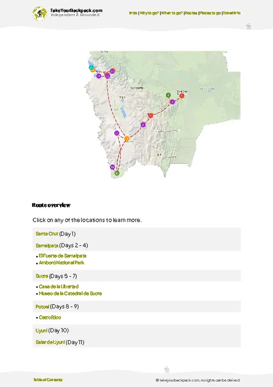
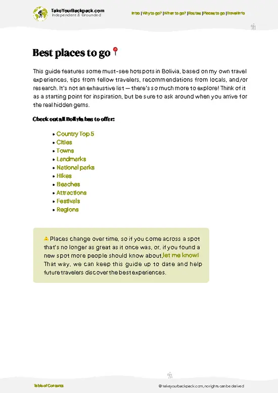
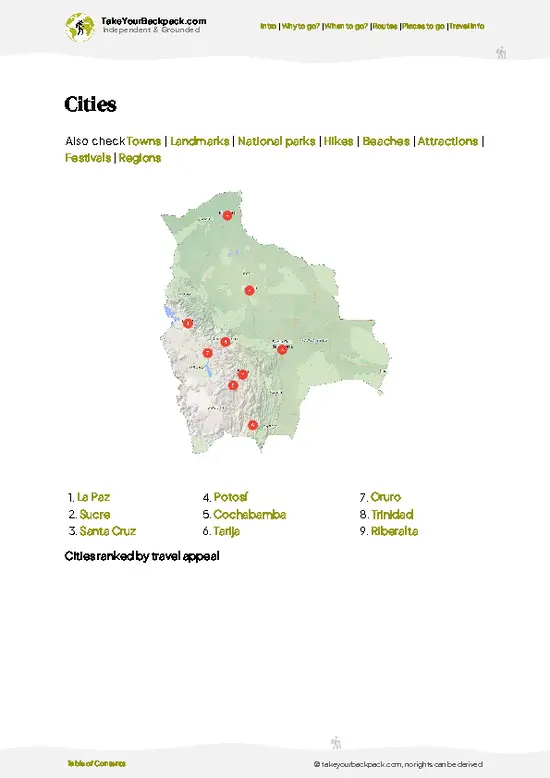
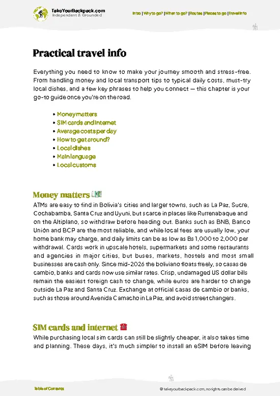
example page 0 from our offline Travel Guide for Bolivia
example page 1 from our offline Travel Guide for Bolivia
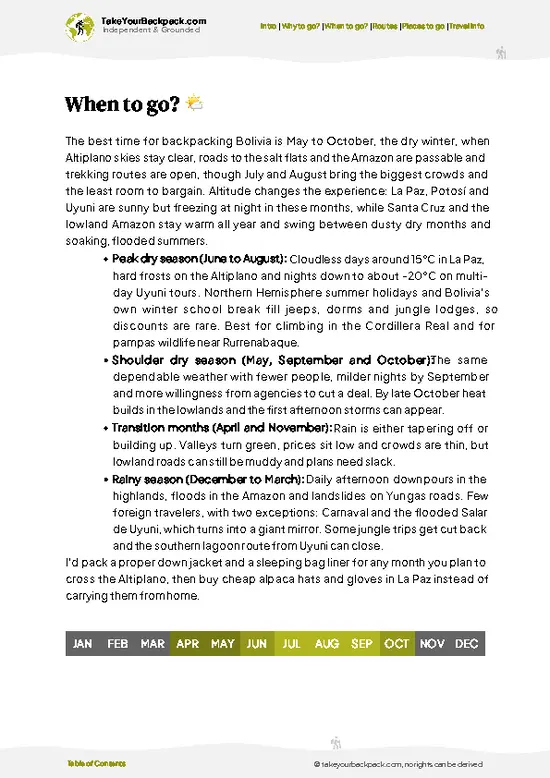
example page 2 from our offline Travel Guide for Bolivia
example page 3 from our offline Travel Guide for Bolivia
example page 4 from our offline Travel Guide for Bolivia
example page 5 from our offline Travel Guide for Bolivia
example page 6 from our offline Travel Guide for Bolivia
example page 7 from our offline Travel Guide for Bolivia
Loading the map 🌍
CLICK TO FILTER
cities
towns
landmarks
national parks
hikes
beaches
attractions
festivals
regions
SHOW COUNTRY’S BESTSHOW ALL

✨ Why go?
Ranked #2 hike in Bolivia
What makes it a must-see hike

Isla del Sol rewards walkers because the island packs the 8 km ridge trail between Challapampa and Yumani into one easy-to-plan day. You step off a boat from Copacabana, climb past Aymara farm terraces and descend to a village with a bed waiting. No vehicles run on the paths, so the only sounds are sheep bells, wind and your own breathing at altitude.

The trail is also the best way to meet the island’s Inca story. Locals say the sun was born here, and the Sacred Rock near Challapampa is where that tale lives. Ruins along the route give you history without a guided tour, and the walk is simple enough that you can split it over two days and sleep at either end.

For backpackers, the island fits neatly into a Titicaca loop between Copacabana and the Peruvian border. Lodging is basic and affordable, … read more 👉
Isla del Sol rewards walkers because the island packs the 8 km ridge trail between Challapampa and Yumani into one easy-to-plan day. You step off a boat from Copacabana, climb past Aymara farm terraces and descend to a village with a bed waiting. No vehicles run on the paths, so the only sounds are sheep bells, wind and your own breathing at altitude.

The trail is also the best way to meet the island’s Inca story. Locals say the sun was born here, and the Sacred Rock near Challapampa is where that tale lives. Ruins along the route give you history without a guided tour, and the walk is simple enough that you can split it over two days and sleep at either end.

For backpackers, the island fits neatly into a Titicaca loop between Copacabana and the Peruvian border. Lodging is basic and affordable, and you can leave big bags in town. Staying a night lets you see the Yumani Inca Stairway and the lake after the day boats have left, when the hillside quiets down and the water turns inky.

💡 HighlightsPlaces and moments you shouldn't skip

  1. Sacred Rock (Titikala): The island’s best-known sight, a pale outcrop above Challapampa tied to the Inca myth of the sun’s birth. A small entrance fee applies at the northern gate, and the area is worth 30 to 45 minutes.
  2. Chinkana Ruins: A labyrinth of low stone chambers and passages near the north end, built in Inca times. You can wander the narrow alleys and imagine how priests moved through them.
  3. Ridge Trail Viewpoints: Along the main path you get long looks over Titicaca toward the snowy Cordillera Real on clear days. The ridge is open and rocky, and it makes the walk memorable.
  4. Yumani Inca Stairway: A steep stone staircase climbing from the southern pier to the village, flanked by small cafés and a spring called the Fountain of Youth. Take the steps slowly because of the altitude.
  5. Pilko Kaina:
… read more 👉
  1. Sacred Rock (Titikala): The island’s best-known sight, a pale outcrop above Challapampa tied to the Inca myth of the sun’s birth. A small entrance fee applies at the northern gate, and the area is worth 30 to 45 minutes.
  2. Chinkana Ruins: A labyrinth of low stone chambers and passages near the north end, built in Inca times. You can wander the narrow alleys and imagine how priests moved through them.
  3. Ridge Trail Viewpoints: Along the main path you get long looks over Titicaca toward the snowy Cordillera Real on clear days. The ridge is open and rocky, and it makes the walk memorable.
  4. Yumani Inca Stairway: A steep stone staircase climbing from the southern pier to the village, flanked by small cafés and a spring called the Fountain of Youth. Take the steps slowly because of the altitude.
  5. Pilko Kaina: A well-preserved Inca palace on the southern shore, reached by a short walk from the pier area. Its tidy stone walls and views across the water make it a calm stop at the end of the day.
If you only see one thing on a first visit, make it the Sacred Rock and then walk the ridge south from there.
Spotted a mistake or missing something? Contact us.

🌤️ When to go?Weather, crowds, and seasonal trade-offs

  • Dry Season (May to September): Cold, bright days on Lake Titicaca at 3,800 meters. Daytime highs reach 15 to 18°C (59 to 64°F), and nights drop to around 0°C (32°F). Daylight runs about 11 hours, so start the north-south ridge walk by 8 a.m.
  • Shoulder Months (April, October, November): Fewer hikers, with showers mostly in the afternoon. Highs of 16 to 19°C (61 to 66°F). Guesthouse prices are often negotiable.
  • Wet Season (December to March): Rain falls most afternoons, and the stone paths turn slick. Highs of 14 to 17°C (57 to 63°F), nights near 4 to 6°C (39 to 43°F). Daylight stretches to about 13 hours, but cloud hides the Cordillera Real.
  • Holidays and Festivals: Late June around the Andean New Year (June 21) and the July to August school break bring the biggest crowds. Rooms in Yumani and Challapampa
… read more 👉
  • Dry Season (May to September): Cold, bright days on Lake Titicaca at 3,800 meters. Daytime highs reach 15 to 18°C (59 to 64°F), and nights drop to around 0°C (32°F). Daylight runs about 11 hours, so start the north-south ridge walk by 8 a.m.
  • Shoulder Months (April, October, November): Fewer hikers, with showers mostly in the afternoon. Highs of 16 to 19°C (61 to 66°F). Guesthouse prices are often negotiable.
  • Wet Season (December to March): Rain falls most afternoons, and the stone paths turn slick. Highs of 14 to 17°C (57 to 63°F), nights near 4 to 6°C (39 to 43°F). Daylight stretches to about 13 hours, but cloud hides the Cordillera Real.
  • Holidays and Festivals: Late June around the Andean New Year (June 21) and the July to August school break bring the biggest crowds. Rooms in Yumani and Challapampa cost more, and boats fill early.
Arrive on a weekday in June or September for clear weather with room on the trail.


source: climatestotravel.comJANJanuary: fair for travelingFEBFebruary: good for travelingMARMarch: fair for travelingAPRApril: fair for travelingMAYMay: highly recommended for travelingJUNJune: excellent for travelingJULJuly: highly recommended for travelingAUGAugust: highly recommended for travelingSEPSeptember: highly recommended for travelingOCTOctober: highly recommended for travelingNOVNovember: fair for travelingDECDecember: fair for traveling
bolivia-hike-isla-del-sol
© Google | Sagnik Saha

✈️ The backpacker research shortcutBolivia Travel Guide

An offline-friendly backpacking guide with optimized travel routes, ranked highlights, transport advice, and the best areas to stay.
example page 0 from our offline Travel Guide for Bolivia
example page 1 from our offline Travel Guide for Bolivia
example page 2 from our offline Travel Guide for Bolivia
example page 3 from our offline Travel Guide for Bolivia
example page 4 from our offline Travel Guide for Bolivia
example page 5 from our offline Travel Guide for Bolivia
example page 6 from our offline Travel Guide for Bolivia
example page 7 from our offline Travel Guide for Bolivia
The digital guide (262 pages) contains:
✅ 76 highlights, ranked by travel appeal
✅ Optimized 7, 14 & 21-day travel routes
✅ Cities, national parks, landmarks, beaches
✅ How to get around
✅ Offline-friendly for travel without Wi-Fi
👉 Click to see all 30+ guide features

📅 Plan smarter in minutes, not weeks
✅ Month by month travel advice
✅ Festivals & national holidays
✅ Budget expectations

🗺️ Go to the right places, skip the overrated ones
✅ Honest pros & cons of destinations
✅ Top hikes, parks & viewpoints
✅ Lesser-known places most travelers miss
✅ Clear “worth it vs skip it” guidance

🛏️ Travel smoothly without rookie mistakes
✅ Best areas to stay
✅ Transport systems explained simply
✅ Common scams & safety advice
✅ SIM cards, money & practical tips

🌍 Understand the country, not just visit it
✅ Culture & traditions
✅ 52 Essential phrases & customs
✅ Festivals worth planning around
✅ Traveler-friendly historical context
✅ Insights that make places more meaningful

📱 Built for real travel conditions
✅ Fully downloadable PDF
✅ Works completely offline
✅ Optimized for phone use
✅ Useful in remote areas & buses
✅ Everything in one place
Stop searching, start planning
Get instant access to your full guide. 30‑day money-back guarantee.
+ Add another guide for just

By proceeding you agree to our terms.
Sent to your inbox immediately after payment • 100% Secure Checkout
Best Backpacking Travel Advisor 2025 tourism awardBest Backpacking
Travel Advisor
2025
What others say about Take Your Backpack Guides:
⭐⭐⭐⭐⭐
Fantastic, amazing amount of information!
⭐⭐⭐⭐⭐
My goodness this is amazing, it's what I've been looking for hats off too you!
⭐⭐⭐⭐⭐
I think this is absolutely BRILLIANT
⭐⭐⭐⭐
Very complete and informative. It's still missing places, but I gotta to commend you
⭐⭐⭐⭐⭐
This is truly amazing, thank you, can't wait to explore it with my kids!
⭐⭐⭐⭐⭐
Awesome resource, thank you!
⭐⭐⭐⭐⭐
This is amazing! Can't wait to explore the ones I haven't seen
⭐⭐⭐⭐
I love this! Well done, great idea.
⭐⭐⭐⭐⭐
Thanks for taking the time to make this gem!
⭐⭐⭐⭐⭐
This might be the best website I've ever seen.
⭐⭐⭐⭐⭐
Congratulations, and thank you so much for your work; it's incredibly valuable.
⭐⭐⭐⭐
In all seriousness I think you did a great job pointing out the important spots
⭐⭐⭐⭐⭐
10/10 very good
⭐⭐⭐⭐⭐
As someone who's only just starting to visit regularly this is awesome, thank you.
⭐⭐⭐⭐
Thank you very much! I'm going to visit my dad, it's going to be very useful!
⭐⭐⭐⭐⭐
This is really cool! We'll be travelling for the first time and this definitely come in handy.
⭐⭐⭐⭐⭐
You are now our minister of culture, congratulations 👨‍💼
⭐⭐⭐⭐⭐
Just wanted to tell you that this is a pearl! Going to follow your recommendations.
⭐⭐⭐⭐⭐
This is so cool. I'll definitely be using the resource for my travels soon.
⭐⭐⭐⭐⭐
This is very impressive! Good work.
⭐⭐⭐⭐⭐
This is an amazing and informative site. Very well done!

🛏️ Where to stay?Where staying makes the most sense

If you enjoy meeting fellow travelers, consider choosing hostels with high ratings for atmosphere. On the other hand, if you prefer having your own space, a hotel might be a better option.

🥾 Hike detailsKey facts about the Isla del Sol hike

Isla del Sol offers a one-way trek of about 8 to 10 km between its northern and southern ends, using the old Inca footpath along the ridge.
Total Distance: Around 8 to 10 km one way from Challapampa to Yumani.
Duration: 3 to 4 hours of walking, plus stops for ruins and views.
Difficulty: Easy to moderate. The path is wide and well worn, but the altitude of roughly 3,800 meters slows most walkers.
Starting Point: Boats run from Copacabana to either Challapampa in the north or Yumani in the south. Most hikers start in the north so the longer climbs come early and the finish ends in a village with food
… read more 👉
Isla del Sol offers a one-way trek of about 8 to 10 km between its northern and southern ends, using the old Inca footpath along the ridge.
Total Distance: Around 8 to 10 km one way from Challapampa to Yumani.
Duration: 3 to 4 hours of walking, plus stops for ruins and views.
Difficulty: Easy to moderate. The path is wide and well worn, but the altitude of roughly 3,800 meters slows most walkers.
Starting Point: Boats run from Copacabana to either Challapampa in the north or Yumani in the south. Most hikers start in the north so the longer climbs come early and the finish ends in a village with food and beds.
Major Landmarks:
  • Challapampa: The northern village, with a small museum and the Sacred Rock nearby.
  • Chinkana Ruins: Stone chambers near the northern end.
  • Ridge Path: The high central section with views of both sides of the lake.
  • Yumani: The southern village, with its stairway and small hostels.
Terrain and Scenery: Dry, rocky tracks and stone steps climb past agricultural terraces and open slopes. Water stretches on both sides, and the Bolivian and Peruvian shores show in the distance.
Vegetation: Low scrub, eucalyptus groves, and terraced fields of potatoes, corn and beans.
Wildlife: Mostly sheep, llamas, donkeys and a variety of Andean birds along the shoreline.
⚠️ Hiking info can sometimes be outdated or inaccurate. Before you hit the trail, check the latest conditions with locals. If you do spot anything that's off, I'd love to hear from you, so I can update it for fellow travelers.

🛡️ SafetySafety Tips and Common Scams in Isla del Sol

The trail along Isla del Sol’s spine is a well-worn, mostly gentle path, and the main challenge is altitude. At roughly 3,800 to 4,000 meters, the climbs from Yumani and Challapampa leave first-timers breathless, so walk slowly, drink plenty of water and spend a night in La Paz or Copacabana before going up. Sun is intense at this elevation, so bring SPF 50, a hat and sunglasses. Nights drop to freezing, and a warm layer and sleeping bag liner matter even in guesthouses without heating. Paths are rocky with some steep stone steps, so wear sturdy shoes. Communities on the island sometimes charge a small entry fee for each section, so carry small bills in cash. Water is not safe from taps; bring purification. Do not leave valuables unattended on the beach. Livestock such as llamas and donkeys … read more 👉
The trail along Isla del Sol’s spine is a well-worn, mostly gentle path, and the main challenge is altitude. At roughly 3,800 to 4,000 meters, the climbs from Yumani and Challapampa leave first-timers breathless, so walk slowly, drink plenty of water and spend a night in La Paz or Copacabana before going up. Sun is intense at this elevation, so bring SPF 50, a hat and sunglasses. Nights drop to freezing, and a warm layer and sleeping bag liner matter even in guesthouses without heating. Paths are rocky with some steep stone steps, so wear sturdy shoes. Communities on the island sometimes charge a small entry fee for each section, so carry small bills in cash. Water is not safe from taps; bring purification. Do not leave valuables unattended on the beach. Livestock such as llamas and donkeys share the path, so step aside and give them room. Local etiquette: ask before photographing people.

FAQFrequently asked questions about Isla del Sol

Most hikers walk Isla del Sol’s north-to-south trail in 3 to 4 hours one way, covering about 8 kilometers between Challapampa and Yumani. A common plan is a one-night stay, with ferries running from Copacabana in about 1.5 to 2 hours (roughly US$3 to 6). Day trippers often take a boat to the north, hike south and catch a late return boat.
Moderate, mostly because of altitude at roughly 3,800 to 4,100 meters rather than technical terrain. Isla del Sol’s ridge trail has a total ascent of about 300 to 500 meters, with rocky steps and exposed stretches. Fit beginners manage it with slow pacing and breaks, ideally after acclimatizing for a day in Copacabana.
No guide is needed, since the main trail on Isla del Sol is clear and easy to follow. There is no national permit, but local communities charge entry fees at the north, center and south, roughly US$1 to 3 each, paid in cash. Guides are optional for history and ruins such as the Chinkana and Inca Stairs, and cost about US$15 to 30.
⚠️ Things can change over time, so always validate details locally before you go.

Other Bolivian hikes near Isla del Sol

Explore more nearby:

  • Sorata to San Pedro—Cave lake, downhill dirt road, coffee and citrus slopes, 15 km one way| 63 km away
  • Laguna Glaciar—Glacial lake at 5,038 m, Illampu and Janko Uma, mule-supported trek, Laguna Chillata camp| 69 km away
  • Choro Trail—Inca cobbles, 3,000 m descent, cloud forest to Yungas| 125 km away

💡 Not sure where to go next?
Create a personalized itinerary for Bolivia including Isla del Sol and the places that fit your trip.

Generate my itinerary

👉 Discover all hikes

Or checkout all Bolivia has to offer (think cities, towns, villages, national parks, hikes, beaches, festivals)
Country photo of Bolivia

We 💚 feedbackKey takeaways before you go

Many travelers rush the walk as a half-day dash between boats and miss the best light and quiet. Stay a night, start early and walk north to south with a full water bottle. I would also skip the main-trail tollbooth stalls for lunch and eat in Yumani instead.

✈️ When did I visit Bolivia?
Bolivia I visited during my half year trip through South and Central America back in 2003

✍️ Help improve this page!
The information on this page is based on my own backpacking experience in Bolivia, supplemented with up-to-date research and feedback from other travelers. Travel details can change, so if you notice anything outdated or incomplete, feel free to let me know.


🙋‍♂️ Give feedback

👋 Meet the founderWho’s Behind Take Your Backpack?

Johan, backpacker and founder of TakeYourBackpackHi, I’m Johan (Netherlands 🇳🇱), the creator of TakeYourBackpack. Over the past 3 decades, I’ve backpacked through 90+ countries across six continents, gaining extensive experience with independent travel, long-term trips, and overland routes.

This site is built on a combination of firsthand travel experience and carefully curated insights from other backpackers. Many guides are based on places I’ve personally visited, while others bring together tips, observations, and practical advice shared by trusted travelers I’ve met along the way.

The goal is to provide realistic, experience-driven guidance — not generic itineraries — so you can explore destinations with better context, clearer expectations, and more confidence.