×

Bolivia🇧🇴 | hikesLaguna GlaciarGlacial lake at 5,038 m, Illampu and Janko Uma, mule-supported trek, Laguna Chillata camp | things to do and best time to go

Explore Isla del SolExplore Sorata to San Pedro

Backpacking in Laguna Glaciar
👌 Worth visitinghike ranked #4
By Johan Kruseman 🇳🇱 | Updated October 19, 2026

Laguna Glaciar gives you a high Andean lake at about 5,038 meters with a mule-supported route that keeps your pack light. It sits in the north of Bolivia, in the Cordillera Real above Sorata, tucked beneath Illampu and Janko Uma. The trek takes 2 to 3 days from Sorata, climbing past Laguna Chillata at roughly 4,200 meters, so you get green valleys, rock walls, hanging ice and turquoise water in one push. The upside is raw scenery and almost no crowds. The downside is real altitude, steep trail and cold camps. Sorata is reachable by shared minibus from La Paz, but the trailhead needs a local arrangement. I still connect this place with the clatter of mule bells rattling up the stony slope ahead of me, a sound that carried across the whole valley. Hire a local guide or arreiro in Sorata, and give yourself time to acclimatize first.

Discover everything you want to know in the 📖 Bolivia Travel Guide.
Best time to go: May - October
Duration: 3 days
Distance: 35 kilometers
Total ascent: 1800 meters


example page 0 from our offline Travel Guide for Bolivia
example page 1 from our offline Travel Guide for Bolivia
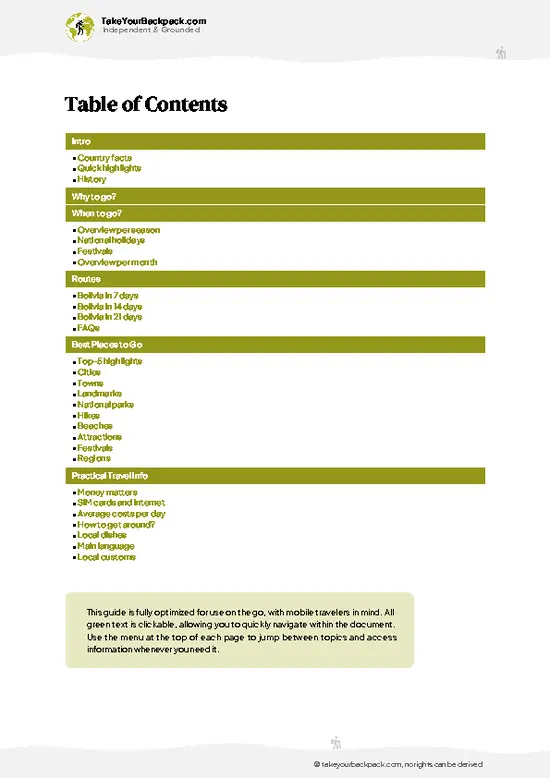
example page 2 from our offline Travel Guide for Bolivia
example page 3 from our offline Travel Guide for Bolivia
example page 4 from our offline Travel Guide for Bolivia
example page 5 from our offline Travel Guide for Bolivia
example page 6 from our offline Travel Guide for Bolivia
example page 7 from our offline Travel Guide for Bolivia
Loading the map 🌍
CLICK TO FILTER
cities
towns
landmarks
national parks
hikes
beaches
attractions
festivals
regions
SHOW COUNTRY’S BESTSHOW ALL

✨ Why go?
Ranked #4 hike in Bolivia
Reasons people choose to hike the here

Laguna Glaciar is the reason trekkers pick Sorata over the busier Huayna Potosí circuit. The lake lies at about 5,038 meters, directly under the ice walls of Illampu and Janko Uma, and you reach it without technical climbing. That is a big prize for a trek of only 2 to 3 days.
The second pull is the setup. Sorata is a laid-back town with local guides and muleteers who haul your gear, so you walk with a day pack and save your legs for the thin air. Hiring mules is a normal way to do it here, not a luxury, and it spreads your money into village hands.
It also fits a longer Bolivian loop. You can come from La Paz, trek for a few days, then drop back toward Lake Titicaca or carry on into the Cordillera Real. Few high-altitude lakes in the country feel this remote while staying this reachable.

💡 HighlightsPlaces and moments you shouldn't skip

  1. Laguna Glaciar: The main target, a glacial lake at about 5,038 meters. Its water sits directly below hanging glaciers, and the surrounding moraine is stark, gray and silent.
  2. Illampu: The huge peak that looms over the route. Its glaciated faces dominate the skyline for much of the climb and make every rest stop a photo stop.
  3. Janko Uma: The neighboring glaciated massif above the lake. Its name relates to white water, and meltwater streams pour from its slopes into the valley below.
  4. Laguna Chillata: A mid-route lake at about 4,200 meters, and the usual camp. It is a calm stop where you can settle in, watch the light change on the ridges and prepare for the higher ground.
  5. Sorata valley approach: The trek begins in a warm, green valley and climbs steadily into rock and ice. You pass terraced farms,
… read more 👉
  1. Laguna Glaciar: The main target, a glacial lake at about 5,038 meters. Its water sits directly below hanging glaciers, and the surrounding moraine is stark, gray and silent.
  2. Illampu: The huge peak that looms over the route. Its glaciated faces dominate the skyline for much of the climb and make every rest stop a photo stop.
  3. Janko Uma: The neighboring glaciated massif above the lake. Its name relates to white water, and meltwater streams pour from its slopes into the valley below.
  4. Laguna Chillata: A mid-route lake at about 4,200 meters, and the usual camp. It is a calm stop where you can settle in, watch the light change on the ridges and prepare for the higher ground.
  5. Sorata valley approach: The trek begins in a warm, green valley and climbs steadily into rock and ice. You pass terraced farms, small stone houses and fast streams, so the shift from cultivated land to high desert is striking.
For a first visit, make Laguna Glaciar itself the focus, since the lake is the reason the route exists.
Spotted a mistake or missing something? Contact us.

Things to do near Laguna Glaciar

Ratings based on Tripadvisor reviews. When you book through this link, you support our work at no extra cost to you.

🌤️ When to go?Choosing the right time of year

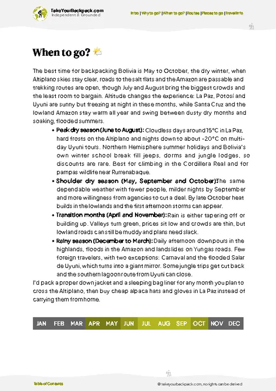
  • Dry Season (May to September): This is the window for Laguna Glaciar, with clear skies and stable trail conditions. Days at Sorata (about 2,700 m) run 18 to 24°C (64 to 75°F), while nights at Laguna Chillata and the glacial lake drop to -10 to -2°C (14 to 28°F). Daylight is short, so start walking early. June to August brings the most trekkers and the highest mule and guide demand.
  • Shoulder Months (April, October): Fewer people, mostly good weather, and occasional afternoon cloud or snow at altitude. Highs in the valley reach 20 to 25°C (68 to 77°F). Prices for guides and muleteers are usually negotiable.
  • Wet Season (November to March): Rain turns the valley paths to mud, cloud hides Illampu and Janko Uma, and snow can cover the high passes. Daytime temperatures hover around 12 to 20°C (54 to
… read more 👉
  • Dry Season (May to September): This is the window for Laguna Glaciar, with clear skies and stable trail conditions. Days at Sorata (about 2,700 m) run 18 to 24°C (64 to 75°F), while nights at Laguna Chillata and the glacial lake drop to -10 to -2°C (14 to 28°F). Daylight is short, so start walking early. June to August brings the most trekkers and the highest mule and guide demand.
  • Shoulder Months (April, October): Fewer people, mostly good weather, and occasional afternoon cloud or snow at altitude. Highs in the valley reach 20 to 25°C (68 to 77°F). Prices for guides and muleteers are usually negotiable.
  • Wet Season (November to March): Rain turns the valley paths to mud, cloud hides Illampu and Janko Uma, and snow can cover the high passes. Daytime temperatures hover around 12 to 20°C (54 to 68°F) in the lower valley and near freezing up high. Few groups go, so services can be hard to find.
Book your Sorata guide and mules a few days ahead in June to August, and aim for a mid-week start to find fewer groups on the trail.


source: climatestotravel.comJANJanuary: below average for travelingFEBFebruary: below average for travelingMARMarch: fair for travelingAPRApril: fair for travelingMAYMay: highly recommended for travelingJUNJune: excellent for travelingJULJuly: excellent for travelingAUGAugust: excellent for travelingSEPSeptember: highly recommended for travelingOCTOctober: good for travelingNOVNovember: fair for travelingDECDecember: below average for traveling
bolivia-hike-laguna-glaciar
© Google | Katleen Lodewyckx

✈️ The backpacker research shortcutBolivia Travel Guide

An offline-friendly backpacking guide with optimized travel routes, ranked highlights, transport advice, and the best areas to stay.
example page 0 from our offline Travel Guide for Bolivia
example page 1 from our offline Travel Guide for Bolivia
example page 2 from our offline Travel Guide for Bolivia
example page 3 from our offline Travel Guide for Bolivia
example page 4 from our offline Travel Guide for Bolivia
example page 5 from our offline Travel Guide for Bolivia
example page 6 from our offline Travel Guide for Bolivia
example page 7 from our offline Travel Guide for Bolivia
The digital guide (262 pages) contains:
✅ 76 highlights, ranked by travel appeal
✅ Optimized 7, 14 & 21-day travel routes
✅ Cities, national parks, landmarks, beaches
✅ How to get around
✅ Offline-friendly for travel without Wi-Fi
👉 Click to see all 30+ guide features

📅 Plan smarter in minutes, not weeks
✅ Month by month travel advice
✅ Festivals & national holidays
✅ Budget expectations

🗺️ Go to the right places, skip the overrated ones
✅ Honest pros & cons of destinations
✅ Top hikes, parks & viewpoints
✅ Lesser-known places most travelers miss
✅ Clear “worth it vs skip it” guidance

🛏️ Travel smoothly without rookie mistakes
✅ Best areas to stay
✅ Transport systems explained simply
✅ Common scams & safety advice
✅ SIM cards, money & practical tips

🌍 Understand the country, not just visit it
✅ Culture & traditions
✅ 52 Essential phrases & customs
✅ Festivals worth planning around
✅ Traveler-friendly historical context
✅ Insights that make places more meaningful

📱 Built for real travel conditions
✅ Fully downloadable PDF
✅ Works completely offline
✅ Optimized for phone use
✅ Useful in remote areas & buses
✅ Everything in one place
Stop searching, start planning
Get instant access to your full guide. 30‑day money-back guarantee.
+ Add another guide for just

By proceeding you agree to our terms.
Sent to your inbox immediately after payment • 100% Secure Checkout
Best Backpacking Travel Advisor 2025 tourism awardBest Backpacking
Travel Advisor
2025
What others say about Take Your Backpack Guides:
⭐⭐⭐⭐⭐
Fantastic, amazing amount of information!
⭐⭐⭐⭐⭐
My goodness this is amazing, it's what I've been looking for hats off too you!
⭐⭐⭐⭐⭐
I think this is absolutely BRILLIANT
⭐⭐⭐⭐
Very complete and informative. It's still missing places, but I gotta to commend you
⭐⭐⭐⭐⭐
This is truly amazing, thank you, can't wait to explore it with my kids!
⭐⭐⭐⭐⭐
Awesome resource, thank you!
⭐⭐⭐⭐⭐
This is amazing! Can't wait to explore the ones I haven't seen
⭐⭐⭐⭐
I love this! Well done, great idea.
⭐⭐⭐⭐⭐
Thanks for taking the time to make this gem!
⭐⭐⭐⭐⭐
This might be the best website I've ever seen.
⭐⭐⭐⭐⭐
Congratulations, and thank you so much for your work; it's incredibly valuable.
⭐⭐⭐⭐
In all seriousness I think you did a great job pointing out the important spots
⭐⭐⭐⭐⭐
10/10 very good
⭐⭐⭐⭐⭐
As someone who's only just starting to visit regularly this is awesome, thank you.
⭐⭐⭐⭐
Thank you very much! I'm going to visit my dad, it's going to be very useful!
⭐⭐⭐⭐⭐
This is really cool! We'll be travelling for the first time and this definitely come in handy.
⭐⭐⭐⭐⭐
You are now our minister of culture, congratulations 👨‍💼
⭐⭐⭐⭐⭐
Just wanted to tell you that this is a pearl! Going to follow your recommendations.
⭐⭐⭐⭐⭐
This is so cool. I'll definitely be using the resource for my travels soon.
⭐⭐⭐⭐⭐
This is very impressive! Good work.
⭐⭐⭐⭐⭐
This is an amazing and informative site. Very well done!

🛏️ Where to stay?Where staying makes the most sense

If you enjoy meeting fellow travelers, consider choosing hostels with high ratings for atmosphere. On the other hand, if you prefer having your own space, a hotel might be a better option.

🥾 Hike detailsEverything you need to know before hiking Laguna Glaciar

Total Distance: Laguna Glaciar is reached on a route of roughly 30 to 40 kilometers round trip from Sorata, depending on the exact trailhead.
Duration: Plan 2 to 3 days, with a camp at Laguna Chillata.
Difficulty: Demanding, mainly because of altitude. The lake sits at about 5,038 meters, and the steep, rocky final stretch is slow going.
Starting Point: Sorata, in the Cordillera Real. Shared minibuses run from La Paz to the town, and from there you arrange transport or walk to the trailhead, often with a local guide and mules.
Major Landmarks:
  • Laguna Chillata: About 4,200 meters, the usual overnight
… read more 👉
Total Distance: Laguna Glaciar is reached on a route of roughly 30 to 40 kilometers round trip from Sorata, depending on the exact trailhead.
Duration: Plan 2 to 3 days, with a camp at Laguna Chillata.
Difficulty: Demanding, mainly because of altitude. The lake sits at about 5,038 meters, and the steep, rocky final stretch is slow going.
Starting Point: Sorata, in the Cordillera Real. Shared minibuses run from La Paz to the town, and from there you arrange transport or walk to the trailhead, often with a local guide and mules.
Major Landmarks:
  • Laguna Chillata: About 4,200 meters, the usual overnight camp.
  • Illampu: The dominant glaciated peak above the route.
  • Janko Uma: The adjacent massif feeding the lake.
  • Laguna Glaciar: The high turquoise lake at the end of the climb.
Terrain and Scenery: The path climbs from farmland through steep valleys, then onto loose rock, moraine and scree. Expect hanging glaciers, cold streams and wide views back toward the valley.
Vegetation: Terraced fields and scrub near Sorata give way to hardy grasses and bare rock higher up. Above the lakes there is almost nothing growing.
Wildlife: Mules and llamas are common near the lower trail. Look for Andean birds around the lakes, and the occasional vizcacha among the boulders.
⚠️ Hiking info can sometimes be outdated or inaccurate. Before you hit the trail, check the latest conditions with locals. If you do spot anything that's off, I'd love to hear from you, so I can update it for fellow travelers.

🛡️ SafetySafety Tips and Common Scams in Laguna Glaciar

The main risk at Laguna Glaciar is altitude, since the lake sits at about 5,038 m and the trek climbs from Sorata through Laguna Chillata at roughly 4,200 m. Spend a couple of days acclimatizing in La Paz or Sorata first, walk slowly, drink plenty of water, and turn back or descend if headache or nausea worsens. Nights are bitterly cold, so bring a sleeping bag rated well below freezing, a warm hat, and waterproof layers, because afternoon snow or sleet can arrive quickly. Footing on the upper stretches is loose rock and steep, and cloud can obscure the path, so carry an offline map or GPS track, or hire a local guide who knows the route. Streams can swell after rain. Wildlife is minimal beyond llamas and the odd condor, so the real hazards are cold and thin air. Carry a water filter and a … read more 👉
The main risk at Laguna Glaciar is altitude, since the lake sits at about 5,038 m and the trek climbs from Sorata through Laguna Chillata at roughly 4,200 m. Spend a couple of days acclimatizing in La Paz or Sorata first, walk slowly, drink plenty of water, and turn back or descend if headache or nausea worsens. Nights are bitterly cold, so bring a sleeping bag rated well below freezing, a warm hat, and waterproof layers, because afternoon snow or sleet can arrive quickly. Footing on the upper stretches is loose rock and steep, and cloud can obscure the path, so carry an offline map or GPS track, or hire a local guide who knows the route. Streams can swell after rain. Wildlife is minimal beyond llamas and the odd condor, so the real hazards are cold and thin air. Carry a water filter and a basic first aid kit, and tell your hostel your return date.

FAQTraveler FAQ

Most trekkers allow 2 to 3 days from Sorata to reach Laguna Glaciar and return, camping near Laguna Chillata (about 4,200 m) on the way. The final climb to the lake at about 5,038 m takes several hours from the camp. Walking time is roughly 5 to 8 hours on each main day, depending on pace and acclimatization.
Laguna Glaciar is a demanding high-altitude trek rather than a casual walk. The route gains well over 2,000 m from Sorata, with steep sections, loose rock near the lake, and cold nights above 4,000 m. Good fitness and a couple of days of acclimatization in La Paz or Sorata make it far more manageable, and mules can carry your heavy gear.
A guide is not legally required for Laguna Glaciar, but most trekkers hire one in Sorata because the route is poorly marked and cloud can hide the path. Expect to pay roughly US$40 to 70 per day for a guide, plus about US$15 to 25 per mule per day. Community entry fees may be collected along the way, usually a few US dollars, and no formal permit is needed beyond that.
⚠️ Things can change over time, so always validate details locally before you go.

Other Bolivian hikes near Laguna Glaciar

Explore more nearby:

  • Sorata to San Pedro—Cave lake, downhill dirt road, coffee and citrus slopes, 15 km one way| 11 km away
  • Isla del Sol—Island ridge walk, Titikala rock, Inca stairway| 69 km away
  • Choro Trail—Inca cobbles, 3,000 m descent, cloud forest to Yungas| 77 km away

💡 Not sure where to go next?
Create a personalized itinerary for Bolivia including Laguna Glaciar and the places that fit your trip.

Generate my itinerary

👉 Discover all hikes

Or checkout all Bolivia has to offer (think cities, towns, villages, national parks, hikes, beaches, festivals)
Country photo of Bolivia

We 💚 feedbackWhat to keep in mind

Laguna Glaciar suits fit walkers who already have a few days at altitude behind them and want a quiet Cordillera Real objective without ropes or crowds. If that is you, I would hire a Sorata muleteer, carry a warm sleeping bag and take the full three days.

✈️ When did I visit Bolivia?
Bolivia I visited during my half year trip through South and Central America back in 2003

✍️ Help improve this page!
The information on this page is based on my own backpacking experience in Bolivia, supplemented with up-to-date research and feedback from other travelers. Travel details can change, so if you notice anything outdated or incomplete, feel free to let me know.


🙋‍♂️ Give feedback

👋 Meet the founderWho’s Behind Take Your Backpack?

Johan, backpacker and founder of TakeYourBackpackHi, I’m Johan (Netherlands 🇳🇱), the creator of TakeYourBackpack. Over the past 3 decades, I’ve backpacked through 90+ countries across six continents, gaining extensive experience with independent travel, long-term trips, and overland routes.

This site is built on a combination of firsthand travel experience and carefully curated insights from other backpackers. Many guides are based on places I’ve personally visited, while others bring together tips, observations, and practical advice shared by trusted travelers I’ve met along the way.

The goal is to provide realistic, experience-driven guidance — not generic itineraries — so you can explore destinations with better context, clearer expectations, and more confidence.