×

Brazil🇧🇷 | national parksPico da Neblina National ParkBrazil’s highest peak, Yanomami approach, tepui cloud forest, permit-only trek | things to do and best time to go

Explore Abrolhos Marine National ParkExplore Serra do Divisor National Park

Backpacking in Pico da Neblina
👀 For curious travelersnational park ranked #28
By Johan Kruseman 🇳🇱 | Updated October 19, 2026

Brazil’s highest mountain is Pico da Neblina at 2,995 meters, and it sits in the far northwest Amazon, in the state of Amazonas on the Venezuelan border, far from any road. Skip the idea of a casual visit: access is by permit and tour only. I once showed up with no clearance and lost days waiting. Arrange permits through the Yanomami-area authorities and ICMBio early. The reward is cloud forest, tepuis and almost no crowds.

Discover everything you want to know in the 📖 Brazil Travel Guide.


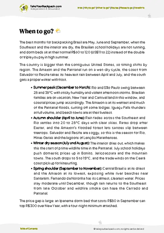
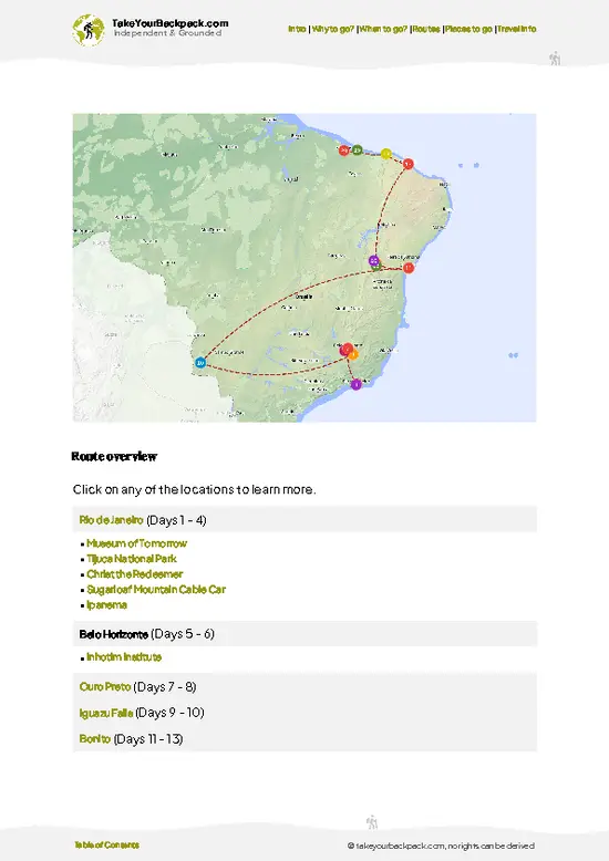
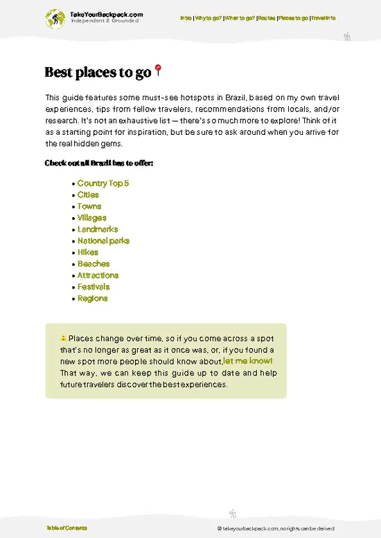
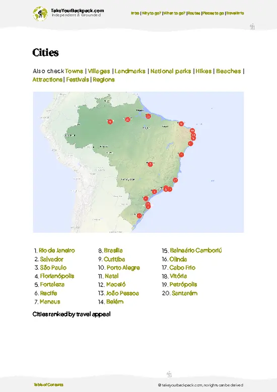
example page 0 from our offline Travel Guide for Brazil
example page 1 from our offline Travel Guide for Brazil
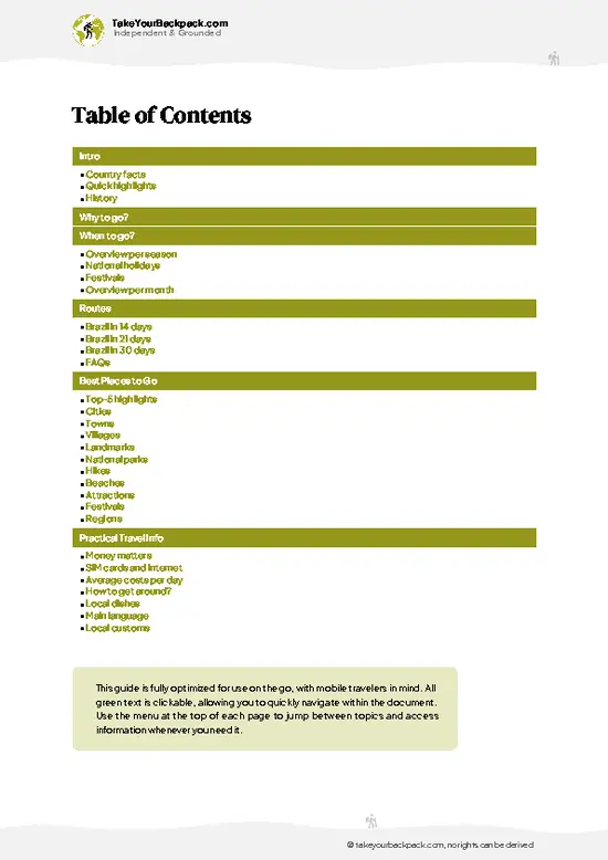
example page 2 from our offline Travel Guide for Brazil
example page 3 from our offline Travel Guide for Brazil
example page 4 from our offline Travel Guide for Brazil
example page 5 from our offline Travel Guide for Brazil
example page 6 from our offline Travel Guide for Brazil
example page 7 from our offline Travel Guide for Brazil
Loading the map 🌍
CLICK TO FILTER
cities
towns
villages
landmarks
national parks
hikes
beaches
attractions
festivals
regions
SHOW COUNTRY’S BESTSHOW ALL

✨ Why go?
Ranked #28 national park in Brazil
What makes it a must-see national park

Pico da Neblina National Park draws backpackers who want a true expedition, not a marked loop. The summit trek from the Yanomami community of Maturacá climbs through lowland rainforest into cloud forest, with Pico 31 de Março and the Neblina massif as the goal. Gear is carried by indigenous porters and guides, so you are not truly independent, but the remoteness is the point. Camps are basic, wildlife is rich, and you see almost no other hikers, which suits those who value solitude over comfort.

💡 HighlightsThe experiences that define the visit

  1. Pico da Neblina summit: Brazil’s highest point at 2,995 meters, reached after a multi-day climb, with views over cloud-filled valleys and the Venezuelan frontier.
  2. Pico 31 de Março: Brazil’s second-highest peak, next to the main summit, often climbed in the same expedition.
  3. Cloud forest and tepui vegetation: stunted, mossy trees, orchids and carnivorous plants thrive on the damp upper slopes.
  4. Maturacá community: Yanomami village near the trailhead where guides and porters are arranged, with access to the culture of the region.
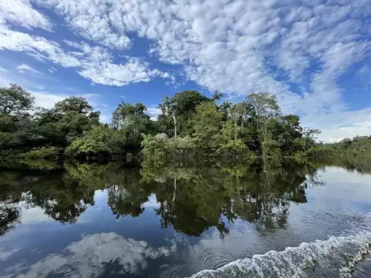
  5. Rio Cauaburi: the blackwater river used on the approach, with sandy banks and thick forest on either side.
  6. Wildlife: birds, monkeys and amphibians appear along the climb, including species found only in these highlands.
  7. Acampamento Garimpo: a high-altitude camp on the route
… read more 👉
  1. Pico da Neblina summit: Brazil’s highest point at 2,995 meters, reached after a multi-day climb, with views over cloud-filled valleys and the Venezuelan frontier.
  2. Pico 31 de Março: Brazil’s second-highest peak, next to the main summit, often climbed in the same expedition.
  3. Cloud forest and tepui vegetation: stunted, mossy trees, orchids and carnivorous plants thrive on the damp upper slopes.
  4. Maturacá community: Yanomami village near the trailhead where guides and porters are arranged, with access to the culture of the region.
  5. Rio Cauaburi: the blackwater river used on the approach, with sandy banks and thick forest on either side.
  6. Wildlife: birds, monkeys and amphibians appear along the climb, including species found only in these highlands.
  7. Acampamento Garimpo: a high-altitude camp on the route where hikers stage for the final push.
The summit and Pico 31 de Março combine well in one day for strong hikers staying at a high camp.
Spotted a mistake or missing something? Contact us.

🌤️ When to go?Seasonal considerations and timing

  • Drier Months (roughly September to February): Rain still falls, but the summit trail is most feasible. Days run about 22 to 30°C (72 to 86°F), nights on the peak drop to roughly 8 to 12°C (46 to 54°F).
  • Wet Months (March to August): Heavy rain swells rivers, trails turn to mud, and the summit sits in cloud most days. Permits and boat transfers are harder to arrange.
  • Crowds and Prices: Visitor numbers stay tiny all year, and day length hardly changes near the equator, about 12 hours.
Book your permit and guide months ahead, since expeditions run only in limited windows.

source: climatestotravel.comJANJanuary: fair for travelingFEBFebruary: fair for travelingMARMarch: fair for travelingAPRApril: fair for travelingMAYMay: fair for travelingJUNJune: excellent for travelingJULJuly: excellent for travelingAUGAugust: excellent for travelingSEPSeptember: excellent for travelingOCTOctober: excellent for travelingNOVNovember: excellent for travelingDECDecember: excellent for traveling
when-to-go

✈️ The backpacker research shortcutBrazil Travel Guide

An offline-friendly backpacking guide with optimized travel routes, ranked highlights, transport advice, and the best areas to stay.
example page 0 from our offline Travel Guide for Brazil
example page 1 from our offline Travel Guide for Brazil
example page 2 from our offline Travel Guide for Brazil
example page 3 from our offline Travel Guide for Brazil
example page 4 from our offline Travel Guide for Brazil
example page 5 from our offline Travel Guide for Brazil
example page 6 from our offline Travel Guide for Brazil
example page 7 from our offline Travel Guide for Brazil
The digital guide (410 pages) contains:
✅ 146 highlights, ranked by travel appeal
✅ Optimized 14, 21 & 30-day travel routes
✅ Cities, national parks, landmarks, beaches
✅ How to get around
✅ Offline-friendly for travel without Wi-Fi
👉 Click to see all 30+ guide features

📅 Plan smarter in minutes, not weeks
✅ Month by month travel advice
✅ Festivals & national holidays
✅ Budget expectations

🗺️ Go to the right places, skip the overrated ones
✅ Honest pros & cons of destinations
✅ Top hikes, parks & viewpoints
✅ Lesser-known places most travelers miss
✅ Clear “worth it vs skip it” guidance

🛏️ Travel smoothly without rookie mistakes
✅ Best areas to stay
✅ Transport systems explained simply
✅ Common scams & safety advice
✅ SIM cards, money & practical tips

🌍 Understand the country, not just visit it
✅ Culture & traditions
✅ 52 Essential phrases & customs
✅ Festivals worth planning around
✅ Traveler-friendly historical context
✅ Insights that make places more meaningful

📱 Built for real travel conditions
✅ Fully downloadable PDF
✅ Works completely offline
✅ Optimized for phone use
✅ Useful in remote areas & buses
✅ Everything in one place
Stop searching, start planning
Get instant access to your full guide. 30‑day money-back guarantee.
+ Add another guide for just

By proceeding you agree to our terms.
Sent to your inbox immediately after payment • 100% Secure Checkout
Best Backpacking Travel Advisor 2025 tourism awardBest Backpacking
Travel Advisor
2025
What others say about Take Your Backpack Guides:
⭐⭐⭐⭐⭐
Fantastic, amazing amount of information!
⭐⭐⭐⭐⭐
My goodness this is amazing, it's what I've been looking for hats off too you!
⭐⭐⭐⭐⭐
I think this is absolutely BRILLIANT
⭐⭐⭐⭐
Very complete and informative. It's still missing places, but I gotta to commend you
⭐⭐⭐⭐⭐
This is truly amazing, thank you, can't wait to explore it with my kids!
⭐⭐⭐⭐⭐
Awesome resource, thank you!
⭐⭐⭐⭐⭐
This is amazing! Can't wait to explore the ones I haven't seen
⭐⭐⭐⭐
I love this! Well done, great idea.
⭐⭐⭐⭐⭐
Thanks for taking the time to make this gem!
⭐⭐⭐⭐⭐
This might be the best website I've ever seen.
⭐⭐⭐⭐⭐
Congratulations, and thank you so much for your work; it's incredibly valuable.
⭐⭐⭐⭐
In all seriousness I think you did a great job pointing out the important spots
⭐⭐⭐⭐⭐
10/10 very good
⭐⭐⭐⭐⭐
As someone who's only just starting to visit regularly this is awesome, thank you.
⭐⭐⭐⭐
Thank you very much! I'm going to visit my dad, it's going to be very useful!
⭐⭐⭐⭐⭐
This is really cool! We'll be travelling for the first time and this definitely come in handy.
⭐⭐⭐⭐⭐
You are now our minister of culture, congratulations 👨‍💼
⭐⭐⭐⭐⭐
Just wanted to tell you that this is a pearl! Going to follow your recommendations.
⭐⭐⭐⭐⭐
This is so cool. I'll definitely be using the resource for my travels soon.
⭐⭐⭐⭐⭐
This is very impressive! Good work.
⭐⭐⭐⭐⭐
This is an amazing and informative site. Very well done!

🛏️ Where to stay?Best areas to stay in Brazil

No hotels or lodges operate inside Pico da Neblina National Park, so camping is the only option, usually at established sites along the climb such as Garimpo and Camp Rio Tucano arranged through your guide. The base town is São Gabriel da Cachoeira, about 4 to 5 hours by road and river from the trailhead region near Maturacá. There you find simple pousadas and small hotels, roughly US$25 to 60 a night, with fans or air-conditioning and basic breakfast. Hammock lodging is common in the area. Book ahead during the drier months, when expedition groups fill the few decent rooms.

👛 Costs (as of 19 October 2026)What things cost and how to budget

Plan on roughly US$90 to 185 a day for Pico da Neblina National Park, because the trek must be organized through a guide and logistics are remote.
CategoryBudget RangeLocal Reality
Entrance and permitsUS$10 to 25Park and FUNAI authorization are handled through your operator
AccommodationUS$25 to 60Pousada in São Gabriel da Cachoeira; camping on the trail is included in guided packages
Local transportUS$40 to 70Share of 4x4 and boat costs, averaged per day
Food and suppliesUS$15 to 30Mostly bought in town and carried; meals cooked by your team
Total Daily BudgetUS$90 to 185Guide fees and group size push the total toward the upper end


source: gov.br
⚠️ Prices can change and everyone travels differently, so take this as a rough guide. Hope it helps you plan your adventure!

🥾 TrailsPlan your hike in Pico da Neblina: routes, terrain, and sights

Pico da Neblina National Park offers one major route, the summit trek, rather than a network of day walks. Reaching it needs permits and an authorized local guide.
  • Pico da Neblina summit trek: Roughly 8 to 12 days round trip, starting from the Yanomami area near Maturacá and including river travel. Difficulty is high, with steep rooty climbs, mud, river crossings and rain at any time.
  • Terrain: lowland jungle gives way to rocky cloud forest, then bare, windy ridges near the top.
  • Wildlife: birds, primates, insects and amphibians are common, and endemic plants stand out at higher camps.
  • Difficulty: you
… read more 👉
Pico da Neblina National Park offers one major route, the summit trek, rather than a network of day walks. Reaching it needs permits and an authorized local guide.
  • Pico da Neblina summit trek: Roughly 8 to 12 days round trip, starting from the Yanomami area near Maturacá and including river travel. Difficulty is high, with steep rooty climbs, mud, river crossings and rain at any time.
  • Terrain: lowland jungle gives way to rocky cloud forest, then bare, windy ridges near the top.
  • Wildlife: birds, primates, insects and amphibians are common, and endemic plants stand out at higher camps.
  • Difficulty: you need good fitness, waterproof gear and tolerance for basic camping.
The park is remote. Most people fly to São Gabriel da Cachoeira, then continue by road and boat with a guide. Crowds are minimal, with only small groups each year. Entry requires authorization from the indigenous community and park authorities, and fees vary by operator, so arrange everything well ahead.
⚠️ Hiking info can sometimes be outdated or inaccurate. Before you hit the trail, check the latest conditions with locals. If you do spot anything that's off, I'd love to hear from you, so I can update it for fellow travelers.

🛡️ SafetyScams, Hazards, and Annoyances

The main hazards here are weather and exhaustion, not crime or large animals. The climb is steep, wet and muddy, with roots and slick rock, so wear boots with real grip and pack a rain shell. Temperatures drop sharply near the summit, and mist hides trail markers, so go only with the authorized Yanomami guides the park requires. Treat all water, carry insect repellent, and keep your pace slow. Snakes and insects exist, but sightings are rare if you watch your footing.

FAQFrequently asked questions about Pico da Neblina

Plan on 8 to 12 days for Pico da Neblina National Park, since the round trip to the summit alone takes about 7 to 10 days on foot. Add 1 to 2 days to reach São Gabriel da Cachoeira and arrange logistics. Boat and road transfers to the trailhead eat up the rest.
No, Pico da Neblina National Park cannot be reached independently without motorized transport. You fly into São Gabriel da Cachoeira, then ride a 4x4 and boat for around 4 to 5 hours to the trailhead area, arranged through a licensed operator. The final stretch is on foot.
Yes, Pico da Neblina National Park requires authorization from ICMBio and FUNAI, and expeditions run only with Yanomami guides coordinated by the AYRCA and AMYK associations. The fee itself is small, roughly US$10 to 25, but guide and logistics costs run into the hundreds of dollars. Apply months ahead through an operator in São Gabriel da Cachoeira.
⚠️ Things can change over time, so always validate details locally before you go.

Other Brazilian national parks near Pico da Neblina

Explore more nearby:


💡 Not sure where to go next?
Create a personalized itinerary for Brazil including Pico da Neblina and the places that fit your trip.

Generate my itinerary

👉 Discover all national parks

Or checkout all Brazil has to offer (think cities, towns, villages, national parks, hikes, beaches, festivals)
Country photo of Brazil

We 💚 feedbackIs it worth it?

Plan on about two weeks including travel and a spare weather day in Pico da Neblina National Park. Shorter schedules leave no margin for river delays, and the summit is not worth rushing. I would bring dry socks and spares.

✈️ When did I visit Brazil?
Call it good timing or luck, but I was able to celebrate Carnaval in Rio de Janeiro in February 2022, after a round trip in the north and east coast.

✍️ Help improve this page!
The information on this page is based on my own backpacking experience in Brazil, supplemented with up-to-date research and feedback from other travelers. Travel details can change, so if you notice anything outdated or incomplete, feel free to let me know.


🙋‍♂️ Give feedback

👋 Meet the founderWho’s Behind Take Your Backpack?

Johan, backpacker and founder of TakeYourBackpackHi, I’m Johan (Netherlands 🇳🇱), the creator of TakeYourBackpack. Over the past 3 decades, I’ve backpacked through 90+ countries across six continents, gaining extensive experience with independent travel, long-term trips, and overland routes.

This site is built on a combination of firsthand travel experience and carefully curated insights from other backpackers. Many guides are based on places I’ve personally visited, while others bring together tips, observations, and practical advice shared by trusted travelers I’ve met along the way.

The goal is to provide realistic, experience-driven guidance — not generic itineraries — so you can explore destinations with better context, clearer expectations, and more confidence.