×

Cabo Verde🇨🇻 | hikesPonta do Sol to Chã de IgrejaCliff-edge path, Fontainhas ledge village, terraced cane fields, highland mist | things to do and best time to go

Explore Pico do FogoExplore Serra Malagueta

Backpacking in Ponta do Sol to Chã de Igreja
🌟 Highlighthike ranked #2
By Johan Kruseman 🇳🇱 | Updated October 22, 2026

Ponta do Sol to Chã de Igreja packs a coastal cliff walk, a village inside a ravine mouth and a long climb into cool highland into one day, with a trailhead you can reach by shared minibus. Ponta do Sol sits at the northern tip of Santo Antão, in the north-west of Cabo Verde, and the trail heads west then climbs. The views are huge: black cliffs dropping to Atlantic surf, terraced fields, tiny houses stuck to ledges. The downsides are plain. It is steep, exposed in places, and shadeless for long stretches. Buses thin out in the afternoon, so a late start can leave you paying for a private taxi. Start by 8 a.m., carry more water than seems sensible, and wear shoes with grip, because loose gravel on the descents catches people out. Before you go, ask your guesthouse in Ponta do Sol which aluguer will run back that evening.

Discover everything you want to know in the 📖 Cabo Verde Travel Guide.
Best time to go: October - July
Duration: 7 hours
Distance: 14 kilometers
Total ascent: 1100 meters


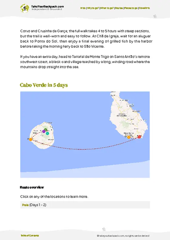
example page 0 from our offline Travel Guide for Cabo Verde
example page 1 from our offline Travel Guide for Cabo Verde
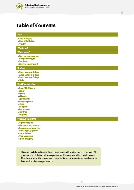
example page 2 from our offline Travel Guide for Cabo Verde
example page 3 from our offline Travel Guide for Cabo Verde
example page 4 from our offline Travel Guide for Cabo Verde
example page 5 from our offline Travel Guide for Cabo Verde
example page 6 from our offline Travel Guide for Cabo Verde
example page 7 from our offline Travel Guide for Cabo Verde
Loading the map 🌍
CLICK TO FILTER
cities
towns
villages
landmarks
national parks
hikes
beaches
attractions
festivals
regions
SHOW COUNTRY’S BESTSHOW ALL

✨ Why go?
Ranked #2 hike in Cabo Verde
What makes this hike worth hiking

Ponta do Sol to Chã de Igreja gives you a full tour of Santo Antão’s north-west in a single push. You begin on a sea-level promenade, pass the cliff-hanging houses of Fontainhas, and end among the cool, windy farms of Chã de Igreja, far above the ocean. Few Cabo Verde walks change climate and landscape so quickly. Second, the route is easy to join. Ponta do Sol has guesthouses and a trailhead right in town, so you do not need a car or a tour. You can shorten the day by turning around at Fontainhas, or stretch it by sleeping in a village and carrying on the next morning. Third, it fits a longer island loop well. Many hikers pair it with the Cova crater and Paul valley trails on the same trip, using Ponta do Sol as a home base and moving by minibus. You will meet farmers carrying loads, hear … read more 👉
Ponta do Sol to Chã de Igreja gives you a full tour of Santo Antão’s north-west in a single push. You begin on a sea-level promenade, pass the cliff-hanging houses of Fontainhas, and end among the cool, windy farms of Chã de Igreja, far above the ocean. Few Cabo Verde walks change climate and landscape so quickly. Second, the route is easy to join. Ponta do Sol has guesthouses and a trailhead right in town, so you do not need a car or a tour. You can shorten the day by turning around at Fontainhas, or stretch it by sleeping in a village and carrying on the next morning. Third, it fits a longer island loop well. Many hikers pair it with the Cova crater and Paul valley trails on the same trip, using Ponta do Sol as a home base and moving by minibus. You will meet farmers carrying loads, hear Kriolu in the lanes and drink grogue offered with more generosity than caution.

💡 HighlightsWhat this place is best known for

  1. Fontainhas: The village most people photograph, its pastel houses clinging to a cliff edge high above the sea. The path rises toward it with sea views behind you, and the lookout is a good place for a break.
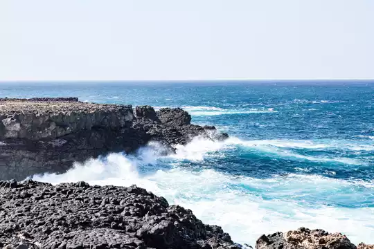
  2. Ponta do Sol coastal path: The walk begins along a cliff-side path of paved stones where waves hit black rock far below. It is the most scenic opening on the island.
  3. Cruzinha: A small settlement on the coast, with a calm feel and sea views, where you can stop for a simple meal and rest before the climb.
  4. Terraced fields: Sugar cane, bananas and vegetable plots step up steep slopes beside the trail. Watching farmers work them from narrow paths is one of the most revealing sights of the hike.
  5. Chã de Igreja: The highland village at the end, where the air turns cooler and mist often drifts across
… read more 👉
  1. Fontainhas: The village most people photograph, its pastel houses clinging to a cliff edge high above the sea. The path rises toward it with sea views behind you, and the lookout is a good place for a break.
  2. Ponta do Sol coastal path: The walk begins along a cliff-side path of paved stones where waves hit black rock far below. It is the most scenic opening on the island.
  3. Cruzinha: A small settlement on the coast, with a calm feel and sea views, where you can stop for a simple meal and rest before the climb.
  4. Terraced fields: Sugar cane, bananas and vegetable plots step up steep slopes beside the trail. Watching farmers work them from narrow paths is one of the most revealing sights of the hike.
  5. Chã de Igreja: The highland village at the end, where the air turns cooler and mist often drifts across the slopes. Its church and scattered farms make a quiet finish above the coast.
Ponta do Sol to Chã de Igreja costs nothing to walk, and all five stops are free to see; the only spending is on food or a drink in the villages.
Spotted a mistake or missing something? Contact us.

Things to do near Ponta do Sol to Chã de Igreja

Ratings based on Tripadvisor reviews. When you book through this link, you support our work at no extra cost to you.

🌤️ When to go?Best time to hike the Ponta do Sol to Chã de Igreja

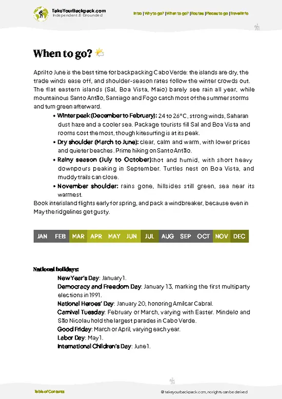
  • November to June (dry, cooler season): Santo Antão’s northeast coast stays mostly rain-free, with daytime highs of 24 to 28°C (75 to 82°F) and nights around 18 to 21°C (64 to 70°F). The coastal path from Ponta do Sol east toward Chã de Igreja is a hot, exposed walk, so this is when it is most comfortable. Expect about 11 to 12 hours of daylight in winter.
  • December to February (peak season): Hikers from Europe fill guesthouses in Ponta do Sol, and rooms cost roughly €25 to 50 a night. Book ahead around Christmas and New Year.
  • July to September (hotter, hazier): Highs reach 29 to 32°C (84 to 90°F), with muggy air and the occasional dust haze. Daylight stretches to nearly 13 hours, and prices ease by 10 to 20 percent.
  • August to October (rain window): Short, heavy showers come in most years, mainly
… read more 👉
  • November to June (dry, cooler season): Santo Antão’s northeast coast stays mostly rain-free, with daytime highs of 24 to 28°C (75 to 82°F) and nights around 18 to 21°C (64 to 70°F). The coastal path from Ponta do Sol east toward Chã de Igreja is a hot, exposed walk, so this is when it is most comfortable. Expect about 11 to 12 hours of daylight in winter.
  • December to February (peak season): Hikers from Europe fill guesthouses in Ponta do Sol, and rooms cost roughly €25 to 50 a night. Book ahead around Christmas and New Year.
  • July to September (hotter, hazier): Highs reach 29 to 32°C (84 to 90°F), with muggy air and the occasional dust haze. Daylight stretches to nearly 13 hours, and prices ease by 10 to 20 percent.
  • August to October (rain window): Short, heavy showers come in most years, mainly late August to October, and can turn gullies on the trail slick or briefly impassable. Greenery is at its best, but plan flexible days.
Start walking by 7:30 a.m. in any season so the climbs are done before the midday heat.


source: climatestotravel.comJANJanuary: highly recommended for travelingFEBFebruary: highly recommended for travelingMARMarch: highly recommended for travelingAPRApril: excellent for travelingMAYMay: excellent for travelingJUNJune: highly recommended for travelingJULJuly: highly recommended for travelingAUGAugust: fair for travelingSEPSeptember: fair for travelingOCTOctober: good for travelingNOVNovember: excellent for travelingDECDecember: highly recommended for traveling
cabo-verde-hike-ponta-do-sol-to-cha-de-igreja v1
© Google |

✈️ The backpacker research shortcutCabo Verde Travel Guide

An offline-friendly backpacking guide with optimized travel routes, ranked highlights, transport advice, and the best areas to stay.
example page 0 from our offline Travel Guide for Cabo Verde
example page 1 from our offline Travel Guide for Cabo Verde
example page 2 from our offline Travel Guide for Cabo Verde
example page 3 from our offline Travel Guide for Cabo Verde
example page 4 from our offline Travel Guide for Cabo Verde
example page 5 from our offline Travel Guide for Cabo Verde
example page 6 from our offline Travel Guide for Cabo Verde
example page 7 from our offline Travel Guide for Cabo Verde
The digital guide (234 pages) contains:
✅ 57 highlights, ranked by travel appeal
✅ Optimized 2, 3 & 5-day travel routes
✅ Cities, national parks, landmarks, beaches
✅ How to get around
✅ Offline-friendly for travel without Wi-Fi
👉 Click to see all 30+ guide features

📅 Plan smarter in minutes, not weeks
✅ Month by month travel advice
✅ Festivals & national holidays
✅ Budget expectations

🗺️ Go to the right places, skip the overrated ones
✅ Honest pros & cons of destinations
✅ Top hikes, parks & viewpoints
✅ Lesser-known places most travelers miss
✅ Clear “worth it vs skip it” guidance

🛏️ Travel smoothly without rookie mistakes
✅ Best areas to stay
✅ Transport systems explained simply
✅ Common scams & safety advice
✅ SIM cards, money & practical tips

🌍 Understand the country, not just visit it
✅ Culture & traditions
✅ 52 Essential phrases & customs
✅ Festivals worth planning around
✅ Traveler-friendly historical context
✅ Insights that make places more meaningful

📱 Built for real travel conditions
✅ Fully downloadable PDF
✅ Works completely offline
✅ Optimized for phone use
✅ Useful in remote areas & buses
✅ Everything in one place
Stop searching, start planning
Get instant access to your full guide. 30‑day money-back guarantee.
+ Add another guide for just

By proceeding you agree to our terms.
Sent to your inbox immediately after payment • 100% Secure Checkout
Best Backpacking Travel Advisor 2025 tourism awardBest Backpacking
Travel Advisor
2025
What others say about Take Your Backpack Guides:
⭐⭐⭐⭐⭐
Fantastic, amazing amount of information!
⭐⭐⭐⭐⭐
My goodness this is amazing, it's what I've been looking for hats off too you!
⭐⭐⭐⭐⭐
I think this is absolutely BRILLIANT
⭐⭐⭐⭐
Very complete and informative. It's still missing places, but I gotta to commend you
⭐⭐⭐⭐⭐
This is truly amazing, thank you, can't wait to explore it with my kids!
⭐⭐⭐⭐⭐
Awesome resource, thank you!
⭐⭐⭐⭐⭐
This is amazing! Can't wait to explore the ones I haven't seen
⭐⭐⭐⭐
I love this! Well done, great idea.
⭐⭐⭐⭐⭐
Thanks for taking the time to make this gem!
⭐⭐⭐⭐⭐
This might be the best website I've ever seen.
⭐⭐⭐⭐⭐
Congratulations, and thank you so much for your work; it's incredibly valuable.
⭐⭐⭐⭐
In all seriousness I think you did a great job pointing out the important spots
⭐⭐⭐⭐⭐
10/10 very good
⭐⭐⭐⭐⭐
As someone who's only just starting to visit regularly this is awesome, thank you.
⭐⭐⭐⭐
Thank you very much! I'm going to visit my dad, it's going to be very useful!
⭐⭐⭐⭐⭐
This is really cool! We'll be travelling for the first time and this definitely come in handy.
⭐⭐⭐⭐⭐
You are now our minister of culture, congratulations 👨‍💼
⭐⭐⭐⭐⭐
Just wanted to tell you that this is a pearl! Going to follow your recommendations.
⭐⭐⭐⭐⭐
This is so cool. I'll definitely be using the resource for my travels soon.
⭐⭐⭐⭐⭐
This is very impressive! Good work.
⭐⭐⭐⭐⭐
This is an amazing and informative site. Very well done!

🛏️ Where to stay?Choosing the right base

If you enjoy meeting fellow travelers, consider choosing hostels with high ratings for atmosphere. On the other hand, if you prefer having your own space, a hotel might be a better option.

🥾 Hike detailsKey facts about the Ponta do Sol to Chã de Igreja hike

Ponta do Sol to Chã de Igreja: This is a demanding one-day walk from the coast to the highlands on Santo Antão.
Total Distance: Roughly 14 kilometers one way, depending on the variant you pick.
Estimated Duration: About 6 to 7 hours of walking, plus stops.
Difficulty: Moderate to hard. Steep stone steps, uneven gravel and exposed edges. Not suited to anyone afraid of heights.
Starting Point: Ponta do Sol town, where the coastal path leaves from the seafront. Shared minibuses (aluguers) reach Ponta do Sol from the Porto Novo ferry port and from Ribeira Grande. Return services from the highlands are
… read more 👉
Ponta do Sol to Chã de Igreja: This is a demanding one-day walk from the coast to the highlands on Santo Antão.
Total Distance: Roughly 14 kilometers one way, depending on the variant you pick.
Estimated Duration: About 6 to 7 hours of walking, plus stops.
Difficulty: Moderate to hard. Steep stone steps, uneven gravel and exposed edges. Not suited to anyone afraid of heights.
Starting Point: Ponta do Sol town, where the coastal path leaves from the seafront. Shared minibuses (aluguers) reach Ponta do Sol from the Porto Novo ferry port and from Ribeira Grande. Return services from the highlands are limited, so confirm timings first.
Major Landmarks:
  • Ponta do Sol seafront: The start, with the harbor and fishing boats.
  • Fontainhas: A cliff village with a viewpoint and small cafés.
  • Cruzinha: A coastal hamlet used as a rest stop.
  • Chã de Igreja: The highland village with its church.
Terrain and Scenery: Cobbled paths cut into steep cliffs, followed by a long ascent over rocky switchbacks. Views run from the Atlantic to deep valleys and ridgelines.
Vegetation: Dry scrub and cactus near the coast, then sugar cane, banana, papaya and vegetable terraces in the farmland. Higher up, grasses and pines appear where moisture lingers.
Wildlife: Mostly birds, including kestrels and seabirds along the cliffs, plus goats, cattle, chickens and the occasional lizard on the path.
⚠️ Hiking info can sometimes be outdated or inaccurate. Before you hit the trail, check the latest conditions with locals. If you do spot anything that's off, I'd love to hear from you, so I can update it for fellow travelers.

🛡️ SafetyTraveler Safety Guide

Ponta do Sol to Chã de Igreja is a manageable coastal walk, but sun and footing deserve respect. Much of the route follows cobbled paths and cliff-side tracks with little shade, so carry at least 2 to 3 liters of water, a hat and sunscreen, because villages on the way offer few shops. Cobbles are slick after rain, and loose gravel on steep descents rolls underfoot, so wear shoes with real grip rather than sandals. Drop-offs beside sections of the path are steep and unfenced. Keep a firm pace on narrow stretches and let donkeys and locals with loads pass first. The Atlantic is powerful along this coast, with strong currents and heavy swell, so admire it from the trail rather than swimming off rocks. Trails fork near farm terraces, so download an offline map before you leave. No dangerous wildlife … read more 👉
Ponta do Sol to Chã de Igreja is a manageable coastal walk, but sun and footing deserve respect. Much of the route follows cobbled paths and cliff-side tracks with little shade, so carry at least 2 to 3 liters of water, a hat and sunscreen, because villages on the way offer few shops. Cobbles are slick after rain, and loose gravel on steep descents rolls underfoot, so wear shoes with real grip rather than sandals. Drop-offs beside sections of the path are steep and unfenced. Keep a firm pace on narrow stretches and let donkeys and locals with loads pass first. The Atlantic is powerful along this coast, with strong currents and heavy swell, so admire it from the trail rather than swimming off rocks. Trails fork near farm terraces, so download an offline map before you leave. No dangerous wildlife is a concern here, though village dogs can bark. Tell your guesthouse your route and expected return time.

FAQTraveler FAQ

Ponta do Sol to Chã de Igreja takes roughly 4 to 6 hours one way, depending on the route you choose and how often you stop. Most hikers cover it in a single day, starting early from Ponta do Sol and finishing in the afternoon. Allow extra time for photo stops in the terraced valleys, and plan a return by local aluguer (shared minibus) or taxi.
Ponta do Sol to Chã de Igreja is moderate. The distance is not long, but steep climbs on cobbled paths, exposed sun and some steep drop-offs make it tiring in heat. Reasonably fit walkers with sturdy shoes manage it fine, and total ascent is a few hundred meters. Carry 2 to 3 liters of water because shade and shops are limited.
Ponta do Sol to Chã de Igreja does not require a permit, and the route is open to independent hikers. A local guide is optional but useful for first-timers or when the trail forks, and a half-day to full-day guide typically costs about €30 to 60 in Ponta do Sol. Guesthouses can arrange one, along with transport back by aluguer or taxi.
⚠️ Things can change over time, so always validate details locally before you go.

Other Cape Verdean hikes near Ponta do Sol to Chã de Igreja

Explore more nearby:

  • Monte Verde—wind-swept summit, agricultural terraces, island-wide vistas| 41 km away
  • Pico do Fogo—active volcano, black lava fields, crater villages| 263 km away
  • Serra Malagueta—misty ridges, endemic flora, panoramic viewpoints, rural hamlets| 270 km away

💡 Not sure where to go next?
Create a personalized itinerary for Cabo Verde including Ponta do Sol to Chã de Igreja and the places that fit your trip.

Generate my itinerary

👉 Discover all hikes

Or checkout all Cabo Verde has to offer (think cities, towns, villages, national parks, hikes, beaches, festivals)
Country photo of Cabo Verde

We 💚 feedbackFinal thoughts on hiking the Ponta do Sol to Chã de Igreja

Ponta do Sol to Chã de Igreja trips up hikers who treat it as a gentle coastal stroll and set out at ten o’clock with one small water bottle. Leave at first light, carry plenty of water and sun protection, and settle your ride back before you climb. If your legs tire, sleep in a village and finish the next morning.

✍️ Help improve this page!
The information on this page is based on in-depth research, insights shared by experienced travelers, and feedback from the local travel community in Cabo Verde. While every effort is made to keep the information accurate and current, conditions can change — so if you spot anything incorrect or outdated, please get in touch.


🙋‍♂️ Give feedback

👋 Meet the founderWho’s Behind Take Your Backpack?

Johan, backpacker and founder of TakeYourBackpackHi, I’m Johan (Netherlands 🇳🇱), the creator of TakeYourBackpack. Over the past 3 decades, I’ve backpacked through 90+ countries across six continents, gaining extensive experience with independent travel, long-term trips, and overland routes.

This site is built on a combination of firsthand travel experience and carefully curated insights from other backpackers. Many guides are based on places I’ve personally visited, while others bring together tips, observations, and practical advice shared by trusted travelers I’ve met along the way.

The goal is to provide realistic, experience-driven guidance — not generic itineraries — so you can explore destinations with better context, clearer expectations, and more confidence.