×

Chile🇨🇱 | national parksPumalín Douglas Tompkins National ParkChaitén crater, alerce groves, fjord ferries, free trails | things to do and best time to go

Explore Vicente Pérez Rosales National ParkExplore Alerce Andino National Park

Backpacking in Pumalín Douglas Tompkins
🏆 Top picknational park ranked #3
By Johan Kruseman 🇳🇱 | Updated October 19, 2026

The decision that shapes a trip here is whether to arrive by the Carretera Austral ferries or by road through Chaitén, and it comes down to summer crossings filling weeks ahead and the road section having gaps in service. Book vehicle and passenger spots early, carry cash for small towns, and keep a spare day, because rain cancels sailings and nobody refunds your schedule. Pumalín Douglas Tompkins National Park sits in Chile’s Los Lagos region, south of Puerto Montt, a long rainy slice of temperate rainforest between fjords and volcanoes. Trails are well built and free to enter, wildlife is shy, and shared campsites are tidy but few. On the Chaitén volcano rim, the hiss of steam vents carried across the crater like a kettle left on. Hikers who like green, wet, quiet days will love it. Anyone chasing big-summit drama or quick itineraries will not.

Discover everything you want to know in the 📖 Chile Travel Guide.


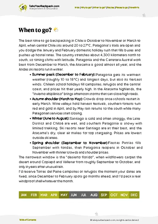
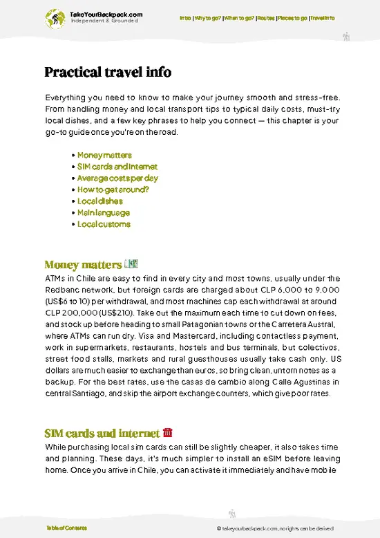
example page 0 from our offline Travel Guide for Chile
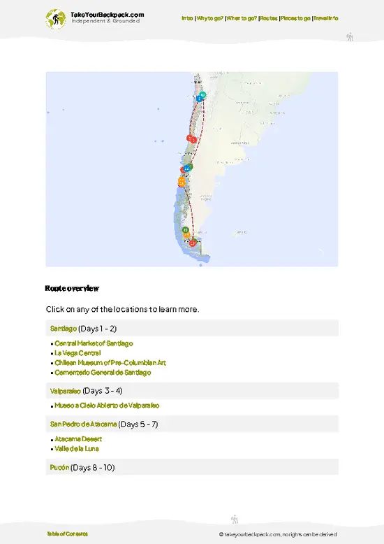
example page 1 from our offline Travel Guide for Chile
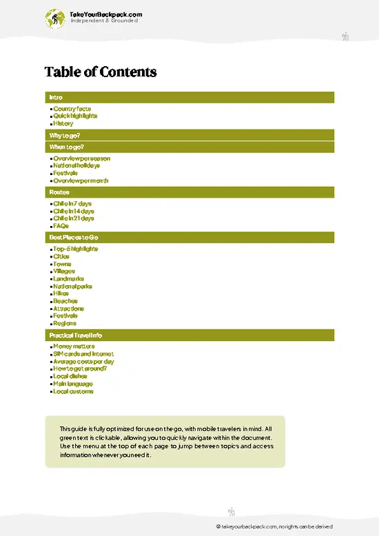
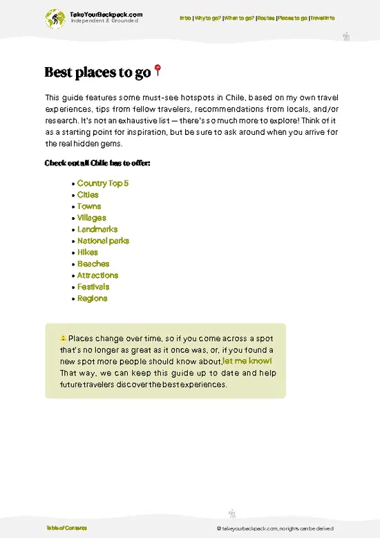
example page 2 from our offline Travel Guide for Chile
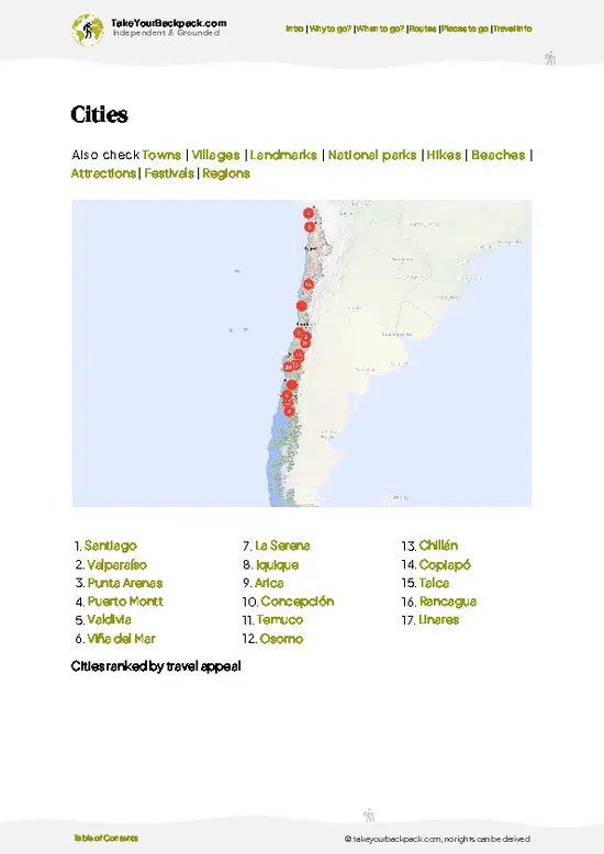
example page 3 from our offline Travel Guide for Chile
example page 4 from our offline Travel Guide for Chile
example page 5 from our offline Travel Guide for Chile
example page 6 from our offline Travel Guide for Chile
example page 7 from our offline Travel Guide for Chile
Loading the map 🌍
CLICK TO FILTER
cities
towns
villages
landmarks
national parks
hikes
beaches
attractions
festivals
regions
SHOW COUNTRY’S BESTSHOW ALL

✨ Why go?
Ranked #3 national park in Chile
Why Pumalín Douglas Tompkins should be on your travel list

Pumalín Douglas Tompkins National Park suits people who plan their own days, because the trails start right beside the Carretera Austral and need no guide. You stack short walks around the road, camp at maintained sites with covered kitchen shelters, and move on when the weather turns, which it does. The park rewards that flexibility with alerce trees that are over a thousand years old within a short walk of the road, plus a climb to the crater of Chaitén volcano, which erupted in 2008 and still steams. Few other places in Chile put ancient rainforest, a live volcano and fjord shoreline within a single week of walking. Hostels in nearby towns fill the gaps between camping nights, so you can mix tents and beds. Tours exist, but they mostly repeat what a rental car, a bus pass and a good rain … read more 👉
Pumalín Douglas Tompkins National Park suits people who plan their own days, because the trails start right beside the Carretera Austral and need no guide. You stack short walks around the road, camp at maintained sites with covered kitchen shelters, and move on when the weather turns, which it does. The park rewards that flexibility with alerce trees that are over a thousand years old within a short walk of the road, plus a climb to the crater of Chaitén volcano, which erupted in 2008 and still steams. Few other places in Chile put ancient rainforest, a live volcano and fjord shoreline within a single week of walking. Hostels in nearby towns fill the gaps between camping nights, so you can mix tents and beds. Tours exist, but they mostly repeat what a rental car, a bus pass and a good rain jacket already get you. Self-guided travelers also control timing, which matters when clouds hide views until afternoon.

💡 HighlightsEssential experiences to have while exploring Pumalín Douglas Tompkins

  1. Sendero Cascadas Escondidas: A loop through dripping rainforest with ferns, moss-covered trunks and a series of waterfalls tucked behind a bridge. It is the shortest way to see why the park is called a rainforest.
  2. Volcán Chaitén crater: A steep climb ending at a rim overlooking a steaming lava dome, with views toward the Gulf of Corcovado on clear days. Ash fields and rocky terrain make it feel unlike the forest below.
  3. Sendero de los Alerces: A short forest walk to alerce trees, slow-growing conifers that live for thousands of years. Their fibrous red bark and enormous trunks make the visit memorable even in drizzle.
  4. Laguna Tronador: A longer walk through wet forest to a lagoon fed by a hanging glacier. The trail climbs through tree roots and mud, and you will often have it nearly to yourself.
… read more 👉
  1. Sendero Cascadas Escondidas: A loop through dripping rainforest with ferns, moss-covered trunks and a series of waterfalls tucked behind a bridge. It is the shortest way to see why the park is called a rainforest.
  2. Volcán Chaitén crater: A steep climb ending at a rim overlooking a steaming lava dome, with views toward the Gulf of Corcovado on clear days. Ash fields and rocky terrain make it feel unlike the forest below.
  3. Sendero de los Alerces: A short forest walk to alerce trees, slow-growing conifers that live for thousands of years. Their fibrous red bark and enormous trunks make the visit memorable even in drizzle.
  4. Laguna Tronador: A longer walk through wet forest to a lagoon fed by a hanging glacier. The trail climbs through tree roots and mud, and you will often have it nearly to yourself.
  5. Caleta Gonzalo shoreline: The ferry landing and campground on the fjord, with kayak launches, cold water and mountain views. Evenings here bring birdsong and a sky that changes quickly.
  6. Michinmahuida glacier trail: A forest approach toward the glacier descending from Michinmahuida volcano, with river crossings and dense undergrowth. Good for hikers who want a quieter, more remote day.
  7. Lago Negro: A quiet lake with dark water reflecting surrounding forest, reached on an easy walk. Pudú, the tiny native deer, sometimes appear at dusk.
For a first visit, start with Cascadas Escondidas, since it shows the rainforest at its most dramatic in under half a day.
Spotted a mistake or missing something? Contact us.

Things to do near Pumalín Douglas Tompkins National Park

Ratings based on Tripadvisor reviews. When you book through this link, you support our work at no extra cost to you.

🌤️ When to go?Choosing the right time of year

December to March is the window for Pumalín Douglas Tompkins National Park, when trails are driest and the free campsites and ferries run on full schedules.
  • Summer (Dec to Mar): Daytime highs of 15 to 22°C (59 to 72°F), lows around 7 to 10°C (45 to 50°F), and long daylight into the evening. Rain still falls on many days. Crowds and ferry demand peak in January and February, and Chilean holiday weekends fill campsites fast.
  • Autumn (Apr to May): Highs of 10 to 15°C (50 to 59°F), fewer people, and the lenga and ñire forests turn red and gold. Rain increases and daylight shortens, so plan shorter hikes.
  • Winter (Jun to Aug): Highs of 5 to 10°C (41 to 50°F), lows near freezing, and very short days. Heavy rain is routine, some campsites and services close, and snow can block higher trails. Lodging prices
… read more 👉
December to March is the window for Pumalín Douglas Tompkins National Park, when trails are driest and the free campsites and ferries run on full schedules.
  • Summer (Dec to Mar): Daytime highs of 15 to 22°C (59 to 72°F), lows around 7 to 10°C (45 to 50°F), and long daylight into the evening. Rain still falls on many days. Crowds and ferry demand peak in January and February, and Chilean holiday weekends fill campsites fast.
  • Autumn (Apr to May): Highs of 10 to 15°C (50 to 59°F), fewer people, and the lenga and ñire forests turn red and gold. Rain increases and daylight shortens, so plan shorter hikes.
  • Winter (Jun to Aug): Highs of 5 to 10°C (41 to 50°F), lows near freezing, and very short days. Heavy rain is routine, some campsites and services close, and snow can block higher trails. Lodging prices drop.
  • Spring (Sep to Nov): Highs of 9 to 15°C (48 to 59°F), mud on many trails, and waterfalls at full volume. Services reopen gradually through November.
Book summer ferries and cabins several weeks ahead, or travel in early December when the weather is good and the crowds have not yet arrived.


source: climatestotravel.comJANJanuary: excellent for travelingFEBFebruary: excellent for travelingMARMarch: highly recommended for travelingAPRApril: fair for travelingMAYMay: fair for travelingJUNJune: below average for travelingJULJuly: below average for travelingAUGAugust: below average for travelingSEPSeptember: fair for travelingOCTOctober: good for travelingNOVNovember: highly recommended for travelingDECDecember: excellent for traveling
chile-national-park-pumalin-douglas-tompkins-national-park
© Google |

✈️ The backpacker research shortcutChile Travel Guide

An offline-friendly backpacking guide with optimized travel routes, ranked highlights, transport advice, and the best areas to stay.
example page 0 from our offline Travel Guide for Chile
example page 1 from our offline Travel Guide for Chile
example page 2 from our offline Travel Guide for Chile
example page 3 from our offline Travel Guide for Chile
example page 4 from our offline Travel Guide for Chile
example page 5 from our offline Travel Guide for Chile
example page 6 from our offline Travel Guide for Chile
example page 7 from our offline Travel Guide for Chile
The digital guide (333 pages) contains:
✅ 107 highlights, ranked by travel appeal
✅ Optimized 7, 14 & 21-day travel routes
✅ Cities, national parks, landmarks, beaches
✅ How to get around
✅ Offline-friendly for travel without Wi-Fi
👉 Click to see all 30+ guide features

📅 Plan smarter in minutes, not weeks
✅ Month by month travel advice
✅ Festivals & national holidays
✅ Budget expectations

🗺️ Go to the right places, skip the overrated ones
✅ Honest pros & cons of destinations
✅ Top hikes, parks & viewpoints
✅ Lesser-known places most travelers miss
✅ Clear “worth it vs skip it” guidance

🛏️ Travel smoothly without rookie mistakes
✅ Best areas to stay
✅ Transport systems explained simply
✅ Common scams & safety advice
✅ SIM cards, money & practical tips

🌍 Understand the country, not just visit it
✅ Culture & traditions
✅ 52 Essential phrases & customs
✅ Festivals worth planning around
✅ Traveler-friendly historical context
✅ Insights that make places more meaningful

📱 Built for real travel conditions
✅ Fully downloadable PDF
✅ Works completely offline
✅ Optimized for phone use
✅ Useful in remote areas & buses
✅ Everything in one place
Stop searching, start planning
Get instant access to your full guide. 30‑day money-back guarantee.
+ Add another guide for just

By proceeding you agree to our terms.
Sent to your inbox immediately after payment • 100% Secure Checkout
Best Backpacking Travel Advisor 2025 tourism awardBest Backpacking
Travel Advisor
2025
What others say about Take Your Backpack Guides:
⭐⭐⭐⭐⭐
Fantastic, amazing amount of information!
⭐⭐⭐⭐⭐
My goodness this is amazing, it's what I've been looking for hats off too you!
⭐⭐⭐⭐⭐
I think this is absolutely BRILLIANT
⭐⭐⭐⭐
Very complete and informative. It's still missing places, but I gotta to commend you
⭐⭐⭐⭐⭐
This is truly amazing, thank you, can't wait to explore it with my kids!
⭐⭐⭐⭐⭐
Awesome resource, thank you!
⭐⭐⭐⭐⭐
This is amazing! Can't wait to explore the ones I haven't seen
⭐⭐⭐⭐
I love this! Well done, great idea.
⭐⭐⭐⭐⭐
Thanks for taking the time to make this gem!
⭐⭐⭐⭐⭐
This might be the best website I've ever seen.
⭐⭐⭐⭐⭐
Congratulations, and thank you so much for your work; it's incredibly valuable.
⭐⭐⭐⭐
In all seriousness I think you did a great job pointing out the important spots
⭐⭐⭐⭐⭐
10/10 very good
⭐⭐⭐⭐⭐
As someone who's only just starting to visit regularly this is awesome, thank you.
⭐⭐⭐⭐
Thank you very much! I'm going to visit my dad, it's going to be very useful!
⭐⭐⭐⭐⭐
This is really cool! We'll be travelling for the first time and this definitely come in handy.
⭐⭐⭐⭐⭐
You are now our minister of culture, congratulations 👨‍💼
⭐⭐⭐⭐⭐
Just wanted to tell you that this is a pearl! Going to follow your recommendations.
⭐⭐⭐⭐⭐
This is so cool. I'll definitely be using the resource for my travels soon.
⭐⭐⭐⭐⭐
This is very impressive! Good work.
⭐⭐⭐⭐⭐
This is an amazing and informative site. Very well done!

🛏️ Where to stay?How to pick the right area

Most backpackers sleep inside Pumalín Douglas Tompkins National Park itself, in the park-run campgrounds along the Carretera Austral.
The main sites are Cascadas Escondidas, Playa Cabañitas, Lago Negro, Vodudahue, Caleta Gonzalo and Chaitén Volcano area camps. They are simple but well kept, with wooden platforms or sheltered cooking areas (quinchos), hot showers at some, and toilets. Expect to pay roughly US$10 to 20 per person per night, and book ahead for January and February through the Conaf reservation system. Caleta Gonzalo is the busiest base, with a café serving organic meals and a few … read more 👉
Most backpackers sleep inside Pumalín Douglas Tompkins National Park itself, in the park-run campgrounds along the Carretera Austral.
The main sites are Cascadas Escondidas, Playa Cabañitas, Lago Negro, Vodudahue, Caleta Gonzalo and Chaitén Volcano area camps. They are simple but well kept, with wooden platforms or sheltered cooking areas (quinchos), hot showers at some, and toilets. Expect to pay roughly US$10 to 20 per person per night, and book ahead for January and February through the Conaf reservation system. Caleta Gonzalo is the busiest base, with a café serving organic meals and a few rustic cabins that cost about US$60 to 110 a night.
Outside the park, Chaitén, about 25 km north of the main entrance zone, is the practical town base. It has hostels and guesthouses with dorm beds around US$15 to 25 and private rooms from US$35 to 70, plus supermarkets and the ferry terminal. Hornopirén to the north and Futaleufú to the south offer additional hostels, cabins and groceries.

👛 Costs (as of 19 October 2026)Money, prices, and spending tips

Plan on roughly US$55 to 100 per day for a backpacker in Pumalín Douglas Tompkins National Park, including camping, food and local transport.
CategoryBudget RangeLocal Reality
Entrance feeUS$0Entry to the park is free, and most trailheads need no ticket.
Camping (high season)US$10 to 20Park campgrounds charge per person, and cooking shelters are included. Prices drop off-season.
Hostels in ChaiténUS$15 to 25Dorm beds in summer. Private rooms run US$35 to 70.
Food and suppliesUS$15 to 25Self-catering from Chaitén supermarkets is the cheapest route. A café meal at Caleta Gonzalo costs US$10 to 18.
Local transportUS$10 to 25Buses on the Carretera Austral between Chaitén and the park cost a few dollars each way. Ferries for vehicles and foot passengers cost more.
Gear and extrasUS$5 to 10Gas canisters,
… read more 👉
Plan on roughly US$55 to 100 per day for a backpacker in Pumalín Douglas Tompkins National Park, including camping, food and local transport.
CategoryBudget RangeLocal Reality
Entrance feeUS$0Entry to the park is free, and most trailheads need no ticket.
Camping (high season)US$10 to 20Park campgrounds charge per person, and cooking shelters are included. Prices drop off-season.
Hostels in ChaiténUS$15 to 25Dorm beds in summer. Private rooms run US$35 to 70.
Food and suppliesUS$15 to 25Self-catering from Chaitén supermarkets is the cheapest route. A café meal at Caleta Gonzalo costs US$10 to 18.
Local transportUS$10 to 25Buses on the Carretera Austral between Chaitén and the park cost a few dollars each way. Ferries for vehicles and foot passengers cost more.
Gear and extrasUS$5 to 10Gas canisters, rain gear repairs and the occasional hot drink or snack.
Total Daily BudgetUS$55 to 100Per person, per day, in high season.


source: chile.travel
⚠️ Prices can change and everyone travels differently, so take this as a rough guide. Hope it helps you plan your adventure!

🥾 TrailsWhere to hike in Pumalín Douglas Tompkins: trails for every level

Pumalín Douglas Tompkins National Park has trails of mostly modest length but demanding wet terrain, with boardwalks, steps and slick roots in the forest and loose volcanic rock higher up. Plan for mud and rain year-round, and wear waterproof boots.
  • Sendero Cascadas Escondidas: Roughly 3 km loop, about 1.5 to 2 hours, easy to moderate. Rainforest, ferns, a series of waterfalls and wooden bridges.
  • Sendero Volcán Chaitén: About 4 km round trip, 2.5 to 3 hours, steep and moderate to hard. Climbs roughly 600 m to a crater rim with steaming vents and views over the gulf.
  • Sendero de los Alerces: Under
… read more 👉
Pumalín Douglas Tompkins National Park has trails of mostly modest length but demanding wet terrain, with boardwalks, steps and slick roots in the forest and loose volcanic rock higher up. Plan for mud and rain year-round, and wear waterproof boots.
  • Sendero Cascadas Escondidas: Roughly 3 km loop, about 1.5 to 2 hours, easy to moderate. Rainforest, ferns, a series of waterfalls and wooden bridges.
  • Sendero Volcán Chaitén: About 4 km round trip, 2.5 to 3 hours, steep and moderate to hard. Climbs roughly 600 m to a crater rim with steaming vents and views over the gulf.
  • Sendero de los Alerces: Under 1 km, about 30 minutes, easy. Boardwalk path through ancient alerce trees.
  • Sendero Laguna Tronador: About 7 km round trip, 3 to 4 hours, moderate. Forest climb to a lagoon below a hanging glacier, with some muddy stretches.
  • Sendero Ventisquero Michinmahuida: Longer day hike, moderate to hard, with river crossings. Quiet forest and views toward the glacier.
Wildlife is hard to spot in the dense forest, but you may hear or see black-throated huet-huets, chucao tapaculos, pudú and occasionally pumas’ tracks. Entry to the park is free, though camping at the park’s sites carries a fee paid in Chilean pesos. Reaching the park without a car is possible by long-distance bus along the Carretera Austral, which stops at trailheads in Caleta Gonzalo and near Chaitén, with ferries connecting from the north in summer. Crowds stay small, though January and February can bring full campgrounds and busy trails.
⚠️ Hiking info can sometimes be outdated or inaccurate. Before you hit the trail, check the latest conditions with locals. If you do spot anything that's off, I'd love to hear from you, so I can update it for fellow travelers.

🛡️ SafetyScams, Hazards, and Annoyances

Pumalín is well managed and straightforward, and the main hazard is wet weather rather than anything dramatic.
Rain falls most days of the year in this temperate rainforest, so waterproof shells, quick-dry layers and a dry bag for your sleeping gear matter more than extra equipment. Trails are well marked, but roots and boardwalks get slick and streams swell after heavy rain, so take river crossings slowly and turn back if the water is above your knees. Longer routes such as Michinmahuida involve mud and steeper stretches; start early, since daylight shortens quickly outside summer.
Wildlife is low risk. Pumas exist but are shy and rarely seen. Keep food sealed in your campsite shelter, and respect the rules on fires, which are only permitted in designated spots. Mobile coverage is patchy, so … read more 👉
Pumalín is well managed and straightforward, and the main hazard is wet weather rather than anything dramatic.
Rain falls most days of the year in this temperate rainforest, so waterproof shells, quick-dry layers and a dry bag for your sleeping gear matter more than extra equipment. Trails are well marked, but roots and boardwalks get slick and streams swell after heavy rain, so take river crossings slowly and turn back if the water is above your knees. Longer routes such as Michinmahuida involve mud and steeper stretches; start early, since daylight shortens quickly outside summer.
Wildlife is low risk. Pumas exist but are shy and rarely seen. Keep food sealed in your campsite shelter, and respect the rules on fires, which are only permitted in designated spots. Mobile coverage is patchy, so tell the ranger at the entrance your route and carry offline maps. Many first-timers underestimate the tight ferry schedules on the Carretera Austral.

FAQFrequently asked questions about Pumalín Douglas Tompkins

Plan three to five days for Pumalín Douglas Tompkins National Park. Three days covers the Cascadas Escondidas, Sendero de los Alerces and Volcán Chaitén hikes, while five lets you add the longer Michinmahuida route or a camp at Caleta Gonzalo. Weather is wet, so an extra buffer day helps.
Yes, you can visit Pumalín Douglas Tompkins National Park without a car, though it takes planning. Buses run along the Carretera Austral between Chaitén and Caleta Gonzalo, and hitchhiking is common in summer. Chaitén is reachable by ferry from Puerto Montt (about 10 hours) and by bus from Futaleufú. Trailheads cluster along roughly 60 km of road.
Entry to Pumalín Douglas Tompkins National Park is free, and most day hikes need no permit. Campgrounds charge roughly US$10 to 20 per person per night, and booking ahead is wise from January to February. Fires are allowed only in designated spots, and ask the rangers about trail conditions before multi-day routes such as Michinmahuida.
⚠️ Things can change over time, so always validate details locally before you go.

Other Chilean national parks near Pumalín Douglas Tompkins

Explore more nearby:


💡 Not sure where to go next?
Create a personalized itinerary for Chile including Pumalín Douglas Tompkins and the places that fit your trip.

Generate my itinerary

👉 Discover all national parks

Or checkout all Chile has to offer (think cities, towns, villages, national parks, hikes, beaches, festivals)
Country photo of Chile

We 💚 feedbackFinal thoughts on exploring Pumalín Douglas Tompkins

Pumalín Douglas Tompkins National Park is at its best in February, when long days leave room for a volcano climb after a slow morning of rain. I would start Chaitén early, before the crater clouds thicken, and save the forest walks for the afternoon, when the drizzle is easier to forgive under the canopy.

✈️ When did I visit Chile?
I have visited Chile, together with Argentina, in September 2012.

✍️ Help improve this page!
The information on this page is based on my own backpacking experience in Chile, supplemented with up-to-date research and feedback from other travelers. Travel details can change, so if you notice anything outdated or incomplete, feel free to let me know.


🙋‍♂️ Give feedback

👋 Meet the founderWho’s Behind Take Your Backpack?

Johan, backpacker and founder of TakeYourBackpackHi, I’m Johan (Netherlands 🇳🇱), the creator of TakeYourBackpack. Over the past 3 decades, I’ve backpacked through 90+ countries across six continents, gaining extensive experience with independent travel, long-term trips, and overland routes.

This site is built on a combination of firsthand travel experience and carefully curated insights from other backpackers. Many guides are based on places I’ve personally visited, while others bring together tips, observations, and practical advice shared by trusted travelers I’ve met along the way.

The goal is to provide realistic, experience-driven guidance — not generic itineraries — so you can explore destinations with better context, clearer expectations, and more confidence.