×

Colombia🇨🇴 | national parksParamillo National ParkAndean knot, Alto Sinú, Emberá Katío, no facilities | things to do and best time to go

Explore La Paya National ParkExplore Farallones de Cali National Park

Backpacking in Paramillo
👌 Worth visitingnational park ranked #21
By Johan Kruseman 🇳🇱 | Updated October 19, 2026

Paramillo National Park has no public visitor infrastructure, so there are no ticket booths, marked trailheads or rangers waiting for walk-ins. It sits in the northwest of Colombia, in Antioquia and Córdoba, south of Tierralta. I paid about US$2 for a tinto and a fried arepa in a roadside stand, then found out the guide I needed had to be booked ahead. Skip showing up unannounced. Arrange a local guide first, and bring your own food. The path ends at a muddy river crossing.

Discover everything you want to know in the 📖 Colombia Travel Guide.


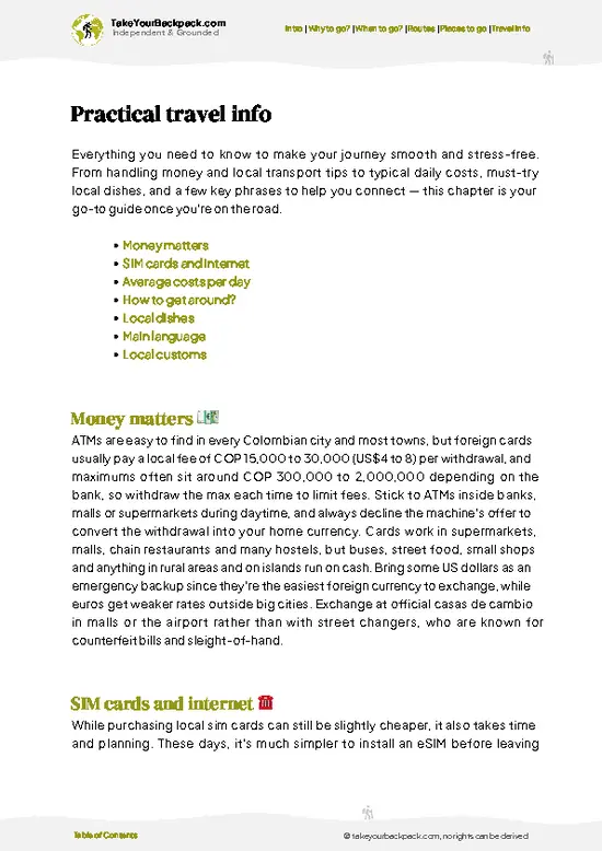
example page 0 from our offline Travel Guide for Colombia
example page 1 from our offline Travel Guide for Colombia
example page 2 from our offline Travel Guide for Colombia
example page 3 from our offline Travel Guide for Colombia
example page 4 from our offline Travel Guide for Colombia
example page 5 from our offline Travel Guide for Colombia
example page 6 from our offline Travel Guide for Colombia
example page 7 from our offline Travel Guide for Colombia
Loading the map 🌍
CLICK TO FILTER
cities
towns
villages
landmarks
national parks
hikes
beaches
attractions
festivals
regions
SHOW COUNTRY’S BESTSHOW ALL

✨ Why go?
Ranked #21 national park in Colombia
Reasons people choose to explore here

Paramillo National Park suits backpackers who want rainforest and cloud forest without other tourists. The park protects the Nudo de Paramillo, where the Cordillera Occidental branches into the Serranías de San Jerónimo and Ayapel, and the Sinú and San Jorge river headwaters. Independent exploring is limited here, so you go with local guides, often through Emberá Katío communities near Tierralta. That makes it a slow, arranged trip rather than a quick trail weekend. Expect effort, mud and few facilities, in return for real isolation.

💡 HighlightsKey sights and experiences for travelers

  1. Nudo de Paramillo: the high knot of the Cordillera Occidental where the Serranías de San Jerónimo and Ayapel branch off, with cloud forest around it.
  2. Alto Sinú: the upper Sinú River valley, with clear water, river crossings and thick lowland forest.
  3. Río Verde: a river that runs through Emberá Katío territory, good for forest walks and swimming in pools.
  4. Cloud forest ridges: mossy slopes with orchids, bromeliads and frequent mist at higher elevations.
  5. Birdwatching: tanagers, toucans and parrots appear along forest edges, and early mornings are best.
  6. Emberá Katío communities: local villages near the park edge where guides and cultural exchanges can be arranged with permission.
Start with the Alto Sinú, because it is the most reachable section and gives a feel for the forest before you commit to anything higher.
Spotted a mistake or missing something? Contact us.

🌤️ When to go?Choosing the right time of year

  • December to March: Driest stretch, with clearer trails and views from the ridgelines. Lowland days run 28 to 33°C (82 to 91°F), while the high páramo drops to 5 to 10°C (41 to 50°F) at night. Colombian holidays bring the biggest crowds.
  • April to November: Two wetter periods, heaviest in April to May and October to November. Expect afternoon downpours, muddy tracks and swollen rivers. Daylight stays close to 12 hours all year, so start early. Lodging is easier to find and cheaper.
Book the trip for January or February and leave by early afternoon.

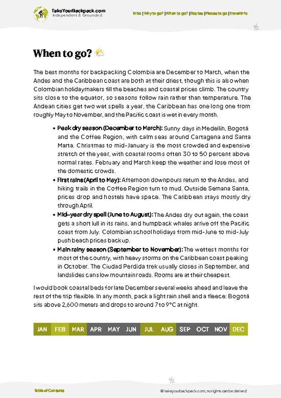
source: climatestotravel.comJANJanuary: highly recommended for travelingFEBFebruary: excellent for travelingMARMarch: excellent for travelingAPRApril: fair for travelingMAYMay: fair for travelingJUNJune: fair for travelingJULJuly: good for travelingAUGAugust: good for travelingSEPSeptember: good for travelingOCTOctober: fair for travelingNOVNovember: fair for travelingDECDecember: highly recommended for traveling
when-to-go

✈️ The backpacker research shortcutColombia Travel Guide

An offline-friendly backpacking guide with optimized travel routes, ranked highlights, transport advice, and the best areas to stay.
example page 0 from our offline Travel Guide for Colombia
example page 1 from our offline Travel Guide for Colombia
example page 2 from our offline Travel Guide for Colombia
example page 3 from our offline Travel Guide for Colombia
example page 4 from our offline Travel Guide for Colombia
example page 5 from our offline Travel Guide for Colombia
example page 6 from our offline Travel Guide for Colombia
example page 7 from our offline Travel Guide for Colombia
The digital guide (349 pages) contains:
✅ 115 highlights, ranked by travel appeal
✅ Optimized 7, 14 & 21-day travel routes
✅ Cities, national parks, landmarks, beaches
✅ How to get around
✅ Offline-friendly for travel without Wi-Fi
👉 Click to see all 30+ guide features

📅 Plan smarter in minutes, not weeks
✅ Month by month travel advice
✅ Festivals & national holidays
✅ Budget expectations

🗺️ Go to the right places, skip the overrated ones
✅ Honest pros & cons of destinations
✅ Top hikes, parks & viewpoints
✅ Lesser-known places most travelers miss
✅ Clear “worth it vs skip it” guidance

🛏️ Travel smoothly without rookie mistakes
✅ Best areas to stay
✅ Transport systems explained simply
✅ Common scams & safety advice
✅ SIM cards, money & practical tips

🌍 Understand the country, not just visit it
✅ Culture & traditions
✅ 52 Essential phrases & customs
✅ Festivals worth planning around
✅ Traveler-friendly historical context
✅ Insights that make places more meaningful

📱 Built for real travel conditions
✅ Fully downloadable PDF
✅ Works completely offline
✅ Optimized for phone use
✅ Useful in remote areas & buses
✅ Everything in one place
Stop searching, start planning
Get instant access to your full guide. 30‑day money-back guarantee.
+ Add another guide for just

By proceeding you agree to our terms.
Sent to your inbox immediately after payment • 100% Secure Checkout
Best Backpacking Travel Advisor 2025 tourism awardBest Backpacking
Travel Advisor
2025
What others say about Take Your Backpack Guides:
⭐⭐⭐⭐⭐
Fantastic, amazing amount of information!
⭐⭐⭐⭐⭐
My goodness this is amazing, it's what I've been looking for hats off too you!
⭐⭐⭐⭐⭐
I think this is absolutely BRILLIANT
⭐⭐⭐⭐
Very complete and informative. It's still missing places, but I gotta to commend you
⭐⭐⭐⭐⭐
This is truly amazing, thank you, can't wait to explore it with my kids!
⭐⭐⭐⭐⭐
Awesome resource, thank you!
⭐⭐⭐⭐⭐
This is amazing! Can't wait to explore the ones I haven't seen
⭐⭐⭐⭐
I love this! Well done, great idea.
⭐⭐⭐⭐⭐
Thanks for taking the time to make this gem!
⭐⭐⭐⭐⭐
This might be the best website I've ever seen.
⭐⭐⭐⭐⭐
Congratulations, and thank you so much for your work; it's incredibly valuable.
⭐⭐⭐⭐
In all seriousness I think you did a great job pointing out the important spots
⭐⭐⭐⭐⭐
10/10 very good
⭐⭐⭐⭐⭐
As someone who's only just starting to visit regularly this is awesome, thank you.
⭐⭐⭐⭐
Thank you very much! I'm going to visit my dad, it's going to be very useful!
⭐⭐⭐⭐⭐
This is really cool! We'll be travelling for the first time and this definitely come in handy.
⭐⭐⭐⭐⭐
You are now our minister of culture, congratulations 👨‍💼
⭐⭐⭐⭐⭐
Just wanted to tell you that this is a pearl! Going to follow your recommendations.
⭐⭐⭐⭐⭐
This is so cool. I'll definitely be using the resource for my travels soon.
⭐⭐⭐⭐⭐
This is very impressive! Good work.
⭐⭐⭐⭐⭐
This is an amazing and informative site. Very well done!

🛏️ Where to stay?How to pick the right area

Paramillo National Park has no lodging or developed campsites, so you sleep in towns around it. Tierralta in Córdoba is the main gateway, with simple hotels and hostels at roughly US$10 to 25 a night and the best access to the Sinú river side. Montería, about 2 to 3 hours away by road, offers more choice, including mid-range hotels from US$25 to 50, plus banks and supplies. On the Antioquia side, Ituango and Caucasia have basic guesthouses for US$8 to 20. Arrange a local guide and permission before heading in, since this is remote territory.

👛 Costs (as of 19 October 2026)Money, prices, and spending tips

A realistic budget for Paramillo National Park is about US$40 to 102 a day, with guide costs driving the total. Tierralta is the usual base, and you pay in Colombian pesos.
CategoryBudget RangeLocal Reality
Entrance and permitsUS$0 to 10Access depends on authorization from park authorities and local communities.
Accommodation (high season)US$10 to 25Basic hotels or hostels in Tierralta; none inside the park.
Local transportUS$3 to 12Shared taxis, motorcycle taxis and buses from Montería to Tierralta.
GuideUS$20 to 40Local guides are the practical way in and are usually required.
Food and suppliesUS$7 to 15Set lunches in town are cheap; trail food must be carried.
Total Daily BudgetUS$40 to 102Per person, per day, in high season.
⚠️ Prices can change and everyone travels differently, so take this as a rough guide. Hope it helps you plan your adventure!

🥾 TrailsTrail guide for Paramillo national park

Paramillo National Park has no formal, signed trail network, so walks are guided routes that follow river valleys and forest tracks from villages near Tierralta.
  • River valley walks: Flat to rolling forest tracks along the Sinú and its tributaries, usually half a day to a full day, easy to moderate, with several wet crossings.
  • Highland treks: Multi-day climbs toward the Nudo de Paramillo, steep, muddy and demanding, with cold mist near the top. They need an experienced guide and camping gear.
  • Wildlife: Expect birds, monkeys, frogs and butterflies. Large cats and tapirs exist but are rarely seen.
Public … read more 👉
Paramillo National Park has no formal, signed trail network, so walks are guided routes that follow river valleys and forest tracks from villages near Tierralta.
  • River valley walks: Flat to rolling forest tracks along the Sinú and its tributaries, usually half a day to a full day, easy to moderate, with several wet crossings.
  • Highland treks: Multi-day climbs toward the Nudo de Paramillo, steep, muddy and demanding, with cold mist near the top. They need an experienced guide and camping gear.
  • Wildlife: Expect birds, monkeys, frogs and butterflies. Large cats and tapirs exist but are rarely seen.
Public transport only gets you as far as Tierralta, reached by bus from Montería. From there you need local transport and a guide, usually by motorbike or boat. Crowds are essentially nonexistent. Entry access depends on local and park authority permission, so confirm before traveling, and carry cash in Colombian pesos because there are no ATMs beyond town.
⚠️ Hiking info can sometimes be outdated or inaccurate. Before you hit the trail, check the latest conditions with locals. If you do spot anything that's off, I'd love to hear from you, so I can update it for fellow travelers.

🛡️ SafetyScams, Hazards, and Annoyances

Paramillo National Park is remote and access can be restricted, so check current conditions with park authorities and local guides in Tierralta before going, and never go in alone. Rain is frequent, rivers rise fast and trails are muddy and poorly marked. Bring waterproof layers, a water filter and a map, and cross rivers only in the morning. Snakes and insects are the main wildlife issue, so wear closed boots and long sleeves.

FAQFrequently asked questions about Paramillo

Plan on 3 to 5 days for Paramillo National Park, since reaching the trailheads from Tierralta eats up a full day each way. Short visits to the lower Sinú river area can be done in 1 to 2 days with a local guide. Higher treks into the páramo need extra days for weather and river levels.
Going without a car is the normal way to reach Paramillo National Park, because the access runs through public transport. Buses and vans run from Montería to Tierralta in about 1.5 to 2.5 hours for roughly US$4 to 8. From Tierralta, hire a local driver or motorcycle taxi for the rough roads, and arrange a guide in town.
Paramillo National Park has no regular ticket booth, but entry needs coordination with park authorities and local communities. Fees are low or none, typically under US$10, though a guide costs around US$20 to 40 a day. Contact Parques Nacionales Naturales in advance, since access can be limited by security and weather.
⚠️ Things can change over time, so always validate details locally before you go.

Other Colombian national parks near Paramillo

Explore more nearby:


💡 Not sure where to go next?
Create a personalized itinerary for Colombia including Paramillo and the places that fit your trip.

Generate my itinerary

👉 Discover all national parks

Or checkout all Colombia has to offer (think cities, towns, villages, national parks, hikes, beaches, festivals)
Country photo of Colombia

We 💚 feedbackFinal thoughts on exploring Paramillo

Many travelers reach Tierralta expecting to walk into Paramillo National Park on their own. Don’t. Contact a local guide or community before you leave Montería, carry waterproof bags, and treat the trip as an arranged expedition.

✈️ When did I visit Colombia?
Did a good 3-week trip around Colombia in August 2014.

✍️ Help improve this page!
The information on this page is based on my own backpacking experience in Colombia, supplemented with up-to-date research and feedback from other travelers. Travel details can change, so if you notice anything outdated or incomplete, feel free to let me know.


🙋‍♂️ Give feedback

👋 Meet the founderWho’s Behind Take Your Backpack?

Johan, backpacker and founder of TakeYourBackpackHi, I’m Johan (Netherlands 🇳🇱), the creator of TakeYourBackpack. Over the past 3 decades, I’ve backpacked through 90+ countries across six continents, gaining extensive experience with independent travel, long-term trips, and overland routes.

This site is built on a combination of firsthand travel experience and carefully curated insights from other backpackers. Many guides are based on places I’ve personally visited, while others bring together tips, observations, and practical advice shared by trusted travelers I’ve met along the way.

The goal is to provide realistic, experience-driven guidance — not generic itineraries — so you can explore destinations with better context, clearer expectations, and more confidence.