×

Costa Rica🇨🇷 | hikesLa Leona to Sirena TrailCorcovado beach walk, river-mouth crossings, Sirena station, tapirs | things to do and best time to go

Explore Drake Bay to San Josecito Coastal TrailExplore Místico Hanging Bridges

Backpacking in La Leona to Sirena Trail
🏆 Top pickhike ranked #1
By Johan Kruseman 🇳🇱 | Updated October 23, 2026

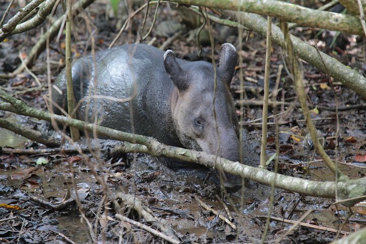
The first thing that stopped me was the sound: a scarlet macaw pair shredding almond nuts overhead on the beach, dropping husks that pattered onto the sand like hail, when I had expected to hear only surf. La Leona to Sirena Trail runs along the Pacific coast of Corcovado National Park, on the Osa Peninsula in Costa Rica. It is flat, roughly 16 kilometers, and brutal anyway: soft sand, 30 degree humidity and tide-dependent river mouths. The scenery is enormous, with empty beaches, jungle walls and tapirs or coatis crossing your path. Getting to La Leona station is the easy bit, since colectivos and buses reach Carate from Puerto Jiménez, but the park limits entry. Book your permit and Sirena bed well ahead, or you may be turned away. Cross the river mouths at low tide to avoid delays and danger, and carry all your water. Plan a first day that starts at dawn, with a tide chart in hand, and you will reach Sirena by mid-afternoon.

Discover everything you want to know in the 📖 Costa Rica Travel Guide.
Best time to go: December - April
Duration: 6 hours
Distance: 16 kilometers
Total ascent: 150 meters


example page 0 from our offline Travel Guide for Costa Rica
example page 1 from our offline Travel Guide for Costa Rica
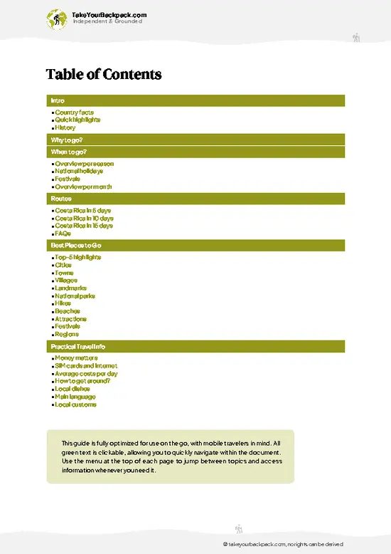
example page 2 from our offline Travel Guide for Costa Rica
example page 3 from our offline Travel Guide for Costa Rica
example page 4 from our offline Travel Guide for Costa Rica
example page 5 from our offline Travel Guide for Costa Rica
example page 6 from our offline Travel Guide for Costa Rica
example page 7 from our offline Travel Guide for Costa Rica
Loading the map 🌍
CLICK TO FILTER
cities
towns
villages
landmarks
national parks
hikes
beaches
attractions
festivals
regions
SHOW COUNTRY’S BESTSHOW ALL

✨ Why go?
Ranked #1 hike in Costa Rica
What makes it a must-see hike

La Leona to Sirena Trail gives you the shortest route into the heart of Corcovado, and it is the one where the coastline does the work for you. There are no switchbacks, no summit pushes, just a long beach walk where the payoff arrives constantly: scarlet macaws in the almond trees, spider monkeys in the canopy edge and the chance of a tapir at dusk. For a wildlife-first hiker, that density of sightings is the main draw.
The second reason is how neatly it fits a longer route. Carate, at the trailhead, links back to Puerto Jiménez by colectivo, and from Sirena you can continue on the interior trail to San Pedrillo or loop out by boat, so you can stretch this into a three-day Corcovado traverse or keep it to a single push. Distances are flexible, because the La Leona ranger station is only a … read more 👉
La Leona to Sirena Trail gives you the shortest route into the heart of Corcovado, and it is the one where the coastline does the work for you. There are no switchbacks, no summit pushes, just a long beach walk where the payoff arrives constantly: scarlet macaws in the almond trees, spider monkeys in the canopy edge and the chance of a tapir at dusk. For a wildlife-first hiker, that density of sightings is the main draw.
The second reason is how neatly it fits a longer route. Carate, at the trailhead, links back to Puerto Jiménez by colectivo, and from Sirena you can continue on the interior trail to San Pedrillo or loop out by boat, so you can stretch this into a three-day Corcovado traverse or keep it to a single push. Distances are flexible, because the La Leona ranger station is only a short walk from the road end, letting you turn around if the tide or the heat beats you.
It also forces real planning, which many hikers come to enjoy. Tide tables, permits and water logistics make this feel like an expedition without needing technical skills.

💡 HighlightsKey sights and experiences for travelers

  1. Sirena Ranger Station: The destination and the best-known stop in the park. Its clearing and trails draw tapirs, coatis, curassows and sometimes bull sharks in the nearby river mouth. Dorm beds and meals here must be booked in advance.
  2. La Leona Ranger Station: The trailhead, set among coconut palms behind the beach. Rangers check your permit here, and it is a good place to spot macaws before the walk begins.
  3. Scarlet macaws in the beach almonds: Pairs gather in the beach almond trees along the whole route. Their raucous calls and the husks they drop are the signature sound of the hike.
  4. River mouth crossings: Several streams cross the beach, and the Río Madrigal mouth is one of them. Depending on the tide they can be shin-deep or dangerously deep, and sharks are sometimes reported at the larger
… read more 👉
  1. Sirena Ranger Station: The destination and the best-known stop in the park. Its clearing and trails draw tapirs, coatis, curassows and sometimes bull sharks in the nearby river mouth. Dorm beds and meals here must be booked in advance.
  2. La Leona Ranger Station: The trailhead, set among coconut palms behind the beach. Rangers check your permit here, and it is a good place to spot macaws before the walk begins.
  3. Scarlet macaws in the beach almonds: Pairs gather in the beach almond trees along the whole route. Their raucous calls and the husks they drop are the signature sound of the hike.
  4. River mouth crossings: Several streams cross the beach, and the Río Madrigal mouth is one of them. Depending on the tide they can be shin-deep or dangerously deep, and sharks are sometimes reported at the larger mouths. Time them at low tide.
  5. Rocky headlands and tidepools: Between beach sections, the trail cuts over small forested points where you step into shade and then drop back onto sand. Tidepools hold crabs and small fish, and howler monkeys often call from above.
Sirena Ranger Station and the scarlet macaws combine well in one day, since you can watch the birds along the beach in the morning and reach the station by afternoon.
Spotted a mistake or missing something? Contact us.
Things to do near La Leona to Sirena Trail

Ratings based on Tripadvisor reviews. When you book through this link, you support our work at no extra cost to you.

🌤️ When to go?When to go for the best experience

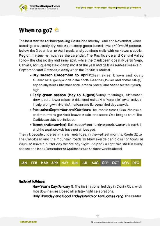
  • Dry Season (late December to April): Best window for the 16 to 20 km coastal walk between La Leona and Sirena in Corcovado National Park. Rain is light, rivers run lower, and days sit around 30 to 34°C (86 to 93°F) with punishing humidity. Sunrise and sunset stay close to 12 hours apart all year, so start early. Bunks at Sirena fill fast, and permits sell out weeks ahead.
  • Green Season (May to mid-November): Daily downpours, hot mornings near 28 to 32°C (82 to 90°F), and swollen river mouths. The Río Madrigal and Río Sirena crossings can become impassable, and low tide windows matter even more.
  • Wettest Months (September to November): Peak rain, lowest prices, very few hikers. Some stretches of beach disappear at high tide, and the park may restrict access.
  • Shoulder Weeks (December and May): Fewer
… read more 👉
  • Dry Season (late December to April): Best window for the 16 to 20 km coastal walk between La Leona and Sirena in Corcovado National Park. Rain is light, rivers run lower, and days sit around 30 to 34°C (86 to 93°F) with punishing humidity. Sunrise and sunset stay close to 12 hours apart all year, so start early. Bunks at Sirena fill fast, and permits sell out weeks ahead.
  • Green Season (May to mid-November): Daily downpours, hot mornings near 28 to 32°C (82 to 90°F), and swollen river mouths. The Río Madrigal and Río Sirena crossings can become impassable, and low tide windows matter even more.
  • Wettest Months (September to November): Peak rain, lowest prices, very few hikers. Some stretches of beach disappear at high tide, and the park may restrict access.
  • Shoulder Weeks (December and May): Fewer people, patchy showers, and room to book on short notice.
Plan your beach sections around low tide, since the tide table matters more than the month.


source: climatestotravel.comJANJanuary: excellent for travelingFEBFebruary: excellent for travelingMARMarch: excellent for travelingAPRApril: excellent for travelingMAYMay: fair for travelingJUNJune: fair for travelingJULJuly: fair for travelingAUGAugust: fair for travelingSEPSeptember: fair for travelingOCTOctober: fair for travelingNOVNovember: fair for travelingDECDecember: excellent for traveling
costa-rica-hike-la-leona-to-sirena-trail v1
© Google |

✈️ The backpacker research shortcutCosta Rica Travel Guide

An offline-friendly backpacking guide with optimized travel routes, ranked highlights, transport advice, and the best areas to stay.
example page 0 from our offline Travel Guide for Costa Rica
example page 1 from our offline Travel Guide for Costa Rica
example page 2 from our offline Travel Guide for Costa Rica
example page 3 from our offline Travel Guide for Costa Rica
example page 4 from our offline Travel Guide for Costa Rica
example page 5 from our offline Travel Guide for Costa Rica
example page 6 from our offline Travel Guide for Costa Rica
example page 7 from our offline Travel Guide for Costa Rica
The digital guide (287 pages) contains:
✅ 90 highlights, ranked by travel appeal
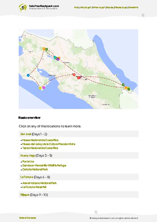
✅ Optimized 5, 10 & 15-day travel routes
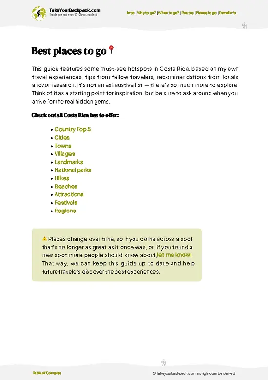
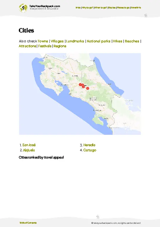
✅ Cities, national parks, landmarks, beaches
✅ How to get around
✅ Offline-friendly for travel without Wi-Fi
👉 Click to see all 30+ guide features

📅 Plan smarter in minutes, not weeks
✅ Month by month travel advice
✅ Festivals & national holidays
✅ Budget expectations

🗺️ Go to the right places, skip the overrated ones
✅ Honest pros & cons of destinations
✅ Top hikes, parks & viewpoints
✅ Lesser-known places most travelers miss
✅ Clear “worth it vs skip it” guidance

🛏️ Travel smoothly without rookie mistakes
✅ Best areas to stay
✅ Transport systems explained simply
✅ Common scams & safety advice
✅ SIM cards, money & practical tips

🌍 Understand the country, not just visit it
✅ Culture & traditions
✅ 52 Essential phrases & customs
✅ Festivals worth planning around
✅ Traveler-friendly historical context
✅ Insights that make places more meaningful

📱 Built for real travel conditions
✅ Fully downloadable PDF
✅ Works completely offline
✅ Optimized for phone use
✅ Useful in remote areas & buses
✅ Everything in one place
Stop searching, start planning
Get instant access to your full guide. 30‑day money-back guarantee.
+ Add another guide for just

By proceeding you agree to our terms.
Sent to your inbox immediately after payment • 100% Secure Checkout
Best Backpacking Travel Advisor 2025 tourism awardBest Backpacking
Travel Advisor
2025
What others say about Take Your Backpack Guides:
⭐⭐⭐⭐⭐
Fantastic, amazing amount of information!
⭐⭐⭐⭐⭐
My goodness this is amazing, it's what I've been looking for hats off too you!
⭐⭐⭐⭐⭐
I think this is absolutely BRILLIANT
⭐⭐⭐⭐
Very complete and informative. It's still missing places, but I gotta to commend you
⭐⭐⭐⭐⭐
This is truly amazing, thank you, can't wait to explore it with my kids!
⭐⭐⭐⭐⭐
Awesome resource, thank you!
⭐⭐⭐⭐⭐
This is amazing! Can't wait to explore the ones I haven't seen
⭐⭐⭐⭐
I love this! Well done, great idea.
⭐⭐⭐⭐⭐
Thanks for taking the time to make this gem!
⭐⭐⭐⭐⭐
This might be the best website I've ever seen.
⭐⭐⭐⭐⭐
Congratulations, and thank you so much for your work; it's incredibly valuable.
⭐⭐⭐⭐
In all seriousness I think you did a great job pointing out the important spots
⭐⭐⭐⭐⭐
10/10 very good
⭐⭐⭐⭐⭐
As someone who's only just starting to visit regularly this is awesome, thank you.
⭐⭐⭐⭐
Thank you very much! I'm going to visit my dad, it's going to be very useful!
⭐⭐⭐⭐⭐
This is really cool! We'll be travelling for the first time and this definitely come in handy.
⭐⭐⭐⭐⭐
You are now our minister of culture, congratulations 👨‍💼
⭐⭐⭐⭐⭐
Just wanted to tell you that this is a pearl! Going to follow your recommendations.
⭐⭐⭐⭐⭐
This is so cool. I'll definitely be using the resource for my travels soon.
⭐⭐⭐⭐⭐
This is very impressive! Good work.
⭐⭐⭐⭐⭐
This is an amazing and informative site. Very well done!

🛏️ Where to stay?Best areas and accommodation options

If you enjoy meeting fellow travelers, consider choosing hostels with high ratings for atmosphere. On the other hand, if you prefer having your own space, a hotel might be a better option.

🥾 Hike detailsHike details: route, duration, and difficulty of La Leona to Sirena Trail

Total Distance: La Leona to Sirena Trail covers about 16 kilometers one way, mostly along the beach.
Estimated Duration: 5 to 7 hours, depending on sand, tide and heat.
Difficulty: Moderate to demanding. The route is nearly flat, but soft sand, humidity and tidal timing make it tiring.
Starting Point: La Leona ranger station near Carate, on the southern edge of Corcovado National Park.
  • Public Transport: Colectivo trucks and buses run from Puerto Jiménez to Carate, and you walk from the road end to the station.
  • Permit: Entry requires a park permit booked ahead, and you must be registered with a night
… read more 👉
Total Distance: La Leona to Sirena Trail covers about 16 kilometers one way, mostly along the beach.
Estimated Duration: 5 to 7 hours, depending on sand, tide and heat.
Difficulty: Moderate to demanding. The route is nearly flat, but soft sand, humidity and tidal timing make it tiring.
Starting Point: La Leona ranger station near Carate, on the southern edge of Corcovado National Park.
  • Public Transport: Colectivo trucks and buses run from Puerto Jiménez to Carate, and you walk from the road end to the station.
  • Permit: Entry requires a park permit booked ahead, and you must be registered with a night at Sirena.
Major Landmarks:
  • La Leona Station: Permit check and the last easy water source.
  • River mouths: Several crossings that depend on the tide.
  • Headlands: Short forest sections that break the beach walk.
  • Sirena Station: Lodging, a dining hall and the main wildlife area.
Terrain and Scenery: Hard and soft sand, rocky points, tree roots and some mud. Views are long and open, with surf on one side and dense forest on the other.
Vegetation: Beach almond, coconut palms, mangrove edges and lowland rainforest with large buttressed trees.
Wildlife: Scarlet macaws, white-faced and spider monkeys, coatis, peccaries and tapirs near Sirena. Crocodiles and sharks can appear at river mouths, so cross carefully.
Practical Notes: Start at dawn, carry plenty of water since sources are limited, and bring a tide chart.
⚠️ Hiking info can sometimes be outdated or inaccurate. Before you hit the trail, check the latest conditions with locals. If you do spot anything that's off, I'd love to hear from you, so I can update it for fellow travelers.

🛡️ SafetyStaying Safe: What Travelers Should Know

The La Leona to Sirena Trail is a hot, tide-driven beach walk where heat and timing cause most problems. Leave La Leona station at first light and aim to cross the Río Madrigal near low tide, because the river mouth can run waist deep and bull sharks have been reported in the lower rivers, so cross quickly, away from the mouth, and only when the ranger advises. Carry at least 4 to 5 liters of water per person, since the beach has few reliable sources, and add electrolytes. Sand walking slows you down, so budget more hours than the distance suggests. Snakes, including the fer-de-lance, hide in leaf litter on the forest edge, so watch where you step and wear closed shoes. Give tapirs, peccaries and crocodiles generous space, and never feed monkeys or coatis. Store food sealed because animals … read more 👉
The La Leona to Sirena Trail is a hot, tide-driven beach walk where heat and timing cause most problems. Leave La Leona station at first light and aim to cross the Río Madrigal near low tide, because the river mouth can run waist deep and bull sharks have been reported in the lower rivers, so cross quickly, away from the mouth, and only when the ranger advises. Carry at least 4 to 5 liters of water per person, since the beach has few reliable sources, and add electrolytes. Sand walking slows you down, so budget more hours than the distance suggests. Snakes, including the fer-de-lance, hide in leaf litter on the forest edge, so watch where you step and wear closed shoes. Give tapirs, peccaries and crocodiles generous space, and never feed monkeys or coatis. Store food sealed because animals raid packs at Sirena. Rain turns the trail muddy, so pack a dry bag.

FAQCommon questions from travelers

The La Leona to Sirena Trail takes most hikers 6 to 9 hours for roughly 16 to 20 km, usually done in a single day. Start at La Leona ranger station around 6 am so you reach the Río Madrigal and Río Sirena at manageable tides. You then sleep at Sirena station, which is the usual midpoint of the longer Corcovado loop.
The La Leona to Sirena Trail is moderately hard, mainly because of heat, soft sand, humidity and tide-dependent river crossings rather than steep climbs. Elevation change is minimal, but you carry 4 to 5 liters of water plus gear across mostly exposed beach. Fit hikers manage it comfortably, while first-timers should expect to finish tired.
Yes, the La Leona to Sirena Trail requires a park permit and, under current Corcovado rules, a licensed guide must accompany you. Permits are booked through the official SINAC system and entry is around US$15 to 20 per day, plus Sirena station bunks and meals booked in advance, often US$40 to 70 per night with food. Guided packages from Puerto Jiménez commonly run US$150 to 300 per person per day, depending on group size.
⚠️ Things can change over time, so always validate details locally before you go.

Other Costa Rican hikes near La Leona to Sirena Trail

Explore more nearby:


💡 Not sure where to go next?
Create a personalized itinerary for Costa Rica including La Leona to Sirena Trail and the places that fit your trip.

Generate my itinerary

👉 Discover all hikes

Or checkout all Costa Rica has to offer (think cities, towns, villages, national parks, hikes, beaches, festivals)
Country photo of Costa Rica

We 💚 feedbackWhat to keep in mind

La Leona to Sirena Trail works best as the opening leg of a longer Corcovado loop. I would walk it in, spend a night or two at Sirena, then continue inland toward San Pedrillo or finish with a boat to Drake Bay. Skip it if you dislike heat, because the sand is relentless.

✈️ When did I visit Costa Rica?
Costa Rica I visited during my half year trip through South and Central America back in 2003

✍️ Help improve this page!
The information on this page is based on my own backpacking experience in Costa Rica, supplemented with up-to-date research and feedback from other travelers. Travel details can change, so if you notice anything outdated or incomplete, feel free to let me know.


🙋‍♂️ Give feedback

👋 Meet the founderWho’s Behind Take Your Backpack?

Johan, backpacker and founder of TakeYourBackpackHi, I’m Johan (Netherlands 🇳🇱), the creator of TakeYourBackpack. Over the past 3 decades, I’ve backpacked through 90+ countries across six continents, gaining extensive experience with independent travel, long-term trips, and overland routes.

This site is built on a combination of firsthand travel experience and carefully curated insights from other backpackers. Many guides are based on places I’ve personally visited, while others bring together tips, observations, and practical advice shared by trusted travelers I’ve met along the way.

The goal is to provide realistic, experience-driven guidance — not generic itineraries — so you can explore destinations with better context, clearer expectations, and more confidence.