×

Costa Rica🇨🇷 | landmarksCerro de la MuertePan-American high point, páramo, dwarf bamboo, quetzal valley | things to do and best time to go

Explore Bijagual WaterfallExplore La Fortuna Waterfall

Backpacking in Cerro de la Muerte
🌟 Highlightunique site ranked #2
By Johan Kruseman 🇳🇱 | Updated October 22, 2026

Cerro de la Muerte costs nothing to see, since the Pan-American Highway climbs right over it and you can stop at any pullout. It sits in the Talamanca range of Costa Rica, south-east of San José on the road toward San Isidro de El General. Be realistic: the summit is a highway, with trucks grinding past, fog that can swallow the view, and no ticketed attraction. The pull is the páramo, a low, wind-combed world of dwarf bamboo, shrubs and stunted oaks that looks nothing like the lowland jungle. At a roadside soda I once paid US$3 for a mug of coffee so hot and sweet it tasted of woodsmoke, plus a cheese empanada with a crust that shattered. Diesel fumes and wet moss hung in the same breath. Unlike the volcano crowds at Poás, you will share the roadside with a handful of birders.

Discover everything you want to know in the 📖 Costa Rica Travel Guide.


example page 0 from our offline Travel Guide for Costa Rica
example page 1 from our offline Travel Guide for Costa Rica
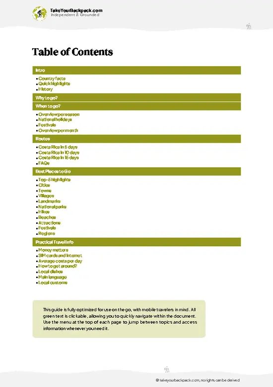
example page 2 from our offline Travel Guide for Costa Rica
example page 3 from our offline Travel Guide for Costa Rica
example page 4 from our offline Travel Guide for Costa Rica
example page 5 from our offline Travel Guide for Costa Rica
example page 6 from our offline Travel Guide for Costa Rica
example page 7 from our offline Travel Guide for Costa Rica
Loading the map 🌍
CLICK TO FILTER
cities
towns
villages
landmarks
national parks
hikes
beaches
attractions
festivals
regions
SHOW COUNTRY’S BESTSHOW ALL

✨ Why go?
Ranked #2 unique site in Costa Rica
What sets this place apart

Cerro de la Muerte is the easiest way in Costa Rica to stand in high-altitude páramo without a mountaineering permit. The road tops out near 3,335 meters, so you reach cloud-forest and alpine-style terrain from a bus window or a rental car seat. That matters if you have a tight route and no appetite for a multi-day Chirripó push.
The second reason is the birds. The highway is the gateway to the Savegre Valley and San Gerardo de Dota, where resplendent quetzals feed on wild avocados, and the roadside oaks hold hummingbirds like the volcano hummingbird and fiery-throated hummingbird. You can see far more here, on a small budget, than at the better-known reserves farther north.
The third is fit. Cerro de la Muerte sits on the natural line between the Central Valley and the south, so it works as … read more 👉
Cerro de la Muerte is the easiest way in Costa Rica to stand in high-altitude páramo without a mountaineering permit. The road tops out near 3,335 meters, so you reach cloud-forest and alpine-style terrain from a bus window or a rental car seat. That matters if you have a tight route and no appetite for a multi-day Chirripó push.
The second reason is the birds. The highway is the gateway to the Savegre Valley and San Gerardo de Dota, where resplendent quetzals feed on wild avocados, and the roadside oaks hold hummingbirds like the volcano hummingbird and fiery-throated hummingbird. You can see far more here, on a small budget, than at the better-known reserves farther north.
The third is fit. Cerro de la Muerte sits on the natural line between the Central Valley and the south, so it works as a pause on the way to Dominical, Uvita, the Osa Peninsula or the Chirripó trailhead. Bring a warm layer and cash for roadside meals. Plan around daylight, because the fog and trucks make night driving here miserable.

💡 HighlightsThe experiences that define the visit

  1. Highway summit and the Pan-American high point: The road peaks at about 3,335 meters, the highest point of the Pan-American Highway in Costa Rica. Pullouts let you stand beside the signs and the wind-bent vegetation. It is free and takes ten minutes.
  2. Páramo landscape: Look for dwarf bamboo, mossy shrubs, bright orange and yellow wildflowers and patches of stunted oak. The ground is spongy, the air thin and cold, and the horizon often flattens into mist.
  3. Cerro Buenavista: The mountain’s own summit (Cerro de la Muerte is also called Cerro Buenavista), crowned with communications towers, around 3,490 meters. On the rare clear morning, the views stretch toward both coasts. The approach is a rough, steep road, so check conditions before you go.
  4. Quetzal viewing in the Savegre Valley: The turnoff to
… read more 👉
  1. Highway summit and the Pan-American high point: The road peaks at about 3,335 meters, the highest point of the Pan-American Highway in Costa Rica. Pullouts let you stand beside the signs and the wind-bent vegetation. It is free and takes ten minutes.
  2. Páramo landscape: Look for dwarf bamboo, mossy shrubs, bright orange and yellow wildflowers and patches of stunted oak. The ground is spongy, the air thin and cold, and the horizon often flattens into mist.
  3. Cerro Buenavista: The mountain’s own summit (Cerro de la Muerte is also called Cerro Buenavista), crowned with communications towers, around 3,490 meters. On the rare clear morning, the views stretch toward both coasts. The approach is a rough, steep road, so check conditions before you go.
  4. Quetzal viewing in the Savegre Valley: The turnoff to San Gerardo de Dota drops you into cloud forest where the resplendent quetzal feeds on wild avocados. Local guides know the fruiting trees, and many lodges charge a modest entry for their trails.
  5. Talamanca oak forests: Oaks draped in bromeliads, ferns and orchids line the road, and their trunks reach upward through the fog. They are good places to listen for the buzz of hummingbirds, which dart among flowering shrubs.
  6. Roadside sodas and trout stops: Small family places along the highway serve coffee, empanadas and rainbow trout farmed in the cold mountain streams. Steam on the windows and a wood-fired smell make them a welcome shelter when the wind picks up.
Start with the summit pullouts at Cerro de la Muerte in the early morning, when the fog has not yet climbed the slope and the páramo is clearest.
Spotted a mistake or missing something? Contact us.

Things to do near Cerro de la Muerte

Ratings based on Tripadvisor reviews. When you book through this link, you support our work at no extra cost to you.

🌤️ When to go?Weather, crowds, and seasonal trade-offs

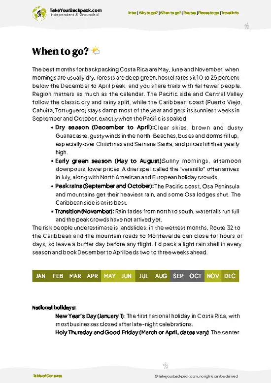
  • Dry Season (December to April): Clear mornings give the best odds of seeing the páramo and the Talamanca ridgelines from the Pan-American Highway, which tops out near 3,335 m (10,942 ft). Daytime highs sit around 12 to 17°C (54 to 63°F), and nights drop close to freezing, 0 to 4°C (32 to 39°F). Daylight lasts about 11 hours. This is peak season for quetzal watching (February to April is nesting time), so lodges fill and rates rise.
  • Green Season (May to November): Afternoon cloud and drizzle roll in early, and fog can cut visibility on the road to a few meters. Temperatures stay similar to the dry months, but everything feels damper. Prices drop 20 to 30 percent and trails are quiet. September and October are the wettest.
  • Quetzal and Birding Window: Wild avocado trees fruit from roughly November
… read more 👉
  • Dry Season (December to April): Clear mornings give the best odds of seeing the páramo and the Talamanca ridgelines from the Pan-American Highway, which tops out near 3,335 m (10,942 ft). Daytime highs sit around 12 to 17°C (54 to 63°F), and nights drop close to freezing, 0 to 4°C (32 to 39°F). Daylight lasts about 11 hours. This is peak season for quetzal watching (February to April is nesting time), so lodges fill and rates rise.
  • Green Season (May to November): Afternoon cloud and drizzle roll in early, and fog can cut visibility on the road to a few meters. Temperatures stay similar to the dry months, but everything feels damper. Prices drop 20 to 30 percent and trails are quiet. September and October are the wettest.
  • Quetzal and Birding Window: Wild avocado trees fruit from roughly November to February, drawing resplendent quetzals down to lower, easier-to-reach elevations.
Start hikes before 8 am, when the sky is clearest and the wind has not yet picked up.


source: climatestotravel.comJANJanuary: excellent for travelingFEBFebruary: excellent for travelingMARMarch: excellent for travelingAPRApril: highly recommended for travelingMAYMay: highly recommended for travelingJUNJune: good for travelingJULJuly: good for travelingAUGAugust: good for travelingSEPSeptember: fair for travelingOCTOctober: fair for travelingNOVNovember: highly recommended for travelingDECDecember: excellent for traveling
costa-rica-unique-site-cerro-de-la-muerte
© Google | Ana Lau Fdz

✈️ The backpacker research shortcutCosta Rica Travel Guide

An offline-friendly backpacking guide with optimized travel routes, ranked highlights, transport advice, and the best areas to stay.
example page 0 from our offline Travel Guide for Costa Rica
example page 1 from our offline Travel Guide for Costa Rica
example page 2 from our offline Travel Guide for Costa Rica
example page 3 from our offline Travel Guide for Costa Rica
example page 4 from our offline Travel Guide for Costa Rica
example page 5 from our offline Travel Guide for Costa Rica
example page 6 from our offline Travel Guide for Costa Rica
example page 7 from our offline Travel Guide for Costa Rica
The digital guide (287 pages) contains:
✅ 90 highlights, ranked by travel appeal
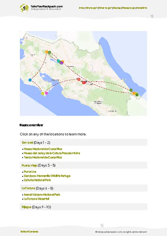
✅ Optimized 5, 10 & 15-day travel routes
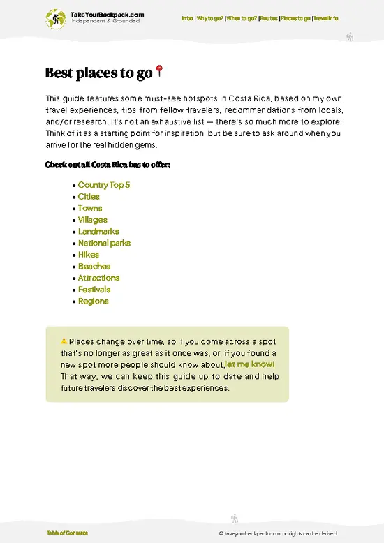
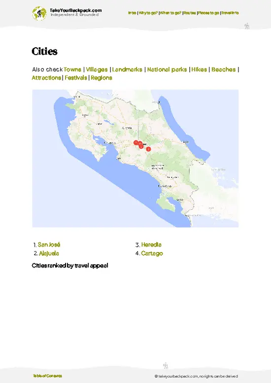
✅ Cities, national parks, landmarks, beaches
✅ How to get around
✅ Offline-friendly for travel without Wi-Fi
👉 Click to see all 30+ guide features

📅 Plan smarter in minutes, not weeks
✅ Month by month travel advice
✅ Festivals & national holidays
✅ Budget expectations

🗺️ Go to the right places, skip the overrated ones
✅ Honest pros & cons of destinations
✅ Top hikes, parks & viewpoints
✅ Lesser-known places most travelers miss
✅ Clear “worth it vs skip it” guidance

🛏️ Travel smoothly without rookie mistakes
✅ Best areas to stay
✅ Transport systems explained simply
✅ Common scams & safety advice
✅ SIM cards, money & practical tips

🌍 Understand the country, not just visit it
✅ Culture & traditions
✅ 52 Essential phrases & customs
✅ Festivals worth planning around
✅ Traveler-friendly historical context
✅ Insights that make places more meaningful

📱 Built for real travel conditions
✅ Fully downloadable PDF
✅ Works completely offline
✅ Optimized for phone use
✅ Useful in remote areas & buses
✅ Everything in one place
Stop searching, start planning
Get instant access to your full guide. 30‑day money-back guarantee.
+ Add another guide for just

By proceeding you agree to our terms.
Sent to your inbox immediately after payment • 100% Secure Checkout
Best Backpacking Travel Advisor 2025 tourism awardBest Backpacking
Travel Advisor
2025
What others say about Take Your Backpack Guides:
⭐⭐⭐⭐⭐
Fantastic, amazing amount of information!
⭐⭐⭐⭐⭐
My goodness this is amazing, it's what I've been looking for hats off too you!
⭐⭐⭐⭐⭐
I think this is absolutely BRILLIANT
⭐⭐⭐⭐
Very complete and informative. It's still missing places, but I gotta to commend you
⭐⭐⭐⭐⭐
This is truly amazing, thank you, can't wait to explore it with my kids!
⭐⭐⭐⭐⭐
Awesome resource, thank you!
⭐⭐⭐⭐⭐
This is amazing! Can't wait to explore the ones I haven't seen
⭐⭐⭐⭐
I love this! Well done, great idea.
⭐⭐⭐⭐⭐
Thanks for taking the time to make this gem!
⭐⭐⭐⭐⭐
This might be the best website I've ever seen.
⭐⭐⭐⭐⭐
Congratulations, and thank you so much for your work; it's incredibly valuable.
⭐⭐⭐⭐
In all seriousness I think you did a great job pointing out the important spots
⭐⭐⭐⭐⭐
10/10 very good
⭐⭐⭐⭐⭐
As someone who's only just starting to visit regularly this is awesome, thank you.
⭐⭐⭐⭐
Thank you very much! I'm going to visit my dad, it's going to be very useful!
⭐⭐⭐⭐⭐
This is really cool! We'll be travelling for the first time and this definitely come in handy.
⭐⭐⭐⭐⭐
You are now our minister of culture, congratulations 👨‍💼
⭐⭐⭐⭐⭐
Just wanted to tell you that this is a pearl! Going to follow your recommendations.
⭐⭐⭐⭐⭐
This is so cool. I'll definitely be using the resource for my travels soon.
⭐⭐⭐⭐⭐
This is very impressive! Good work.
⭐⭐⭐⭐⭐
This is an amazing and informative site. Very well done!

🛏️ Where to stay?Where staying makes the most sense

The best bases are the small highland villages along the Pan-American Highway, plus San Gerardo de Dota, where most birders and hikers end up. San Gerardo de Dota sits in a deep valley about 8 km (5 miles) off the highway, down a steep, winding road. It is quiet and green, with river trails and quetzal-spotting at dawn. Budget beds are limited, so book ahead in the dry months, and expect to bring snacks because there are few shops. It suits solo travelers who like early mornings and cozy lodge common areas.
Copey and Providencia, higher up on the ridge, are cheaper and more rural. They have farm … read more 👉
The best bases are the small highland villages along the Pan-American Highway, plus San Gerardo de Dota, where most birders and hikers end up. San Gerardo de Dota sits in a deep valley about 8 km (5 miles) off the highway, down a steep, winding road. It is quiet and green, with river trails and quetzal-spotting at dawn. Budget beds are limited, so book ahead in the dry months, and expect to bring snacks because there are few shops. It suits solo travelers who like early mornings and cozy lodge common areas.
Copey and Providencia, higher up on the ridge, are cheaper and more rural. They have farm stays and simple cabins with wood stoves, which you will want since nights are cold. Social life here means sharing a table with fellow hikers rather than nightlife.
If you want more services and a livelier hostel scene, stay in San Isidro de El General, on the southern side of the pass. It has ATMs, supermarkets, bus connections and plenty of budget dorms. Buses to the summit area take about 1.5 hours, so it works well if you are traveling onward to the Pacific coast. Pack a warm layer wherever you sleep.

👛 Costs (as of 22 October 2026)What things cost and how to budget

Cerro de la Muerte costs a backpacker about US$38 to 55 a day when you base yourself in the highlands along the Pan-American Highway (Route 2), with no entry fee for the road itself. Most spending goes to a bed, hot food and the bus fare in from San José or San Isidro. Everything is paid in colones, and cards work at the larger lodges and restaurants but not at roadside stands.
CategoryBudget RangeLocal Reality
Accommodation (high season, Dec to Apr)US$15 to 25Dorm beds and basic cabins near Cerro de la Muerte are scarce, so many travelers sleep in San Gerardo de Dota or Santa María de Dota. Mountain cabins with heaters cost more.
Accommodation (low season, May to Nov)US$12 to 20Rooms are easier to find and owners often discount for longer stays.
FoodUS$8 to 14A casado (rice, beans, meat, salad)
… read more 👉
Cerro de la Muerte costs a backpacker about US$38 to 55 a day when you base yourself in the highlands along the Pan-American Highway (Route 2), with no entry fee for the road itself. Most spending goes to a bed, hot food and the bus fare in from San José or San Isidro. Everything is paid in colones, and cards work at the larger lodges and restaurants but not at roadside stands.
CategoryBudget RangeLocal Reality
Accommodation (high season, Dec to Apr)US$15 to 25Dorm beds and basic cabins near Cerro de la Muerte are scarce, so many travelers sleep in San Gerardo de Dota or Santa María de Dota. Mountain cabins with heaters cost more.
Accommodation (low season, May to Nov)US$12 to 20Rooms are easier to find and owners often discount for longer stays.
FoodUS$8 to 14A casado (rice, beans, meat, salad) at a roadside soda runs US$5 to 8. Trout is the local specialty and costs more at lodge restaurants.
Local transportUS$3 to 9Public buses along the highway between San José and San Isidro de El General cost roughly US$4 to 7. A taxi or shuttle down to San Gerardo de Dota is about US$20 to 35 per vehicle.
ActivitiesUS$0 to 12Walking the roadside and páramo trails is free. Private reserves and quetzal-viewing areas charge about US$10 to 20 for entry, and guided bird walks cost extra.
ExtrasUS$2 to 5Hot coffee, a warm layer from a roadside stall, and snacks. Nights drop close to 5°C (41°F).
Total Daily BudgetUS$38 to 55Based on high-season accommodation plus food, bus fares, a modest entry fee and extras.
⚠️ Prices can change and everyone travels differently, so take this as a rough guide. Hope it helps you plan your adventure!

FAQTraveler FAQ

Cerro de la Muerte is a high mountain pass on the Pan-American Highway (Route 2) in the Talamanca range, below a summit of about 3,491 m (11,453 ft). It is known for cold páramo scenery, oak forest and birdwatching, especially the resplendent quetzal in nearby San Gerardo de Dota. The name means “Hill of Death” and dates from when crossing it on foot or by oxcart was dangerous.
Plan on a half day if you only want to drive through and stop at viewpoints, or 2 days if you want to include San Gerardo de Dota. Quetzal tours start around 6 am and last 2 to 3 hours, and hiking the valley trails takes another half day. Cerro de la Muerte works best with one night in the area so you can catch the clear early morning.
Drive or take a bus along the Pan-American Highway, which links San José and San Isidro de El General. From San José, the trip to the summit takes about 2 to 2.5 hours by car, roughly 80 km (50 miles). Buses toward San Isidro cost about US$4 to 6 and will drop you at roadside stops. For San Gerardo de Dota, ask the driver to let you off at the junction near km 80, then take a taxi down the 8 km (5 mile) road for US$15 to 30.
⚠️ Things can change over time, so always validate details locally before you go.

Other Costa Rican landmarks near Cerro de la Muerte

Explore more nearby:

  • Bijagual Waterfall—180-meter plunge, mossy basalt wall, muddy forest trail, Turrubares hills| 95 km away
  • La Fortuna Waterfall—500 steps, 70-meter drop, spray-soaked base, Arenal backdrop| 140 km away

💡 Not sure where to go next?
Create a personalized itinerary for Costa Rica including Cerro de la Muerte and the places that fit your trip.

Generate my itinerary

👉 Discover all landmarks

Or checkout all Costa Rica has to offer (think cities, towns, villages, national parks, hikes, beaches, festivals)
Country photo of Costa Rica

We 💚 feedbackSumming up the experience

Cerro de la Muerte is at its best in the early morning, ideally in the drier months of December to April, when the fog lifts and the páramo shows its colors. I would bring a warm jacket and a thermos, and I would skip the summit after dark.

✈️ When did I visit Costa Rica?
Costa Rica I visited during my half year trip through South and Central America back in 2003

✍️ Help improve this page!
The information on this page is based on my own backpacking experience in Costa Rica, supplemented with up-to-date research and feedback from other travelers. Travel details can change, so if you notice anything outdated or incomplete, feel free to let me know.


🙋‍♂️ Give feedback

👋 Meet the founderWho’s Behind Take Your Backpack?

Johan, backpacker and founder of TakeYourBackpackHi, I’m Johan (Netherlands 🇳🇱), the creator of TakeYourBackpack. Over the past 3 decades, I’ve backpacked through 90+ countries across six continents, gaining extensive experience with independent travel, long-term trips, and overland routes.

This site is built on a combination of firsthand travel experience and carefully curated insights from other backpackers. Many guides are based on places I’ve personally visited, while others bring together tips, observations, and practical advice shared by trusted travelers I’ve met along the way.

The goal is to provide realistic, experience-driven guidance — not generic itineraries — so you can explore destinations with better context, clearer expectations, and more confidence.