×

Cuba🇨🇺 | national parksParque Nacional La BayamesaPico Bayamesa, Sierra Maestra cloud forest, tocororo, rebel routes | things to do and best time to go

Explore Parque Nacional Los CaimanesExplore Parque Nacional Sierra Maestra

Backpacking in Parque Nacional La Bayamesa
👌 Worth visitingnational park ranked #15
By Johan Kruseman 🇳🇱 | Updated October 23, 2026

Parque Nacional La Bayamesa sits in the Sierra Maestra of eastern Cuba, in the Granma and Santiago de Cuba mountains southwest of Bayamo, and its highest ground is the Pico Bayamesa area at roughly 1,700 meters. The cloud forest is the draw, with ferns, orchids and tocororo and hummingbird sightings if you are patient. I arrived on a rutted track and the first thing I noticed was the silence, broken by a single bird call and a farmer’s radio far below. Skip it if you want marked, signed trails and cafés. Go if you like rough, quiet mountain walking with a local guide.

Discover everything you want to know in the 📖 Cuba Travel Guide.


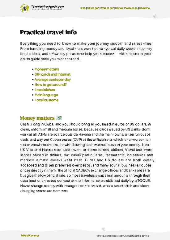
example page 0 from our offline Travel Guide for Cuba
example page 1 from our offline Travel Guide for Cuba
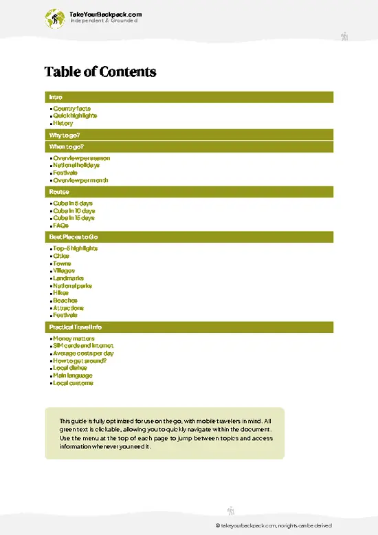
example page 2 from our offline Travel Guide for Cuba
example page 3 from our offline Travel Guide for Cuba
example page 4 from our offline Travel Guide for Cuba
example page 5 from our offline Travel Guide for Cuba
example page 6 from our offline Travel Guide for Cuba
example page 7 from our offline Travel Guide for Cuba
Loading the map 🌍
CLICK TO FILTER
cities
towns
villages
landmarks
national parks
hikes
beaches
attractions
festivals
SHOW COUNTRY’S BESTSHOW ALL

✨ Why go?
Ranked #15 national park in Cuba
What makes this national park worth exploring

Parque Nacional La Bayamesa suits backpackers who want the Sierra Maestra without the busier crowds of Turquino. The main reason is the Pico Bayamesa summit area, where cloud forest and rebel history overlap, since Fidel Castro’s columns moved through these ridges in the late 1950s. A second reason is the casas particulares in the foothill villages, which let you build a self-run trip from small farming communities. Independent travel is possible but guides are effectively required for the higher trails, so expect a hybrid: you arrange logistics yourself, a local leads the walking. Anyone wanting solitude, birds and unpolished mountain Cuba will find it here.

💡 HighlightsMust-see experiences and standout moments

  1. Pico Bayamesa: The park’s signature high point at about 1,700 meters, reached by steep forest paths with ridge views toward the Sierra Maestra peaks.
  2. Cloud forest belt: Moss-draped trees, tree ferns and orchids hold moisture in the upper slopes, and the air stays cool and damp.
  3. Tocororo spotting: Cuba’s national bird, with red, white and blue plumage, lives in these mid-elevation forests and is best looked for early.
  4. Sierra Maestra rebel history sites: Ridges and farm trails in the area were used by Castro’s guerrillas, and local guides point out camps and routes.
  5. Mountain farm hamlets: Small coffee and fruit farms on the lower slopes offer cold water, strong coffee and talk with growers.
  6. River crossings and ravines: Streams cut through the foothills and give shaded rest stops with the sound of
… read more 👉
  1. Pico Bayamesa: The park’s signature high point at about 1,700 meters, reached by steep forest paths with ridge views toward the Sierra Maestra peaks.
  2. Cloud forest belt: Moss-draped trees, tree ferns and orchids hold moisture in the upper slopes, and the air stays cool and damp.
  3. Tocororo spotting: Cuba’s national bird, with red, white and blue plumage, lives in these mid-elevation forests and is best looked for early.
  4. Sierra Maestra rebel history sites: Ridges and farm trails in the area were used by Castro’s guerrillas, and local guides point out camps and routes.
  5. Mountain farm hamlets: Small coffee and fruit farms on the lower slopes offer cold water, strong coffee and talk with growers.
  6. River crossings and ravines: Streams cut through the foothills and give shaded rest stops with the sound of running water.
For a first visit, Parque Nacional La Bayamesa is best experienced through the Pico Bayamesa climb with a local guide.
Spotted a mistake or missing something? Contact us.

🌤️ When to go?Weather, crowds, and seasonal trade-offs

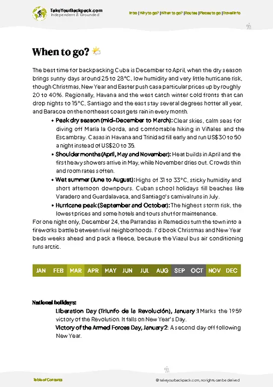
  • Dry Season (December to April): Days reach 28 to 31°C (82 to 88°F), nights drop to 17 to 21°C (63 to 70°F), and trails in the Sierra Maestra foothills stay firm. Roughly 11 to 12 hours of daylight.
  • Wet Season (May to October): Afternoon storms are routine, highs hit 32 to 35°C (90 to 95°F), and muddy tracks slow walking. Casa particular rates dip slightly.
  • Hurricane Window (August to October): Heaviest storm risk, with occasional closures and cancelled transport.
  • Holidays (July, December): Cuban families travel, so buses and rooms fill faster.
Start hikes early, before the midday heat and afternoon cloud build.

source: climatestotravel.comJANJanuary: excellent for travelingFEBFebruary: excellent for travelingMARMarch: excellent for travelingAPRApril: excellent for travelingMAYMay: good for travelingJUNJune: fair for travelingJULJuly: fair for travelingAUGAugust: fair for travelingSEPSeptember: fair for travelingOCTOctober: good for travelingNOVNovember: excellent for travelingDECDecember: excellent for traveling
when-to-go

✈️ The backpacker research shortcutCuba Travel Guide

An offline-friendly backpacking guide with optimized travel routes, ranked highlights, transport advice, and the best areas to stay.
example page 0 from our offline Travel Guide for Cuba
example page 1 from our offline Travel Guide for Cuba
example page 2 from our offline Travel Guide for Cuba
example page 3 from our offline Travel Guide for Cuba
example page 4 from our offline Travel Guide for Cuba
example page 5 from our offline Travel Guide for Cuba
example page 6 from our offline Travel Guide for Cuba
example page 7 from our offline Travel Guide for Cuba
The digital guide (327 pages) contains:
✅ 113 highlights, ranked by travel appeal
✅ Optimized 5, 10 & 15-day travel routes
✅ Cities, national parks, landmarks, beaches
✅ How to get around
✅ Offline-friendly for travel without Wi-Fi
👉 Click to see all 30+ guide features

📅 Plan smarter in minutes, not weeks
✅ Month by month travel advice
✅ Festivals & national holidays
✅ Budget expectations

🗺️ Go to the right places, skip the overrated ones
✅ Honest pros & cons of destinations
✅ Top hikes, parks & viewpoints
✅ Lesser-known places most travelers miss
✅ Clear “worth it vs skip it” guidance

🛏️ Travel smoothly without rookie mistakes
✅ Best areas to stay
✅ Transport systems explained simply
✅ Common scams & safety advice
✅ SIM cards, money & practical tips

🌍 Understand the country, not just visit it
✅ Culture & traditions
✅ 52 Essential phrases & customs
✅ Festivals worth planning around
✅ Traveler-friendly historical context
✅ Insights that make places more meaningful

📱 Built for real travel conditions
✅ Fully downloadable PDF
✅ Works completely offline
✅ Optimized for phone use
✅ Useful in remote areas & buses
✅ Everything in one place
Stop searching, start planning
Get instant access to your full guide. 30‑day money-back guarantee.
+ Add another guide for just

By proceeding you agree to our terms.
Sent to your inbox immediately after payment • 100% Secure Checkout
Best Backpacking Travel Advisor 2025 tourism awardBest Backpacking
Travel Advisor
2025
What others say about Take Your Backpack Guides:
⭐⭐⭐⭐⭐
Fantastic, amazing amount of information!
⭐⭐⭐⭐⭐
My goodness this is amazing, it's what I've been looking for hats off too you!
⭐⭐⭐⭐⭐
I think this is absolutely BRILLIANT
⭐⭐⭐⭐
Very complete and informative. It's still missing places, but I gotta to commend you
⭐⭐⭐⭐⭐
This is truly amazing, thank you, can't wait to explore it with my kids!
⭐⭐⭐⭐⭐
Awesome resource, thank you!
⭐⭐⭐⭐⭐
This is amazing! Can't wait to explore the ones I haven't seen
⭐⭐⭐⭐
I love this! Well done, great idea.
⭐⭐⭐⭐⭐
Thanks for taking the time to make this gem!
⭐⭐⭐⭐⭐
This might be the best website I've ever seen.
⭐⭐⭐⭐⭐
Congratulations, and thank you so much for your work; it's incredibly valuable.
⭐⭐⭐⭐
In all seriousness I think you did a great job pointing out the important spots
⭐⭐⭐⭐⭐
10/10 very good
⭐⭐⭐⭐⭐
As someone who's only just starting to visit regularly this is awesome, thank you.
⭐⭐⭐⭐
Thank you very much! I'm going to visit my dad, it's going to be very useful!
⭐⭐⭐⭐⭐
This is really cool! We'll be travelling for the first time and this definitely come in handy.
⭐⭐⭐⭐⭐
You are now our minister of culture, congratulations 👨‍💼
⭐⭐⭐⭐⭐
Just wanted to tell you that this is a pearl! Going to follow your recommendations.
⭐⭐⭐⭐⭐
This is so cool. I'll definitely be using the resource for my travels soon.
⭐⭐⭐⭐⭐
This is very impressive! Good work.
⭐⭐⭐⭐⭐
This is an amazing and informative site. Very well done!

🛏️ Where to stay?Best areas and accommodation options

Most backpackers sleep in Bayamo, the provincial capital, because Parque Nacional La Bayamesa has no lodging of its own inside its boundaries. Bayamo sits on the northern edge of the Sierra Maestra, and its casas particulares are the standard choice: private rooms with breakfast, often with a rooftop or courtyard, around US$20 to 35 a night. Look near Plaza del Himno Nacional and along the pedestrian Calle General García, where restaurants and the bus stations are within walking distance. For a more rural night, ask your host about family farms in the foothills, where basic rooms and home cooking … read more 👉
Most backpackers sleep in Bayamo, the provincial capital, because Parque Nacional La Bayamesa has no lodging of its own inside its boundaries. Bayamo sits on the northern edge of the Sierra Maestra, and its casas particulares are the standard choice: private rooms with breakfast, often with a rooftop or courtyard, around US$20 to 35 a night. Look near Plaza del Himno Nacional and along the pedestrian Calle General García, where restaurants and the bus stations are within walking distance. For a more rural night, ask your host about family farms in the foothills, where basic rooms and home cooking are sometimes available. Manzanillo and Santiago de Cuba work as alternatives if you are linking the park into a wider Sierra Maestra route.

👛 Costs (as of 23 October 2026)Money, prices, and spending tips

A realistic budget for Parque Nacional La Bayamesa is about US$40 to 90 per day, based out of Bayamo with a guide included. Travelers pay in Cuban pesos for some local services, but many casas and guides quote in dollars or euros.
CategoryBudget RangeLocal Reality
Entrance/guideUS$5 to 15Fees are modest, and a local guide is the main expense for trail days.
Accommodation (high season)US$20 to 35Casa particular in Bayamo, usually with breakfast available for US$3 to 5.
Local transportUS$5 to 20Shared taxis or a hired classic car to trailheads; the price depends on distance and negotiation.
Food/suppliesUS$10 to 20Casa dinners cost US$8 to 12, and snacks and water come from town shops.
Total Daily BudgetUS$40 to 90Roughly US$60 for most backpackers.


source: cubatravel.cu
⚠️ Prices can change and everyone travels differently, so take this as a rough guide. Hope it helps you plan your adventure!

🥾 TrailsExploring Parque Nacional La Bayamesa: trails, terrain, and views

Parque Nacional La Bayamesa has no well-signed trail network, so the walks people do are guided routes from foothill farm settlements.
  • Pico Bayamesa ascent: Steep, muddy forest climbing from the lower farms up toward the summit area, usually a full day, strenuous, with ridge views if the cloud lifts.
  • Lower forest loops: Shorter walks of two to four hours through shaded slopes and coffee plots, moderate, good for birds including the tocororo.
  • Historic ridge routes: Paths linked to the guerrilla campaign, moderate to hard, with a guide explaining the sites.
  • Terrain: Slippery clay, roots, stream crossings
… read more 👉
Parque Nacional La Bayamesa has no well-signed trail network, so the walks people do are guided routes from foothill farm settlements.
  • Pico Bayamesa ascent: Steep, muddy forest climbing from the lower farms up toward the summit area, usually a full day, strenuous, with ridge views if the cloud lifts.
  • Lower forest loops: Shorter walks of two to four hours through shaded slopes and coffee plots, moderate, good for birds including the tocororo.
  • Historic ridge routes: Paths linked to the guerrilla campaign, moderate to hard, with a guide explaining the sites.
  • Terrain: Slippery clay, roots, stream crossings and steep gradients, so boots with grip matter.
  • Wildlife: Hummingbirds, woodpeckers, the tocororo, lizards and land snails.
Getting to Parque Nacional La Bayamesa is easiest from Bayamo by hired taxi or arranged car, since public transport to the trailheads is limited. Crowds are minimal, and you can often walk all day without seeing other visitors. Entry arrangements are usually handled through a local guide or the park office, so confirm before you set out.
⚠️ Hiking info can sometimes be outdated or inaccurate. Before you hit the trail, check the latest conditions with locals. If you do spot anything that's off, I'd love to hear from you, so I can update it for fellow travelers.

🛡️ SafetyScams, Hazards, and Annoyances

La Bayamesa is a straightforward mountain park, and the main hazards are heat, slick clay trails after rain and limited signage. Hire a local guide through your casa host or the park staff, since paths branch through farmland and forest and phone coverage is patchy. Carry at least 2 to 3 liters of water per person, a rain layer, and shoes with real grip. Start early so you finish before afternoon storms. Mosquitoes and sun are more of a nuisance than any wildlife, as there are no dangerous large animals. Keep valuables simple and leave gates as you find them on farmland.

FAQCommon questions from travelers

One full day covers the main trails of Parque Nacional La Bayamesa, though two days lets you pace a longer guided hike and rest in between. Most people stay in Bayamo, the nearest city, and head out each morning. Add another day if you want to continue into the wider Sierra Maestra.
Yes, Parque Nacional La Bayamesa is reachable without a car, but you will need local transport for the final stretch. Bayamo has Viazul buses from Havana (about 12 to 13 hours) and Santiago de Cuba (about 3 hours). From town, shared taxis or a hired driver cost roughly US$5 to 20 to reach the foothill access points.
Parque Nacional La Bayamesa charges only a modest fee, generally under US$10, and it is often bundled with a guide. No special backpacker permit is normally required for day visits. Arrange guides through your casa host in Bayamo, and expect to pay about US$10 to 25 for a half or full day.
⚠️ Things can change over time, so always validate details locally before you go.

Other Cuban national parks near Parque Nacional La Bayamesa

Explore more nearby:


💡 Not sure where to go next?
Create a personalized itinerary for Cuba including Parque Nacional La Bayamesa and the places that fit your trip.

Generate my itinerary

👉 Discover all national parks

Or checkout all Cuba has to offer (think cities, towns, villages, national parks, hikes, beaches, festivals)
Country photo of Cuba

We 💚 feedbackKey takeaways before you go

Parque Nacional La Bayamesa punishes travelers who show up expecting signed paths and a ticket booth, then wander off alone and get lost in cloud. Arrange a local guide from a foothill village the day before, start at first light, and pack rain gear plus plenty of water.

✈️ When did I visit Cuba?
As part of my 1.5 year travel around the world trip, I visited Cuba for 6 weeks in February, March 2016, being extremely lucky that that coincided with the free concert of The Rolling Stones.

✍️ Help improve this page!
The information on this page is based on my own backpacking experience in Cuba, supplemented with up-to-date research and feedback from other travelers. Travel details can change, so if you notice anything outdated or incomplete, feel free to let me know.


🙋‍♂️ Give feedback

👋 Meet the founderWho’s Behind Take Your Backpack?

Johan, backpacker and founder of TakeYourBackpackHi, I’m Johan (Netherlands 🇳🇱), the creator of TakeYourBackpack. Over the past 3 decades, I’ve backpacked through 90+ countries across six continents, gaining extensive experience with independent travel, long-term trips, and overland routes.

This site is built on a combination of firsthand travel experience and carefully curated insights from other backpackers. Many guides are based on places I’ve personally visited, while others bring together tips, observations, and practical advice shared by trusted travelers I’ve met along the way.

The goal is to provide realistic, experience-driven guidance — not generic itineraries — so you can explore destinations with better context, clearer expectations, and more confidence.