×

Ecuador🇪🇨 | national parksSangay National ParkActive ash plume, Atillo lagoons, Ozogoche ducks, Alao springs | things to do and best time to go

Explore Bosque Protector Mindo-NambilloExplore Sumaco Napo-Galeras National Park

Backpacking in Sangay
👍 Recommendednational park ranked #8
By Johan Kruseman 🇳🇱 | Updated October 19, 2026

Sangay National Park is a UNESCO World Heritage Site, and its namesake volcano has been erupting almost continuously for decades, so the summit is rarely climbed. The park sprawls across the provinces of Morona Santiago, Chimborazo and Cañar in central Ecuador, from páramo down to Amazon cloud forest. Expect ice-cold lakes, tapir tracks, spectacled bears and mud that swallows boots. Access is the sting: few roads, few services, few crowds. I rolled into the Atillo lakes at dawn, stepped off the truck and watched Sangay's ash plume lean over a mirror-flat lagoon, silent and enormous. That first look hooked me. You trade comfort for solitude, and you earn every view on foot. Self-sufficient hikers who love remote, wet, wild country will adore it. Anyone wanting tidy signposts, hot showers or guaranteed volcano views should look elsewhere.

Discover everything you want to know in the 📖 Ecuador Travel Guide.


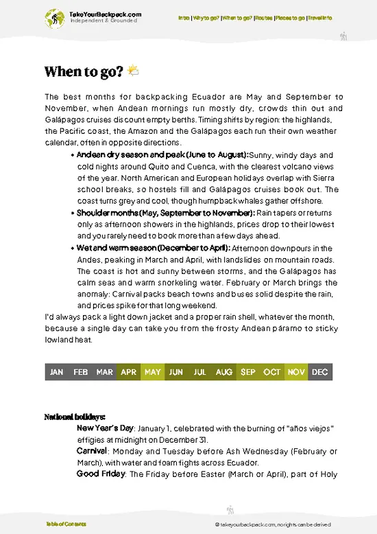
example page 0 from our offline Travel Guide for Ecuador
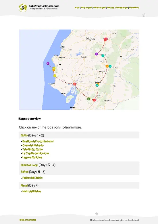
example page 1 from our offline Travel Guide for Ecuador
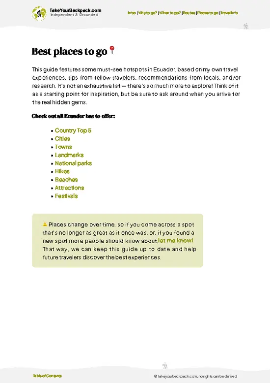
example page 2 from our offline Travel Guide for Ecuador
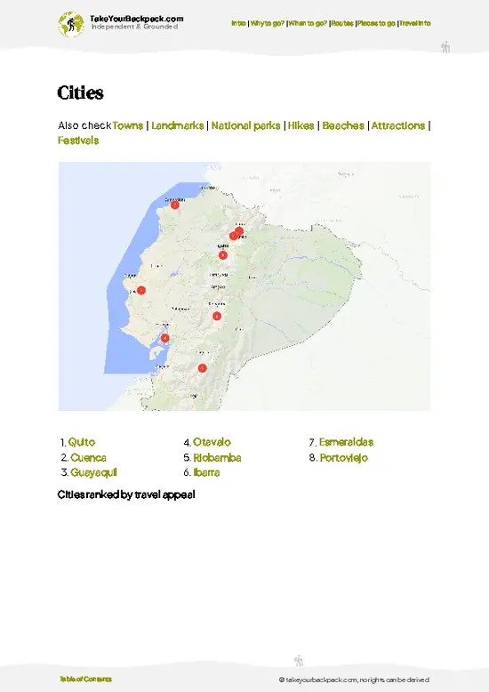
example page 3 from our offline Travel Guide for Ecuador
example page 4 from our offline Travel Guide for Ecuador
example page 5 from our offline Travel Guide for Ecuador
example page 6 from our offline Travel Guide for Ecuador
example page 7 from our offline Travel Guide for Ecuador
Loading the map 🌍
CLICK TO FILTER
cities
towns
landmarks
national parks
hikes
beaches
attractions
festivals
SHOW COUNTRY’S BESTSHOW ALL

✨ Why go?
Ranked #8 national park in Ecuador
What makes this national park worth exploring

Sangay National Park rewards backpackers who want wilderness without a queue. Most people bypass it for Cotopaxi or Baños, so the trails belong to you, a few arrieros (mule handlers) and the odd Andean condor overhead. The big draw is the sheer vertical range: from páramo above 4,000 meters to lowland jungle below 1,000 meters, all inside one protected area. That means you can see mountain tapirs, Andean bears and cloud forest orchids in one trip if you go deep enough. The Atillo lake circuit near Ozogoche gives a gentler taste of the highlands, with camping beside glacial lagoons and a self-guided feel, while the volcano itself usually needs a local guide and porters. Independent travelers who pack their own food, tent and map will find it affordable and wonderfully uncurated.

💡 HighlightsWhat this place is best known for

  1. Sangay Volcano: One of the most active volcanoes on Earth, it throws ash and glowing rock almost daily. Seeing the plume from a distance is the park’s signature moment.
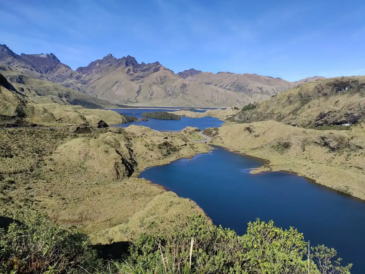
  2. Atillo Lagoons: A chain of cold, glassy lakes at roughly 3,500 meters near the Riobamba side. Wild camping, horse tracks and condor sightings make it the easiest introduction.
  3. Ozogoche Lakes: Some 45 lagoons across high páramo. Each September, migratory birds called cuvivíes arrive and many die in the lakes, an event no one has fully explained.
  4. Culebrillas Lake and Inca Trail Section: A quiet lake near the Ingapirca area with a preserved stretch of the old Inca road. Flat paths and wild horses suit a relaxed day.
  5. Cloud Forest of the Eastern Slope: Dripping moss, bromeliads and orchids on slopes dropping toward the Amazon. Bird
… read more 👉
  1. Sangay Volcano: One of the most active volcanoes on Earth, it throws ash and glowing rock almost daily. Seeing the plume from a distance is the park’s signature moment.
  2. Atillo Lagoons: A chain of cold, glassy lakes at roughly 3,500 meters near the Riobamba side. Wild camping, horse tracks and condor sightings make it the easiest introduction.
  3. Ozogoche Lakes: Some 45 lagoons across high páramo. Each September, migratory birds called cuvivíes arrive and many die in the lakes, an event no one has fully explained.
  4. Culebrillas Lake and Inca Trail Section: A quiet lake near the Ingapirca area with a preserved stretch of the old Inca road. Flat paths and wild horses suit a relaxed day.
  5. Cloud Forest of the Eastern Slope: Dripping moss, bromeliads and orchids on slopes dropping toward the Amazon. Bird lovers listen for mountain toucans.
  6. Andean Bear and Tapir Habitat: Spectacled bears and mountain tapirs live here, usually glimpsed as tracks, claw marks or droppings rather than animals. Patience and a guide improve the odds.
  7. Hot Springs near Alao: Natural thermal pools on the western edge, perfect for thawing muscles after a cold, wet trek.
For a first visit, the Atillo Lagoons give the best mix of scenery, easy camping and volcano views.
Spotted a mistake or missing something? Contact us.

Things to do near Sangay National Park

Ratings based on Tripadvisor reviews. When you book through this link, you support our work at no extra cost to you.

🌤️ When to go?When to go for the best experience

  • Driest Months (June to September, plus December to January): Sangay National Park sees its best trekking odds in the eastern Andean highlands, with fewer days of rain. Páramo above 3,500 m (11,500 ft) runs 3 to 12°C (37 to 54°F), and nights drop near freezing at high camps.
  • Wet Months (March to May): Expect daily downpours, deep mud on the Culebrillas and Atillo trails, and cloud that hides the volcano. Lower slopes stay 15 to 24°C (59 to 75°F).
  • Crowds and Prices: Ecuadorian school holidays (July to August) and Easter fill guesthouses in Riobamba and Macas. Guide fees stay fairly steady year-round.
  • Daylight: Roughly 12 hours all year, so start hikes by 7 a.m. to finish before afternoon cloud.
Book a guide a week ahead for the volcano climb, since many operators run it only when the forecast looks clear.

source: climatestotravel.comJANJanuary: fair for travelingFEBFebruary: fair for travelingMARMarch: fair for travelingAPRApril: fair for travelingMAYMay: fair for travelingJUNJune: excellent for travelingJULJuly: excellent for travelingAUGAugust: excellent for travelingSEPSeptember: excellent for travelingOCTOctober: fair for travelingNOVNovember: fair for travelingDECDecember: fair for traveling
ecuador-national-park-sangay-national-park
© Google | Wilmer Ll. (ato)

✈️ The backpacker research shortcutEcuador Travel Guide

An offline-friendly backpacking guide with optimized travel routes, ranked highlights, transport advice, and the best areas to stay.
example page 0 from our offline Travel Guide for Ecuador
example page 1 from our offline Travel Guide for Ecuador
example page 2 from our offline Travel Guide for Ecuador
example page 3 from our offline Travel Guide for Ecuador
example page 4 from our offline Travel Guide for Ecuador
example page 5 from our offline Travel Guide for Ecuador
example page 6 from our offline Travel Guide for Ecuador
example page 7 from our offline Travel Guide for Ecuador
The digital guide (274 pages) contains:
✅ 87 highlights, ranked by travel appeal
✅ Optimized 5, 10 & 15-day travel routes
✅ Cities, national parks, landmarks, beaches
✅ How to get around
✅ Offline-friendly for travel without Wi-Fi
👉 Click to see all 30+ guide features

📅 Plan smarter in minutes, not weeks
✅ Month by month travel advice
✅ Festivals & national holidays
✅ Budget expectations

🗺️ Go to the right places, skip the overrated ones
✅ Honest pros & cons of destinations
✅ Top hikes, parks & viewpoints
✅ Lesser-known places most travelers miss
✅ Clear “worth it vs skip it” guidance

🛏️ Travel smoothly without rookie mistakes
✅ Best areas to stay
✅ Transport systems explained simply
✅ Common scams & safety advice
✅ SIM cards, money & practical tips

🌍 Understand the country, not just visit it
✅ Culture & traditions
✅ 52 Essential phrases & customs
✅ Festivals worth planning around
✅ Traveler-friendly historical context
✅ Insights that make places more meaningful

📱 Built for real travel conditions
✅ Fully downloadable PDF
✅ Works completely offline
✅ Optimized for phone use
✅ Useful in remote areas & buses
✅ Everything in one place
Stop searching, start planning
Get instant access to your full guide. 30‑day money-back guarantee.
+ Add another guide for just

By proceeding you agree to our terms.
Sent to your inbox immediately after payment • 100% Secure Checkout
Best Backpacking Travel Advisor 2025 tourism awardBest Backpacking
Travel Advisor
2025
What others say about Take Your Backpack Guides:
⭐⭐⭐⭐⭐
Fantastic, amazing amount of information!
⭐⭐⭐⭐⭐
My goodness this is amazing, it's what I've been looking for hats off too you!
⭐⭐⭐⭐⭐
I think this is absolutely BRILLIANT
⭐⭐⭐⭐
Very complete and informative. It's still missing places, but I gotta to commend you
⭐⭐⭐⭐⭐
This is truly amazing, thank you, can't wait to explore it with my kids!
⭐⭐⭐⭐⭐
Awesome resource, thank you!
⭐⭐⭐⭐⭐
This is amazing! Can't wait to explore the ones I haven't seen
⭐⭐⭐⭐
I love this! Well done, great idea.
⭐⭐⭐⭐⭐
Thanks for taking the time to make this gem!
⭐⭐⭐⭐⭐
This might be the best website I've ever seen.
⭐⭐⭐⭐⭐
Congratulations, and thank you so much for your work; it's incredibly valuable.
⭐⭐⭐⭐
In all seriousness I think you did a great job pointing out the important spots
⭐⭐⭐⭐⭐
10/10 very good
⭐⭐⭐⭐⭐
As someone who's only just starting to visit regularly this is awesome, thank you.
⭐⭐⭐⭐
Thank you very much! I'm going to visit my dad, it's going to be very useful!
⭐⭐⭐⭐⭐
This is really cool! We'll be travelling for the first time and this definitely come in handy.
⭐⭐⭐⭐⭐
You are now our minister of culture, congratulations 👨‍💼
⭐⭐⭐⭐⭐
Just wanted to tell you that this is a pearl! Going to follow your recommendations.
⭐⭐⭐⭐⭐
This is so cool. I'll definitely be using the resource for my travels soon.
⭐⭐⭐⭐⭐
This is very impressive! Good work.
⭐⭐⭐⭐⭐
This is an amazing and informative site. Very well done!

🛏️ Where to stay?Where staying makes the most sense

No hotels stand inside Sangay National Park, only basic mountain huts and camping spots on the main trails, so most backpackers sleep in gateway towns. Riobamba, at about 2,750 m (9,000 ft), is the main base for the western side. Hostels and guesthouses run US$10 to 20 for a dorm or simple private room, and the town has the agencies that arrange Sangay climbs and Atillo lake treks. Guamote and Alausí are quieter highland alternatives with homestay-style rooms at US$8 to 15. On the eastern side, Macas is the largest town, with hotels at US$15 to 35, and works for Amazon-side entry points and visits … read more 👉
No hotels stand inside Sangay National Park, only basic mountain huts and camping spots on the main trails, so most backpackers sleep in gateway towns. Riobamba, at about 2,750 m (9,000 ft), is the main base for the western side. Hostels and guesthouses run US$10 to 20 for a dorm or simple private room, and the town has the agencies that arrange Sangay climbs and Atillo lake treks. Guamote and Alausí are quieter highland alternatives with homestay-style rooms at US$8 to 15. On the eastern side, Macas is the largest town, with hotels at US$15 to 35, and works for Amazon-side entry points and visits to the lowland forest sector. Small villages near the Atillo lakes, like Atillo itself, offer community cabins and camping for around US$5 to 12 a night. Bring a warm sleeping bag if you camp, since páramo nights are cold. Book Riobamba beds ahead during July, August and local fiestas.

👛 Costs (as of 19 October 2026)Money, prices, and spending tips

Plan on roughly US$62 a day for Sangay National Park on a backpacker budget, with a guide as the biggest variable.
CategoryBudget RangeLocal Reality
Entrance FeeUS$0 to 10Foreign visitors may pay a small fee at park entrances; amounts vary by sector and guide arrangements.
Accommodation (high season)US$10 to 20Hostel dorms or simple rooms in Riobamba; camping or community cabins near Atillo run US$5 to 12.
Guide and ToursUS$25 to 40Per-person share of a guided trek or volcano climb; multi-day Sangay expeditions cost more in total.
Local TransportUS$3 to 8Buses from Riobamba to Guamote or Alausí cost US$1 to 3; trucks or taxis to trailheads cost extra.
Food and SuppliesUS$8 to 15Set lunches (almuerzos) run US$3 to 4; stock up on snacks and trail food in Riobamba.
Total Daily BudgetUS$62Per person, per day, in high season.
⚠️ Prices can change and everyone travels differently, so take this as a rough guide. Hope it helps you plan your adventure!

🥾 TrailsDiscover Sangay's top trails and natural wonders

Sangay National Park is a high-altitude wilderness of páramo, cloud forest and jungle, and most walking here is demanding, muddy and remote, so plan on real mountain travel rather than a casual stroll. Terrain swings from grassy highlands above 3,500 meters down to steamy lowland forest, with mountain tapirs, Andean bears and pumas in the wider park, though sightings are rare. Condors and toucan-like mountain toucans are far likelier.
  • Sangay Volcano Ascent: A multi-day expedition of roughly 4 to 6 days round trip to a 5,230 meter active cone, starting from the Ozogoche or Alao side. Very hard,
… read more 👉
Sangay National Park is a high-altitude wilderness of páramo, cloud forest and jungle, and most walking here is demanding, muddy and remote, so plan on real mountain travel rather than a casual stroll. Terrain swings from grassy highlands above 3,500 meters down to steamy lowland forest, with mountain tapirs, Andean bears and pumas in the wider park, though sightings are rare. Condors and toucan-like mountain toucans are far likelier.
  • Sangay Volcano Ascent: A multi-day expedition of roughly 4 to 6 days round trip to a 5,230 meter active cone, starting from the Ozogoche or Alao side. Very hard, with cold nights, ash slopes and frequent eruptions. Go only with a licensed guide.
  • Laguna Ozogoche Circuit: Day walks around a chain of high lakes in the south, 3,800 to 4,000 meters up. Easy to moderate, 3 to 5 hours, with open páramo, wind, mist and a chance of condors. Locals know the lakes for the mass bird die-offs that occur there.
  • Alao and Culebrillas Trail: A trek of 2 to 3 days from the Alao area toward Culebrillas lake and old Inca road stonework. Moderate to hard, with boggy páramo, river crossings and big views of Altar and Tungurahua on clear days.
  • Macas Side Approaches: Routes from the eastern lowlands climb through humid forest toward the volcano. Hard, slow and wet, with leeches, steep mud and the best chance of seeing forest birds and monkeys.
Reaching the park takes effort. Buses run to Riobamba, Macas and Alausí, then local pickups or taxis cover the final stretch to trailheads, so expect to arrange transport in town. Crowds are almost nonexistent, and you may spend days without meeting another hiker. Entrance is cheap, usually a few dollars at a ranger post, and a guide with mules is strongly advised for overnight routes. Carry a good tent, warm layers, waterproofs and your own food.
⚠️ Hiking info can sometimes be outdated or inaccurate. Before you hit the trail, check the latest conditions with locals. If you do spot anything that's off, I'd love to hear from you, so I can update it for fellow travelers.

🛡️ SafetyTraveler Safety Guide

Sangay National Park is manageable on well-known routes, but altitude and weather deserve respect. Trails climb from about 2,000 m to over 4,000 m (6,500 to 13,000 ft) at Atillo and Culebrillas, so give yourself two days in Riobamba to adjust and walk slowly. Rain, wind and fog roll in fast on the páramo, and trails turn to boot-sucking mud, so pack waterproofs, gaiters and a warm layer. Navigation in cloud is tricky; hire a local guide for the volcano, where ash and rockfall are real, and check current activity first. Sangay is one of the world’s most active volcanoes, and some routes close when it erupts heavily. Wildlife is mostly shy: you may see Andean condors, spectacled bears are rare, and tapirs live far below. Keep your distance, store food securely, and take rubbish out.

FAQTraveler FAQ

Plan on 3 to 4 days for Sangay National Park if you want a taste of the highlands. That covers a day to adjust in Riobamba, one day around the Atillo lakes, and a day on the Culebrillas trail. Climbing the Sangay volcano itself takes 6 to 8 days round trip with a guide.
Yes, though a car makes it easier. Buses run from Riobamba to Guamote and Alausí for US$1 to 3, and shared trucks or taxis reach Atillo and Culebrillas trailheads for roughly US$10 to 30 per vehicle. From the Amazon side, buses reach Macas from Cuenca or Riobamba in about 6 to 8 hours, and tour agencies arrange transfers.
Entrance rules vary by sector, and some entrances charge foreigners a small fee of around US$0 to 10. Guides are strongly advised and required for the Sangay volcano climb, costing about US$25 to 40 a day per person on shared trips. Check with the Ministry of Environment office in Riobamba or a licensed agency before heading to the trailheads.
⚠️ Things can change over time, so always validate details locally before you go.

Other Ecuadorian national parks near Sangay

Explore more nearby:


💡 Not sure where to go next?
Create a personalized itinerary for Ecuador including Sangay and the places that fit your trip.

Generate my itinerary

👉 Discover all national parks

Or checkout all Ecuador has to offer (think cities, towns, villages, national parks, hikes, beaches, festivals)
Country photo of Ecuador

We 💚 feedbackKey takeaways before you go

Sangay National Park deserves three to five days if you want more than a glimpse. Two days gets you the Atillo lagoons and a taste of páramo. Add more only if you hire a guide and porters for deeper routes. I would bring a real four-season tent, waterproof boots and extra food, because the weather here changes quickly.

✈️ When did I visit Ecuador?
Ecuador I visited during my half year trip through South and Central America back in 2003

✍️ Help improve this page!
The information on this page is based on my own backpacking experience in Ecuador, supplemented with up-to-date research and feedback from other travelers. Travel details can change, so if you notice anything outdated or incomplete, feel free to let me know.


🙋‍♂️ Give feedback

👋 Meet the founderWho’s Behind Take Your Backpack?

Johan, backpacker and founder of TakeYourBackpackHi, I’m Johan (Netherlands 🇳🇱), the creator of TakeYourBackpack. Over the past 3 decades, I’ve backpacked through 90+ countries across six continents, gaining extensive experience with independent travel, long-term trips, and overland routes.

This site is built on a combination of firsthand travel experience and carefully curated insights from other backpackers. Many guides are based on places I’ve personally visited, while others bring together tips, observations, and practical advice shared by trusted travelers I’ve met along the way.

The goal is to provide realistic, experience-driven guidance — not generic itineraries — so you can explore destinations with better context, clearer expectations, and more confidence.