×

Ecuador🇪🇨 | attractionsTelefériQo QuitoGondola ascent, Cruz Loma, páramo loops, Rucu Pichincha trail | things to do and best time to go

Explore Casa del AlabadoExplore La Ronda

Backpacking in TelefériQo Quito
🏆 Top pickattraction ranked #1
By Johan Kruseman 🇳🇱 | Updated October 19, 2026

The cabin lurches off the platform, and the first thing I notice is the gondola ahead of mine swinging over a eucalyptus-choked ravine while a taxi driver I shared the ride up from the Old Town points at a notch in the ridge and says that is where we are headed. TelefériQo sits on the western flank of Quito, in Ecuador’s capital, and it hauls you from the city’s edge up the slope of Volcán Pichincha to a viewpoint known as Cruz Loma. The smarter move is skipping the taxi back down and the midday slot: go early, because cloud typically swallows the summit by afternoon, and buy the ticket at the base so you can ride as soon as a cabin opens. Bring layers, since the top is far above the city, and pay in dollars.

Discover everything you want to know in the 📖 Ecuador Travel Guide.


example page 0 from our offline Travel Guide for Ecuador
example page 1 from our offline Travel Guide for Ecuador
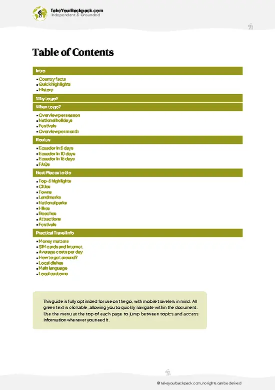
example page 2 from our offline Travel Guide for Ecuador
example page 3 from our offline Travel Guide for Ecuador
example page 4 from our offline Travel Guide for Ecuador
example page 5 from our offline Travel Guide for Ecuador
example page 6 from our offline Travel Guide for Ecuador
example page 7 from our offline Travel Guide for Ecuador
Loading the map 🌍
CLICK TO FILTER
cities
towns
landmarks
national parks
hikes
beaches
attractions
festivals
SHOW COUNTRY’S BESTSHOW ALL

✨ Why go?
Ranked #1 attraction in Ecuador
Reasons people choose to visit here

TelefériQo Quito delivers the quickest big altitude jump on the Ecuadorian circuit, lifting you from the city to roughly 3,945 meters in about twenty minutes. For anyone planning to climb a volcano later, that makes it a smart acclimatization test before committing to bigger peaks. You see how your lungs cope while the mountain stays on a gentle, walkable trail.

The view is the second reason. Quito stretches in a long thin strip between ridges, and from the top you can see how the city really sits in its valley, with the cones of Cotopaxi and Antisana appearing on clear mornings. I would treat it as a milestone stop for understanding the capital’s geography before you head to the highlands.

The third reason is the trail to Rucu Pichincha, the summit hike that starts right from the upper … read more 👉
TelefériQo Quito delivers the quickest big altitude jump on the Ecuadorian circuit, lifting you from the city to roughly 3,945 meters in about twenty minutes. For anyone planning to climb a volcano later, that makes it a smart acclimatization test before committing to bigger peaks. You see how your lungs cope while the mountain stays on a gentle, walkable trail.

The view is the second reason. Quito stretches in a long thin strip between ridges, and from the top you can see how the city really sits in its valley, with the cones of Cotopaxi and Antisana appearing on clear mornings. I would treat it as a milestone stop for understanding the capital’s geography before you head to the highlands.

The third reason is the trail to Rucu Pichincha, the summit hike that starts right from the upper station. Even if you only walk the first stretch of paramo grassland, you get a taste of Andean hiking without a guide, a long transfer or a camping kit.

💡 HighlightsPlaces and moments you shouldn't skip

  1. The cable car ride: the gondolas climb from the base station on the slope above Quito in about twenty minutes, with the city dropping away under the floor and the ravine filling with eucalyptus and cloud forest.
  2. Cruz Loma viewpoint: the upper station area gives the big panorama over Quito’s long valley. On clear mornings the volcanic cones to the east and south show above the cloud line.
  3. Rucu Pichincha hike: the trail to the summit begins at the top and crosses open paramo and rocky ridge. It is a serious full-day effort, but the first section is an easy way to feel the altitude.
  4. Paramo walking paths: short loops near the upper station cross tussock grass and low shrubs, with chances to spot hummingbirds and Andean wildflowers.
  5. Swing at the edge: a swing set placed on the slope lets you sail out
… read more 👉
  1. The cable car ride: the gondolas climb from the base station on the slope above Quito in about twenty minutes, with the city dropping away under the floor and the ravine filling with eucalyptus and cloud forest.
  2. Cruz Loma viewpoint: the upper station area gives the big panorama over Quito’s long valley. On clear mornings the volcanic cones to the east and south show above the cloud line.
  3. Rucu Pichincha hike: the trail to the summit begins at the top and crosses open paramo and rocky ridge. It is a serious full-day effort, but the first section is an easy way to feel the altitude.
  4. Paramo walking paths: short loops near the upper station cross tussock grass and low shrubs, with chances to spot hummingbirds and Andean wildflowers.
  5. Swing at the edge: a swing set placed on the slope lets you sail out over the drop with the valley behind you, a favorite photo stop with a small extra fee.
  6. Mountain-top cafés: a few snack counters at the upper station serve hot drinks and canelazo-style warmers, useful for thawing out between photos.
  7. Vulqano Park amusement area: at the base, a small park with rides and games sits beside the station, mainly useful when traveling with kids.
Pair the cable car ride with the Rucu Pichincha trail’s first stretch in one morning, and you can be back down by early afternoon before the clouds close in.
Spotted a mistake or missing something? Contact us.

Things to do around TelefériQo Quito

Ratings based on Tripadvisor reviews. When you book through this link, you support our work at no extra cost to you.

🌤️ When to go?Weather, crowds, and seasonal trade-offs

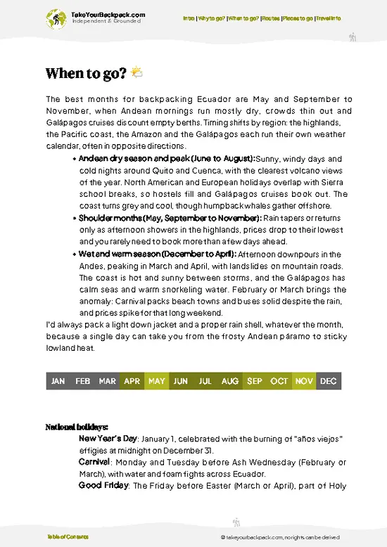
  • Dry Season (June to September): Mornings are usually clear, which matters because the cable car climbs from about 3,117 m (10,226 ft) to roughly 3,945 m (12,943 ft) on the flank of Pichincha volcano. Valley temperatures run 8 to 21°C (46 to 70°F), and the summit sits near 5 to 12°C (41 to 54°F). Expect the biggest crowds in July and August, with Ecuadorian school holidays and foreign visitors overlapping.
  • Wetter Months (October to May): Afternoon cloud and rain roll in most days, often swallowing the views by 1 pm. Mornings can still be sharp and clear. Crowds thin out, and queues shrink to minutes on weekdays.
  • Weekends and Holidays: Saturdays, Sundays and Carnival week bring local families, so lines can stretch past an hour. Entry prices stay fixed through the year, though nearby lodging rises
… read more 👉
  • Dry Season (June to September): Mornings are usually clear, which matters because the cable car climbs from about 3,117 m (10,226 ft) to roughly 3,945 m (12,943 ft) on the flank of Pichincha volcano. Valley temperatures run 8 to 21°C (46 to 70°F), and the summit sits near 5 to 12°C (41 to 54°F). Expect the biggest crowds in July and August, with Ecuadorian school holidays and foreign visitors overlapping.
  • Wetter Months (October to May): Afternoon cloud and rain roll in most days, often swallowing the views by 1 pm. Mornings can still be sharp and clear. Crowds thin out, and queues shrink to minutes on weekdays.
  • Weekends and Holidays: Saturdays, Sundays and Carnival week bring local families, so lines can stretch past an hour. Entry prices stay fixed through the year, though nearby lodging rises in July and August.
  • Daylight: Days stay close to 12 hours all year, so timing depends on cloud, not on short days.
Go on a weekday right when it opens, before the clouds build over the summit, and bring a warm layer and a rain shell.


source: climatestotravel.comJANJanuary: fair for travelingFEBFebruary: fair for travelingMARMarch: fair for travelingAPRApril: good for travelingMAYMay: highly recommended for travelingJUNJune: excellent for travelingJULJuly: excellent for travelingAUGAugust: excellent for travelingSEPSeptember: excellent for travelingOCTOctober: highly recommended for travelingNOVNovember: good for travelingDECDecember: fair for traveling
ecuador-attraction-teleferiqo-quito v1
© Google |

✈️ The backpacker research shortcutEcuador Travel Guide

An offline-friendly backpacking guide with optimized travel routes, ranked highlights, transport advice, and the best areas to stay.
example page 0 from our offline Travel Guide for Ecuador
example page 1 from our offline Travel Guide for Ecuador
example page 2 from our offline Travel Guide for Ecuador
example page 3 from our offline Travel Guide for Ecuador
example page 4 from our offline Travel Guide for Ecuador
example page 5 from our offline Travel Guide for Ecuador
example page 6 from our offline Travel Guide for Ecuador
example page 7 from our offline Travel Guide for Ecuador
The digital guide (274 pages) contains:
✅ 87 highlights, ranked by travel appeal
✅ Optimized 5, 10 & 15-day travel routes
✅ Cities, national parks, landmarks, beaches
✅ How to get around
✅ Offline-friendly for travel without Wi-Fi
👉 Click to see all 30+ guide features

📅 Plan smarter in minutes, not weeks
✅ Month by month travel advice
✅ Festivals & national holidays
✅ Budget expectations

🗺️ Go to the right places, skip the overrated ones
✅ Honest pros & cons of destinations
✅ Top hikes, parks & viewpoints
✅ Lesser-known places most travelers miss
✅ Clear “worth it vs skip it” guidance

🛏️ Travel smoothly without rookie mistakes
✅ Best areas to stay
✅ Transport systems explained simply
✅ Common scams & safety advice
✅ SIM cards, money & practical tips

🌍 Understand the country, not just visit it
✅ Culture & traditions
✅ 52 Essential phrases & customs
✅ Festivals worth planning around
✅ Traveler-friendly historical context
✅ Insights that make places more meaningful

📱 Built for real travel conditions
✅ Fully downloadable PDF
✅ Works completely offline
✅ Optimized for phone use
✅ Useful in remote areas & buses
✅ Everything in one place
Stop searching, start planning
Get instant access to your full guide. 30‑day money-back guarantee.
+ Add another guide for just

By proceeding you agree to our terms.
Sent to your inbox immediately after payment • 100% Secure Checkout
Best Backpacking Travel Advisor 2025 tourism awardBest Backpacking
Travel Advisor
2025
What others say about Take Your Backpack Guides:
⭐⭐⭐⭐⭐
Fantastic, amazing amount of information!
⭐⭐⭐⭐⭐
My goodness this is amazing, it's what I've been looking for hats off too you!
⭐⭐⭐⭐⭐
I think this is absolutely BRILLIANT
⭐⭐⭐⭐
Very complete and informative. It's still missing places, but I gotta to commend you
⭐⭐⭐⭐⭐
This is truly amazing, thank you, can't wait to explore it with my kids!
⭐⭐⭐⭐⭐
Awesome resource, thank you!
⭐⭐⭐⭐⭐
This is amazing! Can't wait to explore the ones I haven't seen
⭐⭐⭐⭐
I love this! Well done, great idea.
⭐⭐⭐⭐⭐
Thanks for taking the time to make this gem!
⭐⭐⭐⭐⭐
This might be the best website I've ever seen.
⭐⭐⭐⭐⭐
Congratulations, and thank you so much for your work; it's incredibly valuable.
⭐⭐⭐⭐
In all seriousness I think you did a great job pointing out the important spots
⭐⭐⭐⭐⭐
10/10 very good
⭐⭐⭐⭐⭐
As someone who's only just starting to visit regularly this is awesome, thank you.
⭐⭐⭐⭐
Thank you very much! I'm going to visit my dad, it's going to be very useful!
⭐⭐⭐⭐⭐
This is really cool! We'll be travelling for the first time and this definitely come in handy.
⭐⭐⭐⭐⭐
You are now our minister of culture, congratulations 👨‍💼
⭐⭐⭐⭐⭐
Just wanted to tell you that this is a pearl! Going to follow your recommendations.
⭐⭐⭐⭐⭐
This is so cool. I'll definitely be using the resource for my travels soon.
⭐⭐⭐⭐⭐
This is very impressive! Good work.
⭐⭐⭐⭐⭐
This is an amazing and informative site. Very well done!

🛏️ Where to stay?How to pick the right area

La Mariscal is the best base for backpackers, and it sits a short taxi or rideshare hop (about 10 to 15 minutes, US$3 to 5) from the cable car’s lower station on the western edge of the city. It is the city’s traveler district, with the densest cluster of hostels, bars, cheap set lunches, tour agencies and Spanish schools, so meeting other travelers takes no effort. Evenings are lively around Plaza Foch, and that is also where petty theft and drink spiking are most likely, so use taxis after dark rather than walking between bars. Dorm beds usually run US$8 to 15.

The Historic Center (Centro Histórico) … read more 👉
La Mariscal is the best base for backpackers, and it sits a short taxi or rideshare hop (about 10 to 15 minutes, US$3 to 5) from the cable car’s lower station on the western edge of the city. It is the city’s traveler district, with the densest cluster of hostels, bars, cheap set lunches, tour agencies and Spanish schools, so meeting other travelers takes no effort. Evenings are lively around Plaza Foch, and that is also where petty theft and drink spiking are most likely, so use taxis after dark rather than walking between bars. Dorm beds usually run US$8 to 15.

The Historic Center (Centro Histórico) suits travelers who want colonial streets, churches and market lunches. Rooms are quieter and often cheaper, and you can reach the cable car in about 20 to 25 minutes by taxi. Stay on busy, well-lit streets such as around Plaza Grande, and avoid wandering the steep side lanes late at night.

Guápulo and the area near Parque La Carolina are calmer options. La Carolina has a mix of mid-range guesthouses and a few hostels, along with a big park for morning runs and easy access to the Metro and buses. Wherever you stay, book a bed with a lockable locker and ask the front desk to arrange a trusted taxi for early starts.

👛 Costs (as of 19 October 2026)Travel costs and budget guide for TelefériQo Quito

A day at TelefériQo Quito costs about US$30 to 76 for a backpacker, including the ride, transport, food and a dorm bed.
CategoryBudget RangeLocal Reality
Cable car ticket (foreign adult)US$10 to 12Round trip. Ecuadorian residents pay less. A fast-pass option costs more and helps on weekends.
Getting there and backUS$6 to 10Taxi or rideshare from La Mariscal or the Historic Center, each way about US$3 to 5.
Food at the topUS$3 to 8Cafés and snack stands at the summit cost more than city markets. Coca tea and hot drinks are common.
Horseback riding or hiking guideUS$0 to 15Walking toward Rucu Pichincha is free, though it is a serious hike. Horse rides at the top are optional.
Attractions at the base (Vulqano Park)US$0 to 10Small amusement park at the lower station. Backpackers can skip it.
Lunch in
… read more 👉
A day at TelefériQo Quito costs about US$30 to 76 for a backpacker, including the ride, transport, food and a dorm bed.
CategoryBudget RangeLocal Reality
Cable car ticket (foreign adult)US$10 to 12Round trip. Ecuadorian residents pay less. A fast-pass option costs more and helps on weekends.
Getting there and backUS$6 to 10Taxi or rideshare from La Mariscal or the Historic Center, each way about US$3 to 5.
Food at the topUS$3 to 8Cafés and snack stands at the summit cost more than city markets. Coca tea and hot drinks are common.
Horseback riding or hiking guideUS$0 to 15Walking toward Rucu Pichincha is free, though it is a serious hike. Horse rides at the top are optional.
Attractions at the base (Vulqano Park)US$0 to 10Small amusement park at the lower station. Backpackers can skip it.
Lunch in the cityUS$3 to 6A set menu (almuerzo) in La Mariscal or the Historic Center.
Accommodation (high season)US$8 to 15Dorm bed in July and August. Off-season dorms run US$7 to 12.
Total Daily BudgetUS$30 to 76About US$45 to 70 for most travelers who choose the cable car without extras.
⚠️ Prices can change and everyone travels differently, so take this as a rough guide. Hope it helps you plan your adventure!

FAQFrequently asked questions about TelefériQo Quito

Plan on 2 to 4 hours at TelefériQo Quito, including the ride up, which takes about 20 minutes each way. Add another 2 to 3 hours if you hike toward Rucu Pichincha from the summit station at roughly 3,945 m (12,943 ft). Going early on a weekday keeps lines short and views clearer.
For most backpackers, yes, TelefériQo Quito is a good use of about US$10 to 12, since it gives a fast route to about 3,945 m (12,943 ft) with wide views of Quito and, on clear mornings, volcanoes such as Cotopaxi. The payoff drops if clouds close in after midday, so go early. Ecuadorian residents pay less, and the fast-pass costs extra.
Take a taxi or rideshare from La Mariscal or the Historic Center to the lower station on the western edge of Quito, about 10 to 25 minutes and US$3 to 6 depending on traffic. There are also local buses toward the Av. Occidental and a short uphill walk, which is cheaper but slower. At the lower station, buy a ticket and ride the gondola about 20 minutes to the summit station.
⚠️ Things can change over time, so always validate details locally before you go.

Other Ecuadorian attractions near TelefériQo Quito

Explore more nearby:


💡 Not sure where to go next?
Create a personalized itinerary for Ecuador including TelefériQo Quito and the places that fit your trip.

Generate my itinerary

👉 Discover all attractions

Or checkout all Ecuador has to offer (think cities, towns, villages, national parks, hikes, beaches, festivals)
Country photo of Ecuador

We 💚 feedbackKey takeaways before you go

Go early in the morning on a weekday, when the cabins run with short lines and the summit is often clear before cloud rolls in. I would bring a warm jacket, water and sunscreen, and save the hike up Rucu Pichincha for a day when you already feel settled at altitude. Skip late afternoons, since views can vanish quickly.

✈️ When did I visit Ecuador?
Ecuador I visited during my half year trip through South and Central America back in 2003

✍️ Help improve this page!
The information on this page is based on my own backpacking experience in Ecuador, supplemented with up-to-date research and feedback from other travelers. Travel details can change, so if you notice anything outdated or incomplete, feel free to let me know.


🙋‍♂️ Give feedback

👋 Meet the founderWho’s Behind Take Your Backpack?

Johan, backpacker and founder of TakeYourBackpackHi, I’m Johan (Netherlands 🇳🇱), the creator of TakeYourBackpack. Over the past 3 decades, I’ve backpacked through 90+ countries across six continents, gaining extensive experience with independent travel, long-term trips, and overland routes.

This site is built on a combination of firsthand travel experience and carefully curated insights from other backpackers. Many guides are based on places I’ve personally visited, while others bring together tips, observations, and practical advice shared by trusted travelers I’ve met along the way.

The goal is to provide realistic, experience-driven guidance — not generic itineraries — so you can explore destinations with better context, clearer expectations, and more confidence.