×

El Salvador🇸🇻 | hikesCerro El Pitalcloud forest, cool climate, border ridge, rare orchids | things to do and best time to go

Explore El Imposible to Tacuba TrailExplore San Miguel volcano

Backpacking in Cerro El Pital
🏆 Top pickhike ranked #2
By Johan Kruseman 🇳🇱 | Updated June 7, 2026

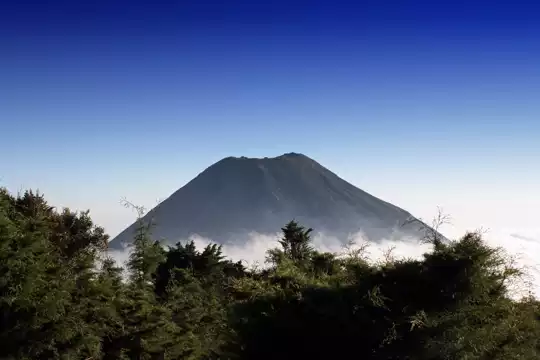
Most travelers realize too late that Cerro El Pital’s altitude means you can hike here at noon and not melt—rare mercy in El Salvador, where the sun usually punishes ambition. Cerro El Pital sits right on the border with Honduras, up in the country’s northern highlands, where the air thins and the landscape trades sugarcane fields for pine forest. The hike itself is a grind—steep, muddy in the rainy season, and often shrouded in cloud, but the payoff is real: moss-draped trees, wild orchids, and, if you’re lucky, a view that stretches all the way to the Honduran mountains. It’s not the hardest trek in El Salvador, but it’s no stroll—expect a few hours of steady climbing. Public buses crawl up to San Ignacio, but from there, you’ll need a pickup or a strong thumb to hitch the last stretch. Compared to the volcano hikes near San Salvador, El Pital feels cooler, quieter, and less trampled—more work, but more reward.

Discover everything you want to know in the 📖 El Salvador Travel Guide.
Best time to go: November - April
Duration: 6 hours
Distance: 7 kilometers
Total ascent: 700 meters
Loading the map 🌍
CLICK TO FILTER
cities
towns
landmarks
national parks
hikes
beaches
attractions
festivals
regions
SHOW COUNTRY’S BESTSHOW ALL

✨ Why go?
Ranked #2 hike in El Salvador
Reasons people choose to hike the here

Backpackers chase down Cerro El Pital because it delivers a raw punch of altitude and atmosphere without demanding a full expedition. This peak, the highest in El Salvador, rewards every step with a shifting panorama that stretches from volcanic ridges to distant Pacific waves. The scenery-to-effort ratio here is a rare find—steep enough to feel earned, but manageable for most hikers with a decent pulse. You’re not just climbing; you’re threading through cloud forests where the air sharpens and the landscape opens up like a secret unveiled.

Getting there is straightforward. Public buses from San Salvador or nearby towns drop you close enough to start your ascent without a pricey taxi or tour. The low cost of transport and entry means you’re investing sweat, not cash. Plus, the trail’s flexible read more 👉
Backpackers chase down Cerro El Pital because it delivers a raw punch of altitude and atmosphere without demanding a full expedition. This peak, the highest in El Salvador, rewards every step with a shifting panorama that stretches from volcanic ridges to distant Pacific waves. The scenery-to-effort ratio here is a rare find—steep enough to feel earned, but manageable for most hikers with a decent pulse. You’re not just climbing; you’re threading through cloud forests where the air sharpens and the landscape opens up like a secret unveiled.

Getting there is straightforward. Public buses from San Salvador or nearby towns drop you close enough to start your ascent without a pricey taxi or tour. The low cost of transport and entry means you’re investing sweat, not cash. Plus, the trail’s flexible distances let you tailor the hike—push for the summit or linger in the misty highlands, soaking in the quiet.

Cerro El Pital slots perfectly into a longer Central American route, a natural high point before or after exploring El Salvador’s beaches or Guatemala’s highlands. It’s a gritty climb with a payoff that hits your lungs and your soul—cold mountain air, a view that stretches forever, and the satisfaction of a challenge met head-on.
Want to include Cerro El Pital in your El Salvador route?
Create a personalized El Salvador itinerary that includes Cerro El Pital and the places that fit your trip — based on your travel style, budget, and available time. Get your route in seconds.

Generate my trip

💡 HighlightsKey sights and experiences for travelers

1. The Summit Viewpoint (2,730 meters)
You earn every meter of this climb, and the payoff is a panorama that feels like a reward for stubbornness. The air thins, the trees shrink, and suddenly the world drops away. On a clear morning, you’ll see the quilt of El Salvador’s north—patchwork farms, the haze of distant Honduras, and, if the clouds cooperate, a glimpse of Guatemala’s highlands. The wind up here is sharp and clean. It’s not just a view; it’s a reset button for your brain. You’ll want to linger, but the chill will keep you moving.


2. The Cloud Forest Corridor
This isn’t your average tropical hike. The trail slices through a corridor of moss-draped trees and ferns that look like they belong in a fantasy novel. The air is heavy with moisture, and every breath tastes green. You’ll brush … read more 👉
1. The Summit Viewpoint (2,730 meters)
You earn every meter of this climb, and the payoff is a panorama that feels like a reward for stubbornness. The air thins, the trees shrink, and suddenly the world drops away. On a clear morning, you’ll see the quilt of El Salvador’s north—patchwork farms, the haze of distant Honduras, and, if the clouds cooperate, a glimpse of Guatemala’s highlands. The wind up here is sharp and clean. It’s not just a view; it’s a reset button for your brain. You’ll want to linger, but the chill will keep you moving.


2. The Cloud Forest Corridor
This isn’t your average tropical hike. The trail slices through a corridor of moss-draped trees and ferns that look like they belong in a fantasy novel. The air is heavy with moisture, and every breath tastes green. You’ll brush past bromeliads and orchids clinging to branches, and if you’re lucky, catch the flash of a motmot or the call of a quetzal. The ground squelches underfoot, and the mist beads on your jacket. It’s a living, breathing ecosystem—rare for Central America at this latitude and altitude.


3. Piedra Rajada (The Split Rock)
Halfway up, the trail spits you out at a boulder cracked clean in two. Local legend says it split during a thunderstorm, but standing between the halves, you feel like you’re in the jaws of the mountain itself. It’s a natural photo op, but more than that, it’s a place to catch your breath and realize how far you’ve climbed. The rock radiates a cool dampness, and the silence here is total—broken only by your own heartbeat and the drip of water from the moss above.


4. The Border Marker: El Salvador Meets Honduras
There’s a spot where you can plant one boot in El Salvador and the other in Honduras. The marker itself is unassuming—a concrete post, a bit battered by weather and time—but the symbolism is potent. You’re straddling two countries, high above the border politics and the noise of the lowlands. It’s a reminder that these mountains don’t care about lines on a map. Snap a photo, swap stories with other hikers, and feel the quiet thrill of standing between worlds.


5. The Descent Through Pine Forests
Most trails save the best for the top, but Cerro El Pital flips the script. The descent plunges you into pine forests that smell like Christmas and campfires. The ground is soft with needles, and the light slants gold through the branches. After the damp chill of the summit, this stretch feels like a warm embrace. Locals sometimes sell hot atol (a sweet corn drink) at trail’s end—sip it slowly, boots off, legs humming, and let the mountain’s energy settle into your bones.
Spotted a mistake or missing something? Contact us.

Things to do near Cerro El Pital

Ratings based on Tripadvisor reviews. When you book through this link, you support our work at no extra cost to you.

🌤️ When to go?Choosing the right time of year


  • Weather: The dry season from November to April is your best bet. Trails stay firm, and rain won’t turn the path into a mudslide. The wet season, May through October, dumps heavy afternoon showers that can soak you and obscure views.

  • Temperature: Expect crisp mountain air. Daytime highs hover around 18-22°C (64-72°F), but nights plunge to 5-10°C (41-50°F). Pack layers—early mornings and evenings bite with cold, especially December through February.

  • Daylight Hours: Daylight stays steady year-round, roughly 11 to 12 hours. Start early to maximize your hike and catch sunrise views that punch through the clouds.

  • Crowds: Peak season (December to March) draws local hikers escaping city heat. Weekdays stay quieter, but weekends can get busy at the summit lookout points.

  • Seasonal Activities:
read more 👉

  • Weather: The dry season from November to April is your best bet. Trails stay firm, and rain won’t turn the path into a mudslide. The wet season, May through October, dumps heavy afternoon showers that can soak you and obscure views.

  • Temperature: Expect crisp mountain air. Daytime highs hover around 18-22°C (64-72°F), but nights plunge to 5-10°C (41-50°F). Pack layers—early mornings and evenings bite with cold, especially December through February.

  • Daylight Hours: Daylight stays steady year-round, roughly 11 to 12 hours. Start early to maximize your hike and catch sunrise views that punch through the clouds.

  • Crowds: Peak season (December to March) draws local hikers escaping city heat. Weekdays stay quieter, but weekends can get busy at the summit lookout points.

  • Seasonal Activities: November to February brings clearer skies perfect for spotting distant volcanoes and Guatemala’s highlands. Avoid the rainy season if you want uninterrupted vistas and safer footing.

  • Price Fluctuations: Accommodation and transport costs spike during the dry season’s holidays, especially around Christmas and Easter. Off-peak months offer better deals but come with the risk of rain.


Pro-tip: Aim for late February to early March—dry trails, manageable crowds, and crisp air combine for a hike that rewards every step with sharp, expansive views.


source: climatestotravel.comJANJanuary: excellent for travelingFEBFebruary: excellent for travelingMARMarch: excellent for travelingAPRApril: highly recommended for travelingMAYMay: fair for travelingJUNJune: fair for travelingJULJuly: fair for travelingAUGAugust: fair for travelingSEPSeptember: fair for travelingOCTOctober: fair for travelingNOVNovember: highly recommended for travelingDECDecember: excellent for traveling
when-to-go

✈️ The backpacker research shortcutEl Salvador Travel Guide

An offline-friendly backpacking guide with optimized travel routes, ranked highlights, transport advice, and the best areas to stay.
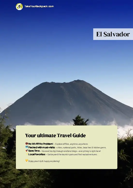
example page 0 from our offline Travel Guide for El Salvador
example page 1 from our offline Travel Guide for El Salvador
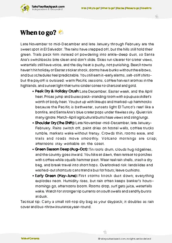
example page 2 from our offline Travel Guide for El Salvador
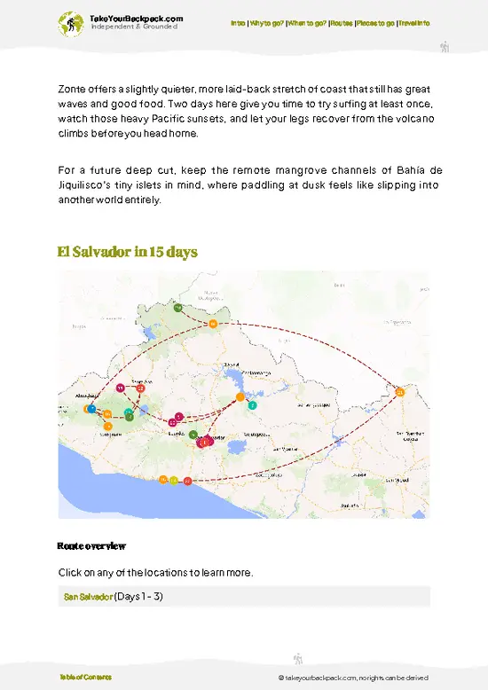
example page 3 from our offline Travel Guide for El Salvador
example page 4 from our offline Travel Guide for El Salvador
example page 5 from our offline Travel Guide for El Salvador
example page 6 from our offline Travel Guide for El Salvador
example page 7 from our offline Travel Guide for El Salvador
The digital guide (302 pages) contains:
79 highlights, ranked by travel appeal
Optimized 5, 10 & 15-day travel routes
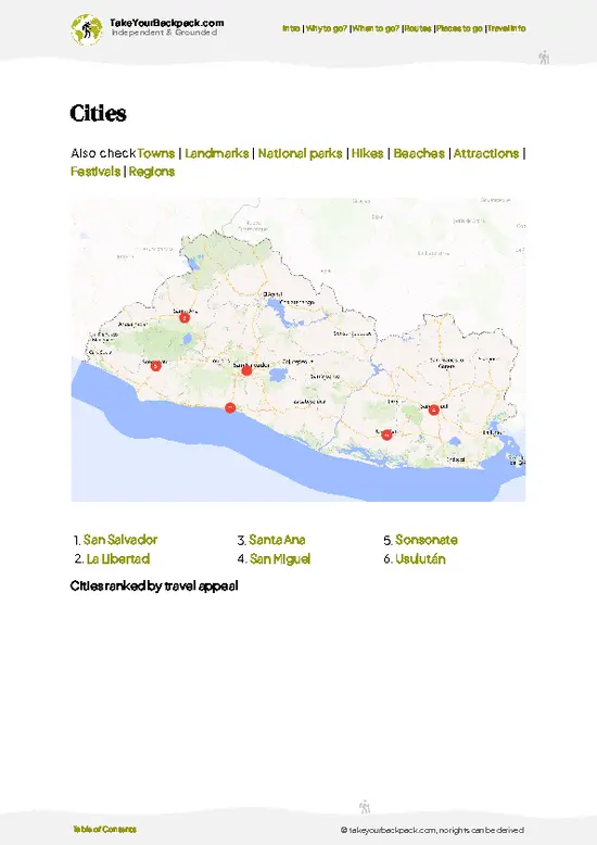
Cities, national parks, landmarks, beaches
How to get around
Offline-friendly for travel without Wi-Fi
👉 Click to see all 30+ guide features

📅 Plan smarter in minutes, not weeks
Month by month travel advice
Festivals & national holidays
Budget expectations

🗺️ Go to the right places, skip the overrated ones
Honest pros & cons of destinations
Top hikes, parks & viewpoints
Lesser-known places most travelers miss
Clear “worth it vs skip it” guidance

🛏️ Travel smoothly without rookie mistakes
Best areas to stay
Transport systems explained simply
Common scams & safety advice
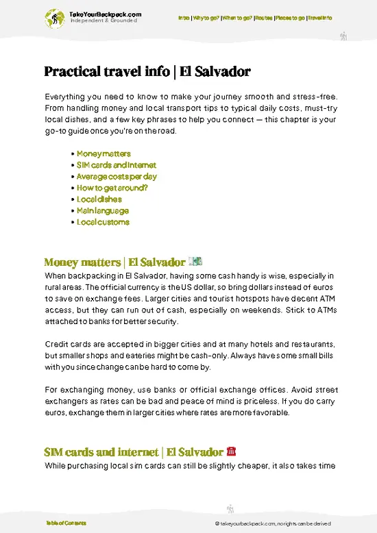
SIM cards, money & practical tips

🌍 Understand the country, not just visit it
Culture & traditions
52 Essential phrases & customs
Festivals worth planning around
Traveler-friendly historical context
Insights that make places more meaningful

📱 Built for real travel conditions
Fully downloadable PDF
Works completely offline
Optimized for phone use
Useful in remote areas & buses
Everything in one place
Save weeks of stressful planning
Get instant access to your full guide. 30‑day money-back guarantee.


By proceeding you agree to our terms.
Sent to your inbox immediately after payment • 100% Secure Checkout
Best Backpacking Travel Advisor 2025 tourism awardBest Backpacking
Travel Advisor
2025
What others say about Take Your Backpack Guides:
⭐⭐⭐⭐⭐
Fantastic, amazing amount of information!
⭐⭐⭐⭐⭐
My goodness this is amazing, it's what I've been looking for hats off too you!
⭐⭐⭐⭐⭐
I think this is absolutely BRILLIANT
⭐⭐⭐⭐
Very complete and informative. It's still missing places, but I gotta to commend you
⭐⭐⭐⭐⭐
This is truly amazing, thank you, can't wait to explore it with my kids!
⭐⭐⭐⭐⭐
Awesome resource, thank you!
⭐⭐⭐⭐⭐
This is amazing! Can't wait to explore the ones I haven't seen
⭐⭐⭐⭐
I love this! Well done, great idea.
⭐⭐⭐⭐⭐
Thanks for taking the time to make this gem!
⭐⭐⭐⭐⭐
This might be the best website I've ever seen.
⭐⭐⭐⭐⭐
Congratulations, and thank you so much for your work; it's incredibly valuable.
⭐⭐⭐⭐
In all seriousness I think you did a great job pointing out the important spots
⭐⭐⭐⭐⭐
10/10 very good
⭐⭐⭐⭐⭐
As someone who's only just starting to visit regularly this is awesome, thank you.
⭐⭐⭐⭐
Thank you very much! I'm going to visit my dad, it's going to be very useful!
⭐⭐⭐⭐⭐
This is really cool! We'll be travelling for the first time and this definitely come in handy.
⭐⭐⭐⭐⭐
You are now our minister of culture, congratulations 👨‍💼
⭐⭐⭐⭐⭐
Just wanted to tell you that this is a pearl! Going to follow your recommendations.
⭐⭐⭐⭐⭐
This is so cool. I'll definitely be using the resource for my travels soon.
⭐⭐⭐⭐⭐
This is very impressive! Good work.
⭐⭐⭐⭐⭐
This is an amazing and informative site. Very well done!

🛏️ Where to stay?Where staying makes the most sense

If you enjoy meeting fellow travelers, consider choosing hostels with high ratings for atmosphere. On the other hand, if you prefer having your own space, a hotel might be a better option.

🥾 Hike detailsEverything you need to know before hiking Cerro El Pital

Total Distance: The main trail to Cerro El Pital’s summit stretches about 7 kilometers round trip. It’s a compact but intense hike that packs a punch in a short distance.

Estimated Duration: Expect to spend 3 to 4 hours on the trail, depending on your pace and how often you stop to catch your breath or snap photos. The climb is steady, so factor in some extra time if you’re not used to altitude.

Difficulty: This trail is moderate to challenging. The elevation gain hits around 1,200 meters, and the terrain shifts from dirt paths to rocky stretches. It’s not technical, but the incline will test … read more 👉
Total Distance: The main trail to Cerro El Pital’s summit stretches about 7 kilometers round trip. It’s a compact but intense hike that packs a punch in a short distance.

Estimated Duration: Expect to spend 3 to 4 hours on the trail, depending on your pace and how often you stop to catch your breath or snap photos. The climb is steady, so factor in some extra time if you’re not used to altitude.

Difficulty: This trail is moderate to challenging. The elevation gain hits around 1,200 meters, and the terrain shifts from dirt paths to rocky stretches. It’s not technical, but the incline will test your legs and lungs. Good boots and a steady pace are your best friends here.

Starting Point: The hike begins at the El Pital National Park entrance, near the village of La Palma. Public transport is straightforward: from San Salvador, catch a bus heading to La Palma or Apaneca. From the village, local taxis or moto-taxis can drop you at the park entrance. The road to the trailhead is rough but accessible.

Major Landmarks: Early on, you’ll pass through a small pine forest that feels like a breath of fresh mountain air. Midway, a lookout platform offers a sweeping view of the Salvadoran valleys below—perfect for a quick break. Near the summit, the landscape opens up to reveal the border with Honduras, marked by a simple stone monument. The summit itself is a rocky plateau where you can stand above the clouds.

Terrain and Scenery: The trail kicks off with soft, pine-needle-covered soil that cushions your steps. As you climb, the path narrows and rocks appear, demanding careful footing. The scenery shifts from dense pine woods to open meadows dotted with wildflowers. On clear days, the horizon stretches endlessly, with volcanic peaks punctuating the skyline.

Vegetation: Pine dominates the landscape, but you’ll also spot patches of oak and wild shrubs. The air smells crisp and earthy, a stark contrast to the tropical lowlands. Seasonal wildflowers add bursts of color, especially in spring.

Wildlife: Keep your eyes peeled for the elusive quetzal, a jewel of a bird with iridescent feathers. You might also hear the chatter of howler monkeys or glimpse agoutis darting through the underbrush. Insects buzz, and if you’re lucky, a hawk might circle overhead.

This trail demands effort, but the payoff is pure: the rare chill of El Salvador’s highest peak, the thrill of standing on the border, and the quiet satisfaction of conquering a climb that few locals and tourists tackle with such grit. The first cold drink back in La Palma tastes like victory.
⚠️ Hiking info can sometimes be outdated or inaccurate. Before you hit the trail, check the latest conditions with locals. If you do spot anything that's off, I'd love to hear from you, so I can update it for fellow travelers.

🛡️ SafetyStaying Safe: What Travelers Should Know

Cerro El Pital’s trail demands respect but doesn’t punish the unprepared. The altitude—just over 2,700 meters—means the air thins enough to slow your pace, so don’t sprint out of the gate. Layer up; mornings bite cold, and weather shifts fast. Fog can roll in, blurring the path and turning the terrain slick with dew. The trail itself is a mix of packed dirt and rocky stretches, with some steep sections that test your footing. Good hiking shoes with solid grip are non-negotiable.

Wildlife is subtle here—mostly birds and the occasional squirrel—no need to worry about aggressive animals. Still, keep your distance and don’t feed anything; the ecosystem is fragile. Water crossings are rare but can be slippery, so step carefully.

Most first-timers underestimate the chill at the summit and the … read more 👉
Cerro El Pital’s trail demands respect but doesn’t punish the unprepared. The altitude—just over 2,700 meters—means the air thins enough to slow your pace, so don’t sprint out of the gate. Layer up; mornings bite cold, and weather shifts fast. Fog can roll in, blurring the path and turning the terrain slick with dew. The trail itself is a mix of packed dirt and rocky stretches, with some steep sections that test your footing. Good hiking shoes with solid grip are non-negotiable.

Wildlife is subtle here—mostly birds and the occasional squirrel—no need to worry about aggressive animals. Still, keep your distance and don’t feed anything; the ecosystem is fragile. Water crossings are rare but can be slippery, so step carefully.

Most first-timers underestimate the chill at the summit and the sun’s strength on the way down. Bring sun protection and a warm jacket. Pace yourself, savor the climb, and when you reach the peak, the panoramic sweep of El Salvador’s patchwork valleys makes every step worth it.

Other Salvadoran hikes near Cerro El Pital

Explore more nearby:

  • Cinquera Forest Trail—regenerating jungle, war history sites, natural pools| 58 km away
  • El Boquerón—volcanic crater rim, urban proximity, lush gardens| 74 km away
  • Santa Ana Volcano—crater lake, exposed summit, lava fields, Pacific views| 81 km away

💡 Not sure where to go next?
Create a personalized itinerary for El Salvador including Cerro El Pital and the places that fit your trip.

Generate my itinerary

👉 Discover all hikes

Or checkout all El Salvador has to offer (think cities, towns, villages, national parks, hikes, beaches, festivals)
Country photo of El Salvador

We 💚 feedbackSumming up the experience

Cerro El Pital isn’t just a hike; it’s a full-body wake-up call. The air bites sharp, and the trails push your legs to talk back. But when you crest that summit, the patchwork of clouds and valleys stretching into Honduras hits you like a reward you earned with sweat. Don’t expect luxury—this is raw, rugged, and real. Pack layers, because the cold sneaks up fast, and savor that first hot coffee or cold soda at the top. It’s a moment that makes every step worth it.

✍️ Help improve this page!
The information on this page is based on in-depth research, insights shared by experienced travelers, and feedback from the local travel community in El Salvador. While every effort is made to keep the information accurate and current, conditions can change — so if you spot anything incorrect or outdated, please get in touch.


🙋‍♂️ Give feedback

👋 Meet the founderWho’s Behind Take Your Backpack?

Johan, backpacker and founder of TakeYourBackpackHi, I’m Johan (Netherlands 🇳🇱), the creator of TakeYourBackpack. Over the past decade, I’ve backpacked through 80+ countries across six continents, gaining extensive experience with independent travel, long-term trips, and overland routes.

This site is built on a combination of firsthand travel experience and carefully curated insights from other backpackers. Many guides are based on places I’ve personally visited, while others bring together tips, observations, and practical advice shared by trusted travelers I’ve met along the way.

The goal is to provide realistic, experience-driven guidance — not generic itineraries — so you can explore destinations with better context, clearer expectations, and more confidence.

Get full country guide •
Instant download • 79 highlights • Full Offline guide