×

El Salvador🇸🇻 | hikesSan Miguel volcanoactive cone, ash slopes, sulfur vents, open summit | things to do and best time to go

Explore Cerro El PitalExplore El Imposible National Park

Backpacking in San Miguel volcano
👍 Recommendedhike ranked #5
By Johan Kruseman 🇳🇱 | Updated June 2, 2026

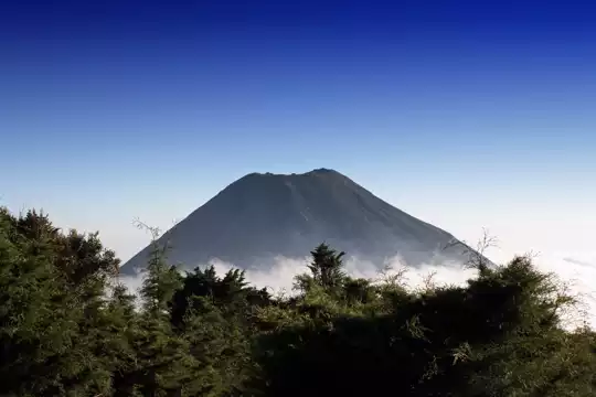
Your boots crunch over black pumice, every step sending up a puff of volcanic dust that sticks to your calves. The air smells faintly of sulfur and hot stone, and sweat stings your eyes as you scramble past twisted, wind-burned shrubs. This is San Miguel volcano—also called Chaparrastique—rising out of El Salvador’s eastern lowlands like a warning. The climb is raw and relentless, a straight shot up loose scree and exposed ridges, with little shade and plenty of heat. You’ll curse the incline, but the payoff is real: the crater’s rim delivers a panoramic punch—smoke curling from the mouth, the Pacific glinting far off, and the city of San Miguel sprawled below. The hike itself is short but brutal, usually two to four hours up, and the public bus from San Miguel city drops you within striking distance of the trailhead. Compared to the lush, cloud-forested climbs of Santa Ana or Izalco, Chaparrastique is all grit and fire—less pretty, more primal, and absolutely worth the sweat if you want to feel the earth’s pulse under your feet.

Discover everything you want to know in the 📖 El Salvador Travel Guide.
Best time to go: November - April
Duration: 6 hours
Distance: 7 kilometers
Total ascent: 728 meters
Loading the map 🌍
CLICK TO FILTER
cities
towns
landmarks
national parks
hikes
beaches
attractions
festivals
regions
SHOW COUNTRY’S BESTSHOW ALL

✨ Why go?
Ranked #5 hike in El Salvador
What sets this place apart

The San Miguel volcano hike in El Salvador grabs backpackers because it delivers raw payoff for every drop of sweat. This isn’t a stroll—it’s a climb that kicks your legs but rewards you with a panoramic sweep of the Pacific coast and sprawling volcanic landscapes that feel like you’ve stepped onto another planet. The scenery-to-effort ratio here is off the charts; you push hard, but the views at the summit make the burn vanish.

Getting there is straightforward, thanks to public transport access from San Salvador or nearby towns. Buses and shared shuttles drop you close enough to start the trek without fuss or inflated tourist prices. Speaking of which, the low cost of this adventure means you can stretch your budget for a cold beer at the base after the hike—trust me, that first sip tastes … read more 👉
The San Miguel volcano hike in El Salvador grabs backpackers because it delivers raw payoff for every drop of sweat. This isn’t a stroll—it’s a climb that kicks your legs but rewards you with a panoramic sweep of the Pacific coast and sprawling volcanic landscapes that feel like you’ve stepped onto another planet. The scenery-to-effort ratio here is off the charts; you push hard, but the views at the summit make the burn vanish.

Getting there is straightforward, thanks to public transport access from San Salvador or nearby towns. Buses and shared shuttles drop you close enough to start the trek without fuss or inflated tourist prices. Speaking of which, the low cost of this adventure means you can stretch your budget for a cold beer at the base after the hike—trust me, that first sip tastes like victory.

The trail itself offers flexible distances—you can tackle a full summit push or opt for shorter loops if you’re pacing a longer route through El Salvador’s volcanic corridor. It slots perfectly into a backpacker’s itinerary, linking up with other volcanoes and coffee plantations without wasting time or energy. This hike is pure, unfiltered challenge and reward, the kind of experience that sticks with you long after the boots hit the ground.
Want to include San Miguel volcano in your El Salvador route?
Create a personalized El Salvador itinerary that includes San Miguel volcano and the places that fit your trip — based on your travel style, budget, and available time. Get your route in seconds.

Generate my trip

💡 HighlightsKey sights and experiences for travelers

1. The Crater Rim: Where Earth Breathes
The final push up San Miguel volcano is a test of will. The trail turns from packed dirt to loose, volcanic scree, and every step slides half a step back. The air thins, the sun feels closer, and your calves start to question your life choices. But then you crest the rim, and the world drops away. The crater is a raw, gaping wound—alive with sulfurous steam and streaks of yellow and ochre. You can smell the minerals, sharp and metallic, and hear the low, guttural hiss of the earth venting below. This isn’t a polite, postcard volcano; it’s a living, breathing beast. The sense of scale is dizzying. You’re not just looking at a view—you’re standing on the edge of something ancient and volatile, and you feel it in your bones.


2. Panoramic Views Over the read more 👉
1. The Crater Rim: Where Earth Breathes
The final push up San Miguel volcano is a test of will. The trail turns from packed dirt to loose, volcanic scree, and every step slides half a step back. The air thins, the sun feels closer, and your calves start to question your life choices. But then you crest the rim, and the world drops away. The crater is a raw, gaping wound—alive with sulfurous steam and streaks of yellow and ochre. You can smell the minerals, sharp and metallic, and hear the low, guttural hiss of the earth venting below. This isn’t a polite, postcard volcano; it’s a living, breathing beast. The sense of scale is dizzying. You’re not just looking at a view—you’re standing on the edge of something ancient and volatile, and you feel it in your bones.


2. Panoramic Views Over the Pacific Lowlands
On a clear day, the reward for your sweat is a 360-degree sweep that stretches from the sugarcane fields of Usulután to the Pacific’s blue haze. The wind up here is relentless, snapping at your shirt and drying the sweat on your face. You can trace the curve of the coastline, spot distant towns, and watch clouds casting shadows over patchwork fields. The contrast between the lush lowlands and the black, scarred slopes of the volcano is stark—proof of how this mountain shapes the land and the lives below. It’s the kind of view that makes you forget your aching legs for a minute and just breathe.


3. The Shifting Forests: Life on Volcanic Soil
The lower slopes of San Miguel are a lesson in resilience. The trail winds through coffee plantations and patches of secondary forest, where the ground is littered with black pumice and the trees grow in improbable angles. You’ll spot bromeliads clinging to branches, hear the chatter of motmots, and maybe catch a flash of emerald as a parakeet darts overhead. The forest here isn’t pristine—it’s shaped by eruptions and regrowth, a living record of survival. The scent of wet earth and coffee blossoms hangs in the air, and every so often, you’ll pass a farmer tending crops on impossibly steep ground, a reminder that life here is stubborn and inventive.


4. The Descent: Gravity and Adrenaline
Going down San Miguel is a different kind of challenge. The scree turns your boots into skis, and you have to trust your balance and your momentum. It’s fast, messy, and a little bit wild. Dust kicks up, your legs burn, and you’ll probably laugh out loud at least once—part relief, part exhilaration. The descent is where the effort transforms into pure, kinetic joy. By the time you reach the bottom, you’re filthy, tired, and grinning. And that first cold drink at the trailhead? It tastes like victory.
Spotted a mistake or missing something? Contact us.

Things to do near San Miguel volcano

Ratings based on Tripadvisor reviews. When you book through this link, you support our work at no extra cost to you.

🌤️ When to go?Seasonal considerations and timing


  • Weather: The dry season from November to April is your best bet. Trails stay firm, and rain won’t turn your hike into a mud slog. May through October drags in heavy rains, making the climb slippery and visibility poor.

  • Temperature: Daytime temps hover around 20-25°C (68-77°F) during the dry months, perfect for sweating it out without overheating. Nights can dip to 10°C (50°F), so pack layers for the summit chill.

  • Daylight Hours: Roughly 11 to 12 hours of daylight year-round, but the dry season offers clearer skies, so you get more reliable light for early starts and late finishes.

  • Crowds: Peak hiking season aligns with the dry months, especially December through February, when local and international hikers converge. For fewer people, aim for November or April.

  • Seasonal Activities:
read more 👉

  • Weather: The dry season from November to April is your best bet. Trails stay firm, and rain won’t turn your hike into a mud slog. May through October drags in heavy rains, making the climb slippery and visibility poor.

  • Temperature: Daytime temps hover around 20-25°C (68-77°F) during the dry months, perfect for sweating it out without overheating. Nights can dip to 10°C (50°F), so pack layers for the summit chill.

  • Daylight Hours: Roughly 11 to 12 hours of daylight year-round, but the dry season offers clearer skies, so you get more reliable light for early starts and late finishes.

  • Crowds: Peak hiking season aligns with the dry months, especially December through February, when local and international hikers converge. For fewer people, aim for November or April.

  • Seasonal Activities: November to April also hosts local festivals and coffee harvests nearby, adding cultural flavor to your trip. Rainy season limits these extras and can close some access points.

  • Price Fluctuations: Expect higher prices for guides and lodging during the dry season, especially around holidays like Christmas and Easter. The rainy season offers cheaper rates but at the cost of comfort and safety.


Pro-tip: Start your hike early in the dry season to catch the sunrise from the summit—nothing beats that first light after earning every step.


source: climatestotravel.comJANJanuary: excellent for travelingFEBFebruary: excellent for travelingMARMarch: excellent for travelingAPRApril: highly recommended for travelingMAYMay: fair for travelingJUNJune: fair for travelingJULJuly: fair for travelingAUGAugust: fair for travelingSEPSeptember: fair for travelingOCTOctober: fair for travelingNOVNovember: highly recommended for travelingDECDecember: excellent for traveling
el-salvador-hike-san-miguel-volcano v1
© Google |

✈️ The backpacker research shortcutEl Salvador Travel Guide

An offline-friendly backpacking guide with optimized travel routes, ranked highlights, transport advice, and the best areas to stay.
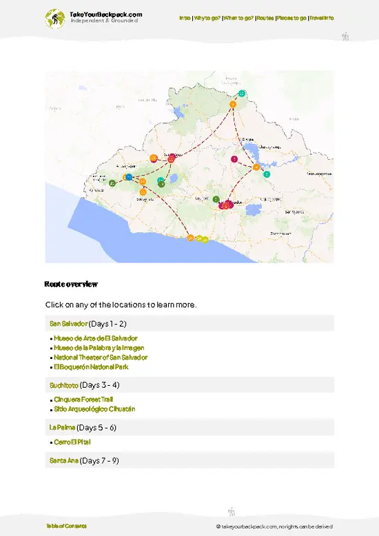
example page 0 from our offline Travel Guide for El Salvador
example page 1 from our offline Travel Guide for El Salvador
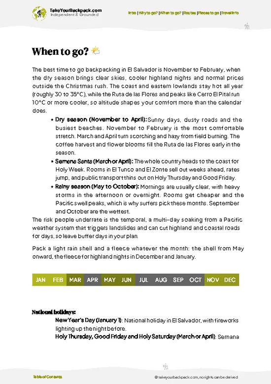
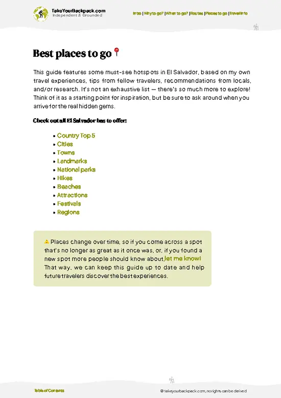
example page 2 from our offline Travel Guide for El Salvador
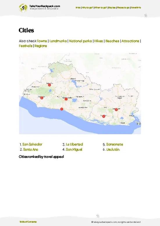
example page 3 from our offline Travel Guide for El Salvador
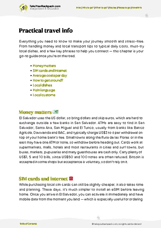
example page 4 from our offline Travel Guide for El Salvador
example page 5 from our offline Travel Guide for El Salvador
example page 6 from our offline Travel Guide for El Salvador
example page 7 from our offline Travel Guide for El Salvador
The digital guide (302 pages) contains:
79 highlights, ranked by travel appeal
Optimized 5, 10 & 15-day travel routes
Cities, national parks, landmarks, beaches
How to get around
Offline-friendly for travel without Wi-Fi
👉 Click to see all 30+ guide features

📅 Plan smarter in minutes, not weeks
Month by month travel advice
Festivals & national holidays
Budget expectations

🗺️ Go to the right places, skip the overrated ones
Honest pros & cons of destinations
Top hikes, parks & viewpoints
Lesser-known places most travelers miss
Clear “worth it vs skip it” guidance

🛏️ Travel smoothly without rookie mistakes
Best areas to stay
Transport systems explained simply
Common scams & safety advice
SIM cards, money & practical tips

🌍 Understand the country, not just visit it
Culture & traditions
52 Essential phrases & customs
Festivals worth planning around
Traveler-friendly historical context
Insights that make places more meaningful

📱 Built for real travel conditions
Fully downloadable PDF
Works completely offline
Optimized for phone use
Useful in remote areas & buses
Everything in one place
Save weeks of stressful planning
Get instant access to your full guide. 30‑day money-back guarantee.


By proceeding you agree to our terms.
Sent to your inbox immediately after payment • 100% Secure Checkout
Best Backpacking Travel Advisor 2025 tourism awardBest Backpacking
Travel Advisor
2025
What others say about Take Your Backpack Guides:
⭐⭐⭐⭐⭐
Fantastic, amazing amount of information!
⭐⭐⭐⭐⭐
My goodness this is amazing, it's what I've been looking for hats off too you!
⭐⭐⭐⭐⭐
I think this is absolutely BRILLIANT
⭐⭐⭐⭐
Very complete and informative. It's still missing places, but I gotta to commend you
⭐⭐⭐⭐⭐
This is truly amazing, thank you, can't wait to explore it with my kids!
⭐⭐⭐⭐⭐
Awesome resource, thank you!
⭐⭐⭐⭐⭐
This is amazing! Can't wait to explore the ones I haven't seen
⭐⭐⭐⭐
I love this! Well done, great idea.
⭐⭐⭐⭐⭐
Thanks for taking the time to make this gem!
⭐⭐⭐⭐⭐
This might be the best website I've ever seen.
⭐⭐⭐⭐⭐
Congratulations, and thank you so much for your work; it's incredibly valuable.
⭐⭐⭐⭐
In all seriousness I think you did a great job pointing out the important spots
⭐⭐⭐⭐⭐
10/10 very good
⭐⭐⭐⭐⭐
As someone who's only just starting to visit regularly this is awesome, thank you.
⭐⭐⭐⭐
Thank you very much! I'm going to visit my dad, it's going to be very useful!
⭐⭐⭐⭐⭐
This is really cool! We'll be travelling for the first time and this definitely come in handy.
⭐⭐⭐⭐⭐
You are now our minister of culture, congratulations 👨‍💼
⭐⭐⭐⭐⭐
Just wanted to tell you that this is a pearl! Going to follow your recommendations.
⭐⭐⭐⭐⭐
This is so cool. I'll definitely be using the resource for my travels soon.
⭐⭐⭐⭐⭐
This is very impressive! Good work.
⭐⭐⭐⭐⭐
This is an amazing and informative site. Very well done!

🛏️ Where to stay?Where staying makes the most sense

If you enjoy meeting fellow travelers, consider choosing hostels with high ratings for atmosphere. On the other hand, if you prefer having your own space, a hotel might be a better option.

🥾 Hike detailsA practical overview of the hike

Total Distance: The round-trip trek clocks in at about 7 kilometers (4.3 miles). It’s a manageable distance, but don’t let that fool you—the elevation gain packs a punch.

Estimated Duration: Expect to spend 4 to 6 hours on the trail, depending on your pace and how often you stop to catch your breath or soak in the views.

Difficulty: This hike is firmly in the moderate to challenging category. The trail climbs steadily, with some steep sections that demand good stamina and sure footing. It’s not technical, but the altitude and uneven volcanic rock can wear you down if you’re not prepared.

Starting read more 👉
Total Distance: The round-trip trek clocks in at about 7 kilometers (4.3 miles). It’s a manageable distance, but don’t let that fool you—the elevation gain packs a punch.

Estimated Duration: Expect to spend 4 to 6 hours on the trail, depending on your pace and how often you stop to catch your breath or soak in the views.

Difficulty: This hike is firmly in the moderate to challenging category. The trail climbs steadily, with some steep sections that demand good stamina and sure footing. It’s not technical, but the altitude and uneven volcanic rock can wear you down if you’re not prepared.

Starting Point: The trailhead is at the base of San Miguel volcano, near the town of La Unión. Public transport options include local buses from San Salvador to La Unión, which take around 3 to 4 hours. From La Unión, you’ll need a short taxi ride or a local mototaxi to reach the trailhead. The access point is well-marked, and locals are generally helpful if you need directions.

Major Landmarks: The first landmark is the old fumarole field—steam vents hissing from the earth, a reminder of the volcano’s restless nature. Midway, you’ll pass a small crater lake, a surreal turquoise pool framed by black volcanic rock. The final prize is the summit crater rim, where you peer into a steaming caldera and gaze out over the sprawling city of San Miguel below.

Terrain and Scenery: The trail snakes through volcanic ash and loose rock, demanding careful footing. You’ll move from dry scrubland at the base to dense cloud forest higher up. The air thins, the wind picks up, and the landscape opens to panoramic views of the Gulf of Fonseca and the surrounding mountain ranges.

Vegetation: At lower elevations, thorny bushes and cacti dominate. As you climb, the vegetation thickens into moss-draped oaks and ferns, with orchids tucked into tree bark. The contrast between arid and lush zones is striking and keeps the hike visually engaging.

Wildlife: Keep your eyes peeled for howler monkeys echoing through the canopy and the occasional agouti darting across the trail. Birdwatchers will appreciate sightings of toucans and colorful tanagers. Insects buzz steadily, a reminder you’re deep in a living ecosystem.

This trail isn’t just a walk—it’s a workout with a payoff. The burn in your legs fades the moment you reach the summit and drink in the vast, smoky crater and endless horizon. That’s the kind of reward that makes every step worth it.
⚠️ Hiking info can sometimes be outdated or inaccurate. Before you hit the trail, check the latest conditions with locals. If you do spot anything that's off, I'd love to hear from you, so I can update it for fellow travelers.

🛡️ SafetySafety Tips and Common Scams in San Miguel volcano

San Miguel volcano’s trail demands respect but doesn’t punish the unprepared. The climb is steep, especially in the final stretch, where loose volcanic rock tests your footing. Expect your boots to kick up dust and your legs to burn—this isn’t a stroll in the park. Weather shifts fast here; mornings start cool but can turn sweltering by midday, so layering is your best friend. Rain is common in the wet season, turning paths slick and muddy, so waterproof shoes and a quick-dry jacket aren’t negotiable.

Altitude tops out around 2,300 meters—enough to make your breathing heavier but not enough to cause serious altitude sickness. Keep a steady pace, and don’t rush the summit push. Wildlife is sparse but watch for stray dogs near the trailhead and occasional birds overhead; no need for special … read more 👉
San Miguel volcano’s trail demands respect but doesn’t punish the unprepared. The climb is steep, especially in the final stretch, where loose volcanic rock tests your footing. Expect your boots to kick up dust and your legs to burn—this isn’t a stroll in the park. Weather shifts fast here; mornings start cool but can turn sweltering by midday, so layering is your best friend. Rain is common in the wet season, turning paths slick and muddy, so waterproof shoes and a quick-dry jacket aren’t negotiable.

Altitude tops out around 2,300 meters—enough to make your breathing heavier but not enough to cause serious altitude sickness. Keep a steady pace, and don’t rush the summit push. Wildlife is sparse but watch for stray dogs near the trailhead and occasional birds overhead; no need for special precautions, just respect their space.

Navigation is straightforward; the trail is well-marked, but a map or GPS app helps if you want to explore side paths. Start early to avoid afternoon heat and crowds, and bring plenty of water. The payoff? A raw, panoramic view of El Salvador’s patchwork below, where sweat and effort crystallize into pure satisfaction.

Other Salvadoran hikes near San Miguel volcano

Explore more nearby:

  • Cinquera Forest Trail—regenerating jungle, war history sites, natural pools| 90 km away
  • Devil‘s Door—rock formations, cliffside lookout, pine woods| 102 km away
  • El Boquerón—volcanic crater rim, urban proximity, lush gardens| 115 km away

💡 Not sure where to go next?
Create a personalized itinerary for El Salvador including San Miguel volcano and the places that fit your trip.

Generate my itinerary

👉 Discover all hikes

Or checkout all El Salvador has to offer (think cities, towns, villages, national parks, hikes, beaches, festivals)
Country photo of El Salvador

We 💚 feedbackSumming up the experience

San Miguel’s climb isn’t a walk in the park—expect sweat, loose rocks, and a steady burn in your legs. But when you break through the clouds near the summit, the crater’s raw power hits you like a punch. That churning, sulfur-scented pit below is a reminder you’re standing on a living beast. The best surprise? The way the early morning light fractures over the valley, turning everything gold. Just don’t underestimate the weather—it shifts fast. Pack layers, move steady, and savor that first gulp of cold water at the top.

✍️ Help improve this page!
The information on this page is based on in-depth research, insights shared by experienced travelers, and feedback from the local travel community in El Salvador. While every effort is made to keep the information accurate and current, conditions can change — so if you spot anything incorrect or outdated, please get in touch.


🙋‍♂️ Give feedback

👋 Meet the founderWho’s Behind Take Your Backpack?

Johan, backpacker and founder of TakeYourBackpackHi, I’m Johan (Netherlands 🇳🇱), the creator of TakeYourBackpack. Over the past decade, I’ve backpacked through 80+ countries across six continents, gaining extensive experience with independent travel, long-term trips, and overland routes.

This site is built on a combination of firsthand travel experience and carefully curated insights from other backpackers. Many guides are based on places I’ve personally visited, while others bring together tips, observations, and practical advice shared by trusted travelers I’ve met along the way.

The goal is to provide realistic, experience-driven guidance — not generic itineraries — so you can explore destinations with better context, clearer expectations, and more confidence.

Get full country guide •
Instant download • 79 highlights • Full Offline guide