×

El Salvador🇸🇻 | best hikesTop-Rated 8 hikes in El Salvador

Hikes in El Salvador climb volcanoes, not mountain passes. Crater rims smell of sulfur and wet earth, cloud forest drips under tree ferns, and coffee farms rustle on the slopes below. The country is small, so the trailheads sit within a few hours of each other, but the experience changes fast. The west has the busiest, best-organized routes, with tourist police escorts and fees of a few dollars. The north near the Honduran border is cooler, quieter and rougher, with pine ridges, village homestays and few signs. For backpackers traveling independently, the choice is between convenience and solitude, and it comes down to how much gravel and chicken-bus time you will accept.

By Johan Kruseman 🇳🇱 | Updated October 9, 2026
Explore the best beaches in El Salvador

Why go?Key Factors That Shape the Experience

El Salvador sits on the Pacific Ring of Fire, and that shapes almost every walk here. Volcanoes rise straight from the coffee belt, so a single morning can take you from warm farmland through mist-soaked forest to a bare crater rim with sulfur wafting off the vents. The country is the smallest on the mainland of Central America, which means short distances: most trailheads are within two to four hours of San Salvador, and altitudes top out around 2,700 meters rather than the 4,000 of neighboring Guatemala. That makes the effort manageable for first-timers.

The civil war (1980 to 1992) left its mark on the north and east, where some trails follow old guerrilla routes and local guides tell that history on the way. Infrastructure is uneven. Popular volcanoes have paved access roads, ranger posts … read more 👉
El Salvador sits on the Pacific Ring of Fire, and that shapes almost every walk here. Volcanoes rise straight from the coffee belt, so a single morning can take you from warm farmland through mist-soaked forest to a bare crater rim with sulfur wafting off the vents. The country is the smallest on the mainland of Central America, which means short distances: most trailheads are within two to four hours of San Salvador, and altitudes top out around 2,700 meters rather than the 4,000 of neighboring Guatemala. That makes the effort manageable for first-timers.

The civil war (1980 to 1992) left its mark on the north and east, where some trails follow old guerrilla routes and local guides tell that history on the way. Infrastructure is uneven. Popular volcanoes have paved access roads, ranger posts and organized groups, while lesser-known trails have little signage and need a local guide. Heat, dust and sudden afternoon downpours are part of the deal.

Before choosing El Salvador, know that guides or police escorts are standard on several popular routes, trails are often short rather than multi-day, and you will rely on a mix of chicken buses, shuttles and pickup trucks to reach trailheads.
How the List Was Created
The list of best hikes in El Salvador is created based on scenery, challenge, trail quality, landmarks, and overall enjoyment. If you feel a hike is missing in this list, please let us know.

When to go?Optimal Periods for Travel

Best months: November to March: The best months for hiking in El Salvador are November to March, the dry season, when skies are clear, trails are firm and crater views are not swallowed by cloud. Mornings are cool and bright, and midday heat in the lowlands sits around 30 to 34°C. At altitude, such as the northern pine ridges and high volcano rims, mornings can drop to 8 to 14°C, so you want a layer.

Wet season: May to October: The rainy season brings heavy afternoon storms, often 1,500 to 2,000 mm of rain across the season in many areas. Trails turn to slick red mud, rivers swell, and clouds close around summits by midday. The upside is intensely green slopes, the smell of wet soil and almost no other hikers. Start before 7 a.m. and plan to be off the mountain by early afternoon, since lightning … read more 👉
Best months: November to March: The best months for hiking in El Salvador are November to March, the dry season, when skies are clear, trails are firm and crater views are not swallowed by cloud. Mornings are cool and bright, and midday heat in the lowlands sits around 30 to 34°C. At altitude, such as the northern pine ridges and high volcano rims, mornings can drop to 8 to 14°C, so you want a layer.

Wet season: May to October: The rainy season brings heavy afternoon storms, often 1,500 to 2,000 mm of rain across the season in many areas. Trails turn to slick red mud, rivers swell, and clouds close around summits by midday. The upside is intensely green slopes, the smell of wet soil and almost no other hikers. Start before 7 a.m. and plan to be off the mountain by early afternoon, since lightning is a real risk on exposed rims.

Shoulder months and crowds: April and October are shoulder months, with building heat in April and unpredictable storms in October. Crowds peak around Semana Santa (the week before Easter) and the Christmas period, when popular volcanoes see local families and prices for guides and lodging in hill towns can rise by 20 to 30 percent. Outside those weeks, trails are quiet year round.

hike hoppingTips for Visiting Multiple Destinations

How many days to plan: A trip combining several hikes in El Salvador needs 7 to 10 days, which leaves room for travel and rest. The country is small, but mountain roads are slow, and a 100 km transfer can take three hours.

Which regions group well: The west clusters around Santa Ana and Juayúa, with volcano trailheads and coffee villages one to two hours apart by bus or shuttle. San Salvador works as the central hub, with buses fanning out to every region. The north around La Palma and El Pital lies roughly three hours from the capital, and the east near Perquín is a further four to five hours. A west to center to north to east loop avoids backtracking. Allow one to two nights per stop, since most hikes take three to six hours and begin at dawn.

Common planning mistakes: The biggest error … read more 👉
How many days to plan: A trip combining several hikes in El Salvador needs 7 to 10 days, which leaves room for travel and rest. The country is small, but mountain roads are slow, and a 100 km transfer can take three hours.

Which regions group well: The west clusters around Santa Ana and Juayúa, with volcano trailheads and coffee villages one to two hours apart by bus or shuttle. San Salvador works as the central hub, with buses fanning out to every region. The north around La Palma and El Pital lies roughly three hours from the capital, and the east near Perquín is a further four to five hours. A west to center to north to east loop avoids backtracking. Allow one to two nights per stop, since most hikes take three to six hours and begin at dawn.

Common planning mistakes: The biggest error is cramming three trailheads into two days. Pickup trucks and chicken buses run on local time, and afternoon rain closes in whether or not you are ready. Instead, give each region a buffer evening for dust, heat and a plate of pupusas. Another mistake is skipping early starts; sunrise at 5:30 a.m. gives the clearest air and coolest trails. Finally, do not count on late buses in the north. Book shuttles or arrange a driver the day before.

The ListMust-Visit hikes in El Salvador

1 Santa Ana Volcano

crater lake, exposed summit, lava fields, Pacific views

Hike up open slopes to peer into a turquoise crater lake, with sweeping vistas stretching from coffee farms to the ocean.

el-salvador-hike-santa-ana-volcano
© Google | M G

2 Cerro El Pital

cloud forest, cool climate, border ridge, rare orchids

Ascend to El Salvador’s highest point for misty forests, panoramic views, and a chance to spot unique highland flora along the way.

3 El Boquerón

volcanic crater rim, urban proximity, lush gardens

Circle the edge of a vast volcanic crater, with city views below and a network of short trails through flower-filled parkland.

4 El Imposible to Tacuba Trail

remote rainforest, river crossings, steep canyons

Traverse rugged terrain through thick jungle, fording rivers and navigating deep ravines in El Salvador’s largest protected area.

el-salvador-hike-el-imposible-to-tacuba-trail
© Google |

5 San Miguel volcano

active cone, ash slopes, sulfur vents, open summit

Climb exposed volcanic flanks to reach a steaming crater, with wide views over eastern plains and frequent signs of recent activity.

el-salvador-hike-san-miguel-volcano
© Google |

6 Devil‘s Door

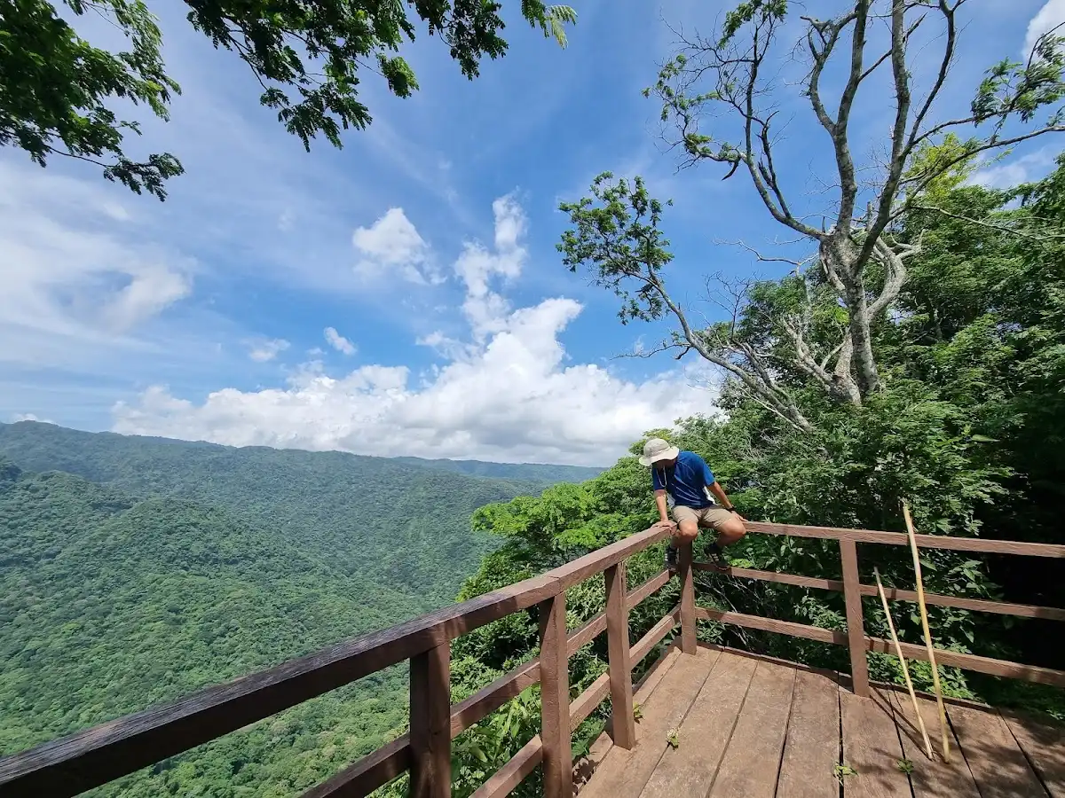
rock formations, cliffside lookout, pine woods

Climb to a dramatic stone arch perched above valleys, with breezy pine forests and sheer drops framing the route.

el-salvador-hike-devils-door
© Google |

7 Cinquera Forest Trail

regenerating jungle, war history sites, natural pools

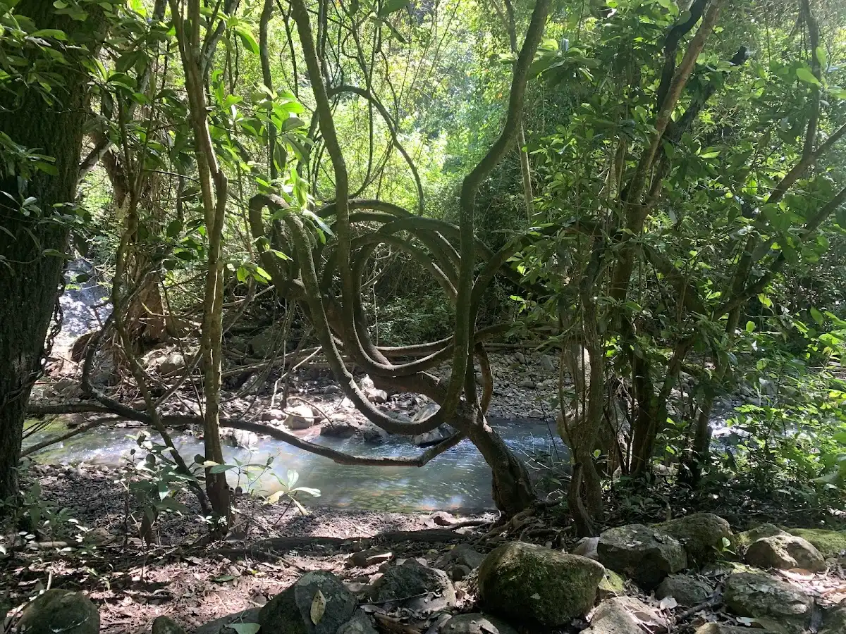
Walk through dense secondary forest, passing remnants of guerrilla camps and cooling off in secluded streams surrounded by thick canopy.

el-salvador-hike-cinquera-forest-trail
© Google |

8 Los Chorros de la Calera

waterfall cascades, travertine pools, riverside boulders

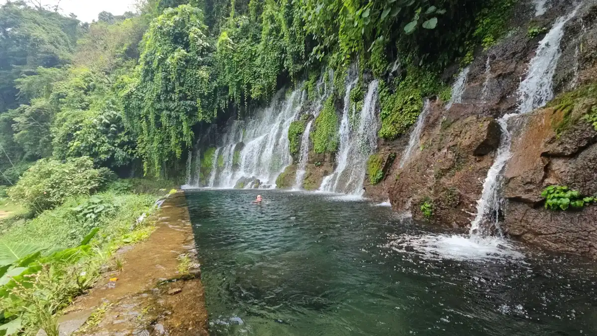
Follow a short path to a series of clear waterfalls, where you can swim in turquoise pools surrounded by mossy rock walls.

el-salvador-hike-los-chorros-de-la-calera
© Google | Benjalyn Yambo
Loading the map 🌍

Expert viewPro Tips for Exploring the Best

How many hikes to do: I advise three to five hikes over a week or so. That number matches the geography: the main trailheads are close, but each one demands a dawn start, followed by an afternoon of sweat, mud and recovery. Fewer than three and you miss the contrast between volcano, cloud forest and the northern highlands. More than five and the rim views start to blur while your legs and schedule fray.

How to prioritize by travel style: First-timers and short-stay travelers do best with volcano hikes in the west: good paths, rangers, and a payoff of crater lakes and steaming vents. Independent travelers wanting solitude should add one northern highland or cloud forest walk, where pine resin and woodsmoke drift through village lanes and a local guide knows where the trail actually goes. History-minded … read more 👉
How many hikes to do: I advise three to five hikes over a week or so. That number matches the geography: the main trailheads are close, but each one demands a dawn start, followed by an afternoon of sweat, mud and recovery. Fewer than three and you miss the contrast between volcano, cloud forest and the northern highlands. More than five and the rim views start to blur while your legs and schedule fray.

How to prioritize by travel style: First-timers and short-stay travelers do best with volcano hikes in the west: good paths, rangers, and a payoff of crater lakes and steaming vents. Independent travelers wanting solitude should add one northern highland or cloud forest walk, where pine resin and woodsmoke drift through village lanes and a local guide knows where the trail actually goes. History-minded hikers get the most from the east, where guides explain the war landscape, and the view is quiet ridgelines rather than crowds.

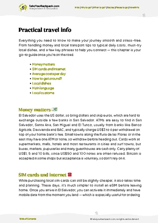
What it costs: Expect US$25 to 45 a day including a dorm or basic room (US$10 to 20), pupusas and set lunches (US$2 to 6 a meal), and local transport. Entry fees for protected areas and volcanoes generally run US$1 to 6. A local guide costs roughly US$10 to 30 per hike, often shared among the group. Private shuttles to remote trailheads can run US$20 to 60 per vehicle, so split with other travelers. Chicken buses cost US$0.25 to 2 per leg and get you close to most starts.

Safety and cultural notes: On several popular volcanoes, tourist police escorts walk with groups, and it is wise to follow their schedule and instructions. Hike with a guide on unmarked trails, and do not wander off the path. Start early to avoid afternoon lightning and heat. Carry at least 2 to 3 liters of water, a rain shell, and sun protection, since exposed rims have little shade.

Salvadorans are warm and curious, and a polite buenos días to anyone you pass on a trail opens conversation and often a cup of coffee at a farm gate. Ask before photographing people, and pay for homestays and guides directly to the community. Keep valuables out of sight on buses and leave flashy gear at the hostel. The reward is a country that feels welcoming, with small-town markets, smoky roadside grills and an evening of cold beer after a hard descent.

✈️ The backpacker research shortcutEl Salvador Travel Guide

An offline-friendly backpacking guide with optimized travel routes, ranked highlights, transport advice, and the best areas to stay.
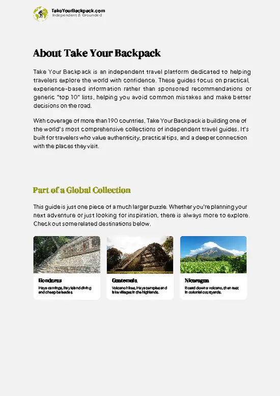
example page 0 from our offline Travel Guide for El Salvador
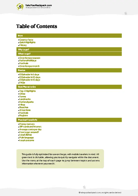
example page 1 from our offline Travel Guide for El Salvador
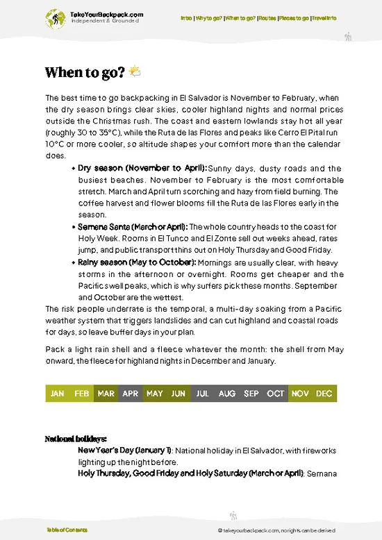
example page 2 from our offline Travel Guide for El Salvador
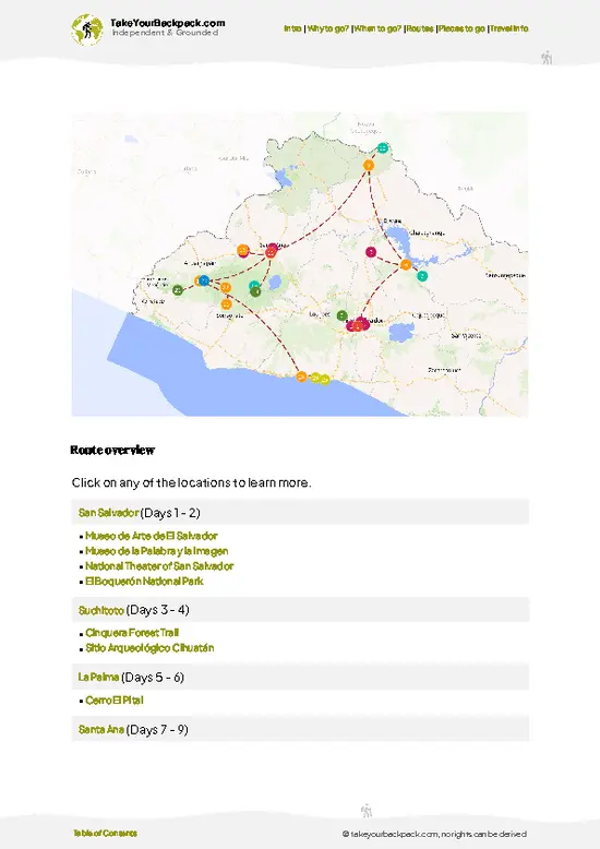
example page 3 from our offline Travel Guide for El Salvador
example page 4 from our offline Travel Guide for El Salvador
example page 5 from our offline Travel Guide for El Salvador
example page 6 from our offline Travel Guide for El Salvador
example page 7 from our offline Travel Guide for El Salvador
The digital guide (294 pages) contains:
✅ 77 highlights, ranked by travel appeal
✅ Optimized 5, 10 & 15-day travel routes
✅ Cities, national parks, landmarks, beaches
✅ How to get around
✅ Offline-friendly for travel without Wi-Fi
👉 Click to see all 30+ guide features

📅 Plan smarter in minutes, not weeks
✅ Month by month travel advice
✅ Festivals & national holidays
✅ Budget expectations

🗺️ Go to the right places, skip the overrated ones
✅ Honest pros & cons of destinations
✅ Top hikes, parks & viewpoints
✅ Lesser-known places most travelers miss
✅ Clear “worth it vs skip it” guidance

🛏️ Travel smoothly without rookie mistakes
✅ Best areas to stay
✅ Transport systems explained simply
✅ Common scams & safety advice
✅ SIM cards, money & practical tips

🌍 Understand the country, not just visit it
✅ Culture & traditions
✅ 52 Essential phrases & customs
✅ Festivals worth planning around
✅ Traveler-friendly historical context
✅ Insights that make places more meaningful

📱 Built for real travel conditions
✅ Fully downloadable PDF
✅ Works completely offline
✅ Optimized for phone use
✅ Useful in remote areas & buses
✅ Everything in one place
Save weeks of stressful planning
Get instant access to your full guide. 30‑day money-back guarantee.
+ Add another guide for just

By proceeding you agree to our terms.
Sent to your inbox immediately after payment • 100% Secure Checkout
Best Backpacking Travel Advisor 2025 tourism awardBest Backpacking
Travel Advisor
2025
What others say about Take Your Backpack Guides:
⭐⭐⭐⭐⭐
Fantastic, amazing amount of information!
⭐⭐⭐⭐⭐
My goodness this is amazing, it's what I've been looking for hats off too you!
⭐⭐⭐⭐⭐
I think this is absolutely BRILLIANT
⭐⭐⭐⭐
Very complete and informative. It's still missing places, but I gotta to commend you
⭐⭐⭐⭐⭐
This is truly amazing, thank you, can't wait to explore it with my kids!
⭐⭐⭐⭐⭐
Awesome resource, thank you!
⭐⭐⭐⭐⭐
This is amazing! Can't wait to explore the ones I haven't seen
⭐⭐⭐⭐
I love this! Well done, great idea.
⭐⭐⭐⭐⭐
Thanks for taking the time to make this gem!
⭐⭐⭐⭐⭐
This might be the best website I've ever seen.
⭐⭐⭐⭐⭐
Congratulations, and thank you so much for your work; it's incredibly valuable.
⭐⭐⭐⭐
In all seriousness I think you did a great job pointing out the important spots
⭐⭐⭐⭐⭐
10/10 very good
⭐⭐⭐⭐⭐
As someone who's only just starting to visit regularly this is awesome, thank you.
⭐⭐⭐⭐
Thank you very much! I'm going to visit my dad, it's going to be very useful!
⭐⭐⭐⭐⭐
This is really cool! We'll be travelling for the first time and this definitely come in handy.
⭐⭐⭐⭐⭐
You are now our minister of culture, congratulations 👨‍💼
⭐⭐⭐⭐⭐
Just wanted to tell you that this is a pearl! Going to follow your recommendations.
⭐⭐⭐⭐⭐
This is so cool. I'll definitely be using the resource for my travels soon.
⭐⭐⭐⭐⭐
This is very impressive! Good work.
⭐⭐⭐⭐⭐
This is an amazing and informative site. Very well done!

🛏️ Where to stay?Top Places to Consider Staying

El Salvador has a solid spread of hostels and budget guesthouses, with dorm beds typically US$10 to 18 and private rooms US$25 to 45. Surf towns El Tunco and El Zonte hold the most options, with El Tunco offering beach bars and late nights while El Zonte is calmer and better for longer surf stays. In San Salvador, the Colonia Escalón, San Benito and Flor Blanca areas are the safest, handy for restaurants and nightlife but a ride away from the historic center, while Santa Ana’s center and Juayúa on the Ruta de las Flores are quiet, cheap bases close to volcanoes and coffee farms.

If you enjoy meeting fellow travelers, consider choosing hostels with high ratings for atmosphere. On the other hand, … read more 👉
El Salvador has a solid spread of hostels and budget guesthouses, with dorm beds typically US$10 to 18 and private rooms US$25 to 45. Surf towns El Tunco and El Zonte hold the most options, with El Tunco offering beach bars and late nights while El Zonte is calmer and better for longer surf stays. In San Salvador, the Colonia Escalón, San Benito and Flor Blanca areas are the safest, handy for restaurants and nightlife but a ride away from the historic center, while Santa Ana’s center and Juayúa on the Ruta de las Flores are quiet, cheap bases close to volcanoes and coffee farms.

If you enjoy meeting fellow travelers, consider choosing hostels with high ratings for atmosphere. On the other hand, if you prefer having your own space, a hotel might be a better option.

El SalvadorMore Places Across El Salvador

👋 Meet the founderWho’s Behind Take Your Backpack?

Johan, backpacker and founder of TakeYourBackpackHi, I’m Johan (Netherlands 🇳🇱), the creator of TakeYourBackpack. Over the past 3 decades, I’ve backpacked through 90+ countries across six continents, gaining extensive experience with independent travel, long-term trips, and overland routes.

This site is built on a combination of firsthand travel experience and carefully curated insights from other backpackers. Many guides are based on places I’ve personally visited, while others bring together tips, observations, and practical advice shared by trusted travelers I’ve met along the way.

The goal is to provide realistic, experience-driven guidance — not generic itineraries — so you can explore destinations with better context, clearer expectations, and more confidence.