×

Eritrea🇪🇷 | hikesSenafe to Metera TrailAmba mountains, Aksumite stelae, sandstone pinnacles, steep gullies | things to do and best time to go

Explore Asmara to Massawa TrekExplore Dahlak Marine National Park

Backpacking in Senafe to Metera Trail
👌 Worth visitinghike ranked #4
By Johan Kruseman 🇳🇱 | Updated October 22, 2026

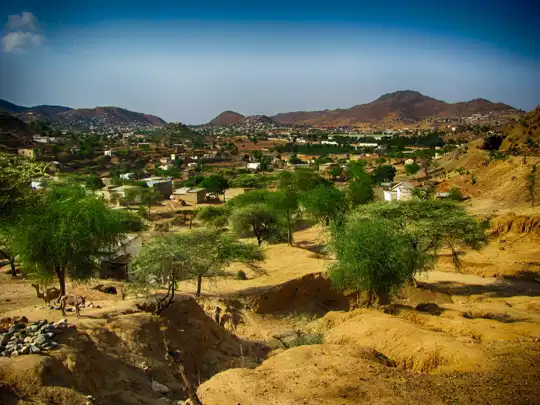
Loose scree shifts under your boots, a goat bell clanks somewhere below, and the air smells of dust and woodsmoke from a hamlet you cannot yet see. The Senafe to Metera Trail runs through the southeastern highlands in the south of Eritrea, linking the market town of Senafe with the ruins of Metera on the old Aksumite trade routes. The scenery is the draw: flat-topped amba mountains, terraced barley fields and deep gullies, with the sandstone pinnacles near Senafe dominating the skyline. The distance is modest and the climbs are short but steep, so fitness matters more than skill. The weak points are plain. Signage is nonexistent, permits and travel authorization from Asmara are required, and public buses reach Senafe but not the trailhead itself. A first day could mean a morning bus to Senafe, a walk through the market, and an easy afternoon loop to get your legs used to the altitude.

Discover everything you want to know in the 📖 Eritrea Travel Guide.
Best time to go: October - April
Duration: 5 hours
Distance: 14 kilometers
Total ascent: 500 meters


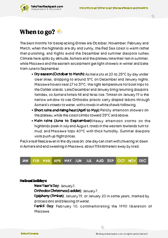
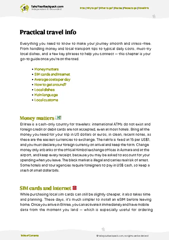
example page 0 from our offline Travel Guide for Eritrea
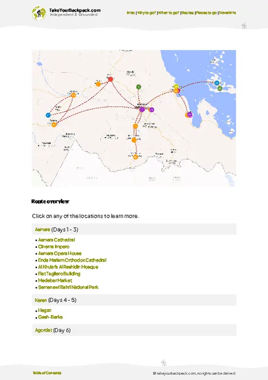
example page 1 from our offline Travel Guide for Eritrea
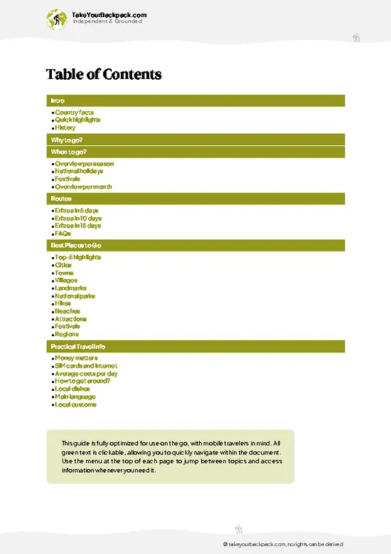
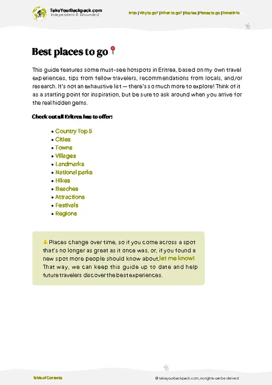
example page 2 from our offline Travel Guide for Eritrea
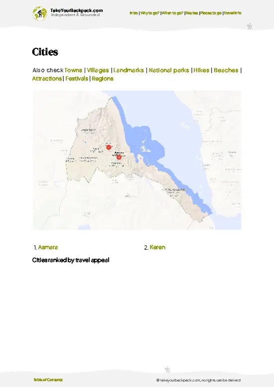
example page 3 from our offline Travel Guide for Eritrea
example page 4 from our offline Travel Guide for Eritrea
example page 5 from our offline Travel Guide for Eritrea
example page 6 from our offline Travel Guide for Eritrea
example page 7 from our offline Travel Guide for Eritrea
Loading the map 🌍
CLICK TO FILTER
cities
towns
villages
landmarks
national parks
hikes
beaches
attractions
festivals
regions
SHOW COUNTRY’S BESTSHOW ALL

✨ Why go?
Ranked #4 hike in Eritrea
Why Senafe to Metera Trail should be on your travel list

Senafe to Metera Trail appeals to backpackers because it joins two places that most Eritrea itineraries treat as separate stops. You start in a working highland town and finish at Metera, where a field of carved stones and a stelae site sit in open farmland with almost nobody around. The reason to go is the walking itself: you pass farmers plowing with oxen, stone-built villages and the Senafe highland escarpment, all at a pace that lets you talk to people along the way. Distance is flexible, because you can break the route at villages and sleep on the floor of a family house if you arrange it. It also fits neatly into a longer loop from Asmara through Adi Keih and Qohaito toward the Ethiopian border region. Expect Tigrinya greetings to do more than any phrasebook, and expect to be offered coffee more than once.

💡 HighlightsMust-see experiences and standout moments

  1. Metera Ruins: The best-known sight at the end of the walk. Carved stelae and a scatter of stone foundations from the Aksumite era lie in open farmland, and you can usually wander them alone.
  2. Senafe Sandstone Pinnacles: Rock towers rise above town and catch the afternoon sun. They make a good short scramble before the main walk.
  3. Terraced Highland Farms: Stone-walled fields of barley and teff climb the slopes. Farmers working with oxen are a common sight, and the patchwork looks best from the ridge tops.
  4. Amba Escarpment Viewpoints: The flat-topped mountains drop away into valleys that stretch toward the lowlands. Early morning gives the clearest air.
  5. Senafe Market Town: The trailhead town is a short stop for supplies, tea and conversation. Market day brings people down from the surrounding villages
… read more 👉
  1. Metera Ruins: The best-known sight at the end of the walk. Carved stelae and a scatter of stone foundations from the Aksumite era lie in open farmland, and you can usually wander them alone.
  2. Senafe Sandstone Pinnacles: Rock towers rise above town and catch the afternoon sun. They make a good short scramble before the main walk.
  3. Terraced Highland Farms: Stone-walled fields of barley and teff climb the slopes. Farmers working with oxen are a common sight, and the patchwork looks best from the ridge tops.
  4. Amba Escarpment Viewpoints: The flat-topped mountains drop away into valleys that stretch toward the lowlands. Early morning gives the clearest air.
  5. Senafe Market Town: The trailhead town is a short stop for supplies, tea and conversation. Market day brings people down from the surrounding villages with livestock and grain.
Senafe to Metera Trail pairs the Senafe Sandstone Pinnacles in the early morning with the Metera Ruins in the afternoon, since both sit close enough to fit one day.
Spotted a mistake or missing something? Contact us.

Things to do near Senafe to Metera Trail

Ratings based on Tripadvisor reviews. When you book through this link, you support our work at no extra cost to you.

🌤️ When to go?Best time to hike the Senafe to Metera Trail

  • Main Dry Season (October to February): This is the window for walking the Senafe to Metera Trail, with crisp, dry days and almost no rain. Highs on the plateau (around 2,400 m) run 20 to 26°C (68 to 79°F), and nights drop to 6 to 12°C (43 to 54°F). Daylight lasts about 11.5 to 12.5 hours, so start early.
  • Hot Pre-Rains Season (March to May): Days warm to 26 to 31°C (79 to 88°F) and haze builds. Walk before 10 a.m. and rest through midday heat.
  • Main Rains (June to September): Afternoon storms soak the escarpment paths, making slopes slick and stream beds run brown. Highs sit near 20 to 25°C (68 to 77°F). The fields turn green, which is lovely, but footing suffers.
  • Crowds and Prices: Eritrea sees few trekkers in any month, so there is no real high-season surge. Transport and guide rates (roughly
… read more 👉
  • Main Dry Season (October to February): This is the window for walking the Senafe to Metera Trail, with crisp, dry days and almost no rain. Highs on the plateau (around 2,400 m) run 20 to 26°C (68 to 79°F), and nights drop to 6 to 12°C (43 to 54°F). Daylight lasts about 11.5 to 12.5 hours, so start early.
  • Hot Pre-Rains Season (March to May): Days warm to 26 to 31°C (79 to 88°F) and haze builds. Walk before 10 a.m. and rest through midday heat.
  • Main Rains (June to September): Afternoon storms soak the escarpment paths, making slopes slick and stream beds run brown. Highs sit near 20 to 25°C (68 to 77°F). The fields turn green, which is lovely, but footing suffers.
  • Crowds and Prices: Eritrea sees few trekkers in any month, so there is no real high-season surge. Transport and guide rates (roughly US$30 to 60 a day) stay steady.
  • Festivals: Orthodox Epiphany in January and Meskel in late September bring colorful gatherings in nearby villages.
Plan for January and you get the coolest, driest walking, plus the Epiphany celebrations.


source: climatestotravel.comJANJanuary: excellent for travelingFEBFebruary: excellent for travelingMARMarch: highly recommended for travelingAPRApril: good for travelingMAYMay: fair for travelingJUNJune: below average for travelingJULJuly: below average for travelingAUGAugust: below average for travelingSEPSeptember: fair for travelingOCTOctober: highly recommended for travelingNOVNovember: excellent for travelingDECDecember: excellent for traveling
when-to-go

✈️ The backpacker research shortcutEritrea Travel Guide

An offline-friendly backpacking guide with optimized travel routes, ranked highlights, transport advice, and the best areas to stay.
example page 0 from our offline Travel Guide for Eritrea
example page 1 from our offline Travel Guide for Eritrea
example page 2 from our offline Travel Guide for Eritrea
example page 3 from our offline Travel Guide for Eritrea
example page 4 from our offline Travel Guide for Eritrea
example page 5 from our offline Travel Guide for Eritrea
example page 6 from our offline Travel Guide for Eritrea
example page 7 from our offline Travel Guide for Eritrea
The digital guide (245 pages) contains:
✅ 56 highlights, ranked by travel appeal
✅ Optimized 5, 10 & 15-day travel routes
✅ Cities, national parks, landmarks, beaches
✅ How to get around
✅ Offline-friendly for travel without Wi-Fi
👉 Click to see all 30+ guide features

📅 Plan smarter in minutes, not weeks
✅ Month by month travel advice
✅ Festivals & national holidays
✅ Budget expectations

🗺️ Go to the right places, skip the overrated ones
✅ Honest pros & cons of destinations
✅ Top hikes, parks & viewpoints
✅ Lesser-known places most travelers miss
✅ Clear “worth it vs skip it” guidance

🛏️ Travel smoothly without rookie mistakes
✅ Best areas to stay
✅ Transport systems explained simply
✅ Common scams & safety advice
✅ SIM cards, money & practical tips

🌍 Understand the country, not just visit it
✅ Culture & traditions
✅ 52 Essential phrases & customs
✅ Festivals worth planning around
✅ Traveler-friendly historical context
✅ Insights that make places more meaningful

📱 Built for real travel conditions
✅ Fully downloadable PDF
✅ Works completely offline
✅ Optimized for phone use
✅ Useful in remote areas & buses
✅ Everything in one place
Stop searching, start planning
Get instant access to your full guide. 30‑day money-back guarantee.
+ Add another guide for just

By proceeding you agree to our terms.
Sent to your inbox immediately after payment • 100% Secure Checkout
Best Backpacking Travel Advisor 2025 tourism awardBest Backpacking
Travel Advisor
2025
What others say about Take Your Backpack Guides:
⭐⭐⭐⭐⭐
Fantastic, amazing amount of information!
⭐⭐⭐⭐⭐
My goodness this is amazing, it's what I've been looking for hats off too you!
⭐⭐⭐⭐⭐
I think this is absolutely BRILLIANT
⭐⭐⭐⭐
Very complete and informative. It's still missing places, but I gotta to commend you
⭐⭐⭐⭐⭐
This is truly amazing, thank you, can't wait to explore it with my kids!
⭐⭐⭐⭐⭐
Awesome resource, thank you!
⭐⭐⭐⭐⭐
This is amazing! Can't wait to explore the ones I haven't seen
⭐⭐⭐⭐
I love this! Well done, great idea.
⭐⭐⭐⭐⭐
Thanks for taking the time to make this gem!
⭐⭐⭐⭐⭐
This might be the best website I've ever seen.
⭐⭐⭐⭐⭐
Congratulations, and thank you so much for your work; it's incredibly valuable.
⭐⭐⭐⭐
In all seriousness I think you did a great job pointing out the important spots
⭐⭐⭐⭐⭐
10/10 very good
⭐⭐⭐⭐⭐
As someone who's only just starting to visit regularly this is awesome, thank you.
⭐⭐⭐⭐
Thank you very much! I'm going to visit my dad, it's going to be very useful!
⭐⭐⭐⭐⭐
This is really cool! We'll be travelling for the first time and this definitely come in handy.
⭐⭐⭐⭐⭐
You are now our minister of culture, congratulations 👨‍💼
⭐⭐⭐⭐⭐
Just wanted to tell you that this is a pearl! Going to follow your recommendations.
⭐⭐⭐⭐⭐
This is so cool. I'll definitely be using the resource for my travels soon.
⭐⭐⭐⭐⭐
This is very impressive! Good work.
⭐⭐⭐⭐⭐
This is an amazing and informative site. Very well done!

🛏️ Where to stay?Where staying makes the most sense

If you enjoy meeting fellow travelers, consider choosing hostels with high ratings for atmosphere. On the other hand, if you prefer having your own space, a hotel might be a better option.

🥾 Hike detailsKey facts about the Senafe to Metera Trail hike

Total Distance: Senafe to Metera Trail covers roughly 12 to 15 kilometers one way, depending on the route chosen through the villages.
Duration: Four to six hours of walking, or an easy full day with stops.
Difficulty: Moderate. Altitude sits around 2,400 meters, and short steep sections follow dry stream beds.
Starting Point: Senafe, reached by bus from Asmara or Adi Keih. The trailhead is on foot from town, so no further transport is needed.
Major Landmarks:
  • Senafe Pinnacles: Sandstone towers above the start.
  • Highland Villages: Stone houses and farmland along the path.
  • Metera: Ruins and stelae at the
… read more 👉
Total Distance: Senafe to Metera Trail covers roughly 12 to 15 kilometers one way, depending on the route chosen through the villages.
Duration: Four to six hours of walking, or an easy full day with stops.
Difficulty: Moderate. Altitude sits around 2,400 meters, and short steep sections follow dry stream beds.
Starting Point: Senafe, reached by bus from Asmara or Adi Keih. The trailhead is on foot from town, so no further transport is needed.
Major Landmarks:
  • Senafe Pinnacles: Sandstone towers above the start.
  • Highland Villages: Stone houses and farmland along the path.
  • Metera: Ruins and stelae at the end.
Terrain and Scenery: Rocky paths, dry gullies and terraced slopes under wide skies, with flat-topped mountains on the horizon.
Vegetation: Euphorbia, acacia, prickly pear and cultivated fields of barley and teff.
Wildlife: Baboons on rock faces, raptors overhead, and plenty of goats, cattle and donkeys on the path.
Practical Notes: Carry water and food, since shops are rare outside Senafe. A local guide helps with the unmarked route, and travel permits from Asmara must be arranged beforehand.
⚠️ Hiking info can sometimes be outdated or inaccurate. Before you hit the trail, check the latest conditions with locals. If you do spot anything that's off, I'd love to hear from you, so I can update it for fellow travelers.

🛡️ SafetyTraveler Safety Guide

The Senafe to Metera Trail is a manageable walk, and the main hazards are sun, altitude and loose footing rather than anything dramatic. At roughly 2,400 m, newcomers often feel breathless on climbs, so keep a slow, steady pace and drink two to three liters a day, since refills between villages are unreliable. Rocky descents toward the Metera ruins turn slippery after rain, so sturdy boots with grip help, and trekking poles save knees. Paths cross farmland and are not always signed, which is why a local guide is wise. Carry your own food and a sun hat, as shade is scarce. Baboons and hyenas live in the area but rarely bother walkers in daylight. Do not photograph military sites or personnel, and carry your travel permit and passport. Finish well before dusk, when temperatures fall quickly.

FAQTraveler FAQ

The Senafe to Metera Trail takes about 4 to 6 hours one way on foot, covering roughly 12 to 15 km between Senafe and the Metera archaeological site. Most walkers go at a relaxed pace with stops at villages and viewpoints. Allow a full day if you plan to explore the Metera ruins and return by vehicle.
The Senafe to Metera Trail is moderate, mostly gentle with a few rocky descents and climbs on a plateau around 2,400 m. No technical skills are needed, but altitude, sun and uneven footing tire first-timers. Expect mild ups and downs of a few hundred meters and carry at least 2 to 3 liters of water.
Yes, you need a travel permit and are best off with a guide for the Senafe to Metera Trail. Foreigners must obtain a travel permit in Asmara from the Ministry of Tourism before leaving the capital, usually costing a few US dollars and needing a day or so. Local guides in Senafe cost around US$30 to 60 a day and help with navigation and checkpoints.
⚠️ Things can change over time, so always validate details locally before you go.

Other Eritrean hikes near Senafe to Metera Trail

Explore more nearby:

  • Mount Soira—highest summit, alpine flora, panoramic ridges, remote ascent| 12 km away
  • Haddas Valley Trail—acacia woodland, seasonal riverbeds, rural hamlets, basalt outcrops| 48 km away
  • Asmara to Massawa Trek—highland escarpment, colonial rail bridges, dramatic descent, coastal plain| 90 km away

💡 Not sure where to go next?
Create a personalized itinerary for Eritrea including Senafe to Metera Trail and the places that fit your trip.

Generate my itinerary

👉 Discover all hikes

Or checkout all Eritrea has to offer (think cities, towns, villages, national parks, hikes, beaches, festivals)
Country photo of Eritrea

We 💚 feedbackKey takeaways before you go

Senafe to Metera Trail suits curious walkers who like ruins without crowds and do not need waymarks or cafés. I would bring more water than seems sensible, hire a local guide in Senafe, and start early, because the afternoon sun on open ground is strong.

✍️ Help improve this page!
The information on this page is based on in-depth research, insights shared by experienced travelers, and feedback from the local travel community in Eritrea. While every effort is made to keep the information accurate and current, conditions can change — so if you spot anything incorrect or outdated, please get in touch.


🙋‍♂️ Give feedback

👋 Meet the founderWho’s Behind Take Your Backpack?

Johan, backpacker and founder of TakeYourBackpackHi, I’m Johan (Netherlands 🇳🇱), the creator of TakeYourBackpack. Over the past 3 decades, I’ve backpacked through 90+ countries across six continents, gaining extensive experience with independent travel, long-term trips, and overland routes.

This site is built on a combination of firsthand travel experience and carefully curated insights from other backpackers. Many guides are based on places I’ve personally visited, while others bring together tips, observations, and practical advice shared by trusted travelers I’ve met along the way.

The goal is to provide realistic, experience-driven guidance — not generic itineraries — so you can explore destinations with better context, clearer expectations, and more confidence.