×

France🇫🇷 | hikesVercors CrossingKarst plateaus, alpine meadows, WWII history | things to do and best time to go

Explore Chemin de Saint-Jacques (Le Puy Route)Explore Massif des Bauges Traverse

Backpacking in Vercors Crossing
👌 Worth visitinghike ranked #9
By Johan Kruseman 🇳🇱 | Updated September 4, 2026

Most summaries sell the Vercors Crossing as a mellow plateau stroll; in reality, long waterless stretches and sudden limestone cliffs turn it into a serious commitment. The route cuts across the Vercors Massif in southeastern France, between Grenoble and Valence, a high karst fortress above the Rhône valley. You get big, empty ridges, hanging forests, and those abrupt balcony views over the Alps that feel earned, not handed out. It’s long, often 5–8 days, with steady ups and downs that punish lazy training. Access by train and bus from Grenoble is decent, but not plug-and-play like the Tour du Mont Blanc. Compared to the GR54 or Mercantour, it’s wilder, less polished, and far quieter—great if you like solitude, rough if you need comfort.

Discover everything you want to know in the 📖 France Travel Guide.
Best time to go: May - September
Duration: 5 days
Distance: 120 kilometers
Total ascent: 4,000 meters


Get your France guide
142 ranked highlights, routes & tips, works offline (461 pages)
Loading the map 🌍
CLICK TO FILTER
cities
towns
villages
landmarks
national parks
hikes
beaches
attractions
festivals
regions
SHOW COUNTRY’S BESTSHOW ALL

✨ Why go?
Ranked #9 hike in France
Why Vercors Crossing should be on your travel list

The Vercors Crossing in France is a magnet for backpackers, and for good reason. You’ll find a scenery-to-effort ratio that’s hard to beat. Imagine rugged cliffs, lush valleys, and panoramic views that stretch for miles—all without needing to be a seasoned mountaineer. The trails are accessible via public transport, making it easy to hop on a bus or train and dive into nature without breaking the bank.

Costs are low, too. You can camp or stay in cozy gîtes, keeping your budget intact while soaking in the stunning landscapes. The flexible distances allow you to tailor your trek, whether you want a leisurely stroll or a grueling day hike.

This hike fits seamlessly into a longer backpacking route, connecting you to other trails and experiences in the region. Each step is a challenge, but … read more 👉
The Vercors Crossing in France is a magnet for backpackers, and for good reason. You’ll find a scenery-to-effort ratio that’s hard to beat. Imagine rugged cliffs, lush valleys, and panoramic views that stretch for miles—all without needing to be a seasoned mountaineer. The trails are accessible via public transport, making it easy to hop on a bus or train and dive into nature without breaking the bank.

Costs are low, too. You can camp or stay in cozy gîtes, keeping your budget intact while soaking in the stunning landscapes. The flexible distances allow you to tailor your trek, whether you want a leisurely stroll or a grueling day hike.

This hike fits seamlessly into a longer backpacking route, connecting you to other trails and experiences in the region. Each step is a challenge, but the reward—that first cold beer at a village café or the moment you crest a ridge and take in the view—is what makes it all worthwhile.
Want to include Vercors Crossing in your France route?
Create a personalized France itinerary that includes Vercors Crossing and the places that fit your trip — based on your travel style, budget, and available time. Get your route in seconds.

Generate my trip

💡 HighlightsEssential experiences to have while hiking the Vercors Crossing

  1. Grand Veymont summit — The highest point of the Vercors (2,341 m) delivers an expansive, alpine panorama you won’t get on lowland hikes: jagged ridges, Mont Aiguille across the valley and seas of wildflower carpets in summer. It’s the payoff after long ridge walking—great for sunrise, and a real sense of being on a proper mountain rather than a forested trail.
  2. Combe Laval viewpoint — That suspended road carved into sheer cliffs is cinematic: narrow switchbacks, vertiginous drop-offs and postcard-perfect views into the Bourne gorge. It’s more than photo-op scenery — the engineering and scale of the cliffs make this stretch feel unique compared with ordinary forest tracks.
  3. Choranche caves — A sudden underground world of delicate “pipe” stalactites, an underground river and dim-lit chambers
read more 👉
  1. Grand Veymont summit — The highest point of the Vercors (2,341 m) delivers an expansive, alpine panorama you won’t get on lowland hikes: jagged ridges, Mont Aiguille across the valley and seas of wildflower carpets in summer. It’s the payoff after long ridge walking—great for sunrise, and a real sense of being on a proper mountain rather than a forested trail.
  2. Combe Laval viewpoint — That suspended road carved into sheer cliffs is cinematic: narrow switchbacks, vertiginous drop-offs and postcard-perfect views into the Bourne gorge. It’s more than photo-op scenery — the engineering and scale of the cliffs make this stretch feel unique compared with ordinary forest tracks.
  3. Choranche caves — A sudden underground world of delicate “pipe” stalactites, an underground river and dim-lit chambers that contrast the open plateaus above. Visiting the caves adds a geology-and-biolgy chapter to the crossing: rare cave formations and bat/bryophyte life you won’t stumble across on most long-distance hikes.
  4. Vassieux-en-Vercors (Resistance memorial) — The Vercors was a major maquis stronghold in WWII and Vassieux is where history hits you: memorials, a small museum and rebuilt village streets. It’s a sobering cultural stop that gives the landscape real human context — not just pretty views but stories of resistance and sacrifice.
  5. High plateaus, pastures and wildlife encounters — The wide karst plateaus and alpages are Vercors’ signature: open, wind-exposed meadows with shepherd huts, marmots whistling on the rocks and chamois on the cliffs. The combination of limestone pavements, seasonal grazing and large vertical walls makes the ecology and light very different from wooded trails elsewhere.
Spotted a mistake or missing something? Contact us.

Things to do near Vercors Crossing

Ratings based on Tripadvisor reviews. When you book through this link, you support our work at no extra cost to you.

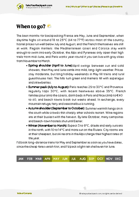
🌤️ When to go?When to go for the best experience


  • Weather: Late June through early September delivers the most stable weather. Expect dry trails and clear skies, but be ready for sudden mountain shifts—afternoon thunderstorms can roll in fast.

  • Temperature: Daytime highs hover between 20-25°C (68-77°F), perfect for hiking without overheating. Nights dip to 10-15°C (50-59°F), so pack layers for crisp mountain air.

  • Daylight Hours: Summer grants long days—up to 16 hours of light—letting you push farther without rushing. Early starts and late finishes become your allies.

  • Crowds: July and August bring the busiest trails. If you crave solitude, aim for late June or early September when hikers thin out but conditions remain solid.

  • Seasonal Activities: Summer opens mountain huts and local markets, adding culture and comfort to your trek.
read more 👉

  • Weather: Late June through early September delivers the most stable weather. Expect dry trails and clear skies, but be ready for sudden mountain shifts—afternoon thunderstorms can roll in fast.

  • Temperature: Daytime highs hover between 20-25°C (68-77°F), perfect for hiking without overheating. Nights dip to 10-15°C (50-59°F), so pack layers for crisp mountain air.

  • Daylight Hours: Summer grants long days—up to 16 hours of light—letting you push farther without rushing. Early starts and late finishes become your allies.

  • Crowds: July and August bring the busiest trails. If you crave solitude, aim for late June or early September when hikers thin out but conditions remain solid.

  • Seasonal Activities: Summer opens mountain huts and local markets, adding culture and comfort to your trek. Outside this window, many services close, upping the challenge.

  • Price Fluctuations: Peak summer sees higher prices on accommodations and transport. Booking early or choosing shoulder months can save you a chunk without sacrificing experience.


Pro-tip: Hit the trail in early September—fewer crowds, stable weather, and that sweet spot of warm days and cool nights make every step feel earned and every evening a reward.


source: climatestotravel.comJANJanuary: below average for travelingFEBFebruary: below average for travelingMARMarch: fair for travelingAPRApril: fair for travelingMAYMay: good for travelingJUNJune: highly recommended for travelingJULJuly: excellent for travelingAUGAugust: excellent for travelingSEPSeptember: highly recommended for travelingOCTOctober: fair for travelingNOVNovember: below average for travelingDECDecember: below average for traveling
france-hike-vercors-crossing
© Google |

✈️ The backpacker research shortcutFrance Travel Guide

An offline-friendly backpacking guide with optimized travel routes, ranked highlights, transport advice, and the best areas to stay.
example page 0 from our offline Travel Guide for France
example page 1 from our offline Travel Guide for France
example page 2 from our offline Travel Guide for France
example page 3 from our offline Travel Guide for France
example page 4 from our offline Travel Guide for France
example page 5 from our offline Travel Guide for France
example page 6 from our offline Travel Guide for France
example page 7 from our offline Travel Guide for France
The digital guide (461 pages) contains:
142 highlights, ranked by travel appeal
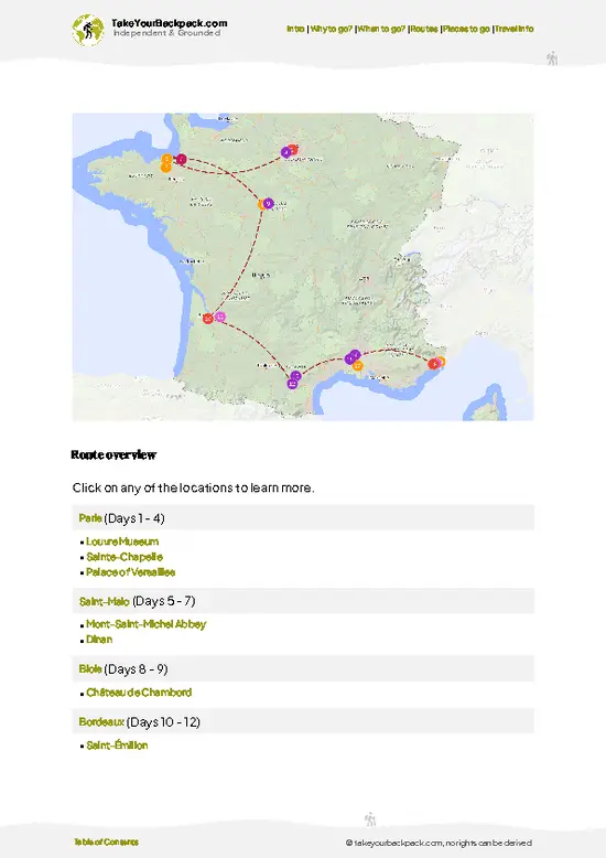
Optimized 7, 14 & 21-day travel routes
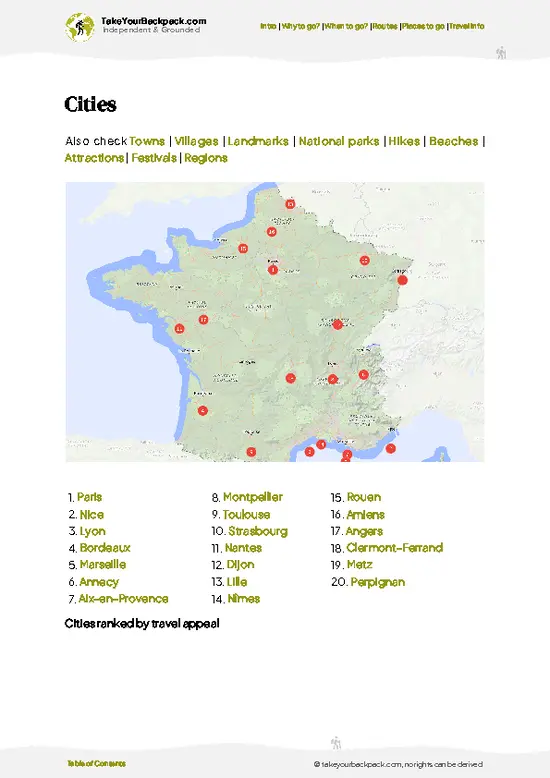
Cities, national parks, landmarks, beaches
How to get around
Offline-friendly for travel without Wi-Fi
👉 Click to see all 30+ guide features

📅 Plan smarter in minutes, not weeks
Month by month travel advice
Festivals & national holidays
Budget expectations

🗺️ Go to the right places, skip the overrated ones
Honest pros & cons of destinations
Top hikes, parks & viewpoints
Lesser-known places most travelers miss
Clear “worth it vs skip it” guidance

🛏️ Travel smoothly without rookie mistakes
Best areas to stay
Transport systems explained simply
Common scams & safety advice
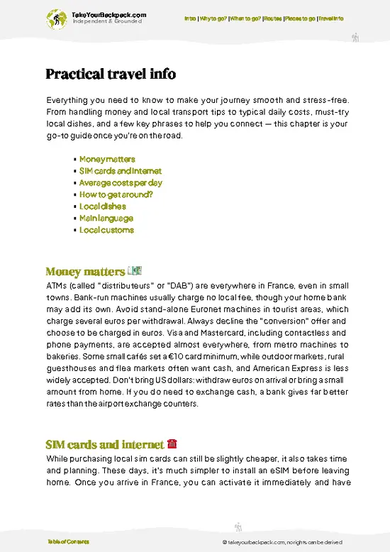
SIM cards, money & practical tips

🌍 Understand the country, not just visit it
Culture & traditions
52 Essential phrases & customs
Festivals worth planning around
Traveler-friendly historical context
Insights that make places more meaningful

📱 Built for real travel conditions
Fully downloadable PDF
Works completely offline
Optimized for phone use
Useful in remote areas & buses
Everything in one place
Save weeks of stressful planning
Get instant access to your full guide. 30‑day money-back guarantee.
+ Add another guide for just R$44.25

By proceeding you agree to our terms.
Sent to your inbox immediately after payment • 100% Secure Checkout
Best Backpacking Travel Advisor 2025 tourism awardBest Backpacking
Travel Advisor
2025
What others say about Take Your Backpack Guides:
⭐⭐⭐⭐⭐
Fantastic, amazing amount of information!
⭐⭐⭐⭐⭐
My goodness this is amazing, it's what I've been looking for hats off too you!
⭐⭐⭐⭐⭐
I think this is absolutely BRILLIANT
⭐⭐⭐⭐
Very complete and informative. It's still missing places, but I gotta to commend you
⭐⭐⭐⭐⭐
This is truly amazing, thank you, can't wait to explore it with my kids!
⭐⭐⭐⭐⭐
Awesome resource, thank you!
⭐⭐⭐⭐⭐
This is amazing! Can't wait to explore the ones I haven't seen
⭐⭐⭐⭐
I love this! Well done, great idea.
⭐⭐⭐⭐⭐
Thanks for taking the time to make this gem!
⭐⭐⭐⭐⭐
This might be the best website I've ever seen.
⭐⭐⭐⭐⭐
Congratulations, and thank you so much for your work; it's incredibly valuable.
⭐⭐⭐⭐
In all seriousness I think you did a great job pointing out the important spots
⭐⭐⭐⭐⭐
10/10 very good
⭐⭐⭐⭐⭐
As someone who's only just starting to visit regularly this is awesome, thank you.
⭐⭐⭐⭐
Thank you very much! I'm going to visit my dad, it's going to be very useful!
⭐⭐⭐⭐⭐
This is really cool! We'll be travelling for the first time and this definitely come in handy.
⭐⭐⭐⭐⭐
You are now our minister of culture, congratulations 👨‍💼
⭐⭐⭐⭐⭐
Just wanted to tell you that this is a pearl! Going to follow your recommendations.
⭐⭐⭐⭐⭐
This is so cool. I'll definitely be using the resource for my travels soon.
⭐⭐⭐⭐⭐
This is very impressive! Good work.
⭐⭐⭐⭐⭐
This is an amazing and informative site. Very well done!

🛏️ Where to stay?Choosing the right base

If you enjoy meeting fellow travelers, consider choosing hostels with high ratings for atmosphere. On the other hand, if you prefer having your own space, a hotel might be a better option.

🥾 Hike detailsRoute, distance, and difficulty explained

Total Distance: Approximately 120 kilometers (about 75 miles) spanning the Vercors Massif.

Estimated Duration: Typically takes around 6 to 8 days to complete, depending on your pace and how much time you spend soaking in the views.

Difficulty Level: Moderate to challenging. Expect some steep sections and varied terrain, but nothing too technical if you’re an experienced hiker.

Starting Point: The trail begins in the village of Villard-de-Lans.
Public Transport: You can reach Villard-de-Lans by taking a train to Grenoble and then hopping on a local bus (line 5100) that goes directly to the … read more 👉
Total Distance: Approximately 120 kilometers (about 75 miles) spanning the Vercors Massif.

Estimated Duration: Typically takes around 6 to 8 days to complete, depending on your pace and how much time you spend soaking in the views.

Difficulty Level: Moderate to challenging. Expect some steep sections and varied terrain, but nothing too technical if you’re an experienced hiker.

Starting Point: The trail begins in the village of Villard-de-Lans.
Public Transport: You can reach Villard-de-Lans by taking a train to Grenoble and then hopping on a local bus (line 5100) that goes directly to the village.

Major Landmarks:
  • Villard-de-Lans: A charming village that’s a great place to stock up on supplies before hitting the trail.
  • Les Gorges de la Bourne: Stunning limestone gorges that offer dramatic views and photo ops.
  • Col de la Bataille: A high mountain pass that provides fantastic panoramas of the surrounding peaks.
  • Plateau de la Moucherolle: A beautiful plateau known for its wildflowers and sweeping views, perfect for a picnic break.

Type of Terrain and Scenery: Expect a mix of rocky paths, grassy meadows, and forested trails. The scenery varies from rugged cliffs to lush valleys, with plenty of opportunities to catch glimpses of the dramatic Vercors landscape.

Typical Vegetation and Wildlife:
  • Vegetation: You’ll find a mix of coniferous forests, alpine meadows, and diverse wildflowers, especially in spring and early summer.
  • Wildlife: Keep an eye out for chamois, marmots, and a variety of bird species, including eagles soaring overhead.

This trail is a gem for independent hikers looking to experience the natural beauty of the French Alps without breaking the bank. Just remember to pack enough water and snacks; some stretches can feel a bit remote!
⚠️ Hiking info can sometimes be outdated or inaccurate. Before you hit the trail, check the latest conditions with locals. If you do spot anything that's off, I'd love to hear from you, so I can update it for fellow travelers.

🛡️ SafetyScams, Hazards, and Annoyances

The Vercors Crossing is a stunning adventure, but it demands respect. Weather can shift quickly; sunny mornings can turn into afternoon storms. Dress in layers and pack a reliable rain jacket. The terrain varies, with steep ascents and rocky paths that require focus. Navigation can be tricky, so a good map and compass are essential—don’t rely solely on your phone.

Wildlife encounters are rare but possible. If you spot a chamois or a deer, keep your distance and enjoy the moment quietly. The trails are generally well-maintained, but footing can be tricky near river crossings, especially after rain.

Pace yourself; the views are worth the effort. Take breaks to soak in the landscape, and remember to carry enough water. With the right preparation, you’ll find the Vercors Crossing to be a rewarding … read more 👉
The Vercors Crossing is a stunning adventure, but it demands respect. Weather can shift quickly; sunny mornings can turn into afternoon storms. Dress in layers and pack a reliable rain jacket. The terrain varies, with steep ascents and rocky paths that require focus. Navigation can be tricky, so a good map and compass are essential—don’t rely solely on your phone.

Wildlife encounters are rare but possible. If you spot a chamois or a deer, keep your distance and enjoy the moment quietly. The trails are generally well-maintained, but footing can be tricky near river crossings, especially after rain.

Pace yourself; the views are worth the effort. Take breaks to soak in the landscape, and remember to carry enough water. With the right preparation, you’ll find the Vercors Crossing to be a rewarding challenge that leaves you breathless—in more ways than one.

FAQTraveler FAQ

The Vercors Crossing hike typically takes 5 to 7 days to complete, covering around 120 kilometers. The route is usually done in late spring to early autumn, from May to October, when weather conditions are favorable.
The hike is moderately difficult, suitable for experienced backpackers with good fitness. It involves significant elevation changes, rugged terrain, and some exposed sections, with daily distances averaging 20 to 25 kilometers.
No guide or permit is required to hike the Vercors Crossing. However, carrying detailed maps and a GPS device is recommended, and hikers should be prepared for self-navigation and overnight camping in designated areas.
⚠️ Things can change over time, so always validate details locally before you go.

Other French hikes near Vercors Crossing

Explore more nearby:


💡 Not sure where to go next?
Create a personalized itinerary for France including Vercors Crossing and the places that fit your trip.

Generate my itinerary

👉 Discover all hikes

Or checkout all France has to offer (think cities, towns, villages, national parks, hikes, beaches, festivals)
Country photo of France

We 💚 feedbackParting advice and final tips

The Vercors Crossing is a wild ride through some of France’s most rugged beauty. You’ll feel the burn in your legs as you tackle those steep ascents, but the payoff? Jaw-dropping views that make every step worth it. Just know this: the weather can turn on a dime. Be ready for sudden storms. Pack wisely, and you’ll find that the grit of the journey is what makes it truly unforgettable.

✈️ When did I visit France?
Being close to The Netherlands, my home base, I visited France many times.

✍️ Help improve this page!
The information on this page is based on my own backpacking experience in France, supplemented with up-to-date research and feedback from other travelers. Travel details can change, so if you notice anything outdated or incomplete, feel free to let me know.


🙋‍♂️ Give feedback

👋 Meet the founderWho’s Behind Take Your Backpack?

Johan, backpacker and founder of TakeYourBackpackHi, I’m Johan (Netherlands 🇳🇱), the creator of TakeYourBackpack. Over the past decade, I’ve backpacked through 80+ countries across six continents, gaining extensive experience with independent travel, long-term trips, and overland routes.

This site is built on a combination of firsthand travel experience and carefully curated insights from other backpackers. Many guides are based on places I’ve personally visited, while others bring together tips, observations, and practical advice shared by trusted travelers I’ve met along the way.

The goal is to provide realistic, experience-driven guidance — not generic itineraries — so you can explore destinations with better context, clearer expectations, and more confidence.

Get full France guide •
Instant download • 142 highlights • Full Offline guide