×

French Polynesia🇵🇫 | national parksTahiti ItiTeahupo’o barrel, Te Pari cliffs, road's end, Taravao plateau | things to do and best time to go

Explore Temehani PlateauExplore Tikehau

Backpacking in Tahiti Iti
👌 Worth visitingnational park ranked #4
By Johan Kruseman 🇳🇱 | Updated October 15, 2026

The south road of Tahiti Iti ends at Teahupo’o, where the pavement simply stops and a track of roots and mud carries on toward the Te Pari cliffs. Tahiti Iti is the smaller, southeastern lobe of Tahiti, in French Polynesia, joined to the main island by the narrow Taravao isthmus. Roads are quiet, fruit stands sell pineapples and vanilla, and the coast road ends at Teahupo’o, home of the famous wave. The trade-off is access: no public trail network, patchy transport, and rain that turns tracks to clay. Wildlife means turtles, rays and humpbacks offshore in season, and the vibe is rural, friendly, unhurried. Go early, when the lagoon is flat and the ridgelines are clear. Your first day could mean renting a car in Taravao, driving to Teahupo’o for a late breakfast, then watching surfers from a boat at sunset.

Discover everything you want to know in the 📖 French Polynesia Travel Guide.


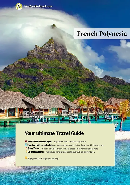
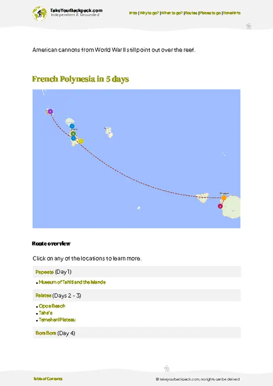
example page 0 from our offline Travel Guide for French Polynesia
example page 1 from our offline Travel Guide for French Polynesia
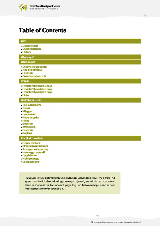
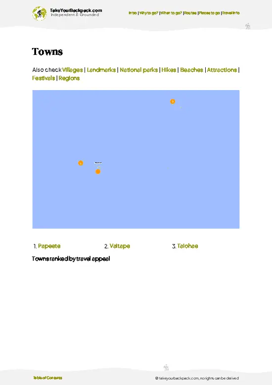
example page 2 from our offline Travel Guide for French Polynesia
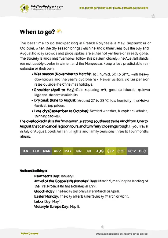
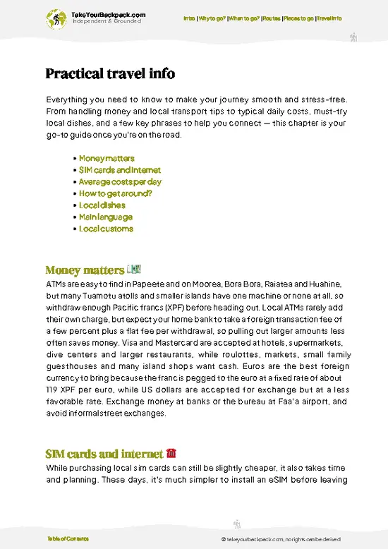
example page 3 from our offline Travel Guide for French Polynesia
example page 4 from our offline Travel Guide for French Polynesia
example page 5 from our offline Travel Guide for French Polynesia
example page 6 from our offline Travel Guide for French Polynesia
example page 7 from our offline Travel Guide for French Polynesia
Loading the map 🌍
CLICK TO FILTER
towns
villages
landmarks
national parks
hikes
beaches
attractions
festivals
regions
SHOW COUNTRY’S BESTSHOW ALL

✨ Why go?
Ranked #4 national park in French Polynesia
The unique appeal for travelers

Backpackers come for the road that ends. Tahiti Iti rewards people who like making their own plan, because there is no ticketed circuit and no queue for anything. You drive or hitch the coastal roads, stop where a fruit stand or a waterfall catches your eye, and sleep in family-run guesthouses that cost far less than the resort islands. The big draw is Teahupo’o, where the wave breaks over a shallow reef just offshore. On a big swell you can watch from a boat, and on a calm day you can paddle the same lagoon yourself. The second draw is the wild end of the road, where the Te Pari coastline opens into sheer green cliffs reached only on foot or by boat. Together they give you a rugged, quiet corner of Tahiti where local life, not tours, sets the pace, and where a self-guided day feels natural.

💡 HighlightsDon't-miss highlights and experiences

  1. Teahupo’o wave: Among the most famous barrels in surfing, breaking over a shallow reef just off the village. Even when it is flat, the lagoon and the view of green peaks behind it are worth the drive.
  2. Te Pari cliffs: The wild southern coast beyond the end of the road, with sea cliffs hundreds of meters high, caves and hidden waterfalls. Most people see it by boat; hikers can reach parts on foot with a guide.
  3. Vaipoiri Cave: A sea-level cave on the Te Pari coast, with a freshwater pool inside, reached on a guided boat trip.
  4. Plateau de Taravao: A cool, green upland above the isthmus with farms, cattle and sweeping views over both Tahiti Nui and Tahiti Iti. A short drive up the Belvédère road gives the best look.
  5. Lagoon of Teahupo’o: Calm, clear water suited to snorkeling and kayaking, with turtles
… read more 👉
  1. Teahupo’o wave: Among the most famous barrels in surfing, breaking over a shallow reef just off the village. Even when it is flat, the lagoon and the view of green peaks behind it are worth the drive.
  2. Te Pari cliffs: The wild southern coast beyond the end of the road, with sea cliffs hundreds of meters high, caves and hidden waterfalls. Most people see it by boat; hikers can reach parts on foot with a guide.
  3. Vaipoiri Cave: A sea-level cave on the Te Pari coast, with a freshwater pool inside, reached on a guided boat trip.
  4. Plateau de Taravao: A cool, green upland above the isthmus with farms, cattle and sweeping views over both Tahiti Nui and Tahiti Iti. A short drive up the Belvédère road gives the best look.
  5. Lagoon of Teahupo’o: Calm, clear water suited to snorkeling and kayaking, with turtles and colorful fish near the reef edge.
  6. Tautira village: Quiet east coast village with black sand, a church and a relaxed feel, popular with surfers and for a lazy afternoon.
Start with the Teahupo’o lagoon at dawn, because the water is calm, the light is soft and boat operators fill up fast by midday.
Spotted a mistake or missing something? Contact us.

Things to do near Tahiti Iti

Ratings based on Tripadvisor reviews. When you book through this link, you support our work at no extra cost to you.

🌤️ When to go?Seasonal considerations and timing

May to October is the best window for Tahiti Iti, with the driest, clearest days for hiking the Plateau of Taravao and surfing at Teahupo’o.
  • Dry Season (May to October): Days run 27 to 29°C (81 to 84°F), nights 20 to 22°C (68 to 72°F), with low rainfall and steady trade winds. Sunrise is around 6:00 and sunset around 17:45. The big Teahupo’o swells arrive roughly May to September, so spectators and surfers fill the lodging.
  • Wet Season (November to April): Expect 29 to 32°C (84 to 90°F), heavy humid downpours, and muddy tracks on the Vaiurua and Te Pari routes. Days stretch to about 13 hours of light. Sea swells are smaller, lagoon diving is calm, and guesthouse rates often drop 10 to 20%.
  • July and August: Peak crowds and peak prices, with rental cars and pensions booked weeks ahead.
Book Teahupo’o … read more 👉
May to October is the best window for Tahiti Iti, with the driest, clearest days for hiking the Plateau of Taravao and surfing at Teahupo’o.
  • Dry Season (May to October): Days run 27 to 29°C (81 to 84°F), nights 20 to 22°C (68 to 72°F), with low rainfall and steady trade winds. Sunrise is around 6:00 and sunset around 17:45. The big Teahupo’o swells arrive roughly May to September, so spectators and surfers fill the lodging.
  • Wet Season (November to April): Expect 29 to 32°C (84 to 90°F), heavy humid downpours, and muddy tracks on the Vaiurua and Te Pari routes. Days stretch to about 13 hours of light. Sea swells are smaller, lagoon diving is calm, and guesthouse rates often drop 10 to 20%.
  • July and August: Peak crowds and peak prices, with rental cars and pensions booked weeks ahead.
Book Teahupo’o stays at least two months ahead if your dates fall in the big-swell months.


source: climatestotravel.comJANJanuary: fair for travelingFEBFebruary: fair for travelingMARMarch: fair for travelingAPRApril: fair for travelingMAYMay: highly recommended for travelingJUNJune: excellent for travelingJULJuly: excellent for travelingAUGAugust: excellent for travelingSEPSeptember: excellent for travelingOCTOctober: highly recommended for travelingNOVNovember: fair for travelingDECDecember: fair for traveling
when-to-go

✈️ The backpacker research shortcutFrench Polynesia Travel Guide

An offline-friendly backpacking guide with optimized travel routes, ranked highlights, transport advice, and the best areas to stay.
example page 0 from our offline Travel Guide for French Polynesia
example page 1 from our offline Travel Guide for French Polynesia
example page 2 from our offline Travel Guide for French Polynesia
example page 3 from our offline Travel Guide for French Polynesia
example page 4 from our offline Travel Guide for French Polynesia
example page 5 from our offline Travel Guide for French Polynesia
example page 6 from our offline Travel Guide for French Polynesia
example page 7 from our offline Travel Guide for French Polynesia
The digital guide (149 pages) contains:
✅ 41 highlights, ranked by travel appeal
✅ Optimized 2, 3 & 5-day travel routes
✅ Cities, national parks, landmarks, beaches
✅ How to get around
✅ Offline-friendly for travel without Wi-Fi
👉 Click to see all 30+ guide features

📅 Plan smarter in minutes, not weeks
✅ Month by month travel advice
✅ Festivals & national holidays
✅ Budget expectations

🗺️ Go to the right places, skip the overrated ones
✅ Honest pros & cons of destinations
✅ Top hikes, parks & viewpoints
✅ Lesser-known places most travelers miss
✅ Clear “worth it vs skip it” guidance

🛏️ Travel smoothly without rookie mistakes
✅ Best areas to stay
✅ Transport systems explained simply
✅ Common scams & safety advice
✅ SIM cards, money & practical tips

🌍 Understand the country, not just visit it
✅ Culture & traditions
✅ 52 Essential phrases & customs
✅ Festivals worth planning around
✅ Traveler-friendly historical context
✅ Insights that make places more meaningful

📱 Built for real travel conditions
✅ Fully downloadable PDF
✅ Works completely offline
✅ Optimized for phone use
✅ Useful in remote areas & buses
✅ Everything in one place
Stop searching, start planning
Get instant access to your full guide. 30‑day money-back guarantee.
+ Add another guide for just

By proceeding you agree to our terms.
Sent to your inbox immediately after payment • 100% Secure Checkout
Best Backpacking Travel Advisor 2025 tourism awardBest Backpacking
Travel Advisor
2025
What others say about Take Your Backpack Guides:
⭐⭐⭐⭐⭐
Fantastic, amazing amount of information!
⭐⭐⭐⭐⭐
My goodness this is amazing, it's what I've been looking for hats off too you!
⭐⭐⭐⭐⭐
I think this is absolutely BRILLIANT
⭐⭐⭐⭐
Very complete and informative. It's still missing places, but I gotta to commend you
⭐⭐⭐⭐⭐
This is truly amazing, thank you, can't wait to explore it with my kids!
⭐⭐⭐⭐⭐
Awesome resource, thank you!
⭐⭐⭐⭐⭐
This is amazing! Can't wait to explore the ones I haven't seen
⭐⭐⭐⭐
I love this! Well done, great idea.
⭐⭐⭐⭐⭐
Thanks for taking the time to make this gem!
⭐⭐⭐⭐⭐
This might be the best website I've ever seen.
⭐⭐⭐⭐⭐
Congratulations, and thank you so much for your work; it's incredibly valuable.
⭐⭐⭐⭐
In all seriousness I think you did a great job pointing out the important spots
⭐⭐⭐⭐⭐
10/10 very good
⭐⭐⭐⭐⭐
As someone who's only just starting to visit regularly this is awesome, thank you.
⭐⭐⭐⭐
Thank you very much! I'm going to visit my dad, it's going to be very useful!
⭐⭐⭐⭐⭐
This is really cool! We'll be travelling for the first time and this definitely come in handy.
⭐⭐⭐⭐⭐
You are now our minister of culture, congratulations 👨‍💼
⭐⭐⭐⭐⭐
Just wanted to tell you that this is a pearl! Going to follow your recommendations.
⭐⭐⭐⭐⭐
This is so cool. I'll definitely be using the resource for my travels soon.
⭐⭐⭐⭐⭐
This is very impressive! Good work.
⭐⭐⭐⭐⭐
This is an amazing and informative site. Very well done!

🛏️ Where to stay?How to pick the right area

Most backpackers sleep in family-run pensions along the Tahiti Iti coast, since there are no hostels and no national park lodging on the peninsula itself.
Teahupo’o village is the main base, at the end of the road. Pensions here have fan or air-conditioned rooms, kitchen access, and boat transfers to the wave, so it suits surfers and anyone wanting a quiet lagoon. Expect US$80 to 150 for a double room. Book early in swell season.
Taravao, the isthmus town linking Tahiti Nui and Tahiti Iti, has supermarkets, a gas station, and a few guesthouses at lower prices (US$60 to 110). It works well if you … read more 👉
Most backpackers sleep in family-run pensions along the Tahiti Iti coast, since there are no hostels and no national park lodging on the peninsula itself.
Teahupo’o village is the main base, at the end of the road. Pensions here have fan or air-conditioned rooms, kitchen access, and boat transfers to the wave, so it suits surfers and anyone wanting a quiet lagoon. Expect US$80 to 150 for a double room. Book early in swell season.
Taravao, the isthmus town linking Tahiti Nui and Tahiti Iti, has supermarkets, a gas station, and a few guesthouses at lower prices (US$60 to 110). It works well if you plan hikes on the plateau and want shops nearby.
Along the east coast at Tautira and Pueu, you find quieter pensions and homestays facing the open Pacific, usually US$70 to 120. Few restaurants exist, so self-catering is smart.
Papeete, about 60 km away, has the only true dorm-style options and the widest choice of rental cars. Some travelers stay there and drive down for day trips, though the trip takes around 1.5 hours each way.

👛 Costs (as of 15 October 2026)What things cost and how to budget

Plan on roughly US$110 to 250 per day on Tahiti Iti, with accommodation and car hire driving most of the total.
CategoryBudget RangeLocal Reality
Accommodation (high season)US$70 to 130Family pensions and guesthouses at Teahupo’o or Taravao, often with a kitchenette
Food and suppliesUS$25 to 50Supermarket picnic items are cheaper than restaurants. Roulottes (food trucks) serve meals for US$10 to 18
Local transportUS$10 to 30Le Truck buses are limited on the peninsula, so a rental car (US$60 to 90 a day) is often split between travelers
Entrance fees and activitiesUS$0 to 40Beaches and the coastal road are free. Guided hikes cost US$40 to 80, and a boat to see the wave costs US$20 to 50
Total Daily BudgetUS$110 to 250Lower if you share rooms and cars and cook your own meals
⚠️ Prices can change and everyone travels differently, so take this as a rough guide. Hope it helps you plan your adventure!

🥾 TrailsScenic routes and wildlife spotting in Tahiti Iti

Hiking on Tahiti Iti is more about local tracks and guided routes than a marked national park system. Terrain is steep, wet, and thick with ferns, hibiscus and wild bananas, so expect mud and slippery roots, especially after rain.
  • Te Pari coast: Guided walk or boat trip to the cliffs and caves of the southern coast. Allow most of a day. Moderate to hard, with rough ground and river crossings in places.
  • Vaipoiri Cave walk: A short guided trip to the freshwater pool inside the cave. Easy once you arrive, but the sea access depends on swell.
  • Plateau de Taravao tracks: Gentle farm roads and forest paths
… read more 👉
Hiking on Tahiti Iti is more about local tracks and guided routes than a marked national park system. Terrain is steep, wet, and thick with ferns, hibiscus and wild bananas, so expect mud and slippery roots, especially after rain.
  • Te Pari coast: Guided walk or boat trip to the cliffs and caves of the southern coast. Allow most of a day. Moderate to hard, with rough ground and river crossings in places.
  • Vaipoiri Cave walk: A short guided trip to the freshwater pool inside the cave. Easy once you arrive, but the sea access depends on swell.
  • Plateau de Taravao tracks: Gentle farm roads and forest paths with open views. Easy, about two to three hours, good for beginners.
  • Teahupo’o river valley: A walk up the river from the end of the road, passing pools and small falls. Easy to moderate, usually two to three hours return.
  • Wildlife: Look for turtles and rays in the lagoon, and humpback whales offshore in the cooler months. Birds and fruit bats live in the forest.
Reaching Tahiti Iti is simple if you have a car or scooter, since roads run from Taravao along the north and south coasts. Public buses are infrequent and often stop early in the afternoon, so plan ahead or hitch carefully. The area is far quieter than the main island and rarely crowded, except around surf contests. There are no entrance fees for roads, beaches or village paths, but boat trips and guided hikes are paid by the operator. Bring water, insect repellent and sturdy shoes with grip, and start early to avoid afternoon rain.
⚠️ Hiking info can sometimes be outdated or inaccurate. Before you hit the trail, check the latest conditions with locals. If you do spot anything that's off, I'd love to hear from you, so I can update it for fellow travelers.

🛡️ SafetyScams, Hazards, and Annoyances

Tahiti Iti is generally safe and straightforward, with the main risks coming from water, weather, and rough trails.
The lagoon looks calm, yet the pass at Teahupo’o has strong currents and shallow, sharp reef, so watch the wave from a tour boat rather than paddling out unless you are an experienced surfer. Wear reef shoes and check tides with a local guide before snorkeling.
Trails on the plateau and toward Vaiurua are steep, muddy after rain, and poorly marked. Hire a guide for the longer routes and carry at least 2 liters of water, a rain layer, and insect repellent for mosquitoes, which can carry dengue. Rivers rise quickly after heavy rain, so avoid crossings when clouds build over the mountains.
The peninsula road ends at Teahupo’o and the far southeast coast is reachable only by boat or … read more 👉
Tahiti Iti is generally safe and straightforward, with the main risks coming from water, weather, and rough trails.
The lagoon looks calm, yet the pass at Teahupo’o has strong currents and shallow, sharp reef, so watch the wave from a tour boat rather than paddling out unless you are an experienced surfer. Wear reef shoes and check tides with a local guide before snorkeling.
Trails on the plateau and toward Vaiurua are steep, muddy after rain, and poorly marked. Hire a guide for the longer routes and carry at least 2 liters of water, a rain layer, and insect repellent for mosquitoes, which can carry dengue. Rivers rise quickly after heavy rain, so avoid crossings when clouds build over the mountains.
The peninsula road ends at Teahupo’o and the far southeast coast is reachable only by boat or on foot, so tell your host your plans. Do not leave valuables visible in rental cars at trailheads. Phone signal fades past Teahupo’o.

FAQCommon questions from travelers

Two to three days is enough for Tahiti Iti. That covers a day for Teahupo’o and a boat trip to the wave, a day for the Vaiurua Valley or plateau hikes, and a half day at the Pueu and Tautira coast. Surfers or divers often add two or more days.
A car makes things far easier, but you can manage without one. Le Truck buses run from Papeete to Taravao (about 1 hour) and onward with limited service toward Teahupo’o, and your pension can often arrange transfers for US$20 to 50. Taxis from Papeete cost roughly US$100 to 150 each way.
There is no entrance fee for Tahiti Iti’s coast, beaches, or roads. Most hiking in the interior is done with a local guide, costing roughly US$40 to 80 per person for a day. Some hikes cross private land, so ask your pension or guide about access before setting off.
⚠️ Things can change over time, so always validate details locally before you go.

Other French Polynesian national parks near Tahiti Iti

Explore more nearby:

  • Teahupo’o—reef break, surf culture, remote coastline| 7 km away
  • Papenoo Valley—Unpaved 4x4 crossing, Lake Vaihiria eels, waterfall walls, river-mouth black sand| 39 km away
  • Temehani Plateau—Tiare apetahi, dawn guided climb, cloud forest, Raiatea rim views| 264 km away

💡 Not sure where to go next?
Create a personalized itinerary for French Polynesia including Tahiti Iti and the places that fit your trip.

Generate my itinerary

👉 Discover all national parks

Or checkout all French Polynesia has to offer (think cities, towns, villages, national parks, hikes, beaches, festivals)
Country photo of French Polynesia

We 💚 feedbackIs it worth it?

Pair Tahiti Iti with a few nights on the main island’s west coast, then finish with a ferry to Moorea. Use Tahiti Iti as the quiet middle stop, when you want surf, forest and village life without crowds. I would book a boat for the cliffs early in the trip, since calm mornings decide whether it runs, and bring a rain jacket regardless.

✍️ Help improve this page!
The information on this page is based on in-depth research, insights shared by experienced travelers, and feedback from the local travel community in French Polynesia. While every effort is made to keep the information accurate and current, conditions can change — so if you spot anything incorrect or outdated, please get in touch.


🙋‍♂️ Give feedback

👋 Meet the founderWho’s Behind Take Your Backpack?

Johan, backpacker and founder of TakeYourBackpackHi, I’m Johan (Netherlands 🇳🇱), the creator of TakeYourBackpack. Over the past 3 decades, I’ve backpacked through 90+ countries across six continents, gaining extensive experience with independent travel, long-term trips, and overland routes.

This site is built on a combination of firsthand travel experience and carefully curated insights from other backpackers. Many guides are based on places I’ve personally visited, while others bring together tips, observations, and practical advice shared by trusted travelers I’ve met along the way.

The goal is to provide realistic, experience-driven guidance — not generic itineraries — so you can explore destinations with better context, clearer expectations, and more confidence.