
×

Guatemala🇬🇹 | hikesTodos Santos CuchumatánLa Torre 3,837 m, Mam ridgelines, pine moorland, thin air | things to do and best time to go

Explore El Mirador TrekExplore Semuc Champey to Lanquín Trail

Backpacking in Todos Santos Cuchumatán
👌 Worth visitinghike ranked #8
By Johan Kruseman 🇳🇱 | Updated October 22, 2026

A tin cup of atol de elote, steaming and faintly sweet, costs about US$0.50 at a market stall, and the woman ladling it wears the red-striped pants and embroidered collar that mark Mam women and men here. Todos Santos Cuchumatán sits high in the Cuchumatanes mountains in the northwest of Guatemala, in Huehuetenango department. The hikes from town are steep, between 2,400 and 3,500 meters, on rocky and sometimes muddy paths. Views over pine ridges are big, and the pace is slow because of the altitude. Minibuses from Huehuetenango reach town easily, though the road is winding. Unlike Nebaj, where hikes lean on Ixil villages and lowland cloud forest, this one is all high Mam ridgeline.

Discover everything you want to know in the 📖 Guatemala Travel Guide.
Best time to go: October - April
Duration: 1 day
Distance: 15 kilometers
Total ascent: 900 meters


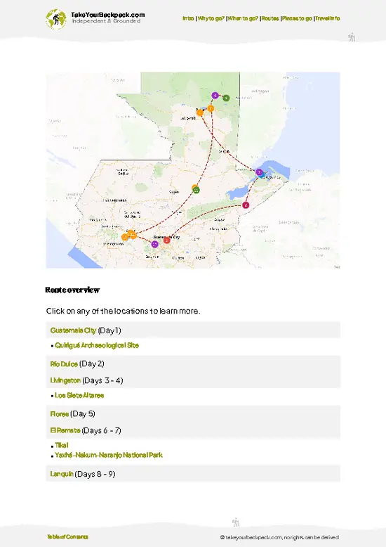
example page 0 from our offline Travel Guide for Guatemala
example page 1 from our offline Travel Guide for Guatemala
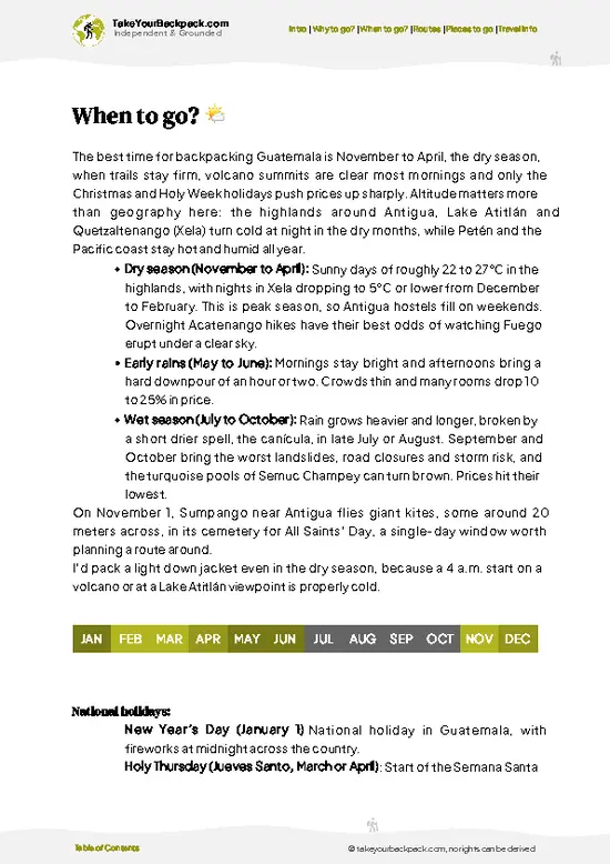
example page 2 from our offline Travel Guide for Guatemala
example page 3 from our offline Travel Guide for Guatemala
example page 4 from our offline Travel Guide for Guatemala
example page 5 from our offline Travel Guide for Guatemala
example page 6 from our offline Travel Guide for Guatemala
example page 7 from our offline Travel Guide for Guatemala
Loading the map 🌍
CLICK TO FILTER
cities
towns
villages
landmarks
national parks
hikes
beaches
attractions
festivals
regions
SHOW COUNTRY’S BESTSHOW ALL

✨ Why go?
Ranked #8 hike in Guatemala
The unique appeal for travelers

Todos Santos Cuchumatán sits at about 2,500 meters in the Cuchumatanes, and backpackers come for the Mam culture that is still worn on the body: men in red-striped trousers and blue-striped shirts with wide collars, women in woven huipiles. Few Guatemalan towns keep dress this specific in daily use. The scenery arrives fast. Pine ridges and potato and wheat fields climb straight out of the edge of town, so a half-day walk gives you big views without a heavy pack.

The second reason is the high-plateau trail network around the town. You can string together short loops or commit to a long day toward La Torre, the highest point of the plateau at 3,837 meters, and the distances flex to your legs and the weather. Guesthouses are simple and cheap, which keeps a multi-day stay easy on a tight budget. … read more 👉
Todos Santos Cuchumatán sits at about 2,500 meters in the Cuchumatanes, and backpackers come for the Mam culture that is still worn on the body: men in red-striped trousers and blue-striped shirts with wide collars, women in woven huipiles. Few Guatemalan towns keep dress this specific in daily use. The scenery arrives fast. Pine ridges and potato and wheat fields climb straight out of the edge of town, so a half-day walk gives you big views without a heavy pack.

The second reason is the high-plateau trail network around the town. You can string together short loops or commit to a long day toward La Torre, the highest point of the plateau at 3,837 meters, and the distances flex to your legs and the weather. Guesthouses are simple and cheap, which keeps a multi-day stay easy on a tight budget.

The town also fits a longer route through the western highlands, with Huehuetenango as the usual gateway. Come in late October and the All Saints horse race on November 1 fills the streets, though beds go fast then.

💡 HighlightsThe experiences that define the visit

  1. La Torre summit: At 3,837 meters, this is the high point of the Cuchumatanes plateau. It is about 30 minutes by road from town, then roughly 2 hours of climbing on foot. The top is open moorland and wind, with cloud sliding below you on clear mornings.
  2. Mam traditional dress in town: Red-striped trousers and embroidered collars on the men are seen daily, especially on market days. Keep your camera lowered unless you ask first.
  3. All Saints horse race: Each November 1, riders gallop between two points in the village, many of them drunk and in full costume. It is loud, risky and wildly local, and it is the reason some travelers plan the whole trip around the date.
  4. Saturday market: Farmers come down from the hamlets with potatoes, apples, and wool. Weavers sell textiles here with less pressure than
… read more 👉
  1. La Torre summit: At 3,837 meters, this is the high point of the Cuchumatanes plateau. It is about 30 minutes by road from town, then roughly 2 hours of climbing on foot. The top is open moorland and wind, with cloud sliding below you on clear mornings.
  2. Mam traditional dress in town: Red-striped trousers and embroidered collars on the men are seen daily, especially on market days. Keep your camera lowered unless you ask first.
  3. All Saints horse race: Each November 1, riders gallop between two points in the village, many of them drunk and in full costume. It is loud, risky and wildly local, and it is the reason some travelers plan the whole trip around the date.
  4. Saturday market: Farmers come down from the hamlets with potatoes, apples, and wool. Weavers sell textiles here with less pressure than in lowland tourist towns.
  5. Pine ridge viewpoints above town: Short tracks climb from the edge of town through potato fields to open ridgelines. They give a clear look back over the tin roofs and the deep valley that holds the town, and they suit a tired afternoon.
For a first visit, the walk up to the pine ridge viewpoints gives the best return, since you can finish before dark and still see the whole valley.
Spotted a mistake or missing something? Contact us.

Things to do near Todos Santos Cuchumatán

Ratings based on Tripadvisor reviews. When you book through this link, you support our work at no extra cost to you.

🌤️ When to go?Weather, crowds, and seasonal trade-offs

  • Dry Season (November to April): Mornings start near 0 to 5°C (32 to 41°F) at 2,450 meters, with frost on some January and February dawns, and afternoons reach 15 to 20°C (59 to 68°F). Sky is mostly clear, so Cuchumatanes ridgelines show off their views. Trails are firm.
  • Wet Season (May to October): Afternoon cloud and rain are routine, and tracks turn slick and muddy. Highs sit around 14 to 18°C (57 to 64°F). Views close in by midday, but prices stay flat and the hills turn green.
  • All Saints Week (late October to November 1): The festival, with its horse races and heavy drinking, fills the town. Rooms book out and nightly rates can double, so reserve ahead or skip it if you want quiet trails.
  • Daylight: Near 11 to 13 hours all year, so start walking early.
Start hikes by 8 a.m. in any season, because cloud tends to build after lunch.

source: climatestotravel.comJANJanuary: highly recommended for travelingFEBFebruary: highly recommended for travelingMARMarch: excellent for travelingAPRApril: excellent for travelingMAYMay: fair for travelingJUNJune: fair for travelingJULJuly: fair for travelingAUGAugust: fair for travelingSEPSeptember: fair for travelingOCTOctober: good for travelingNOVNovember: excellent for travelingDECDecember: good for traveling
when-to-go

✈️ The backpacker research shortcutGuatemala Travel Guide

An offline-friendly backpacking guide with optimized travel routes, ranked highlights, transport advice, and the best areas to stay.
example page 0 from our offline Travel Guide for Guatemala
example page 1 from our offline Travel Guide for Guatemala
example page 2 from our offline Travel Guide for Guatemala
example page 3 from our offline Travel Guide for Guatemala
example page 4 from our offline Travel Guide for Guatemala
example page 5 from our offline Travel Guide for Guatemala
example page 6 from our offline Travel Guide for Guatemala
example page 7 from our offline Travel Guide for Guatemala
The digital guide (272 pages) contains:
✅ 85 highlights, ranked by travel appeal
✅ Optimized 5, 10 & 15-day travel routes
✅ Cities, national parks, landmarks, beaches
✅ How to get around
✅ Offline-friendly for travel without Wi-Fi
👉 Click to see all 30+ guide features

📅 Plan smarter in minutes, not weeks
✅ Month by month travel advice
✅ Festivals & national holidays
✅ Budget expectations

🗺️ Go to the right places, skip the overrated ones
✅ Honest pros & cons of destinations
✅ Top hikes, parks & viewpoints
✅ Lesser-known places most travelers miss
✅ Clear “worth it vs skip it” guidance

🛏️ Travel smoothly without rookie mistakes
✅ Best areas to stay
✅ Transport systems explained simply
✅ Common scams & safety advice
✅ SIM cards, money & practical tips

🌍 Understand the country, not just visit it
✅ Culture & traditions
✅ 52 Essential phrases & customs
✅ Festivals worth planning around
✅ Traveler-friendly historical context
✅ Insights that make places more meaningful

📱 Built for real travel conditions
✅ Fully downloadable PDF
✅ Works completely offline
✅ Optimized for phone use
✅ Useful in remote areas & buses
✅ Everything in one place
Stop searching, start planning
Get instant access to your full guide. 30‑day money-back guarantee.
+ Add another guide for just

By proceeding you agree to our terms.
Sent to your inbox immediately after payment • 100% Secure Checkout
Best Backpacking Travel Advisor 2025 tourism awardBest Backpacking
Travel Advisor
2025
What others say about Take Your Backpack Guides:
⭐⭐⭐⭐⭐
Fantastic, amazing amount of information!
⭐⭐⭐⭐⭐
My goodness this is amazing, it's what I've been looking for hats off too you!
⭐⭐⭐⭐⭐
I think this is absolutely BRILLIANT
⭐⭐⭐⭐
Very complete and informative. It's still missing places, but I gotta to commend you
⭐⭐⭐⭐⭐
This is truly amazing, thank you, can't wait to explore it with my kids!
⭐⭐⭐⭐⭐
Awesome resource, thank you!
⭐⭐⭐⭐⭐
This is amazing! Can't wait to explore the ones I haven't seen
⭐⭐⭐⭐
I love this! Well done, great idea.
⭐⭐⭐⭐⭐
Thanks for taking the time to make this gem!
⭐⭐⭐⭐⭐
This might be the best website I've ever seen.
⭐⭐⭐⭐⭐
Congratulations, and thank you so much for your work; it's incredibly valuable.
⭐⭐⭐⭐
In all seriousness I think you did a great job pointing out the important spots
⭐⭐⭐⭐⭐
10/10 very good
⭐⭐⭐⭐⭐
As someone who's only just starting to visit regularly this is awesome, thank you.
⭐⭐⭐⭐
Thank you very much! I'm going to visit my dad, it's going to be very useful!
⭐⭐⭐⭐⭐
This is really cool! We'll be travelling for the first time and this definitely come in handy.
⭐⭐⭐⭐⭐
You are now our minister of culture, congratulations 👨‍💼
⭐⭐⭐⭐⭐
Just wanted to tell you that this is a pearl! Going to follow your recommendations.
⭐⭐⭐⭐⭐
This is so cool. I'll definitely be using the resource for my travels soon.
⭐⭐⭐⭐⭐
This is very impressive! Good work.
⭐⭐⭐⭐⭐
This is an amazing and informative site. Very well done!

🛏️ Where to stay?Best areas to stay in Guatemala

If you enjoy meeting fellow travelers, consider choosing hostels with high ratings for atmosphere. On the other hand, if you prefer having your own space, a hotel might be a better option.

🥾 Hike detailsKey facts about the Todos Santos Cuchumatán hike

Total Distance: Todos Santos Cuchumatán offers loops from about 5 kilometers up to a long day of 15 to 20 kilometers toward La Torre, depending on whether you take the road to the trailhead.
Estimated Duration: Short ridge walks take 2 to 4 hours. La Torre takes a full day, including about 2 hours of climbing from the end of the road.
Difficulty: Moderate. The effort comes from altitude, since the whole area sits above 2,500 meters and the summit passes 3,800 meters.
Starting Point: The center of Todos Santos Cuchumatán, reached by minibus from Huehuetenango. Trails leave from the edge of town. For
… read more 👉
Total Distance: Todos Santos Cuchumatán offers loops from about 5 kilometers up to a long day of 15 to 20 kilometers toward La Torre, depending on whether you take the road to the trailhead.
Estimated Duration: Short ridge walks take 2 to 4 hours. La Torre takes a full day, including about 2 hours of climbing from the end of the road.
Difficulty: Moderate. The effort comes from altitude, since the whole area sits above 2,500 meters and the summit passes 3,800 meters.
Starting Point: The center of Todos Santos Cuchumatán, reached by minibus from Huehuetenango. Trails leave from the edge of town. For La Torre, you arrange a pickup or shared ride for the 30-minute road section.
Major Landmarks:
  • La Torre: The highest point on the plateau, with a cross and wide views.
  • Ridge viewpoints: Open spots above the potato fields looking back toward town.
  • Hamlets and fields: Mam farming settlements along the paths.
Terrain and Scenery: Dirt tracks, steep farm paths and open limestone moorland. Views run across deep valleys and folded ridgelines.
Vegetation: Pine and cypress on the lower slopes, then bunch grass and low scrub near the top. Cultivated plots of potatoes, wheat and corn surround town.
Wildlife: Mostly birds and grazing sheep. Expect cold nights and fast fog, so carry layers and a rain shell.
⚠️ Hiking info can sometimes be outdated or inaccurate. Before you hit the trail, check the latest conditions with locals. If you do spot anything that's off, I'd love to hear from you, so I can update it for fellow travelers.

🛡️ SafetySafety Tips and Common Scams in Todos Santos Cuchumatán

Todos Santos Cuchumatán sits at about 2,450 meters, and the trails above it climb past 3,000, so the main issue is thin, cold air rather than danger. Give yourself a night or two in town before long days, walk slowly, and drink plenty of water. Weather swings fast: pack a rain shell and a warm layer even in the dry season, since nights are near freezing. Paths are often unmarked and cross farmland, so download an offline map or hire a local guide to avoid wrong turns. Footing gets slippery after rain. Stray dogs near villages are the most common animal nuisance; walk calmly and carry a stick if worried. Start early, tell your guesthouse your route, and be respectful when passing Mam homes and fields.

FAQTraveler FAQ

Most day hikes around Todos Santos Cuchumatán take 3 to 6 hours, while the popular route to Laguna Magdalena or the Mirador viewpoint fits into a morning. The well-known multiday trek to Laguna Magdalena and beyond can run 2 to 3 days. The classic ridge and village loops cover roughly 10 to 20 kilometers depending on the route.
Todos Santos Cuchumatán hikes are moderate overall, with the challenge coming from altitude rather than technical ground. Town sits near 2,450 meters and ridges rise above 3,000, so climbs feel harder than the distances suggest. Most day routes cover 8 to 15 kilometers with 400 to 800 meters of ascent, and fit reasonably fit walkers who have spent a night or two acclimatizing.
Todos Santos Cuchumatán does not require a permit for the usual day hikes, and no national park fee applies on most trails. A local guide is strongly recommended because paths are poorly marked, and costs about US$20 to 40 per day through guesthouses or community guides in town. Multiday treks usually need a guide for navigation and camping arrangements.
⚠️ Things can change over time, so always validate details locally before you go.

Other Guatemalan hikes near Todos Santos Cuchumatán

Explore more nearby:

  • El Cimarrón—Sinkhole rim, 170 to 200 m drop, guided abseil, gravel climb| 57 km away
  • Tajumulco Volcano—Central America’s highest point, bunchgrass camp, twin craters, Tuichán start| 61 km away
  • Santa María Volcano—Santiaguito dome, Llano del Pinal, steep roots, Xela sunrise| 83 km away

💡 Not sure where to go next?
Create a personalized itinerary for Guatemala including Todos Santos Cuchumatán and the places that fit your trip.

Generate my itinerary

👉 Discover all hikes

Or checkout all Guatemala has to offer (think cities, towns, villages, national parks, hikes, beaches, festivals)
Country photo of Guatemala

We 💚 feedbackKey takeaways before you go

Todos Santos Cuchumatán rewards two full nights better than one, because the first day mostly goes to adjusting to the altitude. I would plan a viewpoint morning, a market day, then a longer village hike if your legs feel good. Bring a warm layer and a rain shell.

✈️ When did I visit Guatemala?
Guatemala I visited during my half year trip through South and Central America back in 2003

✍️ Help improve this page!
The information on this page is based on my own backpacking experience in Guatemala, supplemented with up-to-date research and feedback from other travelers. Travel details can change, so if you notice anything outdated or incomplete, feel free to let me know.


🙋‍♂️ Give feedback

👋 Meet the founderWho’s Behind Take Your Backpack?

Johan, backpacker and founder of TakeYourBackpackHi, I’m Johan (Netherlands 🇳🇱), the creator of TakeYourBackpack. Over the past 3 decades, I’ve backpacked through 90+ countries across six continents, gaining extensive experience with independent travel, long-term trips, and overland routes.

This site is built on a combination of firsthand travel experience and carefully curated insights from other backpackers. Many guides are based on places I’ve personally visited, while others bring together tips, observations, and practical advice shared by trusted travelers I’ve met along the way.

The goal is to provide realistic, experience-driven guidance — not generic itineraries — so you can explore destinations with better context, clearer expectations, and more confidence.