×

Indonesia🇮🇩 | hikesGunung Gede PangrangoTwin peaks, cloud forest, hot springs, Cibodas gateway | things to do and best time to go

Explore Gunung SemeruExplore Gunung Papandayan

Backpacking in Gunung Gede Pangrango
🌟 Highlighthike ranked #8
By Johan Kruseman 🇳🇱 | Updated October 15, 2026

The first choice you'll face: do you push for the summit in one brutal day, or split the climb across two days and actually enjoy the mountain? Gunung Gede Pangrango sits in West Java, about 60 kilometers south of Jakarta, straddling a national park that protects two volcanic peaks. The two-day route is the smarter play for most hikers. The trail climbs through dense montane forest, emerges into alpine meadows, and rewards you with views across Java's volcanic spine. I remember stepping out of the mist at 2,400 meters, suddenly surrounded by edelweiss flowers and the sharp clarity of high altitude, the valley floor invisible below. The hike is accessible by public transport from Jakarta, moderately steep but well-marked, and far less crowded than Bromo or Semeru. The trade-off: you'll share the trail with Indonesian school groups and weekend warriors, especially on Saturdays.

Discover everything you want to know in the 📖 Indonesia Travel Guide.
Best time to go: May - September
Duration: 2 days
Total ascent: 2000 meters


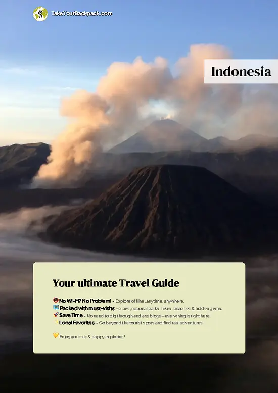
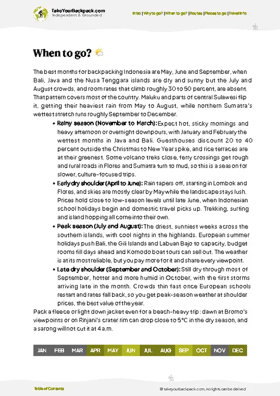
example page 0 from our offline Travel Guide for Indonesia
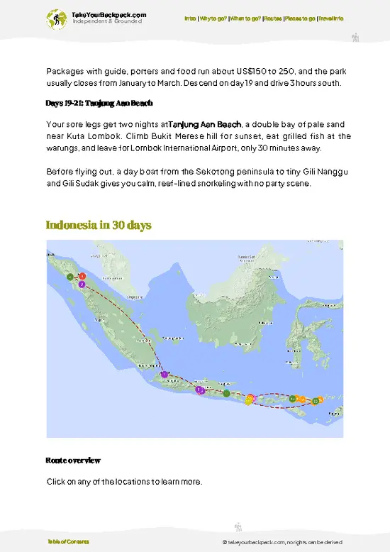
example page 1 from our offline Travel Guide for Indonesia
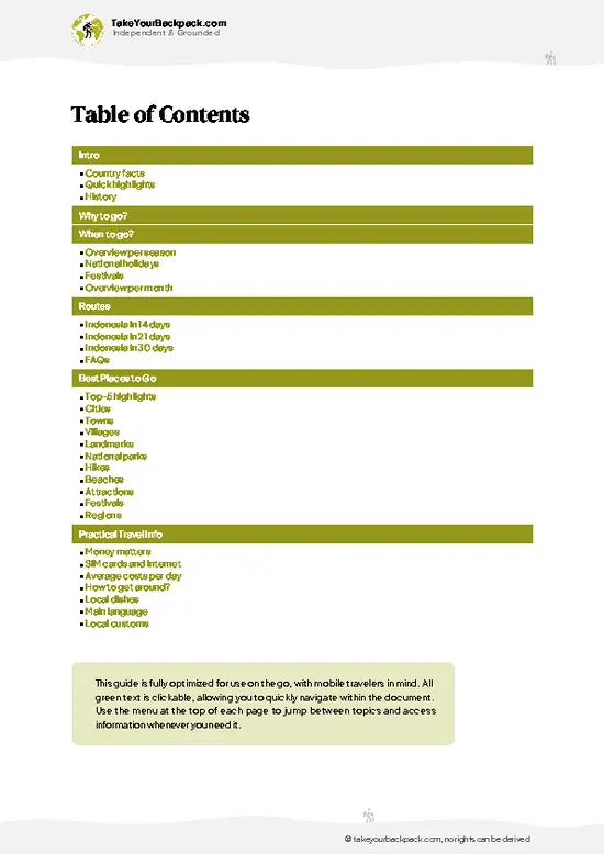
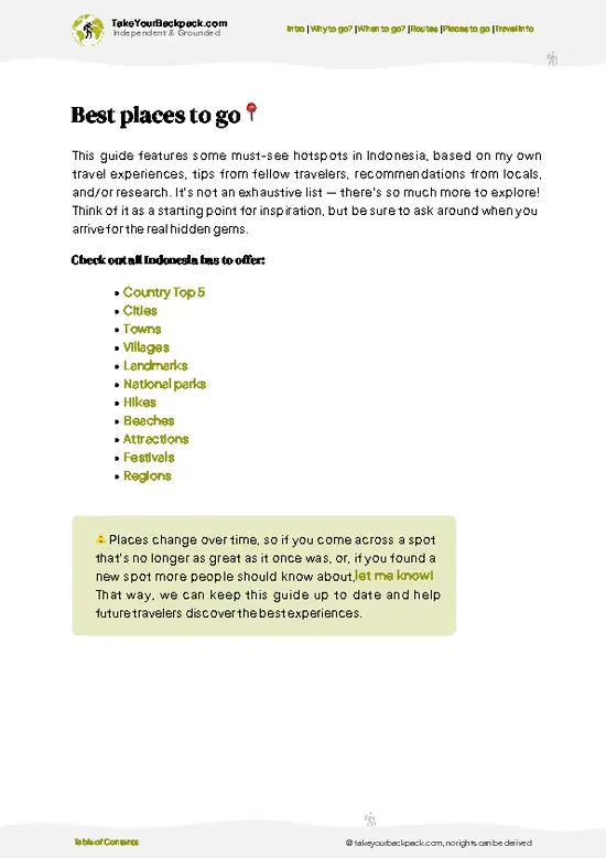
example page 2 from our offline Travel Guide for Indonesia
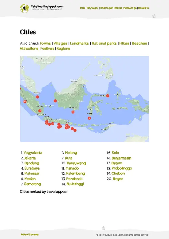
example page 3 from our offline Travel Guide for Indonesia
example page 4 from our offline Travel Guide for Indonesia
example page 5 from our offline Travel Guide for Indonesia
example page 6 from our offline Travel Guide for Indonesia
example page 7 from our offline Travel Guide for Indonesia
Loading the map 🌍
CLICK TO FILTER
cities
towns
villages
landmarks
national parks
hikes
beaches
attractions
festivals
regions
SHOW COUNTRY’S BESTSHOW ALL

✨ Why go?
Ranked #8 hike in Indonesia
Reasons people choose to hike the here

Backpackers seek out Gunung Gede Pangrango for its accessible two-day summit push from Jakarta, just three hours by public transport from the capital. The low cost (minimal fees, cheap guesthouses nearby) and flexible routing mean you can slot it into almost any Java itinerary without derailing plans. The payoff is genuine: you climb through five distinct vegetation zones, from tropical forest to alpine meadow, gaining 1,500 meters of elevation while staying on a well-maintained trail. Crowds thin out quickly above the lower camps, and the summit views across the Sundanese highlands reward the early start. For backpackers moving between Bandung and Yogyakarta, this hike sits at the perfect sweet spot between effort and scenery.

💡 HighlightsThe experiences that define the visit

  1. Cibodas Gate (1,425 meters): The main trailhead where most hikers begin. It marks the transition from lowland forest to montane zone and sits within Gede Pangrango National Park, where you'll register and pay the modest entrance fee.
  2. Kandang Batu Camp (2,000 meters): The first major rest point, nestled in dense cloud forest where moss clings to every branch. The air cools noticeably here, and the trail becomes steeper and more technical.
  3. Cibeureum Waterfall: A side attraction near the lower camps where hikers refill water bottles. The falls drop through a narrow gorge surrounded by ferns and dripping rock, offering a moment of quiet before the push higher.
  4. Gunung Gede Summit (2,958 meters): The primary objective. On clear mornings, the view stretches across the Sundanese plateau toward Bandung
… read more 👉
  1. Cibodas Gate (1,425 meters): The main trailhead where most hikers begin. It marks the transition from lowland forest to montane zone and sits within Gede Pangrango National Park, where you'll register and pay the modest entrance fee.
  2. Kandang Batu Camp (2,000 meters): The first major rest point, nestled in dense cloud forest where moss clings to every branch. The air cools noticeably here, and the trail becomes steeper and more technical.
  3. Cibeureum Waterfall: A side attraction near the lower camps where hikers refill water bottles. The falls drop through a narrow gorge surrounded by ferns and dripping rock, offering a moment of quiet before the push higher.
  4. Gunung Gede Summit (2,958 meters): The primary objective. On clear mornings, the view stretches across the Sundanese plateau toward Bandung and beyond. The crater rim itself is narrow and dramatic, with sulfur vents releasing wisps of steam.
  5. Gunung Pangrango Summit (3,019 meters): The higher of the two peaks, reached via a ridge traverse from Gede. The extra 60 meters of elevation and the exposed scramble make it feel like a separate achievement, with even fewer hikers reaching it.
I'd pick the Gunung Pangrango summit first because it's the true high point, and the ridge walk between the two peaks is the most exposed and rewarding section of the entire hike. Most people stop at Gede and miss it.
Spotted a mistake or missing something? Contact us.

Things to do near Gunung Gede Pangrango

Ratings based on Tripadvisor reviews. When you book through this link, you support our work at no extra cost to you.

🌤️ When to go?Weather, crowds, and seasonal trade-offs

  • Dry Season (May to September): The best window. Temperatures range from 15 to 22°C (59 to 72°F) at the summit, with clear skies and stable conditions. Trails dry quickly, and visibility extends for kilometers. Crowds peak in July and August, especially on weekends.
  • Shoulder Months (April, October): Still reliable, with fewer hikers. Temperatures similar to peak season, occasional afternoon clouds but generally passable.
  • Wet Season (November to March): Heavy rain, poor visibility, and slippery terrain make this risky. Trails become muddy and exposed sections turn treacherous. Avoid unless you have serious mountain experience.
Start your hike early Friday or Saturday morning to secure a hut spot and avoid the worst crowds.

source: climatestotravel.comJANJanuary: fair for travelingFEBFebruary: fair for travelingMARMarch: fair for travelingAPRApril: fair for travelingMAYMay: excellent for travelingJUNJune: excellent for travelingJULJuly: excellent for travelingAUGAugust: excellent for travelingSEPSeptember: excellent for travelingOCTOctober: fair for travelingNOVNovember: fair for travelingDECDecember: fair for traveling
when-to-go

✈️ The backpacker research shortcutIndonesia Travel Guide

An offline-friendly backpacking guide with optimized travel routes, ranked highlights, transport advice, and the best areas to stay.
example page 0 from our offline Travel Guide for Indonesia
example page 1 from our offline Travel Guide for Indonesia
example page 2 from our offline Travel Guide for Indonesia
example page 3 from our offline Travel Guide for Indonesia
example page 4 from our offline Travel Guide for Indonesia
example page 5 from our offline Travel Guide for Indonesia
example page 6 from our offline Travel Guide for Indonesia
example page 7 from our offline Travel Guide for Indonesia
The digital guide (460 pages) contains:
✅ 153 highlights, ranked by travel appeal
✅ Optimized 14, 21 & 30-day travel routes
✅ Cities, national parks, landmarks, beaches
✅ How to get around
✅ Offline-friendly for travel without Wi-Fi
👉 Click to see all 30+ guide features

📅 Plan smarter in minutes, not weeks
✅ Month by month travel advice
✅ Festivals & national holidays
✅ Budget expectations

🗺️ Go to the right places, skip the overrated ones
✅ Honest pros & cons of destinations
✅ Top hikes, parks & viewpoints
✅ Lesser-known places most travelers miss
✅ Clear “worth it vs skip it” guidance

🛏️ Travel smoothly without rookie mistakes
✅ Best areas to stay
✅ Transport systems explained simply
✅ Common scams & safety advice
✅ SIM cards, money & practical tips

🌍 Understand the country, not just visit it
✅ Culture & traditions
✅ 52 Essential phrases & customs
✅ Festivals worth planning around
✅ Traveler-friendly historical context
✅ Insights that make places more meaningful

📱 Built for real travel conditions
✅ Fully downloadable PDF
✅ Works completely offline
✅ Optimized for phone use
✅ Useful in remote areas & buses
✅ Everything in one place
Stop searching, start planning
Get instant access to your full guide. 30‑day money-back guarantee.
+ Add another guide for just

By proceeding you agree to our terms.
Sent to your inbox immediately after payment • 100% Secure Checkout
Best Backpacking Travel Advisor 2025 tourism awardBest Backpacking
Travel Advisor
2025
What others say about Take Your Backpack Guides:
⭐⭐⭐⭐⭐
Fantastic, amazing amount of information!
⭐⭐⭐⭐⭐
My goodness this is amazing, it's what I've been looking for hats off too you!
⭐⭐⭐⭐⭐
I think this is absolutely BRILLIANT
⭐⭐⭐⭐
Very complete and informative. It's still missing places, but I gotta to commend you
⭐⭐⭐⭐⭐
This is truly amazing, thank you, can't wait to explore it with my kids!
⭐⭐⭐⭐⭐
Awesome resource, thank you!
⭐⭐⭐⭐⭐
This is amazing! Can't wait to explore the ones I haven't seen
⭐⭐⭐⭐
I love this! Well done, great idea.
⭐⭐⭐⭐⭐
Thanks for taking the time to make this gem!
⭐⭐⭐⭐⭐
This might be the best website I've ever seen.
⭐⭐⭐⭐⭐
Congratulations, and thank you so much for your work; it's incredibly valuable.
⭐⭐⭐⭐
In all seriousness I think you did a great job pointing out the important spots
⭐⭐⭐⭐⭐
10/10 very good
⭐⭐⭐⭐⭐
As someone who's only just starting to visit regularly this is awesome, thank you.
⭐⭐⭐⭐
Thank you very much! I'm going to visit my dad, it's going to be very useful!
⭐⭐⭐⭐⭐
This is really cool! We'll be travelling for the first time and this definitely come in handy.
⭐⭐⭐⭐⭐
You are now our minister of culture, congratulations 👨‍💼
⭐⭐⭐⭐⭐
Just wanted to tell you that this is a pearl! Going to follow your recommendations.
⭐⭐⭐⭐⭐
This is so cool. I'll definitely be using the resource for my travels soon.
⭐⭐⭐⭐⭐
This is very impressive! Good work.
⭐⭐⭐⭐⭐
This is an amazing and informative site. Very well done!

🛏️ Where to stay?Where staying makes the most sense

If you enjoy meeting fellow travelers, consider choosing hostels with high ratings for atmosphere. On the other hand, if you prefer having your own space, a hotel might be a better option.

🥾 Hike detailsEverything you need to know before hiking Gunung Gede Pangrango

Total Distance: Approximately 14 to 16 kilometers round trip from Cibodas Botanical Garden trailhead to Gede summit and back. Adding Pangrango extends this to 18 to 20 kilometers.
Estimated Duration: Two days is standard. Day one covers 6 to 8 kilometers and 1,200 meters of ascent to Kandang Batu hut (4 to 6 hours). Day two splits into two options: summit Gede only (2 to 3 hours up, 1.5 to 2 hours down), or traverse to Pangrango (additional 3 to 4 hours).
Difficulty: Moderate to moderately steep. The terrain is well-defined but relentless, with sustained elevation gain and exposed sections above
… read more 👉
Total Distance: Approximately 14 to 16 kilometers round trip from Cibodas Botanical Garden trailhead to Gede summit and back. Adding Pangrango extends this to 18 to 20 kilometers.
Estimated Duration: Two days is standard. Day one covers 6 to 8 kilometers and 1,200 meters of ascent to Kandang Batu hut (4 to 6 hours). Day two splits into two options: summit Gede only (2 to 3 hours up, 1.5 to 2 hours down), or traverse to Pangrango (additional 3 to 4 hours).
Difficulty: Moderate to moderately steep. The terrain is well-defined but relentless, with sustained elevation gain and exposed sections above 2,600 meters. Altitude and weather volatility pose more risk than technical scrambling.
Starting Point: Cibodas Botanical Garden entrance, accessible by minibus from Bogor (1 to 1.5 hours, 30,000 to 50,000 IDR). From Jakarta, take a train or bus to Bogor, then minibus to Cibodas. No private vehicle needed.
Major Landmarks:
  • Cibodas Botanical Garden: Trailhead and acclimatization zone at 1,425 meters.
  • Kandang Batu Hut: Main overnight shelter at 2,400 meters.
  • Gede Summit: 2,958 meters, reached by mid-morning on day two.
  • Pangrango Summit: 3,019 meters, accessible via exposed ridge from Gede.
Terrain and Scenery: The first 2 kilometers wind through dense montane forest with moss-covered trees and ferns. Above 2,000 meters, forest transitions to alpine meadows and grassland. The final 300 meters to Gede involve steep, rocky scrambling with chains bolted into the rock face. Pangrango's ridge is narrow and exposed, with drop-offs on both sides.
Vegetation: Lower slopes feature Java's endemic montane forest, including wild ginger and orchids. Higher elevations host edelweiss, alpine grasses, and low shrubs adapted to cool, windy conditions.
Wildlife: Rarely encountered but present: Javan leopards, sambar deer, and various bird species including the Javan hawk-eagle. Most hikers see only birds and insects.
⚠️ Hiking info can sometimes be outdated or inaccurate. Before you hit the trail, check the latest conditions with locals. If you do spot anything that's off, I'd love to hear from you, so I can update it for fellow travelers.

🛡️ SafetyStaying Safe: What Travelers Should Know

The hike is well-established and generally safe for prepared hikers, but altitude and weather demand respect. Most injuries stem from poor pacing on day one, not terrain difficulty. Start early and move slowly to reach the hut by mid-afternoon, allowing time to acclimatize. The exposed ridge between Gede and Pangrango becomes hazardous in wind or rain; turn back if visibility drops below 50 meters or gusts intensify. Afternoon clouds roll in regularly above 2,500 meters, so summit early on day two. Bring a headlamp, rain jacket, and warm layers regardless of forecast. The hut provides basic shelter but no heating; sleeping bags rated to 5°C (41°F) are essential. Water sources exist along the trail, but carry a filter or purification tablets. Navigation is straightforward on marked trails, … read more 👉
The hike is well-established and generally safe for prepared hikers, but altitude and weather demand respect. Most injuries stem from poor pacing on day one, not terrain difficulty. Start early and move slowly to reach the hut by mid-afternoon, allowing time to acclimatize. The exposed ridge between Gede and Pangrango becomes hazardous in wind or rain; turn back if visibility drops below 50 meters or gusts intensify. Afternoon clouds roll in regularly above 2,500 meters, so summit early on day two. Bring a headlamp, rain jacket, and warm layers regardless of forecast. The hut provides basic shelter but no heating; sleeping bags rated to 5°C (41°F) are essential. Water sources exist along the trail, but carry a filter or purification tablets. Navigation is straightforward on marked trails, but mist can disorient hikers above 2,600 meters. The biggest risk is underestimating the cold and wind at altitude.

FAQTraveler FAQ

The standard two-day hike takes 4 to 6 hours on day one to reach Kandang Batu hut, then 3 to 5 hours on day two to summit Gede and descend. Adding Pangrango extends day two to 6 to 8 hours. Most hikers complete the full circuit in two days without rushing.
The hike is moderately steep, not technical. The main challenge is sustained elevation gain (1,200 meters on day one) and altitude above 2,400 meters, not rock scrambling or exposure. Fitness matters more than climbing skill. The exposed ridge to Pangrango requires sure footing and comfort with heights, but chains assist the steepest sections.
No permit or guide is required. Park entry costs 150,000 IDR (US$10) at Cibodas Botanical Garden. Guides are optional and cost 300,000 to 500,000 IDR (US$20 to 33) per day; hiring one is worthwhile if you're unfamiliar with mountain navigation or want cultural context about the park's ecology.
⚠️ Things can change over time, so always validate details locally before you go.

Other Indonesian hikes near Gunung Gede Pangrango

Explore more nearby:

  • Gunung Papandayan—Active fumaroles, sulfur vents, easy crater walk, Garut| 102 km away
  • Gunung Cikuray—Tea plantations, steep ridge, Garut highlands, sunrise summit| 114 km away
  • Gunung Prau—Dieng Plateau, golden sunrise, short climb, tent camping| 328 km away

💡 Not sure where to go next?
Create a personalized itinerary for Indonesia including Gunung Gede Pangrango and the places that fit your trip.

Generate my itinerary

👉 Discover all hikes

Or checkout all Indonesia has to offer (think cities, towns, villages, national parks, hikes, beaches, festivals)
Country photo of Indonesia

We 💚 feedbackParting advice and final tips

The proximity to Jakarta and the sheer variety of ecosystems you pass through make this hike exceptional value for the effort. The catch is that the lower sections can feel crowded on weekends, and the weather turns unpredictably in the afternoon, so an early start is non-negotiable.

✈️ When did I visit Indonesia?
As part of my 1.5 year travel around the world trip, I visited Indonesia twice (and it was worth it): first in September 2015 and a bit later again in January and February 2016.

✍️ Help improve this page!
The information on this page is based on my own backpacking experience in Indonesia, supplemented with up-to-date research and feedback from other travelers. Travel details can change, so if you notice anything outdated or incomplete, feel free to let me know.


🙋‍♂️ Give feedback

👋 Meet the founderWho’s Behind Take Your Backpack?

Johan, backpacker and founder of TakeYourBackpackHi, I’m Johan (Netherlands 🇳🇱), the creator of TakeYourBackpack. Over the past 3 decades, I’ve backpacked through 90+ countries across six continents, gaining extensive experience with independent travel, long-term trips, and overland routes.

This site is built on a combination of firsthand travel experience and carefully curated insights from other backpackers. Many guides are based on places I’ve personally visited, while others bring together tips, observations, and practical advice shared by trusted travelers I’ve met along the way.

The goal is to provide realistic, experience-driven guidance — not generic itineraries — so you can explore destinations with better context, clearer expectations, and more confidence.