
×

Indonesia🇮🇩 | hikesGunung LawuHindu shrines, pilgrimage route, Hargo Dalem, Central Java border | things to do and best time to go

Explore Gunung MerbabuExplore Gunung Semeru

Backpacking in Gunung Lawu
👍 Recommendedhike ranked #12
By Johan Kruseman 🇳🇱 | Updated October 15, 2026

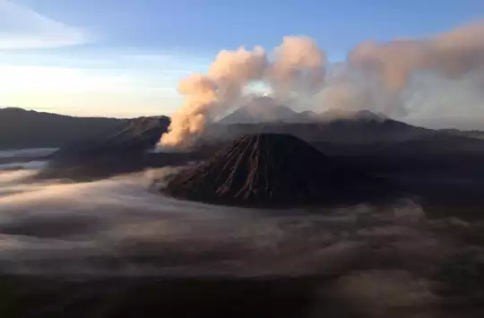
Your legs burn as you push through the final switchbacks, the air thinning with each step, and then the crater rim opens before you: a vast volcanic bowl rimmed with sulfur vents that hiss and steam in the dawn light. Gunung Lawu, a 3,265-meter volcano straddling the border between East Java and Central Java, rewards climbers with one of Indonesia's most dramatic summit experiences. The hike is steep and relentless, but the payoff is immediate and visceral. Public transport gets you to the trailhead easily from nearby towns, and the route is well-established, making it far more accessible than the country's higher peaks. I remember standing at the crater edge, my breath visible in the cool air, watching sulfur smoke curl upward while the valley below dissolved into cloud. The climb demands respect but not mountaineering skill, and it fits neatly into a Java-based backpacking loop.

Discover everything you want to know in the 📖 Indonesia Travel Guide.
Best time to go: May - September
Duration: 2 days
Distance: 15 kilometers
Total ascent: 1,200 meters


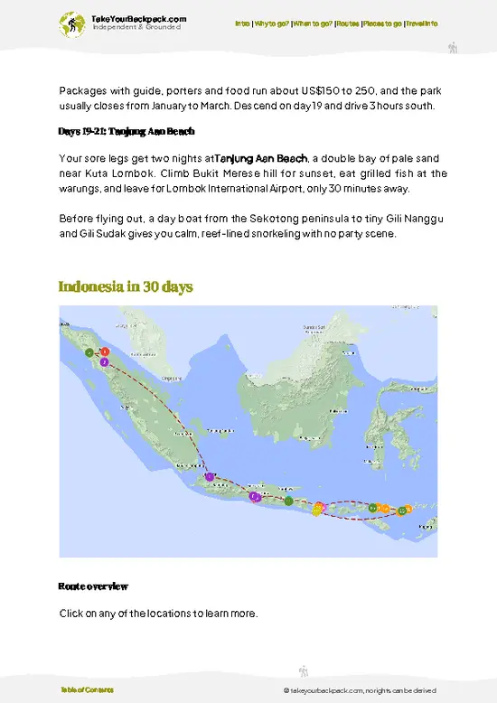
example page 0 from our offline Travel Guide for Indonesia
example page 1 from our offline Travel Guide for Indonesia
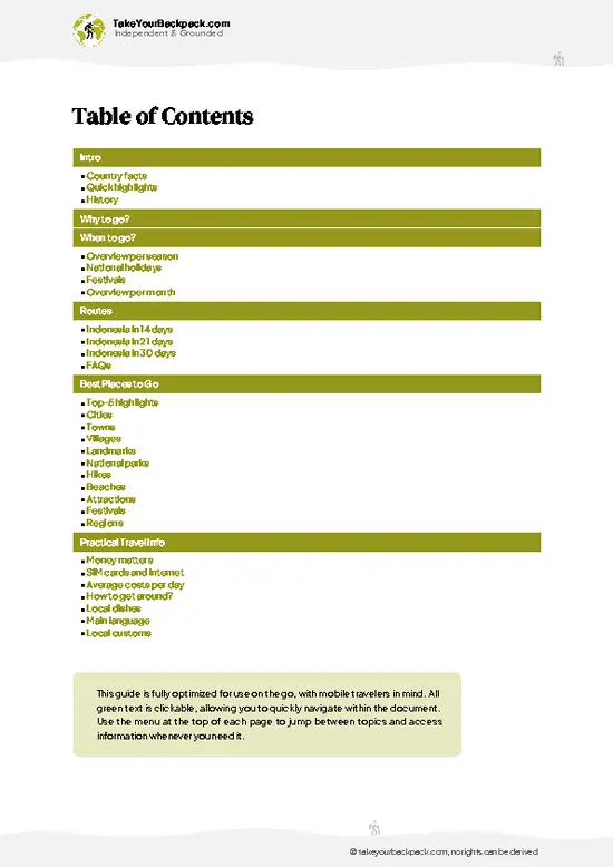
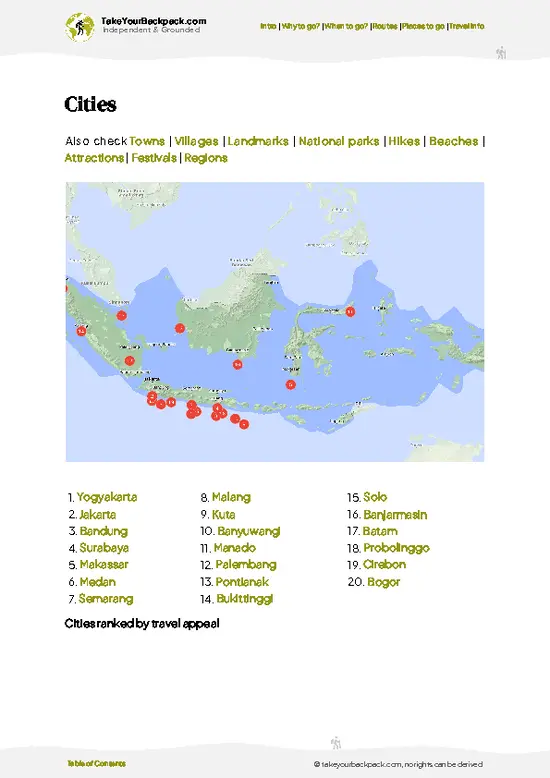
example page 2 from our offline Travel Guide for Indonesia
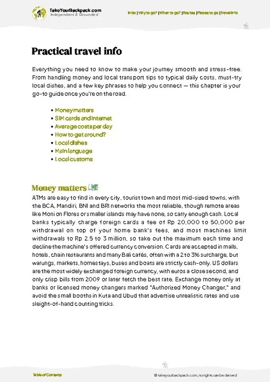
example page 3 from our offline Travel Guide for Indonesia
example page 4 from our offline Travel Guide for Indonesia
example page 5 from our offline Travel Guide for Indonesia
example page 6 from our offline Travel Guide for Indonesia
example page 7 from our offline Travel Guide for Indonesia
Loading the map 🌍
CLICK TO FILTER
cities
towns
villages
landmarks
national parks
hikes
beaches
attractions
festivals
regions
SHOW COUNTRY’S BESTSHOW ALL

✨ Why go?
Ranked #12 hike in Indonesia
Reasons people choose to hike the here

Gunung Lawu delivers dramatic volcanic scenery without requiring technical climbing skills or expensive guides. The steep but straightforward route means you gain serious elevation and reward in a single push, making it ideal for backpackers with limited time. Public transport access from Surabaya or Solo is reliable and cheap, and the mountain sits naturally on a Java itinerary between cultural sites. The sulfur crater and panoramic views of the surrounding highlands justify the effort, and the hike works as a day trip or overnight adventure depending on your pace. Accommodation and food near the trailhead are budget-friendly, and the trail itself is well-marked and popular enough that navigation is straightforward without a guide.

💡 HighlightsThe experiences that define the visit

  1. Candi Cetho Temple sits at 1,496 meters on the upper slopes, a 15th-century Hindu sanctuary with stone terraces and intricate carvings. The temple offers both cultural depth and a natural rest point during the climb, with views across the valley below.
  2. The Summit Plateau at 3,265 meters spreads across a wide, open expanse where you can watch sunrise paint the landscape in layers of color. On clear mornings, you see Mount Merapi and Mount Merbabu on the horizon, making the final push genuinely worthwhile.
  3. Cemoro Sewu Forest blankets the middle slopes with dense pine and cypress trees, creating a cool, shadowed corridor that feels like stepping into a different climate zone. The air shifts noticeably cooler and damper here, a sensory marker of elevation gain.
  4. Goa Gajah (Elephant Cave) sits partway
… read more 👉
  1. Candi Cetho Temple sits at 1,496 meters on the upper slopes, a 15th-century Hindu sanctuary with stone terraces and intricate carvings. The temple offers both cultural depth and a natural rest point during the climb, with views across the valley below.
  2. The Summit Plateau at 3,265 meters spreads across a wide, open expanse where you can watch sunrise paint the landscape in layers of color. On clear mornings, you see Mount Merapi and Mount Merbabu on the horizon, making the final push genuinely worthwhile.
  3. Cemoro Sewu Forest blankets the middle slopes with dense pine and cypress trees, creating a cool, shadowed corridor that feels like stepping into a different climate zone. The air shifts noticeably cooler and damper here, a sensory marker of elevation gain.
  4. Goa Gajah (Elephant Cave) sits partway up the mountain, a natural cave formation used historically as a meditation site. The cave offers shelter, a moment to rest, and a tangible connection to the mountain's spiritual significance for local communities.
  5. The Descent Ridge on the eastern side opens into panoramic views of agricultural terraces and distant peaks. The trail here is less crowded than the main route, offering solitude and a different perspective on the mountain's geography.
I'd pick the summit plateau first because that's where the effort converts into something you'll remember: standing at 3,265 meters with the island spreading below you, the air thin and clear, and the knowledge that you climbed it on foot.
Spotted a mistake or missing something? Contact us.

Things to do near Gunung Lawu

Ratings based on Tripadvisor reviews. When you book through this link, you support our work at no extra cost to you.

🌤️ When to go?Seasonal considerations and timing

  • Dry Season (May to September): The best window for hiking. Temperatures range from 15 to 25°C (59 to 77°F) at lower elevations, dropping to 5 to 10°C (41 to 50°F) near the summit. Trails are firm, visibility is excellent, and daylight stretches to about 12 hours. Crowds peak in July and August, especially on weekends. Accommodation prices rise 20 to 30 percent during these months.
  • Wet Season (October to April): Heavy rainfall, particularly November through March, makes trails slippery and navigation harder. Temperatures stay warmer, around 20 to 28°C (68 to 82°F) lower down, but clouds obscure views frequently. Fewer hikers mean quieter trails and lower prices. Early morning starts are essential to avoid afternoon downpours.
  • Shoulder Months (April and October): Unpredictable weather but manageable
… read more 👉
  • Dry Season (May to September): The best window for hiking. Temperatures range from 15 to 25°C (59 to 77°F) at lower elevations, dropping to 5 to 10°C (41 to 50°F) near the summit. Trails are firm, visibility is excellent, and daylight stretches to about 12 hours. Crowds peak in July and August, especially on weekends. Accommodation prices rise 20 to 30 percent during these months.
  • Wet Season (October to April): Heavy rainfall, particularly November through March, makes trails slippery and navigation harder. Temperatures stay warmer, around 20 to 28°C (68 to 82°F) lower down, but clouds obscure views frequently. Fewer hikers mean quieter trails and lower prices. Early morning starts are essential to avoid afternoon downpours.
  • Shoulder Months (April and October): Unpredictable weather but manageable conditions. Fewer crowds than peak season, prices are moderate, and you still get decent visibility on clear days.
Start your hike before dawn regardless of season; the summit view rewards early risers, and you'll descend before afternoon storms arrive.


source: climatestotravel.comJANJanuary: fair for travelingFEBFebruary: fair for travelingMARMarch: fair for travelingAPRApril: fair for travelingMAYMay: excellent for travelingJUNJune: excellent for travelingJULJuly: excellent for travelingAUGAugust: excellent for travelingSEPSeptember: excellent for travelingOCTOctober: fair for travelingNOVNovember: fair for travelingDECDecember: fair for traveling
when-to-go

✈️ The backpacker research shortcutIndonesia Travel Guide

An offline-friendly backpacking guide with optimized travel routes, ranked highlights, transport advice, and the best areas to stay.
example page 0 from our offline Travel Guide for Indonesia
example page 1 from our offline Travel Guide for Indonesia
example page 2 from our offline Travel Guide for Indonesia
example page 3 from our offline Travel Guide for Indonesia
example page 4 from our offline Travel Guide for Indonesia
example page 5 from our offline Travel Guide for Indonesia
example page 6 from our offline Travel Guide for Indonesia
example page 7 from our offline Travel Guide for Indonesia
The digital guide (460 pages) contains:
✅ 153 highlights, ranked by travel appeal
✅ Optimized 14, 21 & 30-day travel routes
✅ Cities, national parks, landmarks, beaches
✅ How to get around
✅ Offline-friendly for travel without Wi-Fi
👉 Click to see all 30+ guide features

📅 Plan smarter in minutes, not weeks
✅ Month by month travel advice
✅ Festivals & national holidays
✅ Budget expectations

🗺️ Go to the right places, skip the overrated ones
✅ Honest pros & cons of destinations
✅ Top hikes, parks & viewpoints
✅ Lesser-known places most travelers miss
✅ Clear “worth it vs skip it” guidance

🛏️ Travel smoothly without rookie mistakes
✅ Best areas to stay
✅ Transport systems explained simply
✅ Common scams & safety advice
✅ SIM cards, money & practical tips

🌍 Understand the country, not just visit it
✅ Culture & traditions
✅ 52 Essential phrases & customs
✅ Festivals worth planning around
✅ Traveler-friendly historical context
✅ Insights that make places more meaningful

📱 Built for real travel conditions
✅ Fully downloadable PDF
✅ Works completely offline
✅ Optimized for phone use
✅ Useful in remote areas & buses
✅ Everything in one place
Stop searching, start planning
Get instant access to your full guide. 30‑day money-back guarantee.
+ Add another guide for just

By proceeding you agree to our terms.
Sent to your inbox immediately after payment • 100% Secure Checkout
Best Backpacking Travel Advisor 2025 tourism awardBest Backpacking
Travel Advisor
2025
What others say about Take Your Backpack Guides:
⭐⭐⭐⭐⭐
Fantastic, amazing amount of information!
⭐⭐⭐⭐⭐
My goodness this is amazing, it's what I've been looking for hats off too you!
⭐⭐⭐⭐⭐
I think this is absolutely BRILLIANT
⭐⭐⭐⭐
Very complete and informative. It's still missing places, but I gotta to commend you
⭐⭐⭐⭐⭐
This is truly amazing, thank you, can't wait to explore it with my kids!
⭐⭐⭐⭐⭐
Awesome resource, thank you!
⭐⭐⭐⭐⭐
This is amazing! Can't wait to explore the ones I haven't seen
⭐⭐⭐⭐
I love this! Well done, great idea.
⭐⭐⭐⭐⭐
Thanks for taking the time to make this gem!
⭐⭐⭐⭐⭐
This might be the best website I've ever seen.
⭐⭐⭐⭐⭐
Congratulations, and thank you so much for your work; it's incredibly valuable.
⭐⭐⭐⭐
In all seriousness I think you did a great job pointing out the important spots
⭐⭐⭐⭐⭐
10/10 very good
⭐⭐⭐⭐⭐
As someone who's only just starting to visit regularly this is awesome, thank you.
⭐⭐⭐⭐
Thank you very much! I'm going to visit my dad, it's going to be very useful!
⭐⭐⭐⭐⭐
This is really cool! We'll be travelling for the first time and this definitely come in handy.
⭐⭐⭐⭐⭐
You are now our minister of culture, congratulations 👨‍💼
⭐⭐⭐⭐⭐
Just wanted to tell you that this is a pearl! Going to follow your recommendations.
⭐⭐⭐⭐⭐
This is so cool. I'll definitely be using the resource for my travels soon.
⭐⭐⭐⭐⭐
This is very impressive! Good work.
⭐⭐⭐⭐⭐
This is an amazing and informative site. Very well done!

🛏️ Where to stay?Choosing the right base

If you enjoy meeting fellow travelers, consider choosing hostels with high ratings for atmosphere. On the other hand, if you prefer having your own space, a hotel might be a better option.

🥾 Hike detailsTrail overview: what to expect on the hike

Total Distance: Approximately 12 kilometers round trip from the main trailhead at Cemoro Sewu.
Estimated Duration: 6 to 8 hours round trip, depending on fitness and pace. Most hikers start before dawn to summit at sunrise.
Difficulty: Moderate to moderately strenuous. The trail is steep and relentless, gaining roughly 1,200 meters of elevation, but requires no technical climbing or scrambling.
Starting Point: Cemoro Sewu parking area, accessible by minibus from Solo (1.5 hours) or Surabaya (3 to 4 hours). Local transport from either city is cheap and frequent. The trailhead is well-signposted.
Major
… read more 👉
Total Distance: Approximately 12 kilometers round trip from the main trailhead at Cemoro Sewu.
Estimated Duration: 6 to 8 hours round trip, depending on fitness and pace. Most hikers start before dawn to summit at sunrise.
Difficulty: Moderate to moderately strenuous. The trail is steep and relentless, gaining roughly 1,200 meters of elevation, but requires no technical climbing or scrambling.
Starting Point: Cemoro Sewu parking area, accessible by minibus from Solo (1.5 hours) or Surabaya (3 to 4 hours). Local transport from either city is cheap and frequent. The trailhead is well-signposted.
Major Landmarks:
  • Cemoro Sewu Forest: The lower forest zone with pine and oak trees, cooler and shadier than surrounding areas.
  • Kawah Candi: A secondary crater feature roughly halfway up, offering views and a natural rest point.
  • The Crater Rim: The summit destination, featuring active sulfur vents and panoramic views.
Terrain and Scenery: The trail climbs steeply through forest, then opens onto exposed volcanic slopes with sparse vegetation. The final approach crosses volcanic scree and rock.
Vegetation: Lower sections feature pine and oak forest; upper sections transition to alpine scrub and volcanic rock.
Wildlife: Occasional sightings of Java's endemic birds and small mammals, though wildlife encounters are uncommon on the main trail.
⚠️ Hiking info can sometimes be outdated or inaccurate. Before you hit the trail, check the latest conditions with locals. If you do spot anything that's off, I'd love to hear from you, so I can update it for fellow travelers.

🛡️ SafetyScams, Hazards, and Annoyances

The hike is straightforward and well-traveled, but the steep terrain and altitude demand respect. Start early to finish before afternoon clouds roll in, which reduces visibility and makes the descent riskier. Wear sturdy hiking boots with good grip; the volcanic rock and scree are loose and can shift underfoot, especially on descent. Bring more water than you think you'll need, as there are no reliable sources on the mountain. The sulfur vents at the crater are active but safe if you stay on the marked trail and avoid leaning over unstable edges. Weather can change quickly; even in dry season, afternoon rain is possible. Altitude is moderate, so acute mountain sickness is rare, but take the climb at a steady pace and rest as needed. The trail is popular and well-marked, so navigation is not an issue.

FAQCommon questions from travelers

The hike takes 6 to 8 hours round trip from Cemoro Sewu trailhead, with most hikers starting before dawn to reach the summit at sunrise. The ascent takes roughly 3 to 4 hours, and the descent 2 to 3 hours. Many climbers overnight near the trailhead and start the hike at 2 or 3 a.m. to catch the sunrise at the crater rim.
The hike is moderately strenuous, not technical. The main challenge is the steep, relentless gradient gaining 1,200 meters over 6 kilometers. There is no scrambling or exposed climbing, and the trail is well-marked and heavily traveled. Fitness matters more than experience; anyone comfortable with sustained uphill hiking can complete it.
No permit or guide is required. The trail is open to independent hikers, and the route is straightforward enough that navigation is easy without a guide. Many backpackers climb solo or in small groups. A guide is optional and useful only if you want cultural or geological context about the volcano.
⚠️ Things can change over time, so always validate details locally before you go.

Other Indonesian hikes near Gunung Lawu

Explore more nearby:

  • Gunung Merbabu—Open ridgelines, Selo basecamp, twin savannas, Merapi backdrop| 85 km away
  • Gunung Sumbing—Tobacco fields, steep Garung track, twin of Sindoro, rocky crater| 127 km away
  • Gunung Sindoro—Kledung route, dusty switchbacks, Temanggung, camp-and-summit| 137 km away

💡 Not sure where to go next?
Create a personalized itinerary for Indonesia including Gunung Lawu and the places that fit your trip.

Generate my itinerary

👉 Discover all hikes

Or checkout all Indonesia has to offer (think cities, towns, villages, national parks, hikes, beaches, festivals)
Country photo of Indonesia

We 💚 feedbackParting advice and final tips

Gunung Lawu delivers a genuine volcanic experience and serious views in a single day, making it one of Java's best value hikes. The main drawback is the relentless steepness, which can be punishing on tired legs during the descent. If you're fit and start early, it's absolutely worth the effort.

✈️ When did I visit Indonesia?
As part of my 1.5 year travel around the world trip, I visited Indonesia twice (and it was worth it): first in September 2015 and a bit later again in January and February 2016.

✍️ Help improve this page!
The information on this page is based on my own backpacking experience in Indonesia, supplemented with up-to-date research and feedback from other travelers. Travel details can change, so if you notice anything outdated or incomplete, feel free to let me know.


🙋‍♂️ Give feedback

👋 Meet the founderWho’s Behind Take Your Backpack?

Johan, backpacker and founder of TakeYourBackpackHi, I’m Johan (Netherlands 🇳🇱), the creator of TakeYourBackpack. Over the past 3 decades, I’ve backpacked through 90+ countries across six continents, gaining extensive experience with independent travel, long-term trips, and overland routes.

This site is built on a combination of firsthand travel experience and carefully curated insights from other backpackers. Many guides are based on places I’ve personally visited, while others bring together tips, observations, and practical advice shared by trusted travelers I’ve met along the way.

The goal is to provide realistic, experience-driven guidance — not generic itineraries — so you can explore destinations with better context, clearer expectations, and more confidence.