×

Kenya🇰🇪 | hikesOl Donyo Sabuksingle peak, montane forest, buffalo herds, distant city views | things to do and best time to go

Explore Menengai CraterExplore Taita Hills

Backpacking in Ol Donyo Sabuk
👀 For curious travelershike ranked #11
By Johan Kruseman 🇳🇱 | Updated June 8, 2026

Forget the idea that Ol Donyo Sabuk is just a lazy hill stroll for Nairobi day-trippers. This is a real climb—dusty switchbacks, sun on your neck, and the kind of relentless gradient that makes you question your breakfast choices. Ol Donyo Sabuk sits northeast of Nairobi, just outside Thika, and the hike is a 10-kilometer grind straight up to the summit. You’ll earn every panoramic sweep: the Athi plains, the snaking river, and on a clear day, Mount Kenya teasing you from the horizon. Public transport drops you at the park gate, but you’ll walk a few extra kilometers before the real ascent even begins. Compared to the lush chaos of Karura Forest or the volcanic drama of Mount Longonot, Ol Donyo Sabuk is raw, exposed, and honest—no shade, no shortcuts, but the summit view and that first gulp of water at the top are pure, earned satisfaction.

Discover everything you want to know in the 📖 Kenya Travel Guide.
Best time to go: May - March
Duration: 2 days
Distance: 14 kilometers
Total ascent: 1,200 meters


Get your Kenya guide
114 ranked highlights, routes & tips, works offline (429 pages)
Loading the map 🌍
CLICK TO FILTER
cities
towns
landmarks
national parks
hikes
beaches
attractions
festivals
regions
SHOW COUNTRY’S BESTSHOW ALL

✨ Why go?
Ranked #11 hike in Kenya
Why visitors keep coming back

The hike up Ol Donyo Sabuk is a magnet for backpackers craving a blend of challenge and reward. With a scenery-to-effort ratio that’s hard to beat, you’ll find yourself surrounded by lush forests, vibrant wildlife, and panoramic views that stretch for miles. The trail is accessible via public transport, making it a breeze to reach from Nairobi.

Cost? Minimal. You can tackle this trek without breaking the bank, which is a huge plus for budget-conscious travelers. The flexible distances allow you to tailor your hike, whether you’re in for a quick ascent or a more leisurely exploration.

As you climb, the burn in your legs is matched only by the exhilaration of standing at the summit, where the world unfolds beneath you. It’s a perfect fit in a longer backpacking route, offering a refreshing … read more 👉
The hike up Ol Donyo Sabuk is a magnet for backpackers craving a blend of challenge and reward. With a scenery-to-effort ratio that’s hard to beat, you’ll find yourself surrounded by lush forests, vibrant wildlife, and panoramic views that stretch for miles. The trail is accessible via public transport, making it a breeze to reach from Nairobi.

Cost? Minimal. You can tackle this trek without breaking the bank, which is a huge plus for budget-conscious travelers. The flexible distances allow you to tailor your hike, whether you’re in for a quick ascent or a more leisurely exploration.

As you climb, the burn in your legs is matched only by the exhilaration of standing at the summit, where the world unfolds beneath you. It’s a perfect fit in a longer backpacking route, offering a refreshing detour that packs a punch. This is where the journey becomes as rewarding as the destination.
Want to include Ol Donyo Sabuk in your Kenya route?
Create a personalized Kenya itinerary that includes Ol Donyo Sabuk and the places that fit your trip — based on your travel style, budget, and available time. Get your route in seconds.

Generate my trip

💡 HighlightsEssential experiences to have while hiking the Ol Donyo Sabuk

  1. Summit viewpoint — A short-but-steady climb rewards you with sweeping views over the Athi plains and surrounding highlands; the panorama changes fast with the light, making sunrise or late-afternoon climbs especially worth it. It’s a proper summit feeling without the hours of approach you get on bigger peaks.
  2. Granite domes and boulder scrambles — The mountain’s rocky outcrops are classic inselberg granite: smooth slabs, stacked boulders and little chimneys that make the final sections more of a fun scramble than a flat trail. Great for photos and a bit of playful scrambling that breaks up the walk.
  3. Remnant indigenous forest — Sections of shady, older forest cling to the slopes, with different plant layers and cooler air than the surrounding plains. Birdwatchers notice species you won’t
read more 👉
  1. Summit viewpoint — A short-but-steady climb rewards you with sweeping views over the Athi plains and surrounding highlands; the panorama changes fast with the light, making sunrise or late-afternoon climbs especially worth it. It’s a proper summit feeling without the hours of approach you get on bigger peaks.
  2. Granite domes and boulder scrambles — The mountain’s rocky outcrops are classic inselberg granite: smooth slabs, stacked boulders and little chimneys that make the final sections more of a fun scramble than a flat trail. Great for photos and a bit of playful scrambling that breaks up the walk.
  3. Remnant indigenous forest — Sections of shady, older forest cling to the slopes, with different plant layers and cooler air than the surrounding plains. Birdwatchers notice species you won’t see on open savannahs — turacos, sunbirds and loud forest-dwelling parrots are common.
  4. Wildlife close to the trail — Expect small, close encounters rather than safari-sized sightings: troops of monkeys, bushbuck and the occasional small buffalo herd move through the park. Animals here are used to hikers, so you get honest, low-key wildlife moments rather than staged views.
  5. Local villages and smallholder landscapes — The approach goes past Kamba farms and small villages, so the hike includes a human landscape: terraced plots, coffee/maize plots and the chance to meet local guides or farmers. It’s a convenient cultural flavour that makes the trip feel like a real day out from Nairobi rather than a sterile nature walk.
Spotted a mistake or missing something? Contact us.

Things to do near Ol Donyo Sabuk

Ratings based on Tripadvisor reviews. When you book through this link, you support our work at no extra cost to you.

🌤️ When to go?Best time to hike the Ol Donyo Sabuk


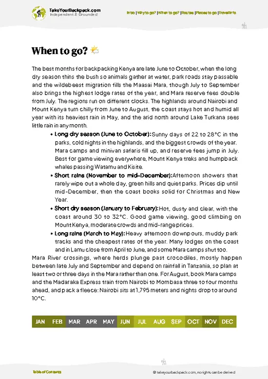
  • Weather: The dry seasons, from June to October and January to February, offer the best hiking conditions. Trails stay firm, and the risk of slipping on mud or facing sudden downpours drops sharply.

  • Temperature: Daytime highs hover around 20-25°C (68-77°F), perfect for sustained effort without overheating. Nights can dip to 10°C (50°F), so pack a light jacket for early mornings and evenings.

  • Daylight Hours: Expect roughly 11 to 12 hours of daylight, enough to start early and finish your trek without rushing, but not so long that you lose track of time on the trail.

  • Crowds: Peak tourist months (July and August) bring more hikers, which means busier trails and less solitude. Off-peak months offer a quieter, more personal experience.

  • Seasonal Activities: Dry seasons coincide with local
read more 👉

  • Weather: The dry seasons, from June to October and January to February, offer the best hiking conditions. Trails stay firm, and the risk of slipping on mud or facing sudden downpours drops sharply.

  • Temperature: Daytime highs hover around 20-25°C (68-77°F), perfect for sustained effort without overheating. Nights can dip to 10°C (50°F), so pack a light jacket for early mornings and evenings.

  • Daylight Hours: Expect roughly 11 to 12 hours of daylight, enough to start early and finish your trek without rushing, but not so long that you lose track of time on the trail.

  • Crowds: Peak tourist months (July and August) bring more hikers, which means busier trails and less solitude. Off-peak months offer a quieter, more personal experience.

  • Seasonal Activities: Dry seasons coincide with local wildlife viewing opportunities and cultural events, adding layers to your backpacking adventure beyond the climb.

  • Price Fluctuations: Accommodation and guide fees spike during peak months. Booking in shoulder seasons can save money without sacrificing trail conditions.


Pro-tip: Aim for early dry season hikes—trails are solid, crowds thin, and you’ll catch the landscape waking up after rains, fresh and vibrant.


source: climatestotravel.comJANJanuary: excellent for travelingFEBFebruary: excellent for travelingMARMarch: good for travelingAPRApril: fair for travelingMAYMay: good for travelingJUNJune: excellent for travelingJULJuly: highly recommended for travelingAUGAugust: highly recommended for travelingSEPSeptember: excellent for travelingOCTOctober: excellent for travelingNOVNovember: good for travelingDECDecember: good for traveling
when-to-go

✈️ The backpacker research shortcutKenya Travel Guide

An offline-friendly backpacking guide with optimized travel routes, ranked highlights, transport advice, and the best areas to stay.
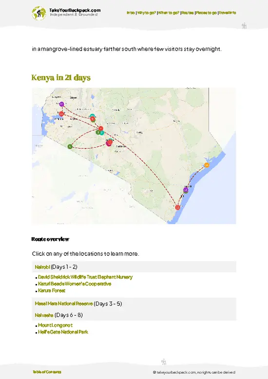
example page 0 from our offline Travel Guide for Kenya
example page 1 from our offline Travel Guide for Kenya
example page 2 from our offline Travel Guide for Kenya
example page 3 from our offline Travel Guide for Kenya
example page 4 from our offline Travel Guide for Kenya
example page 5 from our offline Travel Guide for Kenya
example page 6 from our offline Travel Guide for Kenya
example page 7 from our offline Travel Guide for Kenya
The digital guide (429 pages) contains:
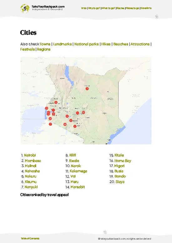
114 highlights, ranked by travel appeal
Optimized 7, 14 & 21-day travel routes
Cities, national parks, landmarks, beaches
How to get around
Offline-friendly for travel without Wi-Fi
👉 Click to see all 30+ guide features

📅 Plan smarter in minutes, not weeks
Month by month travel advice
Festivals & national holidays
Budget expectations

🗺️ Go to the right places, skip the overrated ones
Honest pros & cons of destinations
Top hikes, parks & viewpoints
Lesser-known places most travelers miss
Clear “worth it vs skip it” guidance

🛏️ Travel smoothly without rookie mistakes
Best areas to stay
Transport systems explained simply
Common scams & safety advice
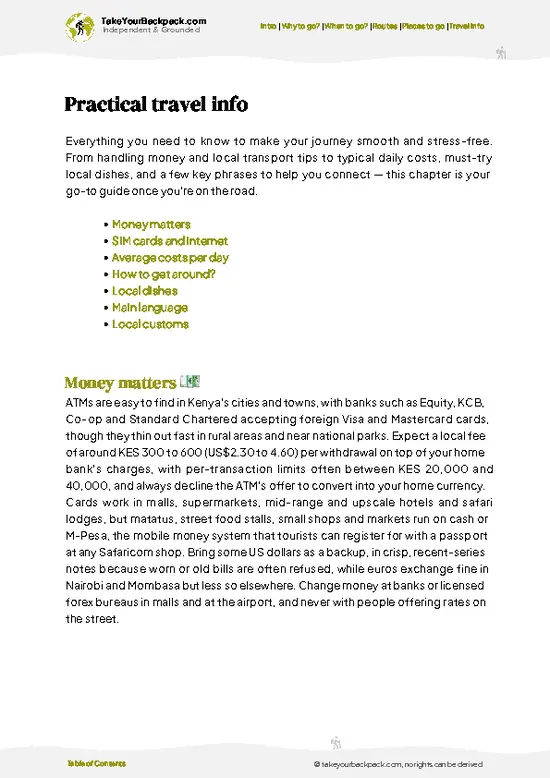
SIM cards, money & practical tips

🌍 Understand the country, not just visit it
Culture & traditions
52 Essential phrases & customs
Festivals worth planning around
Traveler-friendly historical context
Insights that make places more meaningful

📱 Built for real travel conditions
Fully downloadable PDF
Works completely offline
Optimized for phone use
Useful in remote areas & buses
Everything in one place
Save weeks of stressful planning
Get instant access to your full guide. 30‑day money-back guarantee.


By proceeding you agree to our terms.
Sent to your inbox immediately after payment • 100% Secure Checkout
Best Backpacking Travel Advisor 2025 tourism awardBest Backpacking
Travel Advisor
2025
What others say about Take Your Backpack Guides:
⭐⭐⭐⭐⭐
Fantastic, amazing amount of information!
⭐⭐⭐⭐⭐
My goodness this is amazing, it's what I've been looking for hats off too you!
⭐⭐⭐⭐⭐
I think this is absolutely BRILLIANT
⭐⭐⭐⭐
Very complete and informative. It's still missing places, but I gotta to commend you
⭐⭐⭐⭐⭐
This is truly amazing, thank you, can't wait to explore it with my kids!
⭐⭐⭐⭐⭐
Awesome resource, thank you!
⭐⭐⭐⭐⭐
This is amazing! Can't wait to explore the ones I haven't seen
⭐⭐⭐⭐
I love this! Well done, great idea.
⭐⭐⭐⭐⭐
Thanks for taking the time to make this gem!
⭐⭐⭐⭐⭐
This might be the best website I've ever seen.
⭐⭐⭐⭐⭐
Congratulations, and thank you so much for your work; it's incredibly valuable.
⭐⭐⭐⭐
In all seriousness I think you did a great job pointing out the important spots
⭐⭐⭐⭐⭐
10/10 very good
⭐⭐⭐⭐⭐
As someone who's only just starting to visit regularly this is awesome, thank you.
⭐⭐⭐⭐
Thank you very much! I'm going to visit my dad, it's going to be very useful!
⭐⭐⭐⭐⭐
This is really cool! We'll be travelling for the first time and this definitely come in handy.
⭐⭐⭐⭐⭐
You are now our minister of culture, congratulations 👨‍💼
⭐⭐⭐⭐⭐
Just wanted to tell you that this is a pearl! Going to follow your recommendations.
⭐⭐⭐⭐⭐
This is so cool. I'll definitely be using the resource for my travels soon.
⭐⭐⭐⭐⭐
This is very impressive! Good work.
⭐⭐⭐⭐⭐
This is an amazing and informative site. Very well done!

🛏️ Where to stay?Best areas and accommodation options

If you enjoy meeting fellow travelers, consider choosing hostels with high ratings for atmosphere. On the other hand, if you prefer having your own space, a hotel might be a better option.

🥾 Hike detailsEverything you need to know before hiking Ol Donyo Sabuk

Total Distance: The Ol Donyo Sabuk trail spans approximately 14 kilometers (about 8.7 miles) round trip. It’s a decent length for a day hike, but you’ll want to pace yourself.

Estimated Duration: Plan for around 4 to 6 hours to complete the hike. This includes time for breaks and soaking in the views, which are definitely worth it.

Difficulty Level: The trail is generally considered moderate. There are some steep sections, especially as you approach the summit, but it’s manageable for most hikers with a reasonable fitness level.

Starting Point: The hike begins at the Ol Donyo Sabuk National … read more 👉
Total Distance: The Ol Donyo Sabuk trail spans approximately 14 kilometers (about 8.7 miles) round trip. It’s a decent length for a day hike, but you’ll want to pace yourself.

Estimated Duration: Plan for around 4 to 6 hours to complete the hike. This includes time for breaks and soaking in the views, which are definitely worth it.

Difficulty Level: The trail is generally considered moderate. There are some steep sections, especially as you approach the summit, but it’s manageable for most hikers with a reasonable fitness level.

Starting Point: The hike begins at the Ol Donyo Sabuk National Park entrance. To get there by public transport, you can catch a matatu (shared minibus) from Nairobi to Machakos. Once in Machakos, look for another matatu heading toward the park entrance. It’s a bit of a hassle, but the journey adds to the adventure.

Major Landmarks Along the Route:
  • Park Entrance: This is where you’ll pay your entry fee and get any necessary permits.
  • Viewpoints: There are several stunning viewpoints along the way where you can catch breathtaking panoramas of the surrounding landscape, including Mount Kenya on a clear day.
  • Summit: The peak offers a 360-degree view, making it a perfect spot for a picnic or just to catch your breath.

Type of Terrain and Scenery: Expect a mix of rocky paths and well-trodden trails. The ascent can be steep in places, but the paths are generally clear. The scenery transitions from dense forest at the base to more open grasslands and rocky outcrops as you climb higher.

Typical Vegetation and Wildlife:
  • Vegetation: You’ll find a variety of flora, including acacia trees and various shrubs. The higher you go, the more you’ll see unique alpine plants.
  • Wildlife: Keep an eye out for monkeys, various bird species, and maybe even some antelope. The park is home to a range of wildlife, but spotting them can be hit or miss.

Pack plenty of water, wear good shoes, and maybe bring a light jacket for the summit. Enjoy the hike!
⚠️ Hiking info can sometimes be outdated or inaccurate. Before you hit the trail, check the latest conditions with locals. If you do spot anything that's off, I'd love to hear from you, so I can update it for fellow travelers.

🛡️ SafetyStaying Safe: What Travelers Should Know

The hike up Ol Donyo Sabuk is a thrilling blend of challenge and reward. Expect variable weather; mornings can be crisp, while afternoons heat up quickly. Dress in layers to adapt. The terrain is mostly well-defined, but some sections are steep and rocky, so good hiking boots are essential for grip and support.

Wildlife encounters are part of the experience—keep your distance from any animals you spot, especially elephants. They’re majestic but should be respected.

Timing is key; start early to avoid the midday sun and enjoy cooler temperatures. Carry enough water, as hydration is crucial. The trail is manageable, but a steady pace will help you savor the views as they unfold. The summit offers a breathtaking panorama that makes every step worthwhile.

Other Kenyan hikes near Ol Donyo Sabuk

Explore more nearby:

  • Karura Forest—urban woodland, waterfalls, cycling trails, shaded paths| 49 km away
  • Ngong Hills—windy ridgeline, rolling summits, Nairobi views, open grassland| 75 km away
  • Mount Longonot—steep crater rim, volcanic ash, Rift Valley panorama, open savanna| 92 km away

💡 Not sure where to go next?
Create a personalized itinerary for Kenya including Ol Donyo Sabuk and the places that fit your trip.

Generate my itinerary

👉 Discover all hikes

Or checkout all Kenya has to offer (think cities, towns, villages, national parks, hikes, beaches, festivals)
Country photo of Kenya

We 💚 feedbackWhat to keep in mind

Ol Donyo Sabuk is a raw, untamed slice of Kenya that gets under your skin. The trails are steep and the air is thick with the scent of earth and sweat, but when you reach that summit, the view is a heart-stopper. Expect a few surprises—like a herd of elephants crossing your path. Just watch out for the weather; it can turn on you fast. Embrace the grit, and you’ll leave with stories that stick.

✍️ Help improve this page!
The information on this page is based on in-depth research, insights shared by experienced travelers, and feedback from the local travel community in Kenya. While every effort is made to keep the information accurate and current, conditions can change — so if you spot anything incorrect or outdated, please get in touch.


🙋‍♂️ Give feedback

👋 Meet the founderWho’s Behind Take Your Backpack?

Johan, backpacker and founder of TakeYourBackpackHi, I’m Johan (Netherlands 🇳🇱), the creator of TakeYourBackpack. Over the past decade, I’ve backpacked through 80+ countries across six continents, gaining extensive experience with independent travel, long-term trips, and overland routes.

This site is built on a combination of firsthand travel experience and carefully curated insights from other backpackers. Many guides are based on places I’ve personally visited, while others bring together tips, observations, and practical advice shared by trusted travelers I’ve met along the way.

The goal is to provide realistic, experience-driven guidance — not generic itineraries — so you can explore destinations with better context, clearer expectations, and more confidence.

Get full Kenya guide •
Instant download • 114 highlights • Full Offline guide