×

Mali🇲🇱 | national parksWongo National ParkManding escarpments, Falémé valley, rocky gullies, chimpanzee hills | things to do and best time to go

Explore Kouroufing National ParkExplore Fina Reserve

Backpacking in Wongo
👀 For curious travelersnational park ranked #8
By Johan Kruseman 🇳🇱 | Updated October 22, 2026

Wongo National Park has no marked trail network, ranger-run visitor center or ticket booth, so plan it as a guided bush trip rather than a park visit. It lies in western Mali, in the Kayes region toward the Falémé River and the Senegal border. The scenery is real: sandstone escarpments, dry savanna woodland and river valleys with almost no other visitors. The wildlife is shy, and you should expect birds, tracks and the chance of primates rather than a safari checklist. Roads are rough and slow, so build in spare days or a missed connection will eat your budget. Hire a local guide through the nearest town before you set out, because wandering alone costs you time and wrong turns. Check current security advice for the Kayes region before committing. Carry far more water than you think you need.

Discover everything you want to know in the 📖 Mali Travel Guide.
Safety warning

The current risk level for Mali is high. Check the advice before going.


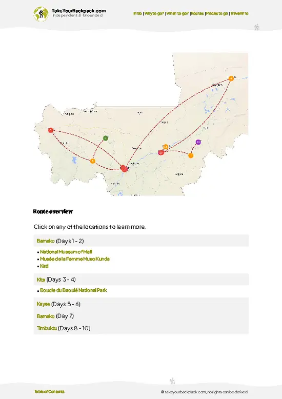
example page 0 from our offline Travel Guide for Mali
example page 1 from our offline Travel Guide for Mali
example page 2 from our offline Travel Guide for Mali
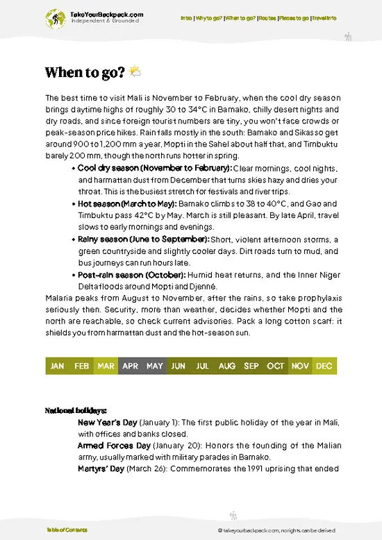
example page 3 from our offline Travel Guide for Mali
example page 4 from our offline Travel Guide for Mali
example page 5 from our offline Travel Guide for Mali
example page 6 from our offline Travel Guide for Mali
example page 7 from our offline Travel Guide for Mali
Loading the map 🌍
CLICK TO FILTER
cities
towns
landmarks
national parks
hikes
attractions
festivals
regions
SHOW COUNTRY’S BESTSHOW ALL

✨ Why go?
Ranked #8 national park in Mali
The unique appeal for travelers

Wongo National Park suits backpackers who prefer working things out on foot with a local guide over joining a convoy of jeeps. The first draw is the sandstone escarpments of the Manding plateau, where you can scramble up to ledges that look over open savanna and see the landscape run for kilometers with no road or roofline in sight. The second is the Falémé River corridor, a green ribbon in dry country where birdlife concentrates and the walking turns cooler and shadier. Nobody sells packages here, so you set the pace, stop where the view is good and sleep where villagers can host you or where your own tent fits. That freedom has a price in planning, but for travelers who like rough edges and empty ground it is exactly the point. Bring your own food, a water filter and patience.

💡 HighlightsTop highlights of Wongo

  1. Manding plateau escarpments: The sandstone cliffs and ledges are the park’s signature landscape. Climb to a rim for wide views across savanna and rocky gullies.
  2. Falémé River valley: The river keeps the vegetation green long after the surrounding grass has turned straw yellow. Expect kingfishers, herons and other water birds along the banks.
  3. Savanna woodland walks: Open woodland of tall grasses and hardy trees makes for easy walking on footpaths used by herders and villagers. Look for animal tracks in the soft ground.
  4. Chimpanzee country: This part of western Mali is home to West African chimpanzees, which are rarely seen and need patient listening. Pant-hoots at dawn from hillside forest patches are the likeliest encounter.
  5. Rocky gullies and seasonal streams: Cut into the plateau, these shaded
… read more 👉
  1. Manding plateau escarpments: The sandstone cliffs and ledges are the park’s signature landscape. Climb to a rim for wide views across savanna and rocky gullies.
  2. Falémé River valley: The river keeps the vegetation green long after the surrounding grass has turned straw yellow. Expect kingfishers, herons and other water birds along the banks.
  3. Savanna woodland walks: Open woodland of tall grasses and hardy trees makes for easy walking on footpaths used by herders and villagers. Look for animal tracks in the soft ground.
  4. Chimpanzee country: This part of western Mali is home to West African chimpanzees, which are rarely seen and need patient listening. Pant-hoots at dawn from hillside forest patches are the likeliest encounter.
  5. Rocky gullies and seasonal streams: Cut into the plateau, these shaded ravines hold pools and ferns in the cooler months and make good rest stops.
  6. Village life on the park edge: Walking between farming hamlets shows the working landscape of millet fields, mango trees and water-fetching trails.
Start with the escarpment rim, because a single high viewpoint shows you how the river, woodland and gullies connect and helps you choose where to walk next.
Spotted a mistake or missing something? Contact us.

🌤️ When to go?When to go for the best experience

  • Cool Dry Season (November to February): Mornings start around 18 to 22°C (64 to 72°F) and afternoons reach 32 to 35°C (90 to 95°F). Dust-laden Harmattan wind can haze the views in January and February. Nights are cool enough for a light layer.
  • Hot Season (March to May): Afternoons climb to 38 to 43°C (100 to 109°F), and walking becomes a dawn-only activity. Waterholes shrink, which makes animals easier to find.
  • Rainy Season (June to October): Highs of 30 to 35°C (86 to 95°F), heavy storms in July and August, flooded tracks and tall grass. Access gets unreliable and the park is nearly empty.
  • Crowds and Prices: Visitors are very few in any month. Guide and vehicle rates in Kéniéba and Kayes edge up slightly in the cool season.
Days run roughly 11 to 13 hours of light, so plan your trek around the dry months from late November onward.

source: climatestotravel.comJANJanuary: excellent for travelingFEBFebruary: highly recommended for travelingMARMarch: good for travelingAPRApril: fair for travelingMAYMay: fair for travelingJUNJune: below average for travelingJULJuly: below average for travelingAUGAugust: below average for travelingSEPSeptember: below average for travelingOCTOctober: fair for travelingNOVNovember: highly recommended for travelingDECDecember: excellent for traveling
when-to-go

✈️ The backpacker research shortcutMali Travel Guide

An offline-friendly backpacking guide with optimized travel routes, ranked highlights, transport advice, and the best areas to stay.
example page 0 from our offline Travel Guide for Mali
example page 1 from our offline Travel Guide for Mali
example page 2 from our offline Travel Guide for Mali
example page 3 from our offline Travel Guide for Mali
example page 4 from our offline Travel Guide for Mali
example page 5 from our offline Travel Guide for Mali
example page 6 from our offline Travel Guide for Mali
example page 7 from our offline Travel Guide for Mali
The digital guide (266 pages) contains:
✅ 61 highlights, ranked by travel appeal
✅ Optimized 5, 10 & 15-day travel routes
✅ Cities, national parks, landmarks, beaches
✅ How to get around
✅ Offline-friendly for travel without Wi-Fi
👉 Click to see all 30+ guide features

📅 Plan smarter in minutes, not weeks
✅ Month by month travel advice
✅ Festivals & national holidays
✅ Budget expectations

🗺️ Go to the right places, skip the overrated ones
✅ Honest pros & cons of destinations
✅ Top hikes, parks & viewpoints
✅ Lesser-known places most travelers miss
✅ Clear “worth it vs skip it” guidance

🛏️ Travel smoothly without rookie mistakes
✅ Best areas to stay
✅ Transport systems explained simply
✅ Common scams & safety advice
✅ SIM cards, money & practical tips

🌍 Understand the country, not just visit it
✅ Culture & traditions
✅ 52 Essential phrases & customs
✅ Festivals worth planning around
✅ Traveler-friendly historical context
✅ Insights that make places more meaningful

📱 Built for real travel conditions
✅ Fully downloadable PDF
✅ Works completely offline
✅ Optimized for phone use
✅ Useful in remote areas & buses
✅ Everything in one place
Stop searching, start planning
Get instant access to your full guide. 30‑day money-back guarantee.
+ Add another guide for just

By proceeding you agree to our terms.
Sent to your inbox immediately after payment • 100% Secure Checkout
Best Backpacking Travel Advisor 2025 tourism awardBest Backpacking
Travel Advisor
2025
What others say about Take Your Backpack Guides:
⭐⭐⭐⭐⭐
Fantastic, amazing amount of information!
⭐⭐⭐⭐⭐
My goodness this is amazing, it's what I've been looking for hats off too you!
⭐⭐⭐⭐⭐
I think this is absolutely BRILLIANT
⭐⭐⭐⭐
Very complete and informative. It's still missing places, but I gotta to commend you
⭐⭐⭐⭐⭐
This is truly amazing, thank you, can't wait to explore it with my kids!
⭐⭐⭐⭐⭐
Awesome resource, thank you!
⭐⭐⭐⭐⭐
This is amazing! Can't wait to explore the ones I haven't seen
⭐⭐⭐⭐
I love this! Well done, great idea.
⭐⭐⭐⭐⭐
Thanks for taking the time to make this gem!
⭐⭐⭐⭐⭐
This might be the best website I've ever seen.
⭐⭐⭐⭐⭐
Congratulations, and thank you so much for your work; it's incredibly valuable.
⭐⭐⭐⭐
In all seriousness I think you did a great job pointing out the important spots
⭐⭐⭐⭐⭐
10/10 very good
⭐⭐⭐⭐⭐
As someone who's only just starting to visit regularly this is awesome, thank you.
⭐⭐⭐⭐
Thank you very much! I'm going to visit my dad, it's going to be very useful!
⭐⭐⭐⭐⭐
This is really cool! We'll be travelling for the first time and this definitely come in handy.
⭐⭐⭐⭐⭐
You are now our minister of culture, congratulations 👨‍💼
⭐⭐⭐⭐⭐
Just wanted to tell you that this is a pearl! Going to follow your recommendations.
⭐⭐⭐⭐⭐
This is so cool. I'll definitely be using the resource for my travels soon.
⭐⭐⭐⭐⭐
This is very impressive! Good work.
⭐⭐⭐⭐⭐
This is an amazing and informative site. Very well done!

🛏️ Where to stay?How to pick the right area

No lodging exists inside Wongo National Park, so you stay in towns nearby and arrange guided visits from there. Kéniéba is the closest practical base, a small market town in the Kéniéba cercle with a few simple guesthouses and rooms at roughly €8 to 20 a night. Expect basic bedding, bucket showers and patchy electricity. Bring a sleeping sheet and a head torch. Kayes, the regional capital, has more choice, including a handful of modest hotels with air conditioning at €25 to 45 a night, and it is where you can stock up on supplies, cash and transport before heading south. Bamako has the full range, … read more 👉
No lodging exists inside Wongo National Park, so you stay in towns nearby and arrange guided visits from there. Kéniéba is the closest practical base, a small market town in the Kéniéba cercle with a few simple guesthouses and rooms at roughly €8 to 20 a night. Expect basic bedding, bucket showers and patchy electricity. Bring a sleeping sheet and a head torch. Kayes, the regional capital, has more choice, including a handful of modest hotels with air conditioning at €25 to 45 a night, and it is where you can stock up on supplies, cash and transport before heading south. Bamako has the full range, from hostels at €10 to 15 to mid-range hotels, and it is where most journeys begin. Wild camping near the park is possible only with permission from village chiefs and a local guide. Ask the community first, never pitch unannounced, and carry all your own water and food.

👛 Costs (as of 22 October 2026)Money, prices, and spending tips

A realistic budget for Wongo National Park is about €36 to 80 per day for a backpacker who hires a guide and moves by local transport. The park is remote and rarely visited, so costs depend largely on arranging a guide and a vehicle.
CategoryBudget RangeLocal Reality
Entrance and guide€8 to 20Any fee is informal and paid locally; a guide is the real cost
Accommodation (high season)€8 to 20Simple rooms in Kéniéba or village hosts
Local transport€15 to 30Shared bush taxi to Kéniéba, then a hired motorbike or 4x4 share
Food and supplies€5 to 10Rice, grilled meat and sauces at roadside stalls; bring snacks and water
Total Daily Budget€36 to 80About €58 on a typical day
Everything is paid in cash, in West African francs, and there are no card machines near the park, so withdraw in Bamako or Kayes.
⚠️ Prices can change and everyone travels differently, so take this as a rough guide. Hope it helps you plan your adventure!

🥾 TrailsHiking Wongo national park: highlights and difficulty

Wongo National Park has no signposted, named trails, so the walks people actually do are guide-led routes starting from the villages along the park edge. Distances and times depend on your guide and the heat. The list below describes the walks as they typically unfold.
  • Escarpment rim walk: Start at a village at the foot of the plateau and climb a rocky footpath to the rim. Allow a half day. Terrain is loose sandstone and steep in places, moderate in difficulty.
  • River valley stroll: Follow herders’ paths along the Falémé River through shady trees and grassy flats. Easy, flat and best for birdwatching.
… read more 👉
Wongo National Park has no signposted, named trails, so the walks people actually do are guide-led routes starting from the villages along the park edge. Distances and times depend on your guide and the heat. The list below describes the walks as they typically unfold.
  • Escarpment rim walk: Start at a village at the foot of the plateau and climb a rocky footpath to the rim. Allow a half day. Terrain is loose sandstone and steep in places, moderate in difficulty.
  • River valley stroll: Follow herders’ paths along the Falémé River through shady trees and grassy flats. Easy, flat and best for birdwatching. A few hours is enough.
  • Gully and stream route: Scramble up dry stream beds cut into the plateau. Moderate, with uneven rock underfoot and little shade once you leave the gully.
  • Full-day plateau circuit: Link the rim, woodland and river into a long loop with a guide. Hard, with the heat and distance the main challenges.
Wildlife is elusive. Birds are the most reliable sighting, while primates and larger animals call for a quiet group and early starts. Getting here means long, rough road stretches, and public transport is thin and unpredictable, so many travelers arrange a local driver for the final leg. Crowds are essentially nonexistent. I know of no formal entrance fee system, so expect to pay for your guide and local hospitality directly, and carry cash since there are no ATMs nearby.
⚠️ Hiking info can sometimes be outdated or inaccurate. Before you hit the trail, check the latest conditions with locals. If you do spot anything that's off, I'd love to hear from you, so I can update it for fellow travelers.

🛡️ SafetyStaying Safe: What Travelers Should Know

Wongo National Park is remote and lightly managed, so self-reliance matters more than any single hazard. Heat is the main issue. From March to May, start walking at first light, stop by late morning, and carry at least 4 to 5 liters of water per person because sources are unreliable. Trails are often faint tracks through savanna and rocky outcrops, so hire a local guide and keep a offline map. Rainy-season storms flood streams and make roads impassable. Wildlife is elusive and mostly small antelope, monkeys and baboons. Give any animal distance, never feed them, and avoid thick grass at dusk where snakes rest. Malaria is present, so take prophylaxis and use repellent. Check current security advice for the region before you travel, as conditions in western Mali can change, and carry a first-aid kit and a charged phone.

FAQTraveler FAQ

Plan on 2 to 3 days for Wongo National Park, not counting travel. Reaching the area from Bamako takes a long day or more by road via Kayes and Kéniéba, so a day to arrive, a full day with a guide on foot and a spare day for delays is realistic.
Visiting Wongo National Park without a car is possible but slow. Buses and shared taxis run from Bamako to Kayes and on to Kéniéba, a journey of roughly 10 to 14 hours or more, and from there you hire a motorbike or local vehicle with a driver for about €15 to 30 a day.
Wongo National Park has no formal ticketing system that travelers can rely on, so any fee is usually small and arranged locally, around €5 to 15 with your guide. Ask the local authorities or village chief in Kéniéba for permission before entering, and check current regional travel advice, as access can be restricted.
⚠️ Things can change over time, so always validate details locally before you go.

Other Malian national parks near Wongo

Explore more nearby:


💡 Not sure where to go next?
Create a personalized itinerary for Mali including Wongo and the places that fit your trip.

Generate my itinerary

👉 Discover all national parks

Or checkout all Mali has to offer (think cities, towns, villages, national parks, hikes, beaches, festivals)
Country photo of Mali

We 💚 feedbackParting advice and final tips

Wongo National Park is at its best in the cooler, drier months after the rains, when the grass has dried enough to see animal tracks and the plateau air stays tolerable through midday. Start walking at first light and rest in the shade when the heat peaks. I would bring a headlamp and extra water bladders.

✍️ Help improve this page!
The information on this page is based on in-depth research, insights shared by experienced travelers, and feedback from the local travel community in Mali. While every effort is made to keep the information accurate and current, conditions can change — so if you spot anything incorrect or outdated, please get in touch.


🙋‍♂️ Give feedback

👋 Meet the founderWho’s Behind Take Your Backpack?

Johan, backpacker and founder of TakeYourBackpackHi, I’m Johan (Netherlands 🇳🇱), the creator of TakeYourBackpack. Over the past 3 decades, I’ve backpacked through 90+ countries across six continents, gaining extensive experience with independent travel, long-term trips, and overland routes.

This site is built on a combination of firsthand travel experience and carefully curated insights from other backpackers. Many guides are based on places I’ve personally visited, while others bring together tips, observations, and practical advice shared by trusted travelers I’ve met along the way.

The goal is to provide realistic, experience-driven guidance — not generic itineraries — so you can explore destinations with better context, clearer expectations, and more confidence.