
×

Marshall Islands🇲🇭 | national parksAilinginae AtollUninhabited lagoon, 1954 fallout history, seabird colonies, reef sharks | things to do and best time to go

Explore Majuro Island WalkExplore Jaluit Atoll Conservation Area

Backpacking in Ailinginae Atoll
👍 Recommendednational park ranked #3
By Johan Kruseman 🇳🇱 | Updated October 15, 2026

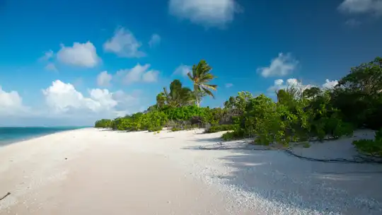
Ailinginae is a lagoon with no one living on it, and the silence over the water is the first thing you notice, broken only by seabird wings and surf on the outer reef. This uninhabited atoll sits in the northwest of the Marshall Islands, roughly 11 degrees north of the equator, east of Bikini, next to Rongelap, and far from any town. There are no marked hiking trails, no shops and no ferry. The upside is huge: sooty-white sand, nesting seabirds, green turtles and reef sharks in clear water. The downside is logistics. Access needs a permit and a chartered boat or ship from Majuro, and delays from weather or fuel are normal, so leave generous slack around any date and carry food, water and a satellite communicator. Gear that gets wet is gear that corrodes, so seal electronics in dry bags. Pack out every scrap of trash. A first day could go like this: anchor inside the lagoon, wade ashore at low tide with the sun still soft, and walk the coral-rubble beach counting nests before the midday glare sets in.

Discover everything you want to know in the 📖 Marshall Islands Travel Guide.


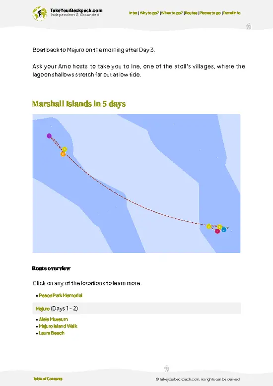
example page 0 from our offline Travel Guide for Marshall Islands
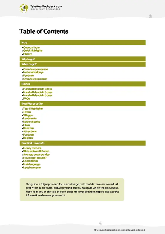
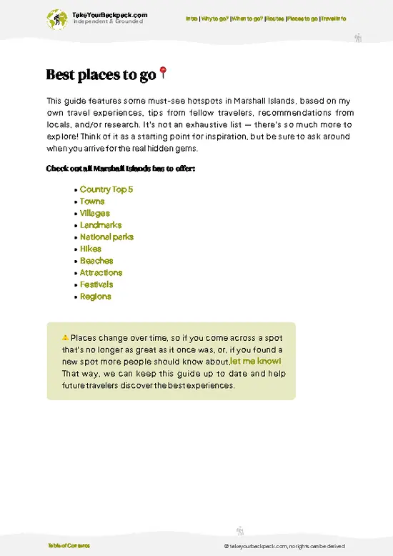
example page 1 from our offline Travel Guide for Marshall Islands
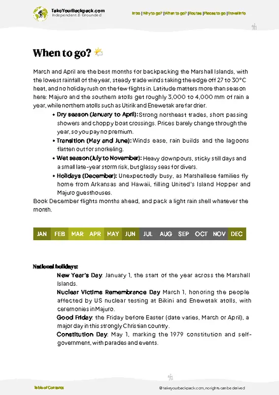
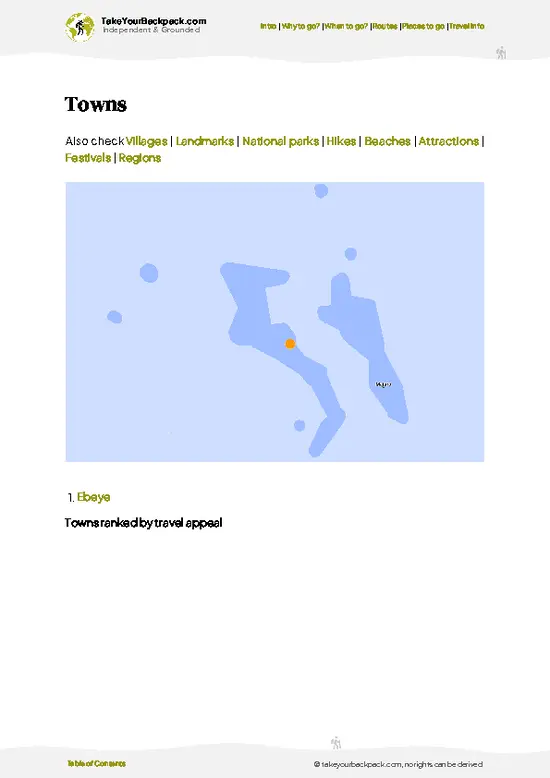
example page 2 from our offline Travel Guide for Marshall Islands
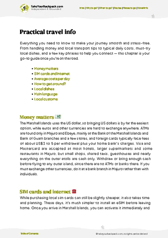
example page 3 from our offline Travel Guide for Marshall Islands
example page 4 from our offline Travel Guide for Marshall Islands
example page 5 from our offline Travel Guide for Marshall Islands
example page 6 from our offline Travel Guide for Marshall Islands
example page 7 from our offline Travel Guide for Marshall Islands
Loading the map 🌍
CLICK TO FILTER
towns
villages
landmarks
national parks
hikes
beaches
attractions
festivals
regions
SHOW COUNTRY’S BESTSHOW ALL

✨ Why go?
Ranked #3 national park in Marshall Islands
Why Ailinginae Atoll should be on your travel list

Backpackers come here for the opposite of a managed park. Ailinginae is one of the least-visited places in the northern Marshall Islands, and reaching it on your own terms, by arranging a charter and a permit through local authorities, gives the trip a self-built feel that tours rarely match. Nobody will hand you a map, so you need to be comfortable with navigation, camping skills and long stretches of nothing.

The second pull is the wildlife. The atoll shares a protected setting with neighboring Rongelap, and its reefs have seen little fishing pressure, which shows underwater in the density of reef fish, sharks and large grouper. Seabirds and green turtles use the motus (islets) for nesting, so a slow walk along the shoreline is the main activity.

Finally, there is history. The atoll sits … read more 👉
Backpackers come here for the opposite of a managed park. Ailinginae is one of the least-visited places in the northern Marshall Islands, and reaching it on your own terms, by arranging a charter and a permit through local authorities, gives the trip a self-built feel that tours rarely match. Nobody will hand you a map, so you need to be comfortable with navigation, camping skills and long stretches of nothing.

The second pull is the wildlife. The atoll shares a protected setting with neighboring Rongelap, and its reefs have seen little fishing pressure, which shows underwater in the density of reef fish, sharks and large grouper. Seabirds and green turtles use the motus (islets) for nesting, so a slow walk along the shoreline is the main activity.

Finally, there is history. The atoll sits within the region shaped by nuclear testing in the 1950s, and that context deepens the visit. This is a place for self-sufficient travelers who value quiet, not for anyone who wants a schedule.

💡 HighlightsMust-see experiences and standout moments

  1. Ailinginae Lagoon: The centerpiece is a wide, shallow lagoon ringed by low coral islets, with water that shifts from pale green over sand to deep blue near the passes. Nobody lives here, so the only sounds are surf on the outer reef, wind in the pandanus and coconut palms, and birds.
  2. The 1954 fallout story: Rongelap islanders were camped on Ailinginae when fallout from the Bravo hydrogen bomb test dusted the atoll, and they were evacuated. Standing on the islets with that history in mind changes how the empty beaches read. Old coconut groves and clearings still show where people once worked.
  3. Outer reef and pass dive sites: Reefs left unfished for decades hold big groupers, reef sharks and dense schools of fish. Divers with their own boat support come for walls that drop away steeply from the
… read more 👉
  1. Ailinginae Lagoon: The centerpiece is a wide, shallow lagoon ringed by low coral islets, with water that shifts from pale green over sand to deep blue near the passes. Nobody lives here, so the only sounds are surf on the outer reef, wind in the pandanus and coconut palms, and birds.
  2. The 1954 fallout story: Rongelap islanders were camped on Ailinginae when fallout from the Bravo hydrogen bomb test dusted the atoll, and they were evacuated. Standing on the islets with that history in mind changes how the empty beaches read. Old coconut groves and clearings still show where people once worked.
  3. Outer reef and pass dive sites: Reefs left unfished for decades hold big groupers, reef sharks and dense schools of fish. Divers with their own boat support come for walls that drop away steeply from the reef edge. Current can rip through the passes, so timing around the tide matters.
  4. Seabird colonies: The quiet islets host nesting terns, noddies, boobies and frigatebirds. Walk slowly, keep to the beach edge, and the birds tolerate you. Their noise, and the guano smell in the heat, announce a colony well before you see it.
  5. Green turtle beaches: Green turtles use the sandy shores of the atoll, and tracks up the beach at dawn are the giveaway. They are protected, so keep lights off at night and stay well back from any nesting female.
  6. Coconut crabs: Large coconut crabs, long gone from inhabited islands where they get eaten, still climb and scuttle through the undergrowth here. Look under fallen fronds and around coconut bases at dusk. Never handle them, because the claws can crush a finger.
  7. Night sky from the islets: With no settlement, no generator and no streetlight anywhere on the atoll, the Milky Way throws shadows on a clear night. Lie on the lagoon beach after dark and the phosphorescence in the shallows adds a second show at your feet.
For a first visit, spend the most time on the lagoon and its islets, since that is where the reef, birds and history all sit within a short boat hop of each other.
Spotted a mistake or missing something? Contact us.

🌤️ When to go?Seasonal considerations and timing

The best window for Ailinginae is the drier stretch from about December to April, when trade winds blow steadily and the lagoon is calmest for a boat landing.
  • Dry Season (December to April): Highs of 28 to 31°C (82 to 88°F), lighter rain and steady northeast trades. Seas are workable for the multi-day boat trip from Majuro or Kwajalein. Charter demand and prices peak.
  • Wet Season (May to November): Daily squalls, humid air and swells that make anchoring and lagoon crossings slower. Temperatures barely move, but rain can last for days. Charters are easier to book and sometimes cheaper.
  • Daylight: Close to 11°N, days run about 11 to 13 hours all year, with sunrise between about 6:30 and 7:15 and sunset between about 6:30 and 7:20.
  • Crowds: None in any month. The atoll is uninhabited, so timing is about
… read more 👉
The best window for Ailinginae is the drier stretch from about December to April, when trade winds blow steadily and the lagoon is calmest for a boat landing.
  • Dry Season (December to April): Highs of 28 to 31°C (82 to 88°F), lighter rain and steady northeast trades. Seas are workable for the multi-day boat trip from Majuro or Kwajalein. Charter demand and prices peak.
  • Wet Season (May to November): Daily squalls, humid air and swells that make anchoring and lagoon crossings slower. Temperatures barely move, but rain can last for days. Charters are easier to book and sometimes cheaper.
  • Daylight: Close to 11°N, days run about 11 to 13 hours all year, with sunrise between about 6:30 and 7:15 and sunset between about 6:30 and 7:20.
  • Crowds: None in any month. The atoll is uninhabited, so timing is about sea conditions and boat availability.
  • Seasonal Activities: Seabird nesting and green turtle activity are visible on the islets in most months, and snorkeling is best on calm, sunny days.
Book your boat at least several months ahead and keep two spare days in your schedule for weather delays.


source: climatestotravel.comJANJanuary: excellent for travelingFEBFebruary: excellent for travelingMARMarch: excellent for travelingAPRApril: highly recommended for travelingMAYMay: fair for travelingJUNJune: fair for travelingJULJuly: fair for travelingAUGAugust: fair for travelingSEPSeptember: fair for travelingOCTOctober: fair for travelingNOVNovember: highly recommended for travelingDECDecember: excellent for traveling
when-to-go

✈️ The backpacker research shortcutMarshall Islands Travel Guide

An offline-friendly backpacking guide with optimized travel routes, ranked highlights, transport advice, and the best areas to stay.
example page 0 from our offline Travel Guide for Marshall Islands
example page 1 from our offline Travel Guide for Marshall Islands
example page 2 from our offline Travel Guide for Marshall Islands
example page 3 from our offline Travel Guide for Marshall Islands
example page 4 from our offline Travel Guide for Marshall Islands
example page 5 from our offline Travel Guide for Marshall Islands
example page 6 from our offline Travel Guide for Marshall Islands
example page 7 from our offline Travel Guide for Marshall Islands
The digital guide (125 pages) contains:
✅ 27 highlights, ranked by travel appeal
✅ Optimized 2, 3 & 5-day travel routes
✅ Cities, national parks, landmarks, beaches
✅ How to get around
✅ Offline-friendly for travel without Wi-Fi
👉 Click to see all 30+ guide features

📅 Plan smarter in minutes, not weeks
✅ Month by month travel advice
✅ Festivals & national holidays
✅ Budget expectations

🗺️ Go to the right places, skip the overrated ones
✅ Honest pros & cons of destinations
✅ Top hikes, parks & viewpoints
✅ Lesser-known places most travelers miss
✅ Clear “worth it vs skip it” guidance

🛏️ Travel smoothly without rookie mistakes
✅ Best areas to stay
✅ Transport systems explained simply
✅ Common scams & safety advice
✅ SIM cards, money & practical tips

🌍 Understand the country, not just visit it
✅ Culture & traditions
✅ 52 Essential phrases & customs
✅ Festivals worth planning around
✅ Traveler-friendly historical context
✅ Insights that make places more meaningful

📱 Built for real travel conditions
✅ Fully downloadable PDF
✅ Works completely offline
✅ Optimized for phone use
✅ Useful in remote areas & buses
✅ Everything in one place
Stop searching, start planning
Get instant access to your full guide. 30‑day money-back guarantee.
+ Add another guide for just

By proceeding you agree to our terms.
Sent to your inbox immediately after payment • 100% Secure Checkout
Best Backpacking Travel Advisor 2025 tourism awardBest Backpacking
Travel Advisor
2025
What others say about Take Your Backpack Guides:
⭐⭐⭐⭐⭐
Fantastic, amazing amount of information!
⭐⭐⭐⭐⭐
My goodness this is amazing, it's what I've been looking for hats off too you!
⭐⭐⭐⭐⭐
I think this is absolutely BRILLIANT
⭐⭐⭐⭐
Very complete and informative. It's still missing places, but I gotta to commend you
⭐⭐⭐⭐⭐
This is truly amazing, thank you, can't wait to explore it with my kids!
⭐⭐⭐⭐⭐
Awesome resource, thank you!
⭐⭐⭐⭐⭐
This is amazing! Can't wait to explore the ones I haven't seen
⭐⭐⭐⭐
I love this! Well done, great idea.
⭐⭐⭐⭐⭐
Thanks for taking the time to make this gem!
⭐⭐⭐⭐⭐
This might be the best website I've ever seen.
⭐⭐⭐⭐⭐
Congratulations, and thank you so much for your work; it's incredibly valuable.
⭐⭐⭐⭐
In all seriousness I think you did a great job pointing out the important spots
⭐⭐⭐⭐⭐
10/10 very good
⭐⭐⭐⭐⭐
As someone who's only just starting to visit regularly this is awesome, thank you.
⭐⭐⭐⭐
Thank you very much! I'm going to visit my dad, it's going to be very useful!
⭐⭐⭐⭐⭐
This is really cool! We'll be travelling for the first time and this definitely come in handy.
⭐⭐⭐⭐⭐
You are now our minister of culture, congratulations 👨‍💼
⭐⭐⭐⭐⭐
Just wanted to tell you that this is a pearl! Going to follow your recommendations.
⭐⭐⭐⭐⭐
This is so cool. I'll definitely be using the resource for my travels soon.
⭐⭐⭐⭐⭐
This is very impressive! Good work.
⭐⭐⭐⭐⭐
This is an amazing and informative site. Very well done!

🛏️ Where to stay?Choosing the right base

There is nowhere to stay on Ailinginae itself, and you should plan on sleeping aboard a boat or camping only if your permit specifically allows it.
The atoll is uninhabited and has no lodging, shops or fresh water. It is a remote protected area in the northern Ralik Chain, and access requires government permission and a chartered vessel or expedition ship. Most visitors sleep on the vessel at anchor in the lagoon.
For the nights before and after, Majuro is the practical base. Guesthouses and small hotels along the main road around Delap, Uliga and Rita range from basic rooms with air conditioning … read more 👉
There is nowhere to stay on Ailinginae itself, and you should plan on sleeping aboard a boat or camping only if your permit specifically allows it.
The atoll is uninhabited and has no lodging, shops or fresh water. It is a remote protected area in the northern Ralik Chain, and access requires government permission and a chartered vessel or expedition ship. Most visitors sleep on the vessel at anchor in the lagoon.
For the nights before and after, Majuro is the practical base. Guesthouses and small hotels along the main road around Delap, Uliga and Rita range from basic rooms with air conditioning to mid-range waterfront properties. Hotels book up when flights are full, so reserve ahead. Kwajalein Atoll's Ebeye has a few modest guesthouses, but it is crowded and gives fewer options, and Kwajalein island itself is a US military base with restricted access.
If you want a more local stay, ask in Majuro about homestays on outer islands, though none are at Ailinginae. Bring all food, water, fuel and camping gear with you, and arrange the boat, permit and provisions in Majuro before anything else.

👛 Costs (as of 15 October 2026)Travel costs and budget guide for Ailinginae Atoll

Expect roughly USD 180 to 420 per day for Ailinginae, almost all of it spent on getting a boat there and back.
CategoryBudget RangeLocal Reality
Entrance and permitUSD 0 to 50No ticket booth exists. Access needs government approval arranged in Majuro, and fees vary.
Boat charter (shared per person)USD 100 to 250Multi-day charters from Majuro are costly. Splitting among 6 to 8 people brings the daily share down.
Accommodation (high season)USD 0 to 40You sleep aboard the vessel. Add Majuro guesthouse nights at about USD 60 to 150 outside the trip.
Food and waterUSD 25 to 50All supplies come from Majuro supermarkets. Nothing is sold on the atoll.
Local transportUSD 5 to 20Shared taxis in Majuro cost about USD 1 to 2 per ride, plus airport transfers.
Fuel, gear and extrasUSD 10 to 50Snorkel kit, satellite
… read more 👉
Expect roughly USD 180 to 420 per day for Ailinginae, almost all of it spent on getting a boat there and back.
CategoryBudget RangeLocal Reality
Entrance and permitUSD 0 to 50No ticket booth exists. Access needs government approval arranged in Majuro, and fees vary.
Boat charter (shared per person)USD 100 to 250Multi-day charters from Majuro are costly. Splitting among 6 to 8 people brings the daily share down.
Accommodation (high season)USD 0 to 40You sleep aboard the vessel. Add Majuro guesthouse nights at about USD 60 to 150 outside the trip.
Food and waterUSD 25 to 50All supplies come from Majuro supermarkets. Nothing is sold on the atoll.
Local transportUSD 5 to 20Shared taxis in Majuro cost about USD 1 to 2 per ride, plus airport transfers.
Fuel, gear and extrasUSD 10 to 50Snorkel kit, satellite communicator rental and a share of fuel and crew tips.
Total Daily BudgetUSD 180 to 420Flights to Majuro are extra and the biggest single cost.


source: doi.gov
⚠️ Prices can change and everyone travels differently, so take this as a rough guide. Hope it helps you plan your adventure!

🥾 TrailsScenic routes and wildlife spotting in Ailinginae Atoll

Ailinginae has no designated trails, so the walking here means beach and islet exploration, done at your own pace and mostly at low tide.
  • Lagoon-side beach walk: soft sand and coral rubble along the inner shore of an islet, roughly one to two hours at a slow pace. Easy, flat, and the best place to spot nesting turtles, hermit crabs and reef herons.
  • Islet interior loop: a short push through coconut and pandanus where the ground is leaf litter and broken coral. Allow an hour, wear closed shoes, and expect humidity and mosquitoes. Easy in effort, awkward underfoot.
  • Reef-flat wading: at low tide the
… read more 👉
Ailinginae has no designated trails, so the walking here means beach and islet exploration, done at your own pace and mostly at low tide.
  • Lagoon-side beach walk: soft sand and coral rubble along the inner shore of an islet, roughly one to two hours at a slow pace. Easy, flat, and the best place to spot nesting turtles, hermit crabs and reef herons.
  • Islet interior loop: a short push through coconut and pandanus where the ground is leaf litter and broken coral. Allow an hour, wear closed shoes, and expect humidity and mosquitoes. Easy in effort, awkward underfoot.
  • Reef-flat wading: at low tide the exposed reef flat lets you wade between islets in places. Sharp coral and sudden tide changes make this moderate, so go with reef shoes and watch the water level.
  • Seabird colony edge: a careful approach to the nesting areas, best kept to the edge of the vegetation. Ten to thirty minutes is plenty and disturbs the birds least.
  • Night crab watch: a slow stroll with a dim headlamp under the palms to see coconut crabs. Easy terrain, but darkness makes the coral rubble a trip hazard.
Shade is scarce away from the palms, and the equatorial sun is intense, so start early and carry more water than seems sensible. Fresh water is not available on the atoll.

Getting here is the hard part. There is no public transport and no scheduled service. Reaching the atoll means arranging a chartered vessel from Majuro with permission from the relevant local and national authorities, and the voyage is long and weather dependent. Crowds are not a concern, since you may be the only people there. Check current entry requirements and any permit or conservation fees before committing, as arrangements are made case by case.
⚠️ Hiking info can sometimes be outdated or inaccurate. Before you hit the trail, check the latest conditions with locals. If you do spot anything that's off, I'd love to hear from you, so I can update it for fellow travelers.

🛡️ SafetyTraveler Safety Guide

Ailinginae is physically easy but logistically unforgiving, because help is days away by sea.
The real hazards are on the water. Open-ocean crossings can be rough in the wet season, so pack seasickness medication and check forecasts with your captain. Islets are flat, so there is no altitude or steep terrain, but coral rubble and sharp reef edges cut feet quickly. Wear reef shoes, not flip-flops, and keep wounds clean in the humid heat. The sun is intense at 11°N: use reef-safe sunscreen, long sleeves and plenty of water, since none is available ashore.
Sharks are present in the lagoon and passes. Snorkel in calm conditions, avoid spearfishing and stay out of channels with strong current. Nesting seabirds and turtles are easily disturbed, so keep your distance and stay off nests. Cone shells … read more 👉
Ailinginae is physically easy but logistically unforgiving, because help is days away by sea.
The real hazards are on the water. Open-ocean crossings can be rough in the wet season, so pack seasickness medication and check forecasts with your captain. Islets are flat, so there is no altitude or steep terrain, but coral rubble and sharp reef edges cut feet quickly. Wear reef shoes, not flip-flops, and keep wounds clean in the humid heat. The sun is intense at 11°N: use reef-safe sunscreen, long sleeves and plenty of water, since none is available ashore.
Sharks are present in the lagoon and passes. Snorkel in calm conditions, avoid spearfishing and stay out of channels with strong current. Nesting seabirds and turtles are easily disturbed, so keep your distance and stay off nests. Cone shells and stonefish deserve a no-touch rule.
Bring a satellite communicator, a full first-aid kit and a boat with working radio. The atoll was affected by nuclear fallout in the 1950s, so follow your permit guidance on what to eat or collect.

FAQFrequently asked questions about Ailinginae Atoll

Plan on 5 to 8 days in total, including the trip out. The sea passage from Majuro takes roughly two to three days each way depending on the vessel, and you want at least two days in the lagoon for snorkeling and landing on the islets. Add a buffer day for weather.
Not realistically. There are no roads, flights or scheduled ferries to the atoll, so you need a chartered boat or expedition ship, typically departing from Majuro. Charters run about USD 100 to 250 per person per day when shared, and the trip usually takes several days each way.
There is no entrance booth, but access to this protected, uninhabited atoll requires permission from Marshall Islands authorities, which you arrange through Majuro before sailing. Fees, if any, are modest compared with charter costs, roughly USD 0 to 50. Your boat operator can usually help with the paperwork, so start several weeks ahead.
⚠️ Things can change over time, so always validate details locally before you go.

Where to go next

Ailinginae Atoll isn’t the only highlight in Marshall Islands. Explore all what Marshall Islands has to offer.
Country photo of Marshall Islands

We 💚 feedbackFinal thoughts on exploring Ailinginae Atoll

The classic mistake is treating Ailinginae like an ordinary beach stop and arriving underprepared. Nothing here can be bought, borrowed or fixed. Bring double the water you calculated, spare fuel and a backup communicator, and agree on a flexible pickup window with your boat captain. Then slow down, because the nesting birds and turtles are the whole point and rushing scares them off.

✍️ Help improve this page!
The information on this page is based on in-depth research, insights shared by experienced travelers, and feedback from the local travel community in Marshall Islands. While every effort is made to keep the information accurate and current, conditions can change — so if you spot anything incorrect or outdated, please get in touch.


🙋‍♂️ Give feedback

👋 Meet the founderWho’s Behind Take Your Backpack?

Johan, backpacker and founder of TakeYourBackpackHi, I’m Johan (Netherlands 🇳🇱), the creator of TakeYourBackpack. Over the past 3 decades, I’ve backpacked through 90+ countries across six continents, gaining extensive experience with independent travel, long-term trips, and overland routes.

This site is built on a combination of firsthand travel experience and carefully curated insights from other backpackers. Many guides are based on places I’ve personally visited, while others bring together tips, observations, and practical advice shared by trusted travelers I’ve met along the way.

The goal is to provide realistic, experience-driven guidance — not generic itineraries — so you can explore destinations with better context, clearer expectations, and more confidence.