

×

Marshall Islands🇲🇭 | beachesBigej BeachKwajalein missile-range islet, permission-only access, coral-head snorkeling, 1944 battle ruins | things to do and best time to go

Explore DeBrum HouseExplore Eneko Beach

Backpacking in Bigej Beach
👍 Recommendedbeach ranked #3
By Johan Kruseman 🇳🇱 | Updated October 15, 2026

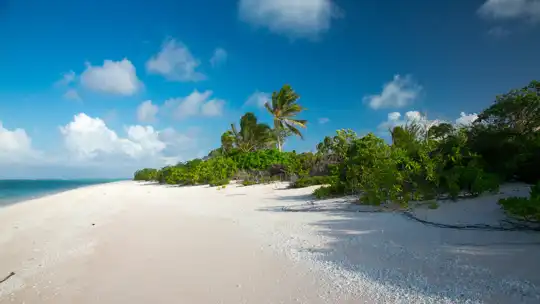
Bigej Beach is not a resort strip with a public landing; it sits on a small islet within the U.S. Army missile range zone of Kwajalein Atoll, in the Marshall Islands, and visits depend on permission from the garrison or the landowners. Once you are there, the reward is quiet. White coral sand crunches underfoot, coconut fronds clatter in the trade wind, and the lagoon turns from milky green to deep blue within a few strides. Crowds are essentially absent, and so are cafes, shade shelters and a surf scene. Snorkeling over coral heads is the main draw, though the heat is heavy and the sun hard. Nothing about reaching it is simple, and nothing nearby is a proper budget hostel or street stall, so plan food and water yourself. It suits patient, self-sufficient travelers who like empty shorelines. It will frustrate anyone who wants nightlife, easy transport or walk-in access.

Discover everything you want to know in the 📖 Marshall Islands Travel Guide.


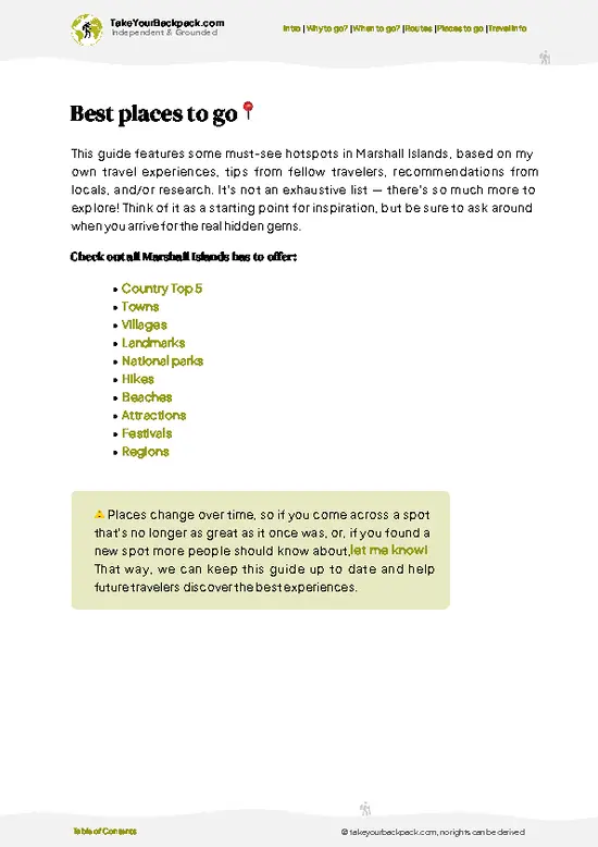
example page 0 from our offline Travel Guide for Marshall Islands
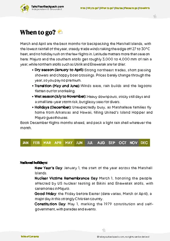
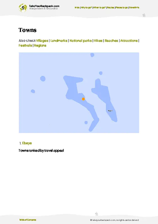
example page 1 from our offline Travel Guide for Marshall Islands
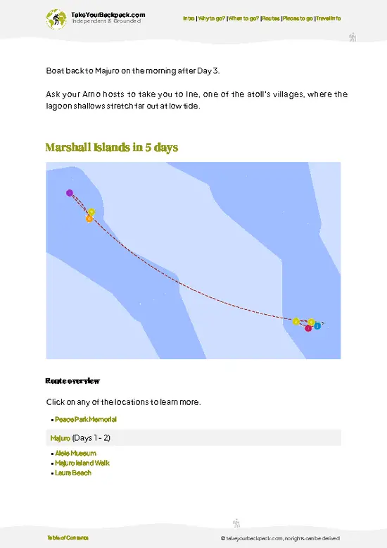
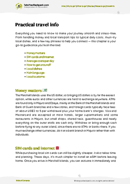
example page 2 from our offline Travel Guide for Marshall Islands
example page 3 from our offline Travel Guide for Marshall Islands
example page 4 from our offline Travel Guide for Marshall Islands
example page 5 from our offline Travel Guide for Marshall Islands
example page 6 from our offline Travel Guide for Marshall Islands
example page 7 from our offline Travel Guide for Marshall Islands
Loading the map 🌍
CLICK TO FILTER
towns
villages
landmarks
national parks
hikes
beaches
attractions
festivals
regions
SHOW COUNTRY’S BESTSHOW ALL

✨ Why go?
Ranked #3 beach in Marshall Islands
What makes it a must-see beach

Backpackers who end up at Bigej come for a stretch of Kwajalein Atoll’s lagoon, one of the largest enclosed bodies of water on Earth, without anyone selling you anything. That is the first reason: silence. You hear wind, wave lap and the occasional seabird, and little else.

The second is the water. The lagoon side of the islet gives calm, clear swimming and easy snorkeling over coral heads close to the shoreline, which is a very different experience from the rougher ocean-facing reef. You can float for an hour and see reef fish pass beneath you without a boat or a guide.

The third is context. This atoll saw one of the major Pacific battles of early 1944, and the islands around it carry that history in rusted metal and broken concrete. Spending a day here is a way to connect the Marshallese … read more 👉
Backpackers who end up at Bigej come for a stretch of Kwajalein Atoll’s lagoon, one of the largest enclosed bodies of water on Earth, without anyone selling you anything. That is the first reason: silence. You hear wind, wave lap and the occasional seabird, and little else.

The second is the water. The lagoon side of the islet gives calm, clear swimming and easy snorkeling over coral heads close to the shoreline, which is a very different experience from the rougher ocean-facing reef. You can float for an hour and see reef fish pass beneath you without a boat or a guide.

The third is context. This atoll saw one of the major Pacific battles of early 1944, and the islands around it carry that history in rusted metal and broken concrete. Spending a day here is a way to connect the Marshallese present with the war that reshaped it. It works best as a deliberate detour from the atoll’s other islands, not a place to settle in.

💡 HighlightsKey sights and experiences for travelers

  1. Lagoon-side swimming: The shore facing the lagoon is the calm one, with shallow, warm water over pale sand. Entry is easy and there is no surf to fight, so it is a relaxed place to cool off after a hot, shadeless walk.
  2. Snorkeling the coral heads: Just off the beach, coral outcrops hold small reef fish and the occasional larger visitor. Visibility is best in calm weather and bright light. Bring your own mask and fins, since nothing is rented on site.
  3. Beachcombing the shoreline: The tide line is scattered with shells, bleached coral fragments and driftwood. It is a slow, absorbing walk, and the sand underfoot shifts from fine to rubbly in short stretches, so sturdy sandals help.
  4. Sunset over the lagoon: With open water on one side and little artificial light across the atoll, the evening sky carries
… read more 👉
  1. Lagoon-side swimming: The shore facing the lagoon is the calm one, with shallow, warm water over pale sand. Entry is easy and there is no surf to fight, so it is a relaxed place to cool off after a hot, shadeless walk.
  2. Snorkeling the coral heads: Just off the beach, coral outcrops hold small reef fish and the occasional larger visitor. Visibility is best in calm weather and bright light. Bring your own mask and fins, since nothing is rented on site.
  3. Beachcombing the shoreline: The tide line is scattered with shells, bleached coral fragments and driftwood. It is a slow, absorbing walk, and the sand underfoot shifts from fine to rubbly in short stretches, so sturdy sandals help.
  4. Sunset over the lagoon: With open water on one side and little artificial light across the atoll, the evening sky carries long bands of orange and pink, followed by dense stars. It is the only real nighttime activity here, and it is free.
  5. Wartime remnants of Kwajalein Atoll: The 1944 battle left concrete ruins and corroded debris across the atoll’s islets. Seeing this landscape gives the beach a harder, more honest backdrop than any postcard.
Start with the snorkeling in the morning, when the lagoon is calmest and the sun sits high enough to light the coral heads clearly.
Spotted a mistake or missing something? Contact us.

🌤️ When to go?Weather, crowds, and seasonal trade-offs

  • Dry Season (December to April): Trade winds blow steadily, rain is lighter, and the lagoon side stays calm enough for easy swimming. Highs run 29 to 31°C (84 to 88°F), with nights around 26°C (79°F). This is the best window for boat rides across the lagoon.
  • Wet Season (May to November): Expect frequent squalls, muggy air and choppier crossings. Temperatures barely move, at 27 to 31°C (81 to 88°F), but rain can cancel a boat trip with little notice. Flights and rooms in the atoll do not get cheaper in any consistent way.
  • Daylight: Days stay close to 11.5 to 12.5 hours all year, with sunrise between about 6:30 and 7:10 am and sunset between about 6:25 and 7:10 pm. Plan to be back at your lodging before dark.
  • Crowds and Prices: Bigej has no tourist season. You will share the sand with locals and
… read more 👉
  • Dry Season (December to April): Trade winds blow steadily, rain is lighter, and the lagoon side stays calm enough for easy swimming. Highs run 29 to 31°C (84 to 88°F), with nights around 26°C (79°F). This is the best window for boat rides across the lagoon.
  • Wet Season (May to November): Expect frequent squalls, muggy air and choppier crossings. Temperatures barely move, at 27 to 31°C (81 to 88°F), but rain can cancel a boat trip with little notice. Flights and rooms in the atoll do not get cheaper in any consistent way.
  • Daylight: Days stay close to 11.5 to 12.5 hours all year, with sunrise between about 6:30 and 7:10 am and sunset between about 6:25 and 7:10 pm. Plan to be back at your lodging before dark.
  • Crowds and Prices: Bigej has no tourist season. You will share the sand with locals and the odd fisherman in any month. Flight prices to the atoll hold fairly steady, and holiday weeks around Christmas and Constitution Day (May 1) fill the seats from Majuro.
Book your boat the day before, and aim for a morning trip, when the lagoon is usually flattest.


source: climatestotravel.comJANJanuary: excellent for travelingFEBFebruary: excellent for travelingMARMarch: excellent for travelingAPRApril: highly recommended for travelingMAYMay: fair for travelingJUNJune: fair for travelingJULJuly: fair for travelingAUGAugust: fair for travelingSEPSeptember: fair for travelingOCTOctober: fair for travelingNOVNovember: fair for travelingDECDecember: highly recommended for traveling
when-to-go

✈️ The backpacker research shortcutMarshall Islands Travel Guide

An offline-friendly backpacking guide with optimized travel routes, ranked highlights, transport advice, and the best areas to stay.
example page 0 from our offline Travel Guide for Marshall Islands
example page 1 from our offline Travel Guide for Marshall Islands
example page 2 from our offline Travel Guide for Marshall Islands
example page 3 from our offline Travel Guide for Marshall Islands
example page 4 from our offline Travel Guide for Marshall Islands
example page 5 from our offline Travel Guide for Marshall Islands
example page 6 from our offline Travel Guide for Marshall Islands
example page 7 from our offline Travel Guide for Marshall Islands
The digital guide (125 pages) contains:
✅ 27 highlights, ranked by travel appeal
✅ Optimized 2, 3 & 5-day travel routes
✅ Cities, national parks, landmarks, beaches
✅ How to get around
✅ Offline-friendly for travel without Wi-Fi
👉 Click to see all 30+ guide features

📅 Plan smarter in minutes, not weeks
✅ Month by month travel advice
✅ Festivals & national holidays
✅ Budget expectations

🗺️ Go to the right places, skip the overrated ones
✅ Honest pros & cons of destinations
✅ Top hikes, parks & viewpoints
✅ Lesser-known places most travelers miss
✅ Clear “worth it vs skip it” guidance

🛏️ Travel smoothly without rookie mistakes
✅ Best areas to stay
✅ Transport systems explained simply
✅ Common scams & safety advice
✅ SIM cards, money & practical tips

🌍 Understand the country, not just visit it
✅ Culture & traditions
✅ 52 Essential phrases & customs
✅ Festivals worth planning around
✅ Traveler-friendly historical context
✅ Insights that make places more meaningful

📱 Built for real travel conditions
✅ Fully downloadable PDF
✅ Works completely offline
✅ Optimized for phone use
✅ Useful in remote areas & buses
✅ Everything in one place
Stop searching, start planning
Get instant access to your full guide. 30‑day money-back guarantee.
+ Add another guide for just

By proceeding you agree to our terms.
Sent to your inbox immediately after payment • 100% Secure Checkout
Best Backpacking Travel Advisor 2025 tourism awardBest Backpacking
Travel Advisor
2025
What others say about Take Your Backpack Guides:
⭐⭐⭐⭐⭐
Fantastic, amazing amount of information!
⭐⭐⭐⭐⭐
My goodness this is amazing, it's what I've been looking for hats off too you!
⭐⭐⭐⭐⭐
I think this is absolutely BRILLIANT
⭐⭐⭐⭐
Very complete and informative. It's still missing places, but I gotta to commend you
⭐⭐⭐⭐⭐
This is truly amazing, thank you, can't wait to explore it with my kids!
⭐⭐⭐⭐⭐
Awesome resource, thank you!
⭐⭐⭐⭐⭐
This is amazing! Can't wait to explore the ones I haven't seen
⭐⭐⭐⭐
I love this! Well done, great idea.
⭐⭐⭐⭐⭐
Thanks for taking the time to make this gem!
⭐⭐⭐⭐⭐
This might be the best website I've ever seen.
⭐⭐⭐⭐⭐
Congratulations, and thank you so much for your work; it's incredibly valuable.
⭐⭐⭐⭐
In all seriousness I think you did a great job pointing out the important spots
⭐⭐⭐⭐⭐
10/10 very good
⭐⭐⭐⭐⭐
As someone who's only just starting to visit regularly this is awesome, thank you.
⭐⭐⭐⭐
Thank you very much! I'm going to visit my dad, it's going to be very useful!
⭐⭐⭐⭐⭐
This is really cool! We'll be travelling for the first time and this definitely come in handy.
⭐⭐⭐⭐⭐
You are now our minister of culture, congratulations 👨‍💼
⭐⭐⭐⭐⭐
Just wanted to tell you that this is a pearl! Going to follow your recommendations.
⭐⭐⭐⭐⭐
This is so cool. I'll definitely be using the resource for my travels soon.
⭐⭐⭐⭐⭐
This is very impressive! Good work.
⭐⭐⭐⭐⭐
This is an amazing and informative site. Very well done!

🛏️ Where to stay?Choosing the right base

Ebeye is the realistic base for reaching Bigej Beach, and it is where almost every budget traveler in Kwajalein Atoll ends up. It is one of the most densely populated islets in the Pacific, so expect noise, close quarters and a lively street life rather than quiet. Rooms here are basic guesthouse-style, typically US$40 to 90 a night, and there is no hostel scene or backpacker bar crowd. The upside is that you are among Marshallese families, and the boat captains who can run you out to Bigej live here too. Ask around the harbor and at the small shops near the ferry landing, as most arrangements … read more 👉
Ebeye is the realistic base for reaching Bigej Beach, and it is where almost every budget traveler in Kwajalein Atoll ends up. It is one of the most densely populated islets in the Pacific, so expect noise, close quarters and a lively street life rather than quiet. Rooms here are basic guesthouse-style, typically US$40 to 90 a night, and there is no hostel scene or backpacker bar crowd. The upside is that you are among Marshallese families, and the boat captains who can run you out to Bigej live here too. Ask around the harbor and at the small shops near the ferry landing, as most arrangements happen by word of mouth.

Staying on Ebeye also keeps you close to the cheap local eateries and the dock where lagoon boats leave. Kwajalein island itself, a few minutes away by ferry, is a restricted US Army base, so it is not somewhere you can book a bed without sponsorship. Bigej itself is a small residential islet, and overnight stays depend on a personal invitation from a local family or landowner. Do not count on this. If you want more choice, base yourself in Majuro, where guesthouses are more plentiful, and fly to Kwajalein for a short side trip.

🛡️ SafetyScams, Hazards, and Annoyances

Bigej Beach is a quiet lagoon shore, and the main risks are sun and logistics rather than surf. Water on the lagoon side is generally calm, shallow near the shore and warm, with little wave energy. Currents pick up where the lagoon drains toward channels between islets, so skip swimming near those gaps and stay close to the beach, especially when the tide is moving hard. Coral heads and broken coral sit close to the shore in places, so wear reef shoes to prevent cuts, which can turn infected in the tropical heat. Sharks live in the atoll, but local swimmers share the water with them daily, and you should avoid swimming at dawn and dusk or near fishing activity. Sun is intense from mid-morning, so bring plenty of water and cover up. Theft is uncommon, but this is private community land. Ask … read more 👉
Bigej Beach is a quiet lagoon shore, and the main risks are sun and logistics rather than surf. Water on the lagoon side is generally calm, shallow near the shore and warm, with little wave energy. Currents pick up where the lagoon drains toward channels between islets, so skip swimming near those gaps and stay close to the beach, especially when the tide is moving hard. Coral heads and broken coral sit close to the shore in places, so wear reef shoes to prevent cuts, which can turn infected in the tropical heat. Sharks live in the atoll, but local swimmers share the water with them daily, and you should avoid swimming at dawn and dusk or near fishing activity. Sun is intense from mid-morning, so bring plenty of water and cover up. Theft is uncommon, but this is private community land. Ask permission before you settle in, keep your boat arrangements clear, and leave valuables at your lodging.

FAQFrequently asked questions about Bigej Beach

Getting there takes two steps: fly from Majuro to Kwajalein on United (about 45 minutes) or Air Marshall Islands, then take the short ferry to Ebeye. From Ebeye, you hire a local boat to cross the lagoon to Bigej, which is usually an hour or so depending on the boat and conditions, and costs vary by negotiation. Kwajalein is a US Army installation, so you should carry your passport and keep your itinerary tied to Ebeye. Allow at least two or three days for the whole trip, as flights are not daily.
Swimming is the one thing Bigej Beach does well, thanks to calm, warm lagoon water that is 28 to 30°C (82 to 86°F) most of the year. Surfing is not realistic, because the lagoon side has no real breaking waves and the ocean reefs are far away. Snorkeling is possible over patches of coral near shore, but visibility varies with wind and rain, and there is no rental shop, so bring your own mask and fins from Majuro or home. Reef shoes and sun protection matter more here than any other gear.
Yes, there is no entrance fee, and no ticket booth or gate at Bigej Beach. The land belongs to local families, so you should ask permission before you spend time there, and your boat captain can usually make the introduction. The real cost is the boat ride from Ebeye, which is typically a negotiated price in the range of US$20 to 60 depending on group size and the time spent waiting. Carry small US dollar bills, as the US dollar is the currency used across the Marshall Islands.
⚠️ Things can change over time, so always validate details locally before you go.

Other Marshallese beaches near Bigej Beach

Explore more nearby:

  • Laura Beach—White sand, taro and breadfruit lanes, Saturday family picnics, western atoll end| 408 km away
  • Eneko Beach—Boat-only islet, glassy shallows, palm-shade picnic, lap-the-islet walk| 433 km away
  • Enemanit Island—High-tide swimming, giant clams, tideline cowries, local fishing families| 435 km away

💡 Not sure where to go next?
Create a personalized itinerary for Marshall Islands including Bigej Beach and the places that fit your trip.

Generate my itinerary

👉 Discover all beaches

Or checkout all Marshall Islands has to offer (think cities, towns, villages, national parks, hikes, beaches, festivals)
Country photo of Marshall Islands

We 💚 feedbackIs it worth it?

The classic mistake is arriving without sorting out permission and supplies, then finding yourself turned away or stranded hot and thirsty. Confirm access in advance, and carry more water than seems sensible, plus snacks, sun protection and your own snorkel gear. I would go early, leave before the midday glare, and treat the beach as a quiet morning, not a full day.

✍️ Help improve this page!
The information on this page is based on in-depth research, insights shared by experienced travelers, and feedback from the local travel community in Marshall Islands. While every effort is made to keep the information accurate and current, conditions can change — so if you spot anything incorrect or outdated, please get in touch.


🙋‍♂️ Give feedback

👋 Meet the founderWho’s Behind Take Your Backpack?

Johan, backpacker and founder of TakeYourBackpackHi, I’m Johan (Netherlands 🇳🇱), the creator of TakeYourBackpack. Over the past 3 decades, I’ve backpacked through 90+ countries across six continents, gaining extensive experience with independent travel, long-term trips, and overland routes.

This site is built on a combination of firsthand travel experience and carefully curated insights from other backpackers. Many guides are based on places I’ve personally visited, while others bring together tips, observations, and practical advice shared by trusted travelers I’ve met along the way.

The goal is to provide realistic, experience-driven guidance — not generic itineraries — so you can explore destinations with better context, clearer expectations, and more confidence.