×

Marshall Islands🇲🇭 | beachesEneko BeachBoat-only islet, glassy shallows, palm-shade picnic, lap-the-islet walk | things to do and best time to go

Explore Bigej BeachExplore Enemanit Island

Backpacking in Eneko Beach
🏆 Top pickbeach ranked #1
By Johan Kruseman 🇳🇱 | Updated October 15, 2026

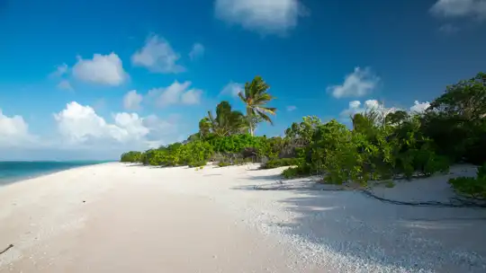
Eneko is a small islet in Majuro’s lagoon, so you get there by boat rather than by the atoll’s single road, and that detail shapes everything about the visit. It lies in the northwest of the Marshall Islands’ main atoll, across the water from the capital’s ribbon of concrete and tin roofs. What you get is soft white-gray coral sand, the slap of lagoon wavelets, coconut palms rattling overhead, and the faint smell of salt and drying copra. Swimming is easy in the sheltered, shallow, bathwater-warm lagoon, and the water is clear enough for casual snorkeling over coral heads. There is no surf to speak of, and the ocean side is not the point here. Crowds are thin, which is the main draw, but there is little shade management, no real nightlife, and you must plan your own food and water because this is not a place with a row of cheap cafés. Skip it if you want a scene. Go for quiet. A good first day means a morning boat across the lagoon, a long swim and snorkel before the heat peaks, a picnic in the palm shade, and a late-afternoon walk around the sand edge.

Discover everything you want to know in the 📖 Marshall Islands Travel Guide.


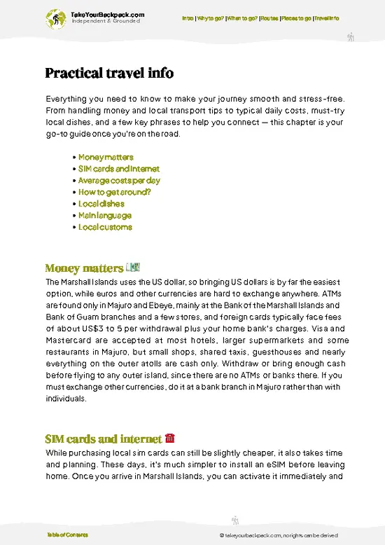
example page 0 from our offline Travel Guide for Marshall Islands
example page 1 from our offline Travel Guide for Marshall Islands
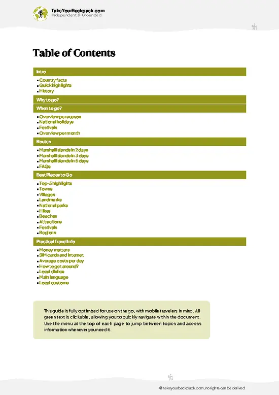
example page 2 from our offline Travel Guide for Marshall Islands
example page 3 from our offline Travel Guide for Marshall Islands
example page 4 from our offline Travel Guide for Marshall Islands
example page 5 from our offline Travel Guide for Marshall Islands
example page 6 from our offline Travel Guide for Marshall Islands
example page 7 from our offline Travel Guide for Marshall Islands
Loading the map 🌍
CLICK TO FILTER
towns
villages
landmarks
national parks
hikes
beaches
attractions
festivals
regions
SHOW COUNTRY’S BESTSHOW ALL

✨ Why go?
Ranked #1 beach in Marshall Islands
The unique appeal for travelers

Backpackers stop at Eneko because it gives you something Majuro’s main road never will: a patch of sand with no traffic. The atoll’s strip of shops, trucks and dust can wear on you after a couple of days, and a short hop across the water resets that quickly. The islet is small enough that you can walk the whole shoreline in one lazy loop, with the lagoon on one side and low vegetation on the other.

The second reason is the water. The calm lagoon side is warm and shallow, and coral patches close to shore make snorkeling simple even if you have never put on a mask. Nobody is hustling gear on the sand, so bring your own and swim whenever you like.

The third is the quiet that comes from being a boat-only stop. You will see families from town on a weekend outing and perhaps a handful of other … read more 👉
Backpackers stop at Eneko because it gives you something Majuro’s main road never will: a patch of sand with no traffic. The atoll’s strip of shops, trucks and dust can wear on you after a couple of days, and a short hop across the water resets that quickly. The islet is small enough that you can walk the whole shoreline in one lazy loop, with the lagoon on one side and low vegetation on the other.

The second reason is the water. The calm lagoon side is warm and shallow, and coral patches close to shore make snorkeling simple even if you have never put on a mask. Nobody is hustling gear on the sand, so bring your own and swim whenever you like.

The third is the quiet that comes from being a boat-only stop. You will see families from town on a weekend outing and perhaps a handful of other travelers, rarely a crowd. In a country with few places to stop and decompress between island hops and flights, this is a cheap, low-effort way to feel like you have actually been to a Pacific atoll instead of just landed on one.

💡 HighlightsTop highlights of Eneko Beach

  1. Eneko’s Lagoon-Side Beach: The islet’s main draw is its pale sand edge facing the sheltered lagoon. The shallows are warm and flat, and the bottom shelves gently, so it suits weak swimmers and anyone who wants to float for an hour. Come in the morning when the light is soft and the water is glassy.
  2. Snorkeling the Coral Patches: Just off the shoreline, coral heads rise from the sandy lagoon floor and attract small reef fish. Visibility is best when the sun is high and the wind is light. It is not a world-class dive site, but it is easy, close and free, and a mask and snorkel are all you need.
  3. The Boat Crossing: Reaching Eneko means crossing open lagoon water, and the trip itself is a highlight. You watch Majuro’s shoreline shrink, the water turn from murky green to clear turquoise, and frigatebirds
… read more 👉
  1. Eneko’s Lagoon-Side Beach: The islet’s main draw is its pale sand edge facing the sheltered lagoon. The shallows are warm and flat, and the bottom shelves gently, so it suits weak swimmers and anyone who wants to float for an hour. Come in the morning when the light is soft and the water is glassy.
  2. Snorkeling the Coral Patches: Just off the shoreline, coral heads rise from the sandy lagoon floor and attract small reef fish. Visibility is best when the sun is high and the wind is light. It is not a world-class dive site, but it is easy, close and free, and a mask and snorkel are all you need.
  3. The Boat Crossing: Reaching Eneko means crossing open lagoon water, and the trip itself is a highlight. You watch Majuro’s shoreline shrink, the water turn from murky green to clear turquoise, and frigatebirds and terns working overhead. Go with a local operator or a friend with a boat, and agree on a pickup time before you step off.
  4. Shoreline Walk Around the Islet: The islet is small enough to circle on foot. You pass coconut palms, driftwood, scattered shells and the occasional hermit crab trail in the sand. The texture changes from soft sand to crunchy coral rubble, so bring sandals you can wet. Walking it takes well under an hour at a slow pace.
  5. Palm-Shade Picnic and Sunset: With no restaurant to count on, the traditional way to spend time here is a packed lunch under the palms, followed by the late-afternoon light turning the lagoon copper and pink. Majuro’s distant outline glows on the horizon. Pack water, snacks and something for trash, and leave nothing behind.
For a first visit, the lagoon-side beach is the one to put first, because a long swim in that flat, warm water is exactly what the trip is for.
Spotted a mistake or missing something? Contact us.

🌤️ When to go?Seasonal considerations and timing

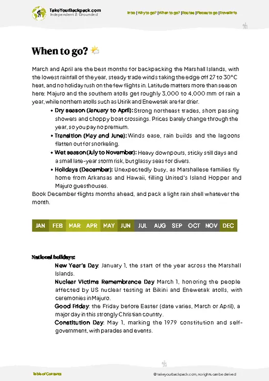
  • Dry Season (December to April): The best window for a lagoon day. Trade winds blow steadily, rain comes in short showers, and the lagoon is usually calm enough for small boats. Highs run 29 to 31°C (84 to 88°F).
  • Wet Season (May to November): Squalls roll through often, skies stay gray for days, and the lagoon gets choppy, so boat runs get canceled. Temperatures barely change, 26 to 31°C (79 to 88°F), but the humidity is heavier.
  • Daylight: Near the equator, the day is about 12 hours all year, with sunrise around 6:30 am and sunset near 6:30 pm. Plan to be back on the main island before dark.
  • Crowds and Prices: Weekends and holidays bring local picnic groups, while weekdays are quiet. Airfare to Majuro stays high all year, and boat rates depend more on the day and the operator than on the season.
… read more 👉
  • Dry Season (December to April): The best window for a lagoon day. Trade winds blow steadily, rain comes in short showers, and the lagoon is usually calm enough for small boats. Highs run 29 to 31°C (84 to 88°F).
  • Wet Season (May to November): Squalls roll through often, skies stay gray for days, and the lagoon gets choppy, so boat runs get canceled. Temperatures barely change, 26 to 31°C (79 to 88°F), but the humidity is heavier.
  • Daylight: Near the equator, the day is about 12 hours all year, with sunrise around 6:30 am and sunset near 6:30 pm. Plan to be back on the main island before dark.
  • Crowds and Prices: Weekends and holidays bring local picnic groups, while weekdays are quiet. Airfare to Majuro stays high all year, and boat rates depend more on the day and the operator than on the season.
Go on a weekday in February or March and ask your boat driver for a morning drop-off, when the lagoon is flattest.


source: climatestotravel.comJANJanuary: excellent for travelingFEBFebruary: excellent for travelingMARMarch: excellent for travelingAPRApril: excellent for travelingMAYMay: highly recommended for travelingJUNJune: fair for travelingJULJuly: fair for travelingAUGAugust: fair for travelingSEPSeptember: fair for travelingOCTOctober: fair for travelingNOVNovember: highly recommended for travelingDECDecember: excellent for traveling
marshall-islands-beach-eneko-beach
© Google | Nick Delly

✈️ The backpacker research shortcutMarshall Islands Travel Guide

An offline-friendly backpacking guide with optimized travel routes, ranked highlights, transport advice, and the best areas to stay.
example page 0 from our offline Travel Guide for Marshall Islands
example page 1 from our offline Travel Guide for Marshall Islands
example page 2 from our offline Travel Guide for Marshall Islands
example page 3 from our offline Travel Guide for Marshall Islands
example page 4 from our offline Travel Guide for Marshall Islands
example page 5 from our offline Travel Guide for Marshall Islands
example page 6 from our offline Travel Guide for Marshall Islands
example page 7 from our offline Travel Guide for Marshall Islands
The digital guide (125 pages) contains:
✅ 27 highlights, ranked by travel appeal
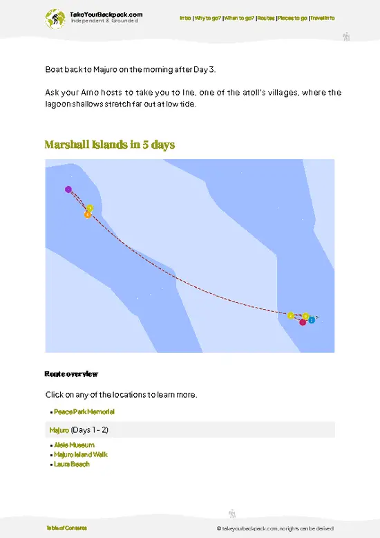
✅ Optimized 2, 3 & 5-day travel routes
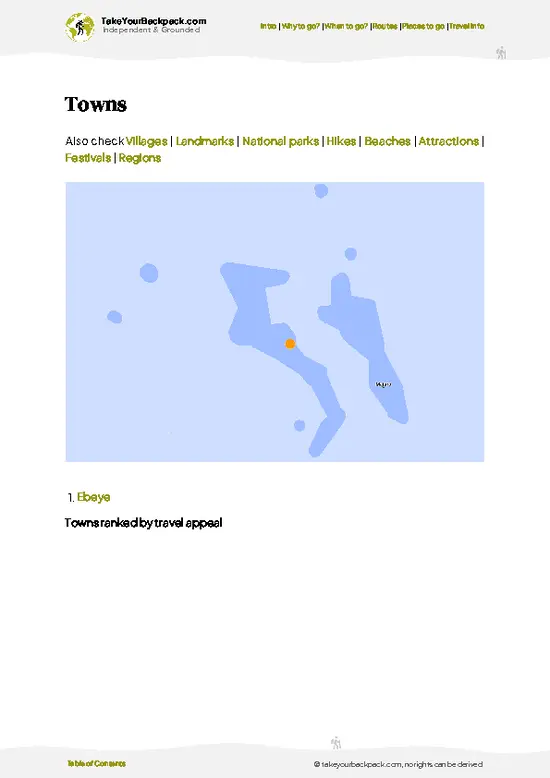
✅ Cities, national parks, landmarks, beaches
✅ How to get around
✅ Offline-friendly for travel without Wi-Fi
👉 Click to see all 30+ guide features

📅 Plan smarter in minutes, not weeks
✅ Month by month travel advice
✅ Festivals & national holidays
✅ Budget expectations

🗺️ Go to the right places, skip the overrated ones
✅ Honest pros & cons of destinations
✅ Top hikes, parks & viewpoints
✅ Lesser-known places most travelers miss
✅ Clear “worth it vs skip it” guidance

🛏️ Travel smoothly without rookie mistakes
✅ Best areas to stay
✅ Transport systems explained simply
✅ Common scams & safety advice
✅ SIM cards, money & practical tips

🌍 Understand the country, not just visit it
✅ Culture & traditions
✅ 52 Essential phrases & customs
✅ Festivals worth planning around
✅ Traveler-friendly historical context
✅ Insights that make places more meaningful

📱 Built for real travel conditions
✅ Fully downloadable PDF
✅ Works completely offline
✅ Optimized for phone use
✅ Useful in remote areas & buses
✅ Everything in one place
Stop searching, start planning
Get instant access to your full guide. 30‑day money-back guarantee.
+ Add another guide for just

By proceeding you agree to our terms.
Sent to your inbox immediately after payment • 100% Secure Checkout
Best Backpacking Travel Advisor 2025 tourism awardBest Backpacking
Travel Advisor
2025
What others say about Take Your Backpack Guides:
⭐⭐⭐⭐⭐
Fantastic, amazing amount of information!
⭐⭐⭐⭐⭐
My goodness this is amazing, it's what I've been looking for hats off too you!
⭐⭐⭐⭐⭐
I think this is absolutely BRILLIANT
⭐⭐⭐⭐
Very complete and informative. It's still missing places, but I gotta to commend you
⭐⭐⭐⭐⭐
This is truly amazing, thank you, can't wait to explore it with my kids!
⭐⭐⭐⭐⭐
Awesome resource, thank you!
⭐⭐⭐⭐⭐
This is amazing! Can't wait to explore the ones I haven't seen
⭐⭐⭐⭐
I love this! Well done, great idea.
⭐⭐⭐⭐⭐
Thanks for taking the time to make this gem!
⭐⭐⭐⭐⭐
This might be the best website I've ever seen.
⭐⭐⭐⭐⭐
Congratulations, and thank you so much for your work; it's incredibly valuable.
⭐⭐⭐⭐
In all seriousness I think you did a great job pointing out the important spots
⭐⭐⭐⭐⭐
10/10 very good
⭐⭐⭐⭐⭐
As someone who's only just starting to visit regularly this is awesome, thank you.
⭐⭐⭐⭐
Thank you very much! I'm going to visit my dad, it's going to be very useful!
⭐⭐⭐⭐⭐
This is really cool! We'll be travelling for the first time and this definitely come in handy.
⭐⭐⭐⭐⭐
You are now our minister of culture, congratulations 👨‍💼
⭐⭐⭐⭐⭐
Just wanted to tell you that this is a pearl! Going to follow your recommendations.
⭐⭐⭐⭐⭐
This is so cool. I'll definitely be using the resource for my travels soon.
⭐⭐⭐⭐⭐
This is very impressive! Good work.
⭐⭐⭐⭐⭐
This is an amazing and informative site. Very well done!

🛏️ Where to stay?How to pick the right area

The Delap, Uliga and Djarrit stretch (locals call it DUD) is the best place to stay, because it is where the lagoon boats leave from and where you can walk to almost everything. It sits at the eastern end of Majuro, the capital atoll, and holds most guesthouses, small hotels and the best selection of cheap eateries. Rooms here cost roughly US$60 to 120 a night, and there are no true hostels, so social contact comes from shared dining rooms, local cafes and the dive shops along the main road. Solo travelers do well here. The single road through Majuro has frequent shared taxis that cost about US$1 … read more 👉
The Delap, Uliga and Djarrit stretch (locals call it DUD) is the best place to stay, because it is where the lagoon boats leave from and where you can walk to almost everything. It sits at the eastern end of Majuro, the capital atoll, and holds most guesthouses, small hotels and the best selection of cheap eateries. Rooms here cost roughly US$60 to 120 a night, and there are no true hostels, so social contact comes from shared dining rooms, local cafes and the dive shops along the main road. Solo travelers do well here. The single road through Majuro has frequent shared taxis that cost about US$1 to 2 a ride, so you can get to the airport, grocery stores and the boat landing without a rental car.

The Laura end of the atoll, on the far western side, is quieter, with white sand beaches and village homestays, but it is about 45 minutes to an hour from DUD by road, and shops and restaurants are limited. It suits a night or two if you want calm, not a base for reaching Eneko Beach by boat. For a first visit, stay in DUD, arrange the boat the evening before, and use the other end of the atoll as a day trip.

🛡️ SafetyScams, Hazards, and Annoyances

Eneko Beach is a calm lagoon-side spot, and swimming is generally easy. The water is shallow and warm, and you rarely see the surf you would find on the ocean side of Majuro. Currents can pick up around channels and at tide changes, so keep an eye on drift, and wear reef shoes because coral rubble and sharp shells sit close to shore. Stonefish are possible on shallow reef flats, so shuffle your feet when wading. The sun is the biggest issue. At this latitude it is strong all day, and the white sand reflects it, so bring reef-safe sunscreen, a hat and a long-sleeve rash guard, and carry more drinking water than you expect to use. Squalls can blow in quickly, and the boat ride back can turn wet and rough, so agree on a pickup time and have a dry bag for phones and cash. Petty theft is uncommon, … read more 👉
Eneko Beach is a calm lagoon-side spot, and swimming is generally easy. The water is shallow and warm, and you rarely see the surf you would find on the ocean side of Majuro. Currents can pick up around channels and at tide changes, so keep an eye on drift, and wear reef shoes because coral rubble and sharp shells sit close to shore. Stonefish are possible on shallow reef flats, so shuffle your feet when wading. The sun is the biggest issue. At this latitude it is strong all day, and the white sand reflects it, so bring reef-safe sunscreen, a hat and a long-sleeve rash guard, and carry more drinking water than you expect to use. Squalls can blow in quickly, and the boat ride back can turn wet and rough, so agree on a pickup time and have a dry bag for phones and cash. Petty theft is uncommon, but keep valuables with you. Local families picnic here on weekends, which is a good sign the water is safe.

FAQFrequently asked questions about Eneko Beach

Take a small boat from the lagoon-side landings around Delap or Uliga on Majuro, since the beach sits across the water from the main road. The ride takes about 45 minutes depending on the weather, and a charter typically costs about US$30 to 80 round trip, split among passengers. Majuro is reached by flight from Honolulu on the United Island Hopper, which takes about 4.5 to 5 hours nonstop, or from Guam. From the airport, a shared taxi to Delap costs around US$1 to 3.
Swimming is the main draw, because the lagoon water is shallow, warm (about 28 to 30°C or 82 to 86°F) and usually calm. Snorkeling is decent on nearby coral patches in clear weather, and you will want reef shoes for the rubble near shore. Surfing is not an option here, since the lagoon has no breaking waves, and surf spots like Laura and the ocean-side reef breaks are a separate trip. Bring your own mask and fins, because rental options on Majuro are limited.
There is generally no formal entrance fee for the beach, but you will pay for the boat ride to reach it, usually US$30 to 80 for a round trip charter that can be shared among four to six people. Land on the islets of Majuro is owned by local families, so ask your boat operator or hotel about permission or a small courtesy fee, especially on weekends. Bring your own food, water and a trash bag, because there are no shops on the islet.
⚠️ Things can change over time, so always validate details locally before you go.

Other Marshallese beaches near Eneko Beach

Explore more nearby:

  • Enemanit Island—High-tide swimming, giant clams, tideline cowries, local fishing families| 9 km away
  • Majuro Atoll Beach—Roadside lagoon access, Pacific reef spray, seawall sunsets, atoll-length shoreline| 9 km away
  • Laura Beach—White sand, taro and breadfruit lanes, Saturday family picnics, western atoll end| 27 km away

💡 Not sure where to go next?
Create a personalized itinerary for Marshall Islands including Eneko Beach and the places that fit your trip.

Generate my itinerary

👉 Discover all beaches

Or checkout all Marshall Islands has to offer (think cities, towns, villages, national parks, hikes, beaches, festivals)
Country photo of Marshall Islands

We 💚 feedbackSumming up the experience

Give Eneko one full day and no more. Any less and the boat ride eats your swim time, any more and you will run out of things to do and, more importantly, of fresh water. I would go on a calm, clear morning, bring a mask, plenty of drinking water and a hat, and agree on the boat pickup before you land.

✍️ Help improve this page!
The information on this page is based on in-depth research, insights shared by experienced travelers, and feedback from the local travel community in Marshall Islands. While every effort is made to keep the information accurate and current, conditions can change — so if you spot anything incorrect or outdated, please get in touch.


🙋‍♂️ Give feedback

👋 Meet the founderWho’s Behind Take Your Backpack?

Johan, backpacker and founder of TakeYourBackpackHi, I’m Johan (Netherlands 🇳🇱), the creator of TakeYourBackpack. Over the past 3 decades, I’ve backpacked through 90+ countries across six continents, gaining extensive experience with independent travel, long-term trips, and overland routes.

This site is built on a combination of firsthand travel experience and carefully curated insights from other backpackers. Many guides are based on places I’ve personally visited, while others bring together tips, observations, and practical advice shared by trusted travelers I’ve met along the way.

The goal is to provide realistic, experience-driven guidance — not generic itineraries — so you can explore destinations with better context, clearer expectations, and more confidence.