×

Mexico🇲🇽 | hikesSierra de San Francisco Cave PaintingsGreat Murals, guided canyon days, mule approach, ranch stays | things to do and best time to go

Explore Cañón de GuadalupeExplore Laguna de Bacalar Trail

Backpacking in Sierra de San Francisco Cave Paintings
👌 Worth visitinghike ranked #10
By Johan Kruseman 🇳🇱 | Updated October 20, 2026

The main decision is whether to hire a guide and mule for the deep canyon sites or stay with the road-accessible ones, and your calendar and knees tip it. Sierra de San Francisco Cave Paintings sits in the mountains of Baja California Sur in the north-west of Mexico, inland from San Ignacio. The Great Murals, red and black figures of people and animals, are spectacular. Getting there is easy by bus to San Ignacio, but every site needs a permit and a mandatory local guide. At the INAH office in San Ignacio, a clerk told me, “Sí, the paintings are older than the paperwork, but not by much.” Fair. Expect rough tracks and long days. Your first day could be permit shopping in town, then a ranch-bound truck ride and a night under stars.

Discover everything you want to know in the 📖 Mexico Travel Guide.
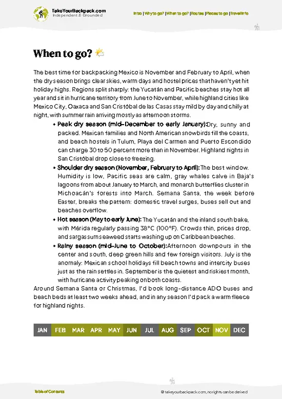
Best time to go: October - April
Duration: 2 days
Distance: 25 kilometers
Total ascent: 700 meters


example page 0 from our offline Travel Guide for Mexico
example page 1 from our offline Travel Guide for Mexico
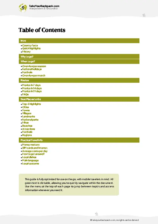
example page 2 from our offline Travel Guide for Mexico
example page 3 from our offline Travel Guide for Mexico
example page 4 from our offline Travel Guide for Mexico
example page 5 from our offline Travel Guide for Mexico
example page 6 from our offline Travel Guide for Mexico
example page 7 from our offline Travel Guide for Mexico
Loading the map 🌍
CLICK TO FILTER
cities
towns
villages
landmarks
national parks
hikes
beaches
attractions
festivals
regions
SHOW COUNTRY’S BESTSHOW ALL

✨ Why go?
Ranked #10 hike in Mexico
Reasons people choose to hike the here

Sierra de San Francisco Cave Paintings draws backpackers who want rock art without a tour-bus crowd. The first reason is the art itself: the Great Murals of the Sierra, with figures often larger than life-size, painted on rock shelter walls and listed by UNESCO. The second is the way you reach them. You hike or ride mules down canyons such as Cañón de San Pablo, sleeping at small ranches run by families who have lived here for generations. Their guides know every ledge, and you pay them directly, so money stays local. The third is flexibility. You can do one site in a long day or string several together over three or four days, then roll on along the Baja peninsula by bus to Mulegé or Guerrero Negro. Few places in Mexico offer this mix of deep history and genuine remoteness.

💡 HighlightsWhat this place is best known for

  1. Cueva del Ratón: The best-known site, reached in a day from the ranches near the Sierra. Its painted panel shows human and animal figures in red and black, some above head height, and the guide explains how the artists reached the high walls.
  2. Cueva Pintada: A big shelter in Cañón de San Pablo with crowded murals of deer, rabbits and human figures pierced by arrows. Its panel is among the largest in the Sierra.
  3. Cañón de San Pablo: The canyon itself is a draw: palms, rock walls and seasonal pools, with a steady trail that makes the approach pleasant.
  4. La Pintada: A mural site near the Sierra de San Francisco ranches, with red-and-black figures facing each other across the rock. Guides here point out overlapping layers where older paintings sit under newer ones.
  5. Rancho Santa Marta: Rather than a sight,
… read more 👉
  1. Cueva del Ratón: The best-known site, reached in a day from the ranches near the Sierra. Its painted panel shows human and animal figures in red and black, some above head height, and the guide explains how the artists reached the high walls.
  2. Cueva Pintada: A big shelter in Cañón de San Pablo with crowded murals of deer, rabbits and human figures pierced by arrows. Its panel is among the largest in the Sierra.
  3. Cañón de San Pablo: The canyon itself is a draw: palms, rock walls and seasonal pools, with a steady trail that makes the approach pleasant.
  4. La Pintada: A mural site near the Sierra de San Francisco ranches, with red-and-black figures facing each other across the rock. Guides here point out overlapping layers where older paintings sit under newer ones.
  5. Rancho Santa Marta: Rather than a sight, this is an experience: a small ranch base where guides, mules and simple meals are arranged. You get the local view of ranch life and cheese-making traditions.
Cañón de San Pablo costs nothing beyond your guide fee and the base permit, so it is the cheapest item here.
Spotted a mistake or missing something? Contact us.

🌤️ When to go?Seasonal considerations and timing

  • Winter (November to February): Days run 18 to 24°C (64 to 75°F), nights near freezing at canyon floors, so a warm sleeping layer matters. Daylight is short, about 10 to 11 hours, which limits mule days. This is the busiest window, with the most guide availability.
  • Spring (March to April): Highs reach 26 to 32°C (79 to 90°F) and mornings stay crisp. Wildflowers and steady conditions make this the sweet spot for most backpackers.
  • Summer (May to September): Canyon heat of 38 to 45°C (100 to 113°F) makes walking miserable, and tours mostly pause. Prices at San Ignacio lodgings dip.
  • Fall (October): Temperatures ease to 28 to 33°C (82 to 91°F), with occasional late storms.
Book your guide a few weeks ahead for November through March, since the local guide pool is small.

source: climatestotravel.comJANJanuary: highly recommended for travelingFEBFebruary: good for travelingMARMarch: highly recommended for travelingAPRApril: highly recommended for travelingMAYMay: fair for travelingJUNJune: below average for travelingJULJuly: below average for travelingAUGAugust: below average for travelingSEPSeptember: fair for travelingOCTOctober: good for travelingNOVNovember: highly recommended for travelingDECDecember: highly recommended for traveling
mexico-hike-sierra-de-san-francisco-cave-paintings
© Google |

✈️ The backpacker research shortcutMexico Travel Guide

An offline-friendly backpacking guide with optimized travel routes, ranked highlights, transport advice, and the best areas to stay.
example page 0 from our offline Travel Guide for Mexico
example page 1 from our offline Travel Guide for Mexico
example page 2 from our offline Travel Guide for Mexico
example page 3 from our offline Travel Guide for Mexico
example page 4 from our offline Travel Guide for Mexico
example page 5 from our offline Travel Guide for Mexico
example page 6 from our offline Travel Guide for Mexico
example page 7 from our offline Travel Guide for Mexico
The digital guide (402 pages) contains:
✅ 138 highlights, ranked by travel appeal
✅ Optimized 7, 14 & 21-day travel routes
✅ Cities, national parks, landmarks, beaches
✅ How to get around
✅ Offline-friendly for travel without Wi-Fi
👉 Click to see all 30+ guide features

📅 Plan smarter in minutes, not weeks
✅ Month by month travel advice
✅ Festivals & national holidays
✅ Budget expectations

🗺️ Go to the right places, skip the overrated ones
✅ Honest pros & cons of destinations
✅ Top hikes, parks & viewpoints
✅ Lesser-known places most travelers miss
✅ Clear “worth it vs skip it” guidance

🛏️ Travel smoothly without rookie mistakes
✅ Best areas to stay
✅ Transport systems explained simply
✅ Common scams & safety advice
✅ SIM cards, money & practical tips

🌍 Understand the country, not just visit it
✅ Culture & traditions
✅ 52 Essential phrases & customs
✅ Festivals worth planning around
✅ Traveler-friendly historical context
✅ Insights that make places more meaningful

📱 Built for real travel conditions
✅ Fully downloadable PDF
✅ Works completely offline
✅ Optimized for phone use
✅ Useful in remote areas & buses
✅ Everything in one place
Stop searching, start planning
Get instant access to your full guide. 30‑day money-back guarantee.
+ Add another guide for just

By proceeding you agree to our terms.
Sent to your inbox immediately after payment • 100% Secure Checkout
Best Backpacking Travel Advisor 2025 tourism awardBest Backpacking
Travel Advisor
2025
What others say about Take Your Backpack Guides:
⭐⭐⭐⭐⭐
Fantastic, amazing amount of information!
⭐⭐⭐⭐⭐
My goodness this is amazing, it's what I've been looking for hats off too you!
⭐⭐⭐⭐⭐
I think this is absolutely BRILLIANT
⭐⭐⭐⭐
Very complete and informative. It's still missing places, but I gotta to commend you
⭐⭐⭐⭐⭐
This is truly amazing, thank you, can't wait to explore it with my kids!
⭐⭐⭐⭐⭐
Awesome resource, thank you!
⭐⭐⭐⭐⭐
This is amazing! Can't wait to explore the ones I haven't seen
⭐⭐⭐⭐
I love this! Well done, great idea.
⭐⭐⭐⭐⭐
Thanks for taking the time to make this gem!
⭐⭐⭐⭐⭐
This might be the best website I've ever seen.
⭐⭐⭐⭐⭐
Congratulations, and thank you so much for your work; it's incredibly valuable.
⭐⭐⭐⭐
In all seriousness I think you did a great job pointing out the important spots
⭐⭐⭐⭐⭐
10/10 very good
⭐⭐⭐⭐⭐
As someone who's only just starting to visit regularly this is awesome, thank you.
⭐⭐⭐⭐
Thank you very much! I'm going to visit my dad, it's going to be very useful!
⭐⭐⭐⭐⭐
This is really cool! We'll be travelling for the first time and this definitely come in handy.
⭐⭐⭐⭐⭐
You are now our minister of culture, congratulations 👨‍💼
⭐⭐⭐⭐⭐
Just wanted to tell you that this is a pearl! Going to follow your recommendations.
⭐⭐⭐⭐⭐
This is so cool. I'll definitely be using the resource for my travels soon.
⭐⭐⭐⭐⭐
This is very impressive! Good work.
⭐⭐⭐⭐⭐
This is an amazing and informative site. Very well done!

🛏️ Where to stay?How to pick the right area

If you enjoy meeting fellow travelers, consider choosing hostels with high ratings for atmosphere. On the other hand, if you prefer having your own space, a hotel might be a better option.

🥾 Hike detailsRoute, distance, and difficulty explained

Total Distance: Sierra de San Francisco Cave Paintings is a network of day and multi-day routes, roughly 10 to 40 kilometers depending on the sites you choose.
Duration: One long day for a single site, or 2 to 4 days with overnight stays at ranches.
Difficulty: Moderate. Descents into canyons are steep and rocky, and the return climb is the hard part.
Starting Point: San Ignacio. Buses on the Baja highway stop in town, and the permit office and guides arrange the ride on dirt roads to the ranch trailheads.
Major Landmarks:
  • Cueva del Ratón: A panel of figures at a rock shelter.
  • Cueva Pintada: Crowded
… read more 👉
Total Distance: Sierra de San Francisco Cave Paintings is a network of day and multi-day routes, roughly 10 to 40 kilometers depending on the sites you choose.
Duration: One long day for a single site, or 2 to 4 days with overnight stays at ranches.
Difficulty: Moderate. Descents into canyons are steep and rocky, and the return climb is the hard part.
Starting Point: San Ignacio. Buses on the Baja highway stop in town, and the permit office and guides arrange the ride on dirt roads to the ranch trailheads.
Major Landmarks:
  • Cueva del Ratón: A panel of figures at a rock shelter.
  • Cueva Pintada: Crowded murals of animals and humans.
  • Cañón de San Pablo: A palm-lined canyon floor.
Terrain and Scenery: Volcanic mesas, rocky trails and canyons cut into dry desert uplands, with deep drops to the canyon floor.
Vegetation: Cardón cacti, palms, mesquite and desert shrubs. Water from springs brings greener patches.
Wildlife: Mule deer, rabbits, birds of prey and lizards, with bighorn sheep sometimes spotted in remote stretches.
⚠️ Hiking info can sometimes be outdated or inaccurate. Before you hit the trail, check the latest conditions with locals. If you do spot anything that's off, I'd love to hear from you, so I can update it for fellow travelers.

🛡️ SafetyStaying Safe: What Travelers Should Know

Heat, remoteness and rough footing are the real issues here, not danger. Most sites sit in deep canyons reached by long dirt tracks and short but rocky descents, with loose stone and little shade. Carry more water than seems sensible, wear sturdy shoes, and start early in warm months. Cell coverage is absent, so your guide’s local knowledge and vehicle are your safety net. Winter nights can drop near freezing, so bring a proper sleeping bag. Rattlesnakes live in the rocks. Watch where you put hands and feet, and give any snake space. Stay behind the markers at the paintings and never touch the rock, since oils damage the pigments. Mules are used on multi-day trips, so step aside calmly when they pass.

FAQCommon questions from travelers

Most visits to Sierra de San Francisco Cave Paintings take 2 to 5 days, depending on how many canyons you want. A single day trip from San Ignacio to Cueva del Ratón is possible, with roughly 2 hours of driving each way on dirt roads. Multi-day mule trips to Cueva Pintada and the Santa Teresa area add hikes of 1 to 3 hours per site.
Sierra de San Francisco Cave Paintings is moderate overall. Individual walks are short, usually 1 to 3 km (0.6 to 1.9 miles), but involve rocky descents and strong heat. Multi-day trips mean camping, long vehicle transfers and early starts, though you ride mules for gear and some distance.
Yes, Sierra de San Francisco Cave Paintings requires both. Entry is arranged through the INAH office in San Ignacio, Baja California Sur, which issues permits and assigns an authorized local guide. Expect roughly US$5 to 10 for the site permit plus guide and mule fees that typically total US$50 to 100 per day, paid in pesos.
⚠️ Things can change over time, so always validate details locally before you go.

Other Mexican hikes near Sierra de San Francisco Cave Paintings

Explore more nearby:


💡 Not sure where to go next?
Create a personalized itinerary for Mexico including Sierra de San Francisco Cave Paintings and the places that fit your trip.

Generate my itinerary

👉 Discover all hikes

Or checkout all Mexico has to offer (think cities, towns, villages, national parks, hikes, beaches, festivals)
Country photo of Mexico

We 💚 feedbackKey takeaways before you go

Sierra de San Francisco Cave Paintings trips fail when travelers arrive without arranging permits and a guide first. Visit the INAH office in San Ignacio early, confirm your sites, and allow an extra day in your schedule. I would bring good boots, a hat and cash, because ranches do not take cards.

✈️ When did I visit Mexico?
As part of my 1.5 year travel around the world trip, I visited Mexico in February and March 2016. Had to hurry a bit as I didn’t want to miss the free performance of the Rolling Stones in Cuba.

✍️ Help improve this page!
The information on this page is based on my own backpacking experience in Mexico, supplemented with up-to-date research and feedback from other travelers. Travel details can change, so if you notice anything outdated or incomplete, feel free to let me know.


🙋‍♂️ Give feedback

👋 Meet the founderWho’s Behind Take Your Backpack?

Johan, backpacker and founder of TakeYourBackpackHi, I’m Johan (Netherlands 🇳🇱), the creator of TakeYourBackpack. Over the past 3 decades, I’ve backpacked through 90+ countries across six continents, gaining extensive experience with independent travel, long-term trips, and overland routes.

This site is built on a combination of firsthand travel experience and carefully curated insights from other backpackers. Many guides are based on places I’ve personally visited, while others bring together tips, observations, and practical advice shared by trusted travelers I’ve met along the way.

The goal is to provide realistic, experience-driven guidance — not generic itineraries — so you can explore destinations with better context, clearer expectations, and more confidence.