×

Mexico🇲🇽 | national parksEl Pinacate y Gran Desierto de AltarElegante maar crater, lava fields, orange dunes, saguaro desert | things to do and best time to go

Explore Arrecifes de CozumelExplore Sierra de Manantlán

Backpacking in El Pinacate y Gran Desierto de Altar
🏆 Top picknational park ranked #4
By Johan Kruseman 🇳🇱 | Updated October 20, 2026

Entry is a short permit stop at the Pinacate visitor center, and the park sits beside a paved highway, so no tour is required. El Pinacate y Gran Desierto de Altar lies in the northwest of Mexico, in Sonora, near the Arizona border. The scenery is volcanic: black cinder cones, ten or so enormous craters, and rust-colored dunes rolling toward the Gulf of California. Hiking is good but exposed, wildlife is shy, and you will likely share the place with almost nobody. I expected a flat, empty sand sea. Instead I stood at the rim of Elegante Crater and found it deep, round and oddly tidy, like a bowl dug by a giant with a ruler. Roads here are dirt, so a high-clearance vehicle matters more than a sturdy pack, and cell signal vanishes quickly. Before going, get the permit at the visitor center first, because rangers will not let you wander in without one.

Discover everything you want to know in the 📖 Mexico Travel Guide.


example page 0 from our offline Travel Guide for Mexico
example page 1 from our offline Travel Guide for Mexico
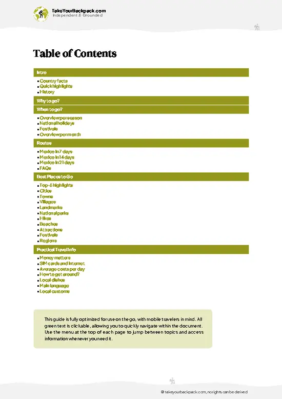
example page 2 from our offline Travel Guide for Mexico
example page 3 from our offline Travel Guide for Mexico
example page 4 from our offline Travel Guide for Mexico
example page 5 from our offline Travel Guide for Mexico
example page 6 from our offline Travel Guide for Mexico
example page 7 from our offline Travel Guide for Mexico
Loading the map 🌍
CLICK TO FILTER
cities
towns
villages
landmarks
national parks
hikes
beaches
attractions
festivals
regions
SHOW COUNTRY’S BESTSHOW ALL

✨ Why go?
Ranked #4 national park in Mexico
Reasons people choose to explore here

El Pinacate y Gran Desierto de Altar rewards people who like to decide their own pace. There is no guided-only gate, so you can drive the dirt loop from the visitor center, park at a trailhead and walk at dawn without a group schedule. That freedom is the main draw for self-guided travelers. The second reason is the geology, which is hard to find anywhere else in North America: roughly 400 volcanic cones and 10 giant maar craters, including the 1.5 kilometer wide Crater Elegante, sit beside the largest active sand dune field on the continent, the Gran Desierto de Altar. You can stand on black basalt in the morning and sink your boots into dunes the same afternoon. Third, camping is simple and cheap at designated sites near the visitor center, with the quiet of a place that sees few foreign … read more 👉
El Pinacate y Gran Desierto de Altar rewards people who like to decide their own pace. There is no guided-only gate, so you can drive the dirt loop from the visitor center, park at a trailhead and walk at dawn without a group schedule. That freedom is the main draw for self-guided travelers. The second reason is the geology, which is hard to find anywhere else in North America: roughly 400 volcanic cones and 10 giant maar craters, including the 1.5 kilometer wide Crater Elegante, sit beside the largest active sand dune field on the continent, the Gran Desierto de Altar. You can stand on black basalt in the morning and sink your boots into dunes the same afternoon. Third, camping is simple and cheap at designated sites near the visitor center, with the quiet of a place that sees few foreign visitors. Nights are dark enough for the Milky Way to cast faint shadows. Come self-sufficient and it feels like a private expedition.

💡 HighlightsThe experiences that define the visit

  1. Crater Elegante: The park's signature sight, a nearly perfect maar crater about 1.6 kilometers across and 250 meters deep, with a rim you can walk around for different views.
  2. Cerro del Pinacate: The highest peak, around 1,190 meters, a demanding climb from the volcanic landscape that rewards you with views across to the Gulf of California on clear days.
  3. Volcán Santa Clara: A broad shield volcano whose slopes show how lava once spread across the desert floor in thick, rough sheets.
  4. Campo de Dunas: Part of the Gran Desierto de Altar, tall sweeping sand ridges in orange and tan, with ripples that show wind direction and tracks of beetles and lizards.
  5. Tinajas and lava tubes: Small rock basins and tubes that hold seasonal water, drawing birds and bighorn sheep, and used for centuries by the Tohono
… read more 👉
  1. Crater Elegante: The park's signature sight, a nearly perfect maar crater about 1.6 kilometers across and 250 meters deep, with a rim you can walk around for different views.
  2. Cerro del Pinacate: The highest peak, around 1,190 meters, a demanding climb from the volcanic landscape that rewards you with views across to the Gulf of California on clear days.
  3. Volcán Santa Clara: A broad shield volcano whose slopes show how lava once spread across the desert floor in thick, rough sheets.
  4. Campo de Dunas: Part of the Gran Desierto de Altar, tall sweeping sand ridges in orange and tan, with ripples that show wind direction and tracks of beetles and lizards.
  5. Tinajas and lava tubes: Small rock basins and tubes that hold seasonal water, drawing birds and bighorn sheep, and used for centuries by the Tohono O’odham and Hia-Ced O’odham.
  6. Sendero Cerro Colorado: A short, easy walk to a red cinder cone with crater views, ideal for a first look at the volcanic field.
  7. Saguaro and cholla gardens: Dense stands near the lower roads, glowing at dawn and loud with cactus wrens.
  8. Visitor Center exhibits: Clear maps, geology displays and staff who know current road conditions.
El Pinacate y Gran Desierto de Altar can be sampled in one long day, though two to three days lets you cover the crater, a climb and the dunes without rushing.
Spotted a mistake or missing something? Contact us.

🌤️ When to go?Choosing the right time of year

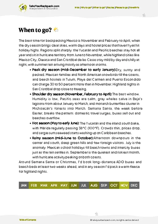
  • Winter (December to February): Days run 18 to 24°C (64 to 75°F), nights can fall to 2 to 8°C (36 to 46°F), and daylight lasts roughly 10 to 11 hours. This is the comfortable window for hiking the lava fields and climbing Cerro Pinacate, and it is also the busiest, though still quiet by national park standards.
  • Spring (March to April): Highs climb from 26 to 35°C (79 to 95°F). Wildflowers can carpet the dunes after wet winters, and camping is pleasant. Start hikes at dawn by April.
  • Summer (May to September): Highs of 40 to 48°C (104 to 118°F) make hiking dangerous in the afternoon. Monsoon storms bring brief downpours and humidity from July. The reserve is nearly empty and lodging is cheapest.
  • Autumn (October to November): Highs ease from 35 to 25°C (95 to 77°F), days shorten to about 11 hours,
… read more 👉
  • Winter (December to February): Days run 18 to 24°C (64 to 75°F), nights can fall to 2 to 8°C (36 to 46°F), and daylight lasts roughly 10 to 11 hours. This is the comfortable window for hiking the lava fields and climbing Cerro Pinacate, and it is also the busiest, though still quiet by national park standards.
  • Spring (March to April): Highs climb from 26 to 35°C (79 to 95°F). Wildflowers can carpet the dunes after wet winters, and camping is pleasant. Start hikes at dawn by April.
  • Summer (May to September): Highs of 40 to 48°C (104 to 118°F) make hiking dangerous in the afternoon. Monsoon storms bring brief downpours and humidity from July. The reserve is nearly empty and lodging is cheapest.
  • Autumn (October to November): Highs ease from 35 to 25°C (95 to 77°F), days shorten to about 11 hours, and visitor numbers rise slowly toward winter.
Book a ranger-guided or self-guided trip for late November through February, and you get the best weather with space to yourself on weekdays.


source: climatestotravel.comJANJanuary: excellent for travelingFEBFebruary: excellent for travelingMARMarch: highly recommended for travelingAPRApril: highly recommended for travelingMAYMay: fair for travelingJUNJune: below average for travelingJULJuly: below average for travelingAUGAugust: below average for travelingSEPSeptember: fair for travelingOCTOctober: highly recommended for travelingNOVNovember: excellent for travelingDECDecember: excellent for traveling
when-to-go

✈️ The backpacker research shortcutMexico Travel Guide

An offline-friendly backpacking guide with optimized travel routes, ranked highlights, transport advice, and the best areas to stay.
example page 0 from our offline Travel Guide for Mexico
example page 1 from our offline Travel Guide for Mexico
example page 2 from our offline Travel Guide for Mexico
example page 3 from our offline Travel Guide for Mexico
example page 4 from our offline Travel Guide for Mexico
example page 5 from our offline Travel Guide for Mexico
example page 6 from our offline Travel Guide for Mexico
example page 7 from our offline Travel Guide for Mexico
The digital guide (402 pages) contains:
✅ 138 highlights, ranked by travel appeal
✅ Optimized 7, 14 & 21-day travel routes
✅ Cities, national parks, landmarks, beaches
✅ How to get around
✅ Offline-friendly for travel without Wi-Fi
👉 Click to see all 30+ guide features

📅 Plan smarter in minutes, not weeks
✅ Month by month travel advice
✅ Festivals & national holidays
✅ Budget expectations

🗺️ Go to the right places, skip the overrated ones
✅ Honest pros & cons of destinations
✅ Top hikes, parks & viewpoints
✅ Lesser-known places most travelers miss
✅ Clear “worth it vs skip it” guidance

🛏️ Travel smoothly without rookie mistakes
✅ Best areas to stay
✅ Transport systems explained simply
✅ Common scams & safety advice
✅ SIM cards, money & practical tips

🌍 Understand the country, not just visit it
✅ Culture & traditions
✅ 52 Essential phrases & customs
✅ Festivals worth planning around
✅ Traveler-friendly historical context
✅ Insights that make places more meaningful

📱 Built for real travel conditions
✅ Fully downloadable PDF
✅ Works completely offline
✅ Optimized for phone use
✅ Useful in remote areas & buses
✅ Everything in one place
Stop searching, start planning
Get instant access to your full guide. 30‑day money-back guarantee.
+ Add another guide for just

By proceeding you agree to our terms.
Sent to your inbox immediately after payment • 100% Secure Checkout
Best Backpacking Travel Advisor 2025 tourism awardBest Backpacking
Travel Advisor
2025
What others say about Take Your Backpack Guides:
⭐⭐⭐⭐⭐
Fantastic, amazing amount of information!
⭐⭐⭐⭐⭐
My goodness this is amazing, it's what I've been looking for hats off too you!
⭐⭐⭐⭐⭐
I think this is absolutely BRILLIANT
⭐⭐⭐⭐
Very complete and informative. It's still missing places, but I gotta to commend you
⭐⭐⭐⭐⭐
This is truly amazing, thank you, can't wait to explore it with my kids!
⭐⭐⭐⭐⭐
Awesome resource, thank you!
⭐⭐⭐⭐⭐
This is amazing! Can't wait to explore the ones I haven't seen
⭐⭐⭐⭐
I love this! Well done, great idea.
⭐⭐⭐⭐⭐
Thanks for taking the time to make this gem!
⭐⭐⭐⭐⭐
This might be the best website I've ever seen.
⭐⭐⭐⭐⭐
Congratulations, and thank you so much for your work; it's incredibly valuable.
⭐⭐⭐⭐
In all seriousness I think you did a great job pointing out the important spots
⭐⭐⭐⭐⭐
10/10 very good
⭐⭐⭐⭐⭐
As someone who's only just starting to visit regularly this is awesome, thank you.
⭐⭐⭐⭐
Thank you very much! I'm going to visit my dad, it's going to be very useful!
⭐⭐⭐⭐⭐
This is really cool! We'll be travelling for the first time and this definitely come in handy.
⭐⭐⭐⭐⭐
You are now our minister of culture, congratulations 👨‍💼
⭐⭐⭐⭐⭐
Just wanted to tell you that this is a pearl! Going to follow your recommendations.
⭐⭐⭐⭐⭐
This is so cool. I'll definitely be using the resource for my travels soon.
⭐⭐⭐⭐⭐
This is very impressive! Good work.
⭐⭐⭐⭐⭐
This is an amazing and informative site. Very well done!

🛏️ Where to stay?Where staying makes the most sense

The most practical bases are the towns of Sonoyta and Puerto Peñasco, with simple camping available at the reserve itself. Sonoyta, about 15 to 25 minutes by road from the visitor center turnoff, has a few basic hotels at roughly US$35 to 60 a night and taco stands for dinner. It is the closest option and the usual place to stock up on water and food.
Puerto Peñasco, around 1.5 to 2 hours away on the Gulf of California, offers more choice: hostels and budget hotels from about US$20 to 70, beachfront places that cost more in spring break and summer weekends, and plenty of seafood restaurants. It … read more 👉
The most practical bases are the towns of Sonoyta and Puerto Peñasco, with simple camping available at the reserve itself. Sonoyta, about 15 to 25 minutes by road from the visitor center turnoff, has a few basic hotels at roughly US$35 to 60 a night and taco stands for dinner. It is the closest option and the usual place to stock up on water and food.
Puerto Peñasco, around 1.5 to 2 hours away on the Gulf of California, offers more choice: hostels and budget hotels from about US$20 to 70, beachfront places that cost more in spring break and summer weekends, and plenty of seafood restaurants. It suits you if you want a beach day before or after the desert.
Inside the reserve, the visitor center (Centro de Visitantes Schuk Toak) area has designated camping areas with basic facilities, and you can also camp at designated spots near craters such as Elegante. There are no hotels, shops, or reliable water inside, so bring everything. Camping is free or low cost with your entry permit. Across the border, Ajo and Lukeville in Arizona have motels and RV parks if you are crossing at Sonoyta.

👛 Costs (as of 20 October 2026)Money, prices, and spending tips

A realistic budget for El Pinacate y Gran Desierto de Altar is about US$53 to 110 a day, with most of that going to transport and food. The table shows typical costs paid in pesos.
CategoryBudget RangeLocal Reality
Entrance feeUS$3 to 5Paid per person at the visitor center; fees are low and cash is preferred.
Accommodation (high season)US$20 to 45Camping in the reserve is basic and cheap; hotels in Sonoyta or hostels in Puerto Peñasco cost more.
Local transportUS$15 to 30Few buses reach the reserve, so expect a shared ride, taxi from Sonoyta, or fuel costs if driving.
Food and suppliesUS$10 to 20Tacos and set meals in Sonoyta are cheap; stock water and snacks before entering because nothing is sold in the park.
Guide (optional)US$5 to 10Local guides charge per group, so costs per person drop in
… read more 👉
A realistic budget for El Pinacate y Gran Desierto de Altar is about US$53 to 110 a day, with most of that going to transport and food. The table shows typical costs paid in pesos.
CategoryBudget RangeLocal Reality
Entrance feeUS$3 to 5Paid per person at the visitor center; fees are low and cash is preferred.
Accommodation (high season)US$20 to 45Camping in the reserve is basic and cheap; hotels in Sonoyta or hostels in Puerto Peñasco cost more.
Local transportUS$15 to 30Few buses reach the reserve, so expect a shared ride, taxi from Sonoyta, or fuel costs if driving.
Food and suppliesUS$10 to 20Tacos and set meals in Sonoyta are cheap; stock water and snacks before entering because nothing is sold in the park.
Guide (optional)US$5 to 10Local guides charge per group, so costs per person drop in a larger party.
Total Daily BudgetUS$53 to 110Lower end assumes camping and shared driving costs.


source: gob.mx
⚠️ Prices can change and everyone travels differently, so take this as a rough guide. Hope it helps you plan your adventure!

🥾 TrailsHiking El Pinacate y Gran Desierto de Altar national park: highlights and difficulty

El Pinacate y Gran Desierto de Altar offers walking that ranges from short rim strolls to full-day volcanic climbs, on lava rock, cinder and loose sand. Most routes start from dirt roads reached from the visitor center.
  • Sendero Crater Elegante: Short, easy to moderate walk to the rim, about 1 to 2 hours depending on how far you circle. Open, exposed, with big views down into the crater.
  • Sendero Cerro Colorado: Easy, brief, around 1 hour, to a red cinder cone and crater view.
  • Sendero Cerro Pinacate: Hard, a full day, long and hot, on sharp lava and loose cinders, to the summit. Start at first light.
… read more 👉
El Pinacate y Gran Desierto de Altar offers walking that ranges from short rim strolls to full-day volcanic climbs, on lava rock, cinder and loose sand. Most routes start from dirt roads reached from the visitor center.
  • Sendero Crater Elegante: Short, easy to moderate walk to the rim, about 1 to 2 hours depending on how far you circle. Open, exposed, with big views down into the crater.
  • Sendero Cerro Colorado: Easy, brief, around 1 hour, to a red cinder cone and crater view.
  • Sendero Cerro Pinacate: Hard, a full day, long and hot, on sharp lava and loose cinders, to the summit. Start at first light.
  • Dunes walks: Moderate, a few hours, soft sand that tires the legs quickly and requires careful navigation since tracks blow away.
Wildlife is mostly seen at dawn and dusk: pronghorn, desert tortoises, coyotes, lizards and many birds. Rattlesnakes exist, so watch where you step. Public transport does not reach the park, so most people drive from Sonoyta or come with a tour from Puerto Peñasco. Entry requires a permit at the visitor center for a modest fee, paid in pesos. Crowds are rare, even on weekends, and some days you may see few other people. Shade is almost absent, and mobile signal is patchy, so tell someone your plan and carry extra water and a printed map.
⚠️ Hiking info can sometimes be outdated or inaccurate. Before you hit the trail, check the latest conditions with locals. If you do spot anything that's off, I'd love to hear from you, so I can update it for fellow travelers.

🛡️ SafetyStaying Safe: What Travelers Should Know

The main risk here is heat and distance, not people or animals. Summer temperatures above 45°C (113°F) have caused real emergencies, so plan hikes between October and April and start at first light. Carry at least 4 liters of water per person per day, a hat, and sun protection, and expect no shade on the lava fields or dunes.
The volcanic rock is sharp and uneven, so wear sturdy boots and gloves for scrambling. Trails and tracks can look similar in the dunes, so download an offline map and carry a GPS track. Cell service is patchy to absent.
Dirt roads inside the reserve turn to soft sand, so a high-clearance vehicle is wise and a second spare tire is smart. Tell someone your route. Rattlesnakes, scorpions, and desert tortoises are present; watch where you place hands and feet, and leave animals … read more 👉
The main risk here is heat and distance, not people or animals. Summer temperatures above 45°C (113°F) have caused real emergencies, so plan hikes between October and April and start at first light. Carry at least 4 liters of water per person per day, a hat, and sun protection, and expect no shade on the lava fields or dunes.
The volcanic rock is sharp and uneven, so wear sturdy boots and gloves for scrambling. Trails and tracks can look similar in the dunes, so download an offline map and carry a GPS track. Cell service is patchy to absent.
Dirt roads inside the reserve turn to soft sand, so a high-clearance vehicle is wise and a second spare tire is smart. Tell someone your route. Rattlesnakes, scorpions, and desert tortoises are present; watch where you place hands and feet, and leave animals alone. Check for a current ranger briefing at the visitor center.

FAQTraveler FAQ

Plan on 2 to 3 days for El Pinacate y Gran Desierto de Altar. One day covers the visitor center, the Elegante Crater rim and a short lava-field walk, while a second day lets you tackle Cerro Pinacate (about 1,190 meters) or explore the dunes. Add a third if you want to camp near the craters.
Visiting El Pinacate y Gran Desierto de Altar without a car is difficult but possible. Buses run to Sonoyta from Puerto Peñasco (about 1.5 to 2 hours) and Mexicali or Hermosillo, and from Sonoyta you can arrange a taxi or local guide for the roughly 20 to 30 minute trip to the visitor center. Inside the reserve distances are long on sandy tracks, so hiring a driver for a day is the realistic option.
Yes, El Pinacate y Gran Desierto de Altar charges a small entrance fee, typically around US$3 to 5 per person, paid at the visitor center. Camping and hiking inside the reserve are covered by registering there, and you should carry cash in pesos. Bring ID and register before heading to the craters, since rangers track visitors for safety.
⚠️ Things can change over time, so always validate details locally before you go.

Other Mexican national parks near El Pinacate y Gran Desierto de Altar

Explore more nearby:

  • Sierra de San Pedro Mártir—Picacho del Diablo, dark-sky observatory, Vallecitos meadow, Jeffrey pines| 189 km away
  • El Vizcaíno—Gray whale lagoons, Sierra de San Francisco rock art, salt works, boojum trees| 489 km away
  • Basaseachic Falls—246-meter drop, rim lookouts, plunge-pool descent, Candameña gorge| 683 km away

💡 Not sure where to go next?
Create a personalized itinerary for Mexico including El Pinacate y Gran Desierto de Altar and the places that fit your trip.

Generate my itinerary

👉 Discover all national parks

Or checkout all Mexico has to offer (think cities, towns, villages, national parks, hikes, beaches, festivals)
Country photo of Mexico

We 💚 feedbackIs it worth it?

El Pinacate y Gran Desierto de Altar hides its best trick in the dark. Most first-timers rush the craters by day and leave, yet the park’s sky is remarkably free of light pollution, and the black lava rock makes camping nights feel strangely quiet. I would stay past dusk, bring a red flashlight, and give the stars a full evening.

✈️ When did I visit Mexico?
As part of my 1.5 year travel around the world trip, I visited Mexico in February and March 2016. Had to hurry a bit as I didn’t want to miss the free performance of the Rolling Stones in Cuba.

✍️ Help improve this page!
The information on this page is based on my own backpacking experience in Mexico, supplemented with up-to-date research and feedback from other travelers. Travel details can change, so if you notice anything outdated or incomplete, feel free to let me know.


🙋‍♂️ Give feedback

👋 Meet the founderWho’s Behind Take Your Backpack?

Johan, backpacker and founder of TakeYourBackpackHi, I’m Johan (Netherlands 🇳🇱), the creator of TakeYourBackpack. Over the past 3 decades, I’ve backpacked through 90+ countries across six continents, gaining extensive experience with independent travel, long-term trips, and overland routes.

This site is built on a combination of firsthand travel experience and carefully curated insights from other backpackers. Many guides are based on places I’ve personally visited, while others bring together tips, observations, and practical advice shared by trusted travelers I’ve met along the way.

The goal is to provide realistic, experience-driven guidance — not generic itineraries — so you can explore destinations with better context, clearer expectations, and more confidence.