×

Mexico🇲🇽 | national parksSierra de San Pedro MártirPicacho del Diablo, dark-sky observatory, Vallecitos meadow, Jeffrey pines | things to do and best time to go

Explore Lagunas de MontebelloExplore Basaseachic Falls

Backpacking in Sierra de San Pedro Mártir
👌 Worth visitingnational park ranked #19
By Johan Kruseman 🇳🇱 | Updated October 20, 2026

Mainland Mexico’s highest peak outside the volcanic belt, Picacho del Diablo, sits here, and the park has no entrance gate staffed like a postcard. Sierra de San Pedro Mártir rises in the north of Mexico, in Baja California, southeast of Ensenada. I once showed up with no cash for the park fee and a half-empty fuel tank, and the ranger shrugged at both. Fill up and carry pesos beforehand. Best for self-sufficient hikers and stargazers; skip it if you need cell signal or café stops.

Discover everything you want to know in the 📖 Mexico Travel Guide.


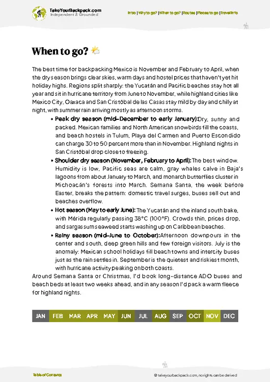
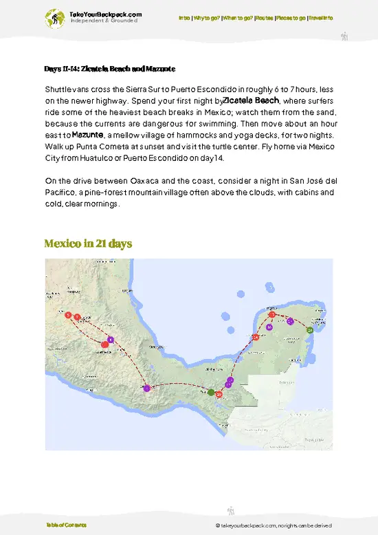
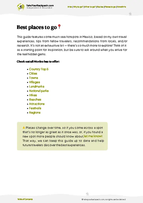
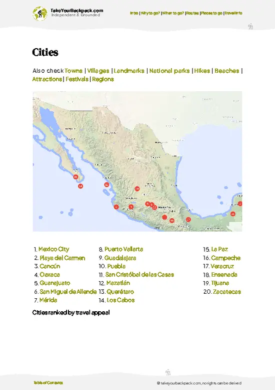
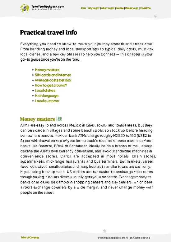
example page 0 from our offline Travel Guide for Mexico
example page 1 from our offline Travel Guide for Mexico
example page 2 from our offline Travel Guide for Mexico
example page 3 from our offline Travel Guide for Mexico
example page 4 from our offline Travel Guide for Mexico
example page 5 from our offline Travel Guide for Mexico
example page 6 from our offline Travel Guide for Mexico
example page 7 from our offline Travel Guide for Mexico
Loading the map 🌍
CLICK TO FILTER
cities
towns
villages
landmarks
national parks
hikes
beaches
attractions
festivals
regions
SHOW COUNTRY’S BESTSHOW ALL

✨ Why go?
Ranked #19 national park in Mexico
Reasons people choose to explore here

Sierra de San Pedro Mártir suits backpackers who like to plan their own route, because the park runs on self-reliance, not guided packages. The reasons to come are specific. The high plateau holds Picacho del Diablo, the tallest peak in Baja at roughly 3,096 meters, and the pine forest around it is quiet enough that you may share a trail with no one. The National Astronomical Observatory sits here because the night sky is among the darkest in North America, so your free camp doubles as a planetarium.

💡 HighlightsPlaces and moments you shouldn't skip

  1. Picacho del Diablo: The highest summit in Baja California, a granite pyramid that rewards a multi-day scramble with views of both the Pacific and the Sea of Cortez.
  2. Observatorio Astronómico Nacional: Domes on the plateau where the dark, dry air draws astronomers; the white buildings are visible from the road.
  3. La Encantada Meadow: A high, grassy clearing ringed by pines, popular for camping and reached on foot from the road end.
  4. Cañón del Diablo: A deep, steep-walled gorge on the east face with pools and boulder fields, for experienced canyon walkers.
  5. Vallecitos: A cool meadow with a seasonal stream and open campsites, a gentle introduction to the high country.
  6. Dark-sky stargazing: Away from any town, the Milky Way throws shadows on clear nights, with no lights to compete.
  7. Pine forest and wildlife:
… read more 👉
  1. Picacho del Diablo: The highest summit in Baja California, a granite pyramid that rewards a multi-day scramble with views of both the Pacific and the Sea of Cortez.
  2. Observatorio Astronómico Nacional: Domes on the plateau where the dark, dry air draws astronomers; the white buildings are visible from the road.
  3. La Encantada Meadow: A high, grassy clearing ringed by pines, popular for camping and reached on foot from the road end.
  4. Cañón del Diablo: A deep, steep-walled gorge on the east face with pools and boulder fields, for experienced canyon walkers.
  5. Vallecitos: A cool meadow with a seasonal stream and open campsites, a gentle introduction to the high country.
  6. Dark-sky stargazing: Away from any town, the Milky Way throws shadows on clear nights, with no lights to compete.
  7. Pine forest and wildlife: Jeffrey pines shelter mule deer, bighorn sheep, and the occasional California condor overhead.
Sierra de San Pedro Mártir pairs the observatory and La Encantada Meadow nicely in a single day, since both lie along the same high road.
Spotted a mistake or missing something? Contact us.

Things to do near Sierra de San Pedro Mártir

Ratings based on Tripadvisor reviews. When you book through this link, you support our work at no extra cost to you.

🌤️ When to go?Seasonal considerations and timing

  • Late Spring (May to June): Dry, with daytime highs of 15 to 24°C (59 to 75°F) and cold nights near freezing at the top. Long daylight, and the best window for hiking to Picacho del Diablo.
  • Summer (July to September): Afternoon thunderstorms are common. Highs of 22 to 28°C (72 to 82°F). Fewer people.
  • Fall (October to November): Crisp and settled, with highs of 12 to 20°C (54 to 68°F). Short days and busy weekends.
  • Winter (December to March): Snow is possible, lows reach -10°C (14°F).
Book Mexican holiday weeks like Semana Santa early, as camping and lodging fill.

source: climatestotravel.comJANJanuary: highly recommended for travelingFEBFebruary: excellent for travelingMARMarch: excellent for travelingAPRApril: excellent for travelingMAYMay: highly recommended for travelingJUNJune: fair for travelingJULJuly: below average for travelingAUGAugust: below average for travelingSEPSeptember: fair for travelingOCTOctober: good for travelingNOVNovember: highly recommended for travelingDECDecember: highly recommended for traveling
mexico-national-park-sierra-de-san-pedro-martir
© Google |

✈️ The backpacker research shortcutMexico Travel Guide

An offline-friendly backpacking guide with optimized travel routes, ranked highlights, transport advice, and the best areas to stay.
example page 0 from our offline Travel Guide for Mexico
example page 1 from our offline Travel Guide for Mexico
example page 2 from our offline Travel Guide for Mexico
example page 3 from our offline Travel Guide for Mexico
example page 4 from our offline Travel Guide for Mexico
example page 5 from our offline Travel Guide for Mexico
example page 6 from our offline Travel Guide for Mexico
example page 7 from our offline Travel Guide for Mexico
The digital guide (402 pages) contains:
✅ 138 highlights, ranked by travel appeal
✅ Optimized 7, 14 & 21-day travel routes
✅ Cities, national parks, landmarks, beaches
✅ How to get around
✅ Offline-friendly for travel without Wi-Fi
👉 Click to see all 30+ guide features

📅 Plan smarter in minutes, not weeks
✅ Month by month travel advice
✅ Festivals & national holidays
✅ Budget expectations

🗺️ Go to the right places, skip the overrated ones
✅ Honest pros & cons of destinations
✅ Top hikes, parks & viewpoints
✅ Lesser-known places most travelers miss
✅ Clear “worth it vs skip it” guidance

🛏️ Travel smoothly without rookie mistakes
✅ Best areas to stay
✅ Transport systems explained simply
✅ Common scams & safety advice
✅ SIM cards, money & practical tips

🌍 Understand the country, not just visit it
✅ Culture & traditions
✅ 52 Essential phrases & customs
✅ Festivals worth planning around
✅ Traveler-friendly historical context
✅ Insights that make places more meaningful

📱 Built for real travel conditions
✅ Fully downloadable PDF
✅ Works completely offline
✅ Optimized for phone use
✅ Useful in remote areas & buses
✅ Everything in one place
Stop searching, start planning
Get instant access to your full guide. 30‑day money-back guarantee.
+ Add another guide for just

By proceeding you agree to our terms.
Sent to your inbox immediately after payment • 100% Secure Checkout
Best Backpacking Travel Advisor 2025 tourism awardBest Backpacking
Travel Advisor
2025
What others say about Take Your Backpack Guides:
⭐⭐⭐⭐⭐
Fantastic, amazing amount of information!
⭐⭐⭐⭐⭐
My goodness this is amazing, it's what I've been looking for hats off too you!
⭐⭐⭐⭐⭐
I think this is absolutely BRILLIANT
⭐⭐⭐⭐
Very complete and informative. It's still missing places, but I gotta to commend you
⭐⭐⭐⭐⭐
This is truly amazing, thank you, can't wait to explore it with my kids!
⭐⭐⭐⭐⭐
Awesome resource, thank you!
⭐⭐⭐⭐⭐
This is amazing! Can't wait to explore the ones I haven't seen
⭐⭐⭐⭐
I love this! Well done, great idea.
⭐⭐⭐⭐⭐
Thanks for taking the time to make this gem!
⭐⭐⭐⭐⭐
This might be the best website I've ever seen.
⭐⭐⭐⭐⭐
Congratulations, and thank you so much for your work; it's incredibly valuable.
⭐⭐⭐⭐
In all seriousness I think you did a great job pointing out the important spots
⭐⭐⭐⭐⭐
10/10 very good
⭐⭐⭐⭐⭐
As someone who's only just starting to visit regularly this is awesome, thank you.
⭐⭐⭐⭐
Thank you very much! I'm going to visit my dad, it's going to be very useful!
⭐⭐⭐⭐⭐
This is really cool! We'll be travelling for the first time and this definitely come in handy.
⭐⭐⭐⭐⭐
You are now our minister of culture, congratulations 👨‍💼
⭐⭐⭐⭐⭐
Just wanted to tell you that this is a pearl! Going to follow your recommendations.
⭐⭐⭐⭐⭐
This is so cool. I'll definitely be using the resource for my travels soon.
⭐⭐⭐⭐⭐
This is very impressive! Good work.
⭐⭐⭐⭐⭐
This is an amazing and informative site. Very well done!

🛏️ Where to stay?How to pick the right area

Camping is the main option inside the park, because the only real lodging sits at the edges. Sleep at designated sites near La Grulla and Vallecitos, or at the trailhead meadows, where you pitch a tent for a small fee and bring everything you need. Outside the boundary, San Telmo de Abajo and the village of Santo Tomás have a few simple guesthouses. The nearest real town for hotels, supplies and hostels is San Quintín, about two hours west by road. Ensenada is farther, around four hours, with a much wider choice of budget rooms.

👛 Costs (as of 20 October 2026)Typical daily expenses

A typical day in Sierra de San Pedro Mártir runs about US$30 to 76 for a camping-based trip with self-catered food. The table breaks it down.
CategoryBudget RangeLocal Reality
Park entranceUS$3 to 6Paid per person at the gate, in pesos
AccommodationUS$5 to 30Camping is cheap; a guesthouse or motel nearby costs more
Local transportUS$10 to 20Shared rides or fuel share for the dirt road from the highway
Food and suppliesUS$12 to 20Buy staples in San Quintín, since nothing is sold in the park
Total Daily BudgetUS$30 to 76Midpoint around US$45 with camping


source: gob.mx
⚠️ Prices can change and everyone travels differently, so take this as a rough guide. Hope it helps you plan your adventure!

🥾 TrailsHiking Sierra de San Pedro Mártir national park: highlights and difficulty

Sierra de San Pedro Mártir offers high-altitude walking on granite and pine, with trails that are mostly unsigned and best followed with a map and GPS.
  • La Grulla to La Encantada: Roughly 8 to 10 km one way, 3 to 4 hours, moderate. Gentle forested terrain across meadows and streams.
  • Vallecitos loop: Short, easy walks of 1 to 2 hours around the meadow, good for acclimatizing at about 2,400 meters.
  • Picacho del Diablo route: Strenuous, usually 3 to 4 days round trip, with steep scrambling, route-finding, and serious elevation gain. Experienced hikers only.
  • Wildlife: Watch for mule deer, coyotes, bighorn
… read more 👉
Sierra de San Pedro Mártir offers high-altitude walking on granite and pine, with trails that are mostly unsigned and best followed with a map and GPS.
  • La Grulla to La Encantada: Roughly 8 to 10 km one way, 3 to 4 hours, moderate. Gentle forested terrain across meadows and streams.
  • Vallecitos loop: Short, easy walks of 1 to 2 hours around the meadow, good for acclimatizing at about 2,400 meters.
  • Picacho del Diablo route: Strenuous, usually 3 to 4 days round trip, with steep scrambling, route-finding, and serious elevation gain. Experienced hikers only.
  • Wildlife: Watch for mule deer, coyotes, bighorn sheep, and condors; mountain lions live here but are rarely seen.
Reaching the park without a vehicle is difficult. Buses run to San Telmo de Abajo or Colonet, and from there you must hitch or arrange a ride up the long dirt road. Crowds are tiny, even on weekends. A modest entrance fee is paid in pesos at the gate, so carry cash. Water sources are seasonal, so check them before heading out.
⚠️ Hiking info can sometimes be outdated or inaccurate. Before you hit the trail, check the latest conditions with locals. If you do spot anything that's off, I'd love to hear from you, so I can update it for fellow travelers.

🛡️ SafetyTraveler Safety Guide

Sierra de San Pedro Mártir is straightforward for prepared hikers, with the main issues being altitude and weather. Trails climb above 2,400 meters (7,900 feet), so pace yourself and drink steadily. Water sources are sparse in dry months, so check streams and carry a filter. Nights drop below freezing even in late spring, and summer storms bring lightning on open ridges. Navigation on the Picacho del Diablo route needs a map or GPS track. Pumas and rattlesnakes exist but are rarely seen; store food securely and give wildlife space.

FAQCommon questions from travelers

Plan on 3 to 4 days for Sierra de San Pedro Mártir if you want to see the plateau, the observatory area and La Grulla. Hiking Picacho del Diablo, the tallest peak in Baja California at about 3,096 meters (10,157 feet), takes 3 to 4 days round trip. Add a day for the long drive in and acclimatizing.
Visiting Sierra de San Pedro Mártir without a car is hard but possible. Buses run from Ensenada to San Quintín in about 3 hours, but the 90 km (56 mile) paved road up to the park has no public transport. You can hire a driver in San Telmo or San Quintín for roughly US$60 to 100 one way, or hitch with other hikers.
Yes, Sierra de San Pedro Mártir charges a small entrance fee, around US$3 to 6 per person, paid in pesos at the gate. Camping adds a modest fee, and backcountry hikers to Picacho del Diablo should register with park staff. Bring cash, since cards are not accepted.
⚠️ Things can change over time, so always validate details locally before you go.

Other Mexican national parks near Sierra de San Pedro Mártir

Explore more nearby:


💡 Not sure where to go next?
Create a personalized itinerary for Mexico including Sierra de San Pedro Mártir and the places that fit your trip.

Generate my itinerary

👉 Discover all national parks

Or checkout all Mexico has to offer (think cities, towns, villages, national parks, hikes, beaches, festivals)
Country photo of Mexico

We 💚 feedbackWhat to keep in mind

Sierra de San Pedro Mártir will delight self-sufficient hikers, campers, and night-sky addicts who like their trails empty. If you need services or signs, it will frustrate you. I would bring a water filter, printed maps, and a full tank.

✈️ When did I visit Mexico?
As part of my 1.5 year travel around the world trip, I visited Mexico in February and March 2016. Had to hurry a bit as I didn’t want to miss the free performance of the Rolling Stones in Cuba.

✍️ Help improve this page!
The information on this page is based on my own backpacking experience in Mexico, supplemented with up-to-date research and feedback from other travelers. Travel details can change, so if you notice anything outdated or incomplete, feel free to let me know.


🙋‍♂️ Give feedback

👋 Meet the founderWho’s Behind Take Your Backpack?

Johan, backpacker and founder of TakeYourBackpackHi, I’m Johan (Netherlands 🇳🇱), the creator of TakeYourBackpack. Over the past 3 decades, I’ve backpacked through 90+ countries across six continents, gaining extensive experience with independent travel, long-term trips, and overland routes.

This site is built on a combination of firsthand travel experience and carefully curated insights from other backpackers. Many guides are based on places I’ve personally visited, while others bring together tips, observations, and practical advice shared by trusted travelers I’ve met along the way.

The goal is to provide realistic, experience-driven guidance — not generic itineraries — so you can explore destinations with better context, clearer expectations, and more confidence.