×
Te Araroa Trail

New Zealand🇳🇿 | hikesTe Araroa TrailRichmond Range, greywacke ridges, Nelson Lakes, flood-prone rivers | things to do and best time to go

Explore Routeburn TrackExplore Tongariro Alpine Crossing

Backpacking in Te Araroa Trail
👌 Worth visitinghike ranked #7
By Johan Kruseman 🇳🇱 | Updated October 15, 2026

The Te Araroa Trail starts at Cape Reinga and ends 3,000 kilometers south at Bluff, running the length of New Zealand. Its northern South Island stretch through the Richmond Range and Nelson Lakes is remote: long ridgelines, huts every day or so, and river valleys that flood after rain, which is why hikers there check forecasts before every crossing. I still connect it with the clack of poles on greywacke scree and the bellbirds ringing out of beech forest above the Pelorus River. Public transport reaches Nelson and Havelock, but trailheads need a shuttle or hitched ride. The effort buys you alpine views over Tasman Bay and a real sense of the country. It suits fit, self-reliant walkers best, and will frustrate anyone wanting easy logistics or fixed schedules.

Discover everything you want to know in the 📖 New Zealand Travel Guide.
Best time to go: October - May
Duration: 5 months
Distance: 3000 kilometers
Total ascent: About 60000 meters


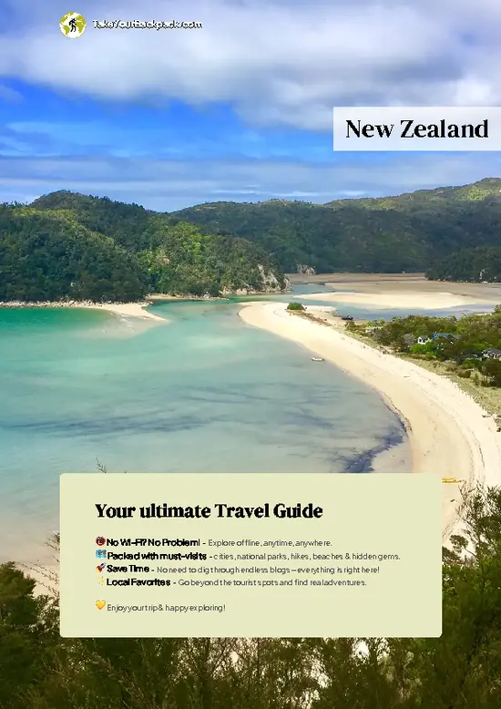
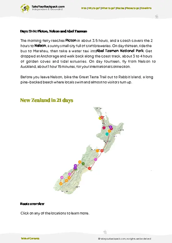
example page 0 from our offline Travel Guide for New Zealand
example page 1 from our offline Travel Guide for New Zealand
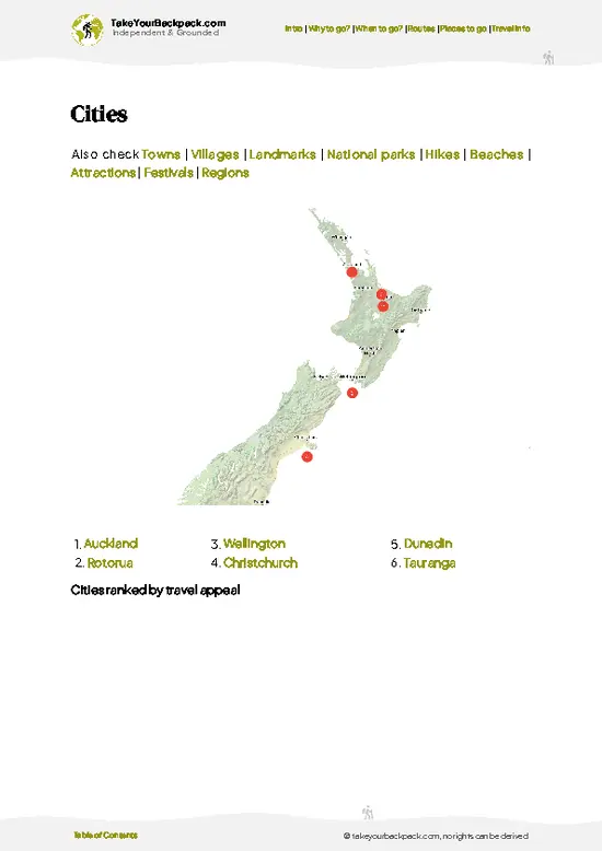
example page 2 from our offline Travel Guide for New Zealand
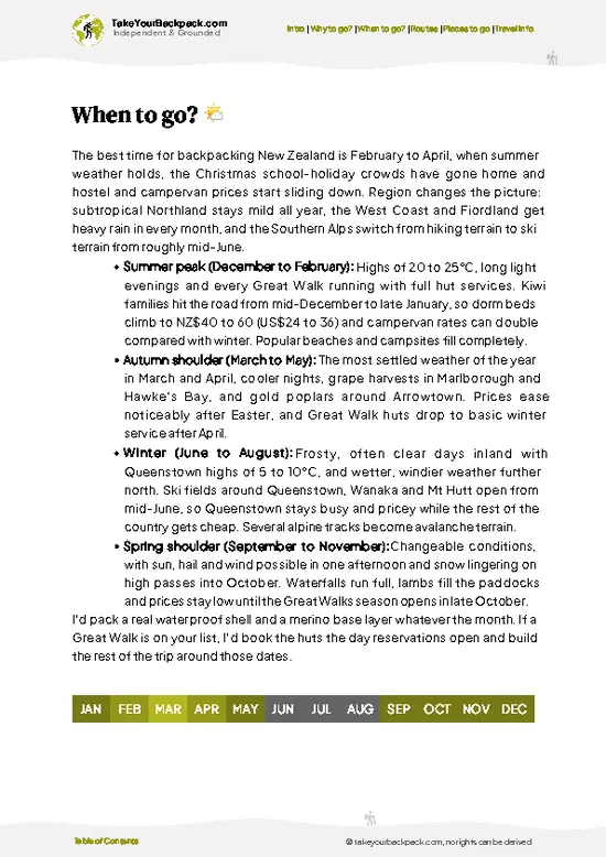
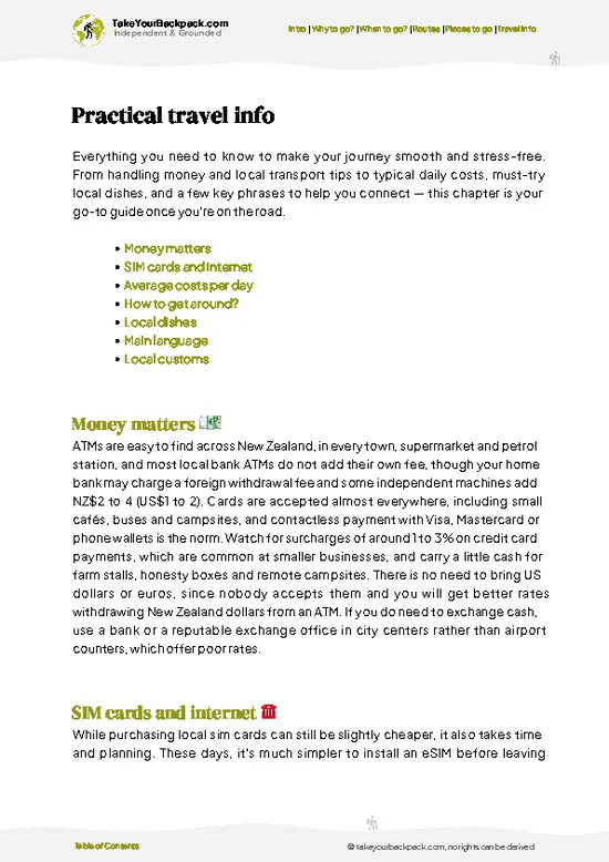
example page 3 from our offline Travel Guide for New Zealand
example page 4 from our offline Travel Guide for New Zealand
example page 5 from our offline Travel Guide for New Zealand
example page 6 from our offline Travel Guide for New Zealand
example page 7 from our offline Travel Guide for New Zealand
Loading the map 🌍
CLICK TO FILTER
cities
towns
villages
landmarks
national parks
hikes
beaches
attractions
festivals
regions
SHOW COUNTRY’S BESTSHOW ALL

✨ Why go?
Ranked #7 hike in New Zealand
What makes it a must-see hike

Backpackers come for the sheer 3,000 kilometer length from Cape Reinga to Bluff, which turns a holiday into a way of life for around five months. The trail strings together towns every few days, so resupply is straightforward and you rarely carry more than a few days of food. Huts and campsites are cheap compared with hotels, and the Department of Conservation network means you can sleep dry in many remote valleys. The route also lets you shorten it: plenty of walkers pick one section, such as the Richmond Range or the Tongariro Northern Circuit stretch, and finish in a week. That flexibility fits a longer New Zealand loop, since highways and bus links meet the trail at many points. You get beaches, volcanoes, farmland and alpine passes in one continuous line, which no single Great Walk can match.

💡 HighlightsWhat this place is best known for

  1. Cape Reinga Lighthouse: The northern start, where the Tasman Sea and Pacific Ocean meet in visible churning currents below the white lighthouse.
  2. Ninety Mile Beach: Days of hard-packed sand with surf on one side and dunes on the other, flat and fast, though tide times matter.
  3. Tongariro Alpine Crossing: Volcanic craters, the bright Emerald Lakes and steaming vents on a high pass that is the trail's most famous day.
  4. Whanganui River: A multi-day canoe section through deep green gorges, with riverside huts and a very different pace from walking.
  5. Richmond Range: Rugged ridges, beech forest and alpine tops in the north of the South Island, with sweeping views and demanding climbs.
For a first visit, the Tongariro Alpine Crossing is the best item, since it is a single day with huge payoff.
Spotted a mistake or missing something? Contact us.

Things to do near Te Araroa Trail

Ratings based on Tripadvisor reviews. When you book through this link, you support our work at no extra cost to you.

🌤️ When to go?Choosing the right time of year

  • Southbound or northbound window (Oct to Apr): Most walkers start at Cape Reinga from late October or at Bluff from early December, since the 3,000 km route takes 3 to 5 months. Snow on the southern alpine sections generally clears by December.
  • Summer (Dec to Feb): Days run 14 to 15 hours of light and highs reach 20 to 28°C (68 to 82°F). Huts and shuttles are busiest, and Nelson Lakes and Queenstown beds cost more.
  • Autumn (Mar to Apr): Highs of 14 to 22°C (57 to 72°F), steadier weather and thinner crowds. Daylight falls to about 11 hours by April.
  • Winter (May to Sep): Highs of 8 to 14°C (46 to 57°F) and heavy snow in the South Island ranges. Most walkers avoid it, and avalanche risk closes passes to those without alpine skills.
Start in the north in late October or early November so you reach the South Island ranges in mid-summer.

source: climatestotravel.comJANJanuary: highly recommended for travelingFEBFebruary: highly recommended for travelingMARMarch: excellent for travelingAPRApril: excellent for travelingMAYMay: good for travelingJUNJune: fair for travelingJULJuly: below average for travelingAUGAugust: below average for travelingSEPSeptember: fair for travelingOCTOctober: good for travelingNOVNovember: excellent for travelingDECDecember: highly recommended for traveling
New Zealand - Te Araroa Trail

✈️ The backpacker research shortcutNew Zealand Travel Guide

An offline-friendly backpacking guide with optimized travel routes, ranked highlights, transport advice, and the best areas to stay.
example page 0 from our offline Travel Guide for New Zealand
example page 1 from our offline Travel Guide for New Zealand
example page 2 from our offline Travel Guide for New Zealand
example page 3 from our offline Travel Guide for New Zealand
example page 4 from our offline Travel Guide for New Zealand
example page 5 from our offline Travel Guide for New Zealand
example page 6 from our offline Travel Guide for New Zealand
example page 7 from our offline Travel Guide for New Zealand
The digital guide (327 pages) contains:
✅ 110 highlights, ranked by travel appeal
✅ Optimized 7, 14 & 21-day travel routes
✅ Cities, national parks, landmarks, beaches
✅ How to get around
✅ Offline-friendly for travel without Wi-Fi
👉 Click to see all 30+ guide features

📅 Plan smarter in minutes, not weeks
✅ Month by month travel advice
✅ Festivals & national holidays
✅ Budget expectations

🗺️ Go to the right places, skip the overrated ones
✅ Honest pros & cons of destinations
✅ Top hikes, parks & viewpoints
✅ Lesser-known places most travelers miss
✅ Clear “worth it vs skip it” guidance

🛏️ Travel smoothly without rookie mistakes
✅ Best areas to stay
✅ Transport systems explained simply
✅ Common scams & safety advice
✅ SIM cards, money & practical tips

🌍 Understand the country, not just visit it
✅ Culture & traditions
✅ Local customs
✅ Festivals worth planning around
✅ Traveler-friendly historical context
✅ Insights that make places more meaningful

📱 Built for real travel conditions
✅ Fully downloadable PDF
✅ Works completely offline
✅ Optimized for phone use
✅ Useful in remote areas & buses
✅ Everything in one place
Stop searching, start planning
Get instant access to your full guide. 30‑day money-back guarantee.
+ Add another guide for just

By proceeding you agree to our terms.
Sent to your inbox immediately after payment • 100% Secure Checkout
Best Backpacking Travel Advisor 2025 tourism awardBest Backpacking
Travel Advisor
2025
What others say about Take Your Backpack Guides:
⭐⭐⭐⭐⭐
Fantastic, amazing amount of information!
⭐⭐⭐⭐⭐
My goodness this is amazing, it's what I've been looking for hats off too you!
⭐⭐⭐⭐⭐
I think this is absolutely BRILLIANT
⭐⭐⭐⭐
Very complete and informative. It's still missing places, but I gotta to commend you
⭐⭐⭐⭐⭐
This is truly amazing, thank you, can't wait to explore it with my kids!
⭐⭐⭐⭐⭐
Awesome resource, thank you!
⭐⭐⭐⭐⭐
This is amazing! Can't wait to explore the ones I haven't seen
⭐⭐⭐⭐
I love this! Well done, great idea.
⭐⭐⭐⭐⭐
Thanks for taking the time to make this gem!
⭐⭐⭐⭐⭐
This might be the best website I've ever seen.
⭐⭐⭐⭐⭐
Congratulations, and thank you so much for your work; it's incredibly valuable.
⭐⭐⭐⭐
In all seriousness I think you did a great job pointing out the important spots
⭐⭐⭐⭐⭐
10/10 very good
⭐⭐⭐⭐⭐
As someone who's only just starting to visit regularly this is awesome, thank you.
⭐⭐⭐⭐
Thank you very much! I'm going to visit my dad, it's going to be very useful!
⭐⭐⭐⭐⭐
This is really cool! We'll be travelling for the first time and this definitely come in handy.
⭐⭐⭐⭐⭐
You are now our minister of culture, congratulations 👨‍💼
⭐⭐⭐⭐⭐
Just wanted to tell you that this is a pearl! Going to follow your recommendations.
⭐⭐⭐⭐⭐
This is so cool. I'll definitely be using the resource for my travels soon.
⭐⭐⭐⭐⭐
This is very impressive! Good work.
⭐⭐⭐⭐⭐
This is an amazing and informative site. Very well done!

🛏️ Where to stay?Choosing the right base

If you enjoy meeting fellow travelers, consider choosing hostels with high ratings for atmosphere. On the other hand, if you prefer having your own space, a hotel might be a better option.

🥾 Hike detailsKey facts about the Te Araroa Trail hike

Total Distance: About 3,000 kilometers from Cape Reinga to Bluff.
Estimated Duration: Most thru-hikers take 4 to 6 months; sections take days to weeks.
Difficulty: Moderate to hard overall, with long days, river crossings and weather changes.
Starting Point: Cape Reinga in the far north, reached by tour bus and shuttles from Kaitaia; the finish is at Bluff, reached from Invercargill.
Major Landmarks:
  • Ninety Mile Beach: Long beach walk early on.
  • Tongariro National Park: Volcanic high point of the North Island.
  • Richmond Range: Rugged stretch near Nelson.
  • Southern Alps passes: High, exposed sections in the
… read more 👉
Total Distance: About 3,000 kilometers from Cape Reinga to Bluff.
Estimated Duration: Most thru-hikers take 4 to 6 months; sections take days to weeks.
Difficulty: Moderate to hard overall, with long days, river crossings and weather changes.
Starting Point: Cape Reinga in the far north, reached by tour bus and shuttles from Kaitaia; the finish is at Bluff, reached from Invercargill.
Major Landmarks:
  • Ninety Mile Beach: Long beach walk early on.
  • Tongariro National Park: Volcanic high point of the North Island.
  • Richmond Range: Rugged stretch near Nelson.
  • Southern Alps passes: High, exposed sections in the far south.
Terrain and Scenery: Beaches, farmland, forest, volcanic plateau, river valleys and alpine ridges.
Vegetation: Kauri and subtropical forest in the north, beech forest in the south, tussock grassland and alpine scrub on high ground.
Wildlife: Tui, bellbirds, fantails, weka, kea in the alpine areas, plus seals and dolphins along some coasts.
⚠️ Hiking info can sometimes be outdated or inaccurate. Before you hit the trail, check the latest conditions with locals. If you do spot anything that's off, I'd love to hear from you, so I can update it for fellow travelers.

🛡️ SafetySafety Tips and Common Scams in Te Araroa Trail

The biggest hazards on the Te Araroa are weather and river crossings, not wildlife. New Zealand has no snakes or large predators, and sandflies are the main nuisance. In the South Island, rain upstream can turn knee-deep rivers like the Rangitata and Waimakariri impassable within hours, so check MetService, wait for levels to drop, and never cross alone when flooded. Alpine passes such as Waiau Pass and Travers Saddle bring sudden cold, wind and snow even in summer, so carry a warm layer, waterproof shell and a personal locator beacon. Hypothermia is the usual serious risk. Mud and slick roots slow progress on North Island forest sections like the Raetea, so plan on 2 km an hour. Register on the Intentions system and carry offline maps. Treat all stream water, and carry road-walk sun protection.

FAQTraveler FAQ

Most walkers take 3 to 5 months to complete the roughly 3,000 km trail between Cape Reinga and Bluff. That averages 25 to 30 km a day with rest days in towns such as Auckland, Whanganui, Wellington and Queenstown. Section hikers often choose single stretches of 1 to 2 weeks, like the Richmond Range or Nelson Lakes.
The trail is moderately difficult overall, with long days rather than technical climbing. The hardest stretches are the Raetea Forest in the north, the Richmond Ranges, Waiau Pass and the unbridged rivers of the South Island, where fitness and judgment both matter. Daily distances of 20 to 35 km are normal, and the Whanganui River canoe section adds a different challenge.
No guide or permit is needed to walk the trail. Through-walkers and South Island walkers must register and buy the Te Araroa Trail Pass (NZ$195 in 2024/25, roughly US$115), which covers 71 DOC huts and campsites along the route; section walkers can use hut tickets instead. Some private land and the Whanganui River need separate arrangements such as canoe hire.
⚠️ Things can change over time, so always validate details locally before you go.

Other New Zealander hikes near Te Araroa Trail

Explore more nearby:


💡 Not sure where to go next?
Create a personalized itinerary for New Zealand including Te Araroa Trail and the places that fit your trip.

Generate my itinerary

👉 Discover all hikes

Or checkout all New Zealand has to offer (think cities, towns, villages, national parks, hikes, beaches, festivals)
Country photo of New Zealand

We 💚 feedbackFinal thoughts on hiking the Te Araroa Trail

Plan at least four months if you want the whole trail, or pick one 7 to 10 day section if time is short. I would walk the south in the warmest weeks and skip any river crossing when levels are high.

✈️ When did I visit New Zealand?
All the way back in high school I have been visiting the North Island of New Zealand (1993).

✍️ Help improve this page!
The information on this page is based on my own backpacking experience in New Zealand, supplemented with up-to-date research and feedback from other travelers. Travel details can change, so if you notice anything outdated or incomplete, feel free to let me know.


🙋‍♂️ Give feedback

👋 Meet the founderWho’s Behind Take Your Backpack?

Johan, backpacker and founder of TakeYourBackpackHi, I’m Johan (Netherlands 🇳🇱), the creator of TakeYourBackpack. Over the past 3 decades, I’ve backpacked through 90+ countries across six continents, gaining extensive experience with independent travel, long-term trips, and overland routes.

This site is built on a combination of firsthand travel experience and carefully curated insights from other backpackers. Many guides are based on places I’ve personally visited, while others bring together tips, observations, and practical advice shared by trusted travelers I’ve met along the way.

The goal is to provide realistic, experience-driven guidance — not generic itineraries — so you can explore destinations with better context, clearer expectations, and more confidence.