×

New Zealand🇳🇿 | regionsGreat Barrier IslandOff-grid island, kauri ridge, free hot springs, dark skies | things to do and best time to go

Explore Coromandel PeninsulaExplore Northern Island

Backpacking in Great Barrier Island
👌 Worth visitingregion ranked #3
By Johan Kruseman 🇳🇱 | Updated October 15, 2026

Decades ago, Great Barrier Island meant kauri logging, whaling and copper mining, with mud roads and little else. Today it is a largely off-grid island in the Hauraki Gulf, northeast of Auckland in the north of New Zealand, and most of its land is conservation estate. Power comes from solar panels and generators, so shops are small, few and often shut. I once stepped off the boat assuming I would buy dinner on the way to camp, found the Claris shop closed, and ate dry crackers while someone’s woodsmoke drifted past. Experienced visitors now buy food on the mainland, because freight arrives by boat and the shelves reflect it. They also book a rental car or shuttle ahead, since there is no public bus. The payoff is empty beaches, hot springs and very dark skies. A good first day is dropping your bags at Tryphena, walking the nearest beach, and getting an early night.

Discover everything you want to know in the 📖 New Zealand Travel Guide.


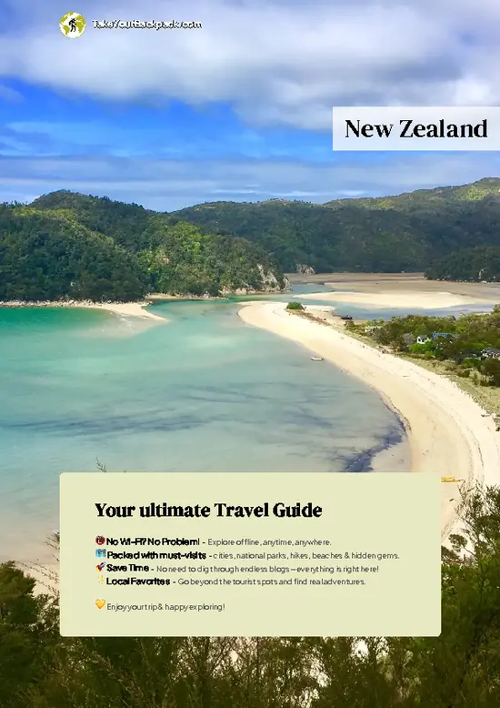
example page 0 from our offline Travel Guide for New Zealand
example page 1 from our offline Travel Guide for New Zealand
example page 2 from our offline Travel Guide for New Zealand
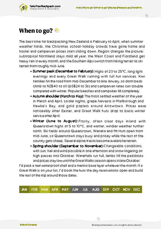
example page 3 from our offline Travel Guide for New Zealand
example page 4 from our offline Travel Guide for New Zealand
example page 5 from our offline Travel Guide for New Zealand
example page 6 from our offline Travel Guide for New Zealand
example page 7 from our offline Travel Guide for New Zealand
Loading the map 🌍
CLICK TO FILTER
cities
towns
villages
landmarks
national parks
hikes
beaches
attractions
festivals
regions
SHOW COUNTRY’S BESTSHOW ALL

✨ Why go?
Ranked #3 region in New Zealand
Why Great Barrier Island should be on your travel list

Backpackers come here because one island holds more terrain than its size suggests. The Aotea Track climbs through kauri forest to rocky ridgelines, then drops to beaches on the Pacific side that rarely see more than a handful of people. You can walk all day and finish in a natural hot spring at Kaitoke, which is a combination you cannot easily repeat on the mainland.
The island also suits slow travel. Roads are few and mostly unsealed in places, so you settle into one or two bases and use a rental car or a pre-booked shuttle for day trips instead of racing between sights. DOC huts such as Mt Heale Hut let you string together a multi-day tramp without carrying a tent, and the walks link easily with swimming, surfing and kayaking. With no mains power and little light pollution, nights add a … read more 👉
Backpackers come here because one island holds more terrain than its size suggests. The Aotea Track climbs through kauri forest to rocky ridgelines, then drops to beaches on the Pacific side that rarely see more than a handful of people. You can walk all day and finish in a natural hot spring at Kaitoke, which is a combination you cannot easily repeat on the mainland.
The island also suits slow travel. Roads are few and mostly unsealed in places, so you settle into one or two bases and use a rental car or a pre-booked shuttle for day trips instead of racing between sights. DOC huts such as Mt Heale Hut let you string together a multi-day tramp without carrying a tent, and the walks link easily with swimming, surfing and kayaking. With no mains power and little light pollution, nights add a free activity. The limited ferry and flight schedule forces you to commit, and that commitment is what makes the island feel remote rather than just another weekend escape.

💡 HighlightsThe experiences that define the visit

  1. Hirakimata (Mt Hobson): the island’s highest point at 621 m, reached by a steady climb through kauri and rock stairs, with views over both coasts.
  2. Windy Canyon: a short walk between narrow rock walls to lookouts over the island’s spine, and an easy sunrise or sunset stop.
  3. Kaitoke Hot Springs: a boardwalk across wetland leads to natural pools in a stream, free to use and best visited early.
  4. Kaiarara Kauri Dam: the remains of a timber dam once used to float logs downstream, set in regenerating forest.
  5. Mt Heale Hut: a large DOC hut on the Aotea Track, useful as a base for sunrise on the ridge.
  6. Medlands Beach: a long stretch of pale sand with consistent surf and plenty of space to yourself outside the school holidays.
  7. Whangapoua Beach and Estuary: a sheltered tidal inlet with mangroves, ideal for kayaking
… read more 👉
  1. Hirakimata (Mt Hobson): the island’s highest point at 621 m, reached by a steady climb through kauri and rock stairs, with views over both coasts.
  2. Windy Canyon: a short walk between narrow rock walls to lookouts over the island’s spine, and an easy sunrise or sunset stop.
  3. Kaitoke Hot Springs: a boardwalk across wetland leads to natural pools in a stream, free to use and best visited early.
  4. Kaiarara Kauri Dam: the remains of a timber dam once used to float logs downstream, set in regenerating forest.
  5. Mt Heale Hut: a large DOC hut on the Aotea Track, useful as a base for sunrise on the ridge.
  6. Medlands Beach: a long stretch of pale sand with consistent surf and plenty of space to yourself outside the school holidays.
  7. Whangapoua Beach and Estuary: a sheltered tidal inlet with mangroves, ideal for kayaking and birdwatching.
  8. Whangaparapara whaling station remains: rusting relics and foundations around the harbor that show what the island’s industrial past looked like.
  9. Tryphena and Pah Beach: a calm swimming bay near the main settlement, good for a slow afternoon after the ferry.
  10. Aotea Dark Sky Sanctuary: the whole island holds international dark sky status, so a beach after sunset on a moonless night shows the Milky Way clearly.
Most visitors skip Whangaparapara’s whaling remains, yet a quiet half hour there explains more about the island than any lookout.
Spotted a mistake or missing something? Contact us.

Things to do near Great Barrier Island

Ratings based on Tripadvisor reviews. When you book through this link, you support our work at no extra cost to you.

⌛️ 5 daysSeeing the highlights in 5 days

Day 1: Tryphena: Start here because the main ferry docks close to it, and it has the island’s best selection of beds, a small store and a beach to settle into. Transport on the island is thin, so collect a rental car or confirm a shuttle before arriving, and treat the sailing schedule as the anchor for everything else. Spend the afternoon at Pah Beach and keep the evening free for stars.
Day 2: Whangaparapara: Move north along the main road to the harbor, where the whaling station remains are an easy morning stop. Continue to the Kaitoke Hot Springs walk in the afternoon, since the boardwalk is flat and the pools are less crowded later in the day. Staying near Claris keeps driving short.
Day 3: Hirakimata: Climb early from Windy Canyon to the summit while the light is soft and the track is quiet, … read more 👉
Day 1: Tryphena: Start here because the main ferry docks close to it, and it has the island’s best selection of beds, a small store and a beach to settle into. Transport on the island is thin, so collect a rental car or confirm a shuttle before arriving, and treat the sailing schedule as the anchor for everything else. Spend the afternoon at Pah Beach and keep the evening free for stars.
Day 2: Whangaparapara: Move north along the main road to the harbor, where the whaling station remains are an easy morning stop. Continue to the Kaitoke Hot Springs walk in the afternoon, since the boardwalk is flat and the pools are less crowded later in the day. Staying near Claris keeps driving short.
Day 3: Hirakimata: Climb early from Windy Canyon to the summit while the light is soft and the track is quiet, then drop toward Mt Heale Hut if you want to overnight. This is the day that justifies the whole trip, because the ridgeline gives you forest, both coasts and open sky in one walk.
Day 4: Medlands and Whangapoua: Rest your legs on the east coast. Surf or walk Medlands in the morning, then paddle the Whangapoua estuary on the incoming tide, when water depth makes it easier to move through the mangroves. The detour is the Harataonga coastal walk, which adds a pohutukawa-lined beach without much extra driving.
Day 5: Departure: Keep the last day short and head back toward the ferry or airfield early, since a missed sailing leaves you stuck for days.

🌤️ When to go?Weather, crowds, and seasonal trade-offs

  • Summer (December to February): Days run 22 to 25°C (72 to 77°F) with about 14 hours of light, and the sea is warm enough for long swims at Medlands and Kaitoke. This is the busiest stretch, with Auckland holidaymakers filling the island and beds and rental cars booking out weeks ahead.
  • Autumn (March to May): Highs of 17 to 22°C (63 to 72°F), settled weather, quiet tracks and lower rates make this a strong window for the Aotea Track and the hot springs.
  • Winter (June to August): Expect 11 to 15°C (52 to 59°F), about 9.5 hours of daylight, heavy rain and muddy trails. Some tracks flood, and a few cafés and lodges close or cut their hours.
  • Spring (September to November): Temperatures climb from 14 to 19°C (57 to 66°F), the bush is green, and crowds stay thin until the December holidays.
Book ferry … read more 👉
  • Summer (December to February): Days run 22 to 25°C (72 to 77°F) with about 14 hours of light, and the sea is warm enough for long swims at Medlands and Kaitoke. This is the busiest stretch, with Auckland holidaymakers filling the island and beds and rental cars booking out weeks ahead.
  • Autumn (March to May): Highs of 17 to 22°C (63 to 72°F), settled weather, quiet tracks and lower rates make this a strong window for the Aotea Track and the hot springs.
  • Winter (June to August): Expect 11 to 15°C (52 to 59°F), about 9.5 hours of daylight, heavy rain and muddy trails. Some tracks flood, and a few cafés and lodges close or cut their hours.
  • Spring (September to November): Temperatures climb from 14 to 19°C (57 to 66°F), the bush is green, and crowds stay thin until the December holidays.
Book ferry and flight seats early for anywhere between Christmas and the end of January.


source: climatestotravel.comJANJanuary: highly recommended for travelingFEBFebruary: highly recommended for travelingMARMarch: excellent for travelingAPRApril: excellent for travelingMAYMay: good for travelingJUNJune: fair for travelingJULJuly: below average for travelingAUGAugust: fair for travelingSEPSeptember: good for travelingOCTOctober: highly recommended for travelingNOVNovember: excellent for travelingDECDecember: highly recommended for traveling
when-to-go

✈️ The backpacker research shortcutNew Zealand Travel Guide

An offline-friendly backpacking guide with optimized travel routes, ranked highlights, transport advice, and the best areas to stay.
example page 0 from our offline Travel Guide for New Zealand
example page 1 from our offline Travel Guide for New Zealand
example page 2 from our offline Travel Guide for New Zealand
example page 3 from our offline Travel Guide for New Zealand
example page 4 from our offline Travel Guide for New Zealand
example page 5 from our offline Travel Guide for New Zealand
example page 6 from our offline Travel Guide for New Zealand
example page 7 from our offline Travel Guide for New Zealand
The digital guide (327 pages) contains:
✅ 110 highlights, ranked by travel appeal
✅ Optimized 7, 14 & 21-day travel routes
✅ Cities, national parks, landmarks, beaches
✅ How to get around
✅ Offline-friendly for travel without Wi-Fi
👉 Click to see all 30+ guide features

📅 Plan smarter in minutes, not weeks
✅ Month by month travel advice
✅ Festivals & national holidays
✅ Budget expectations

🗺️ Go to the right places, skip the overrated ones
✅ Honest pros & cons of destinations
✅ Top hikes, parks & viewpoints
✅ Lesser-known places most travelers miss
✅ Clear “worth it vs skip it” guidance

🛏️ Travel smoothly without rookie mistakes
✅ Best areas to stay
✅ Transport systems explained simply
✅ Common scams & safety advice
✅ SIM cards, money & practical tips

🌍 Understand the country, not just visit it
✅ Culture & traditions
✅ Local customs
✅ Festivals worth planning around
✅ Traveler-friendly historical context
✅ Insights that make places more meaningful

📱 Built for real travel conditions
✅ Fully downloadable PDF
✅ Works completely offline
✅ Optimized for phone use
✅ Useful in remote areas & buses
✅ Everything in one place
Stop searching, start planning
Get instant access to your full guide. 30‑day money-back guarantee.
+ Add another guide for just

By proceeding you agree to our terms.
Sent to your inbox immediately after payment • 100% Secure Checkout
Best Backpacking Travel Advisor 2025 tourism awardBest Backpacking
Travel Advisor
2025
What others say about Take Your Backpack Guides:
⭐⭐⭐⭐⭐
Fantastic, amazing amount of information!
⭐⭐⭐⭐⭐
My goodness this is amazing, it's what I've been looking for hats off too you!
⭐⭐⭐⭐⭐
I think this is absolutely BRILLIANT
⭐⭐⭐⭐
Very complete and informative. It's still missing places, but I gotta to commend you
⭐⭐⭐⭐⭐
This is truly amazing, thank you, can't wait to explore it with my kids!
⭐⭐⭐⭐⭐
Awesome resource, thank you!
⭐⭐⭐⭐⭐
This is amazing! Can't wait to explore the ones I haven't seen
⭐⭐⭐⭐
I love this! Well done, great idea.
⭐⭐⭐⭐⭐
Thanks for taking the time to make this gem!
⭐⭐⭐⭐⭐
This might be the best website I've ever seen.
⭐⭐⭐⭐⭐
Congratulations, and thank you so much for your work; it's incredibly valuable.
⭐⭐⭐⭐
In all seriousness I think you did a great job pointing out the important spots
⭐⭐⭐⭐⭐
10/10 very good
⭐⭐⭐⭐⭐
As someone who's only just starting to visit regularly this is awesome, thank you.
⭐⭐⭐⭐
Thank you very much! I'm going to visit my dad, it's going to be very useful!
⭐⭐⭐⭐⭐
This is really cool! We'll be travelling for the first time and this definitely come in handy.
⭐⭐⭐⭐⭐
You are now our minister of culture, congratulations 👨‍💼
⭐⭐⭐⭐⭐
Just wanted to tell you that this is a pearl! Going to follow your recommendations.
⭐⭐⭐⭐⭐
This is so cool. I'll definitely be using the resource for my travels soon.
⭐⭐⭐⭐⭐
This is very impressive! Good work.
⭐⭐⭐⭐⭐
This is an amazing and informative site. Very well done!

🛏️ Where to stay?How to pick the right area

Tryphena is the best base for most backpackers, because it has the island’s highest concentration of budget beds, a small shop, a few cafés and a harbor where the ferry docks. Its scattered bays (Pah Beach, Mulberry Grove, Shoal Bay) sit within walking distance of each other, so you can meet other travelers without a car, and tracks start close by. It feels sociable in the evenings, with guests sharing tables and swapping hiking plans.
Medlands and Okiwi lie farther north and are better for surfers or anyone wanting space. Medlands has a long sweep of sand and easy access to Kaitoke’s beach, and … read more 👉
Tryphena is the best base for most backpackers, because it has the island’s highest concentration of budget beds, a small shop, a few cafés and a harbor where the ferry docks. Its scattered bays (Pah Beach, Mulberry Grove, Shoal Bay) sit within walking distance of each other, so you can meet other travelers without a car, and tracks start close by. It feels sociable in the evenings, with guests sharing tables and swapping hiking plans.
Medlands and Okiwi lie farther north and are better for surfers or anyone wanting space. Medlands has a long sweep of sand and easy access to Kaitoke’s beach, and the quiet there is a draw in itself. Claris, near the airport, has the main store, a fuel stop and a few places to sleep, which makes it handy for a first or last night around flights, though it lacks atmosphere.
Port Fitzroy, on the sheltered west side, suits trampers heading into the Aotea Track and those who want a calm harbor setting with boats at anchor. It has fewer services and fewer fellow travelers, so bring your own food. Camping is available at several Department of Conservation sites, and booking ahead matters in summer. Tryphena works best for solo travelers, while the north and west suit people happy with solitude.

🚌 Getting aroundHow to get around Great Barrier Island

Hiring a car or arranging a shuttle is the easiest way to move around the island, because there is no public bus, no taxi rank and the settlements are spread along roughly 40 kilometers of road. Most backpackers arrive by ferry or small plane, then rely on a mix of rentals, lifts and their own feet. Everything runs on island time and weather, so build slack into your plans.
  • Ferry from Auckland: The car and passenger ferry to Tryphena or Port Fitzroy takes about 4.5 hours and costs roughly NZ$150 to 200 return per adult. Sailings are only a few a week, and the slow crossing is why many travelers fly out instead and ferry back. Book early in summer, since vehicle space is tight.
  • Flights from Auckland: Small planes land at Claris in about 35 to 40 minutes, with return fares around NZ$250 to 350.
… read more 👉
Hiring a car or arranging a shuttle is the easiest way to move around the island, because there is no public bus, no taxi rank and the settlements are spread along roughly 40 kilometers of road. Most backpackers arrive by ferry or small plane, then rely on a mix of rentals, lifts and their own feet. Everything runs on island time and weather, so build slack into your plans.
  • Ferry from Auckland: The car and passenger ferry to Tryphena or Port Fitzroy takes about 4.5 hours and costs roughly NZ$150 to 200 return per adult. Sailings are only a few a week, and the slow crossing is why many travelers fly out instead and ferry back. Book early in summer, since vehicle space is tight.
  • Flights from Auckland: Small planes land at Claris in about 35 to 40 minutes, with return fares around NZ$250 to 350. Bags are weight-limited, so pack light, and flights are cancelled in low cloud or high wind. Keep your onward plans flexible.
  • Rental cars and vans: Expect NZ$80 to 130 a day, and note that fleets are small, so they sell out in summer. Roads are narrow and winding, and many side roads are unsealed gravel. There is no petrol at night and few pumps, so fill up in Claris or Tryphena.
  • Island shuttles and tours: Local operators run transfers between the airport, wharves and trailheads, typically NZ$20 to 50 per leg depending on distance. Operators are small, so they need to be booked ahead and confirmed after you land. This suits trampers who only need to reach a track end.
  • Hitchhiking and walking: Locals regularly pick up walkers, and a lift between Tryphena and Claris is common. Traffic is light, though, so waiting can take an hour or more. Experienced travelers combine this with walks along short sections of road, and never rely on a lift to catch a flight or ferry.
Stock up on groceries in Claris or Tryphena before heading anywhere remote, and book your ferry or flight back before arranging anything else, since that is the one leg that cannot be improvised.

🍲 FoodWhat to Eat & Drink

Eating on Great Barrier means fresh fish, smoked mussels and home-baked pies served in small cafés, since the island has no supermarket chains and few restaurants. Snapper, kingfish and crayfish come off local boats, and you will smell wood smoke from smokehouses before you see them. Many travelers pick up a smoked fish pâté and crackers for a beach picnic.
The main places to eat are the café-bar scene around Tryphena and the Claris general store, which doubles as a social hub and sells basics at prices higher than on the mainland. Expect NZ$15 to 25 for a café lunch and NZ$28 to 40 for a pub dinner. Local craft beer and island-roasted coffee appear in cafés, and a flat white after a muddy track tastes especially good.
Self-catering is the norm for budget travelers. Bring staples from Auckland, … read more 👉
Eating on Great Barrier means fresh fish, smoked mussels and home-baked pies served in small cafés, since the island has no supermarket chains and few restaurants. Snapper, kingfish and crayfish come off local boats, and you will smell wood smoke from smokehouses before you see them. Many travelers pick up a smoked fish pâté and crackers for a beach picnic.
The main places to eat are the café-bar scene around Tryphena and the Claris general store, which doubles as a social hub and sells basics at prices higher than on the mainland. Expect NZ$15 to 25 for a café lunch and NZ$28 to 40 for a pub dinner. Local craft beer and island-roasted coffee appear in cafés, and a flat white after a muddy track tastes especially good.
Self-catering is the norm for budget travelers. Bring staples from Auckland, because groceries can cost 20 to 30 percent more here and stock runs low in peak season. Many places run on tank water and solar power, so keep showers short and carry rubbish out. Kitchens and cafés close early, often by 8 or 9 pm, and some shut entirely in winter, so plan dinner before dark. Tipping is not expected.

FAQFrequently asked questions about Great Barrier Island

Plan three to four days to see the island properly, or five if you want to hike the Aotea Track, which takes two to three days with nights at Mt Heale Hut and Kaiaraara Hut. Three days covers the Kaitoke Hot Springs, a beach day at Medlands and a walk to the Windy Canyon lookout. Ferry and flight cancellations are common in bad weather, so add a spare day.
Most visitors rely on rental cars (about NZ$80 to 130 a day), local shuttles (NZ$20 to 50 per leg) and hitchhiking, since the island has no public buses. The roads run about 40 kilometers between Tryphena and Port Fitzroy, and they are narrow and partly unsealed. Walking works well for short hops within Tryphena and Medlands, but book shuttles ahead for trailheads and ferry connections.
Great Barrier is known for its remote, uncrowded feel, with no mains electricity and a population of under 1,000. It holds the Aotea Track, the Kaitoke Hot Springs (a 40 to 60 minute walk from the road), and surf beaches such as Medlands and Awana. It was also designated an International Dark Sky Sanctuary, so clear nights show the Milky Way, and about 60 percent of the land is conservation estate.
⚠️ Things can change over time, so always validate details locally before you go.

Other New Zealander regions near Great Barrier Island

Explore more nearby:

  • Coromandel Peninsula—Limestone arch, tide-dug hot pools, Highway 25, goldmining gorge| 65 km away
  • Bay of Islands—Treaty grounds, Hole in the Rock cruises, Russell ferry, island beaches| 167 km away
  • Northern Island—geothermal valleys, Māori heritage, volcanic plateaus, subtropical forests| 299 km away

💡 Not sure where to go next?
Create a personalized itinerary for New Zealand including Great Barrier Island and the places that fit your trip.

Generate my itinerary

👉 Discover all regions

Or checkout all New Zealand has to offer (think cities, towns, villages, national parks, hikes, beaches, festivals)
Country photo of New Zealand

We 💚 feedbackSumming up the experience

Come during a new-moon week outside the school holidays, and plan to be on a dark beach after sunset. That is when the island earns its Dark Sky status and feels almost private. I would skip any rushed itinerary here, and bring a headlamp with a red setting, plus enough food to cover your first two nights.

✈️ When did I visit New Zealand?
All the way back in high school I have been visiting the North Island of New Zealand (1993).

✍️ Help improve this page!
The information on this page is based on my own backpacking experience in New Zealand, supplemented with up-to-date research and feedback from other travelers. Travel details can change, so if you notice anything outdated or incomplete, feel free to let me know.


🙋‍♂️ Give feedback

👋 Meet the founderWho’s Behind Take Your Backpack?

Johan, backpacker and founder of TakeYourBackpackHi, I’m Johan (Netherlands 🇳🇱), the creator of TakeYourBackpack. Over the past 3 decades, I’ve backpacked through 90+ countries across six continents, gaining extensive experience with independent travel, long-term trips, and overland routes.

This site is built on a combination of firsthand travel experience and carefully curated insights from other backpackers. Many guides are based on places I’ve personally visited, while others bring together tips, observations, and practical advice shared by trusted travelers I’ve met along the way.

The goal is to provide realistic, experience-driven guidance — not generic itineraries — so you can explore destinations with better context, clearer expectations, and more confidence.