
×

North Korea🇰🇵 | hikesMount Kumgangcrystal pools, sheer cliffs, seasonal foliage | things to do and best time to go

Explore Mount ChilboExplore Chilbosan Sea Route

Backpacking in Mount Kumgang
🏆 Top pickhike ranked #1
By Johan Kruseman 🇳🇱 | Updated June 9, 2026

Your boots scrape granite and wet pine needles as the trail pitches up again, stone steps slick from the morning mist. Your shirt clings. Your breath fogs in the cool air. Somewhere below, a stream hammers through a gorge you can’t quite see, but you feel it in the air—cold, metallic, alive. Then the trees thin, and suddenly the rock faces of Mount Kumgang rear up in front of you like broken teeth, catching stray shafts of light.

Mount Kumgang sits in the southeast of North Korea, near the border with South Korea, and hiking here is equal parts mountain and theater. The scenery is fierce—sheer cliffs, tight valleys, waterfalls that feel almost over-designed—but the route is tightly controlled, guided, and shorter than it looks on a map. The walking itself is moderate, more stair-climb than wilderness, and access is entirely dependent on organized transport, not casual buses. Compared with the Paektu area, Kumgang is less remote, more curated, and honestly, less free—but the raw rock walls and sudden views still punch hard enough to be worth the constraints.

Discover everything you want to know in the 📖 North Korea Travel Guide.
Best time to go: April - June, September - November
Duration: 3 to 4 days
Distance: 30 kilometers
Total ascent: 1,638 meters
Safety warning

The current risk level for North Korea is high. Check the advice before going.


Get your North Korea guide
74 ranked highlights, routes & tips, works offline (296 pages)
Loading the map 🌍
CLICK TO FILTER
cities
towns
landmarks
national parks
hikes
beaches
attractions
festivals
regions
SHOW COUNTRY’S BESTSHOW ALL

✨ Why go?
Ranked #1 hike in North Korea
Why Mount Kumgang should be on your travel list

Mount Kumgang draws backpackers like moths to a flame. The scenery-to-effort ratio is off the charts. You’re greeted by jagged peaks and lush valleys that make every uphill step worth it. The trails are well-marked, offering options for both the casual hiker and the seasoned trekker.

Accessing this slice of North Korea is surprisingly easy. Public transport whisks you from Pyongyang to the trailhead, making it a seamless addition to your journey. The low cost of entry is a bonus; you can experience this stunning landscape without breaking the bank.

Flexibility is key here. You can choose shorter routes for a quick day hike or tackle longer paths that stretch your limits. Each turn reveals a new vista, a fresh challenge, and the thrill of exploration.

After a day of conquering trails, … read more 👉
Mount Kumgang draws backpackers like moths to a flame. The scenery-to-effort ratio is off the charts. You’re greeted by jagged peaks and lush valleys that make every uphill step worth it. The trails are well-marked, offering options for both the casual hiker and the seasoned trekker.

Accessing this slice of North Korea is surprisingly easy. Public transport whisks you from Pyongyang to the trailhead, making it a seamless addition to your journey. The low cost of entry is a bonus; you can experience this stunning landscape without breaking the bank.

Flexibility is key here. You can choose shorter routes for a quick day hike or tackle longer paths that stretch your limits. Each turn reveals a new vista, a fresh challenge, and the thrill of exploration.

After a day of conquering trails, the reward is palpable. Picture yourself at the summit, the wind whipping through your hair, and the first cold beer in hand as you soak in the breathtaking views. Mount Kumgang isn’t just a hike; it’s a visceral experience that fits perfectly into any backpacking route.
Want to include Mount Kumgang in your North Korea route?
Create a personalized North Korea itinerary that includes Mount Kumgang and the places that fit your trip — based on your travel style, budget, and available time. Get your route in seconds.

Generate my trip

💡 HighlightsWhat this place is best known for

  • Jagged granite spires — The sculpted, needle-like rock formations are the mountain’s signature. Weather and erosion carved dramatic ridges and narrow gullies; scrambling past them feels more like exploring a natural cathedral than a typical forest trail.
  • Sea-facing cliffs & East Sea panoramas — Trails that drop to the coast give sweeping views where granite meets the water. Sunrises here are fierce and clean, with salt air and wind that make the scenery feel cinematic. (Personal favorite — nothing beats a cliffside coffee and that open horizon.)
  • Kuryong Falls (Nine-Dragon Waterfall) — A multi-tiered cascade that threads through steep rock steps and pools. It’s a great mid-hike rest point: mist cools you, the sound drowns out everything, and the waterfall is especially impressive after
read more 👉
  • Jagged granite spires — The sculpted, needle-like rock formations are the mountain’s signature. Weather and erosion carved dramatic ridges and narrow gullies; scrambling past them feels more like exploring a natural cathedral than a typical forest trail.
  • Sea-facing cliffs & East Sea panoramas — Trails that drop to the coast give sweeping views where granite meets the water. Sunrises here are fierce and clean, with salt air and wind that make the scenery feel cinematic. (Personal favorite — nothing beats a cliffside coffee and that open horizon.)
  • Kuryong Falls (Nine-Dragon Waterfall) — A multi-tiered cascade that threads through steep rock steps and pools. It’s a great mid-hike rest point: mist cools you, the sound drowns out everything, and the waterfall is especially impressive after spring rains.
  • Autumn foliage and seasonal contrasts — In fall the maples and mixed forests turn vivid red and orange against the pale granite, creating sharp color contrasts that are rare on many other mountain trails. If you time it right, the views are basically a natural postcard.
  • Mountain temples and cliffside hermitages — Small wooden shrines and stone pagodas tucked into ledges or forest clearings add a cultural layer to the hike. They’re modest, often quiet, and give the area a feeling of long human connection to the rugged landscape.
Spotted a mistake or missing something? Contact us.

🌤️ When to go?Weather, crowds, and seasonal trade-offs


  • Weather: Spring (April to June) and autumn (September to October) deliver the best conditions. Expect crisp air and clear skies, avoiding the heavy rains of summer and the bitter cold of winter. Summer can be a slog with humidity and sudden downpours, while winter plunges temperatures well below freezing.

  • Temperature: Spring highs hover around 15-22°C (59-72°F), cooling sharply at night. Autumn offers a similar range but with drier air, making the chill more bearable. Winter dips to -10°C (14°F) or lower, turning trails icy and treacherous.

  • Daylight Hours: Spring and autumn provide a solid 10-12 hours of daylight, enough to tackle the trails without rushing. Winter’s short days limit exploration time, while summer’s long daylight can be a double-edged sword with heat and humidity.

read more 👉

  • Weather: Spring (April to June) and autumn (September to October) deliver the best conditions. Expect crisp air and clear skies, avoiding the heavy rains of summer and the bitter cold of winter. Summer can be a slog with humidity and sudden downpours, while winter plunges temperatures well below freezing.

  • Temperature: Spring highs hover around 15-22°C (59-72°F), cooling sharply at night. Autumn offers a similar range but with drier air, making the chill more bearable. Winter dips to -10°C (14°F) or lower, turning trails icy and treacherous.

  • Daylight Hours: Spring and autumn provide a solid 10-12 hours of daylight, enough to tackle the trails without rushing. Winter’s short days limit exploration time, while summer’s long daylight can be a double-edged sword with heat and humidity.

  • Crowds: Peak tourist influx hits in late spring and early autumn, especially weekends. Weekdays and early mornings offer more solitude, letting you soak in the rugged landscape without the buzz of groups.

  • Seasonal Activities: Autumn brings vibrant foliage, painting the mountain in fiery reds and golds—a visual payoff worth the climb. Spring bursts with wildflowers and fresh greenery, energizing the trail with life after winter’s dormancy.

  • Price Fluctuations: Tours and permits tend to spike during peak seasons (spring and autumn). Off-peak winter trips might save money but demand serious gear and grit. Summer prices dip slightly but come with the trade-off of uncomfortable weather.


Pro-tip: Aim for early October—cool air, fewer crowds, and the mountain’s colors at their peak make every step feel earned and every view a reward.


source: climatestotravel.comJANJanuary: below average for travelingFEBFebruary: below average for travelingMARMarch: fair for travelingAPRApril: excellent for travelingMAYMay: excellent for travelingJUNJune: highly recommended for travelingJULJuly: fair for travelingAUGAugust: fair for travelingSEPSeptember: excellent for travelingOCTOctober: excellent for travelingNOVNovember: good for travelingDECDecember: below average for traveling
north-korea-hike-mount-kumgang
© Google |

✈️ The backpacker research shortcutNorth Korea Travel Guide

An offline-friendly backpacking guide with optimized travel routes, ranked highlights, transport advice, and the best areas to stay.
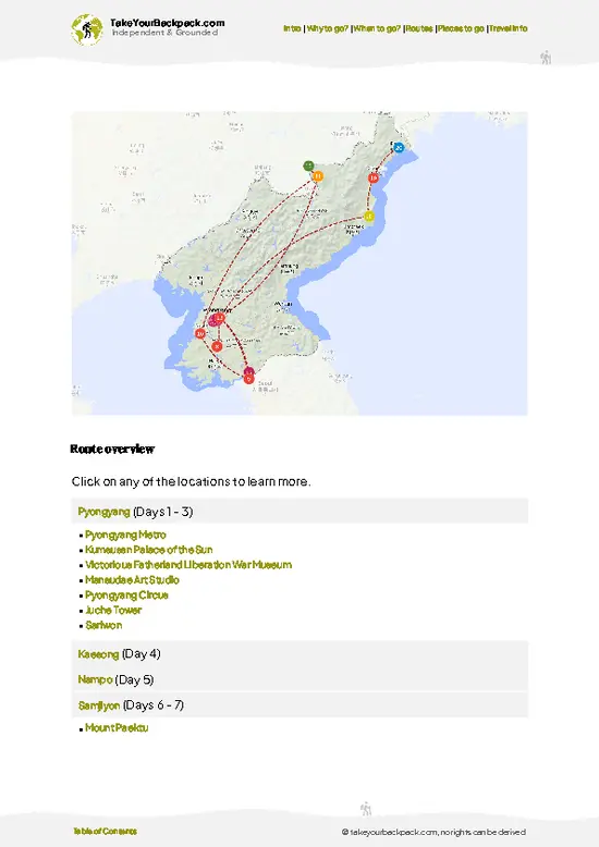
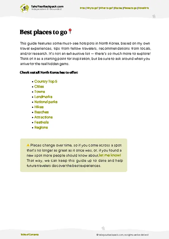
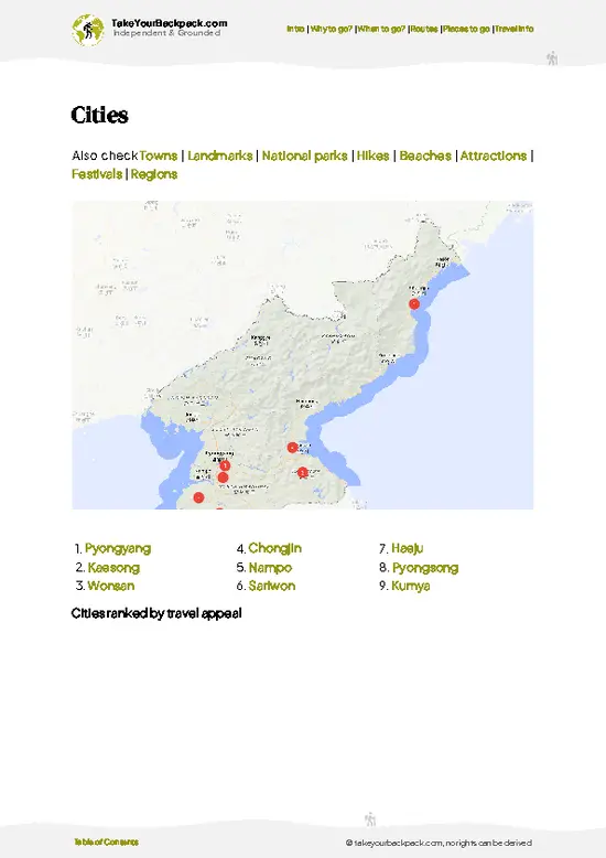
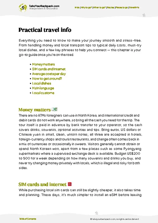
example page 0 from our offline Travel Guide for North Korea
example page 1 from our offline Travel Guide for North Korea
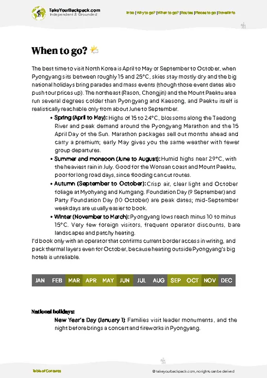
example page 2 from our offline Travel Guide for North Korea
example page 3 from our offline Travel Guide for North Korea
example page 4 from our offline Travel Guide for North Korea
example page 5 from our offline Travel Guide for North Korea
example page 6 from our offline Travel Guide for North Korea
example page 7 from our offline Travel Guide for North Korea
The digital guide (296 pages) contains:
74 highlights, ranked by travel appeal
Optimized 5, 10 & 15-day travel routes
Cities, national parks, landmarks, beaches
How to get around
Offline-friendly for travel without Wi-Fi
👉 Click to see all 30+ guide features

📅 Plan smarter in minutes, not weeks
Month by month travel advice
Festivals & national holidays
Budget expectations

🗺️ Go to the right places, skip the overrated ones
Honest pros & cons of destinations
Top hikes, parks & viewpoints
Lesser-known places most travelers miss
Clear “worth it vs skip it” guidance

🛏️ Travel smoothly without rookie mistakes
Best areas to stay
Transport systems explained simply
Common scams & safety advice
SIM cards, money & practical tips

🌍 Understand the country, not just visit it
Culture & traditions
52 Essential phrases & customs
Festivals worth planning around
Traveler-friendly historical context
Insights that make places more meaningful

📱 Built for real travel conditions
Fully downloadable PDF
Works completely offline
Optimized for phone use
Useful in remote areas & buses
Everything in one place
Save weeks of stressful planning
Get instant access to your full guide. 30‑day money-back guarantee.


By proceeding you agree to our terms.
Sent to your inbox immediately after payment • 100% Secure Checkout
Best Backpacking Travel Advisor 2025 tourism awardBest Backpacking
Travel Advisor
2025
What others say about Take Your Backpack Guides:
⭐⭐⭐⭐⭐
Fantastic, amazing amount of information!
⭐⭐⭐⭐⭐
My goodness this is amazing, it's what I've been looking for hats off too you!
⭐⭐⭐⭐⭐
I think this is absolutely BRILLIANT
⭐⭐⭐⭐
Very complete and informative. It's still missing places, but I gotta to commend you
⭐⭐⭐⭐⭐
This is truly amazing, thank you, can't wait to explore it with my kids!
⭐⭐⭐⭐⭐
Awesome resource, thank you!
⭐⭐⭐⭐⭐
This is amazing! Can't wait to explore the ones I haven't seen
⭐⭐⭐⭐
I love this! Well done, great idea.
⭐⭐⭐⭐⭐
Thanks for taking the time to make this gem!
⭐⭐⭐⭐⭐
This might be the best website I've ever seen.
⭐⭐⭐⭐⭐
Congratulations, and thank you so much for your work; it's incredibly valuable.
⭐⭐⭐⭐
In all seriousness I think you did a great job pointing out the important spots
⭐⭐⭐⭐⭐
10/10 very good
⭐⭐⭐⭐⭐
As someone who's only just starting to visit regularly this is awesome, thank you.
⭐⭐⭐⭐
Thank you very much! I'm going to visit my dad, it's going to be very useful!
⭐⭐⭐⭐⭐
This is really cool! We'll be travelling for the first time and this definitely come in handy.
⭐⭐⭐⭐⭐
You are now our minister of culture, congratulations 👨‍💼
⭐⭐⭐⭐⭐
Just wanted to tell you that this is a pearl! Going to follow your recommendations.
⭐⭐⭐⭐⭐
This is so cool. I'll definitely be using the resource for my travels soon.
⭐⭐⭐⭐⭐
This is very impressive! Good work.
⭐⭐⭐⭐⭐
This is an amazing and informative site. Very well done!

🛏️ Where to stay?Best areas and accommodation options

If you enjoy meeting fellow travelers, consider choosing hostels with high ratings for atmosphere. On the other hand, if you prefer having your own space, a hotel might be a better option.

🥾 Hike detailsRoute, distance, and difficulty explained

Total Distance: Approximately 20 kilometers (12.4 miles) round trip. The trail can be tackled in sections if you’re not up for the full hike.

Estimated Duration: Expect to spend around 8 to 10 hours on the trail, depending on your pace and how often you stop to take in the views or snap photos.

Difficulty Level: Moderate to challenging. The trail has some steep sections and rocky terrain, so a decent level of fitness is recommended.

Starting Point: The hike begins at the Kumgang Tourist Region. To get there, take a bus from Pyongyang to the city of Wonsan. From Wonsan, you can catch a tour … read more 👉
Total Distance: Approximately 20 kilometers (12.4 miles) round trip. The trail can be tackled in sections if you’re not up for the full hike.

Estimated Duration: Expect to spend around 8 to 10 hours on the trail, depending on your pace and how often you stop to take in the views or snap photos.

Difficulty Level: Moderate to challenging. The trail has some steep sections and rocky terrain, so a decent level of fitness is recommended.

Starting Point: The hike begins at the Kumgang Tourist Region. To get there, take a bus from Pyongyang to the city of Wonsan. From Wonsan, you can catch a tour bus specifically heading to Mount Kumgang, which is about a 2-3 hour ride. Make sure to check the schedule in advance, as transport can be limited.

Major Landmarks Along the Route:
  • Samil Lagoon: A stunning spot to rest and enjoy the view of the surrounding peaks.
  • Chilbo Waterfall: A beautiful cascade that’s perfect for a photo op.
  • Guryong Falls: The largest waterfall in the area, worth the detour for its breathtaking beauty.
  • Geumgangsan Temple: A historic site offering insight into local culture and architecture.

Type of Terrain and Scenery: The trail features a mix of rocky paths, steep inclines, and well-maintained sections. The scenery is nothing short of spectacular, with rugged mountains, lush valleys, and clear streams. You’ll find yourself surrounded by towering granite peaks and stunning vistas that make the effort worthwhile.

Typical Vegetation and Wildlife: Expect to see a variety of flora, including coniferous trees, wildflowers, and shrubs. Wildlife is a bit elusive, but you might spot deer, various bird species, and if you’re lucky, maybe even a rare Asiatic black bear in the distance. Just keep your eyes peeled and respect the natural habitat.
⚠️ Hiking info can sometimes be outdated or inaccurate. Before you hit the trail, check the latest conditions with locals. If you do spot anything that's off, I'd love to hear from you, so I can update it for fellow travelers.

🛡️ SafetyScams, Hazards, and Annoyances

Mount Kumgang offers a unique hiking experience, but it’s essential to be prepared for its realities. Weather can shift quickly; sunny skies can turn to rain in a heartbeat. Layer your clothing and pack a waterproof jacket. The trails are generally well-maintained, but expect steep sections that demand your focus. Good footing is crucial, especially on rocky paths.

Altitude isn’t extreme, but you might feel it if you push too hard too fast. Take your time and hydrate. Wildlife encounters are rare, but if you spot a deer or a bird, keep your distance. Respect their space; you’re a visitor here.

First-timers often underestimate the importance of timing. Start early to avoid afternoon storms and to soak in the views when the light is just right. Bring a reliable map or GPS device; navigation … read more 👉
Mount Kumgang offers a unique hiking experience, but it’s essential to be prepared for its realities. Weather can shift quickly; sunny skies can turn to rain in a heartbeat. Layer your clothing and pack a waterproof jacket. The trails are generally well-maintained, but expect steep sections that demand your focus. Good footing is crucial, especially on rocky paths.

Altitude isn’t extreme, but you might feel it if you push too hard too fast. Take your time and hydrate. Wildlife encounters are rare, but if you spot a deer or a bird, keep your distance. Respect their space; you’re a visitor here.

First-timers often underestimate the importance of timing. Start early to avoid afternoon storms and to soak in the views when the light is just right. Bring a reliable map or GPS device; navigation is straightforward, but it’s easy to lose track if you’re not paying attention. Embrace the challenge, and the rewards—a cold drink at the end will taste even better after the climb.

Other North Korean hikes near Mount Kumgang

Explore more nearby:

  • Myohyangsan—temple complexes, deep valleys, misty forests| 215 km away
  • Ryongmun Cavern Trail—limestone caves, subterranean chambers, cool air| 217 km away
  • Suyangsan Trail—rolling hills, panoramic viewpoints, wildflowers| 219 km away

💡 Not sure where to go next?
Create a personalized itinerary for North Korea including Mount Kumgang and the places that fit your trip.

Generate my itinerary

👉 Discover all hikes

Or checkout all North Korea has to offer (think cities, towns, villages, national parks, hikes, beaches, festivals)
Country photo of North Korea

We 💚 feedbackFinal thoughts on hiking the Mount Kumgang

Mount Kumgang is a wild beauty, where jagged peaks pierce the sky and the air is thick with history. The view from the summit is a jaw-dropper, a moment that makes every step worthwhile. But here’s the catch: the restrictions can feel stifling. You’re on a tight leash, and spontaneity is off the table. Still, if you’re craving a raw experience in a place few dare to tread, this hike is a must.

✈️ When did I visit North Korea?
As part of my 1.5 year travel around the world trip, I visited North Korea in August 2015. I had never expected I was able to get in.

✍️ Help improve this page!
The information on this page is based on my own backpacking experience in North Korea, supplemented with up-to-date research and feedback from other travelers. Travel details can change, so if you notice anything outdated or incomplete, feel free to let me know.


🙋‍♂️ Give feedback

👋 Meet the founderWho’s Behind Take Your Backpack?

Johan, backpacker and founder of TakeYourBackpackHi, I’m Johan (Netherlands 🇳🇱), the creator of TakeYourBackpack. Over the past decade, I’ve backpacked through 80+ countries across six continents, gaining extensive experience with independent travel, long-term trips, and overland routes.

This site is built on a combination of firsthand travel experience and carefully curated insights from other backpackers. Many guides are based on places I’ve personally visited, while others bring together tips, observations, and practical advice shared by trusted travelers I’ve met along the way.

The goal is to provide realistic, experience-driven guidance — not generic itineraries — so you can explore destinations with better context, clearer expectations, and more confidence.

Get full country guide •
Instant download • 74 highlights • Full Offline guide