×

Panama🇵🇦 | national parksLa Amistad International ParkTalamanca ridges, Ngäbe trekking, resplendent quetzal, Costa Rica border | things to do and best time to go

Explore El Cope National ParkExplore Soberanía National Park

Backpacking in La Amistad International Park
UNESCO World Heritage site
🌟 Highlightnational park ranked #7
By Johan Kruseman 🇳🇱 | Updated October 23, 2026

Base yourself in Boquete or Cerro Punta and you can reach the park's trailheads without a tour, which saves you the guide markup. La Amistad International Park spans the Talamanca range in western Panama, along the Costa Rican border, north of David. Costs catch people out in two places: the ranger-station fees are small, but getting up a rough 4x4 road by taxi is not, so agree the fare before you climb. Delays come from afternoon cloud, so start walking early. At a Cerro Punta farm stand I paid about US$2 for a cup of fresh strawberries and a thick, warm cup of coffee, and the farmer pointed me to the right trail. Unlike Chiriquí's busier Volcán Barú, this park is remote, wetter and far less traveled.

Discover everything you want to know in the 📖 Panama Travel Guide.


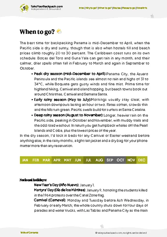
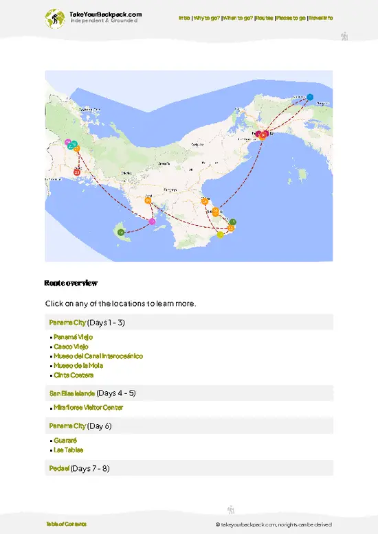
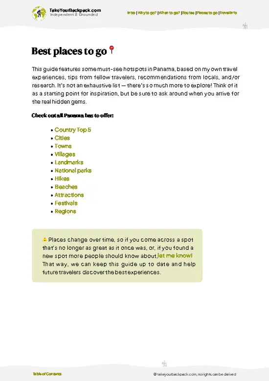
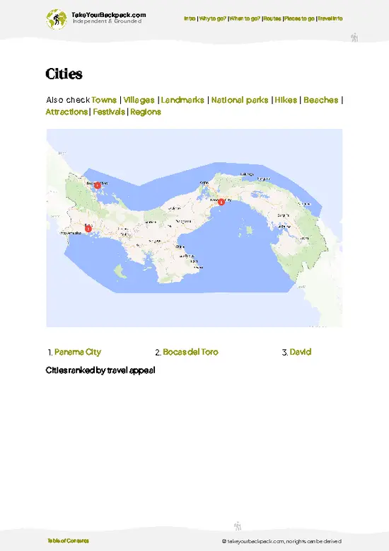
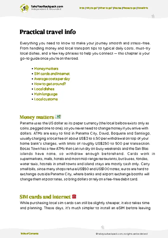
example page 0 from our offline Travel Guide for Panama
example page 1 from our offline Travel Guide for Panama
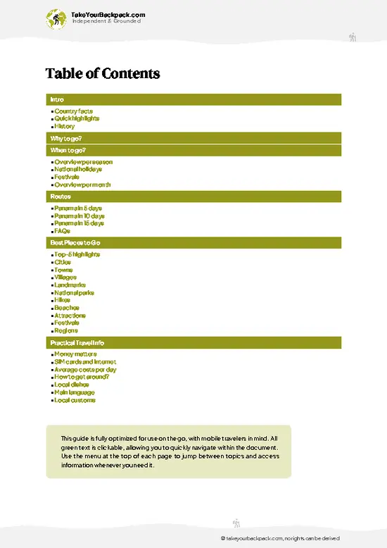
example page 2 from our offline Travel Guide for Panama
example page 3 from our offline Travel Guide for Panama
example page 4 from our offline Travel Guide for Panama
example page 5 from our offline Travel Guide for Panama
example page 6 from our offline Travel Guide for Panama
example page 7 from our offline Travel Guide for Panama
Loading the map 🌍
CLICK TO FILTER
cities
towns
villages
landmarks
national parks
hikes
beaches
attractions
festivals
regions
SHOW COUNTRY’S BESTSHOW ALL

✨ Why go?
Ranked #7 national park in Panama
What makes this national park worth exploring

La Amistad International Park suits independent walkers because the Panamanian side opens through small highland towns where you can arrange everything yourself. The main draw is the Las Nubes sector near Cerro Punta, where a ranger station, a basic trail network and a campsite let you go without an operator. Birders also come for the resplendent quetzal, which lives in the cloud forest here, and a local guide for a few hours is the one tour worth paying for. The park is also part of a binational World Heritage site shared with Costa Rica, so the forest is intact and the wildlife is richer than in busier parks. Camping is simple and cheap, and farm-town hostels sit close by. If you like quiet trails, muddy boots and cold mornings, this is a place where you set your own pace instead of following a group.

💡 HighlightsWhat this place is best known for

  1. Cerro Pandeco and the Talamanca cloud forest: The park’s high ridges around Cerro Pandeco hold some of the least disturbed montane forest in Central America, dripping with moss, bromeliads and tree ferns. Reaching it means a multiday expedition with guides from the Ngäbe communities.
  2. Wekso Ngäbe Ecolodge area: The Ngäbe community of Wekso on the Chiriquí side acts as the trailhead for the park’s better-known walks. You hike through shade-coffee plots and then primary forest, with Ngäbe hosts who know the birds and plants by name.
  3. Resplendent quetzals: The park shelters one of the larger populations of this green and crimson bird, especially in the cool upper forest. Early morning near fruiting wild avocado trees gives you the best odds.
  4. Río Changuinola headwaters: Rivers on the Caribbean slope
… read more 👉
  1. Cerro Pandeco and the Talamanca cloud forest: The park’s high ridges around Cerro Pandeco hold some of the least disturbed montane forest in Central America, dripping with moss, bromeliads and tree ferns. Reaching it means a multiday expedition with guides from the Ngäbe communities.
  2. Wekso Ngäbe Ecolodge area: The Ngäbe community of Wekso on the Chiriquí side acts as the trailhead for the park’s better-known walks. You hike through shade-coffee plots and then primary forest, with Ngäbe hosts who know the birds and plants by name.
  3. Resplendent quetzals: The park shelters one of the larger populations of this green and crimson bird, especially in the cool upper forest. Early morning near fruiting wild avocado trees gives you the best odds.
  4. Río Changuinola headwaters: Rivers on the Caribbean slope start in these mountains and drop through steep gorges. Reaching them takes long approaches by foot and dugout canoe, so this is for committed explorers.
  5. Jaguars, pumas and tapirs: The park protects big cats and Baird’s tapirs, along with harpy eagles. You are far more likely to find tracks, scat and wallows than the animals themselves, which is part of the thrill.
  6. Cultural visits to Ngäbe and Naso communities: Villages on the park’s edge welcome trekkers for home-cooked meals, craft purchases and stories about the forest. Visiting through community programs puts money straight into local hands.
  7. Binational crossing of the Talamanca range: La Amistad continues into Costa Rica as a shared World Heritage site, so the forest you walk through is one of the largest protected tracts in Central America. The sense of unbroken green is the sight itself.
La Amistad International Park has no ticket system for sightseeing, but overnight treks and guided visits to Wekso or the Bocas del Toro side should be booked ahead with the community or a local operator.
Spotted a mistake or missing something? Contact us.

Things to do near La Amistad International Park

Ratings based on Tripadvisor reviews. When you book through this link, you support our work at no extra cost to you.

🌤️ When to go?Best time to explore La Amistad International Park

  • Dry Season (January to April): Trails around Boquete and the Cerro Punta side are firmest now, with mornings of 10 to 18°C (50 to 64°F) and afternoons up to 24°C (75°F). Nights at high camps near Cerro Fábrega can drop close to 5°C (41°F). Lodging and guides cost the most, and the Quetzal viewing and nesting window (March to May) draws birders.
  • Green Season (May to November): Expect rain most afternoons, mud on the ridges and swollen rivers on the Bocas del Toro side, where rain falls nearly year-round. Prices drop 10 to 25 percent and trails are quiet. Days stay about 12 hours long.
  • Early December: Rains ease, forests stay lush and crowds have not yet arrived, so this is the calmest window.
Book guides for February to April weeks ahead, and start hikes by 6 a.m. to finish before clouds close in.

source: climatestotravel.comJANJanuary: excellent for travelingFEBFebruary: excellent for travelingMARMarch: excellent for travelingAPRApril: highly recommended for travelingMAYMay: good for travelingJUNJune: fair for travelingJULJuly: fair for travelingAUGAugust: fair for travelingSEPSeptember: fair for travelingOCTOctober: fair for travelingNOVNovember: good for travelingDECDecember: highly recommended for traveling
panama-national-park-la-amistad-international-park
© Google | Israel Coba

✈️ The backpacker research shortcutPanama Travel Guide

An offline-friendly backpacking guide with optimized travel routes, ranked highlights, transport advice, and the best areas to stay.
example page 0 from our offline Travel Guide for Panama
example page 1 from our offline Travel Guide for Panama
example page 2 from our offline Travel Guide for Panama
example page 3 from our offline Travel Guide for Panama
example page 4 from our offline Travel Guide for Panama
example page 5 from our offline Travel Guide for Panama
example page 6 from our offline Travel Guide for Panama
example page 7 from our offline Travel Guide for Panama
The digital guide (272 pages) contains:
✅ 89 highlights, ranked by travel appeal
✅ Optimized 5, 10 & 15-day travel routes
✅ Cities, national parks, landmarks, beaches
✅ How to get around
✅ Offline-friendly for travel without Wi-Fi
👉 Click to see all 30+ guide features

📅 Plan smarter in minutes, not weeks
✅ Month by month travel advice
✅ Festivals & national holidays
✅ Budget expectations

🗺️ Go to the right places, skip the overrated ones
✅ Honest pros & cons of destinations
✅ Top hikes, parks & viewpoints
✅ Lesser-known places most travelers miss
✅ Clear “worth it vs skip it” guidance

🛏️ Travel smoothly without rookie mistakes
✅ Best areas to stay
✅ Transport systems explained simply
✅ Common scams & safety advice
✅ SIM cards, money & practical tips

🌍 Understand the country, not just visit it
✅ Culture & traditions
✅ 52 Essential phrases & customs
✅ Festivals worth planning around
✅ Traveler-friendly historical context
✅ Insights that make places more meaningful

📱 Built for real travel conditions
✅ Fully downloadable PDF
✅ Works completely offline
✅ Optimized for phone use
✅ Useful in remote areas & buses
✅ Everything in one place
Stop searching, start planning
Get instant access to your full guide. 30‑day money-back guarantee.
+ Add another guide for just

By proceeding you agree to our terms.
Sent to your inbox immediately after payment • 100% Secure Checkout
Best Backpacking Travel Advisor 2025 tourism awardBest Backpacking
Travel Advisor
2025
What others say about Take Your Backpack Guides:
⭐⭐⭐⭐⭐
Fantastic, amazing amount of information!
⭐⭐⭐⭐⭐
My goodness this is amazing, it's what I've been looking for hats off too you!
⭐⭐⭐⭐⭐
I think this is absolutely BRILLIANT
⭐⭐⭐⭐
Very complete and informative. It's still missing places, but I gotta to commend you
⭐⭐⭐⭐⭐
This is truly amazing, thank you, can't wait to explore it with my kids!
⭐⭐⭐⭐⭐
Awesome resource, thank you!
⭐⭐⭐⭐⭐
This is amazing! Can't wait to explore the ones I haven't seen
⭐⭐⭐⭐
I love this! Well done, great idea.
⭐⭐⭐⭐⭐
Thanks for taking the time to make this gem!
⭐⭐⭐⭐⭐
This might be the best website I've ever seen.
⭐⭐⭐⭐⭐
Congratulations, and thank you so much for your work; it's incredibly valuable.
⭐⭐⭐⭐
In all seriousness I think you did a great job pointing out the important spots
⭐⭐⭐⭐⭐
10/10 very good
⭐⭐⭐⭐⭐
As someone who's only just starting to visit regularly this is awesome, thank you.
⭐⭐⭐⭐
Thank you very much! I'm going to visit my dad, it's going to be very useful!
⭐⭐⭐⭐⭐
This is really cool! We'll be travelling for the first time and this definitely come in handy.
⭐⭐⭐⭐⭐
You are now our minister of culture, congratulations 👨‍💼
⭐⭐⭐⭐⭐
Just wanted to tell you that this is a pearl! Going to follow your recommendations.
⭐⭐⭐⭐⭐
This is so cool. I'll definitely be using the resource for my travels soon.
⭐⭐⭐⭐⭐
This is very impressive! Good work.
⭐⭐⭐⭐⭐
This is an amazing and informative site. Very well done!

🛏️ Where to stay?How to pick the right area

The best bases for La Amistad International Park are Boquete on the Pacific side and Changuinola on the Caribbean side, since lodging inside the park is limited to basic ranger stations and camping. Boquete has the strongest backpacker scene, with hostels at US$12 to 18 for a dorm bed, private rooms at US$35 to 60, and guides for Barú-area and cloud forest trips. Volcán and Cerro Punta, closer to the Las Nubes and Cerro Punta sectors, offer simple guesthouses at US$25 to 50 and highland farm stays. Inside the park, the Las Nubes ranger station and Wekso camp take hikers on a basic bunk or tent … read more 👉
The best bases for La Amistad International Park are Boquete on the Pacific side and Changuinola on the Caribbean side, since lodging inside the park is limited to basic ranger stations and camping. Boquete has the strongest backpacker scene, with hostels at US$12 to 18 for a dorm bed, private rooms at US$35 to 60, and guides for Barú-area and cloud forest trips. Volcán and Cerro Punta, closer to the Las Nubes and Cerro Punta sectors, offer simple guesthouses at US$25 to 50 and highland farm stays. Inside the park, the Las Nubes ranger station and Wekso camp take hikers on a basic bunk or tent basis, typically US$5 to 15 per night, and you bring your own food. On the Bocas side, Changuinola is a functional town with budget hotels at US$25 to 45, and indigenous Naso and Ngäbe communities, including Wekso, can host you in village lodging arranged ahead through local community offices. David is the transport hub if you need supplies or buses.

👛 Costs (as of 23 October 2026)Travel costs and budget guide for La Amistad International Park

A realistic daily budget for La Amistad International Park is about US$62 for a backpacker using a high-season hostel bed and local buses. Foreign visitors pay in US dollars, which Panama uses alongside its own balboa coins.
CategoryBudget RangeLocal Reality
Entrance feeUS$5 to 10Foreigners pay at ranger stations such as Las Nubes; rates differ by sector.
AccommodationUS$12 to 25Hostel dorms in Boquete run US$12 to 18; ranger camping costs less, though facilities are basic.
Local transportUS$4 to 12Buses from David to Boquete or Volcán cost US$2 to 4; a taxi to trailheads is US$10 to 25 one way.
Food and suppliesUS$10 to 18Set lunches cost US$4 to 6; stock up in town because the park has no shops.
GuideUS$15 to 40Day guides for popular trails cost more for multi-day treks, and sharing splits the
… read more 👉
A realistic daily budget for La Amistad International Park is about US$62 for a backpacker using a high-season hostel bed and local buses. Foreign visitors pay in US dollars, which Panama uses alongside its own balboa coins.
CategoryBudget RangeLocal Reality
Entrance feeUS$5 to 10Foreigners pay at ranger stations such as Las Nubes; rates differ by sector.
AccommodationUS$12 to 25Hostel dorms in Boquete run US$12 to 18; ranger camping costs less, though facilities are basic.
Local transportUS$4 to 12Buses from David to Boquete or Volcán cost US$2 to 4; a taxi to trailheads is US$10 to 25 one way.
Food and suppliesUS$10 to 18Set lunches cost US$4 to 6; stock up in town because the park has no shops.
GuideUS$15 to 40Day guides for popular trails cost more for multi-day treks, and sharing splits the price.
Total Daily BudgetUS$62Based on the mid-range of rows with one guide-free day plus a shared guide share.
⚠️ Prices can change and everyone travels differently, so take this as a rough guide. Hope it helps you plan your adventure!

🥾 TrailsDiscover La Amistad International Park's top trails and natural wonders

  • Terrain: Steep, muddy, rooty paths climb from foothill farmland into cloud forest above 2,000 meters, with frequent stream crossings and rain almost any month. Waterproof boots and gaiters earn their weight.
  • Wekso area walks: Short guided day hikes of roughly 3 to 6 hours loop through community land and lower forest. They are easy to moderate, good for spotting toucans, trogons and orchids, and a fair first taste of the park.
  • Multiday treks: Routes of 3 to 7 days push toward the high ridges and Cerro Pandeco. They are hard, with long climbs, wet camps and no marked signage, so a local guide is required,
… read more 👉
  • Terrain: Steep, muddy, rooty paths climb from foothill farmland into cloud forest above 2,000 meters, with frequent stream crossings and rain almost any month. Waterproof boots and gaiters earn their weight.
  • Wekso area walks: Short guided day hikes of roughly 3 to 6 hours loop through community land and lower forest. They are easy to moderate, good for spotting toucans, trogons and orchids, and a fair first taste of the park.
  • Multiday treks: Routes of 3 to 7 days push toward the high ridges and Cerro Pandeco. They are hard, with long climbs, wet camps and no marked signage, so a local guide is required, and the Ministry of Environment (MiAmbiente) must be informed.
  • Wildlife: Expect howler monkeys, agoutis, many hummingbird species and, with luck, quetzals. Jaguars, pumas and tapirs live here but rarely show themselves.
  • Difficulty: Moderate for day walks, demanding to extreme for anything beyond the first ridge, mainly because of mud, humidity and remoteness.
La Amistad International Park is one of Panama’s least developed protected areas, and that shapes every logistics question. There are few formal named trails, no visitor center to speak of and little mobile signal once you leave the villages. Most travelers arrange access through community ecotourism groups or a tour operator in Boquete, David or Bocas del Toro, then continue by pickup truck on rough roads for the last stretch. Public buses reach towns on the edge, but the final approach to trailheads usually needs a hired 4x4 or a pre-arranged ride.
Crowds are essentially absent. You may share the forest with a handful of other trekkers in a week, and often with nobody. The dry season, roughly January to April, gives the firmest footing, though cloud and drizzle remain likely at altitude. Entrance fees are small and generally collected at community or ranger points, with guide and lodging charges forming the main cost. Carry cash in US dollars, since Panama uses them and there are no machines nearby. Bring a rain jacket, a water filter and insect repellent, and pack food for any overnight route.
⚠️ Hiking info can sometimes be outdated or inaccurate. Before you hit the trail, check the latest conditions with locals. If you do spot anything that's off, I'd love to hear from you, so I can update it for fellow travelers.

🛡️ SafetySafety Tips and Common Scams in La Amistad International Park

La Amistad is remote, wet and lightly managed, so the main risks are weather and getting lost rather than crime. Rain turns clay trails to slick mud, and streams rise fast after afternoon storms, so cross early and never force a swollen ford. Highland nights are cold and damp, so pack a real rain shell and warm layers. Trails are often faint and poorly signed, and a local guide is worth hiring for anything beyond the Las Nubes and Cerro Punta sectors. Wildlife is mostly shy: you may meet snakes (watch where you place hands and feet), biting insects, and rarely a puma or tapir. Give animals space and store food sealed. Tell your lodge your route and return time, because phone signal disappears quickly.

FAQFrequently asked questions about La Amistad International Park

Plan 2 to 3 days for La Amistad International Park if you stick to the accessible sectors, and 5 to 7 days for a trek to Cerro Fábrega or into Naso territory. A day hike from Boquete or Cerro Punta covers the Las Nubes cloud forest, while the Caribbean-side routes need a full day just to reach them.
Yes, La Amistad International Park can be reached without a car, but expect transfers. Buses run from David to Volcán and Cerro Punta for about US$3 to 5, and taxis cover the last stretch to Las Nubes for US$10 to 25. Remote sectors need a guide or community boat, often arranged from Changuinola.
Yes, La Amistad International Park charges foreigners a small entrance fee, typically around US$5 to 10 depending on the sector, paid at ranger stations such as Las Nubes. Overnight stays at ranger camps cost extra, roughly US$5 to 15. Treks into remote areas require coordination with MiAmbiente and the local indigenous community, so arrange this through your guide ahead of time.
⚠️ Things can change over time, so always validate details locally before you go.

Other Panamanian national parks near La Amistad International Park

Explore more nearby:


💡 Not sure where to go next?
Create a personalized itinerary for Panama including La Amistad International Park and the places that fit your trip.

Generate my itinerary

👉 Discover all national parks

Or checkout all Panama has to offer (think cities, towns, villages, national parks, hikes, beaches, festivals)
Country photo of Panama

We 💚 feedbackKey takeaways before you go

La Amistad International Park is for people who like their forest quiet and damp. I would go in the early morning in the drier months, when the mist lifts and quetzals feed in the open. Skip afternoons, pack warm layers and boots with grip, and bring cash for the ranger station.

✈️ When did I visit Panama?
Panama I visited during my half year trip through South and Central America back in 2003

✍️ Help improve this page!
The information on this page is based on my own backpacking experience in Panama, supplemented with up-to-date research and feedback from other travelers. Travel details can change, so if you notice anything outdated or incomplete, feel free to let me know.


🙋‍♂️ Give feedback

👋 Meet the founderWho’s Behind Take Your Backpack?

Johan, backpacker and founder of TakeYourBackpackHi, I’m Johan (Netherlands 🇳🇱), the creator of TakeYourBackpack. Over the past 3 decades, I’ve backpacked through 90+ countries across six continents, gaining extensive experience with independent travel, long-term trips, and overland routes.

This site is built on a combination of firsthand travel experience and carefully curated insights from other backpackers. Many guides are based on places I’ve personally visited, while others bring together tips, observations, and practical advice shared by trusted travelers I’ve met along the way.

The goal is to provide realistic, experience-driven guidance — not generic itineraries — so you can explore destinations with better context, clearer expectations, and more confidence.